Search
You Searched For
Search Results
- Published / Created:
- 1776
- Call Number:
- 786cea P838 1776
- Container / Volume:
- BRBL_00516
- Image Count:
- 1
- Resource Type:
- Maps, Atlases & Globes
- Found in:
- Beinecke Rare Book and Manuscript Library > A Plan of Port Royal in South Carolina ...
- Published / Created:
- 1755
- Call Number:
- 97 L62 1755
- Container / Volume:
- BRBL_00678
- Image Count:
- 1
- Resource Type:
- Maps, Atlases & Globes
- Found in:
- Beinecke Rare Book and Manuscript Library > A Scenographic Plan of the City of the Kings, otherwise called Lima, the capital of the Kingdonm of Peru ... as it was before the late earthquakes.
- Creator:
- Arlidge, Abraham
- Published / Created:
- 1983
- Call Number:
- 32 L84 1694/1983
- Container / Volume:
- BRBL_00739
- Image Count:
- 2
- Resource Type:
- Maps, Atlases & Globes
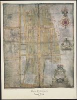
- Found in:
- Beinecke Rare Book and Manuscript Library > A Survey of Hatton Garden : a suruey of Hatton-Garden belonging to ... Barron Hatton of Kirby / by Abraham Arlidge.
- Published / Created:
- 1776
- Call Number:
- 771 C358 1776C
- Container / Volume:
- BRBL_00482
- Image Count:
- 1
- Resource Type:
- Maps, Atlases & Globes
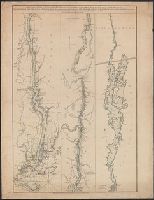
- Found in:
- Beinecke Rare Book and Manuscript Library > A Survey of Lake Champlain including Lake George, Crown Point, and St. John ... by William Brassier, Draughtsman. 1762.
- Published / Created:
- 1776
- Call Number:
- 771 C358 1776
- Container / Volume:
- BRBL_00482
- Image Count:
- 1
- Resource Type:
- Maps, Atlases & Globes
- Found in:
- Beinecke Rare Book and Manuscript Library > A Survey of Lake Champlain including Lake George, Crown Point, and St. John : surveyed by order of his Excellency major General Sr. Jeffery Amherst ... / by William Brassier, Draughtsman, 1762.
- Published / Created:
- 1776
- Call Number:
- 771 H864 1776A
- Container / Volume:
- BRBL_00483
- Image Count:
- 1
- Resource Type:
- Maps, Atlases & Globes
- Found in:
- Beinecke Rare Book and Manuscript Library > A Topographical map of Hudsons River ... Communication with Canada by Lake George and lake Champlain ... by Claude Joseph Sauthier ...
- Published / Created:
- 1776
- Call Number:
- 771 H864 1776
- Container / Volume:
- BRBL_00483
- Image Count:
- 1
- Resource Type:
- Maps, Atlases & Globes
- Found in:
- Beinecke Rare Book and Manuscript Library > A Topographical map of Hudsons River ... Communication with Canada by Lake George and lake Champlain ... by Claude Joseph Sauthier ...
- Published / Created:
- 1777
- Call Number:
- 765cea N16 1777
- Container / Volume:
- BRBL_00464
- Image Count:
- 1
- Resource Type:
- Maps, Atlases & Globes
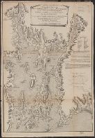
- Found in:
- Beinecke Rare Book and Manuscript Library > A Topological Chart of the Bay of Narragansett in the Province of New englannd ... by Charles Blaskowitz.
- Published / Created:
- 1776
- Call Number:
- 775cea 1776
- Container / Volume:
- BRBL_00502
- Image Count:
- 1
- Resource Type:
- Maps, Atlases & Globes
- Found in:
- Beinecke Rare Book and Manuscript Library > A chart of Delaware Bay and River ... by joshua Fisher.
- Published / Created:
- 1776
- Call Number:
- 775cea 1776B
- Container / Volume:
- BRBL_00502
- Image Count:
- 1
- Resource Type:
- Maps, Atlases & Globes
- Found in:
- Beinecke Rare Book and Manuscript Library > A chart of Delaware Bay and River. Contains a full and exact description of the shores, creeks, harbours, soundings, shoals, sands and bearings of the most considerable landmarks from the Capes to Philadelphia taken from the original chart.
- Creator:
- Sayer, Robert, 1725-1794
- Published / Created:
- 20 Feby. 1782.
- Call Number:
- BrSides Folio 2019 82
- Image Count:
- 1
- Resource Type:
- Maps, Atlases & Globes
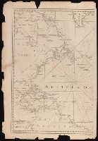
- Found in:
- Beinecke Rare Book and Manuscript Library > A chart of the Atlantic Ocean : I. sheet.
- Creator:
- Chabert, Joseph Bernard, marquis de, 1724-1805
- Published / Created:
- 25th, March 1775.
- Call Number:
- 72cea 1775
- Container / Volume:
- BRBL_00688
- Image Count:
- 1
- Resource Type:
- Maps, Atlases & Globes
- Found in:
- Beinecke Rare Book and Manuscript Library > A chart of the Banks of Newfoundland / drawn from a great number of hydrographical surveys, chiefly from those of Chabert, Cook, and Fleurieu, connected and ascertained by astronomical observations.
- Creator:
- Chabert, Joseph Bernard, marquis de, 1724-1805
- Published / Created:
- 25th, March 1775.
- Call Number:
- 72cea 1775
- Container / Volume:
- BRBL_00373
- Image Count:
- 1
- Resource Type:
- Maps, Atlases & Globes
- Found in:
- Beinecke Rare Book and Manuscript Library > A chart of the Banks of Newfoundland / drawn from a great number of hydrographical surveys, chiefly from those of Chabert, Cook, and Fleurieu, connected and ascertained by astronomical observations.
- Creator:
- Jefferys, Thomas, -1771
- Published / Created:
- 25th March, 1775.
- Call Number:
- 7345cea 1775A
- Container / Volume:
- BRBL_00689
- Image Count:
- 1
- Resource Type:
- Maps, Atlases & Globes
- Found in:
- Beinecke Rare Book and Manuscript Library > A chart of the Gulf of St. Laurence [cartographic material] : composed from a great number of actual surveys and other materials, regulated and connected by astronomical observations.
- Published / Created:
- 1775
- Call Number:
- 966 1775
- Container / Volume:
- BRBL_00676
- Image Count:
- 1
- Resource Type:
- Maps, Atlases & Globes
- Found in:
- Beinecke Rare Book and Manuscript Library > A chart of the Straits of Magellan. Inlarged from a chart published at Madrid in 1769, by Don Juan de la Cruz Cano y Olmedilla ... and improved from the observations and surveys of Captns. Byron, Wallis and Carteret ...
- Creator:
- Delarochette, L. (Louis), 1731-1802
- Published / Created:
- June 28th, 1780.
- Call Number:
- 39cea 1780
- Container / Volume:
- BRBL_00192
- Image Count:
- 1
- Resource Type:
- Maps, Atlases & Globes
- Found in:
- Beinecke Rare Book and Manuscript Library > A chart of the coasts of Spain and Portugal, with the Balearic Islands, and part of the coast of Barbary / by L.S. De la Rochette.
- Creator:
- Morris, Charles, fl. 1749, cartographer
- Published / Created:
- 1759?]
- Call Number:
- 732cea H13 1759
- Container / Volume:
- BRBL_00378
- Image Count:
- 1
- Resource Type:
- Maps, Atlases & Globes
- Found in:
- Beinecke Rare Book and Manuscript Library > A chart of the harbour of Halifax, in Nova Scotia : with Jebucto Bay and Cape Sambrô, also the islands, ledges of rocks, shoals & soundings / survey'd, by order of His Excellency Brigadier General Lawrence, Governour of the Province of Nova Scotia, by Ch
- Creator:
- Lodge, John, -1796
- Published / Created:
- 31 Augst. 1780.
- Call Number:
- 8555 1780A
- Container / Volume:
- BRBL_00695
- Image Count:
- 1
- Resource Type:
- Maps, Atlases & Globes
- Found in:
- Beinecke Rare Book and Manuscript Library > A chart of the island of Jamaica [cartographic material] : with its bays, harbours, rocks, soundings, &c. / Jno. Lodge, sculp.
- Creator:
- W. Mount and T. Page
- Published / Created:
- [between 1732 and 1749]
- Call Number:
- 71cea 1723
- Container / Volume:
- BRBL_00688
- Image Count:
- 1
- Resource Type:
- Maps, Atlases & Globes
- Found in:
- Beinecke Rare Book and Manuscript Library > A chart of the sea coast of New Found Land, New Scotland, New England, New York, New Jersey, with Virginia and Maryland.
- Creator:
- Seller, John, fl. 1658-1698
- Published / Created:
- [1671?]
- Call Number:
- 319cea 1671
- Container / Volume:
- BRBL_00042
- Image Count:
- 1
- Resource Type:
- Maps, Atlases & Globes
- Found in:
- Beinecke Rare Book and Manuscript Library > A chart of ye narrow seas / newly corrected by John Seller, hydrographer to the kings most excellent majestie.