Search
You Searched For
Search Results
- Published / Created:
- 1959
- Call Number:
- 32fb L84 1907
- Container / Volume:
- BRBL_00075
- Image Count:
- 1
- Resource Type:
- Maps, Atlases & Globes
- Found in:
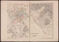
- Beinecke Rare Book and Manuscript Library > City of London showing parish boundaries prior to the Union of Parishes Act, 1907 [cartographic material].
- Published / Created:
- 1909
- Call Number:
- 32 L84 1835
- Container / Volume:
- BRBL_00050
- Image Count:
- 1
- Resource Type:
- Maps, Atlases & Globes
- Found in:
- Beinecke Rare Book and Manuscript Library > Cruchley's new plan of London improved to 1835.
- Creator:
- Edward Stanford Ltd
- Published / Created:
- 1913
- Call Number:
- 32 L84 1913A
- Container / Volume:
- BRBL_00051
- Image Count:
- 1
- Resource Type:
- Maps, Atlases & Globes
- Found in:
- Beinecke Rare Book and Manuscript Library > Stanford's new two inch map of London and its environs.
- Published / Created:
- 1906
- Call Number:
- 319gme 1906
- Container / Volume:
- BRBL_00042
- Image Count:
- 1
- Resource Type:
- Maps, Atlases & Globes
- Found in:
- Beinecke Rare Book and Manuscript Library > The British Isles (Railway) showing main trunk lines and principal branches and connections.
- Creator:
- George Philip & Son
- Published / Created:
- [1915?]
- Call Number:
- 32 1915
- Container / Volume:
- BRBL_00045
- Image Count:
- 1
- Resource Type:
- Maps, Atlases & Globes
- Found in:
- Beinecke Rare Book and Manuscript Library > England and Wales.
- Creator:
- G.W. Bacon & Co
- Published / Created:
- [1907?]
- Call Number:
- 32 L84 1907
- Container / Volume:
- BRBL_00051
- Image Count:
- 1
- Resource Type:
- Maps, Atlases & Globes
- Found in:
- Beinecke Rare Book and Manuscript Library > Bacon's large-print map of the environs of London.
- Published / Created:
- [1910?]
- Call Number:
- 32gmb M752 1910
- Container / Volume:
- BRBL_00076
- Image Count:
- 1
- Resource Type:
- Maps, Atlases & Globes
- Found in:
- Beinecke Rare Book and Manuscript Library > The Royal Automobile Club Official motoring map of England & Wales, Monmouth.
- Published / Created:
- [1910?]
- Call Number:
- 335 L62 1910
- Container / Volume:
- BRBL_00087
- Image Count:
- 1
- Resource Type:
- Maps, Atlases & Globes
- Found in:
- Beinecke Rare Book and Manuscript Library > Plan de Liege Par Joseph Kip.
- Published / Created:
- 1911
- Call Number:
- 32 SP49 1911
- Container / Volume:
- BRBL_00054
- Image Count:
- 1
- Resource Type:
- Maps, Atlases & Globes
- Found in:
- Beinecke Rare Book and Manuscript Library > Position of the fleet at Spithead on the 24th June 1911.
- Published / Created:
- [1908?]
- Call Number:
- 32am L84 1908
- Container / Volume:
- BRBL_00075
- Image Count:
- 1
- Resource Type:
- Maps, Atlases & Globes
- Found in:
- Beinecke Rare Book and Manuscript Library > Bacon's picture map of London.
- Published / Created:
- [c1902]
- Call Number:
- 3212 1920
- Container / Volume:
- BRBL_00055
- Image Count:
- 1
- Resource Type:
- Maps, Atlases & Globes
- Found in:
- Beinecke Rare Book and Manuscript Library > Surrey.
- Published / Created:
- [1916?]
- Call Number:
- BrSides Elephant Folio 2019 3
- Image Count:
- 1
- Resource Type:
- Maps, Atlases & Globes
- Found in:
- Beinecke Rare Book and Manuscript Library > What Germany wants : her claims as set forth by leaders of German thought.
- Creator:
- Wyld, James, 1812-1887
- Published / Created:
- [1861?]
- Call Number:
- 266 1850
- Image Count:
- 1
- Resource Type:
- Maps, Atlases & Globes
- Found in:
- Beinecke Rare Book and Manuscript Library > Tasmania or Van Diemens Land [cartographic material] / by James Wyld Geographer to the Queen.
- Creator:
- Wyld, James, 1812-1887
- Published / Created:
- 1872
- Call Number:
- 262 1872
- Image Count:
- 1
- Resource Type:
- Maps, Atlases & Globes
- Found in:
- Beinecke Rare Book and Manuscript Library > New South Wales [cartographic material] / by James Wyld, geographer to the Queen, Charing Cross East, London.
- Creator:
- Ross, John, active 1762-1789
- Published / Created:
- 1 June 1775.
- Call Number:
- BrSides Folio 2018 122
- Image Count:
- 1
- Resource Type:
- Maps, Atlases & Globes
- Found in:
- Beinecke Rare Book and Manuscript Library > Course of the river Mississipi [sic] from the Balise to Fort Chartres [cartographic material] ; taken on an expedition to the Illinois, in the latter end of the year 1765. / By Lieut. Ross of the 34th Regiment: Improved from the surveys of the river made
- Creator:
- G.W. Bacon & Co
- Published / Created:
- [1864?]
- Call Number:
- 75 1864C
- Container / Volume:
- BRBL_00403
- Image Count:
- 1
- Resource Type:
- Maps, Atlases & Globes
- Found in:
- Beinecke Rare Book and Manuscript Library > Bacon's steel plate map of America : political, historical & military.
- Creator:
- Stanford, Edward, 1827-1904
- Published / Created:
- [1875?].
- Call Number:
- 75 1875B
- Container / Volume:
- BRBL_00405
- Image Count:
- 1
- Resource Type:
- Maps, Atlases & Globes
- Found in:
- Beinecke Rare Book and Manuscript Library > Stanford's handy map of the United States : distinguishing the unsettled territories; the railways; the cities & towns according to population; also the state capitals & county towns.
- Creator:
- Wyld, James, 1812-1887
- Published / Created:
- [1870?]
- Call Number:
- 75 1870B
- Container / Volume:
- BRBL_00404
- Image Count:
- 1
- Resource Type:
- Maps, Atlases & Globes
- Found in:
- Beinecke Rare Book and Manuscript Library > The United States & the relative position of the Oregon & Texas / by James Wyld, Charing Cross East.
- Published / Created:
- [1845?]
- Call Number:
- 75 1845B
- Container / Volume:
- BRBL_00399
- Image Count:
- 1
- Resource Type:
- Maps, Atlases & Globes
- Found in:
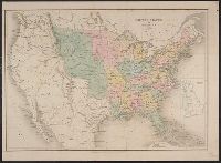
- Beinecke Rare Book and Manuscript Library > United States of America.
- Creator:
- Edward Stanford Ltd
- Published / Created:
- 1861
- Call Number:
- 75 1861G
- Container / Volume:
- BRBL_00402
- Image Count:
- 1
- Resource Type:
- Maps, Atlases & Globes
- Found in:
- Beinecke Rare Book and Manuscript Library > The United States of North America / constructed & engrd.at Stanford's Geographical Establishment.
- Published / Created:
- 1780
- Call Number:
- 76hc 1777
- Container / Volume:
- BRBL_00446A
- Image Count:
- 1
- Resource Type:
- Maps, Atlases & Globes
- Found in:
- Beinecke Rare Book and Manuscript Library > A map of the country in wich the army under Lt. General Burgoyne acted in the campaing of 1777, shewing the marches of the army & the places of the principal actions.
- Published / Created:
- [1775?]
- Call Number:
- 76cea 1775A
- Container / Volume:
- BRBL_00446
- Image Count:
- 1
- Resource Type:
- Maps, Atlases & Globes
- Found in:
- Beinecke Rare Book and Manuscript Library > A Map of the Coast of New England from Staten Island to the Island of Breton; as it was actualy survey'd by Capt Cyprian Southback.
- Published / Created:
- 1758
- Call Number:
- 771 T43 1758
- Container / Volume:
- BRBL_00492
- Image Count:
- 1
- Resource Type:
- Maps, Atlases & Globes
- Found in:
- Beinecke Rare Book and Manuscript Library > A plan of the town and Fort of Carrillon at Ticonderoga with the attack made by the British Army ... by Genl. Abercrombie ...
- Published / Created:
- 1780
- Call Number:
- 771 Sa71 1780
- Container / Volume:
- BRBL_00491
- Image Count:
- 1
- Resource Type:
- Maps, Atlases & Globes
- Found in:
- Beinecke Rare Book and Manuscript Library > Plan of the Position wich the Army under Lt. Genl. Burgoine took Saratoga on the 10th of September 1777, and in which it remained till The Convention was signed.
- Creator:
- Cary, John, approximately 1754-1835, cartographer
- Published / Created:
- Augst. 1. 1799.
- Call Number:
- 401 1799
- Container / Volume:
- BRBL_00233
- Image Count:
- 1
- Resource Type:
- Maps, Atlases & Globes
- Found in:
- Beinecke Rare Book and Manuscript Library > A new map of Piedmont, the duchies of Savoy and Milan, and the republic of Genoa, with their subdivisions : from the latest authorities / by John Cary.
- Creator:
- Rogers, Henry D. (Henry Darwin), 1808-1866
- Published / Created:
- [1857?]
- Call Number:
- 824 1857B
- Container / Volume:
- BRBL_00570
- Image Count:
- 1
- Resource Type:
- Maps, Atlases & Globes
- Found in:
- Beinecke Rare Book and Manuscript Library > Territory of Nebraska / by H.D. Rogers & A. Keith Johnston ; engraved by W. & A.K. Johnston.
- Published / Created:
- 1740
- Call Number:
- 902 C24 1740
- Container / Volume:
- BRBL_00666
- Image Count:
- 1
- Resource Type:
- Maps, Atlases & Globes
- Found in:
- Beinecke Rare Book and Manuscript Library > This plan of the harbour, town, and forts of Cartagena ... taken from a curious and exact survey made in the year 1739.
- Published / Created:
- 1777
- Call Number:
- 765cea N16 1777
- Container / Volume:
- BRBL_00464
- Image Count:
- 1
- Resource Type:
- Maps, Atlases & Globes
- Found in:
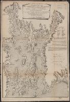
- Beinecke Rare Book and Manuscript Library > A Topological Chart of the Bay of Narragansett in the Province of New englannd ... by Charles Blaskowitz.
- Published / Created:
- 1840
- Call Number:
- 90 1840
- Container / Volume:
- BRBL_00663
- Image Count:
- 1
- Resource Type:
- Maps, Atlases & Globes
- Found in:
- Beinecke Rare Book and Manuscript Library > South America. Drawn & Engraved by J. Dower.
- Published / Created:
- 1824
- Call Number:
- 9023ca 1824
- Container / Volume:
- BRBL_00666
- Image Count:
- 1
- Resource Type:
- Maps, Atlases & Globes
- Found in:
- Beinecke Rare Book and Manuscript Library > Map of the province of Antioquia, in the Republic of Colombia, and its minerals ... compiled by J.W. de Restrepo...
- Published / Created:
- 1802
- Call Number:
- 907cea 1802
- Container / Volume:
- BRBL_00668
- Image Count:
- 1
- Resource Type:
- Maps, Atlases & Globes
- Found in:
- Beinecke Rare Book and Manuscript Library > A new chart of Surinam river (and the coast approaching it) to Paramarabo. Accompanied with sailing directions - views of the land, &c. - 1801.
- Creator:
- Wyld, James, 1812-1887
- Published / Created:
- [1852?]
- Call Number:
- 89 1852
- Container / Volume:
- BRBL_00657
- Image Count:
- 1
- Resource Type:
- Maps, Atlases & Globes
- Found in:
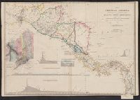
- Beinecke Rare Book and Manuscript Library > Map of Central America, shewing the different lines of Atlantic & Pacific communication / by James Wyld, geographer to the Queen.
- Published / Created:
- 1st June 1776.
- Call Number:
- 771cea N49 1776
- Container / Volume:
- BRBL_00493
- Image Count:
- 1
- Resource Type:
- Maps, Atlases & Globes
- Found in:
- Beinecke Rare Book and Manuscript Library > Chart of the entrance of Hudson's River, from Sandy Hook to New York [cartographic material] : with the banks, depths of water, sailing-marks, & ca.
- Published / Created:
- [1730?]
- Call Number:
- 894 1730
- Container / Volume:
- BRBL_00659
- Image Count:
- 1
- Resource Type:
- Maps, Atlases & Globes
- Found in:
- Beinecke Rare Book and Manuscript Library > ... This draught. being part of ye Spanish & Musketor Shore & the Bay of Honduras with. ye Islands adjacent; ... by ... Samuel Penthalow.
- Published / Created:
- 1849
- Call Number:
- 898 1849
- Container / Volume:
- BRBL_00660
- Image Count:
- 1
- Resource Type:
- Maps, Atlases & Globes
- Found in:
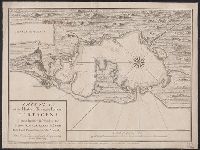
- Beinecke Rare Book and Manuscript Library > Central America Panama Railroad. Surveyed by Col. CW Hughes ...
- Published / Created:
- 1834
- Call Number:
- 400 R66 1834
- Container / Volume:
- BRBL_00233
- Image Count:
- 1
- Resource Type:
- Maps, Atlases & Globes
- Found in:
- Beinecke Rare Book and Manuscript Library > Rome & its environs [cartographic material] : from a trigonometrical survey / by Sir William Gell ; engraved by J. Gardner.
- Creator:
- Müller, Karl, of Paris, cartographer
- Published / Created:
- [1874]
- Call Number:
- 400 R66 1874
- Container / Volume:
- BRBL_00233
- Image Count:
- 1
- Resource Type:
- Maps, Atlases & Globes
- Found in:
- Beinecke Rare Book and Manuscript Library > Rome in the time of the emperors ; the Forum Romanum under the empire and the Imperial Fora ; Rome during the Republic ; The Forum before the time of Julius Cæsar ; Environs of Rome [cartographic material] / drawn by Dr. Charles Müller ; engraved by Edwd
- Creator:
- Vancouver, George, 1757-1798
- Published / Created:
- [1798]
- Call Number:
- BrSides Folio 2017 57
- Collection Title:
- Voyage of discovery to the North Pacific ocean, and round the world.
- Image Count:
- 1
- Resource Type:
- Maps, Atlases & Globes
- Found in:
- Beinecke Rare Book and Manuscript Library > Views of parts of the coast of North West America / W. Alexander, delt. from sketches made on the spot ; J. Fittler sculp.
- Creator:
- Edward Stanford Ltd.
- Published / Created:
- [192-?]
- Call Number:
- 8555 1920
- Container / Volume:
- BRBL_00642
- Image Count:
- 1
- Resource Type:
- Maps, Atlases & Globes
- Found in:
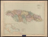
- Beinecke Rare Book and Manuscript Library > Jamaica [cartographic material] / Stanford's Geographical Establishment.
- Creator:
- Vancouver, George, 1757-1798
- Published / Created:
- [1798]
- Call Number:
- BrSides Folio 2017 59
- Collection Title:
- Voyage of discovery to the North Pacific ocean, and round the world.
- Image Count:
- 1
- Resource Type:
- Maps, Atlases & Globes
- Found in:
- Beinecke Rare Book and Manuscript Library > Views of the headlands and islands on the coasts of North West and South America / W. Alexander, delt. from sketches made on the spot ; J. Fittler, sculp.
- Creator:
- Vancouver, George, 1757-1798
- Published / Created:
- [1798]
- Call Number:
- BrSides Folio 2017 56
- Collection Title:
- Voyage of discovery to the North Pacific ocean, and round the world.
- Image Count:
- 1
- Resource Type:
- Maps, Atlases & Globes
- Found in:
- Beinecke Rare Book and Manuscript Library > Views of parts of the coast of North West America / W. Alexander delt. from sketches made on the spot ; engraved by B.T. Pouncy.
- Creator:
- Vancouver, George, 1757-1798
- Published / Created:
- [1798]
- Call Number:
- BrSides Folio 2017 58
- Collection Title:
- Voyage of discovery to the North Pacific ocean, and round the world.
- Image Count:
- 1
- Resource Type:
- Maps, Atlases & Globes
- Found in:
- Beinecke Rare Book and Manuscript Library > Views of parts of the coast of North West America / W. Alexander, delt. from sketches made on the spot ; engraved by B.T. Pouncy.
- Published / Created:
- [180-?]
- Call Number:
- BrSides 2017 4
- Image Count:
- 1
- Resource Type:
- Maps, Atlases & Globes
- Found in:
- Beinecke Rare Book and Manuscript Library > Capt. Cook's last voyage to the Pacific Ocean.
- Creator:
- Pownall, Thomas, 1722-1805
- Published / Created:
- 1776
- Call Number:
- Franklin 131 1776-5
- Image Count:
- 1
- Resource Type:
- Maps, Atlases & Globes
- Found in:
- Beinecke Rare Book and Manuscript Library > The provinces of New York and New Jersey [cartographic material] : with part of Pensilvania, and the Province of Quebec / drawn by Major Holland, Surveyor General, of the Northern District in America ; corrected and improved, from the original materials, by Governr. Pownall, Member of Parliament, 1776.
- Published / Created:
- 1770
- Call Number:
- 3227 1770
- Container / Volume:
- BRBL_00061
- Image Count:
- 4
- Resource Type:
- Maps, Atlases & Globes
- Found in:
- Beinecke Rare Book and Manuscript Library > The county of Buckingham, surveyed in MDCCLXVI, VII, and VIII and engraved by Thomas Jefferys ... MDCCLXX.
- Published / Created:
- 1809
- Call Number:
- 50 1809
- Container / Volume:
- BRBL_00272
- Image Count:
- 4
- Resource Type:
- Maps, Atlases & Globes
- Found in:
- Beinecke Rare Book and Manuscript Library > The Continent and Islands of Asia ... Delineated by Jno. Purdy, Engraved by Josph. Bye.
- Published / Created:
- 1804
- Call Number:
- 53 1804
- Container / Volume:
- BRBL_00284
- Image Count:
- 4
- Resource Type:
- Maps, Atlases & Globes
- Found in:
- Beinecke Rare Book and Manuscript Library > A map of the Environs of Constantinople ... A. Arrowsmith 1801 and 1804.
- Published / Created:
- 1794
- Call Number:
- 755cea 1794
- Container / Volume:
- BRBL_00441
- Image Count:
- 4
- Resource Type:
- Maps, Atlases & Globes
- Found in:
- Beinecke Rare Book and Manuscript Library > A New and Correct Chart of the Coast of New England and New York with the adjacent parts of Nova Scotia and New Brunswick from Cape Sable to the entrance of Hudsons or North River by Captain Holland.
- Creator:
- Bowen, Emanuel, -1767
- Published / Created:
- 2d. July 1772.
- Call Number:
- 71 1763
- Container / Volume:
- BRBL_00364
- Image Count:
- 4
- Resource Type:
- Maps, Atlases & Globes
- Found in:
- Beinecke Rare Book and Manuscript Library > An accurate map of North America [cartographic material] : Describing and distinguishing the British and Spanish dominions on this great continent; according to the definitive treaty concluded at Paris 10th Feby. 1763. Also all the West India Islands belo
- Published / Created:
- 1796
- Call Number:
- 755 1802
- Container / Volume:
- BRBL_00437
- Image Count:
- 4
- Resource Type:
- Maps, Atlases & Globes
- Found in:
- Beinecke Rare Book and Manuscript Library > A map of the United States of North America ...
- Creator:
- Arrowsmith, Aaron, 1750-1823
- Published / Created:
- [betw. 1804 and 1811?]
- Call Number:
- 70 1808
- Container / Volume:
- BRBL_00358
- Image Count:
- 4
- Resource Type:
- Maps, Atlases & Globes
- Found in:
- Beinecke Rare Book and Manuscript Library > Map of America / by A. Arrowsmith ; engraved by W. West, the hills by H. Wilson.
- Creator:
- Mitchell, John, 1711-1768
- Published / Created:
- [1773]
- Call Number:
- 71 1773
- Container / Volume:
- BRBL_00365
- Image Count:
- 4
- Resource Type:
- Maps, Atlases & Globes
- Found in:
- Beinecke Rare Book and Manuscript Library > A map of the British and French dominions in North America : with the roads, distances, limits, and extent of the settlements, humbly inscribed to the Right Honourable the Earl of Halifax, and the other Right Honourable the Lords Commissioners for Trade &
- Published / Created:
- 1809
- Call Number:
- 60 1809
- Container / Volume:
- BRBL_00325
- Image Count:
- 4
- Resource Type:
- Maps, Atlases & Globes
- Found in:
- Beinecke Rare Book and Manuscript Library > The Continent and Islands of Africa ... Delineated by John Purdy.
- Creator:
- Arrowsmith, Aaron, 1750-1823
- Published / Created:
- [1818]
- Call Number:
- 71 1818A
- Container / Volume:
- BRBL_00368
- Image Count:
- 4
- Resource Type:
- Maps, Atlases & Globes
- Found in:
- Beinecke Rare Book and Manuscript Library > A map exhibiting all the new discoveries in the interior parts of North America : inscribed by permission to the honourable governor and company of adventurers of England trading into Hudsons Bay in testimony of their liberal communications to their most
- Published / Created:
- 1858
- Call Number:
- 3222 1858
- Container / Volume:
- BRBL_00059
- Image Count:
- 2
- Resource Type:
- Maps, Atlases & Globes
- Found in:
- Beinecke Rare Book and Manuscript Library > Cruchley's Railway and Station Map of Berkshire showing all the railways & names of stations also the turnpike roads, gentlemens seats &c &c.
- Published / Created:
- [1750?]
- Call Number:
- 3211cea 1750
- Container / Volume:
- BRBL_00055
- Image Count:
- 2
- Resource Type:
- Maps, Atlases & Globes
- Found in:
- Beinecke Rare Book and Manuscript Library > A Large Chart of the Channel between England and France ... by Capt. Edmund Halley ...
- Published / Created:
- 1824
- Call Number:
- 3218 1824
- Container / Volume:
- BRBL_00058
- Image Count:
- 2
- Resource Type:
- Maps, Atlases & Globes
- Found in:
- Beinecke Rare Book and Manuscript Library > Map of the county of Oxford ... by A. Bryant ... Inscribed by permission to the ... and to the Nobility, Clergy and Gentry of the County.
- Published / Created:
- 1811
- Call Number:
- 326 1811
- Container / Volume:
- BRBL_00070
- Image Count:
- 2
- Resource Type:
- Maps, Atlases & Globes
- Found in:
- Beinecke Rare Book and Manuscript Library > A new map of Scotland ... by John Cary, Engraver.
- Creator:
- Cruchley, G. F.
- Call Number:
- 3221gme 1845
- Container / Volume:
- BRBL_00059
- Image Count:
- 2
- Resource Type:
- Maps, Atlases & Globes
- Found in:
- Beinecke Rare Book and Manuscript Library > Cruchley's railway and station map of Suffolk : showing all the railways & names of stations, also the turnpike roads, gentlemens seats, &c. &c.L65, improved from ordnance surveys.
- Creator:
- Collins, Henry George
- Published / Created:
- [1860?]
- Call Number:
- 3226 1860
- Container / Volume:
- BRBL_00061
- Image Count:
- 2
- Resource Type:
- Maps, Atlases & Globes
- Found in:
- Beinecke Rare Book and Manuscript Library > Collins' railway and telegraph map of Devonshire : divided into hundreds, containing the district divisions and other local arrangements effected by the Reform Bill.
- Published / Created:
- 1845
- Call Number:
- 32gme 1845
- Container / Volume:
- BRBL_00076
- Image Count:
- 2
- Resource Type:
- Maps, Atlases & Globes
- Found in:
- Beinecke Rare Book and Manuscript Library > Map of the Railways of England & Wales ...
- Published / Created:
- c1900.
- Call Number:
- 32am L84 1900
- Container / Volume:
- BRBL_00075
- Image Count:
- 2
- Resource Type:
- Maps, Atlases & Globes
- Found in:
- Beinecke Rare Book and Manuscript Library > London in the beginning of the 20th Century.
- Published / Created:
- 1828
- Call Number:
- 327cea 1828
- Container / Volume:
- BRBL_00073
- Image Count:
- 2
- Resource Type:
- Maps, Atlases & Globes
- Found in:
- Beinecke Rare Book and Manuscript Library > Ireland East Coast ... J. & C. Walker, Sculpt.
- Published / Created:
- 1790
- Call Number:
- 326 1790
- Container / Volume:
- BRBL_00069
- Image Count:
- 2
- Resource Type:
- Maps, Atlases & Globes
- Found in:
- Beinecke Rare Book and Manuscript Library > A new and correct map of Scotland or North Britain ... by Lieutenant Campbell.
- Published / Created:
- [1890]
- Call Number:
- 32gme 1890
- Container / Volume:
- BRBL_00076
- Image Count:
- 2
- Resource Type:
- Maps, Atlases & Globes
- Found in:
- Beinecke Rare Book and Manuscript Library > Great Western Railway General Map.
- Published / Created:
- [1794?]
- Call Number:
- 36 1794A
- Container / Volume:
- BRBL_00119
- Image Count:
- 2
- Resource Type:
- Maps, Atlases & Globes
- Found in:
- Beinecke Rare Book and Manuscript Library > Map of the Empire of Germany, ... with the Kingdom of Prussia, etc. By L. Delarochette. T.Kitchin, Sculpt.
- Published / Created:
- 1839
- Call Number:
- 53 1839
- Container / Volume:
- BRBL_00284
- Image Count:
- 2
- Resource Type:
- Maps, Atlases & Globes
- Found in:
- Beinecke Rare Book and Manuscript Library > Map of the Countries lying betwen Turkey and Birmah, Comprising Asia Minor, Persia, India, Egypt, and Arabia and including the Black, Caspian, and Red Seas. By James Wyld, Geographer to t he Queen.
- Published / Created:
- 1857
- Call Number:
- 59 1857A
- Container / Volume:
- BRBL_00317
- Image Count:
- 2
- Resource Type:
- Maps, Atlases & Globes
- Found in:
- Beinecke Rare Book and Manuscript Library > India by A.K. Johnston, F.R.G.S. Engraved by W. & A.K. Johnston.
- Published / Created:
- 1791
- Call Number:
- 59 1791
- Container / Volume:
- BRBL_00316
- Image Count:
- 2
- Resource Type:
- Maps, Atlases & Globes
- Found in:
- Beinecke Rare Book and Manuscript Library > The Southern Countries of India from Madrass to Cape Comorin describing the routes of the armies ... Campaigns of 1782, 1783, & 1784.
- Published / Created:
- 1943
- Call Number:
- 57 1943
- Container / Volume:
- BRBL_00303
- Image Count:
- 2
- Resource Type:
- Maps, Atlases & Globes
- Found in:
- Beinecke Rare Book and Manuscript Library > The Japanese empire : with central and southern Manchukuo (Manchuria).
- Published / Created:
- 1857
- Call Number:
- 59AM 1857
- Container / Volume:
- BRBL_00318
- Image Count:
- 2
- Resource Type:
- Maps, Atlases & Globes
- Found in:
- Beinecke Rare Book and Manuscript Library > Panoramic View of India from the Himalaya Mountains : shewing the actual geographical position of the principal cities, military stations, railways, &c. with table of distances from Calcutta.
- Published / Created:
- [1849?]
- Call Number:
- 61 1849
- Container / Volume:
- BRBL_00331
- Image Count:
- 2
- Resource Type:
- Maps, Atlases & Globes
- Found in:
- Beinecke Rare Book and Manuscript Library > Egypt ... By H. Long ... J. & C. Walker Sculpt.
- Published / Created:
- [1840?]
- Call Number:
- 654 1840
- Container / Volume:
- BRBL_00344
- Image Count:
- 2
- Resource Type:
- Maps, Atlases & Globes
- Found in:
- Beinecke Rare Book and Manuscript Library > West Africa. Engraved by J. & C. Walker.
- Creator:
- Pownall, Thomas, 1722-1805
- Published / Created:
- [1783?]
- Call Number:
- 71 1783B
- Container / Volume:
- BRBL_00366
- Image Count:
- 2
- Resource Type:
- Maps, Atlases & Globes
- Found in:
- Beinecke Rare Book and Manuscript Library > A new and correct map of North America, with the West India Islands : divided according to the preliminary articles of peace, concluded at Versailles, 20 Jan. 1783, wherein are particularly distinguished, the United States & the several provinces and colo
- Published / Created:
- 1787
- Call Number:
- 11 1787
- Container / Volume:
- BRBL_00006
- Image Count:
- 2
- Resource Type:
- Maps, Atlases & Globes
- Found in:
- Beinecke Rare Book and Manuscript Library > A General Map of the World or Terraqueous globe with all the new discoveries ... by Sam'l Dunn ...
- Creator:
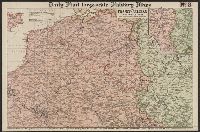
- Philip, George, 1870-1937
- Published / Created:
- [1914.]
- Call Number:
- 11hc 1915B
- Image Count:
- 2
- Resource Type:
- Maps, Atlases & Globes
- Found in:
- Beinecke Rare Book and Manuscript Library > Daily Mail large-scale Military maps No. 3. : The Franco-Belgian Theatre of War / edited by George Philip, F.R.G.S., in conjunction with Military experts.
- Published / Created:
- 1825
- Call Number:
- 23cea 1825A
- Container / Volume:
- BRBL_00021
- Image Count:
- 2
- Resource Type:
- Maps, Atlases & Globes
- Found in:
- Beinecke Rare Book and Manuscript Library > [Two charts of the Pacific Ocean, showing the Northwestern America and Sandwich Islands and ports].
- Creator:
- Longmans, Green, and Co
- Published / Created:
- [191-?]
- Call Number:
- 11hcf 1919A-18
- Container / Volume:
- BRBL_00010M
- Image Count:
- 2
- Resource Type:
- Maps, Atlases & Globes
- Found in:
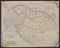
- Beinecke Rare Book and Manuscript Library > Austria-Hungary.
- Creator:
- Longmans, Green, and Co
- Published / Created:
- [191-?]
- Call Number:
- 11hcf 1919A-21
- Container / Volume:
- BRBL_00010M
- Image Count:
- 2
- Resource Type:
- Maps, Atlases & Globes
- Found in:
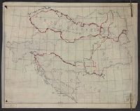
- Beinecke Rare Book and Manuscript Library > Austria-Hungary.
- Creator:
- Longmans, Green, and Co
- Published / Created:
- [191-?]
- Call Number:
- 11hcf 1919A-19
- Container / Volume:
- BRBL_00010M
- Image Count:
- 2
- Resource Type:
- Maps, Atlases & Globes
- Found in:
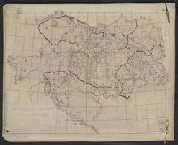
- Beinecke Rare Book and Manuscript Library > Austria-Hungary.
- Creator:
- Pope-Hennessy, Una, 1876-1949
- Published / Created:
- [1917]
- Call Number:
- 11hc 1919Y
- Image Count:
- 2
- Resource Type:
- Maps, Atlases & Globes
- Found in:
- Beinecke Rare Book and Manuscript Library > Map of the main prison camps in Germany and Austria / by Mrs Pope-Hennessy.
- Creator:
- Longmans, Green, and Co
- Published / Created:
- [191-?]
- Call Number:
- 11hcf 1919A-22
- Container / Volume:
- BRBL_00010M
- Image Count:
- 2
- Resource Type:
- Maps, Atlases & Globes
- Found in:
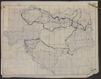
- Beinecke Rare Book and Manuscript Library > Austria-Hungary.
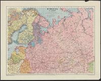
- Creator:
- George Philip & Son
London Geographical Institute
- Published / Created:
- c1942.
- Call Number:
- 352 1942A
- Container / Volume:
- BRBL_00106
- Image Count:
- 2
- Resource Type:
- Maps, Atlases & Globes
- Found in:
- Beinecke Rare Book and Manuscript Library > Russia in Europe.
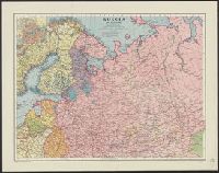
- Creator:
- George Philip & Son
London Geographical Institute
- Published / Created:
- c1942.
- Call Number:
- 352 1942A
- Container / Volume:
- BRBL_00106
- Image Count:
- 2
- Resource Type:
- Maps, Atlases & Globes
- Found in:
- Beinecke Rare Book and Manuscript Library > Russia in Europe.
- Creator:
- Great Britain. War Office. General Staff. Geographical Section
- Published / Created:
- 1940
- Call Number:
- 342 1944
- Container / Volume:
- BRBL_00092
- Image Count:
- 2
- Resource Type:
- Maps, Atlases & Globes
- Found in:
- Beinecke Rare Book and Manuscript Library > The Faeroes / Drawn at the War Office, 1940, from a Danish map of 1932.
- Published / Created:
- 1808
- Call Number:
- 39 1808A
- Container / Volume:
- BRBL_00186
- Image Count:
- 2
- Resource Type:
- Maps, Atlases & Globes
- Found in:
- Beinecke Rare Book and Manuscript Library > A new map of the Kingdom of Spain and Portugal ...
- Published / Created:
- [1802?]
- Call Number:
- 39 1802
- Container / Volume:
- BRBL_00186
- Image Count:
- 2
- Resource Type:
- Maps, Atlases & Globes
- Found in:
- Beinecke Rare Book and Manuscript Library > A map of the Kingdoms of Spain and Portugal according to DeLisle ...
- Published / Created:
- 1873
- Call Number:
- 40 1873
- Container / Volume:
- BRBL_00202
- Image Count:
- 2
- Resource Type:
- Maps, Atlases & Globes
- Found in:
- Beinecke Rare Book and Manuscript Library > Central and South Italy : to accompany the handbooks for travellers / by J. & C. Walker.
- Published / Created:
- [ca. 1760]
- Call Number:
- 40 1780C
- Container / Volume:
- BRBL_00198
- Image Count:
- 2
- Resource Type:
- Maps, Atlases & Globes
- Found in:
- Beinecke Rare Book and Manuscript Library > A new map of Italy : distinguishing all the sovereignties in it whether states, kingdoms, dutchies, principalities, republicks &c. with the post roads, & many remarks not extant in any map, according to the newest and most exact observations.
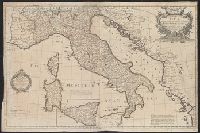
- Published / Created:
- 1800
- Call Number:
- 40 1800
- Container / Volume:
- BRBL_00199
- Image Count:
- 2
- Resource Type:
- Maps, Atlases & Globes
- Found in:
- Beinecke Rare Book and Manuscript Library > Italy with the addition of the southern parts of Germany ... / by L.S. Delarochette.
- Creator:
- Maclure, Macdonald & Macgregor
- Published / Created:
- 1859
- Call Number:
- 402hc 1859
- Container / Volume:
- BRBL_00233A
- Image Count:
- 2
- Resource Type:
- Maps, Atlases & Globes
- Found in:
- Beinecke Rare Book and Manuscript Library > Maclure, Macdonald & Macgregor's large scale map of the seat of war in Italy! [cartographic material] : sheet no. 1 / Maclure, Macdonald & Macgregor, lithrs. by steam power.
- Creator:
- Montrésor, John, 1736-1799
- Published / Created:
- 1768
- Call Number:
- 732 1768
- Container / Volume:
- BRBL_00376A
- Image Count:
- 2
- Resource Type:
- Maps, Atlases & Globes
- Found in:
- Beinecke Rare Book and Manuscript Library > Map of Nova Scotia, or Acadia : with the islands of Cape Breton and St. John's, from actual surveys / by Captn. Montresor, engir.
- Creator:
- Arrowsmith, John, 1790-1873
- Published / Created:
- 25 April 1859.
- Call Number:
- 73 1859D
- Container / Volume:
- BRBL_00375
- Image Count:
- 2
- Resource Type:
- Maps, Atlases & Globes
- Found in:
- Beinecke Rare Book and Manuscript Library > British North America : by permission dedicated to the Honble. Hudsons Bay Company, containing the latest information which their documents furnish / by their obedient servant, J. Arrowsmith.
- Creator:
- Wyld, James, 1812-1887
- Published / Created:
- July 16th, 1858.
- Call Number:
- 739 1858
- Container / Volume:
- BRBL_00388
- Image Count:
- 2
- Resource Type:
- Maps, Atlases & Globes
- Found in:
- Beinecke Rare Book and Manuscript Library > Map of the colony of New Caledonia and the British & American territory west of the Rocky mountains including Vancouvers Island and the gold fields [cartographic material] / by James Wyld, geographer to the Queen & the Prince Consort, Charing Cross East,
- Creator:
- Betts, John, fl. 1844-1863
- Published / Created:
- [18--?]
- Call Number:
- 71 18XX
- Container / Volume:
- BRBL_00371
- Image Count:
- 2
- Resource Type:
- Maps, Atlases & Globes
- Found in:
- Beinecke Rare Book and Manuscript Library > North America.
- Published / Created:
- 1786
- Call Number:
- 70 1786B
- Container / Volume:
- BRBL_00357
- Image Count:
- 2
- Resource Type:
- Maps, Atlases & Globes
- Found in:
- Beinecke Rare Book and Manuscript Library > A new map of the Whole Continent of American ... from the Original Materials of Governor Pownall, M.P.
- Creator:
- Pownall, Thomas, 1722-1805
- Published / Created:
- 1794 May 12
- Call Number:
- 71 1794
- Container / Volume:
- BRBL_00367
- Image Count:
- 2
- Resource Type:
- Maps, Atlases & Globes
- Found in:
- Beinecke Rare Book and Manuscript Library > A new map of North America with the West India Islands : divided according to the preliminary articles of peace, signed at Versailles, 20 Jan. 1783, wherein are particularly distinguished the United States, and the several provinces, governments &ca which
- Creator:
- Wyld, James, 1812-1887
- Published / Created:
- March 2nd 1857.
- Call Number:
- 71 1857
- Container / Volume:
- BRBL_00371
- Image Count:
- 2
- Resource Type:
- Maps, Atlases & Globes
- Found in:
- Beinecke Rare Book and Manuscript Library > The British possessions in North America and the United States with the Hudson's Bay territories / by James Wyld, geographer to the Queen & H.R.H. Prince Albert.
- Creator:
- Arrowsmith, John, 1790-1873
- Published / Created:
- 1839
- Call Number:
- 734 Q31 1839
- Container / Volume:
- BRBL_00380
- Image Count:
- 2
- Resource Type:
- Maps, Atlases & Globes
- Found in:
- Beinecke Rare Book and Manuscript Library > Map of the eastern townships of Lower Canada : drawn principally from actual survey for the British American Land Company by A. Wells, provincial land survr. / by John Arrowsmith.
- Creator:
- Wyld, James, 1812-1887
- Published / Created:
- [1857]
- Call Number:
- 75 1857A
- Container / Volume:
- BRBL_00401
- Image Count:
- 1
- Resource Type:
- Maps, Atlases & Globes
- Found in:
- Beinecke Rare Book and Manuscript Library > The United States & the relative position of the Oregon & Texas / by James Wyld, Charing Cross East.