Search
You Searched For
Search Results
- Published / Created:
- 1861 May 13
- Call Number:
- 75 1861A
- Container / Volume:
- BRBL_00402
- Image Count:
- 1
- Resource Type:
- Maps, Atlases & Globes
- Found in:
- Beinecke Rare Book and Manuscript Library > Stanford's new hand map of the United States of North America / Constructed and engrd. at Stanford's Geographical Establishmt. London.
- Creator:
- Morden, Robert, d. 1703
- Published / Created:
- [1676?]
- Call Number:
- 755 1675E
- Container / Volume:
- BRBL_00423
- Image Count:
- 1
- Resource Type:
- Maps, Atlases & Globes
- Found in:
- Beinecke Rare Book and Manuscript Library > A map of New England, New Yorke, New Jersey, Mary-land & Virginia / Gr. King sculpsit.
- Published / Created:
- [1684?]
- Call Number:
- 755 1684A
- Container / Volume:
- BRBL_00424
- Image Count:
- 1
- Resource Type:
- Maps, Atlases & Globes
- Found in:
- Beinecke Rare Book and Manuscript Library > A map of ye English Empire in Y Continent of America, ... W. Binneman, sculpsit.
- Published / Created:
- 1776
- Call Number:
- 771 H864 1776A
- Container / Volume:
- BRBL_00483
- Image Count:
- 1
- Resource Type:
- Maps, Atlases & Globes
- Found in:
- Beinecke Rare Book and Manuscript Library > A Topographical map of Hudsons River ... Communication with Canada by Lake George and lake Champlain ... by Claude Joseph Sauthier ...
- Published / Created:
- 1776
- Call Number:
- 771 H864 1776
- Container / Volume:
- BRBL_00483
- Image Count:
- 1
- Resource Type:
- Maps, Atlases & Globes
- Found in:
- Beinecke Rare Book and Manuscript Library > A Topographical map of Hudsons River ... Communication with Canada by Lake George and lake Champlain ... by Claude Joseph Sauthier ...
- Published / Created:
- 1776
- Call Number:
- 786cea D32 1776
- Container / Volume:
- BRBL_00516
- Image Count:
- 1
- Resource Type:
- Maps, Atlases & Globes
- Found in:
- Beinecke Rare Book and Manuscript Library > A plan of the RIver And Sound of D'Awfoskee ...
- Published / Created:
- [1780?]
- Call Number:
- 786 1780A
- Container / Volume:
- BRBL_00515
- Image Count:
- 1
- Resource Type:
- Maps, Atlases & Globes
- Found in:
- Beinecke Rare Book and Manuscript Library > A draught of South Carolina and Georgia from Sewee to St. Estaca / by Andrew Hughes
- Published / Created:
- 1770
- Call Number:
- 785 1770
- Container / Volume:
- BRBL_00513
- Image Count:
- 1
- Resource Type:
- Maps, Atlases & Globes
- Found in:
- Beinecke Rare Book and Manuscript Library > A Compleat Map of North-Carolina from an actual Survey. By Capnt. [John A. ] Collet, Governor of Fort Johnson, Engraved by I. Bayly. Published according to Act of Parliament May the 1st. 1770, by S. Hooper Nọ 25 Ludgate Hill, London.
- Published / Created:
- 1776
- Call Number:
- 786cea C38 1776A
- Container / Volume:
- BRBL_00516
- Image Count:
- 1
- Resource Type:
- Maps, Atlases & Globes
- Found in:
- Beinecke Rare Book and Manuscript Library > An exact plan of Charles -Town-Bar and Harbour ...
- Published / Created:
- 1776
- Call Number:
- 786cea P838 1776
- Container / Volume:
- BRBL_00516
- Image Count:
- 1
- Resource Type:
- Maps, Atlases & Globes
- Found in:
- Beinecke Rare Book and Manuscript Library > A Plan of Port Royal in South Carolina ...
- Published / Created:
- [1738]
- Call Number:
- 785cea 1738
- Container / Volume:
- BRBL_00514
- Image Count:
- 1
- Resource Type:
- Maps, Atlases & Globes
- Found in:
- Beinecke Rare Book and Manuscript Library > To his grace Thomas Hollis Pelham, Duke of Newcastle... : this chart of his majesties province of North Carolina... / James Wimble... 1738.
- Published / Created:
- 1776
- Call Number:
- 785cea C17 1776
- Container / Volume:
- BRBL_00514
- Image Count:
- 1
- Resource Type:
- Maps, Atlases & Globes
- Found in:
- Beinecke Rare Book and Manuscript Library > A plan of Cape Fear River from the bar to Brunswick.
- Published / Created:
- 1776
- Call Number:
- 786hc C38 1776
- Container / Volume:
- BRBL_00516
- Image Count:
- 1
- Resource Type:
- Maps, Atlases & Globes
- Found in:
- Beinecke Rare Book and Manuscript Library > A plan of the attack of Fort Sullivan, the key of Charlestown in South Carolina ... by Sir Peter Parker ...
- Creator:
- Broughton, William Robert, 1762-1821
- Published / Created:
- 1st. Novr. 1798.
- Call Number:
- 846 C72 1798
- Container / Volume:
- BRBL_00622
- Image Count:
- 1
- Resource Type:
- Maps, Atlases & Globes
- Found in:
- Beinecke Rare Book and Manuscript Library > Plan of the River Oregan, from an actual survey.
- Creator:
- Vancouver, George, 1757-1798
- Published / Created:
- 1798
- Call Number:
- 845 1798E
- Container / Volume:
- BRBL_00619
- Image Count:
- 1
- Resource Type:
- Maps, Atlases & Globes
- Found in:
- Beinecke Rare Book and Manuscript Library > A chart shewing part of the coast of N.W. America, with the tracks of His Majesty's sloop Discovery and armed tender Chatham / commanded by George Vancouver, esqu. and prepared under his immediate inspection by Lieut. Joseph Baker, in which the continenta
- Creator:
- Vancouver, George, 1757-1798
- Published / Created:
- 1798
- Call Number:
- 845 1798B
- Container / Volume:
- BRBL_00619
- Image Count:
- 1
- Resource Type:
- Maps, Atlases & Globes
- Found in:
- Beinecke Rare Book and Manuscript Library > A chart shewing part of the coast of N.W. America, with the tracks of His Majesty's sloop Discovery and armed tender Chatham / commanded by George Vancouver, esqr. and prepared from the foregoing surveys under his immediate inspection by Lieut. Edwd. Robe
- Creator:
- Wyld, James, 1812-1887
- Published / Created:
- April 10th 1845.
- Call Number:
- 846 1845
- Container / Volume:
- BRBL_00620
- Image Count:
- 1
- Resource Type:
- Maps, Atlases & Globes
- Found in:
- Beinecke Rare Book and Manuscript Library > Map of the Oregon districts and the adjacent country / James Wyld, geographer to the Queen.
- Creator:
- Vancouver, George, 1757-1798
- Published / Created:
- 1798
- Call Number:
- 845 1798C
- Container / Volume:
- BRBL_00619
- Image Count:
- 1
- Resource Type:
- Maps, Atlases & Globes
- Found in:
- Beinecke Rare Book and Manuscript Library > A chart shewing part of the coast of N.W. America, with the tracks of His Majesty's sloop Discovery and armed tender Chatham / commanded by George Vancouver, esq. and prepared under his immediate inspection by Lieut. Joseph Baker, in which the continental
- Creator:
- Vancouver, George, 1757-1798
- Published / Created:
- 1798
- Call Number:
- 845 1798G
- Container / Volume:
- BRBL_00619
- Image Count:
- 1
- Resource Type:
- Maps, Atlases & Globes
- Found in:
- Beinecke Rare Book and Manuscript Library > A chart shewing part of the coast of N.W. America, with the tracks of His Majesty's sloop Discovery and armed tender Chatham / commanded by George Vancouver, esqr. and prepared under his immediate inspection by Lieut. Joseph Baker, in which the continenta
- Creator:
- Wyld, James, 1812-1887
- Published / Created:
- April 10th 1845.
- Call Number:
- 846 1845
- Container / Volume:
- BRBL_00620
- Image Count:
- 1
- Resource Type:
- Maps, Atlases & Globes
- Found in:
- Beinecke Rare Book and Manuscript Library > Map of the Oregon districts and the adjacent country / James Wyld, geographer to the Queen.
- Creator:
- Vancouver, George, 1757-1798
- Published / Created:
- 1798
- Call Number:
- 845 1798A
- Container / Volume:
- BRBL_00619
- Image Count:
- 1
- Resource Type:
- Maps, Atlases & Globes
- Found in:
- Beinecke Rare Book and Manuscript Library > A chart shewing part of the coast of N.W. America : with the tracks of His Majesty's sloop Discovery and armed tender Chatham / commanded by George Vancouver, esqr. and prepared under his immediate inspection by Lieut. Joseph Baker, in which the continent
- Creator:
- Vancouver, George, 1757-1798
- Published / Created:
- 1798
- Call Number:
- 845 1798H
- Container / Volume:
- BRBL_00619
- Image Count:
- 1
- Resource Type:
- Maps, Atlases & Globes
- Found in:
- Beinecke Rare Book and Manuscript Library > A chart shewing part of the coast of N.W. America, with the tracks of His Majesty's sloop Discovery and armed tender Chatham / commanded by George Vancouver, esq. and prepared under his immediate inspection by Lieut. Joseph Baker, in which the continental
- Creator:
- Vancouver, George, 1757-1798
- Published / Created:
- 1798
- Call Number:
- 845 1798F
- Container / Volume:
- BRBL_00619
- Image Count:
- 1
- Resource Type:
- Maps, Atlases & Globes
- Found in:
- Beinecke Rare Book and Manuscript Library > A chart shewing part of the coast of N.W. America, with the tracks of His Majesty's sloop Discovery and armed tender Chatham / commanded by George Vancouver, esqr. and prepared under his immediate inspection by Lieut. Joseph Baker, in which the continenta
- Creator:
- Vancouver, George, 1757-1798
- Published / Created:
- 1798
- Call Number:
- 845 1798D
- Container / Volume:
- BRBL_00619
- Image Count:
- 1
- Resource Type:
- Maps, Atlases & Globes
- Found in:
- Beinecke Rare Book and Manuscript Library > A chart shewing part of the coast of N.W. America, with the tracks of His Majesty's sloop Discovery and armed tender Chatham / commanded by George Vancouver, esqr. and prepared under his immediate inspection by Lieut. Joseph Baker, in which the continenta
- Creator:
- Jefferys, Thomas, -1771, cartographer
- Published / Created:
- 20 Feby. 1775.
- Call Number:
- 792cea 1775A
- Container / Volume:
- BRBL_00691
- Image Count:
- 1
- Resource Type:
- Maps, Atlases & Globes
- Found in:
- Beinecke Rare Book and Manuscript Library > The coast of West Florida and Louisiana : the Peninsula and Gulf of Florida or Channel of Bahama with the Bahama Islands / by Thos. Jefferys ...
- Creator:
- Ross, Lieut
- Published / Created:
- 1 June 1775.
- Call Number:
- 807 1775B
- Container / Volume:
- BRBL_00691
- Image Count:
- 1
- Resource Type:
- Maps, Atlases & Globes
- Found in:
- Beinecke Rare Book and Manuscript Library > Course of the river Mississippi from the Balise to Fort Chartres : taken on an expedition to the Illinois, in the latter end of the year 1765 / by Lieut. Ross of the 34th Regiment ; improved from the surveys of the river made by the French.
- Creator:
- Lynch, H. F. B. (Harry Finnis Blosse), 1862-1913
- Published / Created:
- [1901]
- Call Number:
- 3546 1901
- Container / Volume:
- BRBL_00113
- Image Count:
- 1
- Resource Type:
- Maps, Atlases & Globes
- Found in:
- Beinecke Rare Book and Manuscript Library > Map of Armenia and adjacent countries / by H.F.B. Lynch & F. Oswald. The material compiled by W. Shawe. 1901.
- Creator:
- Weller, Edward, d. 1884
- Published / Created:
- [1905?]
- Call Number:
- 352 1905
- Container / Volume:
- BRBL_00105
- Image Count:
- 1
- Resource Type:
- Maps, Atlases & Globes
- Found in:
- Beinecke Rare Book and Manuscript Library > Handbook map of Russia / Edwa[rd] Weller.
- Published / Created:
- 1905
- Call Number:
- 38hc C71 1871
- Container / Volume:
- BRBL_00172
- Image Count:
- 1
- Resource Type:
- Maps, Atlases & Globes
- Found in:
- Beinecke Rare Book and Manuscript Library > Battle of Colombey-Nouilly.
- Published / Created:
- 1829
- Call Number:
- 32 L84 1829
- Container / Volume:
- BRBL_00049
- Image Count:
- 1
- Resource Type:
- Maps, Atlases & Globes
- Found in:
- Beinecke Rare Book and Manuscript Library > Cruchley's New Plan of London shewing all the new and intended improvements to the present time.
- Published / Created:
- 1905
- Call Number:
- 38hc Se27 1871A
- Container / Volume:
- BRBL_00173
- Image Count:
- 1
- Resource Type:
- Maps, Atlases & Globes
- Found in:
- Beinecke Rare Book and Manuscript Library > Battle of Sedan: position of the Germans in the afternoon shortly before the end of the struggle.
- Published / Created:
- 1905
- Call Number:
- 38hc Se27 1871
- Container / Volume:
- BRBL_00173
- Image Count:
- 1
- Resource Type:
- Maps, Atlases & Globes
- Found in:
- Beinecke Rare Book and Manuscript Library > Battle of Sedan: position of the contending forces towards noon.
- Creator:
- Sōtēriadēs, Geōrgios, 1852-1941
- Published / Created:
- [1918]
- Call Number:
- 44ed 1918A
- Container / Volume:
- BRBL_00257
- Image Count:
- 1
- Resource Type:
- Maps, Atlases & Globes
- Found in:
- Beinecke Rare Book and Manuscript Library > Hellenism in the Near East : an ethnological map compiled from the latest statistics / by George Soteriadis.
- Published / Created:
- [1912]
- Call Number:
- 41 1912
- Container / Volume:
- BRBL_00241
- Image Count:
- 1
- Resource Type:
- Maps, Atlases & Globes
- Found in:
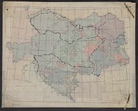
- Beinecke Rare Book and Manuscript Library > Austria-Hungary / The London Geographical Institute.
- Creator:
- George Philip & Son
- Published / Created:
- [1918?]
- Call Number:
- 53 1917
- Container / Volume:
- BRBL_00285
- Image Count:
- 1
- Resource Type:
- Maps, Atlases & Globes
- Found in:
- Beinecke Rare Book and Manuscript Library > Philips' strategical map of Mesopotamia & Asia Minor / George Philip & Son, ltd.
- Creator:
- China Inland Mission
- Published / Created:
- 1911
- Call Number:
- 56 1911
- Container / Volume:
- BRBL_00296
- Image Count:
- 1
- Resource Type:
- Maps, Atlases & Globes
- Found in:
- Beinecke Rare Book and Manuscript Library > A map of China [cartographic material] : prepared for the China Inland Mission.
- Published / Created:
- 1891
- Call Number:
- 212 1891
- Container / Volume:
- BRBL_00017
- Image Count:
- 1
- Resource Type:
- Maps, Atlases & Globes
- Found in:
- Beinecke Rare Book and Manuscript Library > Azores.
- Creator:
- Great Britain. Hydrographic Dept
- Published / Created:
- 1863
- Call Number:
- 5735 1861
- Container / Volume:
- BRBL_00734
- Image Count:
- 1
- Resource Type:
- Maps, Atlases & Globes
- Found in:
- Beinecke Rare Book and Manuscript Library > Japan Kiusiu Island, West Coast. Nagasaki Harbour, 1861 / engraved by Davies & Powell.
- Published / Created:
- [c1760]
- Call Number:
- 7345 Q31 1760
- Container / Volume:
- BRBL_00734
- Image Count:
- 1
- Resource Type:
- Maps, Atlases & Globes
- Found in:
- Beinecke Rare Book and Manuscript Library > An authentic plan of the River St. Laurence from Sillery, to the fall of Montmorenci : with the operations of the siege of Quebec under the command of Vice-Adml. Saunders & Major Genl. Wolfe down to the 5. Sepr. 1759 / drawn by a captain in His Majesties navy.
- Published / Created:
- 1909
- Call Number:
- 583 1909
- Container / Volume:
- BRBL_00314
- Image Count:
- 1
- Resource Type:
- Maps, Atlases & Globes
- Found in:
- Beinecke Rare Book and Manuscript Library > Map of the British territories & British protectorates in the Malay peninsula : to accompany the guide book to the Federated Malay States by C.W. Harrison, Esq., Malay Civil Service.
- Published / Created:
- 1913
- Call Number:
- 641 1913
- Container / Volume:
- BRBL_00338
- Image Count:
- 1
- Resource Type:
- Maps, Atlases & Globes
- Found in:
- Beinecke Rare Book and Manuscript Library > Map of Rhodesia under the administration of the British South Africa Company.
- Published / Created:
- 1912
- Call Number:
- 641 1912
- Container / Volume:
- BRBL_00338
- Image Count:
- 1
- Resource Type:
- Maps, Atlases & Globes
- Found in:
- Beinecke Rare Book and Manuscript Library > Map of Rhodesia under the administration of the British South Africa Company.
- Published / Created:
- c1914.
- Call Number:
- 32am L84 1914
- Container / Volume:
- BRBL_00075
- Image Count:
- 1
- Resource Type:
- Maps, Atlases & Globes
- Found in:
- Beinecke Rare Book and Manuscript Library > Wonderground map of the London Town drawn by MacDonald Gill.
- Creator:
- Carver, Jonathan, 1710-1780
- Published / Created:
- 16th February 1776.
- Call Number:
- 131 1776-6
- Container / Volume:
- BRBL_00011
- Image Count:
- 1
- Resource Type:
- Maps, Atlases & Globes
- Found in:
- Beinecke Rare Book and Manuscript Library > A new map of the province of Quebec : according to the Royal Proclamation, of the 7th of October 1763 / from the French surveys connected with those made after the war, by Captain Carver, and other officers, in His Majesty's service.
- Published / Created:
- 1775
- Call Number:
- 771 1775A
- Container / Volume:
- BRBL_00477
- Image Count:
- 2
- Resource Type:
- Maps, Atlases & Globes
- Found in:
- Beinecke Rare Book and Manuscript Library > Map of the Province of New York with part of Pennsilvania and New England ...
- Creator:
- Scull, William, active 1765, cartographer.
- Published / Created:
- 10 June 1775.
- Call Number:
- 774 1775
- Container / Volume:
- BRBL_00497
- Image Count:
- 2
- Resource Type:
- Maps, Atlases & Globes
- Found in:
- Beinecke Rare Book and Manuscript Library > A map of Pennsylvania exhibiting not only the improved parts of that Province, but also its extensive frontiers: Laid down from actual surveys, and chiefly from the late map of W. Scull published in 1770; and humbly inscribed to the Honorable Thomas Penn
- Published / Created:
- 1776
- Call Number:
- 778cea 1776
- Container / Volume:
- BRBL_00504A
- Image Count:
- 2
- Resource Type:
- Maps, Atlases & Globes
- Found in:
- Beinecke Rare Book and Manuscript Library > A new and Accurate chart of the Bay of Chesapeake ...
- Creator:
- Sayer, Robert, 1725-1794
- Published / Created:
- July the 1st, 1787.
- Call Number:
- 90 1787
- Container / Volume:
- BRBL_00661
- Image Count:
- 2
- Resource Type:
- Maps, Atlases & Globes
- Found in:
- Beinecke Rare Book and Manuscript Library > A map of South America : containing Tierra-Firma, Guayana, New Granada, Amazonia, Brasil, Peru, Paraguay, Chaco, Tucuman, Chili and Patagonia : from Mr. d'Anville with several improvements and additions, and the newest discoveries.
- Creator:
- Anville, Jean Baptiste Bourguignon d', 1697-1782
- Published / Created:
- 1794
- Call Number:
- 70 1794
- Container / Volume:
- BRBL_00686
- Image Count:
- 2
- Resource Type:
- Maps, Atlases & Globes
- Found in:
- Beinecke Rare Book and Manuscript Library > A new map of the whole continent of America : divided into North and South and West Indies wherein are exactly described the United States of North America as well as the several European possessions according to the preliminaries of peace signed at Versa
- Published / Created:
- March 15, 1832
- Call Number:
- 75 1850
- Container / Volume:
- BRBL_00689
- Image Count:
- 2
- Resource Type:
- Maps, Atlases & Globes
- Found in:
- Beinecke Rare Book and Manuscript Library > A geological map of the United States [cartographic material].
- Published / Created:
- 1905
- Call Number:
- 38hc V81 1871
- Container / Volume:
- BRBL_00173
- Image Count:
- 2
- Resource Type:
- Maps, Atlases & Globes
- Found in:
- Beinecke Rare Book and Manuscript Library > Battle of Vionville - Mars la Tour.
- Published / Created:
- [1910?]
- Call Number:
- 32gmb P83 1910
- Container / Volume:
- BRBL_00076
- Image Count:
- 2
- Resource Type:
- Maps, Atlases & Globes
- Found in:
- Beinecke Rare Book and Manuscript Library > The Royal Automobile Club Official motoring map of England & Wales, Portsmouth.
- Published / Created:
- 1794
- Call Number:
- 11 1794
- Container / Volume:
- BRBL_00724
- Image Count:
- 2
- Resource Type:
- Maps, Atlases & Globes
- Found in:
- Beinecke Rare Book and Manuscript Library > A general map of the world, or terraqueous globe ... / by Saml. Dunn, mathematician.
- Creator:
- Anville, Jean Baptiste Bourguignon d', 1697-1782
- Published / Created:
- 1794
- Call Number:
- 70 1794
- Container / Volume:
- BRBL_00725
- Image Count:
- 2
- Resource Type:
- Maps, Atlases & Globes
- Found in:
- Beinecke Rare Book and Manuscript Library > A new map of the whole continent of America : divided into North and South and West Indies wherein are exactly described the United States of North America as well as the several European possessions according to the preliminaries of peace signed at Versa
- Published / Created:
- 1783
- Call Number:
- 71 1783P
- Container / Volume:
- BRBL_00726
- Image Count:
- 2
- Resource Type:
- Maps, Atlases & Globes
- Found in:
- Beinecke Rare Book and Manuscript Library > A new map of North America, with the West India islands ... laid down according to the latest surveys, and corrected from the original materials, of Goverr. Pownall.
- Published / Created:
- 1794
- Call Number:
- 90 1794A
- Container / Volume:
- BRBL_00731
- Image Count:
- 2
- Resource Type:
- Maps, Atlases & Globes
- Found in:
- Beinecke Rare Book and Manuscript Library > A new map of South America ... from Mr. d'Anville ...
- Published / Created:
- 1794
- Call Number:
- 90 1794A
- Container / Volume:
- BRBL_00731
- Image Count:
- 2
- Resource Type:
- Maps, Atlases & Globes
- Found in:
- Beinecke Rare Book and Manuscript Library > A new map of South America ... from Mr. d'Anville ...
- Creator:
- Speed, John, 1552?-1629
- Published / Created:
- [1612?]
- Call Number:
- 3191 1611
- Container / Volume:
- BRBL_00732
- Image Count:
- 2
- Resource Type:
- Maps, Atlases & Globes
- Found in:
- Beinecke Rare Book and Manuscript Library > Britain as it was devided in the tyme of the Englishe Saxons especially during their heptarchy / performed by Iohn Speede and are to be sold by John Sudbury & Georg. Humble, in Popes head alley at Londo[n].
- Creator:
- Arlidge, Abraham
- Published / Created:
- 1983
- Call Number:
- 32 L84 1694/1983
- Container / Volume:
- BRBL_00739
- Image Count:
- 2
- Resource Type:
- Maps, Atlases & Globes
- Found in:
- Beinecke Rare Book and Manuscript Library > A Survey of Hatton Garden : a suruey of Hatton-Garden belonging to ... Barron Hatton of Kirby / by Abraham Arlidge.
- Creator:
- Anville, Jean Baptiste Bourguignon d', 1697-1782
- Published / Created:
- 1st April 1812.
- Call Number:
- 61 1812B
- Image Count:
- 2
- Resource Type:
- Maps, Atlases & Globes
- Found in:
- Beinecke Rare Book and Manuscript Library > Aegyptus Antiqua Mandato Serenissimi Delphini publici juris facta / Auctor d'Anville Regiae Humaniorum Litterarum Academiae et scientiarum Petropolitanae socius, et Aurelianorum Celsiss. Duci a Secretis. MDCCLXV.
- Creator:
- Baluarte, Rafael E
- Published / Created:
- 1903
- Call Number:
- 97 1903A
- Container / Volume:
- BRBL_00677
- Image Count:
- 2
- Resource Type:
- Maps, Atlases & Globes
- Found in:
- Beinecke Rare Book and Manuscript Library > Karta öfver Perú / utgifven af D.E. Larrabure y unánue Utrikesminister. R.E. Baluarte, Kartograf.
- Creator:
- Baluarte, Rafael E
- Published / Created:
- 1903
- Call Number:
- 97 1903
- Container / Volume:
- BRBL_00677
- Image Count:
- 2
- Resource Type:
- Maps, Atlases & Globes
- Found in:
- Beinecke Rare Book and Manuscript Library > Map of Peru / published by D.E. Larrabure y Unánue, Minister of Foreign Affairs.
- Published / Created:
- [1852?].
- Call Number:
- 90 1852
- Container / Volume:
- BRBL_00663
- Image Count:
- 2
- Resource Type:
- Maps, Atlases & Globes
- Found in:
- Beinecke Rare Book and Manuscript Library > Columbia Prima or South America / Drawn from the large map in eight sheets by by Louis Stanislas D'Arcy Delarochette.
- Published / Created:
- [1856?].
- Call Number:
- 90 1856
- Container / Volume:
- BRBL_00663
- Image Count:
- 2
- Resource Type:
- Maps, Atlases & Globes
- Found in:
- Beinecke Rare Book and Manuscript Library > Columbia Prima or South America / Drawn from the large map in eight sheets by by Louis Stanislas D'Arcy Delarochette.
- Creator:
- Anville, Jean Baptiste Bourguignon d', 1697-1782
- Published / Created:
- 1779
- Call Number:
- 90 1779
- Container / Volume:
- BRBL_00661
- Image Count:
- 2
- Resource Type:
- Maps, Atlases & Globes
- Found in:
- Beinecke Rare Book and Manuscript Library > A map of South America containing Tierra-Firma, Guayana, New Granada, Amazonia, Brasil, Peru, Paraguay, Chaco, Tucuman, Chili and Patagonia [cartographic material] : from Mr. d'Anville, with several improvements and additions, and the newest discoveries /
- Published / Created:
- Oct. 1783.
- Call Number:
- 906 1783
- Container / Volume:
- BRBL_00667
- Image Count:
- 2
- Resource Type:
- Maps, Atlases & Globes
- Found in:
- Beinecke Rare Book and Manuscript Library > The Coast of Guyana fron the Oroonoko to the River of Amazons and the Inland Parts, as far as they have been Explored by the French and Dutch Engineers with the Island of Barbadoes Tobago & co. From hte Observations of Capitain Edward Thompson, made in th
- Creator:
- Wyld, James, 1812-1887
- Published / Created:
- 1851
- Call Number:
- 8555 1851
- Container / Volume:
- BRBL_00642
- Image Count:
- 2
- Resource Type:
- Maps, Atlases & Globes
- Found in:
- Beinecke Rare Book and Manuscript Library > The island of Jamaica / by James Wyld, geographer to the Queen and H.R.H. Prince Albert.
- Published / Created:
- c1920.
- Call Number:
- 322gm 1920
- Container / Volume:
- BRBL_00063
- Image Count:
- 2
- Resource Type:
- Maps, Atlases & Globes
- Found in:
- Beinecke Rare Book and Manuscript Library > Channel Islands and Continental and Ocean Routes in Connection with the South Western Railway.
- Creator:
- Henry Blacklock & Co
- Published / Created:
- [c1906]
- Call Number:
- 319gme 1906A
- Container / Volume:
- BRBL_00042
- Image Count:
- 2
- Resource Type:
- Maps, Atlases & Globes
- Found in:
- Beinecke Rare Book and Manuscript Library > Bradshaw's railway map of Great Britain and Ireland.
- Published / Created:
- [1910?]
- Call Number:
- 32gmb Ox1 1910
- Container / Volume:
- BRBL_00076
- Image Count:
- 2
- Resource Type:
- Maps, Atlases & Globes
- Found in:
- Beinecke Rare Book and Manuscript Library > The Royal Automobile Club Official motoring map of England & Wales, Oxford.
- Published / Created:
- 1910
- Call Number:
- 32am L84 1910A
- Container / Volume:
- BRBL_00075
- Image Count:
- 2
- Resource Type:
- Maps, Atlases & Globes
- Found in:
- Beinecke Rare Book and Manuscript Library > The enlarged pictorial plan of London.
- Published / Created:
- March 1880.
- Call Number:
- 11 1584
- Container / Volume:
- BRBL_00722
- Image Count:
- 2
- Resource Type:
- Maps, Atlases & Globes
- Found in:
- Beinecke Rare Book and Manuscript Library > [World map].
- Published / Created:
- 1983
- Call Number:
- 32 L84 1682/1983
- Container / Volume:
- BRBL_00739
- Image Count:
- 2
- Resource Type:
- Maps, Atlases & Globes
- Found in:
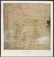
- Beinecke Rare Book and Manuscript Library > The Tower of London 1682.
- Creator:
- George Philip & Son
- Published / Created:
- [1920?]
- Call Number:
- 59 1920
- Container / Volume:
- BRBL_00317
- Image Count:
- 2
- Resource Type:
- Maps, Atlases & Globes
- Found in:
- Beinecke Rare Book and Manuscript Library > Specimen map from Philips' international atlas : Indian empire with Ceylon - general / London Geographical Institute.
- Published / Created:
- [1912?]
- Call Number:
- 59gm 1912
- Container / Volume:
- BRBL_00318
- Image Count:
- 2
- Resource Type:
- Maps, Atlases & Globes
- Found in:
- Beinecke Rare Book and Manuscript Library > Map of India : shewing the lines of railways, telegraphs, and dawk routes.
- Creator:
- Society for the Diffusion of Useful Knowledge (Great Britain), cartographer
- Published / Created:
- 1834
- Call Number:
- 642 1834
- Image Count:
- 2
- Resource Type:
- Maps, Atlases & Globes
- Found in:
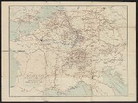
- Beinecke Rare Book and Manuscript Library > South Africa [cartographic material] : compiled from the M.S. maps in the Colonial Office, Captn. Owen's survey &c. / published under the Superintendence of the Society for the Diffusion of Useful Knowledge by Baldwin & Cradock ; J. & C. Walker, sculpt.
- Creator:
- Imray, James F. (James Frederick), 1829?-1891
James Imray and Son
- Published / Created:
- 1882
- Call Number:
- 27cea 1882 3
- Container / Volume:
- BRBL_00023D
- Image Count:
- 2
- Resource Type:
- Maps, Atlases & Globes
- Found in:
- Beinecke Rare Book and Manuscript Library > East India Archipelago, western route to China. Chart no. 6.
- Creator:
- Longmans, Green, and Co
- Published / Created:
- [191-?]
- Call Number:
- 11hcf 1919A-20
- Container / Volume:
- BRBL_00010M
- Image Count:
- 2
- Resource Type:
- Maps, Atlases & Globes
- Found in:
- Beinecke Rare Book and Manuscript Library > Austria-Hungary.
- Creator:
- George Philip & Son
- Published / Created:
- [1920?]
- Call Number:
- 263 1920
- Container / Volume:
- BRBL_00023
- Image Count:
- 2
- Resource Type:
- Maps, Atlases & Globes
- Found in:
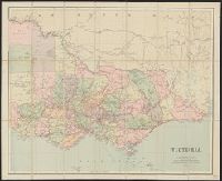
- Beinecke Rare Book and Manuscript Library > Victoria.
- Published / Created:
- 1842
- Call Number:
- 29cea 1842
- Container / Volume:
- BRBL_00028
- Image Count:
- 2
- Resource Type:
- Maps, Atlases & Globes
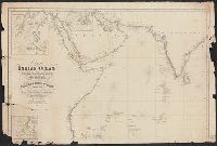
- Found in:
- Beinecke Rare Book and Manuscript Library > Chart of the Indian Ocean from the Cape of Good Hope to Calcutta, Including the Red Sea and the Persian Gulf; Compiled from the most recent Surveys of the East India Company's Officers and those of the Royal Navy by John Walker, geographer to the East Ind
- Published / Created:
- 1794
- Call Number:
- 32 1794
- Container / Volume:
- BRBL_00044
- Image Count:
- 2
- Resource Type:
- Maps, Atlases & Globes
- Found in:
- Beinecke Rare Book and Manuscript Library > A new map of England & Wales ... By Thos. Kitchin ... Printed for Robt. Sayer ...
- Creator:
- G.W. Bacon & Co
- Published / Created:
- [ca. 1917]
- Call Number:
- 307hc 1917
- Container / Volume:
- BRBL_00036A
- Image Count:
- 2
- Resource Type:
- Maps, Atlases & Globes
- Found in:
- Beinecke Rare Book and Manuscript Library > Bacon's map of the seat of war in the North Sea, Belgium and eastern France.
- Creator:
- Hewerdine, Matt
Rose, Fredk. W. (Frederick W.)
- Published / Created:
- c1899.
- Call Number:
- 30an 1899A
- Container / Volume:
- BRBL_00037A
- Image Count:
- 2
- Resource Type:
- Maps, Atlases & Globes
- Found in:
- Beinecke Rare Book and Manuscript Library > Angling in troubled waters [cartographic material] : a serio-comic map of Europe / by Fred. W. Rose ; Matt. Hewerdine, from design by Fred. W. Rose.
- Published / Created:
- [1895?]
- Call Number:
- 32 Ox1 1895
- Container / Volume:
- BRBL_00053
- Image Count:
- 2
- Resource Type:
- Maps, Atlases & Globes
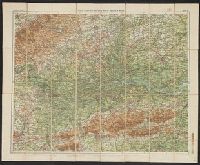
- Found in:
- Beinecke Rare Book and Manuscript Library > Oxford.
- Creator:
- Bradshaw & Blacklock, London
- Published / Created:
- 1872
- Call Number:
- 319gme 1872
- Container / Volume:
- BRBL_00042
- Image Count:
- 2
- Resource Type:
- Maps, Atlases & Globes
- Found in:
- Beinecke Rare Book and Manuscript Library > Bradshaw's railway map of Great Britain and Ireland.
- Creator:
- Gaze, Henry, & sons
John Bartholomew and Son
- Published / Created:
- [1920?]
- Call Number:
- 304ag 1920A
- Container / Volume:
- BRBL_00034A
- Image Count:
- 2
- Resource Type:
- Maps, Atlases & Globes
- Found in:
- Beinecke Rare Book and Manuscript Library > H. gaze & sons : map of central Europe, indicating the principal routes comprised in their system of continental travel tickets.
- Published / Created:
- 1900
- Call Number:
- 32 1900
- Container / Volume:
- BRBL_00045
- Image Count:
- 2
- Resource Type:
- Maps, Atlases & Globes
- Found in:
- Beinecke Rare Book and Manuscript Library > Philips' Clear-Print half-inch map of England & Wales/ London Sheet.
- Published / Created:
- [1899?]
- Call Number:
- 32 Ox1 1899
- Container / Volume:
- BRBL_00053
- Image Count:
- 2
- Resource Type:
- Maps, Atlases & Globes
- Found in:
- Beinecke Rare Book and Manuscript Library > Oxford and District.
- Published / Created:
- [1818?]
- Call Number:
- 32 L84 1818
- Container / Volume:
- BRBL_00049
- Image Count:
- 2
- Resource Type:
- Maps, Atlases & Globes
- Found in:
- Beinecke Rare Book and Manuscript Library > The Stranger's Guide to London and Westminster Exhibiting all the various Alterations & Improvements complete to the present time.
- Creator:
- Stanford, Edward, 1827-1904
- Published / Created:
- 1862
- Call Number:
- 32 L84 1862B
- Image Count:
- 2
- Resource Type:
- Maps, Atlases & Globes
- Found in:
- Beinecke Rare Book and Manuscript Library > Stanford's library map of London and its suburbs [cartographic material].
- Published / Created:
- [1820].
- Call Number:
- 32 1820
- Container / Volume:
- BRBL_00045
- Image Count:
- 2
- Resource Type:
- Maps, Atlases & Globes
- Found in:
- Beinecke Rare Book and Manuscript Library > A new map of England & Wales, drawn from the latest surveys, 1820.
- Published / Created:
- 1833
- Call Number:
- 32 L84 1833
- Container / Volume:
- BRBL_00050
- Image Count:
- 2
- Resource Type:
- Maps, Atlases & Globes
- Found in:
- Beinecke Rare Book and Manuscript Library > Cruchley's new plan of London ...
- Published / Created:
- 1824
- Call Number:
- 319 1824
- Container / Volume:
- BRBL_00040
- Image Count:
- 2
- Resource Type:
- Maps, Atlases & Globes
- Found in:
- Beinecke Rare Book and Manuscript Library > Cary's Reduction of his 6 sheet map of the British Isles ...
- Published / Created:
- 1745
- Call Number:
- 32 L84 1745
- Container / Volume:
- BRBL_00048
- Image Count:
- 2
- Resource Type:
- Maps, Atlases & Globes
- Found in:
- Beinecke Rare Book and Manuscript Library > Survey of London made in the year 1745.
- Published / Created:
- 1783
- Call Number:
- 38 1783
- Container / Volume:
- BRBL_00151
- Image Count:
- 2
- Resource Type:
- Maps, Atlases & Globes
- Found in:
- Beinecke Rare Book and Manuscript Library > A map of the Kingdom of France, ... Jno. Lodge sculp.
- Creator:
- Faden, William, 1749-1836
- Published / Created:
- March 1st 1785.
- Call Number:
- 49 1785
- Container / Volume:
- BRBL_00267
- Image Count:
- 2
- Resource Type:
- Maps, Atlases & Globes
- Found in:
- Beinecke Rare Book and Manuscript Library > A map of the Mediterranean Sea, with the adjacent regions and seas in Europe, Asia, and Africa / by William Faden.
- Published / Created:
- [1849?]
- Call Number:
- 501 1849A
- Container / Volume:
- BRBL_00276
- Image Count:
- 2
- Resource Type:
- Maps, Atlases & Globes
- Found in:
- Beinecke Rare Book and Manuscript Library > Asia Minor by William Henry F. Plate L.L.D. ... J. & C. Walker, Sculp.
- Creator:
- Kitchin, Thomas, d. 1784
- Published / Created:
- 6 Jany. 1787.
- Call Number:
- 50 1787
- Container / Volume:
- BRBL_00271
- Image Count:
- 2
- Resource Type:
- Maps, Atlases & Globes
- Found in:
- Beinecke Rare Book and Manuscript Library > Asia and its islands according to d'Anville : divided into empires, kingdoms, states, regions, & ca. with the European possessions and settlements in the East Indies and an exact delineation of all the discoveries made in the eastern parts by the English
- Creator:
- Wyld, James, 1812-1887
- Published / Created:
- [1861?]
- Call Number:
- 75 1861F
- Container / Volume:
- BRBL_00402
- Image Count:
- 2
- Resource Type:
- Maps, Atlases & Globes
- Found in:
- Beinecke Rare Book and Manuscript Library > The United States & the relative position of the Northern states and the Southern Confederated states / by James Wyld, Charing Cross East.