Skip to search
Skip to main content
Skip to first result
Search
You Searched For
Resource Type
Maps, Atlases & Globes
Publication Place
London :
New Search
Search Results
Creator:
Published / Created:
1918
Call Number:
11hcf 1919E-6
Container / Volume:
BRBL_00010ZA
Image Count:
1
Resource Type:
Maps, Atlases & Globes
Found in:
Beinecke Rare Book and Manuscript Library > (Vienna) Wien : North M 33. / compiled at the Royal Geographical Society under the direction of the Geographical Section ; drawn and printed by Ordnance Survey.
Creator:
Published / Created:
1915
Call Number:
11hcf 1919E-5
Container / Volume:
BRBL_00010ZA
Image Count:
1
Resource Type:
Maps, Atlases & Globes
Found in:
Beinecke Rare Book and Manuscript Library > (Vienna) Wien : North M 33. / compiled at the Royal Geographical Society under the direction of the Geographical Section ; drawn and printed by Ordnance Survey.
Creator:
Published / Created:
1915
Call Number:
11hcf 1919E-12
Image Count:
1
Resource Type:
Maps, Atlases & Globes
Found in:
Beinecke Rare Book and Manuscript Library > (Warsaw) Varshava : North N. 34. / compiled at the Royal Geographical Society under the direction of the Geographical Section; drawn and printed by Ordnance Survey.
Published / Created:
[1730?]
Call Number:
894 1730
Container / Volume:
BRBL_00659
Image Count:
1
Resource Type:
Maps, Atlases & Globes
Found in:
Beinecke Rare Book and Manuscript Library > ... This draught. being part of ye Spanish & Musketor Shore & the Bay of Honduras with. ye Islands adjacent; ... by ... Samuel Penthalow.
Published / Created:
1841
Call Number:
32 L84 1841
Container / Volume:
BRBL_00050
Image Count:
1
Resource Type:
Maps, Atlases & Globes
Found in:
Beinecke Rare Book and Manuscript Library > 24 miles round London.
Published / Created:
1782
Call Number:
21cea 1782
Container / Volume:
BRBL_00016
Image Count:
1
Resource Type:
Maps, Atlases & Globes
Found in:
Beinecke Rare Book and Manuscript Library > A Chart of the Atlantic Ocean.
Published / Created:
1746
Call Number:
307cea 1746
Container / Volume:
BRBL_00036
Image Count:
1
Resource Type:
Maps, Atlases & Globes
Found in:
Beinecke Rare Book and Manuscript Library > A Chart of the English Channel, the Bay of Biscay, with part of the Ocean and Mediterranean ... By T. Kitchin.
Published / Created:
1812
Call Number:
29 1812
Container / Volume:
BRBL_00028
Image Count:
1
Resource Type:
Maps, Atlases & Globes
Found in:
Beinecke Rare Book and Manuscript Library > A Chart of the Great Ethiopian Archipelago in the Indian Seas ... M.D. Apres. For the History of Mauritus by Ch. Grant ... 1801 S.J. Neele Sculp. 1812.
Published / Created:
1779
Call Number:
771 1779A
Container / Volume:
BRBL_00477
Image Count:
3
Resource Type:
Maps, Atlases & Globes
Found in:
Beinecke Rare Book and Manuscript Library > A Chorographical map of the Province of New York ... Mayor General William Tryon, by Claude Joseph Sauthier Esqr.
Published / Created:
1770
Call Number:
785 1770
Container / Volume:
BRBL_00513
Image Count:
1
Resource Type:
Maps, Atlases & Globes
Found in:
Beinecke Rare Book and Manuscript Library > A Compleat Map of North-Carolina from an actual Survey. By Capnt. [John A. ] Collet, Governor of Fort Johnson, Engraved by I. Bayly. Published according to Act of Parliament May the 1st. 1770, by S. Hooper Nọ 25 Ludgate Hill, London.
Published / Created:
1808
Call Number:
89cea 1808
Container / Volume:
BRBL_00658
Image Count:
4
Resource Type:
Maps, Atlases & Globes
Found in:
Beinecke Rare Book and Manuscript Library > A General Chart of the West Indies and Gulf of Mexico, describing the Gulf and Winward Passages, Coasts of Florida, Louisiana and Mexico, Bay of Honduras and Musquito Shore ... Drawn from the surveys taken by Mr. Geo Gaulo ... by Foss Dessiou.
Published / Created:
1776
Call Number:
755 1776A
Container / Volume:
BRBL_00430
Image Count:
1
Resource Type:
Maps, Atlases & Globes
Found in:
Beinecke Rare Book and Manuscript Library > A General Map of the Southern British Colonies in America, comprehending North and South Carolina, Georgia, East and West Florida, with the Neighboring Indian Countries ... by B. Romans, 1776.
Published / Created:
1787
Call Number:
11 1787
Container / Volume:
BRBL_00006
Image Count:
2
Resource Type:
Maps, Atlases & Globes
Found in:
Beinecke Rare Book and Manuscript Library > A General Map of the World or Terraqueous globe with all the new discoveries ... by Sam'l Dunn ...
Published / Created:
[1750?]
Call Number:
3211cea 1750
Container / Volume:
BRBL_00055
Image Count:
2
Resource Type:
Maps, Atlases & Globes
Found in:
Beinecke Rare Book and Manuscript Library > A Large Chart of the Channel between England and France ... by Capt. Edmund Halley ...
Published / Created:
1774
Call Number:
62 1774
Container / Volume:
BRBL_00333
Image Count:
1
Resource Type:
Maps, Atlases & Globes
Found in:
Beinecke Rare Book and Manuscript Library > A Map of Abyssinia and Nubia, By Samuel Dunn.
Published / Created:
1801
Call Number:
3191 1801
Container / Volume:
BRBL_00041
Image Count:
1
Resource Type:
Maps, Atlases & Globes
Found in:
Beinecke Rare Book and Manuscript Library > A Map of England, Wales, & Scotland ... by W. Faden ...
Published / Created:
[1775?]
Call Number:
76cea 1775A
Container / Volume:
BRBL_00446
Image Count:
1
Resource Type:
Maps, Atlases & Globes
Found in:
Beinecke Rare Book and Manuscript Library > A Map of the Coast of New England from Staten Island to the Island of Breton; as it was actualy survey'd by Capt Cyprian Southback.
Published / Created:
1866
Call Number:
304 1866
Container / Volume:
BRBL_00033
Image Count:
1
Resource Type:
Maps, Atlases & Globes
Found in:
Beinecke Rare Book and Manuscript Library > A Map of the Germanic Confederation as it existed in June, 1866 and of Central Europe.
Published / Created:
1757
Call Number:
36hc P88 1756
Container / Volume:
BRBL_00134
Image Count:
1
Resource Type:
Maps, Atlases & Globes
Found in:
Beinecke Rare Book and Manuscript Library > A Map of the country round Prague ... : A Plan of the city of Prague ...
Published / Created:
1798
Call Number:
27cea 1798
Container / Volume:
BRBL_00700
Image Count:
1
Resource Type:
Maps, Atlases & Globes
Found in:
Beinecke Rare Book and Manuscript Library > A New Chart of the Eastern Straits or the Straits of the East of Java, with a part of the Banda Sea; corrected and improved chiefly from the observation of Captn. - Williams.
Published / Created:
1794
Call Number:
11 1794A
Container / Volume:
BRBL_00006
Image Count:
1
Resource Type:
Maps, Atlases & Globes
Found in:
Beinecke Rare Book and Manuscript Library > A New Chart of the World ... with the tracks of the British Circumnavigators Bryon, Wallis, Carteret and Cook, &c.
Published / Created:
1792
Call Number:
326 1792
Container / Volume:
BRBL_00069
Image Count:
1
Resource Type:
Maps, Atlases & Globes
Found in:
Beinecke Rare Book and Manuscript Library > A New Geographical Game exhibiting a complete Tour through Scotland and the Western Isles. Neele Sc.
Published / Created:
1750
Call Number:
3218 1750A
Container / Volume:
BRBL_00057
Image Count:
1
Resource Type:
Maps, Atlases & Globes
Found in:
Beinecke Rare Book and Manuscript Library > A New Improved Map of Oxfordshire ... Thos. Kitchin ... 1750.
Published / Created:
1811
Call Number:
3247 1811
Container / Volume:
BRBL_00066
Image Count:
1
Resource Type:
Maps, Atlases & Globes
Found in:
Beinecke Rare Book and Manuscript Library > A New Map of Northamptonshire, Divided Into Hundreds ... by John Cary.
Published / Created:
1811
Call Number:
3251 1811
Container / Volume:
BRBL_00067
Image Count:
1
Resource Type:
Maps, Atlases & Globes
Found in:
Beinecke Rare Book and Manuscript Library > A New Map of Rutlandshire, Divided into Hundreds ... By John Cary.
Published / Created:
1801
Call Number:
501 1801
Container / Volume:
BRBL_00276
Image Count:
1
Resource Type:
Maps, Atlases & Globes
Found in:
Beinecke Rare Book and Manuscript Library > A New Map of Turkey in Asia divided into its provinces, from the best authorities. By John Cary, Engraver.
Published / Created:
1811
Call Number:
27 1811
Container / Volume:
BRBL_00023A
Image Count:
1
Resource Type:
Maps, Atlases & Globes
Found in:
Beinecke Rare Book and Manuscript Library > A New Map of the East India Isles ... John Cary, Engraver.
Published / Created:
1801
Call Number:
27 1801
Container / Volume:
BRBL_00023A
Image Count:
1
Resource Type:
Maps, Atlases & Globes
Found in:
Beinecke Rare Book and Manuscript Library > A New Map of the East India Isles. From the Latest Authorities. By John Cary, Engraver.
Published / Created:
1794
Call Number:
534 1794
Container / Volume:
BRBL_00289
Image Count:
1
Resource Type:
Maps, Atlases & Globes
Found in:
Beinecke Rare Book and Manuscript Library > A New Map of the Empire of Persia from Monsr. DAnville ... with several Additions and Emendations.
Published / Created:
1794
Call Number:
534 1794
Container / Volume:
BRBL_00289
Image Count:
1
Resource Type:
Maps, Atlases & Globes
Found in:
Beinecke Rare Book and Manuscript Library > A New Map of the Empire of Persia from Monsr. DAnville ... with several Additions and Emendations.
Published / Created:
[ca. 1789]
Call Number:
6555cea 1789
Container / Volume:
BRBL_00708
Image Count:
3
Resource Type:
Maps, Atlases & Globes
Found in:
Beinecke Rare Book and Manuscript Library > A New Survey of that part of the Coast of Africa comprised between Cape Verga and Cape Formoso, including chiefly the Windward and Gold Coasts in which the Latitudes of all the Principal Places are determined by Actual observations, the bearings and cours
Published / Created:
1794
Call Number:
755cea 1794
Container / Volume:
BRBL_00441
Image Count:
4
Resource Type:
Maps, Atlases & Globes
Found in:
Beinecke Rare Book and Manuscript Library > A New and Correct Chart of the Coast of New England and New York with the adjacent parts of Nova Scotia and New Brunswick from Cape Sable to the entrance of Hudsons or North River by Captain Holland.
Published / Created:
[1764?]
Call Number:
76cea 1764
Container / Volume:
BRBL_00446
Image Count:
1
Resource Type:
Maps, Atlases & Globes
Found in:
Beinecke Rare Book and Manuscript Library > A New and Correct Chart of the Sea Coast of New-England, from Cape Codd to Casco Bay. Lately Surbey'd by Capt. Henry Barnsley.
Published / Created:
1794
Call Number:
303cea 1794
Container / Volume:
BRBL_00033
Image Count:
1
Resource Type:
Maps, Atlases & Globes
Found in:
Beinecke Rare Book and Manuscript Library > A New and Correct chart of the Gulf of Finland ... Published by command of the Empress of all the Russias.
Published / Created:
1743
Call Number:
319 1743
Container / Volume:
BRBL_00040
Image Count:
1
Resource Type:
Maps, Atlases & Globes
Found in:
Beinecke Rare Book and Manuscript Library > A New and exact map of Great Britain ... [Including Ireland].
Published / Created:
1811
Call Number:
319 1811
Container / Volume:
BRBL_00040
Image Count:
1
Resource Type:
Maps, Atlases & Globes
Found in:
Beinecke Rare Book and Manuscript Library > A New map of the British Isles ... By John Cary, Engraver.
Published / Created:
1793
Call Number:
304gmd 1793
Container / Volume:
BRBL_00034B
Image Count:
1
Resource Type:
Maps, Atlases & Globes
Found in:
Beinecke Rare Book and Manuscript Library > A New map of the Emperor's Dominions exhibiting the Post Roads of Germany, Hungary, and the Netherlands ... parts of France, Italy, Switzerland and Poland ...
Published / Created:
1828
Call Number:
38GMD 1828
Container / Volume:
BRBL_00171
Image Count:
1
Resource Type:
Maps, Atlases & Globes
Found in:
Beinecke Rare Book and Manuscript Library > A Physical and Topographical map of France ... the post Roads & Relays ... inland Navigation &c. Pickett Sculp. J. Smith Delin.
Published / Created:
1776
Call Number:
792cea Am32 1776
Container / Volume:
BRBL_00519
Image Count:
1
Resource Type:
Maps, Atlases & Globes
Found in:
Beinecke Rare Book and Manuscript Library > A Plan of Amelia Harbour and Barr in east Florida ...
Published / Created:
1776
Call Number:
786cea P838 1776
Container / Volume:
BRBL_00516
Image Count:
1
Resource Type:
Maps, Atlases & Globes
Found in:
Beinecke Rare Book and Manuscript Library > A Plan of Port Royal in South Carolina ...
Published / Created:
1755
Call Number:
97 L62 1755
Container / Volume:
BRBL_00678
Image Count:
1
Resource Type:
Maps, Atlases & Globes
Found in:
Beinecke Rare Book and Manuscript Library > A Scenographic Plan of the City of the Kings, otherwise called Lima, the capital of the Kingdonm of Peru ... as it was before the late earthquakes.
Creator:
Published / Created:
1983
Call Number:
32 L84 1694/1983
Container / Volume:
BRBL_00739
Image Count:
2
Resource Type:
Maps, Atlases & Globes
Found in:
Beinecke Rare Book and Manuscript Library > A Survey of Hatton Garden : a suruey of Hatton-Garden belonging to ... Barron Hatton of Kirby / by Abraham Arlidge.
Published / Created:
1776
Call Number:
771 C358 1776C
Container / Volume:
BRBL_00482
Image Count:
1
Resource Type:
Maps, Atlases & Globes
Found in:
Beinecke Rare Book and Manuscript Library > A Survey of Lake Champlain including Lake George, Crown Point, and St. John ... by William Brassier, Draughtsman. 1762.
Published / Created:
1776
Call Number:
771 C358 1776
Container / Volume:
BRBL_00482
Image Count:
1
Resource Type:
Maps, Atlases & Globes
Found in:
Beinecke Rare Book and Manuscript Library > A Survey of Lake Champlain including Lake George, Crown Point, and St. John : surveyed by order of his Excellency major General Sr. Jeffery Amherst ... / by William Brassier, Draughtsman, 1762.
Published / Created:
1776
Call Number:
771 H864 1776A
Container / Volume:
BRBL_00483
Image Count:
1
Resource Type:
Maps, Atlases & Globes
Found in:
Beinecke Rare Book and Manuscript Library > A Topographical map of Hudsons River ... Communication with Canada by Lake George and lake Champlain ... by Claude Joseph Sauthier ...
Published / Created:
1776
Call Number:
771 H864 1776
Container / Volume:
BRBL_00483
Image Count:
1
Resource Type:
Maps, Atlases & Globes
Found in:
Beinecke Rare Book and Manuscript Library > A Topographical map of Hudsons River ... Communication with Canada by Lake George and lake Champlain ... by Claude Joseph Sauthier ...
Published / Created:
1777
Call Number:
765cea N16 1777
Container / Volume:
BRBL_00464
Image Count:
1
Resource Type:
Maps, Atlases & Globes
Found in:
Beinecke Rare Book and Manuscript Library > A Topological Chart of the Bay of Narragansett in the Province of New englannd ... by Charles Blaskowitz.
Published / Created:
1776
Call Number:
775cea 1776
Container / Volume:
BRBL_00502
Image Count:
1
Resource Type:
Maps, Atlases & Globes
Found in:
Beinecke Rare Book and Manuscript Library > A chart of Delaware Bay and River ... by joshua Fisher.
Published / Created:
1776
Call Number:
775cea 1776B
Container / Volume:
BRBL_00502
Image Count:
1
Resource Type:
Maps, Atlases & Globes
Found in:
Beinecke Rare Book and Manuscript Library > A chart of Delaware Bay and River. Contains a full and exact description of the shores, creeks, harbours, soundings, shoals, sands and bearings of the most considerable landmarks from the Capes to Philadelphia taken from the original chart.
Creator:
Published / Created:
20 Feby. 1782.
Call Number:
BrSides Folio 2019 82
Image Count:
1
Resource Type:
Maps, Atlases & Globes
Found in:
Beinecke Rare Book and Manuscript Library > A chart of the Atlantic Ocean : I. sheet.
Creator:
Published / Created:
25th, March 1775.
Call Number:
72cea 1775
Container / Volume:
BRBL_00688
Image Count:
1
Resource Type:
Maps, Atlases & Globes
Found in:
Beinecke Rare Book and Manuscript Library > A chart of the Banks of Newfoundland / drawn from a great number of hydrographical surveys, chiefly from those of Chabert, Cook, and Fleurieu, connected and ascertained by astronomical observations.
Creator:
Published / Created:
25th, March 1775.
Call Number:
72cea 1775
Container / Volume:
BRBL_00373
Image Count:
1
Resource Type:
Maps, Atlases & Globes
Found in:
Beinecke Rare Book and Manuscript Library > A chart of the Banks of Newfoundland / drawn from a great number of hydrographical surveys, chiefly from those of Chabert, Cook, and Fleurieu, connected and ascertained by astronomical observations.
Creator:
Published / Created:
25th March, 1775.
Call Number:
7345cea 1775A
Container / Volume:
BRBL_00689
Image Count:
1
Resource Type:
Maps, Atlases & Globes
Found in:
Beinecke Rare Book and Manuscript Library > A chart of the Gulf of St. Laurence [cartographic material] : composed from a great number of actual surveys and other materials, regulated and connected by astronomical observations.
Published / Created:
1775
Call Number:
966 1775
Container / Volume:
BRBL_00676
Image Count:
1
Resource Type:
Maps, Atlases & Globes
Found in:
Beinecke Rare Book and Manuscript Library > A chart of the Straits of Magellan. Inlarged from a chart published at Madrid in 1769, by Don Juan de la Cruz Cano y Olmedilla ... and improved from the observations and surveys of Captns. Byron, Wallis and Carteret ...
Creator:
Published / Created:
June 28th, 1780.
Call Number:
39cea 1780
Container / Volume:
BRBL_00192
Image Count:
1
Resource Type:
Maps, Atlases & Globes
Found in:
Beinecke Rare Book and Manuscript Library > A chart of the coasts of Spain and Portugal, with the Balearic Islands, and part of the coast of Barbary / by L.S. De la Rochette.
Creator:
Published / Created:
1759?]
Call Number:
732cea H13 1759
Container / Volume:
BRBL_00378
Image Count:
1
Resource Type:
Maps, Atlases & Globes
Found in:
Beinecke Rare Book and Manuscript Library > A chart of the harbour of Halifax, in Nova Scotia : with Jebucto Bay and Cape Sambrô, also the islands, ledges of rocks, shoals & soundings / survey'd, by order of His Excellency Brigadier General Lawrence, Governour of the Province of Nova Scotia, by Ch
Creator:
Published / Created:
31 Augst. 1780.
Call Number:
8555 1780A
Container / Volume:
BRBL_00695
Image Count:
1
Resource Type:
Maps, Atlases & Globes
Found in:
Beinecke Rare Book and Manuscript Library > A chart of the island of Jamaica [cartographic material] : with its bays, harbours, rocks, soundings, &c. / Jno. Lodge, sculp.
Creator:
Published / Created:
[between 1732 and 1749]
Call Number:
71cea 1723
Container / Volume:
BRBL_00688
Image Count:
1
Resource Type:
Maps, Atlases & Globes
Found in:
Beinecke Rare Book and Manuscript Library > A chart of the sea coast of New Found Land, New Scotland, New England, New York, New Jersey, with Virginia and Maryland.
Creator:
Published / Created:
[1671?]
Call Number:
319cea 1671
Container / Volume:
BRBL_00042
Image Count:
1
Resource Type:
Maps, Atlases & Globes
Found in:
Beinecke Rare Book and Manuscript Library > A chart of ye narrow seas / newly corrected by John Seller, hydrographer to the kings most excellent majestie.
Creator:
Published / Created:
1798
Call Number:
845 1798A
Container / Volume:
BRBL_00619
Image Count:
1
Resource Type:
Maps, Atlases & Globes
Found in:
Beinecke Rare Book and Manuscript Library > A chart shewing part of the coast of N.W. America : with the tracks of His Majesty's sloop Discovery and armed tender Chatham / commanded by George Vancouver, esqr. and prepared under his immediate inspection by Lieut. Joseph Baker, in which the continent
Creator:
Published / Created:
1798
Call Number:
845 1798H
Container / Volume:
BRBL_00619
Image Count:
1
Resource Type:
Maps, Atlases & Globes
Found in:
Beinecke Rare Book and Manuscript Library > A chart shewing part of the coast of N.W. America, with the tracks of His Majesty's sloop Discovery and armed tender Chatham / commanded by George Vancouver, esq. and prepared under his immediate inspection by Lieut. Joseph Baker, in which the continental
Creator:
Published / Created:
1798
Call Number:
845 1798C
Container / Volume:
BRBL_00619
Image Count:
1
Resource Type:
Maps, Atlases & Globes
Found in:
Beinecke Rare Book and Manuscript Library > A chart shewing part of the coast of N.W. America, with the tracks of His Majesty's sloop Discovery and armed tender Chatham / commanded by George Vancouver, esq. and prepared under his immediate inspection by Lieut. Joseph Baker, in which the continental
Creator:
Published / Created:
1798
Call Number:
845 1798B
Container / Volume:
BRBL_00619
Image Count:
1
Resource Type:
Maps, Atlases & Globes
Found in:
Beinecke Rare Book and Manuscript Library > A chart shewing part of the coast of N.W. America, with the tracks of His Majesty's sloop Discovery and armed tender Chatham / commanded by George Vancouver, esqr. and prepared from the foregoing surveys under his immediate inspection by Lieut. Edwd. Robe
Creator:
Published / Created:
1798
Call Number:
845 1798G
Container / Volume:
BRBL_00619
Image Count:
1
Resource Type:
Maps, Atlases & Globes
Found in:
Beinecke Rare Book and Manuscript Library > A chart shewing part of the coast of N.W. America, with the tracks of His Majesty's sloop Discovery and armed tender Chatham / commanded by George Vancouver, esqr. and prepared under his immediate inspection by Lieut. Joseph Baker, in which the continenta
Creator:
Published / Created:
1798
Call Number:
845 1798F
Container / Volume:
BRBL_00619
Image Count:
1
Resource Type:
Maps, Atlases & Globes
Found in:
Beinecke Rare Book and Manuscript Library > A chart shewing part of the coast of N.W. America, with the tracks of His Majesty's sloop Discovery and armed tender Chatham / commanded by George Vancouver, esqr. and prepared under his immediate inspection by Lieut. Joseph Baker, in which the continenta
Creator:
Published / Created:
1798
Call Number:
845 1798D
Container / Volume:
BRBL_00619
Image Count:
1
Resource Type:
Maps, Atlases & Globes
Found in:
Beinecke Rare Book and Manuscript Library > A chart shewing part of the coast of N.W. America, with the tracks of His Majesty's sloop Discovery and armed tender Chatham / commanded by George Vancouver, esqr. and prepared under his immediate inspection by Lieut. Joseph Baker, in which the continenta
Creator:
Published / Created:
1798
Call Number:
845 1798E
Container / Volume:
BRBL_00619
Image Count:
1
Resource Type:
Maps, Atlases & Globes
Found in:
Beinecke Rare Book and Manuscript Library > A chart shewing part of the coast of N.W. America, with the tracks of His Majesty's sloop Discovery and armed tender Chatham / commanded by George Vancouver, esqu. and prepared under his immediate inspection by Lieut. Joseph Baker, in which the continenta
Published / Created:
1788
Call Number:
319 1788
Container / Volume:
BRBL_00040
Image Count:
1
Resource Type:
Maps, Atlases & Globes
Found in:
Beinecke Rare Book and Manuscript Library > A compleat map of the British Isles ...
Published / Created:
1804
Call Number:
32 1804
Container / Volume:
BRBL_00044
Image Count:
1
Resource Type:
Maps, Atlases & Globes
Found in:
Beinecke Rare Book and Manuscript Library > A complete representation of the Coast of England ... intended for the invasion of England, By John Luffman Geog.
Published / Created:
1770
Call Number:
219cea 1770
Image Count:
1
Resource Type:
Maps, Atlases & Globes
Found in:
Beinecke Rare Book and Manuscript Library > A draught of Falklands Islands in the latitude of 51° 22' South, longitude 64° 30' West.
Published / Created:
[1780?]
Call Number:
786 1780A
Container / Volume:
BRBL_00515
Image Count:
1
Resource Type:
Maps, Atlases & Globes
Found in:
Beinecke Rare Book and Manuscript Library > A draught of South Carolina and Georgia from Sewee to St. Estaca / by Andrew Hughes
Creator:
Published / Created:
[1780?]
Call Number:
786 1780A
Image Count:
1
Resource Type:
Maps, Atlases & Globes
Found in:
Beinecke Rare Book and Manuscript Library > A draught of South Carolina and Georgia from Sewee to St. Estaca / by Andrew Hughes.
Creator:
Published / Created:
September 22d, 1796.
Call Number:
85 1796A
Container / Volume:
BRBL_00693
Image Count:
1
Resource Type:
Maps, Atlases & Globes
Found in:
Beinecke Rare Book and Manuscript Library > A general chart of the West India Islands with the adjacent coasts of the Spanish continent [cartographic material] / by L.S. de la Rochette.
Creator:
Published / Created:
10th, May 1775.
Call Number:
72 1775
Container / Volume:
BRBL_00688
Image Count:
1
Resource Type:
Maps, Atlases & Globes
Found in:
Beinecke Rare Book and Manuscript Library > A general chart of the island of Newfoundland with the rocks & soundings / [cartographic material] / drawn from surveys taken by order of the Right Honourable the Lords Commissioners of the Admiralty by James Cook and Michael Lane, surveyors, and others.
Creator:
Published / Created:
1771
Call Number:
755 1771C
Container / Volume:
BRBL_00429
Image Count:
1
Resource Type:
Maps, Atlases & Globes
Found in:
Beinecke Rare Book and Manuscript Library > A general map of the middle British colonies in America : viz. Virginia, Maryland, Delaware, Pensilvania, New-Jersey, New York, Connecticut & Rhode-Island : of Aquanishuonigy the country of the confederate Indians comprehending Aquanishuonigy proper, thei
Creator:
Published / Created:
1776
Call Number:
755 1776
Container / Volume:
BRBL_00430
Image Count:
1
Resource Type:
Maps, Atlases & Globes
Found in:
Beinecke Rare Book and Manuscript Library > A general map of the middle British colonies, in America [cartographic material] : Containing Virginia, Maryland, the Delaware counties, Pennsylvania and New Jersey. With the addition of New York, and the greatest part of New England, as also of the borde
Published / Created:
1794
Call Number:
11 1794
Container / Volume:
BRBL_00724
Image Count:
2
Resource Type:
Maps, Atlases & Globes
Found in:
Beinecke Rare Book and Manuscript Library > A general map of the world, or terraqueous globe ... / by Saml. Dunn, mathematician.
Published / Created:
March 15, 1832
Call Number:
75 1850
Container / Volume:
BRBL_00689
Image Count:
2
Resource Type:
Maps, Atlases & Globes
Found in:
Beinecke Rare Book and Manuscript Library > A geological map of the United States [cartographic material].
Published / Created:
1846
Call Number:
32 L84 1846
Container / Volume:
BRBL_00050
Image Count:
1
Resource Type:
Maps, Atlases & Globes
Found in:
Beinecke Rare Book and Manuscript Library > A guide through London and the surrounding boroughs. Engraved S.I. Russell.
Creator:
Published / Created:
[1878]
Call Number:
BrSides Folio 2019 91
Image Count:
1
Resource Type:
Maps, Atlases & Globes
Found in:
Beinecke Rare Book and Manuscript Library > A language map of further India and the Indian archipelago [cartographic material].
Published / Created:
1768
Call Number:
755FD 1768
Container / Volume:
BRBL_00442
Image Count:
1
Resource Type:
Maps, Atlases & Globes
Found in:
Beinecke Rare Book and Manuscript Library > A map ... of the English rights relative to the Ancient limits of Acadia ...
Creator:
Published / Created:
[1818]
Call Number:
71 1818A
Container / Volume:
BRBL_00368
Image Count:
4
Resource Type:
Maps, Atlases & Globes
Found in:
Beinecke Rare Book and Manuscript Library > A map exhibiting all the new discoveries in the interior parts of North America : inscribed by permission to the honourable governor and company of adventurers of England trading into Hudsons Bay in testimony of their liberal communications to their most
Creator:
Published / Created:
1801
Call Number:
73 1801
Container / Volume:
BRBL_00374
Image Count:
1
Resource Type:
Maps, Atlases & Globes
Found in:
Beinecke Rare Book and Manuscript Library > A map of America between latitudes 40 and 70 north and longitudes 45 and 180 west exhibiting Mackenzie's track from Montreal to Fort Chipewyan & from thence to the north sea in 1789 & to the west Pacific Ocean in 1793.
Published / Created:
1797
Call Number:
70 1797
Container / Volume:
BRBL_00725
Image Count:
1
Resource Type:
Maps, Atlases & Globes
Found in:
Beinecke Rare Book and Manuscript Library > A map of America, or the new world, wherein are introduced all the known parts of the western hemisphere, from the map of d'Anville ...
Creator:
Published / Created:
1903
Call Number:
2732 1903
Container / Volume:
BRBL_00023B
Image Count:
1
Resource Type:
Maps, Atlases & Globes
Found in:
Beinecke Rare Book and Manuscript Library > A map of British North Borneo / compiled from the English Admiralty charts and from the surveys and explorations of F.X. Witti, W.B. Pryer, F. Hatton, Henry Walker, D.D. Daly, and R.D. Beeston in the service of the British North Borneo Company.
Creator:
Published / Created:
Jany. 1st, 1795.
Call Number:
1977 Folio 177
Image Count:
2
Resource Type:
Maps, Atlases & Globes
Found in:
Beinecke Rare Book and Manuscript Library > A map of China : with the surrounding states, correctly copied from Monsr. d'Anville : engraved for Monsr. de Paun's Philosophical dissertations on the Egyptians & Chinese.
Creator:
Published / Created:
1911
Call Number:
56 1911
Container / Volume:
BRBL_00296
Image Count:
1
Resource Type:
Maps, Atlases & Globes
Found in:
Beinecke Rare Book and Manuscript Library > A map of China [cartographic material] : prepared for the China Inland Mission.
Published / Created:
1774
Call Number:
565 1774
Container / Volume:
BRBL_00299
Image Count:
1
Resource Type:
Maps, Atlases & Globes
Found in:
Beinecke Rare Book and Manuscript Library > A map of Chinese Tartary with Corea by Samuel Dunn.
Published / Created:
1795
Call Number:
32gma 1795
Container / Volume:
BRBL_00076
Image Count:
1
Resource Type:
Maps, Atlases & Globes
Found in:
Beinecke Rare Book and Manuscript Library > A map of England showing the lines of all the Navigable Canals; and those which have been proposed ...1795.
Published / Created:
[1845?]
Call Number:
3191 1845
Container / Volume:
BRBL_00041
Image Count:
1
Resource Type:
Maps, Atlases & Globes
Found in:
Beinecke Rare Book and Manuscript Library > A map of England, Wales, & Scotland ...
Published / Created:
1774
Call Number:
542 1774
Container / Volume:
BRBL_00290
Image Count:
1
Resource Type:
Maps, Atlases & Globes
Found in:
Beinecke Rare Book and Manuscript Library > A map of Independent Tartary ... Tibet by Samuel Dunn ...
Published / Created:
[1852?]
Call Number:
327 1852
Container / Volume:
BRBL_00073
Image Count:
1
Resource Type:
Maps, Atlases & Globes
Found in:
Beinecke Rare Book and Manuscript Library > A map of Ireland ... with the distances of the principal towns from Dublin ...
Creator:
Published / Created:
[1769]
Call Number:
40 1777
Container / Volume:
BRBL_00198
Image Count:
1
Resource Type:
Maps, Atlases & Globes
Found in:
Beinecke Rare Book and Manuscript Library > A map of Italy / by Mr. Palairet with improvements & additions from the best authorities by L. Delarochette ; Tho Kitchin sculpt.
Creator:
Published / Created:
1814
Call Number:
80 1814
Container / Volume:
BRBL_00532
Image Count:
1
Resource Type:
Maps, Atlases & Globes
Found in:
Beinecke Rare Book and Manuscript Library > A map of Lewis and Clark's track across the western portion of North America, from the Mississippi to the Pacific Ocean : by order of the executive of the United States in 1804, 5 & 6 / copied by Samuel Lewis from the original drawing of Wm. Clark ; Neele
Creator:
Published / Created:
[1676?]
Call Number:
755 1675E
Container / Volume:
BRBL_00423
Image Count:
1
Resource Type:
Maps, Atlases & Globes
Found in:
Beinecke Rare Book and Manuscript Library > A map of New England, New Yorke, New Jersey, Mary-land & Virginia / Gr. King sculpsit.
Creator:
Published / Created:
1765
Call Number:
71 1765
Container / Volume:
BRBL_00364
Image Count:
1
Resource Type:
Maps, Atlases & Globes
Found in:
Beinecke Rare Book and Manuscript Library > A map of North America / by J. Palairet, with considerable alterations & improvements from d'Anville, Mitchell & Bellin, by L. Delarochette.
Published / Created:
[1700?]
Call Number:
3218 1700
Container / Volume:
BRBL_00057
Image Count:
1
Resource Type:
Maps, Atlases & Globes
Found in:
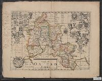
Beinecke Rare Book and Manuscript Library > A map of Oxfordshire ...
Creator:
Published / Created:
10 June 1775.
Call Number:
774 1775
Container / Volume:
BRBL_00730
Image Count:
3
Resource Type:
Maps, Atlases & Globes
Found in:
Beinecke Rare Book and Manuscript Library > A map of Pennsylvania exhibiting not only the improved parts of that Province, but also its extensive frontiers: Laid down from actual surveys, and chiefly from the late map of W. Scull published in 1770; and humbly inscribed to the Honorable Thomas Penn
Branch:v1.60.98 ,Deployed:2024-04-24T10:14:30-04:00