Search
You Searched For
Search Results
- Creator:
- Maury, Matthew Fontaine, 1806-1873
- Published / Created:
- 1851
- Call Number:
- 11DB 1851A-1
- Container / Volume:
- BRBL_00774
- Image Count:
- 1
- Resource Type:
- Maps, Atlases & Globes
- Found in:
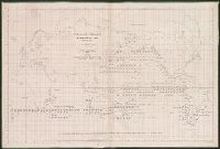
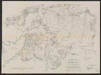
- Beinecke Rare Book and Manuscript Library > Whale chart [cartographic material] : preliminary sketch / by M.F. Maury, A.M. Lieut., U.S. Navy ; constructed by Lts. Leigh. Herndon & Fleming & Pd. Midn. Jackson.
- Creator:
- Maury, Matthew Fontaine, 1806-1873
- Published / Created:
- 1852
- Call Number:
- 11cfk 1850D-2
- Container / Volume:
- BRBL_00773
- Image Count:
- 1
- Resource Type:
- Maps, Atlases & Globes
- Found in:
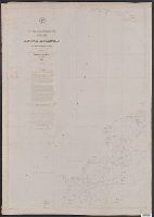
- Beinecke Rare Book and Manuscript Library > Wind and current chart of the South Atlantic [cartographic material] / by M.F. Maury, L.L.D. Lieut. U.S. Navy, Superint'dt. of U.S.N. Observatory ; compiled from materials in the Bureau of Ordnance and Hydrography, Commodore Charles Morris, Chief of Bureau.
- Creator:
- United States. Adjutant-General's Office. Military Information Division
- Published / Created:
- [1898]
- Call Number:
- 855hc 1898G
- Container / Volume:
- BRBL_00765
- Image Count:
- 1
- Resource Type:
- Maps, Atlases & Globes
- Found in:
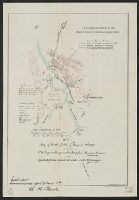
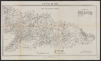
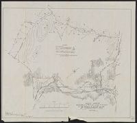
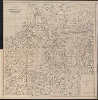
- Beinecke Rare Book and Manuscript Library > Map of battle field of August 10th 1898 : between U.S. regular troops under Brig. Genl. Theodore Schwan, U.S. Volunteers and Spanish forces under Col. Julio Soto Villanueva, Alfonso XIII.
- Creator:
- Maury, Matthew Fontaine, 1806-1873
- Published / Created:
- 1850
- Call Number:
- 11cfk 1850D-1
- Container / Volume:
- BRBL_00773
- Image Count:
- 1
- Resource Type:
- Maps, Atlases & Globes
- Found in:
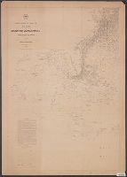
- Beinecke Rare Book and Manuscript Library > Wind and current chart of the North Atlantic [cartographic material] : thermal sheet / by M.F. Maury, A.M. Lieut. U.S. Navy, Superint'dt. of U.S.N. Observatory ; compiled from materials in the Bureau of Ordnance and Hydrography, Commodore Lewis Warrington, Chief of Bureau ; drawn by Lt. Benjn. S. Gantt, U.S.N.
- Published / Created:
- [1898]
- Call Number:
- 855hc 1898M
- Container / Volume:
- BRBL_00765
- Image Count:
- 1
- Resource Type:
- Maps, Atlases & Globes
- Found in:
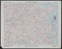
- Beinecke Rare Book and Manuscript Library > Santiago de Cuba Position of American, Cuban, and Spanish forces on July 14th, 1898.
- Published / Created:
- 1898
- Call Number:
- 855hc 1898D
- Container / Volume:
- BRBL_00765
- Image Count:
- 1
- Resource Type:
- Maps, Atlases & Globes
- Found in:
- Beinecke Rare Book and Manuscript Library > Preliminary map of Camp Meade Middletown, PA, Office of Chief Engineer 2nd Army Corps.
- Published / Created:
- [1898]
- Call Number:
- 855hc 1898N
- Container / Volume:
- BRBL_00765
- Image Count:
- 1
- Resource Type:
- Maps, Atlases & Globes
- Found in:
- Beinecke Rare Book and Manuscript Library > Santiago de Cuba Position of Cuban and Spanish forces prior to July 3rd, 1898.
- Creator:
- Maury, Matthew Fontaine, 1806-1873
- Published / Created:
- 1855
- Call Number:
- 11cfk 1850C-11
- Container / Volume:
- BRBL_00772
- Image Count:
- 1
- Resource Type:
- Maps, Atlases & Globes
- Found in:
- Beinecke Rare Book and Manuscript Library > Pilot chart of the north Indian Ocean [cartographic material] / by M.F. Maury, L.L.D. Lieut. U.S. Navy, Superin'dt. of U.S.N. Observatory ; compiled from materials in the Bureau of Ordnance and Hydrography by Lieuts. W.B. Fitzgerald & Wm. C. West, U.S.N, Commodore Charles Morris, Chief of Bureau.
- Published / Created:
- [1898]
- Call Number:
- 855hc 1898O
- Container / Volume:
- BRBL_00765
- Image Count:
- 1
- Resource Type:
- Maps, Atlases & Globes
- Found in:
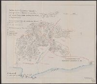
- Beinecke Rare Book and Manuscript Library > Map of Santiago de Cuba showing intrenchments and position of the 5th Corps. U.S. Army and those of the Spanish / compiled from partial transit surveys and foot reconnaisance notes and sketches by Lts. Guy, Smith, Cordray. of the Inf.; Lts. Batson and G.P
- Published / Created:
- [1898]
- Call Number:
- 855hc 1898L
- Container / Volume:
- BRBL_00765
- Image Count:
- 1
- Resource Type:
- Maps, Atlases & Globes
- Found in:
- Beinecke Rare Book and Manuscript Library > Map of Santiago de Cuba showing intrenchments and positions of the Fifth Corps. U.S. Army and those of the Spanish after the taking of Caney and San Juan Hill, evening of July 1st, 1898 / compiled from partial transit surveys and foot reconnaisance notes
- Creator:
- United States. Adjutant-General's Office. Military Information Division
- Published / Created:
- [1898]
- Call Number:
- 855hc 1898A
- Container / Volume:
- BRBL_00765
- Image Count:
- 1
- Resource Type:
- Maps, Atlases & Globes
- Found in:
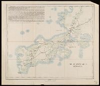
- Beinecke Rare Book and Manuscript Library > Map of Puerto Rico showing line of march of General Schwan's expedition from Ponce and Yauco to crossing of Rio Prieto August 9-15, 1898 / Chas. H. Ourand.
- Published / Created:
- 1898
- Call Number:
- 855hc 1898F
- Container / Volume:
- BRBL_00765
- Image Count:
- 1
- Resource Type:
- Maps, Atlases & Globes
- Found in:
- Beinecke Rare Book and Manuscript Library > Sketch map of Camp Alger, VA including new camp of 1st Div. 2nd Corps near Dunn Loring, 1898.
- Creator:
- Maury, Matthew Fontaine, 1806-1873
- Published / Created:
- 1854
- Call Number:
- 11cfk 1850C-8
- Container / Volume:
- BRBL_00772
- Image Count:
- 1
- Resource Type:
- Maps, Atlases & Globes
- Found in:
- Beinecke Rare Book and Manuscript Library > Pilot chart of the coast of Brazil [cartographic material] / by Lieut. M.F. Maury, U.S. Navy, National Observatory ; eng. by Sherman & Smith.
- Creator:
- United States. Adjutant-General's Office. Military Information Division
- Published / Created:
- [1898]
- Call Number:
- 855hc 1898B
- Container / Volume:
- BRBL_00765
- Image Count:
- 1
- Resource Type:
- Maps, Atlases & Globes
- Found in:
- Beinecke Rare Book and Manuscript Library > Road sketch showing the marches of the independent brigade VI corps (Bates') from Siboney to Elcaney and th position before Santiago.
- Creator:
- United States. Adjutant-General's Office. Military Information Division
- Published / Created:
- [1898]
- Call Number:
- 855hc 1898K
- Container / Volume:
- BRBL_00765
- Image Count:
- 1
- Resource Type:
- Maps, Atlases & Globes
- Found in:
- Beinecke Rare Book and Manuscript Library > Sketch showing movements and positions of troops in the affair of August 9th 1898 at Coamo, Puerto Rico : August 21, 1898, scale 1000' to 1' / Sergt. S.H. Knight, topographer.
- Creator:
- United States. Adjutant-General's Office. Military Information Division
- Published / Created:
- [1898]
- Call Number:
- 855hc 1898
- Container / Volume:
- BRBL_00642
- Image Count:
- 1
- Resource Type:
- Maps, Atlases & Globes
- Found in:
- Beinecke Rare Book and Manuscript Library > Sketch map of Guayama and vicinity showing location of Spanish strongholds, and route of March made by Brig. Gen. Hains on Aug 13, 1898.
- Published / Created:
- .
- Call Number:
- 5684 1905
- Container / Volume:
- BRBL_00300
- Image Count:
- 1
- Resource Type:
- Maps, Atlases & Globes
- Found in:
- Beinecke Rare Book and Manuscript Library > The Regent's Sword Peninsula.
- Published / Created:
- 1909
- Call Number:
- 60g 1909
- Container / Volume:
- BRBL_00329
- Image Count:
- 1
- Resource Type:
- Maps, Atlases & Globes
- Found in:
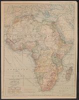
- Beinecke Rare Book and Manuscript Library > The National Geographic Magazine map of Africa / prepared from latest geographical data by Gilbert H. Grosvenor, Editor.
- Creator:
- National Geographic Society (U.S.). Cartographic Division
- Published / Created:
- 1982
- Call Number:
- 7821 1982
- Container / Volume:
- BRBL_00506
- Image Count:
- 2
- Resource Type:
- Maps, Atlases & Globes
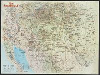
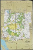
- Found in:
- Beinecke Rare Book and Manuscript Library > The Southwest / produced by the Cartographic Division, National Geographic Society ; John B. Garver, Jr., chief cartographer.
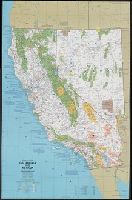
- Creator:
- National Geographic Society (U.S.). Cartographic Division
- Published / Created:
- 1986
- Call Number:
- 8101 1986
- Container / Volume:
- BRBL_00552
- Image Count:
- 2
- Resource Type:
- Maps, Atlases & Globes
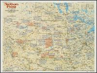
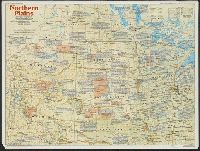
- Found in:
- Beinecke Rare Book and Manuscript Library > Northern Plains / produced by the Cartographic Division, National Geographic Society ... ; John B. Garver, Jr., chief cartographer ; John F. Shupe, associate chief.
- Creator:
- National Geographic Society (U.S.). Cartographic Division
- Published / Created:
- 1986
- Call Number:
- 8101 1986
- Container / Volume:
- BRBL_00552
- Image Count:
- 2
- Resource Type:
- Maps, Atlases & Globes
- Found in:
- Beinecke Rare Book and Manuscript Library > Northern Plains / produced by the Cartographic Division, National Geographic Society ... ; John B. Garver, Jr., chief cartographer ; John F. Shupe, associate chief.
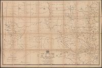
- Creator:
- United States. Post Office Dept
- Published / Created:
- [1883]
- Call Number:
- 831gmd 1883
- Container / Volume:
- BRBL_00581
- Image Count:
- 2
- Resource Type:
- Maps, Atlases & Globes
- Found in:
- Beinecke Rare Book and Manuscript Library > Post route map of the territories of Montana, Idaho, and Wyoming with parts of adjacent states and territories : showing post offices with intermediate distances between them and mail routes in operation on 1st October 1883 / published by order of Postmas
- Creator:
- National Geographic Society (U.S.). Cartographic Division
- Published / Created:
- 1986
- Call Number:
- 796 1986
- Container / Volume:
- BRBL_00526
- Image Count:
- 2
- Resource Type:
- Maps, Atlases & Globes
- Found in:
- Beinecke Rare Book and Manuscript Library > Texas / produced by the Cartographic Division, National Geographic Society.
- Creator:
- National Geographic Society (U.S.). Cartographic Division
- Published / Created:
- c1977.
- Call Number:
- 7821 1977
- Container / Volume:
- BRBL_00506
- Image Count:
- 2
- Resource Type:
- Maps, Atlases & Globes
- Found in:
- Beinecke Rare Book and Manuscript Library > Close-up: U.S.A., the Southwest / produced by the Cartographic Division, National Geographic Society ; William T. Peele, chief cartographer ; Richard K. Rogers, assistant chief cartographer.
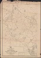
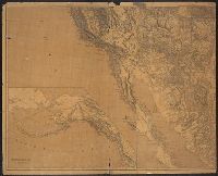
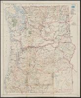
- Creator:
- Freyhold, Edward
- Published / Created:
- 1879
- Call Number:
- 80 1879
- Container / Volume:
- BRBL_00536
- Image Count:
- 2
- Resource Type:
- Maps, Atlases & Globes
- Found in:
- Beinecke Rare Book and Manuscript Library > Map of the territory of the United States, west of the Mississippi River / prepared by authority of the Hon. the Secretary of War, in the office of the Chief of Engineers under the direction of Brig. Gen. A.A. Humphreys, Chief of Engrs. Bvt. Major General
- Creator:
- American Automobile Association
- Published / Created:
- c1946.
- Call Number:
- 80gmb 1945
- Container / Volume:
- BRBL_00538
- Image Count:
- 2
- Resource Type:
- Maps, Atlases & Globes
- Found in:
- Beinecke Rare Book and Manuscript Library > Official AAA road map, south central states.
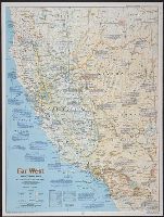
- Creator:
- National Geographic Society (U.S.). Cartographic Division
- Published / Created:
- 1984
- Call Number:
- 80 1984
- Container / Volume:
- BRBL_00536
- Image Count:
- 2
- Resource Type:
- Maps, Atlases & Globes
- Found in:
- Beinecke Rare Book and Manuscript Library > Far West / produced by the Cartographic Division, National Geographic Society.
- Creator:
- American Automobile Association
- Published / Created:
- [1940]
- Call Number:
- 80gmb 1940
- Container / Volume:
- BRBL_00538
- Image Count:
- 2
- Resource Type:
- Maps, Atlases & Globes
- Found in:
- Beinecke Rare Book and Manuscript Library > Official AAA road map : western states.
- Creator:
- United States. Post Office Dept
- Published / Created:
- 1883
- Call Number:
- 821gmd 1883
- Container / Volume:
- BRBL_00566
- Image Count:
- 2
- Resource Type:
- Maps, Atlases & Globes
- Found in:
- Beinecke Rare Book and Manuscript Library > Post route map of the territory of Dakota with adjacent parts of Montana, Wyoming, Nebraska, Iowa and Minnesota : and portions of the Dominion of Canada, showing post offices with the intermediate distances between them and mail routes in operation on 1st
- Creator:
- Maury, Matthew Fontaine, 1806-1873
- Published / Created:
- 1849-[1856?]
- Call Number:
- 11cfk 1850A-1
- Container / Volume:
- BRBL_00767
- Image Count:
- 2
- Resource Type:
- Maps, Atlases & Globes
- Found in:
- Beinecke Rare Book and Manuscript Library > Wind and current chart of the North Pacific [cartographic material] / by M.F. Maury, A.M. Lieut. U.S. Navy, Superint'dt. of U.S.N. Observatory ; compiled from materials in the Bureau of Ordnance and Hydrography, Commodore Lewis Warrington ; drawn by P.M. Lardner Gibbon, U.S.N. ; tracks projected by Lieut. A.W. Johnson, U.S. Navy.
- Creator:
- United States. Army Air Forces
- Published / Created:
- 1944
- Call Number:
- 50 1945C
- Container / Volume:
- BRBL_00273
- Image Count:
- 2
- Resource Type:
- Maps, Atlases & Globes
- Found in:
- Beinecke Rare Book and Manuscript Library > AAF cloth chart [cartographic material] : no. C41, Mindoro Island / Army Map Service U.S. Army.
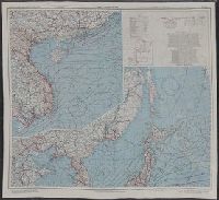
- Creator:
- United States. Army Map Service
- Published / Created:
- 1945
- Call Number:
- 57 1945A
- Container / Volume:
- BRBL_00303
- Image Count:
- 2
- Resource Type:
- Maps, Atlases & Globes
- Found in:
- Beinecke Rare Book and Manuscript Library > Japan and South China Seas / prepared at the direction of the commanding general, Army Air Forces, for the Aeronautical Chart Service by the Lake Survey Branch, Army Map Service, Detroit, Michigan, March 1945.
- Creator:
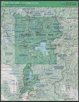
- National Geographic Society (U.S.). Cartographic Division
- Published / Created:
- c1989.
- Call Number:
- 833 Y38 1989
- Container / Volume:
- BRBL_00584
- Image Count:
- 2
- Resource Type:
- Maps, Atlases & Globes
- Found in:
- Beinecke Rare Book and Manuscript Library > Yellowstone and Grand Teton / produce by the Cartographic Division, National Geographic Society ; John B. Garver, Jr., chief cartographer.
- Creator:
- National Geographic Society (U.S.). Cartographic Division
- Published / Created:
- c1978.
- Call Number:
- 844 1978
- Container / Volume:
- BRBL_00603
- Image Count:
- 2
- Resource Type:
- Maps, Atlases & Globes
- Found in:
- Beinecke Rare Book and Manuscript Library > Close-up: U.S.A., California and Nevada / produced by the Cartographic Division, National Geographic Society ; William T. Peele, chief cartographer, David W. Cook, associate chief cartographer.
- Creator:
- Westgard, A. L. (Anthon L.), b. 1865
- Published / Created:
- c1920.
- Call Number:
- 847gmb 1920A
- Container / Volume:
- BRBL_00629
- Image Count:
- 2
- Resource Type:
- Maps, Atlases & Globes
- Found in:
- Beinecke Rare Book and Manuscript Library > Washington and Oregon / prepared and issued by Touring Information Board, American Automobile Association ; prepared by A.L. Westgard, field representative, American Automobile Association ; F.S.R. jr.
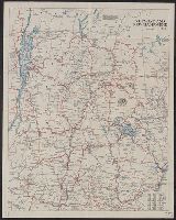
- Creator:
- American Automobile Association
- Published / Created:
- 1920
- Call Number:
- 76gmb 1920A
- Container / Volume:
- BRBL_00446
- Image Count:
- 2
- Resource Type:
- Maps, Atlases & Globes
- Found in:
- Beinecke Rare Book and Manuscript Library > Vermont and New Hampshire / prepared by Touring Information Board American Automobile Association.
- Published / Created:
- 1917
- Call Number:
- 762gcr W588 1917
- Container / Volume:
- BRBL_00451
- Image Count:
- 2
- Resource Type:
- Maps, Atlases & Globes
- Found in:
- Beinecke Rare Book and Manuscript Library > White Mountain National Forest, New Hampshire and Maine / U.S. Department of Agriculture, Forest Service, Henry S. Graves, Forester.
- Creator:
- American Automobile Association
- Published / Created:
- c1917.
- Call Number:
- 76gmb 1917A
- Container / Volume:
- BRBL_00446
- Image Count:
- 2
- Resource Type:
- Maps, Atlases & Globes
- Found in:
- Beinecke Rare Book and Manuscript Library > Lower New England / prepared by Touring Information Board American Automobile Association.
- Creator:
- Maury, Matthew Fontaine, 1806-1873
- Published / Created:
- 1852
- Call Number:
- 11cfk 1850C-9
- Container / Volume:
- BRBL_00772
- Image Count:
- 2
- Resource Type:
- Maps, Atlases & Globes
- Found in:
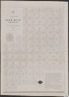
- Beinecke Rare Book and Manuscript Library > Pilot chart for Cape Horn [cartographic material] / by M.F. Maury, L.L.D. Lieut. U.S. Navy, Superin'dt. of U.S.N. Observatory ; compiled from materials in the Bureau of Ordnance and Hydrography, Commodore Charles Morris, Chief of Bureau.
- Creator:
- Maury, Matthew Fontaine, 1806-1873
- Published / Created:
- 1852
- Call Number:
- 11cfk 1850C-9
- Container / Volume:
- BRBL_00772
- Image Count:
- 2
- Resource Type:
- Maps, Atlases & Globes
- Found in:
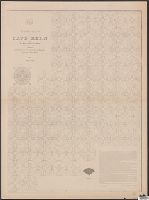
- Beinecke Rare Book and Manuscript Library > Pilot chart for Cape Horn [cartographic material] / by M.F. Maury, L.L.D. Lieut. U.S. Navy, Superin'dt. of U.S.N. Observatory ; compiled from materials in the Bureau of Ordnance and Hydrography, Commodore Charles Morris, Chief of Bureau.
- Published / Created:
- 1943
- Call Number:
- 38FB 1943a
- Container / Volume:
- BRBL_00170
- Image Count:
- 2
- Resource Type:
- Maps, Atlases & Globes
- Found in:
- Beinecke Rare Book and Manuscript Library > France : Board of economic warfare.
- Creator:
- U.S. Coast and Geodetic Survey
- Published / Created:
- 1944
- Call Number:
- 50 1945I
- Container / Volume:
- BRBL_00273
- Image Count:
- 2
- Resource Type:
- Maps, Atlases & Globes
- Found in:
- Beinecke Rare Book and Manuscript Library > AAF cloth chart. No. 133, Kun-Ming, Yunnan, China to Chabua, Assam, India Forces / prepared under the direction of the Commanding General, Army Air Forces, for the Aeronautical Chart Service, by the U.S. Coast and Geodetic Survey, Washington, D.C., Januar
- Creator:
- United States. Army Map Service
- Published / Created:
- 1944
- Call Number:
- 50 1945E
- Container / Volume:
- BRBL_00273
- Image Count:
- 2
- Resource Type:
- Maps, Atlases & Globes
- Found in:
- Beinecke Rare Book and Manuscript Library > AAF cloth map [cartographic material] / prepared under the direction of the Commanding General, Army Air Forces, by the Aeronautical Chart Service.
- Creator:
- United States. Army Map Service
- Published / Created:
- 1944
- Call Number:
- 50 1945F
- Container / Volume:
- BRBL_00273
- Image Count:
- 2
- Resource Type:
- Maps, Atlases & Globes
- Found in:
- Beinecke Rare Book and Manuscript Library > AAF cloth map. Asiatic series. French Indo China / compiled for the U.S. Army Air Forces by the Army Map Service.
- Creator:
- U.S. Coast and Geodetic Survey
- Published / Created:
- 1944
- Call Number:
- 50 1945I
- Container / Volume:
- BRBL_00273
- Image Count:
- 2
- Resource Type:
- Maps, Atlases & Globes
- Found in:
- Beinecke Rare Book and Manuscript Library > AAF cloth chart. No. 133, Kun-Ming, Yunnan, China to Chabua, Assam, India Forces / prepared under the direction of the Commanding General, Army Air Forces, for the Aeronautical Chart Service, by the U.S. Coast and Geodetic Survey, Washington, D.C., Januar
- Creator:
- Great Britain. Army. Royal Engineers. Fd. Survey Coy., 512
- Published / Created:
- 1943
- Call Number:
- 493 1943
- Container / Volume:
- BRBL_00270
- Image Count:
- 2
- Resource Type:
- Maps, Atlases & Globes
- Found in:
- Beinecke Rare Book and Manuscript Library > Malta and Gozo [cartographic material] / drawn at Ordnance Survey Office, Southampton, 1934 ; revised and reprinted by 512 Fd. Survey Coy., R.E. Feb., 1943.
- Creator:
- United States. Army Map Service
- Published / Created:
- 1945
- Call Number:
- 50 1945H
- Container / Volume:
- BRBL_00273
- Image Count:
- 2
- Resource Type:
- Maps, Atlases & Globes
- Found in:
- Beinecke Rare Book and Manuscript Library > AAF cloth map. Asiatic series. South Burma / compiled for the U.S. Army Air Forces by the Army Map Service.
- Creator:
- U.S. Coast and Geodetic Survey
- Published / Created:
- 1944
- Call Number:
- 50 1945I
- Container / Volume:
- BRBL_00273
- Image Count:
- 2
- Resource Type:
- Maps, Atlases & Globes
- Found in:
- Beinecke Rare Book and Manuscript Library > AAF cloth chart. No. 133, Kun-Ming, Yunnan, China to Chabua, Assam, India Forces / prepared under the direction of the Commanding General, Army Air Forces, for the Aeronautical Chart Service, by the U.S. Coast and Geodetic Survey, Washington, D.C., Januar
- Creator:
- United States. Army Map Service
- Published / Created:
- 1945
- Call Number:
- 50 1945D
- Container / Volume:
- BRBL_00273
- Image Count:
- 2
- Resource Type:
- Maps, Atlases & Globes
- Found in:
- Beinecke Rare Book and Manuscript Library > Japan and South China Seas / prepared at the direction of the commanding general, Army Air Forces, for the Aeronautical Chart Service by the Lake Survey Branch, Army Map Service, Detroit, Michigan, March 1945.