Search
You Searched For
Search Results
- Creator:
- Geological Survey (U.S.)
- Published / Created:
- [188-?]
- Call Number:
- 833fcm Y38 1885
- Container / Volume:
- BRBL_00585
- Image Count:
- 1
- Resource Type:
- Maps, Atlases & Globes
- Found in:
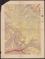
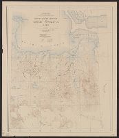
- Beinecke Rare Book and Manuscript Library > Yellowstone National Park and north western Wyoming / U.S. Geological Survey ; Henry Gannett, Chief Geographer ; J.H. Renshawe, Geographer in Charge ; triangulation by H.S. Chase ; topography by J.H. Renshawe, Frank Tweedy, and S.A. Aplin, Jr.
- Creator:
- Geological Survey (U.S.)
- Published / Created:
- 1882]
- Call Number:
- 779 1882
- Container / Volume:
- BRBL_00505
- Image Count:
- 1
- Resource Type:
- Maps, Atlases & Globes
- Found in:
- Beinecke Rare Book and Manuscript Library > Map of Washington and vicinity / prepared at the office of the U.S. Geological Survey, 1882.
- Creator:
- Geological Survey (U.S.)
- Published / Created:
- 1890, 1891.
- Call Number:
- 75CBF 1891A
- Container / Volume:
- BRBL_00408
- Image Count:
- 9
- Resource Type:
- Maps, Atlases & Globes
- Found in:
- Beinecke Rare Book and Manuscript Library > United States / compiled under the direction of Henry Gannett, chief topographer, by Harry King, chief draughtsman.
- Creator:
- Geological Survey (U.S.)
- Published / Created:
- [1893]
- Call Number:
- 831ca 1893
- Container / Volume:
- BRBL_00581
- Image Count:
- 1
- Resource Type:
- Maps, Atlases & Globes
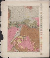
- Found in:
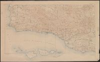
- Beinecke Rare Book and Manuscript Library > Areal geology, Montana, Livingston sheet / U.S. Geological Survey, J.W. Powell, Director ; Henry Gannett, Chief Topographer ; A.H. Thompson, Geographer in charge ; triangulation by E.M. Douglas and J.H. Renshawe ; topography by Northern Transcontinental S
- Creator:
- Geological Survey (U.S.)
- Published / Created:
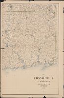
- 1893 (1899 printing)
- Call Number:
- 766 1893C
- Container / Volume:
- BRBL_00467
- Image Count:
- 2
- Resource Type:
- Maps, Atlases & Globes
- Found in:
- Beinecke Rare Book and Manuscript Library > Map of Connecticut / prepared by the U.S. Geological Survey in co-operation with the State of Connecticut.
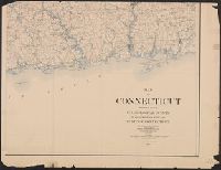
- Creator:
- Geological Survey (U.S.)
- Published / Created:
- 1893 (1899 printing)
- Call Number:
- 766 1893C
- Container / Volume:
- BRBL_00467
- Image Count:
- 3
- Resource Type:
- Maps, Atlases & Globes
- Found in:
- Beinecke Rare Book and Manuscript Library > Map of Connecticut / prepared by the U.S. Geological Survey in co-operation with the State of Connecticut.
- Creator:
- Geological Survey (U.S.)
- Published / Created:
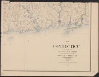
- 1893
- Call Number:
- 766 1893
- Container / Volume:
- BRBL_00467
- Image Count:
- 4
- Resource Type:
- Maps, Atlases & Globes
- Found in:
- Beinecke Rare Book and Manuscript Library > Map of Connecticut / prepared by the U.S. Geological Survey in co-operation with the State of Connecticut.
- Creator:
- Geological Survey (U.S.)
- Published / Created:
- [1897]
- Call Number:
- 831cbf B98 1897
- Container / Volume:
- BRBL_00581
- Image Count:
- 1
- Resource Type:
- Maps, Atlases & Globes
- Found in:
- Beinecke Rare Book and Manuscript Library > Topographic sheet, Montana (Silver Bow Co.) : Butte special map / Henry Gannett, chief topographer ; E.M. Douglas, topographer in charge ; triangulation and topography by R.H. Chapman.
- Creator:
- Geological Survey (U.S.)
- Published / Created:
- [1897]
- Call Number:
- 75BH 1897
- Container / Volume:
- BRBL_00407A
- Image Count:
- 1
- Resource Type:
- Maps, Atlases & Globes
- Found in:
- Beinecke Rare Book and Manuscript Library > Map showing condition and progress of topographic surveys and location of gaging stations for the fiscal year 1896-1897.
- Creator:
- Geological Survey (U.S.)
- Published / Created:
- [1897]
- Call Number:
- 75BF 1897
- Container / Volume:
- BRBL_00407A
- Image Count:
- 1
- Resource Type:
- Maps, Atlases & Globes
- Found in:
- Beinecke Rare Book and Manuscript Library > Map showing condition and progress of astronomic location, primary triangulation, primary traverse and precise leveling, for the fiscal year 1896-7.
- Creator:
- Geological Survey (U.S.)
- Published / Created:
- 1898
- Call Number:
- 848gbc 1898A
- Container / Volume:
- BRBL_00635
- Image Count:
- 1
- Resource Type:
- Maps, Atlases & Globes
- Found in:
- Beinecke Rare Book and Manuscript Library > The gold and coal fields of Alaska, together with the principal steamer routes and trails.
- Creator:
- Geological Survey (U.S.)
- Published / Created:
- 1898
- Call Number:
- 848 C793 1898
- Container / Volume:
- BRBL_00632
- Image Count:
- 1
- Resource Type:
- Maps, Atlases & Globes
- Found in:
- Beinecke Rare Book and Manuscript Library > Alaska military expedition : in charge of Captain W.R. Abercrombie, U.S.A. Copper River and adjacent territory / topography by P.G. Lowe, F.C. Schrader, and Emil Mahlo.
- Creator:
- Geological Survey (U.S.)
- Published / Created:
- [1898].
- Call Number:
- 847gc 1898
- Container / Volume:
- BRBL_00628
- Image Count:
- 1
- Resource Type:
- Maps, Atlases & Globes
- Found in:
- Beinecke Rare Book and Manuscript Library > Map of Western Washington showing density of merchantable timber / U.S. Geological Survey.
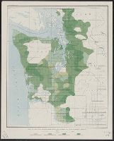
- Creator:
- Geological Survey (U.S.)
- Published / Created:
- [1898]
- Call Number:
- 836gfc T498 1898
- Container / Volume:
- BRBL_00593
- Image Count:
- 2
- Resource Type:
- Maps, Atlases & Globes
- Found in:
- Beinecke Rare Book and Manuscript Library > Utah : Tintic mining map.
- Creator:
- Geological Survey (U.S.)
- Published / Created:
- 1898]
- Call Number:
- 824cbf Om1 1898
- Container / Volume:
- BRBL_00571
- Image Count:
- 1
- Resource Type:
- Maps, Atlases & Globes
- Found in:
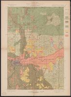
- Beinecke Rare Book and Manuscript Library > Omaha and vicinity / U.S. Geological Survey ; Charles D. Walcott, director ; Henry Gannett, chief topographer ; Jno. H. Renshawe, topographer in charge ; control by Geo. T. Hawkins ; Mo. river from surveys by Mo. Riv. Com. ; topography by H.S. Wallace.
- Creator:
- Geological Survey (U.S.)
- Published / Created:
- 1899
- Call Number:
- 75AK 1899
- Container / Volume:
- BRBL_00407A
- Image Count:
- 1
- Resource Type:
- Maps, Atlases & Globes
- Found in:
- Beinecke Rare Book and Manuscript Library > United States base map / compiled by Henry Gannett ; engraved by U.S.G.S.
- Creator:
- Geological Survey (U.S.)
- Published / Created:
- [1900]
- Call Number:
- 847gc T119 1897
- Container / Volume:
- BRBL_00628
- Image Count:
- 1
- Resource Type:
- Maps, Atlases & Globes
- Found in:
- Beinecke Rare Book and Manuscript Library > Land classification and density of standing timber, Washington, Tacoma quadrangle / U.S. Geological Survey.
- Creator:
- Geological Survey (U.S.)
- Published / Created:
- [1900]
- Call Number:
- 847gc Se18 1897
- Container / Volume:
- BRBL_00628
- Image Count:
- 1
- Resource Type:
- Maps, Atlases & Globes
- Found in:
- Beinecke Rare Book and Manuscript Library > Land classification and density of standing timber, Washington, Seattle quadrangle / U.S. Geological Survey.
- Creator:
- Geological Survey (U.S.)
- Published / Created:
- [1900].
- Call Number:
- 847gc M865 1897
- Container / Volume:
- BRBL_00628
- Image Count:
- 1
- Resource Type:
- Maps, Atlases & Globes
- Found in:
- Beinecke Rare Book and Manuscript Library > Washington, Mount Stuart quadrangle : land classification and density of standing timber / U.S. Geological Survey ; R.U. Goode, geographer in charge ; triangulation by S.S. Gannett ; topography by G.E. Hyde ; Henry Gannett, geographer in charge ; land cla
- Creator:
- Geological Survey (U.S.)
- Published / Created:
- [1900].
- Call Number:
- 847gc El54 1899
- Container / Volume:
- BRBL_00628
- Image Count:
- 1
- Resource Type:
- Maps, Atlases & Globes
- Found in:
- Beinecke Rare Book and Manuscript Library > Washington, Ellensburg quadrangle : land classification and density of standing timber / U.S. Geological Survey ; R.U. Goode, geographer in charge ; triangulation by S.S. Gannett and A.H. Sylvester ; topography by A.E. Murlin ; Henry Gannett, geographer i
- Creator:
- Geological Survey (U.S.)
- Published / Created:
- [1900].
- Call Number:
- 846gc R72 1895
- Container / Volume:
- BRBL_00623
- Image Count:
- 1
- Resource Type:
- Maps, Atlases & Globes
- Found in:
- Beinecke Rare Book and Manuscript Library > Oregon, Roseburg quadrangle : land classification and density of standing timber / U.S. Geological Survey ; Henry Gannett, chief topographer ; R.U. Goode, geographer in charge ; triangulation by W.T. Griswold ; topography by E.C. Barnard ; Henry Gannett,
- Creator:
- Geological Survey (U.S.)
- Published / Created:
- [1900].
- Call Number:
- 846gc P838 1898
- Container / Volume:
- BRBL_00623
- Image Count:
- 1
- Resource Type:
- Maps, Atlases & Globes
- Found in:
- Beinecke Rare Book and Manuscript Library > Oregon, Port Orford quadrangle : land classification and density of standing timber / U.S. Geological Survey ; R.U. Goode, geographer in charge ; triangulation by W.T. Griswold ; topography by A.E. Murlin ; Henry Gannett, geographer in charge ; land class
- Creator:
- Geological Survey (U.S.)
- Published / Created:
- [1900]
- Call Number:
- 846gc C786 1896
- Container / Volume:
- BRBL_00623
- Image Count:
- 1
- Resource Type:
- Maps, Atlases & Globes
- Found in:
- Beinecke Rare Book and Manuscript Library > Oregon, Coos Bay quadrangle : land classification and density of standing timber / U.S. Geological Survey ; R.U. Goode, geographer in charge ; triangulation by W.T. Griswold ; topography by E.C. Barnard ; Henry Gannett, geographer in charge ; land classif
- Creator:
- Geological Survey (U.S.)
- Published / Created:
- [1900].
- Call Number:
- 833gc D337 1899
- Container / Volume:
- BRBL_00586
- Image Count:
- 1
- Resource Type:
- Maps, Atlases & Globes
- Found in:
- Beinecke Rare Book and Manuscript Library > Wyoming, Dayton quadrangle : land classification and density of standing timber / U.S. Geological Survey ; E.M. Douglas, geographer in charge ; triangulation by W.S. Post ; topography by Frank Tweedy ; Henry Gannett, geographer in charge ; land classifica
- Creator:
- Geological Survey (U.S.)
- Published / Created:
- [1900].
- Call Number:
- 833gc C625 1899
- Container / Volume:
- BRBL_00586
- Image Count:
- 1
- Resource Type:
- Maps, Atlases & Globes
- Found in:
- Beinecke Rare Book and Manuscript Library > Wyoming, Cloud Peak quadrangle : land classification and density of standing timber / U.S. Geological Survey ; E.M. Douglas, geographer in charge ; triangulation by T.M. Bannon ; topography by H.S. Wallace and F.E. Matthes ; Henry Gannett, geographer in c
- Creator:
- Geological Survey (U.S.)
- Published / Created:
- [1900].
- Call Number:
- 833gc B19 1898
- Container / Volume:
- BRBL_00586
- Image Count:
- 1
- Resource Type:
- Maps, Atlases & Globes
- Found in:
- Beinecke Rare Book and Manuscript Library > Wyoming, Bald Mountain quadrangle : land classification and density of standing timber / U.S. Geological Survey ; E.M. Douglas, geographer in charge ; triangulation by W.S. Post ; topography by Frank Tweedy ; Henry Gannett, geographer in charge ; land cla
- Creator:
- Geological Survey (U.S.)
- Published / Created:
- [1901]
- Call Number:
- 847gc Sp65 1898
- Container / Volume:
- BRBL_00628
- Image Count:
- 1
- Resource Type:
- Maps, Atlases & Globes
- Found in:
- Beinecke Rare Book and Manuscript Library > Washington-Idaho, Spokane quadrangle : land classification and density of standing timber / U.S. Geological Survey ; R.U. Goode, geographer in charge ; triangulation by S.S. Gannett ; topography by Van H. Manning ; Henry Gannett, geographer in charge ; la
- Creator:
- Geological Survey (U.S.)
- Published / Created:
- [1901].
- Call Number:
- 847gc C417 1898
- Container / Volume:
- BRBL_00628
- Image Count:
- 1
- Resource Type:
- Maps, Atlases & Globes
- Found in:
- Beinecke Rare Book and Manuscript Library > Washington, Chelan quadrangle : land classification and density of standing timber / U.S. Geological Survey ; R.U. Goode, geographer in charge ; triangulation by W.T. Griswold ; topography by R.A. Farmer and W.T. Griswold ; Henry Gannett, geographer in ch
- Creator:
- Geological Survey (U.S.)
- Published / Created:
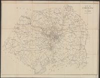
- [1901-193-?]
- Call Number:
- 844 1910
- Container / Volume:
- BRBL_00603
- Image Count:
- 1
- Resource Type:
- Maps, Atlases & Globes
- Found in:
- Beinecke Rare Book and Manuscript Library > Southern California.
- Creator:
- Geological Survey (U.S.)
- Published / Created:
- [1901]
- Call Number:
- 833gc N431 1899
- Container / Volume:
- BRBL_00586
- Image Count:
- 1
- Resource Type:
- Maps, Atlases & Globes
- Found in:
- Beinecke Rare Book and Manuscript Library > Wyoming-South Dakota, Newcastle quadrangle : land classification and density of standing timber / U.S. Geological Survey ; E.M. Douglas, geographer in charge ; triangulation by Frank Tweedy and R.H. Chapman ; topography by W.H. Herron ; Henry Gannett, geo
- Creator:
- Geological Survey (U.S.)
- Published / Created:
- 1902
- Call Number:
- 774cbf P53 1908
- Container / Volume:
- BRBL_00501
- Image Count:
- 1
- Resource Type:
- Maps, Atlases & Globes
- Found in:
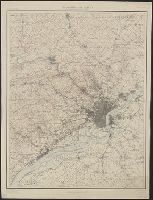
- Beinecke Rare Book and Manuscript Library > Philadelphia and vicinity, Pennsylvania - New Jersey and Delaware.
- Creator:
- Geological Survey (U.S.)
- Published / Created:
- 1902
- Call Number:
- 774cbf P53 1908
- Container / Volume:
- BRBL_00501
- Image Count:
- 1
- Resource Type:
- Maps, Atlases & Globes
- Found in:
- Beinecke Rare Book and Manuscript Library > Philadelphia and vicinity, Pennsylvania - New Jersey and Delaware.
- Creator:
- Geological Survey (U.S.)
- Published / Created:
- 1905?]
- Call Number:
- 847 Y12 1905
- Container / Volume:
- BRBL_00627
- Image Count:
- 1
- Resource Type:
- Maps, Atlases & Globes
- Found in:
- Beinecke Rare Book and Manuscript Library > General map of the Yakima Basin, Washington.
- Creator:
- Geological Survey (U.S.)
- Published / Created:
- 1905?]
- Call Number:
- 837gce T764 1905
- Container / Volume:
- BRBL_00594
- Image Count:
- 1
- Resource Type:
- Maps, Atlases & Globes
- Found in:
- Beinecke Rare Book and Manuscript Library > General map of Truckee-Carson Project, Nevada / U.S. Geological Survey.
- Creator:
- Geological Survey (U.S.)
- Published / Created:
- 1906
- Call Number:
- BrSides Folio 2019 61
- Image Count:
- 1
- Resource Type:
- Maps, Atlases & Globes
- Found in:
- Beinecke Rare Book and Manuscript Library > Colorado, Central City special map [cartographic material] / U.S. Geological Survey ; E.M. Douglas, geographer ; Frank Tweedy, in charge of section ; topography by Pearson Chapman and D.F. Moor ; triangulation by Frank Tweedy.
- Creator:
- Geological Survey (U.S.)
- Published / Created:
- 1906
- Call Number:
- 771cbf Al13 1906
- Image Count:
- 1
- Resource Type:
- Maps, Atlases & Globes
- Found in:
- Beinecke Rare Book and Manuscript Library > Albany and vicinity, New York.
- Creator:
- Geological Survey (U.S.)
- Published / Created:
- 1907
- Call Number:
- 783 N765 1907
- Container / Volume:
- BRBL_00510
- Image Count:
- 2
- Resource Type:
- Maps, Atlases & Globes
- Found in:
- Beinecke Rare Book and Manuscript Library > Virginia, Norfolk special map / topography by U.S. Geological Survey ; control and shore topography by Coast and Geodetic Survey.
- Creator:
- Geological Survey (U.S.)
- Published / Created:
- 1907
- Call Number:
- 848 So47 1909
- Container / Volume:
- BRBL_00634
- Image Count:
- 1
- Resource Type:
- Maps, Atlases & Globes
- Found in:
- Beinecke Rare Book and Manuscript Library > Topographic map of Solomon quadrangle, Alaska.
- Creator:
- Geological Survey (U.S.)
- Published / Created:
- 1907
- Call Number:
- 848 Se87 1907A
- Container / Volume:
- BRBL_00634
- Image Count:
- 1
- Resource Type:
- Maps, Atlases & Globes
- Found in:
- Beinecke Rare Book and Manuscript Library > Reconnaissance map, southern part of Seward Peninsula, Alaska / topography by E.C. Barnard, D.L. Reaburn, J.G. Hefty ... [et al.].
- Creator:
- Geological Survey (U.S.)
- Published / Created:
- 1907
- Call Number:
- 848 Se87 1907
- Container / Volume:
- BRBL_00634
- Image Count:
- 1
- Resource Type:
- Maps, Atlases & Globes
- Found in:
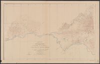
- Beinecke Rare Book and Manuscript Library > Reconnaissance map of northeastern portion of Seward Peninsula Alaska / U.S. Geological Survey ; Alfred H. Brooks, geologist in charge ; D.C. Witherspoon, topographer ; C.E. Hill, field assistant.
- Creator:
- Geological Survey (U.S.)
- Published / Created:
- 1908
- Call Number:
- 848gbc 1908
- Container / Volume:
- BRBL_00635
- Image Count:
- 1
- Resource Type:
- Maps, Atlases & Globes
- Found in:
- Beinecke Rare Book and Manuscript Library > Map of Alaska showing the known distribution of mineral resources / U.S. Geological Survey, compiled under the direction of Alfred H. Brooks, Geologist in charge of Division of Alaskan Mineral Resources, U.S. Geological Survey.
- Creator:
- Geological Survey (U.S.)
- Published / Created:
- [1908]
- Call Number:
- 848 F15 1908
- Container / Volume:
- BRBL_00632
- Image Count:
- 1
- Resource Type:
- Maps, Atlases & Globes
- Found in:
- Beinecke Rare Book and Manuscript Library > Alaska, Fairbanks special map / U.S. Geological Survey.
- Creator:
- Geological Survey (U.S.)
- Published / Created:
- 1909
- Call Number:
- 848 R14 1909
- Container / Volume:
- BRBL_00634
- Image Count:
- 1
- Resource Type:
- Maps, Atlases & Globes
- Found in:
- Beinecke Rare Book and Manuscript Library > Reconnaissance map of Rampart quadrangle, Yukon-Tanana region, Alaska / U.S. Geological Survey ; Alfred H. Brooks, geologist in charge.
- Creator:
- Geological Survey (U.S.)
- Published / Created:
- 1909
- Call Number:
- 848 C26 1909
- Container / Volume:
- BRBL_00632
- Image Count:
- 1
- Resource Type:
- Maps, Atlases & Globes
- Found in:
- Beinecke Rare Book and Manuscript Library > Alaska, Casadepaga quadrangle / U.S. Geological Survey.
- Creator:
- Geological Survey (U.S.)
- Published / Created:
- 1909
- Call Number:
- 848 1909
- Container / Volume:
- BRBL_00630
- Image Count:
- 1
- Resource Type:
- Maps, Atlases & Globes
- Found in:
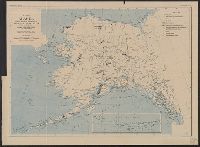
- Beinecke Rare Book and Manuscript Library > Map of Alaska / compiled chiefly from maps of the U.S. Geological Survey ... Alfred H. Brooks, geologist in charge, Division of Alaskan Mineral Resources.
- Creator:
- Geological Survey (U.S.)
- Published / Created:
- 1909
- Call Number:
- 844fcm Y83 1909
- Container / Volume:
- BRBL_00615
- Image Count:
- 1
- Resource Type:
- Maps, Atlases & Globes
- Found in:
- Beinecke Rare Book and Manuscript Library > Map of Yosemite Valley, Mariposa County, California / U.S. Geological Survey, George Otis Smith, Director ; E.M. Douglas, geographer ; State of California, George C. Pardee, Govenor.
- Creator:
- Geological Survey (U.S.)
- Published / Created:
- 1910
- Call Number:
- BrSides Double Folio 2019 84
- Image Count:
- 1
- Resource Type:
- Maps, Atlases & Globes
- Found in:
- Beinecke Rare Book and Manuscript Library > Colorado (Lake County), Leadville special map [cartographic material] / triangulation and topography by A.D. Wilson, chief topographer.
- Creator:
- Geological Survey (U.S.)
- Published / Created:
- 1910
- Call Number:
- 75cbf 1910
- Container / Volume:
- BRBL_00408
- Image Count:
- 1
- Resource Type:
- Maps, Atlases & Globes
- Found in:
- Beinecke Rare Book and Manuscript Library > United States relief map / compiled by Henry Gannett.
- Creator:
- Geological Survey (U.S.)
- Published / Created:
- [1910]
- Call Number:
- 844fcm Y83 1910
- Container / Volume:
- BRBL_00615
- Image Count:
- 1
- Resource Type:
- Maps, Atlases & Globes
- Found in:
- Beinecke Rare Book and Manuscript Library > Administrative map of Yosemite National Park, California / topography by R.E. Marshall and A.H. Sylvester ; surveyed in 1893-94, 1896, 1898-99 and 1905.