Search
You Searched For
Search Results
- Creator:
- United States. General Land Office
- Published / Created:
- 1866
- Call Number:
- 815fcm 1866
- Container / Volume:
- BRBL_00561
- Image Count:
- 1
- Resource Type:
- Maps, Atlases & Globes
- Found in:
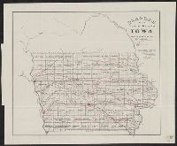
- Beinecke Rare Book and Manuscript Library > Diagram of the public surveys in Iowa.
- Creator:
- United States. General Land Office
- Published / Created:
- 1850?]
- Call Number:
- 816 1850
- Container / Volume:
- BRBL_00561
- Image Count:
- 1
- Resource Type:
- Maps, Atlases & Globes
- Found in:
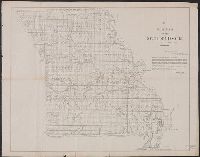
- Beinecke Rare Book and Manuscript Library > Diagram of the state of Missouri : accompanying report of 20th Novr. 1850 / Office of the Surveyor General for Illinois and Missouri, St. Louis, 20th Novr. 1850.
- Creator:
- United States. General Land Office
- Published / Created:
- 1879
- Call Number:
- 826 1879
- Container / Volume:
- BRBL_00577
- Image Count:
- 1
- Resource Type:
- Maps, Atlases & Globes
- Found in:
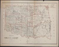
- Beinecke Rare Book and Manuscript Library > Indian Territory, 1879 / compiled from the official records of the General Land Office and other sources by C. Roeser, Principal Draughtsman.
- Creator:
- United States. General Land Office
- Published / Created:
- 1866
- Call Number:
- 844fcm 1866
- Container / Volume:
- BRBL_00615
- Image Count:
- 1
- Resource Type:
- Maps, Atlases & Globes
- Found in:
- Beinecke Rare Book and Manuscript Library > Map of public surveys in California & Nevada : to accompany report of Commissioner of the General Land Office, 1866.
- Creator:
- United States. General Land Office
- Published / Created:
- 1864
- Call Number:
- 75fcm 1864
- Container / Volume:
- BRBL_00410
- Image Count:
- 1
- Resource Type:
- Maps, Atlases & Globes
- Found in:
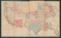
- Beinecke Rare Book and Manuscript Library > Map of the Public Land States and territories [cartographic material] / constructed from the Public Surveys and other official sources in the General Land Office ; drawn by J.H. Hawes, principal draughtsman [and] T. Franks, assistant.
- Creator:
- United States. General Land Office
- Published / Created:
- 1866
- Call Number:
- 75 1866
- Container / Volume:
- BRBL_00403
- Image Count:
- 1
- Resource Type:
- Maps, Atlases & Globes
- Found in:
- Beinecke Rare Book and Manuscript Library > Map of the United States and territories : shewing the extent of public surveys and other details / constructed from the plats and official sources of the General Land Office, under the direction of Hon. Jos. S. Wilson, Commissioner, by Theodore Franks, d
- Creator:
- United States. General Land Office
- Published / Created:
- [1868]
- Call Number:
- 75 1868C
- Container / Volume:
- BRBL_00404
- Image Count:
- 2
- Resource Type:
- Maps, Atlases & Globes
- Found in:
- Beinecke Rare Book and Manuscript Library > Map of the United States and territories, showing the extent of public surveys and other details / constructed from the plats and official sources of the General Land Office, under the direction of the Hon. Jos. S. Wilson, commissioner, by Joseph Gorlinsk
- Creator:
- United States. General Land Office
- Published / Created:
- 1876
- Call Number:
- 75 1876
- Container / Volume:
- BRBL_00405
- Image Count:
- 6
- Resource Type:
- Maps, Atlases & Globes
- Found in:
- Beinecke Rare Book and Manuscript Library > Map of the United States and territories, showing the extent of public surveys, Indian and military reservations, land grant R.R., rail roads, canals, and other details / compiled from the official surveys of the General Land Office, and other authentic s
- Creator:
- United States. General Land Office
- Published / Created:
- 1901
- Call Number:
- 818 1901
- Container / Volume:
- BRBL_00565
- Image Count:
- 1
- Resource Type:
- Maps, Atlases & Globes
- Found in:
- Beinecke Rare Book and Manuscript Library > Map of the state of Arkansas / compiled from the official records of the General Land Office and other sources under the direction of Harry King ; compiled and drawn by E.B. Olney ; lettered by Wm. Bauman, Jr.
- Creator:
- United States. General Land Office
- Published / Created:
- 1866
- Call Number:
- 792 1866
- Container / Volume:
- BRBL_00518
- Image Count:
- 1
- Resource Type:
- Maps, Atlases & Globes
- Found in:
- Beinecke Rare Book and Manuscript Library > Map of the state of Florida : showing the progress of the surveys accompanying [the] annual report of [the] Commissioner.
- Creator:
- United States. General Land Office
- Published / Created:
- 1866
- Call Number:
- 806gbc 1866
- Container / Volume:
- BRBL_00549
- Image Count:
- 1
- Resource Type:
- Maps, Atlases & Globes
- Found in:
- Beinecke Rare Book and Manuscript Library > Map of the state of Illinois [cartographic material].
- Creator:
- United States. General Land Office
- Published / Created:
- 1866
- Call Number:
- 837gbc 1866
- Container / Volume:
- BRBL_00594
- Image Count:
- 1
- Resource Type:
- Maps, Atlases & Globes
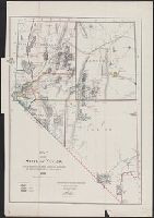
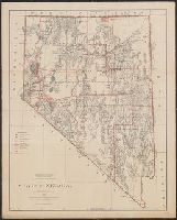
- Found in:
- Beinecke Rare Book and Manuscript Library > Map of the state of Nevada : to accompany the annual report of the Commr. Genl. Land Office.
- Creator:
- United States. General Land Office
- Published / Created:
- 1903
- Call Number:
- 822 1903
- Container / Volume:
- BRBL_00567
- Image Count:
- 1
- Resource Type:
- Maps, Atlases & Globes
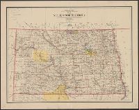
- Found in:
- Beinecke Rare Book and Manuscript Library > Map of the state of North Dakota / compiled from the official records of the General Land Office and other sources under the direction of Frank Bond ; compiled and drawn by M. Hendges ; lettered by Wm. Bauman, Jr.
- Creator:
- United States. General Land Office
- Published / Created:
- 1902
- Call Number:
- 836 1902
- Container / Volume:
- BRBL_00592
- Image Count:
- 1
- Resource Type:
- Maps, Atlases & Globes
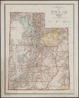
- Found in:
- Beinecke Rare Book and Manuscript Library > Map of the state of Utah / compiled from the official records of the General Land Office, under the direction of Harry King ; compiled and drawn by J. Ulke.
- Creator:
- United States. General Land Office
- Published / Created:
- 1897
- Call Number:
- 847 1897C
- Container / Volume:
- BRBL_00625
- Image Count:
- 1
- Resource Type:
- Maps, Atlases & Globes
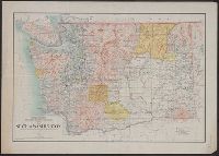
- Found in:
- Beinecke Rare Book and Manuscript Library > Map of the state of Washington / compiled from the official records of the General Land Office and other sources under the direction of Harry King, C.E., Chief of Drafting Division, G.L.O. ; revised and drawn by Daniel O'Hare ; compiled by Robt. H. Morton
- Creator:
- United States. General Land Office
- Published / Created:
- 1896
- Call Number:
- 812 1896
- Container / Volume:
- BRBL_00555A
- Image Count:
- 1
- Resource Type:
- Maps, Atlases & Globes
- Found in:
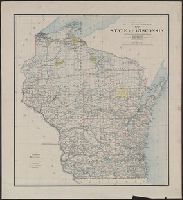
- Beinecke Rare Book and Manuscript Library > Map of the state of Wisconsin / Department of the Interior, General Land Office ; compiled from the official records of the General Land Office and other sources under the direction of Harry King, C.E., chief of Drafting Division G.L.O. ; compiled, drawn
- Creator:
- United States. General Land Office
- Published / Created:
- 1900
- Call Number:
- 833 1900
- Container / Volume:
- BRBL_00584
- Image Count:
- 1
- Resource Type:
- Maps, Atlases & Globes
- Found in:
- Beinecke Rare Book and Manuscript Library > Map of the state of Wyoming / compiled from the official records of the General Office and other sources, under the direction of Harry King, C.E., Chief of Drafting Division G.L.O. ; compiled, drawn, and lettered by I.P. Berthrong.
- Creator:
- United States. General Land Office
- Published / Created:
- 1866
- Call Number:
- 825fcm 1866
- Container / Volume:
- BRBL_00575
- Image Count:
- 1
- Resource Type:
- Maps, Atlases & Globes
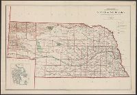
- Found in:
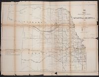
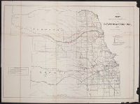
- Beinecke Rare Book and Manuscript Library > Map showing the progress of the public surveys in Kansas and Nebraska / Surveyor General's Office ; Department of the Interior, General Land Office, Oct. 2nd, 1866.
- Creator:
- United States. General Land Office
- Published / Created:
- 1866
- Call Number:
- 825fcm 1866
- Container / Volume:
- BRBL_00575
- Image Count:
- 1
- Resource Type:
- Maps, Atlases & Globes
- Found in:
- Beinecke Rare Book and Manuscript Library > Map showing the progress of the public surveys in Kansas and Nebraska / Surveyor General's Office ; Department of the Interior, General Land Office, Oct. 2nd, 1866.
- Creator:
- United States. General Land Office
- Published / Created:
- 1860?
- Call Number:
- 825fcm 1860
- Container / Volume:
- BRBL_00575
- Image Count:
- 1
- Resource Type:
- Maps, Atlases & Globes
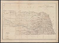
- Found in:
- Beinecke Rare Book and Manuscript Library > Map showing the progress of the public surveys in the territories of Kansas and Nebraska : to accompany annual report of the Surveyor General, 1860.
- Creator:
- United States. General Land Office
- Published / Created:
- 1879
- Call Number:
- 831 1879
- Container / Volume:
- BRBL_00579
- Image Count:
- 1
- Resource Type:
- Maps, Atlases & Globes
- Found in:
- Beinecke Rare Book and Manuscript Library > Montana Territory / compiled from the official records of the General Land Office and other sources by C. Roeser, principal draughtsman G.L.O.
- Creator:
- United States. General Land Office
- Published / Created:
- 1866]
- Call Number:
- 846 1866
- Container / Volume:
- BRBL_00621
- Image Count:
- 1
- Resource Type:
- Maps, Atlases & Globes
- Found in:
- Beinecke Rare Book and Manuscript Library > Oregon.
- Creator:
- United States. General Land Office
- Published / Created:
- 1866]
- Call Number:
- 846 1866
- Container / Volume:
- BRBL_00621
- Image Count:
- 1
- Resource Type:
- Maps, Atlases & Globes
- Found in:
- Beinecke Rare Book and Manuscript Library > Oregon.
- Creator:
- United States. General Land Office
- Published / Created:
- [1908]
- Call Number:
- BrSides Zc35 908un
- Image Count:
- 2
- Resource Type:
- cartographic image
- Found in:
- Beinecke Rare Book and Manuscript Library > Sectionized map of Cheyenne River and Standing Rock Indian Reservation opened by act of May 29, 1908 [cartographic material]
- Creator:
- United States. General Land Office
- Published / Created:
- 1878
- Call Number:
- 793 1878
- Container / Volume:
- BRBL_00520
- Image Count:
- 1
- Resource Type:
- Maps, Atlases & Globes
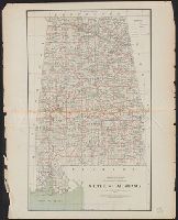
- Found in:
- Beinecke Rare Book and Manuscript Library > State of Alabama / compiled from the official records of the General Land Office and other sources by C. Roeser, principal draughtsman, G.L.O.
- Creator:
- United States. General Land Office
- Published / Created:
- 1933
- Call Number:
- 842 1933
- Container / Volume:
- BRBL_00599
- Image Count:
- 1
- Resource Type:
- Maps, Atlases & Globes
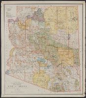
- Found in:
- Beinecke Rare Book and Manuscript Library > State of Arizona / compiled from the official records of the General Land Office and other sources ; compiled and drawn by T.W. Gales.
- Creator:
- United States. General Land Office
- Published / Created:
- 1878
- Call Number:
- 818 1878
- Container / Volume:
- BRBL_00565
- Image Count:
- 1
- Resource Type:
- Maps, Atlases & Globes
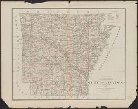
- Found in:
- Beinecke Rare Book and Manuscript Library > State of Arkansas / compiled from the official records of the General Land Office and other sources by C. Roeser, Principal Draughtsman, GLO, Department of the Interior.
- Creator:
- United States. General Land Office
- Published / Created:
- 1934
- Call Number:
- 834 1934
- Container / Volume:
- BRBL_00588
- Image Count:
- 1
- Resource Type:
- Maps, Atlases & Globes
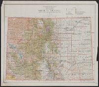
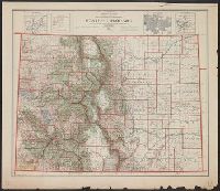
- Found in:
- Beinecke Rare Book and Manuscript Library > State of Colorado : compiled from the official records of the General Land Office and other sources / compiled and drawn by H. Ruh
- Creator:
- United States. General Land Office
- Published / Created:
- 1885
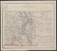
- Call Number:
- 834 1885
- Container / Volume:
- BRBL_00587
- Image Count:
- 1
- Resource Type:
- Maps, Atlases & Globes
- Found in:
- Beinecke Rare Book and Manuscript Library > State of Colorado : compiled from the official records of the General Land Office and other sources / under the supervision of G.P. Strum, principal draughtsman G.L.O.
- Creator:
- United States. General Land Office
- Published / Created:
- 1910
- Call Number:
- 834 1910A
- Container / Volume:
- BRBL_00588
- Image Count:
- 1
- Resource Type:
- Maps, Atlases & Globes
- Found in:
- Beinecke Rare Book and Manuscript Library > State of Colorado : compiled from the official records of the General land office and other sources / compiled by A.F. Dinsmore ; traced and lettered by Wm. Bauman Jr., U.S. General Land Office.
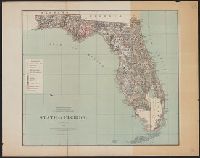
- Creator:
- United States. General Land Office
- Published / Created:
- 1879
- Call Number:
- 792 1879
- Container / Volume:
- BRBL_00518
- Image Count:
- 1
- Resource Type:
- Maps, Atlases & Globes
- Found in:
- Beinecke Rare Book and Manuscript Library > State of Florida / Department of the Interior, General Land Office ; compiled from the official records of the General Land Office and other sources by C. Roeser.
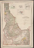
- Creator:
- United States. General Land Office
- Published / Created:
- c1939.
- Call Number:
- 832cbf 1939
- Container / Volume:
- BRBL_00583
- Image Count:
- 1
- Resource Type:
- Maps, Atlases & Globes
- Found in:
- Beinecke Rare Book and Manuscript Library > State of Idaho / compiled from the official records of the General Land Office and other sources ; compiled and drawn by H. Ruh ; revised by T.W. Gales ; relief by D.E. Walker.
- Creator:
- United States. General Land Office
- Published / Created:
- 1907
- Call Number:
- 832 1907
- Container / Volume:
- BRBL_00582
- Image Count:
- 1
- Resource Type:
- Maps, Atlases & Globes
- Found in:
- Beinecke Rare Book and Manuscript Library > State of Idaho : 1907 / compiled from the official records of the General Land Office and other sources under the direction of Frank Bond ; rev. & drawn by Charles J. Helm.
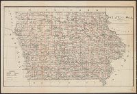
- Creator:
- United States. General Land Office
- Published / Created:
- 1878
- Call Number:
- 815 1878
- Container / Volume:
- BRBL_00560
- Image Count:
- 1
- Resource Type:
- Maps, Atlases & Globes
- Found in:
- Beinecke Rare Book and Manuscript Library > State of Iowa / Department of the Interior, General Land Office, J.A. Williamson, Commissioner ; compiled from the official records of the General Land Office and other sources by C. Roeser, Principal Draughtsman, G.L.O.
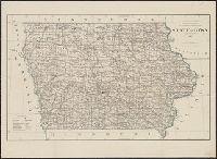
- Creator:
- United States. General Land Office
- Published / Created:
- 1885
- Call Number:
- 815 1885
- Container / Volume:
- BRBL_00560
- Image Count:
- 1
- Resource Type:
- Maps, Atlases & Globes
- Found in:
- Beinecke Rare Book and Manuscript Library > State of Iowa / compiled from the official records of the General Land Office and other sources under supervision of G.P. Strum.
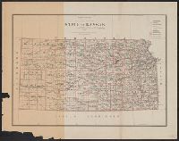
- Creator:
- United States. General Land Office
- Published / Created:
- 1879
- Call Number:
- 825 1879
- Container / Volume:
- BRBL_00573
- Image Count:
- 1
- Resource Type:
- Maps, Atlases & Globes
- Found in:
- Beinecke Rare Book and Manuscript Library > State of Kansas / compiled from the official records of the General Land Office and other sources by C. Roeser ; photo lith. & print. by Julius Bien.
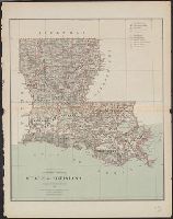
- Creator:
- United States. General Land Office
- Published / Created:
- 1879
- Call Number:
- 795 1879
- Container / Volume:
- BRBL_00521
- Image Count:
- 1
- Resource Type:
- Maps, Atlases & Globes
- Found in:
- Beinecke Rare Book and Manuscript Library > State of Louisiana / compiled from the official records of the General Land Office and other sources by C. Roeser, Principal Draughtsman, G.L.O.
- Creator:
- United States. General Land Office
- Published / Created:
- 1904
- Call Number:
- 811 1904L
- Container / Volume:
- BRBL_00552
- Image Count:
- 1
- Resource Type:
- Maps, Atlases & Globes
- Found in:
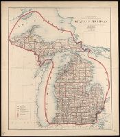
- Beinecke Rare Book and Manuscript Library > State of Michigan / compiled from the official records of the General Land Office and other sources Under the direction of Frank Bond, Chief of Drafting Division, G.L.O. ; revised and drawn by Charles J. Helm.
- Creator:
- United States. General Land Office
- Published / Created:
- 1879
- Call Number:
- 814 1879
- Container / Volume:
- BRBL_00557
- Image Count:
- 1
- Resource Type:
- Maps, Atlases & Globes
- Found in:
- Beinecke Rare Book and Manuscript Library > State of Minnesota : 1879 / compiled from the official records of the General Land Office and other sources by C. Roeser.
- Creator:
- United States. General Land Office
- Published / Created:
- 1878
- Call Number:
- 794 1878
- Container / Volume:
- BRBL_00521
- Image Count:
- 1
- Resource Type:
- Maps, Atlases & Globes
- Found in:
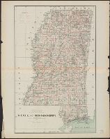
- Beinecke Rare Book and Manuscript Library > State of Mississippi / compiled from the official records of the General Land Office and other sources by C. Roeser, Principal Draughtsman, GLO, Department of the Interior.
- Creator:
- United States. General Land Office
- Published / Created:
- 1891
- Call Number:
- 816 1891
- Container / Volume:
- BRBL_00561
- Image Count:
- 1
- Resource Type:
- Maps, Atlases & Globes
- Found in:
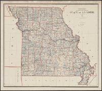
- Beinecke Rare Book and Manuscript Library > State of Missouri / compiled from the official records of the General Land Office, under the supervision of A.F. Dinsmore, Principal Draughtsman.
- Creator:
- United States. General Land Office
- Published / Created:
- 1878
- Call Number:
- 816 1878
- Container / Volume:
- BRBL_00561
- Image Count:
- 1
- Resource Type:
- Maps, Atlases & Globes
- Found in:
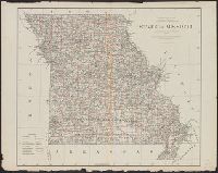
- Beinecke Rare Book and Manuscript Library > State of Missouri : 1878.
- Creator:
- United States. General Land Office
- Published / Created:
- 1908
- Call Number:
- 824 1908
- Container / Volume:
- BRBL_00570
- Image Count:
- 1
- Resource Type:
- Maps, Atlases & Globes
- Found in:
- Beinecke Rare Book and Manuscript Library > State of Nebraska / Department of the Interior, General Land Office ; compiled from the official records of the General Land Office and other sources under the direction of I.P. Berthrong ; compiled by A.F. Dinsmore ; traced and lettered by Wm. Bauman, Jr
- Creator:
- United States. General Land Office
- Published / Created:
- 1879
- Call Number:
- 824 1879
- Container / Volume:
- BRBL_00570
- Image Count:
- 1
- Resource Type:
- Maps, Atlases & Globes
- Found in:
- Beinecke Rare Book and Manuscript Library > State of Nebraska / compiled from the official records of the General Land Office and other sources by C. Roeser.
- Creator:
- United States. General Land Office
- Published / Created:
- 1879
- Call Number:
- 837 1879
- Container / Volume:
- BRBL_00594
- Image Count:
- 1
- Resource Type:
- Maps, Atlases & Globes
- Found in:
- Beinecke Rare Book and Manuscript Library > State of Nevada / compiled from the official records of the General Land Office and other sources by C. Roeser, Principal Draughtsman, G.L.O.
- Creator:
- United States. General Land Office
- Published / Created:
- 1914
- Call Number:
- 837 1914A
- Container / Volume:
- BRBL_00594
- Image Count:
- 1
- Resource Type:
- Maps, Atlases & Globes
- Found in:
- Beinecke Rare Book and Manuscript Library > State of Nevada / compiled from the official records of the General Land Office and other sources under the direction of I.P. Berthrong.
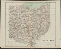
- Creator:
- United States. General Land Office
- Published / Created:
- 1878
- Call Number:
- 804 1878
- Container / Volume:
- BRBL_00543
- Image Count:
- 1
- Resource Type:
- Maps, Atlases & Globes
- Found in:
- Beinecke Rare Book and Manuscript Library > State of Ohio / compiled from the official records of the Department of the Interior, General Land Office by C. Roeser, Principal Draughtsman.
- Creator:
- United States. General Land Office
- Published / Created:
- 1907
- Call Number:
- 827 1907
- Container / Volume:
- BRBL_00577
- Image Count:
- 1
- Resource Type:
- Maps, Atlases & Globes
- Found in:
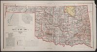
- Beinecke Rare Book and Manuscript Library > State of Oklahoma / compiled from the official records of the General Land Office and other sources under the direction of I.P. Berthrong ; compiled by A.F. Dinsmore and M. Hendges ; drawn by Charles J. Helm.
- Creator:
- United States. General Land Office
- Published / Created:
- 1879
- Call Number:
- 846 1879A
- Container / Volume:
- BRBL_00621
- Image Count:
- 1
- Resource Type:
- Maps, Atlases & Globes
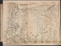
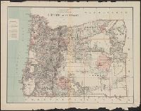
- Found in:
- Beinecke Rare Book and Manuscript Library > State of Oregon / compiled from the official Records of the General Land Office and other sources by C. Roeser, Principal Draughtsman, General Land Office, Department of the Interior.
- Creator:
- United States. General Land Office
- Published / Created:
- 1906
- Call Number:
- 846 1906
- Container / Volume:
- BRBL_00621
- Image Count:
- 1
- Resource Type:
- Maps, Atlases & Globes
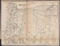
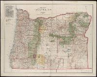
- Found in:
- Beinecke Rare Book and Manuscript Library > State of Oregon / compiled from the official records of the General Land Office and other sources under the direction of Frank Bond ; compiled by M. Hendges ; revised by A.F. Dinsmore ; traced and lettered by Wm. Bauman Jr.
- Creator:
- United States. General Land Office
- Published / Created:
- 1909
- Call Number:
- 847 1909
- Container / Volume:
- BRBL_00625
- Image Count:
- 1
- Resource Type:
- Maps, Atlases & Globes
- Found in:
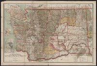
- Beinecke Rare Book and Manuscript Library > State of Washington / compiled from the official records of the General Land Office and other sources under the direction of I. P. Berthrong, chief of Drafting Division, G.L.O. ; compiled and drawn by Daniel O'Hare ; lettering by Wm Bauman, jr.
- Creator:
- United States. General Land Office
- Published / Created:
- 1905
- Call Number:
- 847 1905
- Container / Volume:
- BRBL_00625
- Image Count:
- 1
- Resource Type:
- Maps, Atlases & Globes
- Found in:
- Beinecke Rare Book and Manuscript Library > State of Washington / compiled from the official records of the General Land Office and other sources, under the direction of Frank Bond, chief of drafting division, G.L.O. ; compiled and drawn by Daniel O'Hare ; lettering by Wm. Bauman jr.
- Creator:
- United States. General Land Office
- Published / Created:
- 1878
- Call Number:
- 812 1878
- Container / Volume:
- BRBL_00555
- Image Count:
- 1
- Resource Type:
- Maps, Atlases & Globes
- Found in:
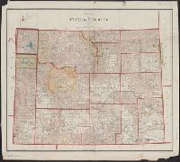
- Beinecke Rare Book and Manuscript Library > State of Wisconsin / Department of the Interior, General Land Office, J.A. Williamson, commissioner ; compiled from the official records of the General Land Office and other sources by C. Roeser, Principal Draughtsman, G.L.O.
- Creator:
- United States. General Land Office
- Published / Created:
- 1901
- Call Number:
- 842 1901
- Container / Volume:
- BRBL_00599
- Image Count:
- 1
- Resource Type:
- Maps, Atlases & Globes
- Found in:
- Beinecke Rare Book and Manuscript Library > Territory of Arizona / compiled from the official records of the General Land Office and other sources under the direction of Harry King, C.E.
- Creator:
- United States. General Land Office
- Published / Created:
- 1902
- Call Number:
- 842 1902
- Container / Volume:
- BRBL_00599
- Image Count:
- 1
- Resource Type:
- Maps, Atlases & Globes
- Found in:
- Beinecke Rare Book and Manuscript Library > Territory of Arizona / compiled from the official records of the General Land Office and other sources under the direction of Harry King, C.E.
- Creator:
- United States. General Land Office
- Published / Created:
- 1896
- Call Number:
- 842 1896
- Container / Volume:
- BRBL_00598
- Image Count:
- 1
- Resource Type:
- Maps, Atlases & Globes
- Found in:
- Beinecke Rare Book and Manuscript Library > Territory of Arizona / revised and reconstructed by R.H. Morton ; compiled from the official records of the General Land Office and other sources under supervision of Harry King, C.E. ; lettered by M. Hendges and R.M. Towson.
- Creator:
- United States. General Land Office
- Published / Created:
- 1882
- Call Number:
- 821 1882
- Container / Volume:
- BRBL_00566
- Image Count:
- 1
- Resource Type:
- Maps, Atlases & Globes
- Found in:
- Beinecke Rare Book and Manuscript Library > Territory of Dakota / compiled from the official records of the General Land Office and other sources by C. Roeser, Principal Draughtsman, G.L.O., Department of the Interior.
- Creator:
- United States. General Land Office
- Published / Created:
- 1879
- Call Number:
- 821 1879
- Container / Volume:
- BRBL_00566
- Image Count:
- 1
- Resource Type:
- Maps, Atlases & Globes
- Found in:
- Beinecke Rare Book and Manuscript Library > Territory of Dakota / compiled from the official records of the General Land Office and other sources by C. Roeser.
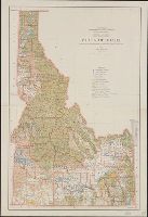
- Creator:
- United States. General Land Office
- Published / Created:
- 1879
- Call Number:
- 832 1879
- Container / Volume:
- BRBL_00582
- Image Count:
- 1
- Resource Type:
- Maps, Atlases & Globes
- Found in:
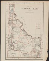
- Beinecke Rare Book and Manuscript Library > Territory of Idaho : 1879 / compiled from the official records of the General Land Office and other sources by C. Roeser.
- Creator:
- United States. General Land Office
- Published / Created:
- 1876
- Call Number:
- 832 1876
- Container / Volume:
- BRBL_00582
- Image Count:
- 1
- Resource Type:
- Maps, Atlases & Globes
- Found in:
- Beinecke Rare Book and Manuscript Library > Territory of Idaho, 1876 / compiled from the official records of the General Land Office and other sources by C. Roeser, Principal Draughtsman, General Land Office.
- Creator:
- United States. General Land Office
- Published / Created:
- 1883
- Call Number:
- 832 1883
- Container / Volume:
- BRBL_00582
- Image Count:
- 1
- Resource Type:
- Maps, Atlases & Globes
- Found in:
- Beinecke Rare Book and Manuscript Library > Territory of Idaho, 1883 / compiled from the official records of the General Land Office and other sources by G.P. Strum, Principal Draughtsman, Department of the Interior, General Land Office.
- Creator:
- United States. General Land Office
- Published / Created:
- 1879
- Call Number:
- 836 1879B
- Container / Volume:
- BRBL_00592
- Image Count:
- 1
- Resource Type:
- Maps, Atlases & Globes
- Found in:
- Beinecke Rare Book and Manuscript Library > Territory of Utah / compiled from the official records of the General Land Office and other sources by C. Roeser, Principal Draughtsman, Department of the Interior, General Land Office.
- Creator:
- United States. General Land Office
- Published / Created:
- 1876
- Call Number:
- 847 1876
- Container / Volume:
- BRBL_00625
- Image Count:
- 1
- Resource Type:
- Maps, Atlases & Globes
- Found in:
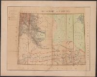
- Beinecke Rare Book and Manuscript Library > Territory of Washington.
- Creator:
- United States. General Land Office
- Published / Created:
- 1876
- Call Number:
- 833 1876
- Container / Volume:
- BRBL_00584
- Image Count:
- 1
- Resource Type:
- Maps, Atlases & Globes
- Found in:
- Beinecke Rare Book and Manuscript Library > Territory of Wyoming / compiled from the official records of the General Land Office and other sources by C. Roeser, Principal Draughtsman, G.L.O.
- Creator:
- United States. General Land Office
- Call Number:
- 833 1879
- Container / Volume:
- BRBL_00584
- Image Count:
- 1
- Resource Type:
- Maps, Atlases & Globes
- Found in:
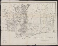
- Beinecke Rare Book and Manuscript Library > Territory of Wyoming : 1879 / compiled from the official records of the General Land Office and other sources by C. Roeser, Principal Draughtsman, G.L.O.
- Creator:
- United States. General Land Office
- Published / Created:
- 1888
- Call Number:
- 833 1888
- Container / Volume:
- BRBL_00584
- Image Count:
- 1
- Resource Type:
- Maps, Atlases & Globes
- Found in:
- Beinecke Rare Book and Manuscript Library > Territory of Wyoming : 1888 / compiled from the official records of the General Land Office and other sources under supervision of Geo. U. Mayo., compiled and drawn by A.F. Dinsmore, 1887.
- Creator:
- United States. General Land Office
- Published / Created:
- 1886
- Call Number:
- 847 1886A
- Container / Volume:
- BRBL_00625
- Image Count:
- 1
- Resource Type:
- Maps, Atlases & Globes
- Found in:
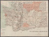
- Beinecke Rare Book and Manuscript Library > Washington Territory / Department of the Interior, General Land Office ; compiled from the official records of the General Land Office and other sources, G.P. Strum, principal draughtsman G.L.O.
- Creator:
- United States. General Land Office
- Published / Created:
- 1879
- Call Number:
- 847 1879
- Container / Volume:
- BRBL_00625
- Image Count:
- 1
- Resource Type:
- Maps, Atlases & Globes
- Found in:
- Beinecke Rare Book and Manuscript Library > Washington Territory / compiled from the official records of the General Land Office and other sources by C. Roeser, Principal Draughtsman, General Land Office.
- Creator:
- Edmunds, J. M. (James Madison), 1810-1879
United States. General Land Office
- Published / Created:
- 1865 October 13
- Call Number:
- WA MSS S-2393
- Collection Title:
- United States Carson City Land Office papers
- Container / Volume:
- Box 1
- Image Count:
- 3
- Found in:
- Beinecke Rare Book and Manuscript Library > [Letter: 1865 October 13, Washington (D.C.): J. M. Edmunds, General Land Office to Register and Receiver, Carson City Land Office]