
Search


Limit your search
- cartographic✖[remove]823
- still image1
- text1
- Engravings✖[remove]823
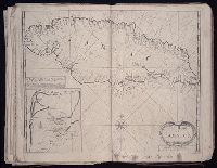
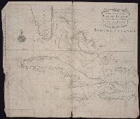
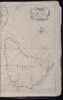
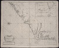
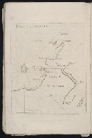
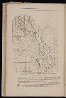
- Maps794
- Maps in books732
- Hand coloring332
- Atlases192
- Prints (Visual works)167
- Illustrations119
- Marginalia59
- Woodcuts27
- Intaglio prints17
- Homann Erben (Firm)79
- Homann, Johann Baptist, 1663-172444
- Berry, William, fl. 1669-1708, creator29
- Sanson, Nicolas, 1600-166726
- Hase, Johann Matthias, 1684-174220
- Mayer, Tobias, 1723-176217
- Moll, Herman, d. 173215
- Visscher, Nicolaes, 1649-170214
- Faden, William, 1749-1836, creator13
- Langren, Arnold Florent van, 1580-164412
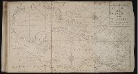
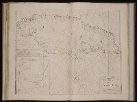
- Pilot guides --Caribbean Area --Early works to 1800159
- Navigation --Early works to 1800134
- Pilot guides --Atlantic Coast (U.S.) --Early works to 1800132
- Atlases --Early works to 180084
- Atlases, German --Early works to 180073
- Voyages and travels --Early works to 180029
- Harbors --Atlantic Coast (North America) --Maps --Early works to 180027
- Nautical charts --Atlantic Coast (North America) --Early works to 180027
- Nautical charts --Caribbean Area --Early works to 180027
- Nautical charts --West Indies --Early works to 180027
- Nicholson, John, d. ca. 1717, bookseller66
- Barker, B. (Benjamin), d. 1764, bookseller24
- Clements, Henry, d. 1719, bookseller24
- King, Charles, d. 1735, bookseller24
- Parker, Richard, fl. 1692-1725, bookseller24
- Tooke, Benjamin, d. 1716, bookseller24
- Elzevier, Gillis, bookseller13
- Hendricksz, Aelbrecht, fl. 1573-1605, printer13
- Villegaignon, Nicolas Durand de, 1510-1571?10
- Claesz, Cornelis, ca. 1546-1609, publisher9