Search
You Searched For
Search Results
- Published / Created:
- 1850
- Call Number:
- 1976 Folio 96
- Collection Title:
- A new universal atlas containing maps of the various empires, kingdoms, states and republics of the
- Image Count:
- 1
- Resource Type:
- Maps, Atlases & Globes
- Found in:
- Beinecke Rare Book and Manuscript Library > 10. Map of Connecticut
- Published / Created:
- 1846
- Call Number:
- 1976 Folio 93
- Collection Title:
- A new universal atlas containing maps of the various empires, kingdoms, states and republics of the
- Image Count:
- 1
- Resource Type:
- Maps, Atlases & Globes
- Found in:
- Beinecke Rare Book and Manuscript Library > 9. Connecticut
- Creator:
- Russell, John, fl. 1733-1795
- Published / Created:
- 1794 July 26
- Call Number:
- 1986 102
- Collection Title:
- An historical, geographical, commercial, and philosophical view of the American United States, and
- Image Count:
- 1
- Found in:
- Beinecke Rare Book and Manuscript Library > A General map of North America drawn from the best sources
- Published / Created:
- 1776
- Call Number:
- Cb23 27
- Collection Title:
- The American military pocket atlas : being an approved collection of correct maps, both general and
- Image Count:
- 1
- Found in:
- Beinecke Rare Book and Manuscript Library > A General map of the northern British colonies in America. which comprehends the province of Quebec, the government of Newfoundland, Nova-Scotia, New-England and New-York. From the maps published by the Admiralty and Board of Trade regulated by the astronomic and trigonometric observations of M. von Holland and corrected from Governor Pownall's late map 1776.
- Creator:
- Romans, B
- Published / Created:
- 1776
- Call Number:
- Cb23 27
- Collection Title:
- The American military pocket atlas : being an approved collection of correct maps, both general and
- Image Count:
- 1
- Found in:
- Beinecke Rare Book and Manuscript Library > A General map of the southern British colonies, in America, comprehending North and South Carolina, Georgia, east and west Florida, with the neighbouring Indian countries. From the modern surveys of engineer de Brahm, Capt. Collet, Mouzon & others; and from the large hydrographical survey of the coasts of east and west Florida
- Call Number:
- Egf 789
- Collection Title:
- The American geography; or, A view of the present situation of the United States of America
- Image Count:
- 1
- Found in:
- Beinecke Rare Book and Manuscript Library > A Map of the northern and middle states; comprehending the western Territory and the British dominions in North America. Compiled from the best authorities
- Creator:
- Doolittle, Amos, 1754-1832
Purcell, Joseph
- Published / Created:
- 1788
- Call Number:
- Egf 789
- Collection Title:
- The American geography; or, A view of the present situation of the United States of America
- Image Count:
- 1
- Found in:
- Beinecke Rare Book and Manuscript Library > A Map of the states of Virginia, North Carolina South Carolina and Georgia comprehending the Spanish provinces of east and west Florida exhibiting the boundaries as fixed by the late Treaty of Peace between the United States and the Spanish dominions comp
- Call Number:
- Taylor 376
- Collection Title:
- The discoveries of John Lederer : in three several marches from Virginia, to the west of Carolina
- Image Count:
- 1
- Found in:
- Beinecke Rare Book and Manuscript Library > A Map of the whole territory traversed by John Lederer in his three marches
- Creator:
- Brasier, William
- Published / Created:
- 1776
- Call Number:
- Cb23 27
- Collection Title:
- The American military pocket atlas : being an approved collection of correct maps, both general and
- Image Count:
- 1
- Found in:
- Beinecke Rare Book and Manuscript Library > A Survey of Lake Champlain, including Lake George, Crown Point and St. John. Surveyed by order of His Excellency Major General Sr. Jeffery Amherst, knight of the most honble. Order of the Bath, Commander in Chief of His Majesty's forces in North America (now Lord Amherst) by William Brassier, draughtsman, 1762
- Creator:
- Cook, James, 1728-1779
Gulielmus Whitchurch
- Published / Created:
- 1776
- Call Number:
- 1977 +300
- Collection Title:
- A voyage towards the South pole, and round the world. Performed in His Majesty’s ships the
- Image Count:
- 1
- Resource Type:
- Maps, Atlases & Globes
- Found in:
- Beinecke Rare Book and Manuscript Library > A chart of the southern hemisphere; shewing the tracks of some of the most distinguished navigators
- Creator:
- Moll, Herman, d. 1732
- Published / Created:
- [1732]
- Call Number:
- E1015 M66 1732
- Collection Title:
- Atlas minor: or a set of sixty-two new and correct maps, of all parts of the world. All composed
- Image Count:
- 1
- Found in:
- Beinecke Rare Book and Manuscript Library > A description of the Bay of Fundy showing ye coast, islands, harbours, creeks, coves, rocks, sholes, soundings & anchorings &c... Observed by Nat. Blackmore in ye yeare 1711 and 1712 ...
- Creator:
- Moll, Herman, d. 1732
- Published / Created:
- [1732]
- Call Number:
- E1015 M66 1732
- Collection Title:
- Atlas minor: or a set of sixty-two new and correct maps, of all parts of the world. All composed
- Image Count:
- 1
- Resource Type:
- Maps, Atlases & Globes
- Found in:
- Beinecke Rare Book and Manuscript Library > A general map of Great Britain and Ireland with part of Germany, Holland, Flanders, France &c. agreeable to modern history
- Published / Created:
- 1776
- Call Number:
- Cb23 27
- Collection Title:
- The American military pocket atlas : being an approved collection of correct maps, both general and
- Image Count:
- 1
- Found in:
- Beinecke Rare Book and Manuscript Library > A general map of the middle British colonies in America. Containing Virginia, Maryland, the Delaware counties, Pennsylvania and New Jersey. With the addition of New York, and of the greatest part of New England, as also of the bordering parts of the province of Quebec, improved from several surveys made after the late war, and corrected from Governor Pownall's late map 1776.
- Creator:
- Dawes, William, 1762-1836
- Published / Created:
- 1791 March
- Call Number:
- DU170 H85+ Oversize
- Collection Title:
- An historical journal of the transactions at Port Jackson and Norfolk island, with the discoveries
- Image Count:
- 1
- Resource Type:
- Books, Journals & Pamphlets
- Found in:
- Beinecke Rare Book and Manuscript Library > A map of all those parts of the territory of New South Wales which have been seen by any person belonging to the settlement established at Port Jackson, in the said territory ...
- Creator:
- Moll, Herman, d. 1732
- Published / Created:
- [1732]
- Call Number:
- E1015 M66 1732
- Collection Title:
- Atlas minor: or a set of sixty-two new and correct maps, of all parts of the world. All composed
- Image Count:
- 1
- Found in:
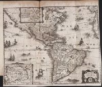
- Beinecke Rare Book and Manuscript Library > A map of the West-Indies & c. Mexico or New Spain. Also ye trade winds, and ye several tracts made by ye galeons and flota from place to place. By H. Moll geographer.
- Call Number:
- 1977 +392
- Collection Title:
- A survey of the cities of London and Westminster : containing the original, antiquity, increase
- Image Count:
- 1
- Resource Type:
- Maps, Atlases & Globes
- Found in:
- Beinecke Rare Book and Manuscript Library > A map of the parish if St. Katherines by the Tower
- Call Number:
- 1977 +392
- Collection Title:
- A survey of the cities of London and Westminster : containing the original, antiquity, increase
- Image Count:
- 1
- Resource Type:
- Maps, Atlases & Globes
- Found in:
- Beinecke Rare Book and Manuscript Library > A map of the parish of St. Dustans Stepney and Stebunheath divided into hamlets
- Call Number:
- 1977 +392
- Collection Title:
- A survey of the cities of London and Westminster : containing the original, antiquity, increase
- Image Count:
- 1
- Resource Type:
- Maps, Atlases & Globes
- Found in:
- Beinecke Rare Book and Manuscript Library > A mapp of the parishes of St. Clements Danes, St. Mary Savoy; with the Rolls Liberty and Lincolns Inn, taken from the last survey with corrections and additions
- Call Number:
- 1977 +392
- Collection Title:
- A survey of the cities of London and Westminster : containing the original, antiquity, increase
- Image Count:
- 1
- Resource Type:
- Maps, Atlases & Globes
- Found in:
- Beinecke Rare Book and Manuscript Library > A mapp of the parishes of St. Saviours Southwark and St. Georges taken from the last survey with corrections
- Creator:
- Moxon, J. (James)
- Call Number:
- EEg 671P
- Collection Title:
- America: being the latest, and most accurate description of the New world; containing the original
- Image Count:
- 1
- Found in:
- Beinecke Rare Book and Manuscript Library > A new discription of Carolina by order of the Lords proprietors
- Published / Created:
- 1833
- Call Number:
- 2002 Folio 97
- Collection Title:
- Tanner’s universal atlas : subscription price $1.00 a number, seperate [sic] numbers $1.50 each
- Image Count:
- 1
- Resource Type:
- Maps, Atlases & Globes
- Found in:
- Beinecke Rare Book and Manuscript Library > A new map of Maine
- Published / Created:
- 1833
- Call Number:
- 1976 Folio 98
- Collection Title:
- A new universal atlas, containing maps of the various empires, kingdoms, states and republics of
- Image Count:
- 1
- Resource Type:
- Maps, Atlases & Globes
- Found in:
- Beinecke Rare Book and Manuscript Library > A new map of Maine
- Published / Created:
- 1850
- Call Number:
- 1976 Folio 96
- Collection Title:
- A new universal atlas containing maps of the various empires, kingdoms, states and republics of the
- Image Count:
- 1
- Resource Type:
- Maps, Atlases & Globes
- Found in:
- Beinecke Rare Book and Manuscript Library > A new map of Maine
- Call Number:
- 1976 Folio 94
- Collection Title:
- A new universal atlas containing maps of the various empires, kingdoms, states and republics of the
- Image Count:
- 1
- Resource Type:
- Maps, Atlases & Globes
- Found in:
- Beinecke Rare Book and Manuscript Library > A new map of Maine
- Creator:
- Moll, Herman, d. 1732
- Published / Created:
- [1732]
- Call Number:
- E1015 M66 1732
- Collection Title:
- Atlas minor: or a set of sixty-two new and correct maps, of all parts of the world. All composed
- Image Count:
- 1
- Found in:
- Beinecke Rare Book and Manuscript Library > A new map of the whole world with the trade winds according to ye latest and most exact observations by H. Moll geographer.
- Creator:
- Moll, Herman, d. 1732
- Published / Created:
- [1732]
- Call Number:
- E1015 M66 1732
- Collection Title:
- Atlas minor: or a set of sixty-two new and correct maps, of all parts of the world. All composed
- Image Count:
- 1
- Found in:
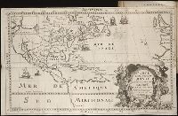
- Beinecke Rare Book and Manuscript Library > A new map of ye north parts of America claimed by France under ye names of Louisiana. Mississipi, Canada & New France, with the adjoyning territories of England & Spain. By H. Moll geographer.
- Call Number:
- CF352 I54 1793
- Collection Title:
- A topographical description of the Western territory of North America; containing a succinct
- Image Count:
- 1
- Found in:
- Beinecke Rare Book and Manuscript Library > A plan of the rapids of the Ohio
- Call Number:
- 1977 +392
- Collection Title:
- A survey of the cities of London and Westminster : containing the original, antiquity, increase
- Image Count:
- 1
- Resource Type:
- Maps, Atlases & Globes
- Found in:
- Beinecke Rare Book and Manuscript Library > Aldgate Ward with its division into parishes. Taken from the last survey, with corrections & additions
- Call Number:
- Taylor 192 4-6
- Collection Title:
- Americae pars sexta, sive, Historiae ab Hieronymo Be[n]zono Mediolane[n]se scriptae, sectio tertia
- Image Count:
- 1
- Found in:
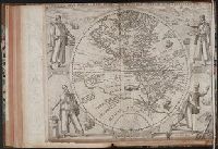
- Beinecke Rare Book and Manuscript Library > America Sive Novus Orbis Respectu Europaeorum Inferior Globe Terrestris Pars 1596
- Call Number:
- Taylor 192 13
- Collection Title:
- Decima tertia pars historiae Americanae, qvae continet exactam et accvratam descriptionem I. Novae
- Image Count:
- 1
- Found in:
- Beinecke Rare Book and Manuscript Library > American nouiter delineata
- Creator:
- Russell, John, fl. 1733-1795
- Published / Created:
- 1794 October 18
- Call Number:
- 1986 102
- Collection Title:
- An historical, geographical, commercial, and philosophical view of the American United States, and
- Image Count:
- 1
- Found in:
- Beinecke Rare Book and Manuscript Library > An Accurate map of the United States of America. according to the Treaty of Peace of 1783
- Creator:
- Nieuhof, Johannes, 1618-1672
- Published / Created:
- 1673
- Call Number:
- 1998 Folio 71
- Image Count:
- 1
- Resource Type:
- Books, Journals & Pamphlets
- Found in:
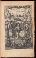
- Beinecke Rare Book and Manuscript Library > An embassy from the East-India Company of the United Provinces, to the Grand Tartar Cham, Emperor of China : deliverd by their excellencies, Peter de Goyer and Jacob de Keyzer, at his imperial city of Peking : wherein the cities, towns, villages, ports, r
- Call Number:
- 1978 +73
- Collection Title:
- The ecclesiastical history of New-England from its first planting in the year 1620 unto the year of
- Image Count:
- 1
- Resource Type:
- Books, Journals & Pamphlets
- Found in:
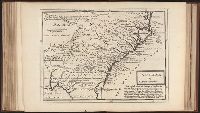
- Beinecke Rare Book and Manuscript Library > An exact mapp of New England and New York
- Creator:
- Visscher, Nicolaes, 1618-1679
- Published / Created:
- anno 1653
- Call Number:
- 1983 Folio 19
- Collection Title:
- [Atlas factice of 96 maps by Blaeu, Visscher, Jansson, Hondius and others]
- Image Count:
- 2
- Resource Type:
- Maps, Atlases & Globes
- Found in:
- Beinecke Rare Book and Manuscript Library > Asiae nova descriptio / auctore Nicola. Io. Visscher
- Creator:
- Moll, Herman, d. 1732
- Published / Created:
- [178-?]
- Call Number:
- 1973 Folio 113
- Image Count:
- 2
- Resource Type:
- Maps, Atlases & Globes
- Found in:
- Beinecke Rare Book and Manuscript Library > Atlas minor: or A new and curious set of sixty two maps, in which are shewn all the empires, kingdoms, countries, states in all the known parts of the earth ... by Herman Moll ...
- Creator:
- Moll, Herman, d. 1732
- Published / Created:
- [1732]
- Call Number:
- E1015 M66 1732
- Image Count:
- 1
- Found in:
- Beinecke Rare Book and Manuscript Library > Atlas minor: or a set of sixty-two new and correct maps, of all parts of the world. All composed and done by Herman Moll, geographer ...
- Call Number:
- 1977 +392
- Collection Title:
- A survey of the cities of London and Westminster : containing the original, antiquity, increase
- Image Count:
- 1
- Resource Type:
- Maps, Atlases & Globes
- Found in:
- Beinecke Rare Book and Manuscript Library > Bishop Gate Street Ward taken from the last survey and corrected
- Call Number:
- 1977 +392
- Collection Title:
- A survey of the cities of London and Westminster : containing the original, antiquity, increase
- Image Count:
- 1
- Resource Type:
- Maps, Atlases & Globes
- Found in:
- Beinecke Rare Book and Manuscript Library > Bread Street Ward and Cordwainer Ward with it's division into parishes taken from the last survey
- Call Number:
- 1977 +392
- Collection Title:
- A survey of the cities of London and Westminster : containing the original, antiquity, increase
- Image Count:
- 1
- Resource Type:
- Maps, Atlases & Globes
- Found in:
- Beinecke Rare Book and Manuscript Library > Candlewick Ward with its division into parishes. Corrected from the last survey
- Creator:
- Moll, Herman, d. 1732
- Published / Created:
- [1732]
- Call Number:
- E1015 M66 1732
- Collection Title:
- Atlas minor: or a set of sixty-two new and correct maps, of all parts of the world. All composed
- Image Count:
- 1
- Found in:
- Beinecke Rare Book and Manuscript Library > Carolina by H. Moll geographer.
- Creator:
- Cardano, Jose Maria
Morata, Antonio?
- Call Number:
- Zc70 +802ea
- Collection Title:
- Relacion del viage hecho por las goletas Sutil y Mexicana en el ano de 1792, para reconocer el
- Image Count:
- 1
- Found in:
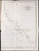
- Beinecke Rare Book and Manuscript Library > Carta esferica de los reconocimientos hechos en la costa N.O. de America en 1791 y 92 por las goletas Sutil y Mexicana y otros buques de S.M. Map No. 1
- Creator:
- Cardano, Jose Maria
- Call Number:
- Zc70 +802ea
- Collection Title:
- Relacion del viage hecho por las goletas Sutil y Mexicana en el ano de 1792, para reconocer el
- Image Count:
- 1
- Found in:
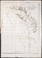
- Beinecke Rare Book and Manuscript Library > Carta esferica de los reconocimientos hechos en la costa N.O. de America en 1791 y 92 por las goletas Sutil y Mexicana y otros buques de S.M. Map no. 2
- Creator:
- Bouttats, Gaspard, b. ca. 1640, engraver
- Call Number:
- Pequot H41
- Collection Title:
- Aenmerckelycke historische reys-beschryvinge door verscheyde landen veel grooter als die van geheel
- Image Count:
- 1
- Found in:
- Beinecke Rare Book and Manuscript Library > Carte d'un nouueau monde, entre le nouueau Mexique et la mer glacialle
- Call Number:
- Cm87 48th
- Collection Title:
- Histoire de Kentucke : nouvelle colonie a l'ouest de al Virginie: contenant, 1o, La decouverte
- Image Count:
- 1
- Found in:
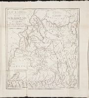
- Beinecke Rare Book and Manuscript Library > Carte de Kentucke, d'apres les observations actuelles: dediee a L'Honorable Congres des Etats-Unis de l'Amerique et a Son Excellence George Washington, Commandant en chef de ses armees par leur tres humble serviteur, John Filson
- Call Number:
- 1977 +392
- Collection Title:
- A survey of the cities of London and Westminster : containing the original, antiquity, increase
- Image Count:
- 1
- Resource Type:
- Maps, Atlases & Globes
- Found in:
- Beinecke Rare Book and Manuscript Library > Cheape Ward with its division into parishes, taken from the last survey, with corrections and additions
- Creator:
- Braun, Georg, 1540 or 1-1622
Hierat, Anton, fl.1597-1627
Hogenberg, Abraham, fl. 1608-1653
Hogenberg, Franz, d. 1590?
- Published / Created:
- 1572]-1618
- Call Number:
- 1975 Folio 41
- Image Count:
- 1
- Resource Type:
- Maps, Atlases & Globes
- Found in:
- Beinecke Rare Book and Manuscript Library > Civitates orbis terrarvm ...
- Call Number:
- 1977 +392
- Collection Title:
- A survey of the cities of London and Westminster : containing the original, antiquity, increase
- Image Count:
- 1
- Resource Type:
- Maps, Atlases & Globes
- Found in:
- Beinecke Rare Book and Manuscript Library > Coleman Street Ward and Bashishaw Ward taken from the last survey, with corrections and additions

- Creator:
- Astrophilus, fl. 1742
Seutter, Matthaeus, 1678-1756
- Published / Created:
- [1742?]
- Call Number:
- BrSides Folio 2009 4
- Image Count:
- 1
- Resource Type:
- Maps, Atlases & Globes
- Found in:
- Beinecke Rare Book and Manuscript Library > Cometa, qui anno Christi 1742 apparuit, ex observationibus, a die 13 Marty usque ad 15 Aprilis : plusquam vigesies quinquies institutis, qua potuit fieri, diligentia notatus, et secundum suas proprietates plerasq[ue], ab astronomia considerari solitas, utpote formam, viam, progressum, plagam coeli, motus velocitatem, descensum ad perigaeum, seu approximationem ad terram, et elongationem ab ea : item distantiam infra, vel supra` horizontem rectum, et etiam obliquum, quoties, saltem intra polum mundi, meridianum constantiensem, et locorum sub elevatione poli 47. grad. 24. min. jacentium, attigit : praecipue vero secundum ascensionem rectam, et declinationem, longitudinem, et latitudinem : et tandem secundum dies, et tempora, lineae trajectoriae inserta, cum in plano tum in figura armillari exhibitus : ubi tum nudo intuitu, tum ope regulae, et circini omnia facile investigantur / observante, et delineante Astrophilo quodam, ex Ord. S. Bened. nomina qui Christo gaudet inesse sua ; a Matth. Seuttero S.C.M.G. Aug. V
- Creator:
- Cardano, Jose Maria
Morata, Antonio?
- Call Number:
- Zc70 +802ea
- Collection Title:
- Relacion del viage hecho por las goletas Sutil y Mexicana en el ano de 1792, para reconocer el
- Image Count:
- 1
- Found in:
- Beinecke Rare Book and Manuscript Library > Contiuacion de los reconocimientos hechos en la costa NO. de America por los buques de S.M. en varias campanas desde 1774 a 1792. Map no. 3
- Call Number:
- 1977 +392
- Collection Title:
- A survey of the cities of London and Westminster : containing the original, antiquity, increase
- Image Count:
- 1
- Resource Type:
- Maps, Atlases & Globes
- Found in:
- Beinecke Rare Book and Manuscript Library > Cornhill Ward with its division into parishes, taken from the last survey &c