
Search


Limit your search
- Public✖[remove]140
- Beinecke Rare Book and Manuscript Library✖[remove]140
- English✖[remove]140
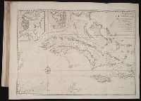
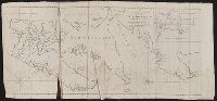
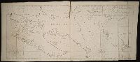
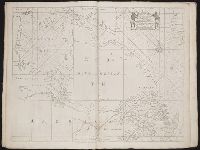
- Navigation --Early works to 1800✖[remove]140
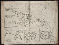
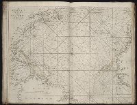
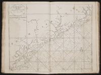
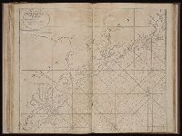
- Pilot guides --Atlantic Coast (U.S.) --Early works to 1800133
- Pilot guides --Caribbean Area --Early works to 1800133
- Nautical astronomy --Early works to 18004
- Cosmography--Early works to 18003
- Navigation --Tables2
- Astronomical instruments --Early works to 18001
- Logarithms1
- Octants1
- Pilot guides --England --Early works to 18001