
Search


Limit your search
- Public✖[remove]149
- cartographic149
- Maps, Atlases & Globes✖[remove]149
- English✖[remove]149
- Latin8
- French7
- German7
- Spanish; Castilian1
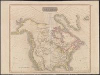
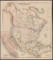
- British--America--Maps--Early works to 180014
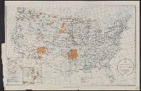
- Indians of North America--Maps12
- British--America--Maps--Early works to 1800.5
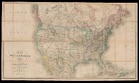
- Railroads--North America--Maps4
- Indians of North America--Oklahoma--Maps3
- Railroads--Canada--Maps3
- Railroads--United States--Maps3
- British--North America--Maps--Early works to 18002
- Indian reservations--North America--Maps2
- Indians of North America--Land tenure--Maps2
- Anville, Jean Baptiste Bourguignon d', 1697-178211
- Condet, Johannes, 1711-1781, engraver6
- Cóvens et Mortier6
- L'Isle, Guillaume de, 1675-1726. Atlas nouveau6
- Homann Erben (Firm). Atlas geographicus maior5
- Robert Sayer and John Bennett (Firm)5
- Sayer, Robert, 1725-17945
- Bowles, John, 1701-17794
- Hammond, Anthony, 1668-17384
- Lahontan, Louis Armand de Lom d'Arce, baron de, 1666-1715?4