Skip to search
Skip to main content
Skip to first result
Search
You Searched For
"Interiors"
Resource Type
Maps, Atlases & Globes
New Search
Search Results
Creator:
Published / Created:
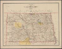
1903
Call Number:
73 1903
Container / Volume:
BRBL_00375
Image Count:
8
Resource Type:
Maps, Atlases & Globes
Publisher:
Dept. of the Interior ,
Subject (Name):
Canada. Dept. of the Interior
Found in:
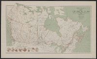
Beinecke Rare Book and Manuscript Library > Map of the Dominion of Canada and Newfoundland / James White, geographer.
Creator:
Published / Created:
1910
Call Number:
73gck 1910
Container / Volume:
BRBL_00376
Image Count:
1
Resource Type:
Maps, Atlases & Globes
Publisher:
Dept. of the Interior ,
Subject (Name):
Canada. Dept. of the Interior
Found in:
Beinecke Rare Book and Manuscript Library > Map of the Dominion of Canada / R.E. Young, D.L.S., Chief Geographer.
Creator:
Published / Created:
[1908]
Call Number:
73gck 1908
Container / Volume:
BRBL_00376
Image Count:
1
Resource Type:
Maps, Atlases & Globes
Publisher:
Dept. of the Interior ,
Subject (Name):
Canada. Dept. of the Interior
Found in:
Beinecke Rare Book and Manuscript Library > Map of the Dominion of Canada / James White, F.R.G.S., Geographer.
Creator:
Published / Created:
1904
Call Number:
73gme 1904
Container / Volume:
BRBL_00376
Image Count:
1
Resource Type:
Maps, Atlases & Globes
Publisher:
Dept. of the Interior ,
Subject (Name):
Canada. Dept. of the Interior
Found in:
Beinecke Rare Book and Manuscript Library > Map of the Dominion of Canada / James White, F.R.G.S., geographer.
Creator:
Published / Created:
1910
Call Number:
73 1910
Container / Volume:
BRBL_00375A
Image Count:
1
Resource Type:
Maps, Atlases & Globes
Publisher:
Dept. of the Interior ,
Subject (Name):
Canada. Dept. of the Interior
Found in:
Beinecke Rare Book and Manuscript Library > Map of the Dominion of Canada / R.E. Young, D.L.S., Chief Geographer.
Creator:
Published / Created:
[1908]
Call Number:
73 1908
Container / Volume:
BRBL_00375A
Image Count:
1
Resource Type:
Maps, Atlases & Globes
Publisher:
Dept. of the Interior ,
Subject (Name):
Canada. Dept. of the Interior
Found in:
Beinecke Rare Book and Manuscript Library > Map of the Dominion of Canada / James White, geographer.
Creator:
Published / Created:
1904
Call Number:
73cbf 1904
Container / Volume:
BRBL_00375A
Image Count:
1
Resource Type:
Maps, Atlases & Globes
Publisher:
Dept. of the Interior ,
Subject (Name):
Canada. Dept. of the Interior
Found in:
Beinecke Rare Book and Manuscript Library > Relief map of the Dominion of Canada / James White, geographer.
Published / Created:
1910?]
Call Number:
73 1910A
Container / Volume:
BRBL_00375A
Image Count:
3
Resource Type:
Maps, Atlases & Globes
Publisher:
Dept. of the Interior ?,
Subject (Name):
Canada. Dept. of the Interior
Found in:
Beinecke Rare Book and Manuscript Library > [Map of Canada north of 60⁰].
Creator:
Published / Created:
[1922]
Call Number:
735gb 1922
Container / Volume:
BRBL_00382
Image Count:
1
Resource Type:
Maps, Atlases & Globes
Subject (Name):
Canada. Dept. of the Interior
Found in:
Beinecke Rare Book and Manuscript Library > Map of Algoma district, Ontario, showing natural resources / prepared in the Natural Resources Intelligence Branch, Department of the Interior.
Creator:
Published / Created:
1902
Call Number:
737cbf 1902
Image Count:
1
Resource Type:
Maps, Atlases & Globes
Publisher:
Department of the Interior ,
Subject (Name):
Canada. Department of the Interior
Found in:
Beinecke Rare Book and Manuscript Library > Topographical map of the Rocky Mountains / James White, F.R.G.S. Geographer.
Creator:
Interior
Published / Created:
190-?]
Call Number:
73gme 1912A
Container / Volume:
BRBL_00376
Image Count:
2
Resource Type:
Maps, Atlases & Globes
Description:
Interior , Atlas of Canada.
Publisher:
Dept. of the Interior ?,
Subject (Name):
Canada. Dept. of the Interior . Atlas of
Found in:
Beinecke Rare Book and Manuscript Library > Atlas of Canada : Railways.
Creator:
Published / Created:
1635]
Call Number:
62 1635
Container / Volume:
BRBL_00734
Image Count:
2
Resource Type:
Maps, Atlases & Globes
Alternative Title:
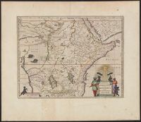
Aethiopia superior vel interior :
Found in:
Beinecke Rare Book and Manuscript Library > Aethiopia svperior vel interior : vulgo Abissinorvm sive Presbiteri Ioannis imperivm.
Creator:
Published / Created:
1919
Call Number:
841fcm 1919
Container / Volume:
BRBL_00597
Image Count:
1
Resource Type:
Maps, Atlases & Globes
Description:
the Interior , under the provisions of the
Publisher:
Dept. of Interior ,
Subject (Name):
United States. Dept. of the Interior
Found in:
Beinecke Rare Book and Manuscript Library > State of New Mexico / compiled by A.F. Dinsmore ; traced and lettered by Wm. Bauman ; engraved and printed by the U.S. Geological Survey.
Creator:
Published / Created:
[190-?]
Call Number:
73G 190X
Container / Volume:
BRBL_00376
Image Count:
1
Resource Type:
Maps, Atlases & Globes
Publisher:
Interior ,
Subject (Name):
Canada. Dept. of the Interior . Railway
Found in:
Beinecke Rare Book and Manuscript Library > Northern Canada / James White, F.R.G.S.
Creator:
Interior
Published / Created:
1914
Call Number:
73gme 1914A
Container / Volume:
BRBL_00376
Image Count:
1
Resource Type:
Maps, Atlases & Globes
Publisher:
Dept. of Interior ,
Found in:
Beinecke Rare Book and Manuscript Library > Map of the dominion of Canada.
Creator:
Published / Created:
1921
Call Number:
733gb 1921
Container / Volume:
BRBL_00379
Image Count:
1
Resource Type:
Maps, Atlases & Globes
Publisher:
Dept. of Interior ,
Found in:
Beinecke Rare Book and Manuscript Library > Map of New Brunswick, indicating natural resources / prepared in the Natural Resources Intelligence Branch.
Creator:
Published / Created:
[1886?]
Call Number:
739GBC C19 1886H
Container / Volume:
BRBL_00392
Image Count:
1
Resource Type:
Maps, Atlases & Globes
Description:
Interior .
Subject (Name):
Canada. Dept. of the Interior
Found in:
Beinecke Rare Book and Manuscript Library > Veins & placer mines of Sugar Creek, Hardscrabble, Slough Creek, Nelson Creek, Willow River and Dragon Creek, Cariboo District, British Columbia / surveyed and drawn by Amos Bowman, assisted by James McEvoy.
Creator:
Published / Created:
[1886?]
Call Number:
739GBC C19 1886G
Container / Volume:
BRBL_00392
Image Count:
1
Resource Type:
Maps, Atlases & Globes
Description:
Interior .
Subject (Name):
Canada. Dept. of the Interior
Found in:
Beinecke Rare Book and Manuscript Library > Quartz veins & placer mines of Little Snowshoe and Keithley Creeks, Cariboo District, British Columbia / surveyed and drawn by Amos Bowman, mining engineer, assisted by James McEvoy.
Creator:
Interior
Published / Created:
1902
Call Number:
737 B22 1902
Container / Volume:
BRBL_00384
Image Count:
2
Resource Type:
Maps, Atlases & Globes
Publisher:
Department of the Interior ,
Found in:
Beinecke Rare Book and Manuscript Library > Topographical map of the Rocky Mountains / Department of the Interior, Canada.
Creator:
Interior
Published / Created:
1905]
Call Number:
735gfc W642 1905
Container / Volume:
BRBL_00382
Image Count:
1
Resource Type:
Maps, Atlases & Globes
Publisher:
Dept. of the Interior ,
Found in:
Beinecke Rare Book and Manuscript Library > Magnetic survey of the Wilbur mine : Lanark County, Ont. Township of Lavant / Department of the Interior.
Creator:
Interior
Published / Created:
1910
Call Number:
737 1910
Container / Volume:
BRBL_00384
Image Count:
2
Resource Type:
Maps, Atlases & Globes
Publisher:
Department of the Interior ,
Found in:
Beinecke Rare Book and Manuscript Library > Rocky Mountains between lat. 51° and 53°10 [cartographic material] / Department of the Interior ; R.E. Young, D.L.S., Chief Geographer.
Creator:
Interior
Published / Created:
1914
Call Number:
739 R59 1914
Container / Volume:
BRBL_00390
Image Count:
2
Resource Type:
Maps, Atlases & Globes
Publisher:
Dept. of the Interior ,
Found in:
Beinecke Rare Book and Manuscript Library > Topographical map of the Rocky and Selkirk Mountains : between Lat. 50⁰37ʹ and 51⁰44ʹ North, Long. 115⁰55ʹ and 118⁰21ʹ West / Department of the Interior ; J.E. Chalifour, chief geographer.
Creator:
Interior
Published / Created:
1886
Call Number:
74FBC 1886
Container / Volume:
BRBL_00394
Image Count:
1
Resource Type:
Maps, Atlases & Globes
Publisher:
Canada. Dept. of the Interior ,
Found in:
Beinecke Rare Book and Manuscript Library > Map shewing mounted police stations & patrols throughout the North-West Territories : during the year 1886 / compiled, drawn and published under the superintendence of J. Johnston, chief draftsman, Department of the Interior.
Creator:
Interior
Published / Created:
[1914?]
Call Number:
737 C88 1914
Container / Volume:
BRBL_00385
Image Count:
5
Resource Type:
Maps, Atlases & Globes
Publisher:
Dept of the Interior ,
Found in:
Beinecke Rare Book and Manuscript Library > Map of Crowsnest Forest and Waterton Lakes Park, Rocky Mountains Forest Reserve / drawn and printed at the Surveyor General's Office.
Creator:
Interior
Published / Created:
1911
Call Number:
734 1911
Container / Volume:
BRBL_00379
Image Count:
1
Resource Type:
Maps, Atlases & Globes
Publisher:
Dept. of the Interior ,
Found in:
Beinecke Rare Book and Manuscript Library > Quebec, 1911.
Creator:
Interior
Published / Created:
1921
Call Number:
739fcm 1921
Container / Volume:
BRBL_00391
Image Count:
1
Resource Type:
Maps, Atlases & Globes
Publisher:
Dept. of the Interior ,
Found in:
Beinecke Rare Book and Manuscript Library > Map of Yoho Park [cartographic material].
Creator:
Interior
Published / Created:
1908
Call Number:
737ad P3111 1908
Container / Volume:
BRBL_00385
Image Count:
1
Resource Type:
Maps, Atlases & Globes
Publisher:
Department of the Interior ,
Found in:
Beinecke Rare Book and Manuscript Library > Northern Alberta [cartographic material] : Peace River district.
Creator:
Interior
Published / Created:
1908
Call Number:
736 1908
Container / Volume:
BRBL_00382
Image Count:
1
Resource Type:
Maps, Atlases & Globes
Publisher:
Dept. of the Interior ,
Found in:
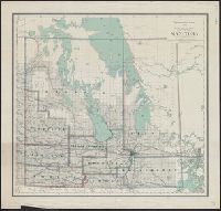
Beinecke Rare Book and Manuscript Library > Manitoba [cartographic material].
Creator:
Interior
Published / Created:
1903
Call Number:
737 1903
Container / Volume:
BRBL_00384
Image Count:
1
Resource Type:
Maps, Atlases & Globes
Publisher:
Dept. of the Interior ,
Found in:
Beinecke Rare Book and Manuscript Library > Alberta and western portions of Saskatchewan and Assiniboia / James White, Geographer.
Creator:
Interior
Published / Created:
1903
Call Number:
741 1903
Container / Volume:
BRBL_00395
Image Count:
1
Resource Type:
Maps, Atlases & Globes
Publisher:
Department of the Interior ,
Found in:
Beinecke Rare Book and Manuscript Library > Map of Yukon District [cartographic material] : with the adjacent northern part of British Columbia.
Creator:
Interior
Published / Created:
1903
Call Number:
738 1903A
Container / Volume:
BRBL_00387
Image Count:
1
Resource Type:
Maps, Atlases & Globes
Publisher:
Canada].Dept. of the Interior ,
Found in:
Beinecke Rare Book and Manuscript Library > Assiniboia [map].
Creator:
Interior
Published / Created:
1904
Call Number:
18 1904
Container / Volume:
BRBL_00013
Image Count:
1
Resource Type:
Maps, Atlases & Globes
Publisher:
Canada. Dept. of the Interior ,
Found in:
Beinecke Rare Book and Manuscript Library > Explorations in northern Canada and adjacent portions of Greenland and Alaska [map] / James White.
Creator:
Interior
Published / Created:
1903
Call Number:
738 1903
Container / Volume:
BRBL_00387
Image Count:
1
Resource Type:
Maps, Atlases & Globes
Publisher:
[Canada]. Dept. of the Interior ,
Found in:
Beinecke Rare Book and Manuscript Library > Saskatchewan [map].
Creator:
Interior
Published / Created:
1923
Call Number:
739 G45 1923
Container / Volume:
BRBL_00389
Image Count:
1
Resource Type:
Maps, Atlases & Globes
Publisher:
Dept. of the Interior , Canada,
Found in:
Beinecke Rare Book and Manuscript Library > Map of Glacier Park, British Columbia.
Creator:
Interior
Published / Created:
1923
Call Number:
739 M86 1923
Container / Volume:
BRBL_00390
Image Count:
1
Resource Type:
Maps, Atlases & Globes
Publisher:
Canada. Dept. of the Interior ,
Found in:
Beinecke Rare Book and Manuscript Library > Map of Mount Revelstoke Park, British Columbia [map].
Creator:
Interior
Published / Created:
1904
Call Number:
74 1904B
Container / Volume:
BRBL_00394
Image Count:
1
Resource Type:
Maps, Atlases & Globes
Publisher:
Canada. Dept. of the Interior ,
Found in:
Beinecke Rare Book and Manuscript Library > Explorations in northern Canada and adjacent portions of Greenland and Alaska [map] / James White.
Creator:
Interior
Published / Created:
1905
Call Number:
737 L14 1905
Container / Volume:
BRBL_00385
Image Count:
1
Resource Type:
Maps, Atlases & Globes
Publisher:
Dept. of the Interior ,
Found in:
Beinecke Rare Book and Manuscript Library > Sketch map showing the vicinity of Lake Louise, Moraine Lake and Vermilion Pass / from photographic surveys by A.O. Wheeler ; assisted by M.P. Bridgland and H.C. Wheeler.
Creator:
Interior
Published / Created:
1902
Call Number:
736 1902
Container / Volume:
BRBL_00382
Image Count:
1
Resource Type:
Maps, Atlases & Globes
Found in:
Beinecke Rare Book and Manuscript Library > Manitoba / Department of the Interior ; James White, F.R.G.S. Geogrpaher.
Creator:
Interior
Published / Created:
1917
Call Number:
741 1917
Container / Volume:
BRBL_00395
Image Count:
1
Resource Type:
Maps, Atlases & Globes
Found in:
Beinecke Rare Book and Manuscript Library > Map of the Yukon Territory / Department of the Interior, Canada ; J.E. Chalifour, chief geographer.
Creator:
Interior
Published / Created:
1905
Call Number:
741 K71 1905
Container / Volume:
BRBL_00395
Image Count:
1
Resource Type:
Maps, Atlases & Globes
Found in:
Beinecke Rare Book and Manuscript Library > Yukon Territory, Kluane, White, and Alsek rivers / James White, F.R.G.S. Geographer ; Department of the Interior.
Creator:
Interior
Published / Created:
1924
Call Number:
739G 1924
Container / Volume:
BRBL_00392
Image Count:
1
Resource Type:
Maps, Atlases & Globes
Found in:
Beinecke Rare Book and Manuscript Library > Southern British Columbia : showing disposition of lands within the railway belt / Department of the Interior, Canada.
Creator:
Interior
Published / Created:
1908
Call Number:
739 1908
Container / Volume:
BRBL_00388
Image Count:
2
Resource Type:
Maps, Atlases & Globes
Found in:
Beinecke Rare Book and Manuscript Library > British Columbia railway belt / Dept. of the Interior ; prepared under the direction of R.E. Young, Superintendent of Railway and Swamp Lands ; James White, F.R.G.S., geographer.
Creator:
Interior
Published / Created:
1907
Call Number:
739G 1907
Container / Volume:
BRBL_00392
Image Count:
2
Resource Type:
Maps, Atlases & Globes
Found in:
Beinecke Rare Book and Manuscript Library > British Columbia railway belt / Dept. of the Interior; prepared under the direction of R.E. Young, Superintendent of Railway and Swamp Lands; James White, F.R.G.S., geographer.
Creator:
Interior
Published / Created:
1913
Call Number:
739gme 1913
Container / Volume:
BRBL_00393
Image Count:
4
Resource Type:
Maps, Atlases & Globes
Found in:
Beinecke Rare Book and Manuscript Library > British Columbia railway belt : map showing disposition of Lands / prepared under the direction of F.C.C. Lynch, Superintendent of Railway Lands.
Creator:
Interior
Published / Created:
1935
Call Number:
738 1935
Container / Volume:
BRBL_00387
Image Count:
1
Resource Type:
Maps, Atlases & Globes
Found in:
Beinecke Rare Book and Manuscript Library > Saskatchewan south / prepared and printed at the Office of the Surveyor General, Ottawa, 1935.
Creator:
Published / Created:
1920
Call Number:
73fcm 1920A
Container / Volume:
BRBL_00375B
Image Count:
1
Resource Type:
Maps, Atlases & Globes
Description:
Interior ."
Publisher:
Dept. of the Interior ,
Found in:
Beinecke Rare Book and Manuscript Library > Map of Manitoba, Saskatchewan and Alberta : showing the number of quarter sections available for homestead entry in each township / prepared in the Natural Resources Intelligence Branch under the direction of F. C. C. Lynch, Superintendent.
Creator:
Published / Created:
1858
Call Number:
8101 1858
Container / Volume:
BRBL_00552
Image Count:
1
Resource Type:
Maps, Atlases & Globes
Publisher:
Dept. of the Interior ,
Subject (Name):
United States. Dept. of the Interior
Found in:
Beinecke Rare Book and Manuscript Library > Map of the Fort Ridgely & South Pass road / by Samuel A. Medary ; drawn by John R. Key.
Creator:
Interior . Railway Lands Branch
Published / Created:
1917
Call Number:
736FCM 1917
Container / Volume:
BRBL_00383
Image Count:
1
Resource Type:
Maps, Atlases & Globes
Publisher:
Dept. of the Interior ,
Found in:
Beinecke Rare Book and Manuscript Library > Map of Manitoba, Saskatchewan and Alberta : showing the land registration and judicial districts / prepared in the Railway Lands Branch under the direction of F.C.C. Lynch, Superintendent.
Creator:
Published / Created:
1916
Call Number:
736gck 1915
Container / Volume:
BRBL_00383
Image Count:
1
Resource Type:
Maps, Atlases & Globes
Description:
Branch, Dept. of the Interior ."
Publisher:
Dept. of the Interior ,
Found in:
Beinecke Rare Book and Manuscript Library > Cereal map of Manitoba [cartographic material] : showing acreage under crop in each township in wheat, oats, barley and flax during 1915 / prepared in the Railway Lands Branch under the direction of F.C.C. Lynch, Superintendent from data supplied by the P
Creator:
Published / Created:
[1920]
Call Number:
73g 1920
Container / Volume:
BRBL_00376
Image Count:
1
Resource Type:
Maps, Atlases & Globes
Description:
Interior revised by Natural Resources
Publisher:
Dept. of the Interior ,
Found in:
Beinecke Rare Book and Manuscript Library > Map of the Dominion of Canada : indicating natural resources, transportation and trade routes / prepared in the Natural Resources Intelligence Branch under the direction of F.C.C. Lynch, Superintendent.
Published / Created:
1904
Call Number:
739 1904
Container / Volume:
BRBL_00388
Image Count:
1
Resource Type:
Maps, Atlases & Globes
Publisher:
Department of the Interior ;
Found in:
Beinecke Rare Book and Manuscript Library > British Columbia railway belt / [by] James White, F.R.G.S., Geographer: Department of the Interior; Honourable Clifford Sifton, Minister; James S. Smart, Deputy Minister.
Published / Created:
1878
Call Number:
75GM 1878
Container / Volume:
BRBL_00410
Image Count:
1
Resource Type:
Maps, Atlases & Globes
Publisher:
Dept. of the Interior ,
Found in:
Beinecke Rare Book and Manuscript Library > Map of the United States : exhibiting the grants of lands made by the General government to aid the construction of railroads and wagon roads / Dept. of the Interior. U.S. Geographical and Geological Survey of the Rocky Mountain Region J.W. Powell, in Cha
Published / Created:
1878
Call Number:
75gme 1878
Container / Volume:
BRBL_00412
Image Count:
1
Resource Type:
Maps, Atlases & Globes
Publisher:
Dept. of the Interior ,
Found in:
Beinecke Rare Book and Manuscript Library > Map of the United States : exhibiting the grants of lands made by the General government to aid the construction of railroads and wagon roads / Dept. of the Interior. U.S. Geographical and Geological Survey of the Rocky Mountain Region J.W. Powell, in Cha
Published / Created:
1912
Call Number:
734 Q31 1912
Container / Volume:
BRBL_00380
Image Count:
1
Resource Type:
Maps, Atlases & Globes
Publisher:
Dept. of the Interior ,
Found in:
Beinecke Rare Book and Manuscript Library > [Map of Québec]
Creator:
Published / Created:
1919
Call Number:
73fbc 1919
Container / Volume:
BRBL_00375B
Image Count:
1
Resource Type:
Maps, Atlases & Globes
Publisher:
Dept. of the Interior ,
Found in:
Beinecke Rare Book and Manuscript Library > Map of Manitoba, Saskatchewan and Alberta : showing the land registration and judicial districts / prepared in the Natural Resources Intelligence Branch under the direction of F.C.C. Lynch, Superintendent.
Creator:
Published / Created:
[1921].
Call Number:
73g 1921
Container / Volume:
BRBL_00376
Image Count:
1
Resource Type:
Maps, Atlases & Globes
Publisher:
Dept. of the Interior ,
Found in:
Beinecke Rare Book and Manuscript Library > Map of the Dominion of Canada : indicating natural resources, transportation and trade routes / prepared in the Natural Resources Intelligence Branch under the direction of F.C.C. Lynch, Superintendent.
Creator:
Published / Created:
[1917]
Call Number:
73gb 1917
Container / Volume:
BRBL_00376
Image Count:
1
Resource Type:
Maps, Atlases & Globes
Publisher:
Dept. of the Interior ,
Found in:
Beinecke Rare Book and Manuscript Library > Map of Manitoba, Saskatchewan & Alberta : showing the number of quarter sections available for homestead entry in each township, also the pre-emption and purchased homestead area as defined by the Dominion Lands Act 1908 / prepared in the Natural Resource
Published / Created:
1925
Call Number:
736 P26 1925
Container / Volume:
BRBL_00382
Image Count:
1
Resource Type:
Maps, Atlases & Globes
Publisher:
Dept. of the Interior ,
Found in:
Beinecke Rare Book and Manuscript Library > Map of The Pas mineral area and adjacent territory to the north, Manitoba and Saskatchewan / ǂc compiled, drawn and printed by the Topographical Survey of Canada.
Published / Created:
1912]
Call Number:
737 Ed58 1912
Container / Volume:
BRBL_00385
Image Count:
1
Resource Type:
Maps, Atlases & Globes
Publisher:
Department of the Interior ,
Found in:
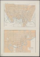
Beinecke Rare Book and Manuscript Library > Edmonton.
Creator:
Published / Created:
1925
Call Number:
737 L14 1925
Container / Volume:
BRBL_00385
Image Count:
1
Resource Type:
Maps, Atlases & Globes
Publisher:
Canada.Dept of the Interior ,
Found in:
Beinecke Rare Book and Manuscript Library > Plan of Lake Louise and vicinity [map] / drawn and printed by the Topographical Survey of Canada.
Published / Created:
1910
Call Number:
736gc 1910
Container / Volume:
BRBL_00383
Image Count:
1
Resource Type:
Maps, Atlases & Globes
Publisher:
Dept. of the Interior ,
Found in:
Beinecke Rare Book and Manuscript Library > Sketch map showing timber conditions along part of the proposed route of the Hudson Bay Railway.
Published / Created:
1912]
Call Number:
739 V66 1912
Container / Volume:
BRBL_00391
Image Count:
1
Resource Type:
Maps, Atlases & Globes
Publisher:
Department of the Interior ,
Found in:
Beinecke Rare Book and Manuscript Library > Vancouver.
Creator:
Published / Created:
1929
Call Number:
741 1929
Container / Volume:
BRBL_00395
Image Count:
1
Resource Type:
Maps, Atlases & Globes
Publisher:
Dept. of the Interior ,
Found in:
Beinecke Rare Book and Manuscript Library > Yukon Territory.
Creator:
Interior . Railway Lands Branch
Published / Created:
[1913]
Call Number:
736 1913A
Container / Volume:
BRBL_00382
Image Count:
1
Resource Type:
Maps, Atlases & Globes
Publisher:
Department of the Interior , Canada,
Found in:
Beinecke Rare Book and Manuscript Library > Map showing elevators in Manitoba, Saskatchewan, and Alberta / prepared in the Railway Lands Branch, F.C.C. Lynch, Superintendent.
Creator:
Published / Created:
1918
Call Number:
737 W31 1914
Container / Volume:
BRBL_00385
Image Count:
1
Resource Type:
Maps, Atlases & Globes
Publisher:
Dept. of the Interior , Canada,
Subject (Name):
Canada. Dept. of the Interior
Found in:
Beinecke Rare Book and Manuscript Library > Map of Waterton Lakes Park, Alberta [map] / from photographic surveys by M. P. Bridgland, D.L.S. and A. O. Wheeler, B.C.L.S. ; drawn and printed at the Surveyor General's Office.
Creator:
Published / Created:
1906
Call Number:
739 Se48 1902
Container / Volume:
BRBL_00390
Image Count:
4
Resource Type:
Maps, Atlases & Globes
Publisher:
Canada. Dept. of the Interior ,
Found in:
Beinecke Rare Book and Manuscript Library > Topographical map of part of the Selkirk Range, British Columbia, adjacent to the Canadian Pacific Railway [map] / from photographic surveys by Arthur O. Wheeler.
Creator:
Published / Created:
1922
Call Number:
73fcm 1922A
Container / Volume:
BRBL_00375B
Image Count:
1
Resource Type:
Maps, Atlases & Globes
Publisher:
Dept. of the Interior , Canada,
Found in:
Beinecke Rare Book and Manuscript Library > Map of Manitoba, Saskatchewan & Alberta : showing the number of quarter sections available for homestead entry, also number of quarter sections privately owned and unoccupied / prepared in the Natural Resources Intelligence Branch.
Creator:
Published / Created:
[1924]
Call Number:
73fcm 1924
Container / Volume:
BRBL_00375B
Image Count:
1
Resource Type:
Maps, Atlases & Globes
Publisher:
Dept. of the Interior , Canada,
Found in:
Beinecke Rare Book and Manuscript Library > Map of Manitoba, Saskatchewan and Alberta : showing the number of vacant quarter sections in each township / prepared in the Natural Resources Intelligence Service.
Creator:
Published / Created:
1919
Call Number:
737FCM P312 1919
Container / Volume:
BRBL_00386
Image Count:
1
Resource Type:
Maps, Atlases & Globes
Publisher:
Canada. Dept. of the Interior ,
Found in:
Beinecke Rare Book and Manuscript Library > Map of Northern Alberta land districts [map] : comprising agencies of Peace River, Grande Prairie & Edmonton, showing number of quarter-sections in each township available for homestead entry / Natural Resources Intelligence Branch ; F.C.C. Lynch, superin
Creator:
Published / Created:
1923
Call Number:
737 R59 1923
Container / Volume:
BRBL_00385
Image Count:
1
Resource Type:
Maps, Atlases & Globes
Publisher:
Department of the Interior , Canada,
Found in:
Beinecke Rare Book and Manuscript Library > Map of Rocky Mountains Park / compiled, drawn and printed by the Topographical Survey of Canada.
Creator:
Published / Created:
1905?]
Call Number:
735gfc B418 1905
Container / Volume:
BRBL_00382
Image Count:
1
Resource Type:
Maps, Atlases & Globes
Publisher:
Dept. of the Interior [Mines Branch,
Subject (Name):
Canada. Dept. of the Interior
Found in:
Beinecke Rare Book and Manuscript Library > Magnetic survey of the Belmont Iron Mine : lot 19, con. 1, Township of Belmont, County of Peterboro, Province of Ontario : map of the vertical intensity / Eugene Haanel, Superintendent of Mines ; surveyed by B.F. Haanel.
Creator:
Published / Created:
[1905?]
Call Number:
735gfc C125 1905
Container / Volume:
BRBL_00382
Image Count:
1
Resource Type:
Maps, Atlases & Globes
Publisher:
Dept. of the Interior , Mines Branch,
Found in:
Beinecke Rare Book and Manuscript Library > Magnetic survey, Calabogie Mine, Bagot Township, Renfrew County : vertical intensity / Eugene Haanel, Superintendent of Mines ; surveyed by E. Nystrom.
Published / Created:
1933
Call Number:
736 C47 1933
Container / Volume:
BRBL_00382
Image Count:
1
Resource Type:
Maps, Atlases & Globes
Publisher:
Surveyor General, Dept. of the Interior ,
Found in:
Beinecke Rare Book and Manuscript Library > Churchill, Manitoba / compiled, drawn, and printed by the Topographical Survey of Canada.
Creator:
Interior . Dominion Lands Branch
Published / Created:
1877
Call Number:
736FCM 1877
Container / Volume:
BRBL_00383
Image Count:
1
Resource Type:
Maps, Atlases & Globes
Publisher:
Dept. of the Interior , Dominion Lands
Found in:
Beinecke Rare Book and Manuscript Library > Map shewing the townships surveyed in the province of Manitoba and the North-west Territory in the Dominion of Canada / published by order of the Honorable David Mills, Minister of the Interior.
Creator:
Interior . Dominion Lands Branch
Published / Created:
1875
Call Number:
73 1875A
Container / Volume:
BRBL_00375
Image Count:
1
Resource Type:
Maps, Atlases & Globes
Publisher:
Dept. of the Interior , Dominion Lands
Found in:
Beinecke Rare Book and Manuscript Library > Map of part of the North West Territory including the province of Manitoba : exhibiting the several tracts of country ceded by the Indian Treaties 1, 2, 3 and 4 : to accompany report of the Honble. the Minister of the Interior, dated 20th January, 1875 /
Creator:
Interior . Railway Lands Branch
Published / Created:
1914
Call Number:
731gr 1914
Container / Volume:
BRBL_00376A
Image Count:
1
Resource Type:
Maps, Atlases & Globes
Found in:
Beinecke Rare Book and Manuscript Library > Map showing the number of chartered banks in New Brunswick, Nova Scotia, and Prince Edward Island. Dept. of the Interior, Canada. Prepared in the Railway Lands Branch under the direction of F.C.C. Lynch, superintendent.
Creator:
Published / Created:
1879
Call Number:
824 1879
Container / Volume:
BRBL_00570
Image Count:
1
Resource Type:
Maps, Atlases & Globes
Description:
Department of the interior , J. A
Found in:
Beinecke Rare Book and Manuscript Library > State of Nebraska / compiled from the official records of the General Land Office and other sources by C. Roeser.
Creator:
Interior . Railway Lands Branch
Published / Created:
1915
Call Number:
73gr 1915B
Container / Volume:
BRBL_00376
Image Count:
2
Resource Type:
Maps, Atlases & Globes
Found in:
Beinecke Rare Book and Manuscript Library > Map showing branches of chartered banks in Ontario and Quebec / prepared in the Railway Lands Branch under the direction of F.C.C. Lynch, superintendent.
Creator:
Published / Created:
1895
Call Number:
793 1895
Container / Volume:
BRBL_00520
Image Count:
1
Resource Type:
Maps, Atlases & Globes
Alternative Title:
Department of the Interior General Land
Publisher:
Department of the Interior , General
Found in:
Beinecke Rare Book and Manuscript Library > Map of the state of Alabama : compiled from the official records of the General Land Office and other sources / under the direction of Harry King, C.E. Chief of Drafting Division G.L.O.; compiled by Rob[t] H. Morton; revised and drawn by Daniel O'Hare.
Published / Created:
1848
Call Number:
806fcm 1848
Container / Volume:
BRBL_00549
Image Count:
1
Resource Type:
Maps, Atlases & Globes
Publisher:
[U.S. Dept. of Interior , General Land
Found in:
Beinecke Rare Book and Manuscript Library > Diagram of the State of Illinois, accompanying the report of the 20th of October,1848; [by] F.R. Conway.
Creator:
Published / Created:
1866
Call Number:
844fcm 1866
Container / Volume:
BRBL_00615
Image Count:
1
Resource Type:
Maps, Atlases & Globes
Publisher:
Department of the Interior , General
Found in:
Beinecke Rare Book and Manuscript Library > Map of public surveys in California & Nevada : to accompany report of Commissioner of the General Land Office, 1866.
Creator:
Published / Created:
1908
Call Number:
75j 1908
Container / Volume:
BRBL_00414A
Image Count:
1
Resource Type:
Maps, Atlases & Globes
Publisher:
Dept. of the Interior , General Land
Found in:
Beinecke Rare Book and Manuscript Library > United States showing routes of principal explorers and early roads and highways [map] / from data prepared by Frank Bond ; by I. B. Berthrong.
Creator:
Published / Created:
1908
Call Number:
75gmb 1908
Container / Volume:
BRBL_00411
Image Count:
1
Resource Type:
Maps, Atlases & Globes
Publisher:
Dept. of the Interior , General Land
Found in:
Beinecke Rare Book and Manuscript Library > United States showing routes of principal explorers and early roads and highways [map] / from data prepared by Frank Bond ; by I. B. Berthrong.
Creator:
Published / Created:
1908
Call Number:
75j 1908
Container / Volume:
BRBL_00414A
Image Count:
1
Resource Type:
Maps, Atlases & Globes
Publisher:
Dept. of the Interior , General Land
Found in:
Beinecke Rare Book and Manuscript Library > United States showing routes of principal explorers and early roads and highways [map] / from data prepared by Frank Bond ; by I. B. Berthrong.
Creator:
Published / Created:
1903
Call Number:
822 1903
Container / Volume:
BRBL_00567
Image Count:
1
Resource Type:
Maps, Atlases & Globes
Publisher:
Dept. of the Interior , General Land
Found in:
Beinecke Rare Book and Manuscript Library > Map of the state of North Dakota / compiled from the official records of the General Land Office and other sources under the direction of Frank Bond ; compiled and drawn by M. Hendges ; lettered by Wm. Bauman, Jr.
Creator:
Published / Created:
1917
Call Number:
BrSides Elephant Folio 2018 24
Image Count:
2
Resource Type:
Maps, Atlases & Globes
Publisher:
Dept. of the Interior , U.S. Geological
Found in:
Beinecke Rare Book and Manuscript Library > Topographic map of the Island of Oahu [cartographic material] : city and county of Honolulu / surveyed 1909-1913 by the Engineer Troops, U.S. Army ; control by U.S. Coast and Geodetic Survey and Hawaiian Territorial Survey ; assembled and drawn by the U.S
Published / Created:
1881
Call Number:
736FCM 1881
Container / Volume:
BRBL_00383
Image Count:
1
Resource Type:
Maps, Atlases & Globes
Publisher:
the Interior ,
Found in:
Beinecke Rare Book and Manuscript Library > Map of Part of the Province of Manitoba, shewing Dominion lands surveyed and lands disposed of.
Creator:
Published / Created:
1916
Call Number:
736FCM 1916
Container / Volume:
BRBL_00383
Image Count:
1
Resource Type:
Maps, Atlases & Globes
Publisher:
Dept. of the Interior , Railway Lands
Found in:
Beinecke Rare Book and Manuscript Library > Map of Manitoba, Saskatchewan and Alberta : showing the number of quarter sections available for homestead entry in each township, also the pre-emption and purchased homestead area as defined by the Dominion Lands Act 1908 / prepared in the Railway Lands
Creator:
Published / Created:
[1912]
Call Number:
737CBF 1912
Container / Volume:
BRBL_00386
Image Count:
1
Resource Type:
Maps, Atlases & Globes
Publisher:
Dept. of the Interior Water Power
Found in:
Beinecke Rare Book and Manuscript Library > Contour map of Bow River Basin above Calgary [Alberta] : to accompany report on power and storage investigation / by M.C. Hendry.
Creator:
Published / Created:
1672]
Call Number:
63 1662
Container / Volume:
BRBL_00334
Image Count:
2
Resource Type:
Maps, Atlases & Globes
Alternative Title:
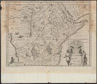
Aethiopia superior vel interior , vulgo
Found in:
Beinecke Rare Book and Manuscript Library > Aethiopia svperior vel interior, vulgo Abissinorvm sive Presbiteri Ioannis imperivm.
Creator:
Published / Created:
1670?]
Call Number:
63 1670
Container / Volume:
BRBL_00334
Image Count:
1
Resource Type:
Maps, Atlases & Globes
Alternative Title:
Aethiopia superior vel interior , vulgo
Found in:
Beinecke Rare Book and Manuscript Library > Aethiopia svperior vel interior, vulgo Abissinorvm sive Presbiteri Ioannis imperivm.
Published / Created:
1722
Call Number:
60 1722
Container / Volume:
BRBL_00323
Image Count:
1
Resource Type:
Maps, Atlases & Globes
Description:
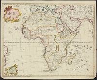
Africa, except there is less interior detail
Found in:
Beinecke Rare Book and Manuscript Library > [Map of Africa].
Creator:
Published / Created:
1871
Call Number:
833 Y38 1871D
Container / Volume:
BRBL_00584
Image Count:
1
Resource Type:
Maps, Atlases & Globes
Description:
Interior , U.S. Geological Survey of the
Found in:
Beinecke Rare Book and Manuscript Library > Upper Geyser Basin, Fire Hole River, Wyoming Territory / surveyed by the party in charge of F.V. Hayden ; compiled and drawn from field notes and sketches of A. Schönborn by E. Hergesheimer.
Creator:
Published / Created:
1878
Call Number:
811 1878
Container / Volume:
BRBL_00552
Image Count:
1
Resource Type:
Maps, Atlases & Globes
Description:
Interior . General Land Office. J.A. Williamson
Found in:
Beinecke Rare Book and Manuscript Library > State of Michigan / compiled from the official records of the General Land Office and other sources by C. Roser, principal draughtsman G.L.O.
Creator:
Published / Created:
1879
Call Number:
814 1879
Container / Volume:
BRBL_00557
Image Count:
1
Resource Type:
Maps, Atlases & Globes
Description:
Interior , General Land Office, J.A. Williamson
Found in:
Beinecke Rare Book and Manuscript Library > State of Minnesota : 1879 / compiled from the official records of the General Land Office and other sources by C. Roeser.
Creator:
Published / Created:
1886
Call Number:
805 1886
Container / Volume:
BRBL_00546
Image Count:
1
Resource Type:
Maps, Atlases & Globes
Description:
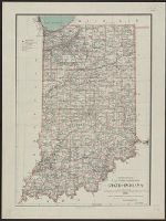
Interior , General Land Office, Wm. A.J. Sparks
Found in:
Beinecke Rare Book and Manuscript Library > State of Indiana / compiled from the official records of the General Land Office and other sources by Geo. U. Mayo, chief of Draughting Div., G.L.O. ; drawn by M. Hendges.
Creator:
Published / Created:
2003
Call Number:
231 2003
Container / Volume:
BRBL_00020
Image Count:
1
Resource Type:
Maps, Atlases & Globes
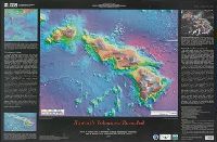
Alternative Title:
. Department of the Interior , U.S. Geological
Publisher:
U.S. Dept. of the Interior , U.S
Found in:
Beinecke Rare Book and Manuscript Library > Hawaii's volcanoes revealed / by Barry W. Eakins ... [et al.] ; prepared in cooperation with the Japan Marine Science and Technology Center, University of Hawaiʻi, School of Ocean and Earth Science and Technology, and the Monterey Bay Aquarium Research In
Creator:
Published / Created:
1926
Call Number:
737 Ed58 1926
Container / Volume:
BRBL_00385
Image Count:
1
Resource Type:
Maps, Atlases & Globes
Publisher:
Dept. of the Interior , Topographical
Found in:
Beinecke Rare Book and Manuscript Library > Edmonton district / drawn and printed at the office of the Topographical Survey of Canada, Department of the Interior, Ottawa, June 1926.
Branch:v1.60.98 ,Deployed:2024-04-24T10:14:32-04:00