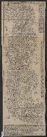
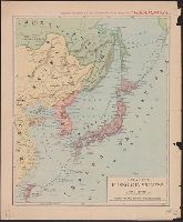
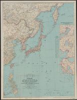
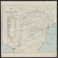
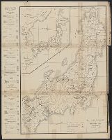
Four-track series., Map of Asia, and New map of Asia and the Chinese empire as they are to-day :
Description:
"Printed for the New York Central's 'Four-Track Series. No. 28'", From panel-title: Issued by the Passenger Department of the New York Central and Hudson River R.R. Copyright 1901 by Geo. H. Daniels General Passenger Agent.", and Recto: advertisements and schedules for trains with text and ill.
Publisher:
Rand, McNally & Co. ,
Subject (Geographic):
China--Maps, Japan--Maps, and Korea--Maps
Subject (Name):
New York Central and Hudson River Railroad Company
Subject (Topic):
Transportation--China--Maps, Transportation--Japan--Maps, and Transportation--Korea--Maps
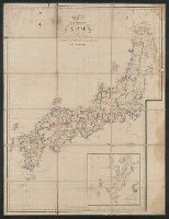
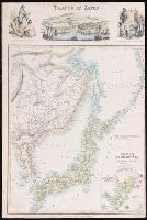
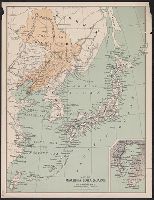
China (östlicheTheil), Korea und Japan im Massstab 1:7.500.000
Description:
From Stieler's Hand-Atlas., In upper left: Stieler's Hand Atlas, N⁰ 65., Insets: Schanghai und Umgebung -- Jedo und Umgebung -- Der Canton-Strom und seine Umgebung., Prime meridians: Greenwich, Ferro, Paris., and Relief shown by hachures.
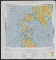
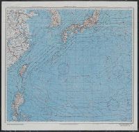
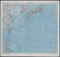
AAF cloth chart, AAF cloth chart., Hakodate, and Nemuro
Description:
"Eastern Asia, 1:1,000,000"--Upper left corner., In lower right corner on each side: 5/45 SS., On verso: Eastern Asia 1:1,000,000. AAF cloth chart Nemuro. NK55., and Relief shown by contours and spot heights.
AAF cloth chart, AAF cloth chart., Hakodate, and Nemuro
Description:
"Eastern Asia, 1:1,000,000"--Upper left corner., On verso: Eastern Asia 1:1,000,000. AAF cloth chart Nemuro. NK55., and Relief shown by contours and spot heights.
In upper margin: Supplemento Straordinario al N. 15933 (13 febbraio 1904) dato agli abbonati della "Perseveranza"., Relief shown by shading., and Shows railroads.
Black-and-white maps with water features shown in blue., Each division mapped in 4 to 6 sheets., Imperfect: Division I wanting., Relief shown by contours and spot heights., and Title, place names and legend in English; sheet information and imprint also in Japanese.
"6-44.", Map of southern Japan showing transportation, water features and populated places., On verso: map of northern Japan, same scale, same features., and Relief shown by hachures and spot heights.
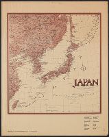
Japan special strategic map, south, Series (Standard map series designation system) ; 5207., and Series ; 5207
Description:
"Army Map Service, U.S. Army, Washington, D.C. 301605 ... 1943 ... 7-45.", Relief shown by hachures and spot heights., and Shows primary and secondary roads and two types of railroads.
"Pinkerton's modern atlas " appears above border at center of map., Covers also Korea., Number "33" on upper right hand corner., and Relief shown by hachures.
Publisher:
Cadell & Davies,
Subject (Geographic):
Japan--Maps and Korea--Maps
Subject (Name):
Cadell & Davies, Hebert, L, Neele, Samuel John, 1758-1824, and Pinkerton, John, 1758-1826. Modern atlas
"Note: This map has been prepared from the Topographical map of the Japanese Empire, published by the Imperial Geological Survey of Japan..." and Inset map showing part of Kotsuke and Shimotsuke provinces, scale 1:800,000.
National Geographic Society (U.S.). Cartographic Division
Published / Created:
1945
Call Number:
57 1945
Container / Volume:
BRBL_00303
Image Count:
1
Resource Type:
Maps, Atlases & Globes
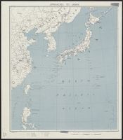
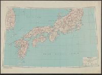
Description:
"Albers conical equal-area projection.", Copy 2 mounted on linen., Includes glossary of geographical terms., and Insets: 1-2. Kuril Islands.--3. Pescadores.--4. Karafuto.--5-7. Ryukyu Islands.--8. Formosa.--9. Tokyo.--10. Location of Japan in the Western Pacific
National Geographic Society (U.S.). Cartographic Division
Published / Created:
1945
Call Number:
57 1945
Container / Volume:
BRBL_00303
Image Count:
1
Resource Type:
Maps, Atlases & Globes
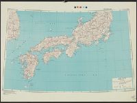
Description:
"Albers conical equal-area projection.", Includes glossary of g, Insets: 1-2. Kuril Islands.--3. Pescadores.--4. Karafuto.--5-7. Ryukyu Islands.--8. Formosa.--9. Tokyo.--10. Location of Japan in the Western Pacific., and Relief shown by shading and spot heights.
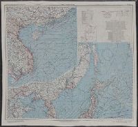
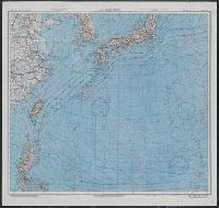
AAF cloth chart ; no. C-52, C-53, AAF cloth chart ; no. C-52, C-53., and East China Sea
Description:
"May 1945.", "N1205-E11320/2703X3740"--Verso., Includes location diagram., Relief shown by contours and spot heights., and Title on verso: East China Sea.
Publisher:
Army Map Service, U.S. Army,
Subject (Geographic):
East China Sea--Maps, Japan--Maps, and South China Sea--Maps
Subject (Name):
United States. Aeronautical Chart Service and United States. Army Air Forces
Subject (Topic):
Aeronautical charts--East China Sea, Aeronautical charts--Japan, Sea of, and Aeronautical charts--South China Sea
National Geographic Society (U.S.). Cartographic Division
Published / Created:
1944
Call Number:
556 1944A
Container / Volume:
BRBL_00293
Image Count:
1
Resource Type:
Maps, Atlases & Globes
Description:
"Azimuthal equidistant projection centered on Tokyo.", Insets: Industrial centers of Japan (5 maps)--Marshall Islands., Issued with the National geographic magazine, v. 85, no. 4, Apr. 1944., and Relief shown by hachures and spot heights.
National Geographic Society (U.S.). Cartographic Division
Published / Created:
1944
Call Number:
57 1944A
Container / Volume:
BRBL_00303
Image Count:
1
Resource Type:
Maps, Atlases & Globes
Description:
"Azimuthal equidistant projection centered on Tokyo.", Insets: Industrial centers of Japan (5 maps)--Marshall Islands., Issued with the National geographic magazine, v. 85, no. 4, Apr. 1944., and Relief shown by hachures and spot heights.
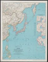
Central Japan, Northern Japan, Series (Standard map series designation system) ; L302., and Series ; L302
Description:
Imperfect: sheet 3, sheet 4 wa, Includes "glossary" and sheet index map., Includes index., Relief indicated by shading; spot heights in meters., and Sheet 1. Northern Japan -- Sheet 2. Central Japan -- Sheet 3. Southern Japan -- Sheet 4. Korea.
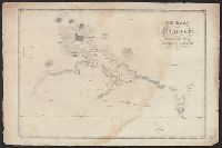
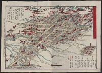
Islands of Japan, Japanese nobleman & fishermen., Japanese women of the higher & lower class., and Port of Simonoseke, Japan.
Description:
Imperfect: trimmed at right, with some loss of text., Inset map: Port of Nagasaki in the island of Kiou-siou. Scale approximately 1:180,000., Shows soundings., and Vignettes in top margin [by John Dunlop]: Port of Simonoseke, Japan -- Japanese nobleman & fishermen -- Japanese women of the higher & lower class.
Publisher:
A. Fullarton & Co.,
Subject (Geographic):
Amur River (China and Russia)--Maps., Japan--Maps, Korea--Maps, Manchuria (China)--Maps., and Nagasaki-shi Region (Japan)--Maps.
Subject (Name):
A. Fullarton & Co., publisher, Bartholomew, John, 1805-1861, engraver, and Dunlop, John, artist.
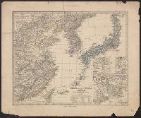
Imperfect: chipped, with some loss of text. Mounted on linen. Label affixed above title, "Library of th, In upper left: Berghaus's Atlas von Asia., In upper right: no. 2., Includes chart of geographic terms in 9 languages., and Relief shown by hachures.
Publisher:
Bei Justus Perthes,
Subject (Geographic):
China--Maps and Japan--Maps
Subject (Name):
American Oriental Society. Library Bookplate, Anville, Jean Baptiste Bourguignon d', 1697-1782, and Justus Perthes (Firm : Gotha, Germany)
Map & guide of Hakone & neighbourhood., Map and guide of Hakone and neighbourhood., and Map of Hakone & neighbourhood.
Description:
"Compiled in February 1921"., Includes table of distances from Miyanoshita., On verso: text, ill. and tourist info., and Shows railway lines, tram lines, roads, "sights and scenes".
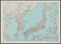
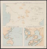
"The London Geographical Institute, M.C.H.", Includes inset maps of Taiwan (Formosa) and Karafuto (Sakhalin), same scale., and Shows Japan, Korea, and the eastern coast of China, railways, air routes, and shipping routes.
"The London Geographical Institute, M.C.H.", Includes inset maps of Taiwan (Formosa) and Karafuto (Sakhalin), same scale., and Shows Japan, Korea, and the eastern coast of China, railways, air routes, and shipping routes.
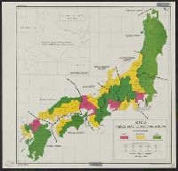
Includes 5 insets, var. scales: Hypsometrical and bathymetrical chart -- Political division of the Japanese Empire -- Chishima (Kurile Islands) -- [Taiwan and Ryūkyū Islands] -- Ogasawa-Jima (Bonin Islands), Ka and Relief shown by contours and spot heights.
Publisher:
Tōyōdō,
Subject (Geographic):
Japan--Administrative and political divisions--Maps, Japan--Maps, and Taiwan--Maps
Subject (Name):
Matsudaira, N, Suzuki, Kiyotada, and Togawa, Tametsugu
"February 1921"., Inset: Sketch map of Unzen Park., On verso: text, ill. and tourist info., Shows roads, waterways, houses, post offices and ports., and Unzen and neighbourhood -- Sea routes with Nagasaki as centre -- Map showing the neighbourhood of Nagasaki.
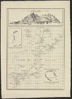
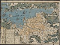
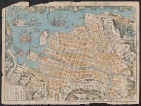
I, Includes sailing directions., Map of the western shore of the Bay of Yedo, Japan with relief shown by hachures. Depth shown by soundings., and Views: Perry I. W.-Mt. Fusee-Webster I. N.W. by W. -- Uraga-Cape Kamisaki -- Saddle N.E. 3/4 N-C. Sagami N.E. 3/4 E.
Publisher:
Hydrographic Dept.],
Subject (Geographic):
Japan--Maps
Subject (Name):
Bien, Julius, 1826-1909, Maury, William L, Perry, Matthew Calbraith, 1794-1858, Sels, Edward, Siebert, Selmar, and United States Naval Expedition to Japan--1852-1854