Search
You Searched For
Search Results
- Creator:
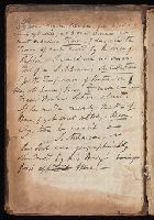
- Donne, John, 1572-1631
- Published / Created:
- 1669
- Call Number:
- Ih D718 C633h
- Image Count:
- 15
- Resource Type:
- Books, Journals & Pamphlets
- Found in:
- Beinecke Rare Book and Manuscript Library > Poems, &c. / by John Donne, late dean of St. Pauls ; with elegies on the authors death ; to which is added divers copies under his own hand, never before printed.
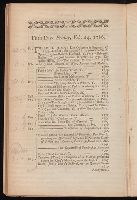
- Creator:
- Thomas and John Egerton (Firm)
- Published / Created:
- [1786]
- Call Number:
- X348 E29 1786/2/20
- Image Count:
- 18
- Resource Type:
- Books, Journals & Pamphlets
- Found in:
- Beinecke Rare Book and Manuscript Library > A catalogue of the library of John Henderson, Esq. ... : which will be sold by auction by T. and J. Egerton, ... on Monday, the 20th of February, 1786 ...
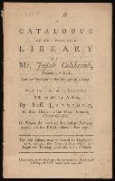
- Creator:
- Langford, Mr. (Abraham), 1711-1774.
- Published / Created:
- [1776]
- Call Number:
- X348 L264 1776
- Image Count:
- 14
- Found in:
- Beinecke Rare Book and Manuscript Library > A catalogue of the valuable library of Mr. Josiah Colebrook, deceased : F.R.S. and late treasurer of the Antiquarian Society, which ... will be sold by auction, by Mess. Langford ... on Tuesday the 20th of this instant February 1776, and the two following evenings ...
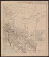
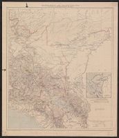
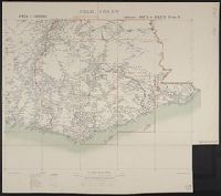
- Creator:
- Allied Forces
Great Britain. War Office. General Staff. Geographical Section
- Published / Created:
- 1943-
- Call Number:
- 11hd 1942D-44
- Image Count:
- 14
- Resource Type:
- Maps, Atlases & Globes
- Found in:
- Beinecke Rare Book and Manuscript Library > Central Europe 1:100,000.
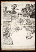
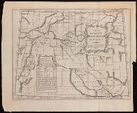
- Creator:
- Rocque, John, -1762.
- Published / Created:
- 1746
- Call Number:
- 2002 Folio 94
- Image Count:
- 16
- Resource Type:
- Maps, Atlases & Globes
- Found in:
- Beinecke Rare Book and Manuscript Library > An exact survey of the city's of London and Westminster, ye borough of Southwark and the country near ten miles round : begun in 1741, finished in 1745, and published in 1746, according to act of Parliament / by John Rocque ; engrav'd by Richard Parr and printed by W. Pratt ... = Urbium maxime insignium Londini et Westmonasterii nec non municipii Sudovercencis, regionumque ad decem quasi milliaria circumjacentium : delineatio ichnographica anno 1741 incohata 1745 absoluta / a Johanne Rocque ... = Carte topographique des villes de Londres, Westminster, et bourg de Southwark et de leurs environs : levée très exactement sur les lieux, en 1741, achevée en 1745, et publieé selon un acte de Parlement en 1746 / par Jean Rocque.
- Published / Created:
- [1738]
- Call Number:
- BrSides Folio 2017 4
- Image Count:
- 12
- Resource Type:
- Maps, Atlases & Globes
- Found in:
- Beinecke Rare Book and Manuscript Library > The first [-twelfth] sheet of Chinese Tartary ...
- Creator:
- Dickens, Charles, 1812-1870
- Published / Created:
- [1861]
- Call Number:
- Gimbel/Dickens B278
- Image Count:
- 5
- Found in:
- Beinecke Rare Book and Manuscript Library > Great expectations, a reading : in three stages.
- Creator:
- Adam, Robert, 1728-1792.
- Published / Created:
- 1764
- Call Number:
- JJp45 15
- Image Count:
- 7
- Resource Type:
- Books, Journals & Pamphlets
- Found in:
- Beinecke Rare Book and Manuscript Library > Rvins of the palace of the Emperor Diocletian at Spalatro in Dalmatia / by R. Adam ...
- Creator:
- Adam, Robert, 1728-1792.
- Published / Created:
- 1764
- Call Number:
- JJp45 16
- Image Count:
- 8
- Resource Type:
- Books, Journals & Pamphlets
- Found in:
- Beinecke Rare Book and Manuscript Library > Rvins of the palace of the Emperor Diocletian at Spalatro in Dalmatia / by R. Adam ...
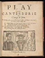
- Published / Created:
- 1641
- Call Number:
- By38a L364 641n
- Image Count:
- 8
- Resource Type:
- Books, Journals & Pamphlets
- Found in:
- Beinecke Rare Book and Manuscript Library > A new play called Canterburie his change of diot : which sheweth variety of wit and mirth: privately acted neare the Palace-yard at Westminster ...
- Creator:
- Pope, Alexander, 1688-1744
- Published / Created:
- 1728
- Call Number:
- Ik P810 728
- Image Count:
- 68
- Found in:
- Beinecke Rare Book and Manuscript Library > The Dunciad. An heroic poem. In three books.
- Published / Created:
- 1809
- Call Number:
- 755 1809
- Container / Volume:
- BRBL_00438
- Image Count:
- 1
- Resource Type:
- Maps, Atlases & Globes
- Found in:
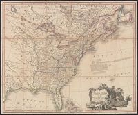
- Beinecke Rare Book and Manuscript Library > The United States of North America : with the British territories and those of Spain.
- Published / Created:
- 1776
- Call Number:
- 764 B65 1776B
- Container / Volume:
- BRBL_00455
- Image Count:
- 1
- Resource Type:
- Maps, Atlases & Globes
- Found in:
- Beinecke Rare Book and Manuscript Library > An accurate map of the country round Boston in New England ...
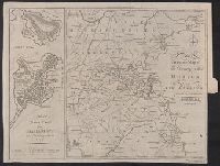
- Published / Created:
- 1776
- Call Number:
- 764 B65 1776B
- Container / Volume:
- BRBL_00455
- Image Count:
- 1
- Resource Type:
- Maps, Atlases & Globes
- Found in:
- Beinecke Rare Book and Manuscript Library > An accurate map of the country round Boston in New England ...
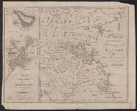
- Published / Created:
- 1777
- Call Number:
- 764 B65 1777A
- Container / Volume:
- BRBL_00455
- Image Count:
- 1
- Resource Type:
- Maps, Atlases & Globes
- Found in:
- Beinecke Rare Book and Manuscript Library > A plan of the town of Boston, with the intrechments &c. of His Majestys Forces in 1775: from the observations of Lieut. Page of His Majesty's Corps of Engineers: and from the plans of other Gentlemen.
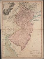
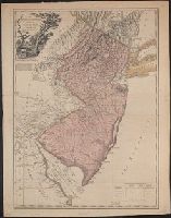
- Creator:
- Faden, William, 1749-1836
- Published / Created:
- 1778
- Call Number:
- 773 1778B
- Container / Volume:
- BRBL_00495
- Image Count:
- 1
- Resource Type:
- Maps, Atlases & Globes
- Found in:
- Beinecke Rare Book and Manuscript Library > The province of New Jersey divided into east and west, commonly called the Jerseys / engraved ... by Wm. Faden.
- Published / Created:
- 1777
- Call Number:
- 773 1777
- Container / Volume:
- BRBL_00495
- Image Count:
- 1
- Resource Type:
- Maps, Atlases & Globes
- Found in:
- Beinecke Rare Book and Manuscript Library > The province of New Jersey divided into east and west, commonly called the Jerseys / engraved ... by Wm. Faden.
- Published / Created:
- [1910]
- Call Number:
- 97 1910
- Container / Volume:
- BRBL_00678
- Image Count:
- 1
- Resource Type:
- Maps, Atlases & Globes
- Found in:
- Beinecke Rare Book and Manuscript Library > South Peru and north Bolivia [cartographic material] : including the rubber yielding montaña.
- Published / Created:
- [1910]
- Call Number:
- 97 1910A
- Container / Volume:
- BRBL_00678
- Image Count:
- 1
- Resource Type:
- Maps, Atlases & Globes
- Found in:
- Beinecke Rare Book and Manuscript Library > South Peru and north Bolivia [cartographic material] : including the rubber yielding montaña.
- Published / Created:
- [1910]
- Call Number:
- 97 1910
- Container / Volume:
- BRBL_00678
- Image Count:
- 1
- Resource Type:
- Maps, Atlases & Globes
- Found in:
- Beinecke Rare Book and Manuscript Library > South Peru and north Bolivia [cartographic material] : including the rubber yielding montaña.
- Published / Created:
- [1910]
- Call Number:
- 97 1910A
- Container / Volume:
- BRBL_00678
- Image Count:
- 1
- Resource Type:
- Maps, Atlases & Globes
- Found in:
- Beinecke Rare Book and Manuscript Library > South Peru and north Bolivia [cartographic material] : including the rubber yielding montaña.
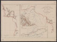
- Published / Created:
- 1910
- Call Number:
- 98fd 1910
- Container / Volume:
- BRBL_00679
- Image Count:
- 1
- Resource Type:
- Maps, Atlases & Globes
- Found in:
- Beinecke Rare Book and Manuscript Library > Maps to illustrate a paper on explorations and boundary surveys in Bolivia : by Major P.H. Fawcett, R.A. (Ret'.)
- Published / Created:
- 1853
- Call Number:
- 74 1853
- Container / Volume:
- BRBL_00723
- Image Count:
- 1
- Resource Type:
- Maps, Atlases & Globes
- Found in:
- Beinecke Rare Book and Manuscript Library > Chart shewing the North West Passage discovered by Capt. R. le M. McClure ... / by E.A. Inglefield ... ; drawn by W.H. Fawekner ...
- Creator:
- Scull, Nicholas, 1686?-1761?
- Published / Created:
- [1753]
- Call Number:
- BrSides 2019 60
- Image Count:
- 1
- Resource Type:
- Maps, Atlases & Globes
- Found in:
- Beinecke Rare Book and Manuscript Library > A map of Philadelphia and parts adjacent / by N. Scull and G. Heap.
- Creator:
- Gibson, J. (John), active 1750-1792
- Published / Created:
- [1749]
- Call Number:
- BrSides 2019 63
- Image Count:
- 1
- Resource Type:
- Maps, Atlases & Globes
- Found in:
- Beinecke Rare Book and Manuscript Library > A map of New Scotland with its dependencies and a succint account of the country.
- Creator:
- Bowen, Emanuel, 1693 or 1694-1767
- Published / Created:
- [1785]
- Call Number:
- BrSides Double Folio 2019 90
- Image Count:
- 1
- Resource Type:
- Maps, Atlases & Globes
- Found in:
- Beinecke Rare Book and Manuscript Library > An accurate map of Northampton Shire divided into its hundreds : and laid down from the best authorities, assisted by the most approved modern maps, with various improvements, illustrated with historical extracts relative to its natural produce, trade, manufactures & present state of its principal towns / by Eman. Bowen Geogr. to His Majesty.
- Creator:
- Bowen, Emanuel, 1693 or 1694-1767
- Published / Created:
- [1785?]
- Call Number:
- BrSides Double Folio 2019 91
- Image Count:
- 1
- Resource Type:
- Maps, Atlases & Globes
- Found in:
- Beinecke Rare Book and Manuscript Library > An accurate map of Buckingham Shire divided into its hundreds : drawn from the best authorities assisted by the most approved modern maps with various improvements. Illustrated with historical extracts relative to natural history, produce, trade and manufactures and the present state of the principal towns / by Eman. Bowen, Geogr. to His Majesty.
- Creator:
- Scull, Nicholas, 1686?-1761?
- Published / Created:
- [1753]
- Call Number:
- BrSides 2019 61
- Image Count:
- 1
- Resource Type:
- Maps, Atlases & Globes
- Found in:
- Beinecke Rare Book and Manuscript Library > A map of Philadelphia and parts adjacent / by N. Scull and G. Heap.
- Published / Created:
- 1783
- Call Number:
- 755 1783A
- Container / Volume:
- BRBL_00434
- Image Count:
- 1
- Resource Type:
- Maps, Atlases & Globes
- Found in:
- Beinecke Rare Book and Manuscript Library > Map of the United States in North America; with the British, French and Spanish Dominions ... treaty of 1783. By Thos. Kitchin.
- Creator:
- Purcell, Joseph (Cartographer)
- Published / Created:
- 1792
- Call Number:
- 755 1792A
- Container / Volume:
- BRBL_00435
- Image Count:
- 1
- Resource Type:
- Maps, Atlases & Globes
- Found in:
- Beinecke Rare Book and Manuscript Library > A map of the states of Virginia, North Carolina, South Carolina and Georgia [cartographic material] : comprehending the Spanish provinces of east and west Florida : exhibiting the boundaries as fixed by the late treaty of peace between the United States a
- Published / Created:
- 1766
- Call Number:
- 771 N49 1766
- Container / Volume:
- BRBL_00484
- Image Count:
- 1
- Resource Type:
- Maps, Atlases & Globes
- Found in:
- Beinecke Rare Book and Manuscript Library > A plan of the City of New York and its environs ... John Montresor Engineer.
- Published / Created:
- 1778
- Call Number:
- 774hc T76 1778
- Container / Volume:
- BRBL_00502
- Image Count:
- 1
- Resource Type:
- Maps, Atlases & Globes
- Found in:
- Beinecke Rare Book and Manuscript Library > British Camp at Trudruffrin from the 18th to the 21th of September 1777 with the Attack made by Major General Gray against the Rebels near White Horse tavern on the 20th of September. Drawn by an Officer on the Spot.
- Published / Created:
- [1720?]
- Call Number:
- 85 1720
- Container / Volume:
- BRBL_00636
- Image Count:
- 1
- Resource Type:
- Maps, Atlases & Globes
- Found in:
- Beinecke Rare Book and Manuscript Library > A map of the West Indies or the Islands of America ... explaining what belongs to Spain, England, France, Holland & c. also ye trade winds ...
- Creator:
- Speed, John, 1552?-1629
- Published / Created:
- 1651 [1676 printing]
- Call Number:
- 11 1651
- Container / Volume:
- BRBL_00680
- Image Count:
- 1
- Resource Type:
- Maps, Atlases & Globes
- Found in:
- Beinecke Rare Book and Manuscript Library > A new and accurat map of the world : drawne according to ye truest descriptions, latest discoueries & best obseruations y[e]t have beene made by english or strangers.
- Creator:
- Moll, Herman, -1732
- Published / Created:
- [1729?]
- Call Number:
- 11 1724
- Container / Volume:
- BRBL_00680
- Image Count:
- 1
- Resource Type:
- Maps, Atlases & Globes
- Found in:
- Beinecke Rare Book and Manuscript Library > A new and correct map of the world laid down according to the newest discoveries, and from the most exact observations / [cartographic material] / by Herman Moll, geographer.
- Creator:
- Garstin, William, Sir, 1849-1925
- Published / Created:
- 1909
- Call Number:
- 60bh 1909
- Container / Volume:
- BRBL_00329
- Image Count:
- 1
- Resource Type:
- Maps, Atlases & Globes
- Found in:
- Beinecke Rare Book and Manuscript Library > The jubilee of Speke's discovery of Victoria Nyanza : maps of Eastern Equatorial Africa showing the progress of exploration / to illustrate a paper by William E. Garstin.
- Published / Created:
- 1905
- Call Number:
- 565 N622 1905
- Container / Volume:
- BRBL_00299
- Image Count:
- 1
- Resource Type:
- Maps, Atlases & Globes
- Found in:
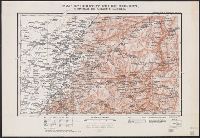
- Beinecke Rare Book and Manuscript Library > Map of country west of Ninguta : to illustrate the campaign in Manchuria.
- Creator:
- Great Britain. War Office. General Staff. Topographical Section
- Published / Created:
- 1907
- Call Number:
- 6555 1907
- Container / Volume:
- BRBL_00346
- Image Count:
- 1
- Resource Type:
- Maps, Atlases & Globes
- Found in:
- Beinecke Rare Book and Manuscript Library > Gold Coast / compiled in the Topographical Section, General Staff 1906.
- Published / Created:
- 1905
- Call Number:
- 565 T442 1905
- Container / Volume:
- BRBL_00299
- Image Count:
- 1
- Resource Type:
- Maps, Atlases & Globes
- Found in:
- Beinecke Rare Book and Manuscript Library > Map of country north of T'ieh-ling : to illustrate the campaign in Manchuria.
- Published / Created:
- 1905
- Call Number:
- 565 H212 1905
- Container / Volume:
- BRBL_00299
- Image Count:
- 1
- Resource Type:
- Maps, Atlases & Globes
- Found in:
- Beinecke Rare Book and Manuscript Library > Map of country south of Harbin : to illustrate the campaign in Manchuria.
- Published / Created:
- 1905
- Call Number:
- 565 M89 1905
- Container / Volume:
- BRBL_00299
- Image Count:
- 1
- Resource Type:
- Maps, Atlases & Globes
- Found in:
- Beinecke Rare Book and Manuscript Library > Map of country round Mukden : to illustrate the campaign in Manchuria.
- Creator:
- Osborne, Thomas, -1767
- Published / Created:
- [1747]
- Call Number:
- BrSides 2019 80
- Image Count:
- 1
- Resource Type:
- Maps, Atlases & Globes
- Found in:
- Beinecke Rare Book and Manuscript Library > A map of Paradise mount Ararat and the city of Babel : according to the three different hypotheses mentioned in this work.
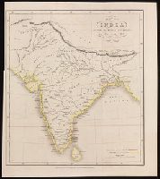
- Creator:
- Danvers, Juland, cartographer.
- Published / Created:
- Decr. 1st, 1842.
- Call Number:
- BrSides 2019 78
- Image Count:
- 1
- Resource Type:
- Maps, Atlases & Globes
- Found in:
- Beinecke Rare Book and Manuscript Library > Map of India : shewing the British possessions in the year 1842 / by Juland Danvers ; J. & C. Walker, sculpt.
- Published / Created:
- [1752]
- Call Number:
- BrSides 2019 81
- Image Count:
- 1
- Resource Type:
- Maps, Atlases & Globes
- Found in:
- Beinecke Rare Book and Manuscript Library > A map of the terrestrial Paradise according to Mr. Huet / with improvements from Dr. Wells.
- Creator:
- Leach, John, Captain
- Published / Created:
- [approximately 1745]
- Call Number:
- BrSides 2019 87
- Image Count:
- 1
- Resource Type:
- Maps, Atlases & Globes
- Found in:
- Beinecke Rare Book and Manuscript Library > A map of the River Gambra from Eropina to Barrakunda / by Captn. John Leach in 1732 ; Thos. Kitchin sculpt.
- Creator:
- Hole, William, -1624
- Published / Created:
- [1614]
- Call Number:
- BrSides 2019 83
- Image Count:
- 1
- Resource Type:
- Maps, Atlases & Globes
- Found in:
- Beinecke Rare Book and Manuscript Library > The great desert of Arabia.
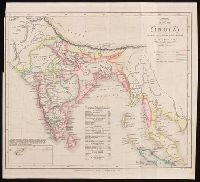
- Creator:
- Danvers, Juland, cartographer
- Published / Created:
- Octr. 17th, 1842.
- Call Number:
- BrSides 2019 77
- Image Count:
- 1
- Resource Type:
- Maps, Atlases & Globes
- Found in:
- Beinecke Rare Book and Manuscript Library > Map of India : shewing the British possessions in the year 1750 / by Juland Danvers ; J. & C. Walker, sculpt.
- Published / Created:
- [1752]
- Call Number:
- BrSides 2019 82
- Image Count:
- 1
- Resource Type:
- Maps, Atlases & Globes
- Found in:
- Beinecke Rare Book and Manuscript Library > The place of Paradise, the habitation of Adam and Seth, and the land of Nod.
- Creator:
- Arrowsmith, John, 1790-1873, cartographer
- Published / Created:
- 1846
- Call Number:
- BrSides 2019 94
- Image Count:
- 1
- Resource Type:
- Maps, Atlases & Globes
- Found in:
- Beinecke Rare Book and Manuscript Library > Arafura Sea [cartographic material] : partly from the surveys of Captn. Owen Stanley / J. Arrowsmith.