Search
You Searched For
Search Results
- Creator:
- From the Collection: Steinberg, Saul, 1914-1999
- Published / Created:
- undated
- Call Number:
- YCAL MSS 1053
- Container / Volume:
- Box 60, folder 1101
- Image Count:
- 66
- Found in:
- Beinecke Rare Book and Manuscript Library > Saul Steinberg papers (YCAL MSS 1053) > Series II: Artwork > Process materials > Street and city maps of Bucharest including annotated copies
- Call Number:
- 1976 1233
- Collection Title:
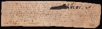
- Forty-two new maps of Asia, Africa, and America ... : all engrav’d, according to the latest
- Image Count:
- 1
- Description:
- In ink on verso: 22.
- Subject (Geographic):
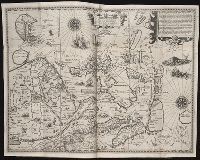
- Ethiopia --Maps --Early works to 1800
- Found in:
- Beinecke Rare Book and Manuscript Library > Abissina and Anian &c
- Call Number:
- 1976 1233
- Collection Title:
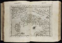
- Twenty four new and accurate maps of the several parts of Europe ... : all (except the last) new
- Image Count:
- 1
- Description:
- In pencil on verso: 22.
- Subject (Geographic):
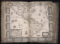
- Switzerland --Maps --Early works to
- Found in:
- Beinecke Rare Book and Manuscript Library > Suisse or Switzerland together with their allies & subjects &c
- Creator:
- From the Collection: Stieglitz, Alfred, 1864-1946
- Published / Created:
- 1918 Jan-Apr
- Call Number:
- YCAL MSS 85
- Container / Volume:
- Box 61, folder 1408-1418
- Image Count:
- 702
- Found in:
- Beinecke Rare Book and Manuscript Library > Alfred Stieglitz / Georgia O'Keeffe archive (YCAL MSS 85) > Series I: Alfred Stieglitz: Correspondence > STIEGLITZ-O'KEEFFE LETTERS > Letters from Stieglitz to O'Keeffe > Letters
- Creator:
- From the Collection: Stenzel, Franz
- Published / Created:
- n.d.
- Call Number:
- WA MSS S-2368
- Container / Volume:
- Box 7, folder 134
- Image Count:
- 1
- Found in:
- Beinecke Rare Book and Manuscript Library > Franz R. and Kathryn M. Stenzel collection of western American art (WA MSS S-2368) > Series II: James G. Swan Artwork and Associated Material > > ARTWORK > Works by Swan > Views of Native American Life > [Map of coastal village Alekistet?] Pencil drawing, 19.1 x 22 cm.
- Call Number:
- WA MSS 443
- Collection Title:
- Isaac Ingalls Stevens papers
- Container / Volume:
- Box 2 | Folder 29
- Image Count:
- 51
- Resource Type:
- Archives or Manuscripts
- Abstract:
- . I. Stevens. 49 p.
Map, "Plan of the
- Found in:
- Beinecke Rare Book and Manuscript Library > [Delacy, Walter Washington]
- Creator:
- Sanborn Map Company, issuing body
- Published / Created:
- 1925
- Call Number:
- 766 M59 1925
- Image Count:
- 31
- Resource Type:
- Maps, Atlases & Globes
- Abstract:
- Sanborn fire insurance maps are a rich
- Description:
- Partial cadastral map.
- Subject (Geographic):
- Milford (Conn.)--Maps
- Subject (Topic):
- --Milford--Maps
- Found in:
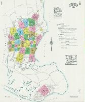
- Beinecke Rare Book and Manuscript Library > Insurance maps of Milford, New Haven County, Connecticut, including Woodmont, Merwin's Point, Bay View, Fort Trumbull Beach, Silver Sands, Seaside, Myrtle Beach, Meadows End, Walnut Beach, Wildmere Beach, Laurel Beach, Cedar Beach, Devon and Rivercliff.
- Creator:
- Sanborn Map Company, issuing body
- Published / Created:
- 1926
- Call Number:
- 766 M31 1926
- Image Count:
- 36
- Resource Type:
- Maps, Atlases & Globes
- Abstract:
- Sanborn fire insurance maps are a rich
- Description:
- Partial cadastral map.
- Subject (Geographic):
- Manchester--Maps
- Subject (Topic):
- --Manchester--Maps
- Found in:
- Beinecke Rare Book and Manuscript Library > Insurance maps of Manchester, including part of Highland Park and Manchester Green, Hartford Co., Connecticut.
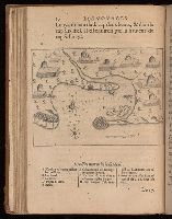
- Call Number:
- 402 M59 1630
- Container / Volume:
- BRBL_00233A
- Image Count:
- 2
- Resource Type:
- Maps, Atlases & Globes
- Description:
- Signature R, page number 22 on verso.
- Subject (Geographic):
- Milan (Italy : Province)--Maps--Early
- Found in:
- Beinecke Rare Book and Manuscript Library > Stato di Milano.
- Creator:
- From the Collection: Kissinger, Henry, 1923-2023
- Published / Created:
- 1970, undated
- Call Number:
- MS 2004
- Container / Volume:
- Box 206, folder 3
- Image Count:
- 76
- Found in:
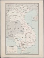
- Manuscripts and Archives > Henry A. Kissinger papers, part III (MS 2004) > Series V: Writing and Research Materials > Research files for books > White House Years > Maps of Indochina
- Creator:
- From the Collection: Kissinger, Henry, 1923-2023
- Published / Created:
- 2004
- Call Number:
- MS 1981
- Container / Volume:
- Box 745, folder 9
- Image Count:
- 176
- Found in:
- Manuscripts and Archives > Henry A. Kissinger papers, part II (MS 1981) > Series III: Post-Government Career > Speeches and writings > General > Testimony before Senate Foreign Relations Committee on "Middle East: Re-thinking the Road Map," Feb 24, 2004 [2 of 2]
- Creator:
- From the Collection: Kissinger, Henry, 1923-2023
- Published / Created:
- 2004
- Call Number:
- MS 1981
- Container / Volume:
- Box 745, folder 8
- Image Count:
- 318
- Found in:
- Manuscripts and Archives > Henry A. Kissinger papers, part II (MS 1981) > Series III: Post-Government Career > Speeches and writings > General > Testimony before Senate Foreign Relations Committee on "Middle East: Re-thinking the Road Map," Feb 24, 2004 [1 of 2]
- Creator:
- Sanborn Map Company, issuing body
- Published / Created:
- 1931
- Call Number:
- 766 W73 1931
- Image Count:
- 23
- Resource Type:
- Maps, Atlases & Globes
- Abstract:
- Sanborn fire insurance maps are a rich
- Description:
- Partial cadastral map.
- Subject (Geographic):
- Winsted (Conn.)--Maps
- Subject (Topic):
- --Winsted--Maps
- Found in:
- Beinecke Rare Book and Manuscript Library > Winsted, Litchfield County, Connecticut.
- Creator:
- Sanborn Map Company, issuing body
- Published / Created:
- 1924
- Call Number:
- 766 W677 1924
- Image Count:
- 26
- Resource Type:
- Maps, Atlases & Globes
- Abstract:
- Sanborn fire insurance maps are a rich
- Description:
- Partial cadastral map.
- Subject (Geographic):
- Coventry (Conn.)--Maps
- Subject (Topic):
- --Coventry--Maps
- Found in:
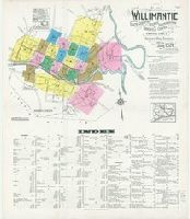
- Beinecke Rare Book and Manuscript Library > Willimantic, including South Coventry, Storrs, South Windham, and Mansfield Center, Windham County, Connecticut.
- Creator:
- Sanborn Map Company, issuing body
- Published / Created:
- 1921
- Call Number:
- 766 W29 1922
- Image Count:
- 86
- Resource Type:
- Maps, Atlases & Globes
- Abstract:
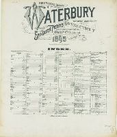
- Sanborn fire insurance maps are a rich
- Description:
- specials, and key maps.
- Subject (Geographic):
- Waterbury (Conn.)--Maps
- Subject (Topic):
- --Waterbury--Maps
- Found in:
- Beinecke Rare Book and Manuscript Library > Insurance maps of Waterbury, New Haven Co., Connecticut. Volume 1.
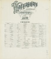
- Creator:
- Sanborn-Perris Map Co., issuing body
- Published / Created:
- 1901
- Call Number:
- 766 W29 1901
- Image Count:
- 69
- Resource Type:
- Maps, Atlases & Globes
- Abstract:
- Sanborn fire insurance maps are a rich
- Description:
- and key map.
- Subject (Geographic):
- Waterbury (Conn.)--Maps
- Subject (Topic):
- --Waterbury--Maps
- Found in:
- Beinecke Rare Book and Manuscript Library > Insurance maps of Waterbury, New Haven Co., Connecticut.
- Creator:
- Sanborn-Perris Map Co., issuing body
- Published / Created:
- 1895
- Call Number:
- 766 W29 1895
- Image Count:
- 37
- Resource Type:
- Maps, Atlases & Globes
- Abstract:
- Sanborn fire insurance maps are a rich
- Description:
- Partial cadastral map.
- Subject (Geographic):
- Waterbury (Conn.)--Maps
- Subject (Topic):
- --Waterbury--Maps
- Found in:
- Beinecke Rare Book and Manuscript Library > Insurance maps of Waterbury, New Haven County, Connecticut.
- Creator:
- Sanborn-Perris Map Co., issuing body
- Published / Created:
- 1890
- Call Number:
- 766 W29 1890
- Image Count:
- 31
- Resource Type:
- Maps, Atlases & Globes
- Abstract:
- Sanborn fire insurance maps are a rich
- Description:
- Partial cadastral map.
- Subject (Geographic):
- Waterbury (Conn.)--Maps
- Subject (Topic):
- --Waterbury--Maps
- Found in:
- Beinecke Rare Book and Manuscript Library > Waterbury, New Haven County, Connecticut.
- Creator:
- Sanborn Map Company, issuing body
- Published / Created:
- 1931
- Call Number:
- 766 T63 1931
- Image Count:
- 39
- Resource Type:
- Maps, Atlases & Globes
- Abstract:
- Sanborn fire insurance maps are a rich
- Description:
- Partial cadastral map.
- Subject (Geographic):
- Torrington (Conn.)--Maps
- Subject (Topic):
- --Torrington--Maps
- Found in:
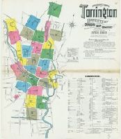
- Beinecke Rare Book and Manuscript Library > Torrington, Litchfield County, Connecticut.
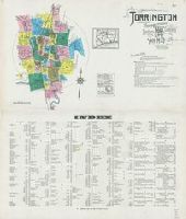
- Creator:
- Sanborn Map Company, issuing body
- Published / Created:
- 1924
- Call Number:
- 766 T63 1924
- Image Count:
- 36
- Resource Type:
- Maps, Atlases & Globes
- Abstract:
- Sanborn fire insurance maps are a rich
- Description:
- Partial cadastral map.
- Subject (Geographic):
- Torrington (Conn.)--Maps
- Subject (Topic):
- --Torrington--Maps
- Found in:
- Beinecke Rare Book and Manuscript Library > Torrington, Litchfield County, Connecticut.
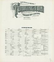
- Creator:
- Sanborn Map Company, issuing body
- Published / Created:
- 1915
- Call Number:
- 766 T63 1915
- Image Count:
- 32
- Resource Type:
- Maps, Atlases & Globes
- Abstract:
- Sanborn fire insurance maps are a rich
- Description:
- Partial cadastral map.
- Subject (Geographic):
- Torrington (Conn.)--Maps
- Subject (Topic):
- --Torrington--Maps
- Found in:
- Beinecke Rare Book and Manuscript Library > Insurance maps of Torrington, Litchfield Co., Connecticut.
- Creator:
- Sanborn Map Company, issuing body
- Published / Created:
- 1909
- Call Number:
- 766 T63 1909
- Image Count:
- 28
- Resource Type:
- Maps, Atlases & Globes
- Abstract:
- Sanborn fire insurance maps are a rich
- Description:
- Partial cadastral map.
- Subject (Geographic):
- Torrington (Conn.)--Maps
- Subject (Topic):
- --Torrington--Maps
- Found in:
- Beinecke Rare Book and Manuscript Library > Insurance maps of Torrington, Litchfield Co., Connecticut.
- Creator:
- Sanborn Map Company, issuing body
- Published / Created:
- 1924
- Call Number:
- 766 St82 1924
- Image Count:
- 41
- Resource Type:
- Maps, Atlases & Globes
- Abstract:
- Sanborn fire insurance maps are a rich
- Description:
- Partial cadastral map.
- Subject (Geographic):
- Stratford (Conn.)--Maps
- Subject (Topic):
- --Stratford--Maps
- Found in:
- Beinecke Rare Book and Manuscript Library > Insurance maps of Stratford, including Lordship Manor, Fairfield County, Connecticut.
- Creator:
- Sanborn-Perris Map Co., issuing body
- Published / Created:
- 1901
- Call Number:
- 766 St22 1901
- Image Count:
- 26
- Resource Type:
- Maps, Atlases & Globes
- Abstract:
- Sanborn fire insurance maps are a rich
- Description:
- Partial cadastral map.
- Subject (Geographic):
- Stamford (Conn.)--Maps
- Subject (Topic):
- --Stamford--Maps
- Found in:
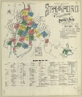
- Beinecke Rare Book and Manuscript Library > Insurance maps of Stamford, Fairfield Co., Connecticut.
- Creator:
- Sanborn Map Company, issuing body
- Published / Created:
- 1923
- Call Number:
- 766 So87 1923
- Image Count:
- 22
- Resource Type:
- Maps, Atlases & Globes
- Abstract:
- Sanborn fire insurance maps are a rich
- Description:
- "22 sheets. (5907)."
- Subject (Geographic):
- Southington (Conn.)--Maps
- Subject (Topic):
- --Southington--Maps
- Found in:
- Beinecke Rare Book and Manuscript Library > Southington, including Plantsville and Milldale, Hartford County, Connecticut.
- Creator:
- Sanborn Map Company, issuing body
- Published / Created:
- 1912
- Call Number:
- 766 So885 1912
- Image Count:
- 28
- Resource Type:
- Maps, Atlases & Globes
- Abstract:
- Sanborn fire insurance maps are a rich
- Description:
- Partial cadastral map.
- Subject (Geographic):
- Norwalk (Conn.)--Maps
- Subject (Topic):
- --Norwalk--Maps
- Found in:
- Beinecke Rare Book and Manuscript Library > Insurance maps of South Norwalk, including East Norwalk, Rowayton, Bell Island, and Roton Point, Fairfield Co., Connecticut.
- Creator:
- Sanborn Map Company, issuing body
- Published / Created:
- 1914
- Call Number:
- 766 N835 1914
- Image Count:
- 33
- Resource Type:
- Maps, Atlases & Globes
- Abstract:
- Sanborn fire insurance maps are a rich
- Description:
- Partial cadastral map.
- Subject (Geographic):
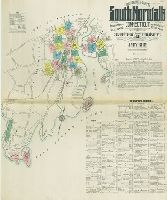
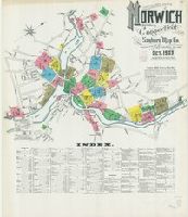
- Norwich (Conn.)--Maps
- Subject (Topic):
- --Norwich--Maps
- Found in:
- Beinecke Rare Book and Manuscript Library > Insurance maps of Norwich, New London Co., Connecticut.
- Creator:
- Sanborn Map Company, issuing body
- Published / Created:
- 1909
- Call Number:
- 766 N835 1909
- Image Count:
- 41
- Resource Type:
- Maps, Atlases & Globes
- Abstract:
- Sanborn fire insurance maps are a rich
- Description:
- Partial cadastral map.
- Subject (Geographic):
- Norwich (Conn.)--Maps
- Subject (Topic):
- --Norwich--Maps
- Found in:
- Beinecke Rare Book and Manuscript Library > Insurance maps of Norwich, New London Co., Connecticut.
- Creator:
- Sanborn Map Company, issuing body
- Published / Created:
- 1903
- Call Number:
- 766 N835 1903
- Image Count:
- 26
- Resource Type:
- Maps, Atlases & Globes
- Abstract:
- Sanborn fire insurance maps are a rich
- Description:
- Partial cadastral map.
- Subject (Geographic):
- Norwich (Conn.)--Maps
- Subject (Topic):
- --Norwich--Maps
- Found in:
- Beinecke Rare Book and Manuscript Library > Insurance maps of Norwich, New London Co., Connecticut.
- Creator:
- Sanborn Map Company, issuing body
- Published / Created:
- 1922
- Call Number:
- 766 N83 1922
- Image Count:
- 70
- Resource Type:
- Maps, Atlases & Globes
- Abstract:
- Sanborn fire insurance maps are a rich
- Description:
- Partial cadastral map.
- Subject (Geographic):
- Norwalk (Conn.)--Maps
- Subject (Topic):
- --Norwalk--Maps
- Found in:
- Beinecke Rare Book and Manuscript Library > Insurance maps of Norwalk, Connecticut.
- Creator:
- Sanborn Map Company, issuing body
- Published / Created:
- 1921
- Call Number:
- 766 N47 1921
- Image Count:
- 73
- Resource Type:
- Maps, Atlases & Globes
- Abstract:
- Sanborn fire insurance maps are a rich
- Description:
- Partial cadastral map.
- Subject (Geographic):
- Groton (Conn.)--Maps
- Subject (Topic):
- --Groton--Maps
- Found in:
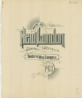
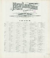
- Beinecke Rare Book and Manuscript Library > Insurance maps of New London, including Groton, Connecticut.
- Creator:
- Sanborn Map Company, issuing body
- Published / Created:
- 1907
- Call Number:
- 766 N47 1907
- Image Count:
- 43
- Resource Type:
- Maps, Atlases & Globes
- Abstract:
- Sanborn fire insurance maps are a rich
- Description:
- Partial cadastral map.
- Subject (Geographic):
- Groton (Conn.)--Maps
- Subject (Topic):
- --Groton--Maps
- Found in:
- Beinecke Rare Book and Manuscript Library > Insurance maps of New London, including Groton, Connecticut.
- Creator:
- Sanborn-Perris Map Co., issuing body
- Published / Created:
- 1901
- Call Number:
- 766 N47 1901
- Image Count:
- 27
- Resource Type:
- Maps, Atlases & Globes
- Abstract:
- Sanborn fire insurance maps are a rich
- Description:
- Partial cadastral map.
- Subject (Geographic):
- Groton (Conn.)--Maps
- Subject (Topic):
- --Groton--Maps
- Found in:
- Beinecke Rare Book and Manuscript Library > Insurance maps of New London, including Groton, New London County, Connecticut.
- Creator:
- Sanborn Map Company, issuing body
- Published / Created:
- 1924
- Call Number:
- 766 N46 1924
- Image Count:
- 110
- Resource Type:
- Maps, Atlases & Globes
- Abstract:
- Sanborn fire insurance maps are a rich
- Alternative Title:
- Insurance maps of New Haven
- Description:
- Partial cadastral maps.
- Subject (Geographic):
- East Haven (Conn.)--Maps
- Subject (Topic):
- Haven--Maps
- Found in:
- Beinecke Rare Book and Manuscript Library > Insurance maps of New Haven, Connecticut. Volume 1.
- Creator:
- Sanborn-Perris Map Co., issuing body
- Published / Created:
- 1901
- Call Number:
- 766 N46 1901
- Image Count:
- 103
- Resource Type:
- Maps, Atlases & Globes
- Abstract:
- Sanborn fire insurance maps are a rich
- Description:
- Partial cadastral map.
- Subject (Geographic):
- New Haven (Conn.)--Maps
- Subject (Topic):
- Haven--Maps
- Found in:
- Beinecke Rare Book and Manuscript Library > Insurance maps of New Haven, Connecticut. Volume 1.
- Creator:
- Sanborn Map & Publishing Co., issuing body
- Published / Created:
- 1886
- Call Number:
- 766 N46 1886 Copy 2
- Image Count:
- 31
- Resource Type:
- Maps, Atlases & Globes
- Abstract:
- Sanborn fire insurance maps are a rich
- Description:
- Partial cadastral map.
- Subject (Geographic):
- New Haven (Conn.)--Maps
- Subject (Topic):
- Haven--Maps
- Found in:
- Beinecke Rare Book and Manuscript Library > Insurance maps of New Haven, Connecticut. Volume 1.
- Creator:
- Sanborn Map Company, issuing body
- Published / Created:
- 1909
- Call Number:
- 766 N42 1909
- Image Count:
- 58
- Resource Type:
- Maps, Atlases & Globes
- Abstract:
- Sanborn fire insurance maps are a rich
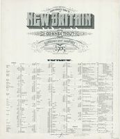
- Description:
- Partial cadastral map.
- Subject (Geographic):
- New Britain (Conn.)--Maps
- Subject (Topic):
- Britain--Maps
- Found in:
- Beinecke Rare Book and Manuscript Library > Insurance maps of New Britain, Hartford County, Connecticut.
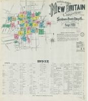
- Creator:
- Sanborn-Perris Map Co., issuing body
- Published / Created:
- 1901
- Call Number:
- 766 N42 1901
- Image Count:
- 35
- Resource Type:
- Maps, Atlases & Globes
- Abstract:
- Sanborn fire insurance maps are a rich
- Description:
- Partial cadastral map.
- Subject (Geographic):
- New Britain (Conn.)--Maps
- Subject (Topic):
- Britain--Maps
- Found in:
- Beinecke Rare Book and Manuscript Library > Insurance maps of New Britain, Hartford County, Connecticut.
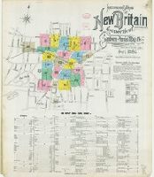
- Creator:
- Sanborn-Perris Map Co., issuing body
- Published / Created:
- 1895
- Call Number:
- 766 N42 1895
- Image Count:
- 24
- Resource Type:
- Maps, Atlases & Globes
- Abstract:
- Sanborn fire insurance maps are a rich
- Description:
- Partial cadastral map.
- Subject (Geographic):
- New Britain (Conn.)--Maps
- Subject (Topic):
- Britain--Maps
- Found in:
- Beinecke Rare Book and Manuscript Library > Insurance maps of New Britain, Hartford Co., Connecticut.
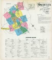
- Creator:
- Sanborn Map Company, issuing body
- Published / Created:
- 1923
- Call Number:
- 766 N22 1923
- Image Count:
- 23
- Resource Type:
- Maps, Atlases & Globes
- Abstract:
- Sanborn fire insurance maps are a rich
- Description:
- Partial cadastral map.
- Subject (Geographic):
- Naugatuck (Conn.)--Maps
- Subject (Topic):
- --Naugatuck--Maps
- Found in:
- Beinecke Rare Book and Manuscript Library > Naugatuck, New Haven County, Connecticut.
- Creator:
- Sanborn Map Company, issuing body
- Published / Created:
- 1920
- Call Number:
- 766 M59 1920
- Image Count:
- 28
- Resource Type:
- Maps, Atlases & Globes
- Abstract:
- Sanborn fire insurance maps are a rich
- Description:
- Partial cadastral map.
- Subject (Geographic):
- Milford (Conn.)--Maps
- Subject (Topic):
- --Milford--Maps
- Found in:
- Beinecke Rare Book and Manuscript Library > Insurance maps of Milford, New Haven County, Connecticut.
- Creator:
- Sanborn Map Company, issuing body
- Published / Created:
- 1907
- Call Number:
- 766 M584 1907
- Image Count:
- 32
- Resource Type:
- Maps, Atlases & Globes
- Abstract:
- Sanborn fire insurance maps are a rich
- Description:
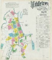
- Partial cadastral map.
- Subject (Geographic):
- Middletown (Conn.)--Maps
- Subject (Name):
- Library of Congress. Map Division Stamp
- Subject (Topic):
- --Middletown--Maps
- Found in:
- Beinecke Rare Book and Manuscript Library > Insurance maps of Middletown, Middlesex County, Connecticut.
- Creator:
- Sanborn-Perris Map Co., issuing body
- Published / Created:
- 1901
- Call Number:
- 766 M584 1901
- Image Count:
- 27
- Resource Type:
- Maps, Atlases & Globes
- Abstract:
- Sanborn fire insurance maps are a rich
- Description:
- Partial cadastral map.
- Subject (Geographic):
- Middletown (Conn.)--Maps
- Subject (Topic):
- --Middletown--Maps
- Found in:
- Beinecke Rare Book and Manuscript Library > Insurance maps of Middletown, Middlesex County, Connecticut.
- Creator:
- Sanborn Map Company, issuing body
- Published / Created:
- 1913
- Call Number:
- 766 M584 1913
- Image Count:
- 38
- Resource Type:
- Maps, Atlases & Globes
- Abstract:
- Sanborn fire insurance maps are a rich
- Description:
- Partial cadastral map.
- Subject (Geographic):
- Middletown (Conn.)--Maps
- Subject (Topic):
- --Middletown--Maps
- Found in:
- Beinecke Rare Book and Manuscript Library > Insurance maps of Middletown, Middlesex County, Connecticut.
- Creator:
- Sanborn-Perris Map Co., issuing body
- Published / Created:
- 1901
- Call Number:
- 766 M54 1901
- Image Count:
- 51
- Resource Type:
- Maps, Atlases & Globes
- Abstract:
- Sanborn fire insurance maps are a rich
- Description:
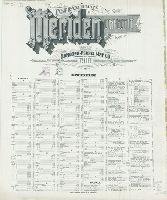
- Partial cadastral map.
- Subject (Geographic):
- Meriden (Conn.)--Maps
- Subject (Topic):
- --Meriden--Maps
- Found in:
- Beinecke Rare Book and Manuscript Library > Insurance maps of Meriden, New Haven, Connecticut.
- Creator:
- Sanborn-Perris Map Co., issuing body
- Published / Created:
- 1896
- Call Number:
- 766 M54 1896
- Image Count:
- 32
- Resource Type:
- Maps, Atlases & Globes
- Abstract:
- Sanborn fire insurance maps are a rich
- Description:
- Partial cadastral map.
- Subject (Geographic):
- Meriden (Conn.)--Maps
- Subject (Topic):
- --Meriden--Maps
- Found in:
- Beinecke Rare Book and Manuscript Library > Insurance maps of Meriden, New Haven Co., Connecticut.
- Creator:
- Sanborn-Perris Map Co., issuing body
- Published / Created:
- 1891
- Call Number:
- 766 M54 1891
- Image Count:
- 28
- Resource Type:
- Maps, Atlases & Globes
- Abstract:
- Sanborn fire insurance maps are a rich
- Description:
- Partial cadastral map.
- Subject (Geographic):
- Meriden (Conn.)--Maps
- Subject (Topic):
- --Meriden--Maps
- Found in:
- Beinecke Rare Book and Manuscript Library > Meriden, Connecticut.
- Creator:
- Sanborn Map Company, issuing body
- Published / Created:
- 1919
- Call Number:
- 766 M31 1919
- Image Count:
- 25
- Resource Type:
- Maps, Atlases & Globes
- Abstract:
- Sanborn fire insurance maps are a rich
- Description:
- Partial cadastral map.
- Subject (Geographic):
- Manchester--Maps
- Subject (Topic):
- --Manchester--Maps
- Found in:
- Beinecke Rare Book and Manuscript Library > Insurance maps of Manchester and South Manchester, Hartford County, Connecticut.
- Creator:
- Sanborn Map Company, issuing body
- Published / Created:
- 1911
- Call Number:
- 766 M31 1911
- Image Count:
- 27
- Resource Type:
- Maps, Atlases & Globes
- Abstract:
- Sanborn fire insurance maps are a rich
- Description:
- Partial cadastral map.
- Subject (Geographic):
- Manchester--Maps
- Subject (Topic):
- --Manchester--Maps
- Found in:
- Beinecke Rare Book and Manuscript Library > Insurance maps of Manchester, Hartford County, Connecticut.
- Creator:
- Sanborn Map Company, issuing body
- Published / Created:
- 1922
- Call Number:
- 766 H26 1922
- Image Count:
- 108
- Resource Type:
- Maps, Atlases & Globes
- Abstract:
- Sanborn fire insurance maps are a rich
- Alternative Title:
- Insurance maps of Hartford and West
- Description:
- Partial cadastral map.
- Subject (Geographic):
- Hartford (Conn.)--Maps
- Subject (Topic):
- --Hartford--Maps
- Found in:
- Beinecke Rare Book and Manuscript Library > Insurance maps of Hartford, Connecticut. Volume 1.
- Creator:
- Sanborn-Perris Map Co., issuing body
- Published / Created:
- 1900
- Call Number:
- 766 H26 1900
- Image Count:
- 82
- Resource Type:
- Maps, Atlases & Globes
- Abstract:
- Sanborn fire insurance maps are a rich
- Description:
- Accompanied by: additional key map of
- Subject (Geographic):
- Hartford (Conn.)--Maps
- Subject (Topic):
- --Hartford--Maps
- Found in:
- Beinecke Rare Book and Manuscript Library > Insurance maps of Hartford, Connecticut. Volume 1.
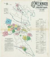
- Creator:
- Sanborn Map Company, issuing body
- Published / Created:
- 1920
- Call Number:
- 766 G852 1920
- Image Count:
- 74
- Resource Type:
- Maps, Atlases & Globes
- Abstract:
- Sanborn fire insurance maps are a rich
- Description:
- Partial cadastral map.
- Subject (Geographic):
- Greenwich (Conn. : Town)--Maps
- Subject (Topic):
- --Greenwich (Town)--Maps
- Found in:
- Beinecke Rare Book and Manuscript Library > Insurance Maps of Greenwich, Connecticut.
- Creator:
- Sanborn Map Company, issuing body
- Published / Created:
- 1912
- Call Number:
- 766 G852 1912
- Image Count:
- 25
- Resource Type:
- Maps, Atlases & Globes
- Abstract:
- Sanborn fire insurance maps are a rich
- Description:
- Partial cadastral map.
- Subject (Geographic):
- Greenwich (Conn. : Town)--Maps
- Subject (Topic):
- --Greenwich (Town)--Maps
- Found in:
- Beinecke Rare Book and Manuscript Library > Insurance Maps of Greenwich, Fairfield Co., Connecticut.
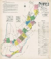
- Creator:
- Sanborn Map Company, issuing body
- Published / Created:
- 1930
- Call Number:
- 766 F16 1930
- Image Count:
- 37
- Resource Type:
- Maps, Atlases & Globes
- Abstract:
- Sanborn fire insurance maps are a rich
- Description:
- Partial cadastral map.
- Subject (Geographic):
- Fairfield (Conn.)--Maps
- Subject (Topic):
- --Fairfield--Maps
- Found in:
- Beinecke Rare Book and Manuscript Library > Fairfield including Stratfield, Fairfield County, Connecticut.
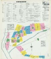
- Creator:
- Sanborn Map Company, issuing body
- Published / Created:
- 1922
- Call Number:
- 766 F16 1922
- Image Count:
- 22
- Resource Type:
- Maps, Atlases & Globes
- Abstract:
- Sanborn fire insurance maps are a rich
- Description:
- "22 sheets (5093)."
- Subject (Geographic):
- Fairfield (Conn.)--Maps
- Subject (Topic):
- --Fairfield--Maps
- Found in:
- Beinecke Rare Book and Manuscript Library > Fairfield, Fairfield County, Connecticut.
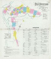
- Creator:
- Sanborn Map Company, issuing body
- Published / Created:
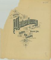
- 1927
- Call Number:
- 766 Ea76 1927
- Image Count:
- 30
- Resource Type:
- Maps, Atlases & Globes
- Abstract:
- Sanborn fire insurance maps are a rich
- Description:
- Partial cadastral map.
- Subject (Geographic):
- East Hartford (Conn.)--Maps
- Subject (Topic):
- Hartford--Maps
- Found in:
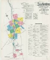
- Beinecke Rare Book and Manuscript Library > East Hartford, Hartford County, Connecticut.
- Creator:
- Sanborn Map Company, issuing body
- Published / Created:
- 1920
- Call Number:
- 766 Ea76 1920
- Image Count:
- 26
- Resource Type:
- Maps, Atlases & Globes
- Abstract:
- Sanborn fire insurance maps are a rich
- Description:
- Partial cadastral map.
- Subject (Geographic):
- East Hartford (Conn.)--Maps
- Subject (Topic):
- Hartford--Maps
- Found in:
- Beinecke Rare Book and Manuscript Library > East Hartford, Hartford County, Connecticut.
- Creator:
- Sanborn Map Company, issuing body
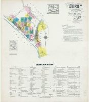
- Published / Created:
- 1924
- Call Number:
- 766 D444 1924
- Image Count:
- 30
- Resource Type:
- Maps, Atlases & Globes
- Abstract:
- Sanborn fire insurance maps are a rich
- Description:
- Partial cadastral map.
- Subject (Geographic):
- Derby (Conn.)--Maps
- Subject (Topic):
- --Derby--Maps
- Found in:
- Beinecke Rare Book and Manuscript Library > Derby, including East Derby, New Haven County, Connecticut.
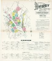
- Creator:
- Sanborn Map Company, issuing body
- Published / Created:
- 1912
- Call Number:
- 766 D444 1912
- Image Count:
- 22
- Resource Type:
- Maps, Atlases & Globes
- Abstract:
- Sanborn fire insurance maps are a rich
- Description:
- "22 sheets. (4763)."
- Subject (Geographic):
- Derby (Conn.)--Maps
- Subject (Name):
- Library of Congress. Map Division Stamp
- Subject (Topic):
- --Derby--Maps
- Found in:
- Beinecke Rare Book and Manuscript Library > Insurance maps of Derby and Shelton, New Haven County, Connecticut.
- Creator:
- Sanborn Map Company, issuing body
- Published / Created:
- 1919
- Call Number:
- 766 D19 1919
- Image Count:
- 29
- Resource Type:
- Maps, Atlases & Globes
- Abstract:
- Sanborn fire insurance maps are a rich
- Description:
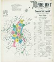
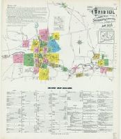
- Partial cadastral map.
- Subject (Geographic):
- Danbury (Conn.)--Maps
- Subject (Topic):
- --Danbury--Maps
- Found in:
- Beinecke Rare Book and Manuscript Library > Insurance maps of Danbury, Fairfield County, Connecticut.
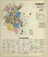
- Creator:
- Sanborn Map Company, issuing body
- Published / Created:
- 1909
- Call Number:
- 766 D19 1909
- Image Count:
- 33
- Resource Type:
- Maps, Atlases & Globes
- Abstract:
- Sanborn fire insurance maps are a rich
- Description:
- Partial cadastral map.
- Subject (Geographic):
- Danbury (Conn.)--Maps
- Subject (Topic):
- --Danbury--Maps
- Found in:
- Beinecke Rare Book and Manuscript Library > Insurance maps of Danbury, Fairfield County, Connecticut.
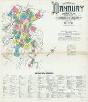
- Creator:
- Sanborn Map Company, issuing body
- Published / Created:
- 1904
- Call Number:
- 766 D19 1904
- Image Count:
- 23
- Resource Type:
- Maps, Atlases & Globes
- Abstract:
- Sanborn fire insurance maps are a rich
- Description:
- Partial cadastral map.
- Subject (Geographic):
- Danbury (Conn.)--Maps
- Subject (Name):
- Library of Congress. Map Division Stamp
- Subject (Topic):
- --Danbury--Maps
- Found in:
- Beinecke Rare Book and Manuscript Library > Insurance maps of Danbury, Fairfield County, Connecticut.
- Creator:
- Sanborn Map Company, issuing body
- Published / Created:
- 1916
- Call Number:
- 766 B77 1916
- Image Count:
- 32
- Resource Type:
- Maps, Atlases & Globes
- Abstract:
- Sanborn fire insurance maps are a rich
- Description:
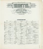
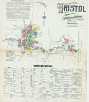
- Partial cadastral map.
- Subject (Geographic):
- Bristol (Conn.)--Maps
- Subject (Topic):
- --Bristol--Maps
- Found in:
- Beinecke Rare Book and Manuscript Library > Insurance maps of Bristol, Hartford County, Connecticut.
- Creator:
- Sanborn Map Company, issuing body
- Published / Created:
- 1921
- Call Number:
- 766 B77 1921
- Image Count:
- 37
- Resource Type:
- Maps, Atlases & Globes
- Abstract:
- Sanborn fire insurance maps are a rich
- Description:
- Partial cadastral map.
- Subject (Geographic):
- Bristol (Conn.)--Maps
- Subject (Topic):
- --Bristol--Maps
- Found in:
- Beinecke Rare Book and Manuscript Library > Insurance maps of Bristol, Hartford Co., Connecticut.
- Creator:
- Sanborn Map Company, issuing body
- Published / Created:
- 1911
- Call Number:
- 766 B77 1911
- Image Count:
- 26
- Resource Type:
- Maps, Atlases & Globes
- Abstract:
- Sanborn fire insurance maps are a rich
- Description:
- Partial cadastral map.
- Subject (Geographic):
- Bristol (Conn.)--Maps
- Subject (Topic):
- --Bristol--Maps
- Found in:
- Beinecke Rare Book and Manuscript Library > Insurance maps of Bristol, Hartford County, Connecticut.
- Creator:
- Sanborn Map Company, issuing body
- Published / Created:
- 1913
- Call Number:
- 766 B76 1913
- Image Count:
- 113
- Resource Type:
- Maps, Atlases & Globes
- Abstract:
- Sanborn fire insurance maps are a rich
- Description:
- Includes "Map of congested district of
- Subject (Geographic):
- Bridgeport (Conn.)--Maps
- Subject (Topic):
- --Bridgeport--Maps
- Found in:
- Beinecke Rare Book and Manuscript Library > Insurance maps of Bridgeport, Connecticut. Volume 1.
- Creator:
- Sanborn-Perris Map Co., issuing body
- Published / Created:
- 1898
- Call Number:
- 766 B76 1898
- Image Count:
- 75
- Resource Type:
- Maps, Atlases & Globes
- Abstract:
- Sanborn fire insurance maps are a rich
- Description:
- Partial cadastral map.
- Subject (Geographic):
- Bridgeport (Conn.)--Maps
- Subject (Topic):
- --Bridgeport--Maps
- Found in:
- Beinecke Rare Book and Manuscript Library > Insurance maps of Bridgeport, Connecticut.
- Creator:
- Sanborn Map & Publishing Co., issuing body
- Published / Created:
- 1889
- Call Number:
- 766 B76 1889
- Image Count:
- 37
- Resource Type:
- Maps, Atlases & Globes
- Abstract:
- Sanborn fire insurance maps are a rich
- Description:
- Partial cadastral map.
- Subject (Geographic):
- Bridgeport (Conn.)--Maps
- Subject (Topic):
- --Bridgeport--Maps
- Found in:
- Beinecke Rare Book and Manuscript Library > Bridgeport, Connecticut.
- Creator:
- Sanborn Map Company, issuing body
- Published / Created:
- 1924
- Call Number:
- 766 B72 1924
- Image Count:
- 24
- Resource Type:
- Maps, Atlases & Globes
- Abstract:
- Sanborn fire insurance maps are a rich
- Description:
- Partial cadastral map.
- Subject (Geographic):
- Branford (Conn.)--Maps
- Subject (Topic):
- --Branford--Maps
- Found in:
- Beinecke Rare Book and Manuscript Library > Branford : including Short Beach, Indian Neck, Pine Orchard, Stony Creek and Pine Orchard West, New Haven Co., Connecticut.
- Creator:
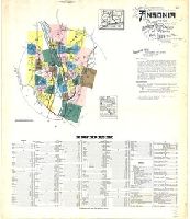
- Sanborn Map Company, issuing body
- Published / Created:
- 1924
- Call Number:
- 766 An81 1924
- Image Count:
- 39
- Resource Type:
- Maps, Atlases & Globes
- Abstract:
- Sanborn fire insurance maps are a rich
- Description:
- Partial cadastral map.
- Subject (Geographic):
- Ansonia (Conn.)--Maps
- Subject (Topic):
- --Ansonia--Maps
- Found in:
- Beinecke Rare Book and Manuscript Library > Ansonia, New Haven Co., Connecticut.
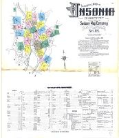
- Creator:
- Sanborn Map Company, issuing body
- Published / Created:
- 1911
- Call Number:
- 766 An81 1911
- Image Count:
- 25
- Resource Type:
- Maps, Atlases & Globes
- Abstract:
- Sanborn fire insurance maps are a rich
- Description:
- Partial cadastral map.
- Subject (Geographic):
- Ansonia (Conn.)--Maps
- Subject (Topic):
- --Ansonia--Maps
- Found in:
- Beinecke Rare Book and Manuscript Library > Insurance maps of Ansonia, Connecticut, New Haven County.
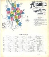
- Creator:
- Sanborn Map Company, issuing body
- Published / Created:
- 1906
- Call Number:
- 766 An81 1906
- Image Count:
- 22
- Resource Type:
- Maps, Atlases & Globes
- Abstract:
- Sanborn fire insurance maps are a rich
- Description:
- "22 sheets (8531)."
- Subject (Geographic):
- Ansonia (Conn.)--Maps
- Subject (Name):
- Library of Congress. Map Divison Stamp
- Subject (Topic):
- --Ansonia--Maps
- Found in:
- Beinecke Rare Book and Manuscript Library > Insurance maps of Ansonia, Connecticut, New Haven County.
- Call Number:
- GEN MSS 491
- Collection Title:
- Louis-Antoine de Bougainville journals, 1778-1782.
- Container / Volume:
- Box 2 | Folder 18
- Image Count:
- 4
- Abstract:
- The second set, dated 1781 Mar 22
- Subject (Geographic):
- Boston Harbor Islands (Mass.)--Maps
- Found in:
- Beinecke Rare Book and Manuscript Library > Campagne aux ordres du Cte. De Grasse
- Call Number:
- Beinecke MS 685
- Container / Volume:
- Box 2
- Image Count:
- 60
- Abstract:
- and letters, and one undated tithe map
- Found in:
- Beinecke Rare Book and Manuscript Library > Sixty-five documents from Aquitaine, 1254-1469
- Creator:
- Agnese, Battista, active 16th century
- Published / Created:
- 1559
- Call Number:
- Beinecke MS 560
- Image Count:
- 33
- Resource Type:
- text
- Description:
- -Grra-Phia" in red. The maps show varying
- Subject (Topic):
- Manuscript maps
- Found in:
- Beinecke Rare Book and Manuscript Library > Portolan atlas
- Creator:
- Bar Hebraeus, 1226-1286
ܒܪ ܥܒܪܝܐ، 1226-1286
- Published / Created:
- 1590.
- Call Number:
- Syriac MSS 7
- Image Count:
- 206
- Resource Type:
- text
- Abstract:
- second chapter of base 1 (pages 22-32). The
- Subject (Topic):
- World maps, Manuscript
- Found in:
- Beinecke Rare Book and Manuscript Library > Mnārat Qúdšē : manuscript, ܡܢܪܬ ܩܘܕܫ̈ܐ : ܣܪܝܛܬܐ
- Creator:
- Bry, Theodor de, 1528-1598
Hariot, Thomas, 1560-1621
- Published / Created:
- 1590
- Call Number:
- Taylor 194
- Image Count:
- 71
- Found in:
- Beinecke Rare Book and Manuscript Library > A briefe and true report of the new found land of Virginia: of the commodities and of the nature and manners of the naturall inhabitants. Discouered by the English colony there seated by Sir Richard Greinuile ... in ... 1585 ... This fore booke is made in
- Creator:
- Langren, Arnold Florent van, 1580-1644
- Published / Created:
- 1595
- Call Number:
- Pequot +L65
- Collection Title:
- Nauigatio ac itinerarium Iohannis Hugonis Linscotani in Orientalem siue Lusitanorum Indiam
- Image Count:
- 1
- Description:
- Bound in following page 22.
- Subject (Geographic):
- Borneo --Maps
- Found in:
- Beinecke Rare Book and Manuscript Library > Exacta & accurata delineatio cum orarum maritimarum tum etiam locorum terrestrium quae in regionibus China, Cauchinchina, Camboia sive Champa, Syao, Malacca, Arracamn & Pegu ...
- Published / Created:
- 1595
- Call Number:
- Taylor 219
- Collection Title:
- Navigatio ac itinerarivm Iohannis Hvgonis Linscotani in Orientalem sive Lvsitanorvm Indiam
- Image Count:
- 1
- Description:
- Bound in following page 22.
- Subject (Geographic):
- Borneo --Maps
- Found in:
- Beinecke Rare Book and Manuscript Library > Exacta & accurata delineatio cum orarum maritimarum tum etiam locorum terrestrium quae in regionibus China, Cauchinchina, Camboia sive Champa, Syao, Malacca, Arracamn & Pegu ...
- Creator:
- Ptolemy, active 2nd century.
- Published / Created:
- [1599]
- Call Number:
- Gfp94 gi561e
- Image Count:
- 12
- Resource Type:
- Maps, Atlases & Globes
- Description:
- old in text double maps, on inner forms of
- Subject (Geographic):
- America--Geography--Maps
- Subject (Topic):
- Geography, Ancient--Maps
- Found in:
- Beinecke Rare Book and Manuscript Library > Geografia di Claudio Tolomeo Alessandrino [cartographic material] / tradotta di Greco nell'idioma volgare Italiano da Girolamo Ruscelli, et hora nuouamente ampliata da Gioseffo Rosaccio, con varie annotationi, & espositioni, & tauole di rame, che nelli stampati altre volte non erano, hauendo etiando poste à i lor luoghi le tauole vecchie, che prima confusamente giaceuano, et vna Geografia vniuersale del medesimo, separata da quella di Tolomeo; nella quale secondo il parere de' più moderni geografi, fedelmente sono poste le prouincie, regni, città, castelli, monti, fiumi, laghi, porti, golfi, isole, penisole, popoli, leggi, riti, & costumi di ciascuna città. Et vna breue descrittione di tutta la terra, distinta in quattro libri, nel primo de' quali si tratta dell'Europa; nel secondo dell'Africa; nel terza dell'Asia, nel quarto dell'America. Con due indici copiosissimi di tutto quello, che di notabile si contiene nell'opera.

- Published / Created:
- MDXCIX [1599]
- Call Number:
- E159 +B794 1-3
- Image Count:
- 1
- Resource Type:
- Books, Journals & Pamphlets
- Description:
- ; 2 maps (Nova tabula insularum Iavae
- Found in:
- Beinecke Rare Book and Manuscript Library > II. pars Indiae Orientalis : in qua Iohan. Hugonis Lintscotani nauigatio in Orientem, item regna, littora, portus, flumina, apparentiae, habitus moresq́ue Indorum & Lusitanorum pariter in Oriente degentium : praeterea merces monentae, mensurae, & pondera, quae quibus in locis, quóve compendio prostent, accurate proponuntur / ea Lintscotus ipse spectator atq[ue] autor primùm vernaculo sibi idiomate Belgice in publicum dedit ; deinde superioribus Germanis Germanice & nunc Latnis item auribus Latine vtcunq[ue] reddita enunciauit Teucrides Annaeus Lonicerus priuatus ciuis Francfordiensis Opus & nauigantibus & mercatoribus historiarumque studiosis apprime vtile ; additae sunt passim D. Paludani annotationes:, item icones in artificiose in are factae per Ioh. Theodorum, & Ioh. Israëlem de Bry fratres quorum sumptibus opus ipsum recens iterum foras datum.
- Creator:
- Bry, Johann Theodor de, 1561-1623?
- Published / Created:
- anno MDCI [1601]
- Call Number:
- E159 +B794 1-3
- Image Count:
- 2
- Resource Type:
- Books, Journals & Pamphlets
- Description:
- Imperfect: plate XXXII and 1 map
- Found in:
- Beinecke Rare Book and Manuscript Library > Tertia pars Indiae Orientalis ... / de Germanico in Latinum translata, & bono ordine disposita à Bilibaldo Strobaeo ; adiectae sunt tabulae, cum iconibus alijs, in aes incisae per Ioan. Theodor. & Ioan. Israel. de Bry fratres quorum sumptibus quoque hoc opus editum est ...
- Creator:
- Champlain, Samuel de, 1567-1635
- Published / Created:
- MDCXIII [1613]. Avec privilege dv Roy.
- Call Number:
- Taylor 257
- Image Count:
- 1
- Resource Type:
- Books, Journals & Pamphlets
- Description:
- 22 x 26 cm.) bound in after p. 22 (first
- Subject (Geographic):
- New France--Maps.
- Found in:
- Beinecke Rare Book and Manuscript Library > Les voyages dv sievr de Champlain Xaintongeois, capitaine ordinaire pour le Roy, en la marine : divisez en devx livres, ou, iovrnal tres-fidele des observations faites es descouuertures de la Nouuelle France : tant en la descriptiõ des terres, costes, riuieres, ports, haures, leurs hauteurs, & plusieurs declinaisons de la guide-aymant : qu'en la crẽace des peuples, leur superstition, façon de viure & de guerroyer : enrichi de quantité de figures : Ensemble deux cartes geografiques : la premiere seruant à la nauigation, dressée selon les compas qui nordestent, sur lesquels les mariniers nauigent : l'autre en son vray Meridien, auec ses longitudes & latitudes : à laquelle est adiousté le voyage du destroict qu'ont trouué les Anglois, au dessus de Labrador, depuis le 53e. degré de latitude, iusques au 63e. en l'an 1612, cerchans vn chemin par le Nord, pour aller à la Chine.
- Creator:
- Hondius, Jodocus, 1563-1612
- Published / Created:
- [1618]
- Call Number:
- 1983 Folio 19
- Collection Title:
- [Atlas factice of 96 maps by Blaeu, Visscher, Jansson, Hondius and others]
- Image Count:
- 1
- Description:
- . Sheet measures 45.7 x 54.6 cm. No. 22 of 92
- Subject (Geographic):
- America --Maps --Early works to 1800
- Found in:
- Beinecke Rare Book and Manuscript Library > America noviter delineata / auct. Judoco Hondio
- Creator:
- Hondius, Hendrik, 1597-1651
- Published / Created:
- 1625]
- Call Number:
- 343 1610
- Container / Volume:
- BRBL_00683
- Image Count:
- 2
- Resource Type:
- Maps, Atlases & Globes
- Alternative Title:
- Chap. 22, Discipline, honour, Island
- Description:
- Paginated 643-644; map on p. 644.
- Subject (Geographic):
- Iceland--Maps--Early works to 1800
- Found in:
- Beinecke Rare Book and Manuscript Library > Island [cartographic material].
- Creator:
- Manley, Roger, Sir, 1626?-1688
- Published / Created:
- 1683
- Call Number:
- DL192 M35 1683+ Oversize
- Image Count:
- 91
- Found in:
- Beinecke Rare Book and Manuscript Library > The history of the late wars in Denmark : comprising, all the transactions, both military and civil ... in the years, 1657, 1658, 1659, 1660 ... / by Sir Roger Manley
- Creator:
- Morgan, William, d. 1690
Ogilby, John, 1600-1676
- Published / Created:
- 1689
- Call Number:
- 1973 425
- Image Count:
- 29
- Found in:
- Beinecke Rare Book and Manuscript Library > Mr. Ogilby's and William Morgan's Pocket book of the roads : with their computed and measured distances, and the distinction of market and post-towns / by William Morgan ...
- Creator:
- Bowrey, Thomas, ca. 1650-1713
- Published / Created:
- [17--]
- Call Number:
- Osborn fc177
- Image Count:
- 174
- Subject (Geographic):
- Bengal, Bay of--Maps
- Found in:
- Beinecke Rare Book and Manuscript Library > Thomas Bowrey logbook and journal, [17--].
- Creator:
- From the Collection: Durand, Maurice M., 1966-
- Published / Created:
- Circa 1700-circa 1900
- Call Number:
- MS 1728
- Container / Volume:
- Box 13, folder 129
- Image Count:
- 115
- Found in:
- Manuscripts and Archives > Maurice Durand papers (MS 1728) > Series II: Han Nom texts with Vietnamese > Chinh Phụ Ngâm, Hán
- Creator:
- Valck, G. (Gerard), 1651 or 1652-1726.
- Published / Created:
- ca. 1702?]
- Call Number:
- 1973 Folio 18
- Image Count:
- 1
- Resource Type:
- Maps, Atlases & Globes
- Description:
- cm. No. 22 of 87 maps bound together.
- Subject (Geographic):
- Germany, Northern--Maps--Early works to
- Found in:
- Beinecke Rare Book and Manuscript Library > Circulus Saxoniae Inferioris, divisa in ducatus Brunsuici, Zellae, Holsatiae, Meklenburgi et Bremae, archiepiscopatum Magdeburgi, et episcopatus Hildesii et Halberstadii [cartographic material] / per Gerardi et Leonardi Valk, cum privilegio.
- Creator:
- Wit, Frederik de., creator
- Published / Created:
- [1706?]
- Call Number:
- 1973 Folio 10
- Image Count:
- 1
- Resource Type:
- Maps, Atlases & Globes
- Description:
- No. 22 of 69 maps bound together in
- Subject (Geographic):
- Italy, Southern --Maps --Early works to
- Found in:
- Beinecke Rare Book and Manuscript Library > Regnum Neapolis: in quo sunt Aprutium ulterius et citerius, Comitatus Molisius, Terra Laboris, Capitaniata Principatus ulterior et citerior, Terra Bariensis et Hidruntina, Basilicata, Calabria citerior et ulterior
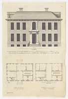
- Creator:
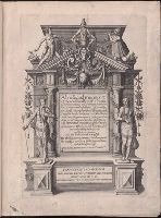
- Campbell, Colen, 1676-1729, artist
- Published / Created:
- [between 1715 and 1731]
- Call Number:
- Topos M627 no. 13+
- Image Count:
- 1
- Resource Type:
- still image
- Description:
- No. 22, "Mr. and Mrs. George Morton
- Found in:
- Lewis Walpole Library > The prospect to the gardens of The Honble. Iames Iohnston Esqr. his house at Twittenham in the county of Midlesex, 1710 Elevation du costé du jardin del la maison du Monsieur Monsr. Iohnston a Twittenham dans la comté de Midlesex ; The plan of the first floor = Plan de la premiere estage ; The Plan of the chamber floor = Plan de la seconde estage / [graphic] =
- Creator:
- Bowen, Emanuel, -1767
- Published / Created:
- 2d. July 1772.
- Call Number:
- 71 1763
- Container / Volume:
- BRBL_00364
- Image Count:
- 4
- Resource Type:
- Maps, Atlases & Globes
- Alternative Title:
- Particular map of Baffin and Hudson's
- Description:
- map of Baffin and Hudson's Bay" and "The
- Subject (Geographic):
- North America--Maps--Early works to
- Subject (Topic):
- British--America--Maps--Early works to
- Found in:
- Beinecke Rare Book and Manuscript Library > An accurate map of North America [cartographic material] : Describing and distinguishing the British and Spanish dominions on this great continent; according to the definitive treaty concluded at Paris 10th Feby. 1763. Also all the West India Islands belo
- Creator:
- Defoe, Daniel, 1661?-1731
Taylor, William, d. 1723, bookseller
- Published / Created:
- MDCCXXII [1722]
- Call Number:
- Defoe 50 722d
- Image Count:
- 164
- Found in:
- Beinecke Rare Book and Manuscript Library > The life, and strange surprizing adventures of Robinson Crusoe, of York, mariner : who lived eight and twenty years all alone in an un-inhabited island on the coast of America, near the mouth of the great river Oroonoque, having been cast on shore by shipwreck, wherein all the men perished by himself, with an account how he was at last as strangely deliver'd by pyrates / written by himself.
- Creator:
- L'Isle, Guillaume de, 1675-1726
- Published / Created:
- [1730?]
- Call Number:
- 755 1730
- Container / Volume:
- BRBL_00426
- Image Count:
- 1
- Resource Type:
- Maps, Atlases & Globes
- Subject (Geographic):
- Louisiana--Maps--Early works to 1800
- Found in:
- Beinecke Rare Book and Manuscript Library > Carte de la Louisiane et du cours du Mississipi / dressée sur un grand nombre de memoires entr'autres sur ceux de Mr. le Maire, par Guillme. de L'Isle de l'Academie Rle. des Sciences.
- Creator:
- Popple, Henry, -1743
- Published / Created:
- 1733
- Call Number:
- 89 1720
- Container / Volume:
- BRBL_00697
- Image Count:
- 1
- Resource Type:
- Maps, Atlases & Globes
- Description:
- . Popple's Map of America. 25 cm.
- Subject (Geographic):
- Great Britain--Colonies--America--Maps
- Found in:
- Beinecke Rare Book and Manuscript Library > A map of the British Empire in America, with the French and Spanish settlements adjacent thereto / by Henry Popple.
- Creator:
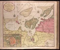
- Keulen, Gerard van.
- Published / Created:
- [ca. 1734]
- Call Number:
- 1973 Folio 18
- Image Count:
- 1
- Resource Type:
- Maps, Atlases & Globes
- Description:
- , map 22.
- Subject (Geographic):
- Wismar (Germany)--Maps--Early works to
- Found in:
- Beinecke Rare Book and Manuscript Library > Nieuwe afteekening van de Haven en Stad Wismar [cartographic material] : met desselfs inkoomende Zee Gaatten soo beoosten als bewesten Poel Eyland en beleegering van dito Stad.
- Creator:
- Moll, Herman, d. 1732
Salmon, Thomas, 1679-1767
- Published / Created:
- 1739
- Call Number:
- 1996 +91
- Image Count:
- 3
- Resource Type:
- Books, Journals & Pamphlets
- Description:
- Frontispiece map, 25 x 41 cm.
- Subject (Geographic):
- Madras (India)--Maps--Early works to
- Found in:
- Beinecke Rare Book and Manuscript Library > Modern history: or, The present state of all nations. Describing their respective situations, persons, habits, ... animals and minerals. ... By Mr. Salmon. Illustrated with cuts and maps ... by Herman Moll ...