Search
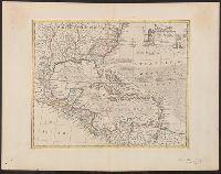
You Searched For
Search Results
- Creator:
- Moll, Herman, d. 1732
- Call Number:
- 85 1745A
- Container / Volume:
- BRBL_00636
- Image Count:
- 1
- Resource Type:
- Maps, Atlases & Globes
- Found in:
- Beinecke Rare Book and Manuscript Library > A chart of ye West-Indies or the islands of America in the North Sea &c., being ye present seat of war / by Herman Moll, geographer.
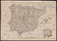
- Creator:
- Senex, John, d. 1740
- Published / Created:
- 1710?]
- Call Number:
- 39 1710
- Container / Volume:
- BRBL_00684
- Image Count:
- 1
- Resource Type:
- Maps, Atlases & Globes
- Found in:
- Beinecke Rare Book and Manuscript Library > A correct map of Spain & Portugal : according to the newest observations and discoveries communicated to the Royal Society at London and the Royal Academy at Paris ... / I. Senex ...
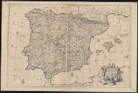
- Creator:
- Senex, John, d. 1740
- Published / Created:
- 1710?]
- Call Number:
- 39 1710A
- Container / Volume:
- BRBL_00185
- Image Count:
- 1
- Resource Type:
- Maps, Atlases & Globes
- Found in:
- Beinecke Rare Book and Manuscript Library > A correct map of Spain & Portugal : according to the newest observations and discoveries communicated to the Royal Society at London and the Royal Academy at Paris ... / I. Senex ...
- Creator:
- Lodge, John, 1756 or 7-1830, engraver
Roberts, Henry, Lieut
- Published / Created:
- 1785
- Call Number:
- 1977 Folio 177
- Image Count:
- 2
- Resource Type:
- Maps, Atlases & Globes
- Found in:
- Beinecke Rare Book and Manuscript Library > A general chart exhibiting the discoveries made by Captn. James Cook in this and his two preceeding voyages with the tracks of the ships under his command / by Lieutt. Roberts of His Majesty's Royal Navy ; Jn. Lodge sc.
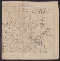
- Published / Created:
- 1775]
- Call Number:
- 76 1740
- Container / Volume:
- BRBL_00690
- Image Count:
- 1
- Resource Type:
- Maps, Atlases & Globes
- Found in:
- Beinecke Rare Book and Manuscript Library > A map of 100 miles round Boston [cartographic material].
- Published / Created:
- 1776]
- Call Number:
- 766 1776
- Container / Volume:
- BRBL_00690
- Image Count:
- 1
- Resource Type:
- Maps, Atlases & Globes
- Found in:
- Beinecke Rare Book and Manuscript Library > A map of Connecticut and Rhode Island with Long Island Sound, &c.
- Published / Created:
- 1776]
- Call Number:
- 766 1776
- Container / Volume:
- BRBL_00690
- Image Count:
- 1
- Resource Type:
- Maps, Atlases & Globes
- Found in:
- Beinecke Rare Book and Manuscript Library > A map of Connecticut and Rhode Island with Long Island Sound, &c.
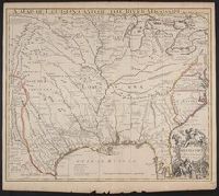
- Creator:
- Senex, John, d. 1740
- Published / Created:
- 1721]
- Call Number:
- 755 1715A
- Container / Volume:
- BRBL_00425
- Image Count:
- 1
- Resource Type:
- Maps, Atlases & Globes
- Found in:
- Beinecke Rare Book and Manuscript Library > A map of Louisiana and of the river Mississipi [i.e. Mississippi] : this map of the Mississipi [i.e. Mississippi] is most humbly inscribed to William Law of Lanreston, esq. / by Iohn Senex.
- Creator:
- Blair, John, d. 1782
- Published / Created:
- 176-?]
- Call Number:
- 71 1760B
- Container / Volume:
- BRBL_00364
- Image Count:
- 1
- Resource Type:
- Maps, Atlases & Globes
- Found in:
- Beinecke Rare Book and Manuscript Library > A map of North America, from the latest surveys and maps / by John Blair as a supplement to his Tables of chronology ; Thos. Kitchin, sculpsit.
- Published / Created:
- 1755]
- Call Number:
- 755 1755A
- Container / Volume:
- BRBL_00690
- Image Count:
- 1
- Resource Type:
- Maps, Atlases & Globes
- Found in:
- Beinecke Rare Book and Manuscript Library > A map of the British & French Plantations in North America.
- Creator:
- Bowen, Emanuel, d. 1767
- Published / Created:
- 1754
- Call Number:
- 75 1720
- Container / Volume:
- BRBL_00689
- Image Count:
- 1
- Resource Type:
- Maps, Atlases & Globes
- Found in:
- Beinecke Rare Book and Manuscript Library > A map of the British American plantations [cartographic material] : extending from Boston in New England to Georgia, including all the back settlements in the respective provinces, as far as the Mississippi / by Eman. Bowen Geogr. to His Majesty ; Tho. Bo
- Creator:
- Bowen, Thomas, d. 1790
- Published / Created:
- 1755]
- Call Number:
- 71 1755E
- Container / Volume:
- BRBL_00687
- Image Count:
- 1
- Resource Type:
- Maps, Atlases & Globes
- Found in:
- Beinecke Rare Book and Manuscript Library > A map of the British and French settlements in North America / T. Bowen, sculpt[or].
- Creator:
- Gibson, J. (John)
- Published / Created:
- 1762]
- Call Number:
- 8555 1762
- Container / Volume:
- BRBL_00695
- Image Count:
- 1
- Resource Type:
- Maps, Atlases & Globes
- Found in:
- Beinecke Rare Book and Manuscript Library > A map of the Island of Jamaica [cartographic material] / J. Gibson sculpt.
- Published / Created:
- 1776]
- Call Number:
- 755 1776R
- Container / Volume:
- BRBL_00728
- Image Count:
- 1
- Resource Type:
- Maps, Atlases & Globes
- Found in:
- Beinecke Rare Book and Manuscript Library > A map of the country round Philadelphia : including part of New Jersey, New York, Staten Island & Long Island.
- Published / Created:
- 1755]
- Call Number:
- 755 1755Q
- Container / Volume:
- BRBL_00690
- Image Count:
- 1
- Resource Type:
- Maps, Atlases & Globes
- Found in:
- Beinecke Rare Book and Manuscript Library > A map of the five Great Lakes with part of Pensilvania, New York, Canada and Hudsons Bay territories &c [cartographic material].
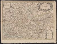
- Published / Created:
- 1713]
- Call Number:
- 38 P21 1713
- Container / Volume:
- BRBL_00160
- Image Count:
- 1
- Resource Type:
- Maps, Atlases & Globes
- Found in:
- Beinecke Rare Book and Manuscript Library > A map of the provostship and vicounty of Paris.
- Creator:
- Bowen, Emanuel, d. 1767
- Published / Created:
- 1747]
- Call Number:
- 855 1747
- Container / Volume:
- BRBL_00695
- Image Count:
- 1
- Resource Type:
- Maps, Atlases & Globes
- Found in:
- Beinecke Rare Book and Manuscript Library > A new & accurate map of the island of Cuba ; A new & accurate map of the islands of Hispaniola or St. Domingo, and Porto Rico / [cartographic material] / drawn from the most approved maps & charts, and regulated by astronl. observations by Eman. Bowen.
- Creator:
- Bowen, Emanuel, d. 1767
- Published / Created:
- 1750?]
- Call Number:
- 855 1750
- Container / Volume:
- BRBL_00641
- Image Count:
- 1
- Resource Type:
- Maps, Atlases & Globes
- Found in:
- Beinecke Rare Book and Manuscript Library > A new & accurate map of the island of Cuba ; A new & accurate map of the islands of Hispaniola or St. Domingo, and Porto Rico / [cartographic material] / drawn from the most approved maps & charts, and regulated by astronl. observations by Eman. Bowen.
- Creator:
- Bowen, Thomas, d. 1790
- Published / Created:
- 1794?]
- Call Number:
- 60 1794B
- Container / Volume:
- BRBL_00324
- Image Count:
- 1
- Resource Type:
- Maps, Atlases & Globes
- Found in:
- Beinecke Rare Book and Manuscript Library > A new and accurate map of Africa, drawn from the best authorities / by Thos. Bowen.
- Published / Created:
- 1780]
- Call Number:
- 773 1778D
- Container / Volume:
- BRBL_00690
- Image Count:
- 1
- Resource Type:
- Maps, Atlases & Globes
- Found in:
- Beinecke Rare Book and Manuscript Library > A new and accurate map of New Jersey [cartographic material] : from the best authorities.
- Creator:
- Bowen, Emanuel, d. 1767
- Call Number:
- 623 1750
- Container / Volume:
- BRBL_00333
- Image Count:
- 1
- Resource Type:
- Maps, Atlases & Globes
- Found in:
- Beinecke Rare Book and Manuscript Library > A new and accurate map of Nubia & Abissinia, together with all the kingdoms tributary thereto, and bordering upon them / laid down from the latest & best authorities and regulated by astronl. observations ny Emanl. Bowen.
- Creator:
- Kitchin, Thomas, d. 1784
- Published / Created:
- 1766?]
- Call Number:
- 755 1763A
- Container / Volume:
- BRBL_00428
- Image Count:
- 1
- Resource Type:
- Maps, Atlases & Globes
- Found in:
- Beinecke Rare Book and Manuscript Library > A new and accurate map of the British dominions in America, according to the Treaty of 1763, divided into the several provinces and jurisdictions : projected upon the best authorities and astronomical observations / by Thos. Kitchin, geographer.
- Creator:
- Bowen, Emanuel, d. 1767
- Published / Created:
- ca. 1750]
- Call Number:
- 73 1752
- Container / Volume:
- BRBL_00373
- Image Count:
- 1
- Resource Type:
- Maps, Atlases & Globes
- Found in:
- Beinecke Rare Book and Manuscript Library > A new and accurate map of the Islands of Newfoundland, Cape Breton, St. John and Anticosta : together with the neighbouring countries of Nova Scotia, Canada &c. Drawn from the most approved modern maps and charts, and regulated by astron. observat. / by E
- Creator:
- Bowen, Emanuel, d. 1767
- Published / Created:
- 1752]
- Call Number:
- 73 1752A
- Container / Volume:
- BRBL_00373
- Image Count:
- 1
- Resource Type:
- Maps, Atlases & Globes
- Found in:
- Beinecke Rare Book and Manuscript Library > A new and accurate map of the islands of Newfoundland, Cape Breton, St. John and Anticosta : together with the neighbouring countries of Nova Scotia, Canada, &c. / drawn from the most approved modern maps and charts and regulated by Astronl. observatns. b
- Creator:
- Kitchin, Thomas, d. 1784
- Published / Created:
- 1762]
- Call Number:
- 85 1760
- Container / Volume:
- BRBL_00693
- Image Count:
- 1
- Resource Type:
- Maps, Atlases & Globes
- Found in:
- Beinecke Rare Book and Manuscript Library > A new and correct map of the American Islands : now called the West Indies, with the whole coast of the neighbouring continent / by Thos. Kitchin geogr.
- Creator:
- Seale, Richard William
- Published / Created:
- 1766]
- Call Number:
- 654 1766
- Container / Volume:
- BRBL_00344
- Image Count:
- 1
- Resource Type:
- Maps, Atlases & Globes
- Found in:
- Beinecke Rare Book and Manuscript Library > A new and correct map of the coast of Africa, from Cape Blanco (lat. 20⁰40Ń) to the coast of Angola (lat. 11⁰S) : with explanatory notes of all the forts and settlements belonging to the several European powers / R.W. Seale, sculp.
- Creator:
- Aitken, Robert, 1735-1802
- Published / Created:
- 1775]
- Call Number:
- 764 B65 1775N
- Container / Volume:
- BRBL_00455
- Image Count:
- 1
- Resource Type:
- Maps, Atlases & Globes
- Found in:
- Beinecke Rare Book and Manuscript Library > A new and correct plan of the town of Boston.
- Creator:
- Senex, John, d. 1740
- Published / Created:
- 1721]
- Call Number:
- 60 1721
- Container / Volume:
- BRBL_00322
- Image Count:
- 1
- Resource Type:
- Maps, Atlases & Globes
- Found in:
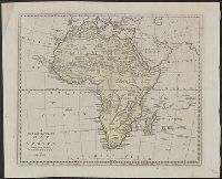
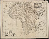
- Beinecke Rare Book and Manuscript Library > A new map of Africa, from the latest observations.
- Published / Created:
- 1700?]
- Call Number:
- 60 1700
- Container / Volume:
- BRBL_00322
- Image Count:
- 1
- Resource Type:
- Maps, Atlases & Globes
- Found in:
- Beinecke Rare Book and Manuscript Library > A new map of Africk : shewing its present general divisions, cheif cities or towns, rivers, mountains &c.
- Creator:
- Wells, Edward, 1667-1727
- Published / Created:
- 172-?]
- Call Number:
- 400 172X
- Container / Volume:
- BRBL_00232
- Image Count:
- 1
- Resource Type:
- Maps, Atlases & Globes
- Found in:
- Beinecke Rare Book and Manuscript Library > A new map of Gallia Cisalpina & Graecia Magna, shewing their cheif [sic] divisions, people, cities, towns &c. / Sutton Nicholls sculp.
- Creator:
- Senex, John, d. 1740
- Published / Created:
- 1708
- Call Number:
- 40 1708
- Container / Volume:
- BRBL_00684
- Image Count:
- 1
- Resource Type:
- Maps, Atlases & Globes
- Found in:
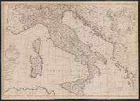
- Beinecke Rare Book and Manuscript Library > A new map of Italy : corrected from the observations communicated to ye Royal Society at london and ye Royal Accademy [sic] at Paris / by Iohn Senex.
- Creator:
- Wells, Edward, 1667-1727
- Published / Created:
- 172-?]
- Call Number:
- 400 172XA
- Container / Volume:
- BRBL_00232
- Image Count:
- 1
- Resource Type:
- Maps, Atlases & Globes
- Found in:
- Beinecke Rare Book and Manuscript Library > A new map of Latium, Etruria, and as much of antient Italy as lay between Gallia Cisalpina and Graecia Magna, shewing their principal divisions, cities, towns, rivers, mountains, &c. / Sutton Nicholls sculp.
- Creator:
- Kiepert, Heinrich, 1818-1899
- Published / Created:
- 1856?]
- Call Number:
- 51 1856
- Container / Volume:
- BRBL_00279
- Image Count:
- 1
- Resource Type:
- Maps, Atlases & Globes
- Found in:
- Beinecke Rare Book and Manuscript Library > A new map of Palestine including also Phoenicia and Coelesyria / Constructed principally from unpublished materials furnished by Ed. Robinson and Eli Smith and J.L. Porter, by Henry Kiepert, 1856.
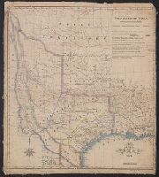
- Published / Created:
- 1841 [i.e. 1842]
- Call Number:
- 796fab 1842
- Container / Volume:
- BRBL_00530
- Image Count:
- 1
- Resource Type:
- Maps, Atlases & Globes
- Found in:
- Beinecke Rare Book and Manuscript Library > A new map of Texas / Day & Haghe, lith.rs to the Queen.
- Creator:
- Wells, Edward, 1667-1727
- Published / Created:
- 172-?]
- Call Number:
- 400 172XB
- Container / Volume:
- BRBL_00232
- Image Count:
- 1
- Resource Type:
- Maps, Atlases & Globes
- Found in:
- Beinecke Rare Book and Manuscript Library > A new map of antient Italy : together with the adjoyning islands of Sicily, Sardinia, and Corsica, shewing their principal divisions, cities, towns, rivers, mountains &c. / Sutton Nicholls sculp.
- Creator:
- Senex, John, d. 1740
- Published / Created:
- 1719]
- Call Number:
- 85 1721
- Container / Volume:
- BRBL_00692
- Image Count:
- 1
- Resource Type:
- Maps, Atlases & Globes
- Found in:
- Beinecke Rare Book and Manuscript Library > A new map of the English empire in the ocean of America or West Indies / revis'd by I. Senex ; I. Harris sculp.
- Creator:
- Senex, John, d. 1740
- Published / Created:
- 1710
- Call Number:
- 33 1710
- Container / Volume:
- BRBL_00683
- Image Count:
- 1
- Resource Type:
- Maps, Atlases & Globes
- Found in:
- Beinecke Rare Book and Manuscript Library > A new map of the provinces of Hainault, Namur and Cambray / by Iohn Senex, F.R.S.
- Creator:
- Senex, John, d. 1740
- Published / Created:
- 1720]
- Call Number:
- 11 1720B
- Container / Volume:
- BRBL_00680
- Image Count:
- 1
- Resource Type:
- Maps, Atlases & Globes
- Found in:
- Beinecke Rare Book and Manuscript Library > A new map of the world [cartographic material] : from the latest observations / revised by I. Senex.
- Published / Created:
- 1759]
- Call Number:
- 734 Q31 1759
- Container / Volume:
- BRBL_00689
- Image Count:
- 1
- Resource Type:
- Maps, Atlases & Globes
- Found in:
- Beinecke Rare Book and Manuscript Library > A plan of Quebec : metropolis of Canada in North America.
- Published / Created:
- 1775]
- Call Number:
- 764 B65 1775H
- Container / Volume:
- BRBL_00454
- Image Count:
- 1
- Resource Type:
- Maps, Atlases & Globes
- Found in:
- Beinecke Rare Book and Manuscript Library > A plan of the town and chart of the harbour of Boston : exhibiting a view of the islands, castle forts, and entrances into the said harbour.
- Creator:
- Ogilby, John, 1600-1676
- Published / Created:
- 1670]
- Call Number:
- 64 1670
- Container / Volume:
- BRBL_00338
- Image Count:
- 1
- Resource Type:
- Maps, Atlases & Globes
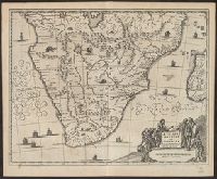
- Found in:
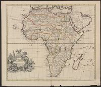
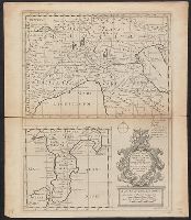
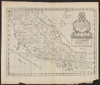
- Beinecke Rare Book and Manuscript Library > Aethiopia inferior vel exterior : partes magis septentrionales, quae hic desiderantur, vide in tabula Aethiopia superioris.
- Creator:
- Ogilby, John, 1600-1676
- Published / Created:
- 1670]
- Call Number:
- 66 1670A
- Container / Volume:
- BRBL_00347
- Image Count:
- 1
- Resource Type:
- Maps, Atlases & Globes
- Found in:
- Beinecke Rare Book and Manuscript Library > Aethiopia superior vel interior vulgo Abissinorum sive Presbiteriioannis Imperior.
- Creator:
- Meurs, Jacob van, 1619-1680
- Published / Created:
- 1670]
- Call Number:
- 60 1670
- Container / Volume:
- BRBL_00322
- Image Count:
- 1
- Resource Type:
- Maps, Atlases & Globes
- Found in:
- Beinecke Rare Book and Manuscript Library > Africae accurata tabula / ex officina Iacobum Meursium.
- Published / Created:
- ca. 1890?]
- Call Number:
- 331 Am88 1890
- Container / Volume:
- BRBL_00079
- Image Count:
- 1
- Resource Type:
- Maps, Atlases & Globes
- Found in:
- Beinecke Rare Book and Manuscript Library > Amsterdam [cartographic material] / Henry Blacklock & Co., Ltd.
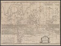
- Creator:
- Kitchin, Thomas, d. 1784
- Published / Created:
- 1760?]
- Call Number:
- 11 1755A
- Container / Volume:
- BRBL_00681
- Image Count:
- 1
- Resource Type:
- Maps, Atlases & Globes
- Found in:
- Beinecke Rare Book and Manuscript Library > An accurate chart of the world with the new discoveries [cartographic material] : also a view of the general and coasting trade winds, monsoons or shifting trade winds and the variations of the compass, from the latest and best authorities / by T. Kitchen
- Creator:
- Bowen, Emanuel, d. 1767
- Published / Created:
- 1747]
- Call Number:
- 85 1730A
- Container / Volume:
- BRBL_00692
- Image Count:
- 1
- Resource Type:
- Maps, Atlases & Globes
- Found in:
- Beinecke Rare Book and Manuscript Library > An accurate map of the West Indies [cartographic material] : drawn from the best authorities, assisted by the most approved modern maps and charts, and regulated by astronomical observations / by Eman: Bowen.
- Creator:
- Bowen, Emanuel, d. 1767
- Published / Created:
- 1747]
- Call Number:
- 867 1747
- Container / Volume:
- BRBL_00696
- Image Count:
- 1
- Resource Type:
- Maps, Atlases & Globes
- Found in:
- Beinecke Rare Book and Manuscript Library > An accurate map of the island of Barbadoes [cartographic material] : drawn from an actual survey containing all the towns, churches, fortifications, roads, paths, plantations &c. / by Eman. Bowen.
- Creator:
- Basire, Isaac, 1704-1768
- Published / Created:
- 1750]
- Call Number:
- 39hc V68 1702
- Container / Volume:
- BRBL_00192
- Image Count:
- 1
- Resource Type:
- Maps, Atlases & Globes
- Found in:
- Beinecke Rare Book and Manuscript Library > An exact draught of the bay and harbour of Vigo [cartographic material] : for Mr. Tindal's continuation of Mr. Rapin's History of England / I. Basire sculp.
- Creator:
- Ogilby, John, 1600-1676
- Published / Created:
- 1670]
- Call Number:
- 66 1670
- Container / Volume:
- BRBL_00347
- Image Count:
- 1
- Resource Type:
- Maps, Atlases & Globes
- Found in:
- Beinecke Rare Book and Manuscript Library > Barbaria Biledulgerid o: Libye et pars Nigritarum terra.