Skip to search
Skip to main content
Skip to first result
Yale University Library
Ask Yale Library
Reserve Rooms
Places to Study
Research
Quicksearch
Search Library Catalog (Orbis)
Search Law Library Catalog (MORRIS)
Search Borrow Direct
Search WorldCat
Search Articles+
Search Digital Collections
Search Archives at Yale
Research Guides
Find Databases by Title
Find eJournals by Title
Guide to Using Special Collections
Services
Your Personal Librarian
Subject Specialists
Research Support and Workshops
Citation Tools
OverDrive: Popular Audio and eBooks
Get It @ Yale (Borrow Direct, Interlibrary Loan, Scan & Deliver)
Course Reserves
Off-Campus Access
EliScholar
OverDrive: Popular Audio and eBooks
Bass Media Equipment
Libraries & Collections
Arts Library
Bass Library
Beinecke Library
Classics Library
Divinity Library
Film Study Center
Fortunoff Archive
Humanities Collections
International Collections
Law Library
Lewis Walpole Library
Library Collection Services
Manuscripts & Archives
Map Collection
Marx Science & Social Science Library
Medical Library
Music Library
Sterling Library
Yale Center for British Art
Information & Policies
Library Hours
Departments & Staff
Borrowing & Circulation
Services for Persons with Disabilities
Copyright Basics
Scanning, Printing & Copying
Computers & Wireless
Library Policies
About the Library
Giving to the Library
Purchase Request
Working at the Library
Terms Governing Use of Materials
Search in
All Fields
Creator
Title
Call Number
Date
Subject
Orbis ID
Full Text
Description
Full text
search for
Search
Search
Advanced Search
Digital Collections
Search
You Searched For
Extent of Digitization
Completely digitized
Access
Public
Genre
Nautical charts
Publication Place
London :
New Search
1
-
28
of
28
Sort
by relevance
relevance
Creator (A --> Z)
Creator (Z --> A)
Title (A --> Z)
Title (Z --> A)
Year (ascending)
Year (descending)
Number of results to display per page
99
per page
9
per page
30
per page
60
per page
99
per page
View results as:
List
List
Gallery
Gallery
Search Results
A chart of the Banks of Newfoundland / drawn from a great number of hydrographical surveys, chiefly
A chart of the Gulf of St. Laurence [cartographic material] : composed from a great number of
A chart of the coasts of Spain and Portugal, with the Balearic Islands, and part of the coast of
A chart of the harbour of Halifax, in Nova Scotia : with Jebucto Bay and Cape Sambrô, also the
A chart of the island of Jamaica [cartographic material] : with its bays, harbours, rocks
A chart of ye narrow seas / newly corrected by John Seller, hydrographer to the kings most
A general chart of the West India Islands with the adjacent coasts of the Spanish continent
A general chart of the island of Newfoundland with the rocks & soundings / [cartographic material
An accurate chart of the Bay of Biscay ... taken in 1756 & 1757 ... By Mr. Magin Engineer to the
An exact chart of the river St. Laurence : from Fort Frontenac to the island of Anticosti shewing
Australia east coast. Sheet I, Cape Howe to Barriga Point / from a running survey by Captn. J. Lort
Australia east coast. Sheet II, Barriga Point to Jervis Bay / from a running survey by Captn. J
Australia east coast. Sheet IV, Broken Bay to Sugarloaf Point / from a running survey by Captn. J
Australia, Coral Sea and Great Barrier Reefs shewing the inner and outer routes to Torres Strait
Australia, north coast, Torres Strait. Thursday Island Harbour / surveyed by Mr. E.A. Cullen.
Chart of the N.W. coast of America and the N.E. coast of Asia, explored in the years 1778 and 1779
Gulf of Venice from Rimino to Cape Promontore : from the Austrian, English & Neapolitan co
Jamaica from the latest surveys / [cartographic material] / improved and engraved by Thomas
Nautical map intended for the use of colonial undertakings on the W. Coast of Africa ... / by the
Nova & accuratissima totius terrarum orbis tabula nautica, variationum magneticarum index juxta
The Bay of Honduras [cartographic material] / by Thos. Jefferys, Geographer to His Majesty.
The coast of West Florida and Louisiana : the Peninsula and Gulf of Florida or Channel of Bahama
The coast of West Florida and Louisiana [cartographic material] : the Peninsula and Gulf of Florida
The coast of Yucatán from Campeche to Baha del Ascencion, with the west end of Cuba / by Thos
The island of Cuba with part of the Bahama banks & the Martyrs / by Thos. Jefferys.
Limit your search
Extent of Digitization
Completely digitized
✖
[remove]
28
Access
Public
✖
[remove]
28
Repository
Beinecke Rare Book and Manuscript Library
28
Format
cartographic
28
Genre
Nautical charts
✖
[remove]
28
Maps
8
Armorial bookplates (Provenance)
1
Early works
1
Resource Type
Maps, Atlases & Globes
28
Language
English
28
Creator
Jefferys, Thomas, d. 1771
5
Great Britain. Hydrographic Dept
4
Jefferys, Thomas, -1771
3
Jefferys, Thomas, -1771, cartographer
3
Chabert, Joseph Bernard, marquis de, 1724-1805
2
Delarochette, L. (Louis), 1731-1802
2
Stokes, J. Lort (John Lort), 1811-1885
2
Beaver, Philip, 1766-1813
1
Evans, F. J. (Frederick J.)
1
Faden, William, 1749-1836
1
more
Creator
»
Subject (Topic)
Nautical charts--Newfoundland and Labrador--Grand Banks of Newfoundland--Early works to 1800
2
Nautical charts--Saint Lawrence River--Early works to 1800
2
Coasts--Africa, North--Maps--Early works to 1800
1
Coasts--Africa, West--Nautical charts
1
Coasts--Portugal--Maps--Early works to 1800
1
Coasts--Spain--Maps--Early works to 1800
1
Discoveries in geography--Maps--Early works to 1800
1
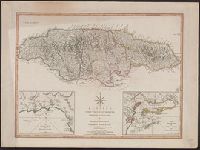
Harbors--Jamaica--Kingston--Maps--Early works to 1800
1
Harbors--Jamaica--Maps--Early works to 1800
1
Harbors--Jamaica--Port Royal--Maps--Early works to 1800
1
more
Subject (Topic)
»
Subject (Name)
Jefferys, Thomas, d. 1771. American atlas
7
Sayer, Robert, 1725-1794
7
Cook, James, 1728-1779
3
Robert Sayer and John Bennett (Firm)
3
Faden, William, 1749-1836. General atlas
2
Fleurieu, C. P. Claret (Charles Pierre Claret), comte de, 1738-1810
2
Kitchin, Thomas, d. 1784. General atlas describing the whole universe
2
Abbot, Charles,--Baron Colchester,--1757-1829--Bookplate
1
Beaver, Philip, 1766-1813. African memoranda
1
Bew, John, -1793, publisher
1
more
Subject (Name)
»
Publication Place
London :
✖
[remove]
28
Date Created
View distribution
Current results range from
1671
to
1903
Date Created range begin
Date Created range end
View larger »