Search
You Searched For
Search Results
- Creator:
- National Geographic Society (U.S.). Cartographic Section
- Published / Created:
- 1941
- Call Number:
- 80 1941
- Container / Volume:
- BRBL_00536
- Image Count:
- 1
- Resource Type:
- Maps, Atlases & Globes
- Found in:
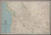
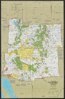
- Beinecke Rare Book and Manuscript Library > A map of Northwestern United States and neighboring Canadian Provinces / prepared in the Cartographic Section of the National Geographic Society for the National geographic magazine ; James M. Darley, chief cartographer.
- Creator:
- Geological Survey (U.S.)
- Published / Created:
- [1910]
- Call Number:
- 844fcm Y83 1910
- Container / Volume:
- BRBL_00615
- Image Count:
- 1
- Resource Type:
- Maps, Atlases & Globes
- Found in:
- Beinecke Rare Book and Manuscript Library > Administrative map of Yosemite National Park, California / topography by R.E. Marshall and A.H. Sylvester ; surveyed in 1893-94, 1896, 1898-99 and 1905.
- Creator:
- Great Britain. War Office. General Staff. Geographical Section
- Published / Created:
- 1943
- Call Number:
- 60gm 1943
- Container / Volume:
- BRBL_00330
- Image Count:
- 1
- Resource Type:
- Maps, Atlases & Globes
- Found in:
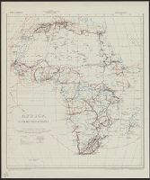
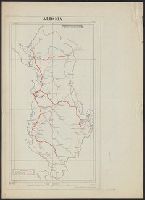
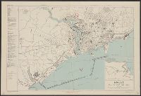
- Beinecke Rare Book and Manuscript Library > Africa : communications.
- Creator:
- Great Britain. War Office. General Staff. Geographical Section
- Published / Created:
- 1943
- Call Number:
- 3897 Aj12 1943
- Container / Volume:
- BRBL_00184
- Image Count:
- 1
- Resource Type:
- Maps, Atlases & Globes
- Found in:
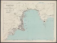
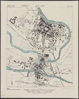
- Beinecke Rare Book and Manuscript Library > Ajaccio, plan of port [cartographic material] / Drawn by War Office, 1943.
- Creator:
- National Geographic Society (U.S.). Cartographic Division
- Published / Created:
- 1983
- Call Number:
- 848 1983
- Container / Volume:
- BRBL_00631
- Image Count:
- 2
- Resource Type:
- Maps, Atlases & Globes
- Found in:
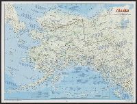
- Beinecke Rare Book and Manuscript Library > Alaska / produced by the Cartographic Division, National Geographic Society.
- Creator:
- Great Britain. Army. Royal Engineers
- Published / Created:
- 1944
- Call Number:
- 475gmb 1944
- Container / Volume:
- BRBL_00262
- Image Count:
- 2
- Resource Type:
- Maps, Atlases & Globes
- Found in:
- Beinecke Rare Book and Manuscript Library > Albania, Road information, AF 5811.
- Creator:
- United States. Army Map Service
- Published / Created:
- 1943
- Call Number:
- 3969gm 1943
- Container / Volume:
- BRBL_00194
- Image Count:
- 1
- Resource Type:
- Maps, Atlases & Globes
- Found in:
- Beinecke Rare Book and Manuscript Library > Balearic islands [cartographic material] : special strategic map / compiled by the Army Map Service.
- Creator:
- United States. Army Map Service
- Published / Created:
- 1943
- Call Number:
- 44gm 1943
- Container / Volume:
- BRBL_00257
- Image Count:
- 1
- Resource Type:
- Maps, Atlases & Globes
- Found in:
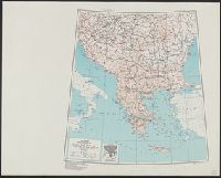
- Beinecke Rare Book and Manuscript Library > Balkans [cartographic material] : special strategic map compiled by the Army Map Service.
- Creator:
- United States. Army Map Service
- Published / Created:
- 1943
- Call Number:
- 39 B23 1943
- Container / Volume:
- BRBL_00189
- Image Count:
- 1
- Resource Type:
- Maps, Atlases & Globes
- Found in:
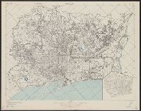
- Beinecke Rare Book and Manuscript Library > Barcelona [cartographic material] : city plan.
- Creator:
- United States. Army. Corps of Engineers
- Published / Created:
- 1943
- Call Number:
- 40 B24 1943
- Container / Volume:
- BRBL_00204
- Image Count:
- 1
- Resource Type:
- Maps, Atlases & Globes
- Found in:
- Beinecke Rare Book and Manuscript Library > Barletta [cartographic material] : city plan / prepared under the direction of the chief of engineers, U. S. Army.
- Creator:
- United States. Army Map Service
- Published / Created:
- 1943
- Call Number:
- 38 B41 1943
- Container / Volume:
- BRBL_00156
- Image Count:
- 1
- Resource Type:
- Maps, Atlases & Globes
- Found in:
- Beinecke Rare Book and Manuscript Library > Belfort [cartographic material] : city plan / prepared under the direction of the Chief of Engineers, U.S. Army.
- Creator:
- British Columbia. Dept. of Lands and Forests
- Published / Created:
- 1947
- Call Number:
- 739 B41 1947
- Container / Volume:
- BRBL_00389
- Image Count:
- 1
- Resource Type:
- Maps, Atlases & Globes
- Found in:
- Beinecke Rare Book and Manuscript Library > Bella Coola. Preliminary map. 1924. AMS 2.
- Creator:
- United States. Army. Corps of Engineers
- Published / Created:
- 1943
- Call Number:
- 40 B414 1943
- Container / Volume:
- BRBL_00204
- Image Count:
- 1
- Resource Type:
- Maps, Atlases & Globes
- Found in:
- Beinecke Rare Book and Manuscript Library > Belvedere [cartographic material] : city plan / prepared under the direction of the chief of engineers, U. S. Army.
- Creator:
- United States. Army. Corps of Engineers
- Published / Created:
- 1943
- Call Number:
- 40 B54 1943
- Container / Volume:
- BRBL_00205
- Image Count:
- 1
- Resource Type:
- Maps, Atlases & Globes
- Found in:
- Beinecke Rare Book and Manuscript Library > Bisceglie [cartographic material] : city plan / prepared under the direction of the chief of engineers, U. S. Army.
- Creator:
- Great Britain. War Office. General Staff. Geographical Section
- Published / Created:
- 1943
- Call Number:
- 213 B63 1943
- Container / Volume:
- BRBL_00015
- Image Count:
- 1
- Resource Type:
- Maps, Atlases & Globes
- Found in:
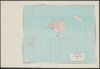
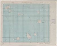
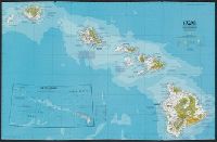
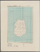
- Beinecke Rare Book and Manuscript Library > Boa Vista / drawn at War Office, 1940, from a Portuguese map of 1924.
- Creator:
- United States. Army Map Service
- Published / Created:
- 1943
- Call Number:
- 38 B66 1943
- Container / Volume:
- BRBL_00156
- Image Count:
- 1
- Resource Type:
- Maps, Atlases & Globes
- Found in:
- Beinecke Rare Book and Manuscript Library > Boulogne [cartographic material] : city plan / prepared under the direction of the Chief of Engineers, U.S. Army.
- Creator:
- Great Britain. Inter-service Topographical Dept
- Published / Created:
- 1943
- Call Number:
- 38 B75 1943
- Container / Volume:
- BRBL_00156
- Image Count:
- 1
- Resource Type:
- Maps, Atlases & Globes
- Found in:
- Beinecke Rare Book and Manuscript Library > Brest [cartographic material] : plan of port and town / compiled and drawn by Inter-service Topographical Dept.
- Published / Created:
- 1943
- Call Number:
- 47gmb 1943
- Container / Volume:
- BRBL_00261
- Image Count:
- 1
- Resource Type:
- Maps, Atlases & Globes
- Found in:
- Beinecke Rare Book and Manuscript Library > Bulgaria Roads.
- Published / Created:
- 1943
- Call Number:
- 47gmk 1943
- Container / Volume:
- BRBL_00261
- Image Count:
- 1
- Resource Type:
- Maps, Atlases & Globes
- Found in:
- Beinecke Rare Book and Manuscript Library > Bulgaria Telecommunications.
- Creator:
- Great Britain. War Office. General Staff. Geographical Section
United States. Army Map Service
- Published / Created:
- 1943
- Call Number:
- 213 1943
- Image Count:
- 1
- Resource Type:
- Maps, Atlases & Globes
- Found in:
- Beinecke Rare Book and Manuscript Library > Cape Verde Archipelago.
- Creator:
- Great Britain. War Office. General Staff. Geographical Section
- Published / Created:
- 1945
- Call Number:
- 56 C442 1945
- Container / Volume:
- BRBL_00296
- Image Count:
- 1
- Resource Type:
- Maps, Atlases & Globes
- Found in:
- Beinecke Rare Book and Manuscript Library > Ch'in-wang-tao & Pei-tai-ho [cartographic material].
- Creator:
- United States. Army Map Service
- Published / Created:
- 1943
- Call Number:
- 38 C38 1943
- Container / Volume:
- BRBL_00156
- Image Count:
- 1
- Resource Type:
- Maps, Atlases & Globes
- Found in:
- Beinecke Rare Book and Manuscript Library > Charleville [cartographic material] : city plan / prepared under the direction of the Chief of Engineers, U.S. Army, 1943.
- Creator:
- National Geographic Society (U.S.). Cartographic Division
- Published / Created:
- 1978
- Call Number:
- 7821 1978A
- Container / Volume:
- BRBL_00506
- Image Count:
- 2
- Resource Type:
- Maps, Atlases & Globes
- Found in:
- Beinecke Rare Book and Manuscript Library > Close-up U.S.A., the Southwest / produced by the Cartographic Division, National Geographic Society ; William T. Peele, chief cartographer ; Richard K. Rogers, assistant chief cartographer.
- Creator:
- National Geographic Society (U.S.). Cartographic Division
- Published / Created:
- 1979
- Call Number:
- 738 1979
- Container / Volume:
- BRBL_00387
- Image Count:
- 2
- Resource Type:
- Maps, Atlases & Globes
- Found in:
- Beinecke Rare Book and Manuscript Library > Close-up, Canada, Saskatchewan and Manitoba / produced by the Cartographic Division, National Geographic Society ; Richard J. Darley, chief cartographer ; John F. Shupe, associate chief cartographer.
- Creator:
- National Geographic Society (U.S.). Cartographic Division
- Published / Created:
- 1978
- Call Number:
- 739 1978
- Container / Volume:
- BRBL_00389
- Image Count:
- 2
- Resource Type:
- Maps, Atlases & Globes
- Found in:
- Beinecke Rare Book and Manuscript Library > Close-up: Canada, British Columbia, Alberta, and the Yukon Territory / produced by the Cartographic Division, National Geographic Society ; William T. Peele, chief cartographer ; Richard K. Rogers, assistant chief cartographer.
- Creator:
- National Geographic Society (U.S.). Cartographic Division
- Published / Created:
- 1978
- Call Number:
- 231 1978
- Container / Volume:
- BRBL_00020
- Image Count:
- 2
- Resource Type:
- Maps, Atlases & Globes
- Found in:
- Beinecke Rare Book and Manuscript Library > Close-up: U.S.A., Hawaii / produced by the Cartographic Division, National Geographic Society.
- Creator:
- United States. Bureau of the Census
- Published / Created:
- 1934
- Call Number:
- 834fb 1930
- Container / Volume:
- BRBL_00590
- Image Count:
- 1
- Resource Type:
- Maps, Atlases & Globes
- Found in:
- Beinecke Rare Book and Manuscript Library > Colorado, minor civil divisions : 1930 / Department of Commerce, Bureau of the Census.
- Creator:
- Great Britain. Inter-service Topographical Dept
- Published / Created:
- 1944
- Call Number:
- 38 C74 1944
- Container / Volume:
- BRBL_00157
- Image Count:
- 1
- Resource Type:
- Maps, Atlases & Globes
- Found in:
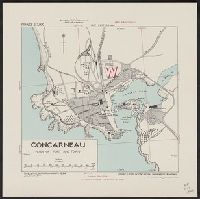
- Beinecke Rare Book and Manuscript Library > Concarneau [cartographic material] : plan of port and town / compiles & drawn by Inter-service Topographical Dept.
- Creator:
- Great Britain. War Office. General Staff. Geographical Section
- Published / Created:
- 1942
- Call Number:
- 212 C81 1942
- Container / Volume:
- BRBL_00014
- Image Count:
- 1
- Resource Type:
- Maps, Atlases & Globes
- Found in:
- Beinecke Rare Book and Manuscript Library > Corvo and Flores / compiled and drawn at War Office.
- Creator:
- United States. Army Map Service
- Published / Created:
- 1943
- Call Number:
- 4891gmb 1943
- Container / Volume:
- BRBL_00266
- Image Count:
- 1
- Resource Type:
- Maps, Atlases & Globes
- Found in:
- Beinecke Rare Book and Manuscript Library > Cyclades [cartographic material] : special strategic map / compiled by the Army Map Service.
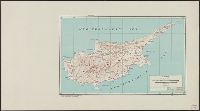
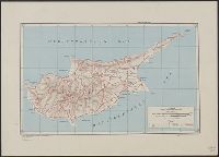
- Creator:
- United States. Army Map Service
- Published / Created:
- 1943
- Call Number:
- 509gm 1943
- Container / Volume:
- BRBL_00277
- Image Count:
- 1
- Resource Type:
- Maps, Atlases & Globes
- Found in:
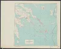
- Beinecke Rare Book and Manuscript Library > Cyprus : special strategic map -- Asia / prepared under the direction of the chief of Engineers.
- Creator:
- United States. Army Map Service
- Published / Created:
- 1947
- Call Number:
- 509gm 1947
- Container / Volume:
- BRBL_00277
- Image Count:
- 1
- Resource Type:
- Maps, Atlases & Globes
- Found in:
- Beinecke Rare Book and Manuscript Library > Cyprus [cartographic material] : special strategic map -- Asia / prepared under the direction of the chief of Engineers.
- Creator:
- Great Britain. Royal Air Force. Central Interpretation Unit
- Published / Created:
- 1944
- Call Number:
- 475 D93 1944
- Container / Volume:
- BRBL_00262
- Image Count:
- 1
- Resource Type:
- Maps, Atlases & Globes
- Found in:
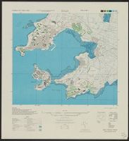
- Beinecke Rare Book and Manuscript Library > Durrës (Durazzo) City plan [cartographic material] / compiled and drawn by C.I.U.
- Creator:
- National Highways Association
- Published / Created:
- c1914.
- Call Number:
- 75gmb 1915A
- Container / Volume:
- BRBL_00411
- Image Count:
- 1
- Resource Type:
- Maps, Atlases & Globes
- Found in:
- Beinecke Rare Book and Manuscript Library > Fifty thousand miles of national highways proposed by the National Highways Association / published under direction of the National Highways Association ; John C. Mulford, cartographer.
- Creator:
- Great Britain. War Office. General Staff. Geographical Section
- Published / Created:
- 1943
- Call Number:
- 213 F68 1943
- Container / Volume:
- BRBL_00015
- Image Count:
- 1
- Resource Type:
- Maps, Atlases & Globes
- Found in:
- Beinecke Rare Book and Manuscript Library > Fogo / drawn at War Office, 1940, from a Portuguese map of 1929.
- Creator:
- United States. Army Map Service
- Published / Created:
- 1945
- Call Number:
- 575gm 1945
- Container / Volume:
- BRBL_00313
- Image Count:
- 1
- Resource Type:
- Maps, Atlases & Globes
- Found in:
- Beinecke Rare Book and Manuscript Library > Formosa : special strategic map / prepared under the direction of the Chief of Engineers, U.S. Army.
- Creator:
- United States. Office of Strategic Services. Research and Analysis Branch
- Published / Created:
- 1945
- Call Number:
- 36gme 1945
- Container / Volume:
- BRBL_00132
- Image Count:
- 1
- Resource Type:
- Maps, Atlases & Globes
- Found in:
- Beinecke Rare Book and Manuscript Library > Germany western border regions : rail traffic volume (excluding inter Ruhr traffic) summer 1939.
- Creator:
- United States. Army Map Service
- Published / Created:
- 1945
- Call Number:
- 575 G44 1945
- Container / Volume:
- BRBL_00312
- Image Count:
- 1
- Resource Type:
- Maps, Atlases & Globes
- Found in:
- Beinecke Rare Book and Manuscript Library > Giran / prepared under the direction of the Chief of Engineers by the Army Map Service.
- Creator:
- United States. Dept. of State
- Published / Created:
- 1947
- Call Number:
- 48es 1947
- Container / Volume:
- BRBL_00264
- Image Count:
- 1
- Resource Type:
- Maps, Atlases & Globes
- Found in:
- Beinecke Rare Book and Manuscript Library > Greece : Destruction of Housing.
- Published / Created:
- 1947
- Call Number:
- 48gme 1947
- Container / Volume:
- BRBL_00265
- Image Count:
- 1
- Resource Type:
- Maps, Atlases & Globes
- Found in:
- Beinecke Rare Book and Manuscript Library > Greece : Projected railway network.
- Creator:
- British Columbia. Dept. of Lands and Forests
- Published / Created:
- 1947
- Call Number:
- 739 G86 1947
- Container / Volume:
- BRBL_00389
- Image Count:
- 1
- Resource Type:
- Maps, Atlases & Globes
- Found in:
- Beinecke Rare Book and Manuscript Library > Grenville Channel. Preliminary map. 1924. AMS 2.
- Creator:
- United States. Army Map Service
- Published / Created:
- 1945
- Call Number:
- 575 H36 1945
- Container / Volume:
- BRBL_00312
- Image Count:
- 1
- Resource Type:
- Maps, Atlases & Globes
- Found in:
- Beinecke Rare Book and Manuscript Library > Heito / prepared under the direction of the Chief of Engineers by the Army Map Service.
- Creator:
- United States. Army Map Service
- Published / Created:
- 1945
- Call Number:
- 575 H68 1945
- Container / Volume:
- BRBL_00312
- Image Count:
- 1
- Resource Type:
- Maps, Atlases & Globes
- Found in:
- Beinecke Rare Book and Manuscript Library > Hokko / prepared under the direction of the Chief of Engineers by the Army Map Service.
- Creator:
- United States. Army Map Service
- Published / Created:
- 1945
- Call Number:
- 575 H85 1945
- Container / Volume:
- BRBL_00312
- Image Count:
- 1
- Resource Type:
- Maps, Atlases & Globes
- Found in:
- Beinecke Rare Book and Manuscript Library > Hozan / prepared under the direction of the Chief of Engineers by the Army Map Service.
- Creator:
- Great Britain. War Office. General Staff. Geographical Section
- Published / Created:
- 1943
- Call Number:
- 3969 Ib4 1943
- Container / Volume:
- BRBL_00194
- Image Count:
- 1
- Resource Type:
- Maps, Atlases & Globes
- Found in:
- Beinecke Rare Book and Manuscript Library > Ibiza & Formentera [cartographic material].
- Creator:
- United States. Army Map Service
- Published / Created:
- 1945
- Call Number:
- 58gm 1945
- Container / Volume:
- BRBL_00313
- Image Count:
- 1
- Resource Type:
- Maps, Atlases & Globes
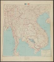
- Found in:
- Beinecke Rare Book and Manuscript Library > Indochina and Thailand : special strategic map / prepared under the direction of the Chief of Engineers, U.S. Army.
- Creator:
- United States. Bureau of the Census
- Published / Created:
- 1934
- Call Number:
- 815fb 1930
- Container / Volume:
- BRBL_00561
- Image Count:
- 1
- Resource Type:
- Maps, Atlases & Globes
- Found in:
- Beinecke Rare Book and Manuscript Library > Iowa, minor civil divisions : 1930 / Bureau of the Census.
- Creator:
- United States. Department of State. Division of Map Intelligence and Cartography
- Published / Created:
- [1946]
- Call Number:
- 57144 1946
- Container / Volume:
- BRBL_00309
- Image Count:
- 1
- Resource Type:
- Maps, Atlases & Globes
- Found in:
- Beinecke Rare Book and Manuscript Library > Japan : Okayama-ken.
- Creator:
- United States. Army Map Service
- Published / Created:
- 1945
- Call Number:
- 575 K11 1945
- Container / Volume:
- BRBL_00312
- Image Count:
- 1
- Resource Type:
- Maps, Atlases & Globes
- Found in:
- Beinecke Rare Book and Manuscript Library > Kagi / prepared under the direction of the Chief of Engineers by the Army Map Service.
- Creator:
- United States. Army Map Service
- Published / Created:
- 1945
- Call Number:
- 575 K14 1945
- Container / Volume:
- BRBL_00312
- Image Count:
- 1
- Resource Type:
- Maps, Atlases & Globes
- Found in:
- Beinecke Rare Book and Manuscript Library > Karenko / prepared under the direction of the Chief of Engineers by the Army Map Service.
- Creator:
- United States. Army Map Service
- Published / Created:
- [1945]
- Call Number:
- 574gm 1945
- Container / Volume:
- BRBL_00311
- Image Count:
- 1
- Resource Type:
- Maps, Atlases & Globes
- Found in:
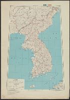
- Beinecke Rare Book and Manuscript Library > Korea : special strategic map.
- Creator:
- United States. Army Map Service
- Published / Created:
- 1943
- Call Number:
- 506gm 1943
- Container / Volume:
- BRBL_00276
- Image Count:
- 1
- Resource Type:
- Maps, Atlases & Globes
- Found in:
- Beinecke Rare Book and Manuscript Library > Levant states, special strategic map / compiled by the Army Map Service, May 1943.
- Creator:
- Great Britain. War Office. General Staff. Geographical Section
- Published / Created:
- 1943
- Call Number:
- 213 M28 1943
- Container / Volume:
- BRBL_00015
- Image Count:
- 1
- Resource Type:
- Maps, Atlases & Globes
- Found in:
- Beinecke Rare Book and Manuscript Library > Maio / drawn at War Office, 1940, from a Portuguese map of 1928.
- Creator:
- United States. Army Map Service
- Published / Created:
- 1945
- Call Number:
- 575 M28 1945
- Container / Volume:
- BRBL_00312
- Image Count:
- 1
- Resource Type:
- Maps, Atlases & Globes
- Found in:
- Beinecke Rare Book and Manuscript Library > Mako / prepared under the direction of the Chief of Engineers by the Army Map Service.
- Creator:
- United States. Army. Corps of Engineers
- Published / Created:
- 1943
- Call Number:
- 40 M31 1943
- Container / Volume:
- BRBL_00209
- Image Count:
- 1
- Resource Type:
- Maps, Atlases & Globes
- Found in:
- Beinecke Rare Book and Manuscript Library > Manfredonia [cartographic material] : city plan / Prepared under the direction of the chief of engineers, U. S. Army.
- Creator:
- Essex, Frank B
- Published / Created:
- 1911
- Call Number:
- 855 1911A
- Container / Volume:
- BRBL_00641
- Image Count:
- 1
- Resource Type:
- Maps, Atlases & Globes
- Found in:
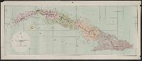
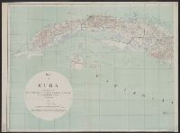
- Beinecke Rare Book and Manuscript Library > Map of Cuba / prepared in the War College Division, General Staff War Department ; drawn by Frank B. Essex & A.B. Williams.
- Creator:
- Essex, Frank B
- Published / Created:
- 1911
- Call Number:
- 855 1911
- Container / Volume:
- BRBL_00641
- Image Count:
- 2
- Resource Type:
- Maps, Atlases & Globes
- Found in:
- Beinecke Rare Book and Manuscript Library > Map of Cuba / prepared in the War College Division, General Staff War Department ; drawn by Frank B. Essex & A.B. Williams.
- Creator:
- Matthews-Northrup Company
National Geographic Society (U.S.)
- Published / Created:
- 1920
- Call Number:
- 30 1920A
- Container / Volume:
- BRBL_00032A
- Image Count:
- 1
- Resource Type:
- Maps, Atlases & Globes
- Found in:
- Beinecke Rare Book and Manuscript Library > Map of Europe showing countries as established by the Peace Conference at Paris / prepared especially for the National Geographic magazine by the Matthews-Northrup Works.
- Creator:
- United States. War Dept. General Staff. War College Division
- Published / Created:
- 1916
- Call Number:
- 658 1916
- Container / Volume:
- BRBL_00346
- Image Count:
- 1
- Resource Type:
- Maps, Atlases & Globes
- Found in:
- Beinecke Rare Book and Manuscript Library > Map of Liberia / prepared in the War College Division, General Staff ; W.J. Jacobi, draftsman.
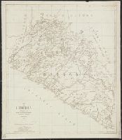
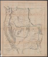
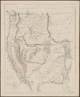
- Creator:
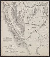
- Frémont, John Charles, 1813-1890
- Published / Created:
- 1848
- Call Number:
- 80 1848A
- Container / Volume:
- BRBL_00533
- Image Count:
- 1
- Resource Type:
- Maps, Atlases & Globes
- Found in:
- Beinecke Rare Book and Manuscript Library > Map of Oregon and upper California from the surveys of John Charles Frémont and other authorities / drawn by Charles Preuss under the order of the Senate of the United States ; lithy. by E. Weber & Co., Balto.
- Creator:
- Frémont, John Charles, 1813-1890
- Published / Created:
- 1848
- Call Number:
- 80 1848A
- Container / Volume:
- BRBL_00533
- Image Count:
- 1
- Resource Type:
- Maps, Atlases & Globes
- Found in:
- Beinecke Rare Book and Manuscript Library > Map of Oregon and upper California from the surveys of John Charles Frémont and other authorities / drawn by Charles Preuss under the order of the Senate of the United States ; lithy. by E. Weber & Co., Balto.
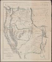
- Creator:
- Frémont, John Charles, 1813-1890
- Published / Created:
- 1848
- Call Number:
- 80 1848D
- Container / Volume:
- BRBL_00533
- Image Count:
- 1
- Resource Type:
- Maps, Atlases & Globes
- Found in:
- Beinecke Rare Book and Manuscript Library > Map of Oregon and upper California, from the surveys of John Charles Frémont and other authorities / drawn by Charles Preuss under the order of the Senate of the United States ; lithy. by E. Weber & Co., Balto.
- Creator:
- United States. Adjutant-General's Office. Military Information Division
- Published / Created:
- 1900
- Call Number:
- 56 1900
- Container / Volume:
- BRBL_00296
- Image Count:
- 1
- Resource Type:
- Maps, Atlases & Globes
- Found in:
- Beinecke Rare Book and Manuscript Library > Map of north eastern China / prepared in the War Department, Adjutant General's Office, Military Information Division.
- Creator:
- Bumstead, Albert H. (Albert Hoit), 1875-1940
National Geographic Society (U.S.). Cartographic Division
- Published / Created:
- 1918
- Call Number:
- 30 1918B
- Container / Volume:
- BRBL_00032A
- Image Count:
- 1
- Resource Type:
- Maps, Atlases & Globes
- Found in:
- Beinecke Rare Book and Manuscript Library > Map of the Western Theatre of War / Prepared in the Map Dept. of the National Geographic Society for the National Geographic Magazine ; A. H. Bumstead, cartographer.
- Creator:
- Bumstead, Albert H. (Albert Hoit), 1875-1940
National Geographic Society (U.S.). Cartographic Division
- Published / Created:
- 1918
- Call Number:
- 11hc 1918C
- Container / Volume:
- BRBL_00010E
- Image Count:
- 1
- Resource Type:
- Maps, Atlases & Globes
- Found in:
- Beinecke Rare Book and Manuscript Library > Map of the Western Theatre of War / Prepared in the Map Dept. of the National Geographic Society for the National Geographic Magazine ; A. H. Bumstead, cartographer.
- Published / Created:
- [1815?]
- Call Number:
- 806 1815
- Container / Volume:
- BRBL_00547
- Image Count:
- 1
- Resource Type:
- Maps, Atlases & Globes
- Found in:
- Beinecke Rare Book and Manuscript Library > Map of the abounty Lands in Illinois Territory by John Gardiner.
- Published / Created:
- [1850?]
- Call Number:
- 779 W27 1795
- Container / Volume:
- BRBL_00505
- Image Count:
- 1
- Resource Type:
- Maps, Atlases & Globes
- Found in:
- Beinecke Rare Book and Manuscript Library > Map of the city of Washington in the district of Columbia established as the permanent seat of the government of the United States of America.
- Published / Created:
- 1838
- Call Number:
- 766cea SA99 1838
- Container / Volume:
- BRBL_00475
- Image Count:
- 1
- Resource Type:
- Maps, Atlases & Globes
- Found in:
- Beinecke Rare Book and Manuscript Library > Map of the mouth of the Connecticut River and Saybrook Harbour.
- Published / Created:
- 1838
- Call Number:
- 792hc 1838
- Container / Volume:
- BRBL_00520
- Image Count:
- 1
- Resource Type:
- Maps, Atlases & Globes
- Found in:
- Beinecke Rare Book and Manuscript Library > Map of the seat of war of Florida. Compiled by order of the Honble. Joel R. Poinsett ... under the direction of Col. J.J. Abert ... by Wash: Hood.
- Creator:
- Hergesheimer, E. (Edwin)
- Published / Created:
- 1861
- Call Number:
- 754EG 1861
- Container / Volume:
- BRBL_00419
- Image Count:
- 1
- Resource Type:
- Maps, Atlases & Globes
- Found in:
- Beinecke Rare Book and Manuscript Library > Map showing the distribution of the slave population of the southern states of the United States, compiled from the census of 1860 / drawn by E. Hergesheimer ; engr. by Th. Leonhardt.
- Creator:
- Great Britain. War Office. General Staff. Geographical Section
- Published / Created:
- 1943
- Call Number:
- 3969 M52 1943
- Container / Volume:
- BRBL_00194
- Image Count:
- 1
- Resource Type:
- Maps, Atlases & Globes
- Found in:
- Beinecke Rare Book and Manuscript Library > Menorca [cartographic material].
- Creator:
- United States. Army. Corps of Engineers
- Published / Created:
- 1943
- Call Number:
- 40 M75 1943
- Container / Volume:
- BRBL_00211
- Image Count:
- 1
- Resource Type:
- Maps, Atlases & Globes
- Found in:
- Beinecke Rare Book and Manuscript Library > Monopoli; city plan [cartographic material] / Prepared under the direction of the chief of engineers, U.S. Army.
- Creator:
- United States. Dept. of the Army. General Staff. Military Intelligence Division
- Published / Created:
- 1919
- Call Number:
- 352gm 1911
- Container / Volume:
- BRBL_00110
- Image Count:
- 1
- Resource Type:
- Maps, Atlases & Globes
- Found in:
- Beinecke Rare Book and Manuscript Library > Movement of merchandise in 1911 on the railways and navigable waterways of Russia.
- Creator:
- Great Britain. War Office. General Staff. Geographical Section
- Published / Created:
- 1945
- Call Number:
- 56 N15 1945
- Container / Volume:
- BRBL_00297
- Image Count:
- 1
- Resource Type:
- Maps, Atlases & Globes
- Found in:
- Beinecke Rare Book and Manuscript Library > Nanking [cartographic material].
- Creator:
- United States. Army Map Service
- Published / Created:
- 1943
- Call Number:
- 72 1943
- Container / Volume:
- BRBL_00372
- Image Count:
- 4
- Resource Type:
- Maps, Atlases & Globes
- Found in:
- Beinecke Rare Book and Manuscript Library > Newfoundland 1:500,000 ...
- Published / Created:
- 1887
- Call Number:
- 779 W27 1791
- Container / Volume:
- BRBL_00505
- Image Count:
- 1
- Resource Type:
- Maps, Atlases & Globes
- Found in:
- Beinecke Rare Book and Manuscript Library > Plan of the City intended for the Permanent Seat of the Government of t[he] United States projected agreable to the direction of the President of the United States in pursuance of an Act of Congress passed the sixteenth Seat on the MDCCXC, "establishing t
- Published / Created:
- 1943
- Call Number:
- 46fa 1943
- Container / Volume:
- BRBL_00260
- Image Count:
- 1
- Resource Type:
- Maps, Atlases & Globes
- Found in:
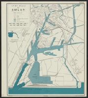
- Beinecke Rare Book and Manuscript Library > Political Partitioning of Yugoslavia : Latest sources available up to July 15, 1942.
- Creator:
- United States. Office of Strategic Services. Research and Analysis Branch
- Published / Created:
- 1944
- Call Number:
- 36 Em27 1944
- Container / Volume:
- BRBL_00123
- Image Count:
- 2
- Resource Type:
- Maps, Atlases & Globes
- Found in:
- Beinecke Rare Book and Manuscript Library > Port plan of Emden.
- Creator:
- United States. Army. Corps of Engineers
- Published / Created:
- 1943
- Call Number:
- 40 P879 1943
- Container / Volume:
- BRBL_00215
- Image Count:
- 1
- Resource Type:
- Maps, Atlases & Globes
- Found in:
- Beinecke Rare Book and Manuscript Library > Pozzuoli [cartographic material] : city plan / prepared under the direction of the chief of engineers, U. S. Army.
- Published / Created:
- [1857?]
- Call Number:
- 761cea K37 1857
- Container / Volume:
- BRBL_00449
- Image Count:
- 1
- Resource Type:
- Maps, Atlases & Globes
- Found in:
- Beinecke Rare Book and Manuscript Library > Preliminary chart of the month of Kennebec River ... A.D. Bache ... 1857.
- Creator:
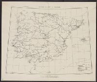
- Great Britain. War Office. General Staff. Geographical Section
- Published / Created:
- 1943
- Call Number:
- 39gme 1943
- Container / Volume:
- BRBL_00192
- Image Count:
- 1
- Resource Type:
- Maps, Atlases & Globes
- Found in:
- Beinecke Rare Book and Manuscript Library > Railways in Spain and Portugal [cartographic material].
- Creator:
- United States. Army Map Service
- Published / Created:
- 1944
- Call Number:
- 575 R18 1944
- Container / Volume:
- BRBL_00312
- Image Count:
- 1
- Resource Type:
- Maps, Atlases & Globes
- Found in:
- Beinecke Rare Book and Manuscript Library > Rato / prepared under the direction of the Chief of Engineers by the Army Map Service.
- Creator:
- Frémont, John Charles, 1813-1890, author.
- Published / Created:
- 1845.
- Call Number:
- 80 1844A
- Image Count:
- 1
- Resource Type:
- Maps, Atlases & Globes
- Found in:
- Beinecke Rare Book and Manuscript Library > Report of the exploring expedition to the Rocky Mountains in the year 1842, and to Oregon and north California in the years 1843-'44 / By Brevet Captain J. C. Frémont, of the topographical engineers under the orders of Col. J. J. Abert, Chief of the Topographical Bureau ; printed by order of the Senate of the United States.
- Published / Created:
- 1945
- Call Number:
- 48gmb 1945
- Container / Volume:
- BRBL_00265
- Image Count:
- 2
- Resource Type:
- Maps, Atlases & Globes
- Found in:
- Beinecke Rare Book and Manuscript Library > Road Communications in Greece Main routes only shown.
- Creator:
- United States. Army Map Service
- Published / Created:
- 1943
- Call Number:
- 4892gmb R346 1945
- Container / Volume:
- BRBL_00266
- Image Count:
- 1
- Resource Type:
- Maps, Atlases & Globes
- Found in:
- Beinecke Rare Book and Manuscript Library > Rodi (Rhodes) special strategic map / compiled by the Army Map Service.
- Creator:
- United States. Army Map Service
- Published / Created:
- 1944
- Call Number:
- 575 R63 1944
- Container / Volume:
- BRBL_00312
- Image Count:
- 1
- Resource Type:
- Maps, Atlases & Globes
- Found in:
- Beinecke Rare Book and Manuscript Library > Rokko / prepared under the direction of the Chief of Engineers by the Army Map Service.
- Creator:
- United States. Army Map Service
- Published / Created:
- [1945?]
- Call Number:
- 5463gm 1945
- Container / Volume:
- BRBL_00290
- Image Count:
- 1
- Resource Type:
- Maps, Atlases & Globes
- Found in:
- Beinecke Rare Book and Manuscript Library > Russian maritime provinces [cartographic material] : special strategic map / prepared under the direction of the Chief of Engineers, U.S. Army.
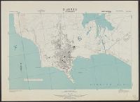
- Creator:
- Great Britain. War Office. General Staff. Geographical Section
- Published / Created:
- 1943
- Call Number:
- 213 Sa61 1943
- Container / Volume:
- BRBL_00015
- Image Count:
- 1
- Resource Type:
- Maps, Atlases & Globes
- Found in:
- Beinecke Rare Book and Manuscript Library > S. Nicolau / drawn at War Office, 1940, from a Portuguese map of 1929.
- Creator:
- Great Britain. War Office. General Staff. Geographical Section
United States. Army Map Service
- Published / Created:
- 1943
- Call Number:
- 213 Sa611 1943
- Image Count:
- 1
- Resource Type:
- Maps, Atlases & Globes
- Found in:
- Beinecke Rare Book and Manuscript Library > S. Tiago / drawn at War Office, 1940, from a Portuguese map of 1932
- Creator:
- Great Britain. War Office. General Staff. Geographical Section
- Published / Created:
- 1943
- Call Number:
- 213 Sa62 1943
- Image Count:
- 1
- Resource Type:
- Maps, Atlases & Globes
- Found in:
- Beinecke Rare Book and Manuscript Library > S. Vicente : drawn at War Office, 1940, from a Portuguese map of 1932.
- Creator:
- Great Britain. War Office. General Staff. Geographical Section
- Published / Created:
- 1943
- Call Number:
- 213 Sa31 1943
- Container / Volume:
- BRBL_00015
- Image Count:
- 1
- Resource Type:
- Maps, Atlases & Globes
- Found in:
- Beinecke Rare Book and Manuscript Library > Sal / crawn at War Office, 1940, from a Portuguese map of 1930.
- Creator:
- Great Britain. War Office. General Staff. Geographical Section
- Published / Created:
- 1943-44.
- Call Number:
- 212 Sa58 1944
- Container / Volume:
- BRBL_00014
- Image Count:
- 1
- Resource Type:
- Maps, Atlases & Globes
- Found in:
- Beinecke Rare Book and Manuscript Library > San Miguel island / drawn by the War Office.
- Creator:
- Great Britain. War Office. General Staff. Geographical Section
- Published / Created:
- 1942
- Call Number:
- 212 Sa59 1942
- Container / Volume:
- BRBL_00014
- Image Count:
- 1
- Resource Type:
- Maps, Atlases & Globes
- Found in:
- Beinecke Rare Book and Manuscript Library > Santa Maria / drawn at the War Office, 1940.