Skip to search
Skip to main content
Skip to first result
Search
You Searched For
Extent of Digitization
Completely digitized
Resource Type
Maps, Atlases & Globes
New Search
Search Results
Creator:
Published / Created:
1917
Call Number:
741 1917
Container / Volume:
BRBL_00395
Image Count:
1
Resource Type:
Maps, Atlases & Globes
Found in:
Beinecke Rare Book and Manuscript Library > Map of the Yukon Territory / Department of the Interior, Canada ; J.E. Chalifour, chief geographer.
Creator:
Published / Created:
1936
Call Number:
741 1936
Container / Volume:
BRBL_00395
Image Count:
1
Resource Type:
Maps, Atlases & Globes
Found in:
Beinecke Rare Book and Manuscript Library > Yukon Territory : south of latitude 65° / prepared and printed at the Office of the Surveyor General.
Creator:
Published / Created:
1784
Call Number:
75 1784
Container / Volume:
BRBL_00396
Image Count:
1
Resource Type:
Maps, Atlases & Globes
Found in:
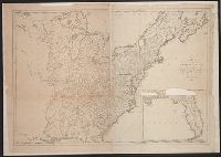
Beinecke Rare Book and Manuscript Library > Carte des Etats-Unis de l'Amerique suivant le Traité de Paix de 1783 : dédiée et présentée a s. excellence Mr. Benjamin Franklin... / par son très humble et très obeissant Serviteur Lattré.
Creator:
Published / Created:
[1886]
Call Number:
739GBC C19 1886F
Container / Volume:
BRBL_00392
Image Count:
1
Resource Type:
Maps, Atlases & Globes
Found in:
Beinecke Rare Book and Manuscript Library > Map of placer mines & quartz veins in the vicinity of Lightning Creek / by Amos Bowman, mining engineer ; drawn by James McEvoy ; drawn for photolithography by L.N. Richard and Is. Marion.
Creator:
Published / Created:
1925
Call Number:
743 L79 1925
Container / Volume:
BRBL_00395
Image Count:
1
Resource Type:
Maps, Atlases & Globes
Found in:
Beinecke Rare Book and Manuscript Library > Map of Lockhart River Basin, Great Slave Lake District, Northwest Territories : including the head waters of Thelon, Back and Coppermine Rivers / compiled, drawn and printed at the Topographical Survey of Canada.
Creator:
Published / Created:
1784
Call Number:
75 1784J
Container / Volume:
BRBL_00396
Image Count:
1
Resource Type:
Maps, Atlases & Globes
Found in:
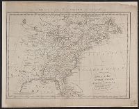
Beinecke Rare Book and Manuscript Library > Carte des Etats-Unis d'Amérique, et du cours du Mississippi; rédigée d'après différentes cartes et relations anglaises et les opérations de la derniere guerre; avec les nouvelles limites générales fixées par les articles préliminaires de paix, s
Creator:
Published / Created:
[1886?]
Call Number:
739GBC C19 1886G
Container / Volume:
BRBL_00392
Image Count:
1
Resource Type:
Maps, Atlases & Globes
Found in:
Beinecke Rare Book and Manuscript Library > Quartz veins & placer mines of Little Snowshoe and Keithley Creeks, Cariboo District, British Columbia / surveyed and drawn by Amos Bowman, mining engineer, assisted by James McEvoy.
Creator:
Published / Created:
1929
Call Number:
741 1929
Container / Volume:
BRBL_00395
Image Count:
1
Resource Type:
Maps, Atlases & Globes
Found in:
Beinecke Rare Book and Manuscript Library > Yukon Territory.
Creator:
Published / Created:
1933
Call Number:
744 B41 1933
Container / Volume:
BRBL_00395
Image Count:
1
Resource Type:
Maps, Atlases & Globes
Found in:
Beinecke Rare Book and Manuscript Library > Belcher Islands, Northwest Territories [map] / compiled, drawn and printed ... by the Topographical Survey of Canada.
Published / Created:
1795
Call Number:
75 1795
Container / Volume:
BRBL_00396
Image Count:
1
Resource Type:
Maps, Atlases & Globes
Found in:
Beinecke Rare Book and Manuscript Library > A map of the United States; Compiled chiefly from the State maps, and other authentic information, by Saml. Lewis. W. Harrison Jun. Sculp.
Published / Created:
[1812?]
Call Number:
75 1812B
Container / Volume:
BRBL_00396
Image Count:
1
Resource Type:
Maps, Atlases & Globes
Found in:
Beinecke Rare Book and Manuscript Library > Etats Unis et Grandes Antilles. Gravé par Chamouin Rue de la Harpe. No. 35. Ecrit par Giraldon.
Published / Created:
1795
Call Number:
75 1795
Container / Volume:
BRBL_00396
Image Count:
1
Resource Type:
Maps, Atlases & Globes
Found in:
Beinecke Rare Book and Manuscript Library > A map of the United States; Compiled chiefly from the State maps, and other authentic information, by Saml. Lewis. W. Harrison Jun. Sculp.
Creator:
Published / Created:
[1818?]
Call Number:
75 1818A
Container / Volume:
BRBL_00397
Image Count:
1
Resource Type:
Maps, Atlases & Globes
Found in:
Beinecke Rare Book and Manuscript Library > United States of America : drawn & engraved for Wardens Statistical Account, etc. / by W. & D. Lizars, Edinburgh.
Published / Created:
1810?]
Call Number:
75 1810A
Container / Volume:
BRBL_00396
Image Count:
1
Resource Type:
Maps, Atlases & Globes
Found in:
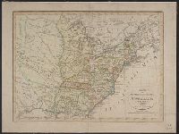
Beinecke Rare Book and Manuscript Library > A correct map of the United States of North America. Including the British and Spanish territories carefully laid down agreeable to the treaty of 1784. By T. Bowen, Geogr.
Creator:
Published / Created:
1905
Call Number:
741GBC 1905
Container / Volume:
BRBL_00395
Image Count:
1
Resource Type:
Maps, Atlases & Globes
Found in:
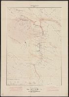
Beinecke Rare Book and Manuscript Library > Map of the Yukon Territory to illustrate the summary report of R.G. McConnell, Jos. Keele, and C. Camsell / compiled by J. Keele from the surveys made by officers of the Geological Survey of Canada, the Department of the Interior, the U.S. Geological Surv
Published / Created:
1809
Call Number:
75 1809
Container / Volume:
BRBL_00396
Image Count:
1
Resource Type:
Maps, Atlases & Globes
Found in:
Beinecke Rare Book and Manuscript Library > Charte von den Vereinigten Staaten von Nord America mit Luisiana.
Published / Created:
1796
Call Number:
75 1796A
Container / Volume:
BRBL_00396
Image Count:
1
Resource Type:
Maps, Atlases & Globes
Found in:
Beinecke Rare Book and Manuscript Library > A Geographical View of all the Post Towns in the United States of America and their distances from each other according to the establishment of the Postmaster General, 1796. By Samuel A. Puddock, Accomptant, Boston. B. Callender, Sculp., Boston.
Creator:
Published / Created:
1936
Call Number:
743 C14 1936
Container / Volume:
BRBL_00395
Image Count:
1
Resource Type:
Maps, Atlases & Globes
Found in:
Beinecke Rare Book and Manuscript Library > Cameron Bay, Northwest Territories [map] / compiled, drawn and printed ... by the Topographical Survey of Canada.
Published / Created:
1795
Call Number:
75 1795
Container / Volume:
BRBL_00396
Image Count:
1
Resource Type:
Maps, Atlases & Globes
Found in:
Beinecke Rare Book and Manuscript Library > A map of the United States; Compiled chiefly from the State maps, and other authentic information, by Saml. Lewis. W. Harrison Jun. Sculp.
Published / Created:
1818
Call Number:
75 1818
Container / Volume:
BRBL_00397
Image Count:
1
Resource Type:
Maps, Atlases & Globes
Found in:
Beinecke Rare Book and Manuscript Library > United States of America, compiled from the latest & best authorities. John Melish.
Published / Created:
1911]
Call Number:
743 1911
Container / Volume:
BRBL_00395
Image Count:
1
Resource Type:
Maps, Atlases & Globes
Found in:
Beinecke Rare Book and Manuscript Library > Yukon and Mackenzie, 1911.
Creator:
Published / Created:
[1851?]
Call Number:
74cea 1851
Container / Volume:
BRBL_00394
Image Count:
1
Resource Type:
Maps, Atlases & Globes
Found in:
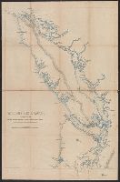
Beinecke Rare Book and Manuscript Library > A chart illustrative of the cruise of the American Arctic expedition in search of Sir John Franklin, in the years 1850 & 1851.
Published / Created:
[1800?]
Call Number:
75 1800
Container / Volume:
BRBL_00396
Image Count:
1
Resource Type:
Maps, Atlases & Globes
Found in:
Beinecke Rare Book and Manuscript Library > United States of America.
Published / Created:
1795
Call Number:
75 1795
Container / Volume:
BRBL_00396
Image Count:
1
Resource Type:
Maps, Atlases & Globes
Found in:
Beinecke Rare Book and Manuscript Library > A map of the United States; Compiled chiefly from the State maps, and other authentic information, by Saml. Lewis. W. Harrison Jun. Sculp.
Published / Created:
1818
Call Number:
75 1818
Container / Volume:
BRBL_00397
Image Count:
1
Resource Type:
Maps, Atlases & Globes
Found in:
Beinecke Rare Book and Manuscript Library > United States of America, compiled from the latest & best authorities. John Melish.
Published / Created:
1909
Call Number:
739gme 1909
Container / Volume:
BRBL_00393
Image Count:
1
Resource Type:
Maps, Atlases & Globes
Found in:
Beinecke Rare Book and Manuscript Library > British Columbia [Railroads].
Creator:
Published / Created:
1929
Call Number:
7391 1929
Container / Volume:
BRBL_00394
Image Count:
1
Resource Type:
Maps, Atlases & Globes
Found in:
Beinecke Rare Book and Manuscript Library > Northerly portion, Vancouver Island / G.G. Aitken, chief geographer.
Published / Created:
[1819?]
Call Number:
75 1819S
Container / Volume:
BRBL_00397
Image Count:
1
Resource Type:
Maps, Atlases & Globes
Found in:
Beinecke Rare Book and Manuscript Library > United States of America. Engraved by J. Warr, Jr.
Creator:
Published / Created:
1898].
Call Number:
739G C19 1898
Container / Volume:
BRBL_00392
Image Count:
1
Resource Type:
Maps, Atlases & Globes
Found in:
Beinecke Rare Book and Manuscript Library > Map of central district of Cariboo / [cartographic material] compiled and prepared, and published under the authority of the provincial government, Victoria, B. C., C. A. Semlin, Chief Commissioner of Lands and Works, by the Province Publishing Company, L
Creator:
Published / Created:
[1909]
Call Number:
739CBF B386 1909
Container / Volume:
BRBL_00391
Image Count:
1
Resource Type:
Maps, Atlases & Globes
Found in:
Beinecke Rare Book and Manuscript Library > Sketch map of part of the railway belt, British Columbia : showing main topographical features in the districts drained by the Blaeberry River, Bush River, Gold Creek and their confluents. Also the Continental Divide northwest from Mt. Freshfield.
Creator:
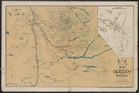
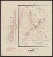
Published / Created:
[1886?]
Call Number:
739GBC C19 1886C
Container / Volume:
BRBL_00392
Image Count:
1
Resource Type:
Maps, Atlases & Globes
Found in:
Beinecke Rare Book and Manuscript Library > Quartz veins & placer diggings in the vicinity of Grouse Creek, Cariboo District, British Columbia / surveyed and drawn by Amos Bowman, mining engineer, assisted by James McEvoy.
Creator:
Published / Created:
1923
Call Number:
739G 1923A
Container / Volume:
BRBL_00392
Image Count:
1
Resource Type:
Maps, Atlases & Globes
Found in:
Beinecke Rare Book and Manuscript Library > British Columbia / Department of Lands, G.G. Aitken, chief geographer.
Published / Created:
1919
Call Number:
739FCM 1919
Container / Volume:
BRBL_00391
Image Count:
1
Resource Type:
Maps, Atlases & Globes
Found in:
Beinecke Rare Book and Manuscript Library > Sketch map, British Columbia. Great natural divisions.
Creator:
Published / Created:
c1933.
Call Number:
739G 1933
Container / Volume:
BRBL_00392
Image Count:
1
Resource Type:
Maps, Atlases & Globes
Found in:
Beinecke Rare Book and Manuscript Library > Northern British Columbia.
Creator:
Published / Created:
1905
Call Number:
741 K71 1905
Container / Volume:
BRBL_00395
Image Count:
1
Resource Type:
Maps, Atlases & Globes
Found in:
Beinecke Rare Book and Manuscript Library > Yukon Territory, Kluane, White, and Alsek rivers / James White, F.R.G.S. Geographer ; Department of the Interior.
Creator:
Published / Created:
1939
Call Number:
74 1939
Container / Volume:
BRBL_00394
Image Count:
1
Resource Type:
Maps, Atlases & Globes
Found in:
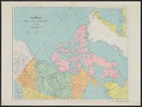
Beinecke Rare Book and Manuscript Library > Northwest Territories and Yukon / compiled, drawn and printed at the Hydrographic and Map Service.
Published / Created:
[1843?]
Call Number:
7391 1843
Container / Volume:
BRBL_00394
Image Count:
1
Resource Type:
Maps, Atlases & Globes
Found in:
Beinecke Rare Book and Manuscript Library > Vancouver's Island.
Creator:
Published / Created:
1899
Call Number:
739GBC SH93 1898
Container / Volume:
BRBL_00393
Image Count:
1
Resource Type:
Maps, Atlases & Globes
Found in:
Beinecke Rare Book and Manuscript Library > British Columbia, Shuswap sheet : economic minerals and glacial striae / by George M. Dawson, assisted by James McEvoy, 1898 ; compiled and drawn by James McEvoy.
Creator:
Published / Created:
[1886?]
Call Number:
739GBC C19 1886D
Container / Volume:
BRBL_00392
Image Count:
1
Resource Type:
Maps, Atlases & Globes
Found in:
Beinecke Rare Book and Manuscript Library > Placer mines of Harvey Creek in Cariboo District, British Columbia / surveyed and drawn by Amos Bowman, mining engineer, assisted by James McEvoy.
Creator:
Published / Created:
1920
Call Number:
7391 1920
Container / Volume:
BRBL_00394
Image Count:
1
Resource Type:
Maps, Atlases & Globes
Found in:
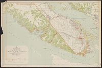
Beinecke Rare Book and Manuscript Library > Southerly portion Vancouver Island / British Columbia, Department of Lands.
Creator:
Published / Created:
1855]
Call Number:
74 1855
Container / Volume:
BRBL_00394
Image Count:
1
Resource Type:
Maps, Atlases & Globes
Found in:
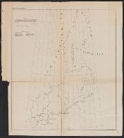
Beinecke Rare Book and Manuscript Library > Chart exhibiting the discoveries of the Second-American-Grinnell-Expedition in search of Sir John Franklin : unrevised from the original material and projected on the spot / E. K. Kent.
Creator:
Published / Created:
[1886?]
Call Number:
739GBC C19 1886A
Container / Volume:
BRBL_00392
Image Count:
1
Resource Type:
Maps, Atlases & Globes
Found in:
Beinecke Rare Book and Manuscript Library > Placer mines of Antler Creek in Cariboo District, B.C. / surveyed and drawn by Amos Bowman, mining engineer, assisted by James McEvoy.
Creator:
Published / Created:
[1886?]
Call Number:
739GBC C19 1886B
Container / Volume:
BRBL_00392
Image Count:
1
Resource Type:
Maps, Atlases & Globes
Found in:
Beinecke Rare Book and Manuscript Library > Placer mines of Cunningham Creek / surveyed and drawn by Amos Bowman, mining engineer, assisted by James McEvoy.
Published / Created:
[1886?]
Call Number:
739GBC C19 1886E
Container / Volume:
BRBL_00392
Image Count:
1
Resource Type:
Maps, Atlases & Globes
Found in:
Beinecke Rare Book and Manuscript Library > Section along Harvey Ck. : Showing explorations of Deep Channel.
Creator:
Published / Created:
1924
Call Number:
739G 1924
Container / Volume:
BRBL_00392
Image Count:
1
Resource Type:
Maps, Atlases & Globes
Found in:
Beinecke Rare Book and Manuscript Library > Southern British Columbia : showing disposition of lands within the railway belt / Department of the Interior, Canada.
Creator:
Published / Created:
1905
Call Number:
739GFC At61 1905
Container / Volume:
BRBL_00393
Image Count:
1
Resource Type:
Maps, Atlases & Globes
Found in:
Beinecke Rare Book and Manuscript Library > Map of Atlin mining district : compiled from the latest surveys / by Brownlee & Lowry, Civil Engineers ; drawn by E.A. Robinson.
Published / Created:
1942
Call Number:
741GMP W33 1942
Container / Volume:
BRBL_00395
Image Count:
1
Resource Type:
Maps, Atlases & Globes
Found in:
Beinecke Rare Book and Manuscript Library > Watson Lake.
Creator:
Published / Created:
1929
Call Number:
739FCM 1929
Container / Volume:
BRBL_00391
Image Count:
1
Resource Type:
Maps, Atlases & Globes
Found in:
Beinecke Rare Book and Manuscript Library > Pre-emptor's map, Prince Rupert sheet.
Published / Created:
c1897.
Call Number:
741 1897
Container / Volume:
BRBL_00395
Image Count:
1
Resource Type:
Maps, Atlases & Globes
Found in:
Beinecke Rare Book and Manuscript Library > Anderson's Map of the Upper Yukon and Adjacent regions / Compiled and Published by the O.P. Anderson Map & Blueprint Co., Inc.
Published / Created:
[1840?]
Call Number:
75 1840
Container / Volume:
BRBL_00399
Image Count:
1
Resource Type:
Maps, Atlases & Globes
Found in:
Beinecke Rare Book and Manuscript Library > Ubersichtskarte der Vereinigten Staaten v. Nord America u. Mejico. Albr. Platt.
Published / Created:
1833
Call Number:
75 1833A
Container / Volume:
BRBL_00398
Image Count:
1
Resource Type:
Maps, Atlases & Globes
Found in:
Beinecke Rare Book and Manuscript Library > Map of the United States constructed from the latest authorities.
Published / Created:
1846.]
Call Number:
75 1846
Container / Volume:
BRBL_00399
Image Count:
1
Resource Type:
Maps, Atlases & Globes
Found in:
Beinecke Rare Book and Manuscript Library > Map of the United States and Mexico Including Oregon, Texas and the Californias. By John Haven.
Creator:
Published / Created:
1835
Call Number:
75 1835A
Container / Volume:
BRBL_00398
Image Count:
1
Resource Type:
Maps, Atlases & Globes
Found in:
Beinecke Rare Book and Manuscript Library > Map of the United States of America with its territories and districts : including also a part of upper & lower Canada and Mexico.
Creator:
Published / Created:
1835
Call Number:
75 1835B
Container / Volume:
BRBL_00398
Image Count:
1
Resource Type:
Maps, Atlases & Globes
Found in:
Beinecke Rare Book and Manuscript Library > Mitchell's map of the United States : showing the principal travelling, turnpike and common roads, on which are given the distances in miles from one place to another, also the courses of the canals & rail-roads throughout the country, carefully compiled
Creator:
Published / Created:
1833
Call Number:
75 1833B
Container / Volume:
BRBL_00398
Image Count:
1
Resource Type:
Maps, Atlases & Globes
Found in:
Beinecke Rare Book and Manuscript Library > Mitchell's travellers guide through the United States [cartographic material] : a map of the roads, distances, steam boat & canal routes &c / by J.H. Young.
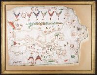
Creator:
Published / Created:
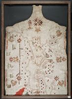
[1505]
Call Number:
Art Storage 30cea 1505
Image Count:
2
Resource Type:
Maps, Atlases & Globes
Found in:
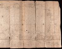
Beinecke Rare Book and Manuscript Library > Portolan chart of the Mediterranean Sea, the North Atlantic Ocean, the Black Sea, and the northwestern African coast.
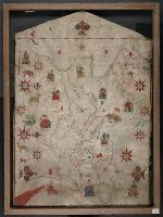
Creator:
Call Number:
Art Storage 30cea 1555
Image Count:
2
Resource Type:
Maps, Atlases & Globes
Found in:
Beinecke Rare Book and Manuscript Library > [Portolan chart of the Mediterranean Sea, the North Atlantic Ocean, the Baltic Sea, and the northwestern African coast].
Creator:
Published / Created:
1748
Call Number:
ZZ35 5 1
Image Count:
1
Resource Type:
Maps, Atlases & Globes
Found in:
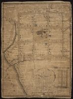
Beinecke Rare Book and Manuscript Library > Plan of the city of New Haven taken in 1748
Published / Created:
1901?]
Call Number:
Zc37 901bg
Image Count:
2
Resource Type:
Maps, Atlases & Globes
Found in:
Beinecke Rare Book and Manuscript Library > Burlington route : annual meeting of the German Baptist Brethren, Lincoln, Nebraska, May, 1901.
Creator:
Published / Created:
1869]
Call Number:
Zc19 C33j 869ce
Image Count:
2
Resource Type:
Maps, Atlases & Globes
Found in:
Beinecke Rare Book and Manuscript Library > Great overland all rail route via Central Pacific, Western Pacific and Cal. & Oregon railroads, connecting at Promontory with the Union Pacific Railroad, and at Omaha with all roads leading to Chicago, St. Louis ... New York ...
Creator:
Published / Created:
1799
Call Number:
2002 Folio 93
Image Count:
40
Resource Type:
Maps, Atlases & Globes
Found in:
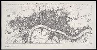
Beinecke Rare Book and Manuscript Library > Plan of the cities of London and Westminster, the Borough of Southwark, and parts adjoining, shewing every house. By R. Horwood
Creator:
Published / Created:
[ca. 1935?]
Call Number:
Zc50 935pe
Image Count:
4
Resource Type:
Maps, Atlases & Globes
Found in:
Beinecke Rare Book and Manuscript Library > Highroads to happiness : south to Mexico : Treat yourself to a grand adventure! ...
Published / Created:
1902?]
Call Number:
Zc47 902bh
Image Count:
2
Resource Type:
Maps, Atlases & Globes
Found in:
Beinecke Rare Book and Manuscript Library > Big Horn Basin, Wyoming : Burlington Route / P.S. Eustis, General Passenger Agent, Chicago.
Creator:
Call Number:
Art Storage 1980 156
Image Count:
2
Resource Type:
Maps, Atlases & Globes
Found in:
Beinecke Rare Book and Manuscript Library > [Portolan chart of the Mediterranean Sea, the North Atlantic Ocean, the Baltic Sea, and the West African coast].
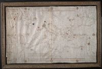
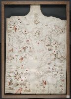
Creator:
Published / Created:
[1403]
Call Number:
Art Storage 1980 158
Image Count:
2
Resource Type:
Maps, Atlases & Globes
Found in:
Beinecke Rare Book and Manuscript Library > Portolan chart of the Mediterranean Sea, the North Atlantic Ocean, the Black Sea, and the northwestern African coast.
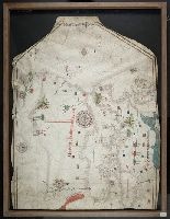
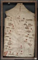
Creator:
Published / Created:
no anno dominus nostris Jh[es]u Xpi de 1492.
Call Number:
Art Storage 30cea 1492
Image Count:
2
Resource Type:
Maps, Atlases & Globes
Found in:
Beinecke Rare Book and Manuscript Library > Portolan chart of the Mediterranean Sea, the North Atlantic Ocean, the Black Sea, and the West African coast as far south as Sierra Leone.
Creator:
Published / Created:
1563
Call Number:
Art Storage 30cea 1563
Image Count:
2
Resource Type:
Maps, Atlases & Globes
Found in:
Beinecke Rare Book and Manuscript Library > [Portolan chart of the Mediterranean Sea, the North Atlantic Ocean, the Baltic Sea, and the northwestern African coast].
Creator:
Published / Created:
1586
Call Number:
Art Storage 30cea 1586
Image Count:
2
Resource Type:
Maps, Atlases & Globes
Found in:
Beinecke Rare Book and Manuscript Library > [Portolan chart of the Mediterranean Sea, the North Atlantic Ocean, the Baltic Sea, and the northwestern African coast].
Creator:
Published / Created:
1594
Call Number:
Art Storage 30cea 1594
Image Count:
2
Resource Type:
Maps, Atlases & Globes
Found in:
Beinecke Rare Book and Manuscript Library > [Portolan chart of the Mediterranean Sea, the North Atlantic Ocean, the Baltic Sea, and the northwestern African coast].
Creator:
Published / Created:
[approximately 1587]
Call Number:
Art Storage 49cea 1587
Image Count:
2
Resource Type:
Maps, Atlases & Globes
Found in:
Beinecke Rare Book and Manuscript Library > [Portolan chart of the Mediterranean Sea and the Baltic Sea].
Published / Created:
c1899
Call Number:
BrSides Zc61 899ro
Image Count:
1
Resource Type:
Maps, Atlases & Globes
Found in:
Beinecke Rare Book and Manuscript Library > Route of the Mormon pioneers from Nauvoo to Great Salt Lake, Feb'y 1846-July 1847
Creator:
Published / Created:
undated
Call Number:
WA MSS 328
Image Count:
1
Resource Type:
Maps, Atlases & Globes
Found in:
Beinecke Rare Book and Manuscript Library > Map of the ’Great Blue-Gravel Lead’ of Northern California /by J. P. Marker
Creator:
Published / Created:
1747
Call Number:
1975 Folio 31
Collection Title:
[Atlas factice of 42 maps, produced by the Homann Erben firm]
Image Count:
1
Resource Type:
Maps, Atlases & Globes
Found in:
Beinecke Rare Book and Manuscript Library > Belgivm Catholicvm seu decem provinciae Germaniae inferioris : cum confiniis Germaniae svp. et Franciae legitime omnia delineata et ad ductum observationum astronomicarum, nec non geometricarum operationum a Cassinio Snellio Muschenbrokio aliisqve rite ha
Creator:
Published / Created:
1739
Call Number:
1973 Folio 30
Collection Title:
[Atlas factice of 32 maps and 1 distance table, produced by the Homann Erben firm]
Image Count:
2
Resource Type:
Maps, Atlases & Globes
Found in:
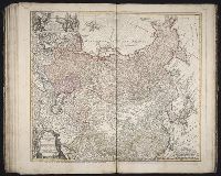
Beinecke Rare Book and Manuscript Library > Imperii Russici et Tatariae universae tam majoris et Asiaticae, qvam minoris et Europaeae tabvla / ex recentissimis et probatissimis monumentis et relationibus concin[n]ata, et ad legitimas projectionum geographic. regulas plane exacta opera Ioh Matthiae Hasii, Math. P.P. ... ; R.A. Schneider, sc.
Creator:
Published / Created:
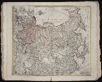
1739
Call Number:
1975 Folio 31
Collection Title:
[Atlas factice of 42 maps, produced by the Homann Erben firm]
Image Count:
1
Resource Type:
Maps, Atlases & Globes
Found in:
Beinecke Rare Book and Manuscript Library > Imperii Russici et Tatariae universae tam majoris et Asiaticae, qvam minoris et Europaeae tabvla / ex recentissimis et probatissimis monumentis et relationibus concin[n]ata, et ad legitimas projectionum geographic. regulas plane exacta opera Ioh Matthiae Hasii, Math. P.P. ... ; R.A. Schneider, sc.
Creator:
Published / Created:
1852
Call Number:
Zc72 852co
Image Count:
3
Resource Type:
Maps, Atlases & Globes
Found in:
Beinecke Rare Book and Manuscript Library > A complete map of San Francisco : compiled from the original map from the latest surveys, containing all the latest extensions and improvements, new streets, alleys, places, wharfs, etc
Published / Created:
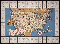
[1939]
Call Number:
BrSides Zc72 939sw
Image Count:
2
Resource Type:
Maps, Atlases & Globes
Found in:
Beinecke Rare Book and Manuscript Library > Join the fun! : see who wins the big race to Treasure Island
Creator:
Published / Created:
[1791]
Call Number:
BrSides Folio 2009 68
Image Count:
2
Resource Type:
Maps, Atlases & Globes
Found in:
Beinecke Rare Book and Manuscript Library > A map exhibiting a general view of the roads and inland navigation of Pennsylvania, and part of the adjacent states : respectfully inscribed to Thomas Mifflin, governor, and the General Assembly of the commonwealth of Pennsylvania / by John Adlum, and John Wallis
Creator:
Published / Created:
anno 1653
Call Number:
1983 Folio 19
Collection Title:
[Atlas factice of 96 maps by Blaeu, Visscher, Jansson, Hondius and others]
Image Count:
2
Resource Type:
Maps, Atlases & Globes
Found in:
Beinecke Rare Book and Manuscript Library > Asiae nova descriptio / auctore Nicola. Io. Visscher
Creator:
Published / Created:
[ca. 163-?]
Call Number:
1983 Folio 19
Collection Title:
[Atlas factice of 96 maps by Blaeu, Visscher, Jansson, Hondius and others]
Image Count:
2
Resource Type:
Maps, Atlases & Globes
Found in:
Beinecke Rare Book and Manuscript Library > Tvrcicvm imperivm
Creator:
Published / Created:
[ca. 163-?]
Call Number:
1983 Folio 19
Collection Title:
[Atlas factice of 96 maps by Blaeu, Visscher, Jansson, Hondius and others]
Image Count:
2
Resource Type:
Maps, Atlases & Globes
Found in:
Beinecke Rare Book and Manuscript Library > Sabavdia dvcatvs, Savoye
Creator:
Published / Created:
1746
Call Number:
2002 Folio 94
Image Count:
1
Resource Type:
Maps, Atlases & Globes
Found in:
Beinecke Rare Book and Manuscript Library > A contracted scetch of the plan of London &c. : printed on 24 sheets of imperial paper, to shew the general appearance of the whole : for the use of those who bind it in a book, and for the better comprehension of the divisions mentioned in the index.
Creator:
Published / Created:
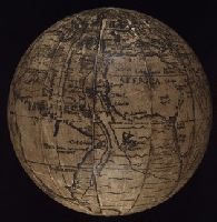
ca. 1885?]
Call Number:
2003 1481
Image Count:
9
Resource Type:
Maps, Atlases & Globes
Found in:
Beinecke Rare Book and Manuscript Library > ["The Ambassadors" globe]
Creator:
Published / Created:
1879
Call Number:
BrSides Zc19 N82k 879it
Image Count:
2
Resource Type:
Maps, Atlases & Globes
Found in:
Beinecke Rare Book and Manuscript Library > It is the shortest, quickest and best route : and the fare is always as low as the lowest
Creator:
Published / Created:
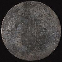
[1589]
Call Number:
Taylor 15
Image Count:
5
Resource Type:
Maps, Atlases & Globes
Found in:
Beinecke Rare Book and Manuscript Library > [Silver map of the world showing the track of Sir Francis Drakes circumnavigation engraved or struck on a flat silver disc by Michael Mercator]
Creator:
Published / Created:
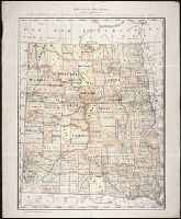
c1884
Call Number:
BrSides Zc35 876rae
Image Count:
1
Resource Type:
Maps, Atlases & Globes
Found in:
Beinecke Rare Book and Manuscript Library > Map of Dakota / printed expressly for E.P. Gates, president Merchants Bank and negotiator of farm loans, Grand Forks, Dakota
Creator:
Published / Created:
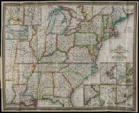
1833
Call Number:
2008 1135
Collection Title:
Mitchell’s travellers guide through the United States [cartographic material] : a map of the roads
Image Count:
1
Resource Type:
Maps, Atlases & Globes
Found in:
Beinecke Rare Book and Manuscript Library > Mitchell's travellers guide through the United States [cartographic material] : a map of the roads, distances, steam boat & canal routes &c / by J.H. Young.
Creator:
Published / Created:
1934]
Call Number:
ZZa L588 G934
Image Count:
2
Resource Type:
Maps, Atlases & Globes
Found in:
Beinecke Rare Book and Manuscript Library > A map of Sinclair Lewis United States as it appears in his novels
Creator:
Published / Created:
[1880?]
Call Number:
BrSides Zc72 880sb
Image Count:
2
Resource Type:
Maps, Atlases & Globes
Found in:
Beinecke Rare Book and Manuscript Library > Map of lands of the Sausalito Land and Ferry Company [cartographic material] : from the official map
Creator:
Published / Created:
[United States : and 1989]
Call Number:
BrSides Folio 2005 20
Image Count:
1
Resource Type:
Maps, Atlases & Globes
Found in:
Beinecke Rare Book and Manuscript Library > A new and exact plan of the cities of London and Westminster, and borough of Southwark, with the additional buildings to the year 1756
Creator:
Published / Created:
[1728?]
Call Number:
1977 Folio 177
Image Count:
3
Resource Type:
Maps, Atlases & Globes
Found in:
Beinecke Rare Book and Manuscript Library > Nieuwe en Zeer Naaukeurige Paskaart van de Kusten van West Indien [cartographic material] : strekkende van Rio Oronoque tot Beneede Cartagena met alle de Caribische Eylanden als ook Porto Rico en de Zuyd Kust van Espaniola / met alle desselfs Dieptens, Dr
Creator:
Published / Created:
1806 January
Call Number:
ZZ35 5 4
Image Count:
1
Resource Type:
Maps, Atlases & Globes
Found in:
Beinecke Rare Book and Manuscript Library > A plan of the town of New Haven with all the buildings in 1748 taken by the Hon. Gen. Wadsworth of Durham ... : respectfully inscribed to the Connecticut Academy of Arts and Sciences / by ... Wm. Lyon
Creator:
Published / Created:
1795
Call Number:
Osborn pc259
Image Count:
4
Resource Type:
Maps, Atlases & Globes
Found in:
Beinecke Rare Book and Manuscript Library > Bowles's European geographical amusement, or, Game of geography ; designed from The grand tour of Europe, by Dr. Nugent
Creator:
Published / Created:
[1742?]
Call Number:
BrSides Folio 2009 4
Image Count:
1
Resource Type:
Maps, Atlases & Globes
Found in:
Beinecke Rare Book and Manuscript Library > Cometa, qui anno Christi 1742 apparuit, ex observationibus, a die 13 Marty usque ad 15 Aprilis : plusquam vigesies quinquies institutis, qua potuit fieri, diligentia notatus, et secundum suas proprietates plerasq[ue], ab astronomia considerari solitas, utpote formam, viam, progressum, plagam coeli, motus velocitatem, descensum ad perigaeum, seu approximationem ad terram, et elongationem ab ea : item distantiam infra, vel supra` horizontem rectum, et etiam obliquum, quoties, saltem intra polum mundi, meridianum constantiensem, et locorum sub elevatione poli 47. grad. 24. min. jacentium, attigit : praecipue vero secundum ascensionem rectam, et declinationem, longitudinem, et latitudinem : et tandem secundum dies, et tempora, lineae trajectoriae inserta, cum in plano tum in figura armillari exhibitus : ubi tum nudo intuitu, tum ope regulae, et circini omnia facile investigantur / observante, et delineante Astrophilo quodam, ex Ord. S. Bened. nomina qui Christo gaudet inesse sua ; a Matth. Seuttero S.C.M.G. Aug. V
Creator:
Published / Created:
ca. 1892]
Call Number:
Zc70 885nof 949
Image Count:
3
Resource Type:
Maps, Atlases & Globes
Found in:
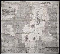
Beinecke Rare Book and Manuscript Library > Sectional land map showing the lands of the Northern Pacific Railroad Co. in western Washington and northern Oregon : with condensed information relating to the Pacific Northwest
Creator:
Published / Created:
[1680?]
Call Number:
1973 Folio 10
Image Count:
1
Resource Type:
Maps, Atlases & Globes
Found in:
Beinecke Rare Book and Manuscript Library > Insula sive regnum Siciliae
Creator:
Published / Created:
[ca. 1670]
Call Number:
1973 Folio 10
Image Count:
1
Resource Type:
Maps, Atlases & Globes
Found in:
Beinecke Rare Book and Manuscript Library > Barbaria
Creator:
Published / Created:
1680
Call Number:
1973 Folio 10
Image Count:
1
Resource Type:
Maps, Atlases & Globes
Found in:
Beinecke Rare Book and Manuscript Library > A mapp of all the world in two hemispheres in which are exactly described all the parts of the earth and seas
Creator:
Published / Created:
1680
Call Number:
1973 Folio 10
Image Count:
1
Resource Type:
Maps, Atlases & Globes
Found in:
Beinecke Rare Book and Manuscript Library > Europe divided into its principall states, which are subdivided into their principall provinces
Creator:
Published / Created:
[ca. 1700]
Call Number:
1973 Folio 10
Image Count:
1
Resource Type:
Maps, Atlases & Globes
Found in:
Beinecke Rare Book and Manuscript Library > A new mapp of the sea coasts of England, Scotland, and Ireland: with the adjacent coasts of France, Holand, Denmark & Norway, shewing the scituation and distance of the several ports, harbors, havens, creeks, sands &c
Branch:v1.60.98 ,Deployed:2024-04-24T10:14:35-04:00