Search
You Searched For
Search Results
- Creator:
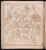
- Burritt, Elijah H. (Elijah Hinsdale), 1794-1838.
- Published / Created:
- c1835.
- Call Number:
- 2000 Folio 110
- Image Count:
- 1
- Resource Type:
- Maps, Atlases & Globes
- Found in:
- Beinecke Rare Book and Manuscript Library > Atlas, designed to illustrate the geography of the heavens ... By Elijah H. Burritt ...
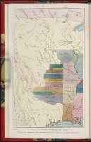
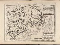
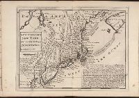
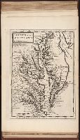
- Creator:
- Tanner, Henry Schenck, 1786-1858
- Published / Created:
- [1839?]
- Call Number:
- G1200 T34 1839 (LC)
- Image Count:
- 4
- Resource Type:
- Maps, Atlases & Globes
- Found in:
- Beinecke Rare Book and Manuscript Library > A new American atlas [cartographic material] : containing maps of the several states of the North American union ... / by Henry S. Tanner.
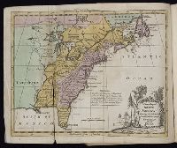
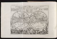
- Creator:
- Moll, Herman, d. 1732
- Published / Created:
- [178-?]
- Call Number:
- 1973 Folio 113
- Image Count:
- 2
- Resource Type:
- Maps, Atlases & Globes
- Found in:
- Beinecke Rare Book and Manuscript Library > Atlas minor: or A new and curious set of sixty two maps, in which are shewn all the empires, kingdoms, countries, states in all the known parts of the earth ... by Herman Moll ...
- Creator:
- Great Britain. Hydrographic Dept.
- Call Number:
- Conrad +Zz1
- Image Count:
- 2
- Resource Type:
- Maps, Atlases & Globes
- Found in:
- Beinecke Rare Book and Manuscript Library > Original navigation charts used by Joseph Conrad.
- Creator:
- Kitchin, Thomas, d. 1784.
- Published / Created:
- 1773
- Call Number:
- 1979 Folio 59
- Image Count:
- 2
- Resource Type:
- Maps, Atlases & Globes
- Found in:
- Beinecke Rare Book and Manuscript Library > A general atlas, describing the whole universe. Being a compleat and new collection of the most approved maps extant; corrected with the utmost care, and augmented from the latest discoveries: the whole being an improvement of the maps of d'Anville and Robert ... By Thomas Kitchen, senior, and others ...
- Creator:
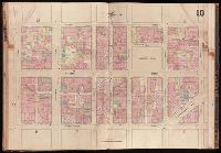
- Sanborn Map Company.
- Published / Created:
- 1881-
- Call Number:
- 1997 Folio 77
- Image Count:
- 2
- Found in:
- Beinecke Rare Book and Manuscript Library > Insurance maps of San Francisco, California.
- Creator:
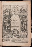
- Thucydides.
- Published / Created:
- 1629
- Call Number:
- Z64 058
- Image Count:
- 2
- Resource Type:
- Books, Journals & Pamphlets
- Found in:
- Beinecke Rare Book and Manuscript Library > Eight bookes of the Peloponnesian Warre / written by Thucydides the sonne of Olorus. ; Interpreted with faith and diligence immediately out of the Greeke, by Thomas Hobbes ...
- Creator:
- Moll, Herman, d. 1732
- Published / Created:
- [1732]
- Call Number:
- E1015 M66 1732
- Image Count:
- 1
- Found in:
- Beinecke Rare Book and Manuscript Library > Atlas minor: or a set of sixty-two new and correct maps, of all parts of the world. All composed and done by Herman Moll, geographer ...
- Creator:
- Moll, Herman, d. 1732
- Published / Created:
- 17--]
- Call Number:
- 1978 47
- Collection Title:
- Atlas minor.
- Image Count:
- 1
- Found in:
- Beinecke Rare Book and Manuscript Library > The Island of St. Christophers By Her. Moll Geographer
- Creator:
- Moll, Herman, d. 1732
- Published / Created:
- [1732]
- Call Number:
- E1015 M66 1732
- Collection Title:
- Atlas minor: or a set of sixty-two new and correct maps, of all parts of the world. All composed
- Image Count:
- 1
- Found in:
- Beinecke Rare Book and Manuscript Library > The Island of St. Christophers, alias St. Kitts By H. Moll Geographer
- Published / Created:
- 1797
- Call Number:
- 3213 1797
- Container / Volume:
- BRBL_00055
- Image Count:
- 1
- Resource Type:
- Maps, Atlases & Globes
- Found in:
- Beinecke Rare Book and Manuscript Library > A map of Kent.
- Creator:
- Anson, George Anson, Baron, 1697-1762
- Published / Created:
- 1748
- Call Number:
- 2000 876
- Image Count:
- 1
- Found in:
- Beinecke Rare Book and Manuscript Library > A voyage round the world in the years MDCCXL, I, II, III, IV / by George Anson, Esq. ; compiled from the papers and other materials of the Right Honourable George Lord Anson and published under his direction by Richard Walter, M.A. ...
- Creator:
- Catlin, George, 1796-1872
- Published / Created:
- 1848
- Call Number:
- Zc12 +841cabj
- Image Count:
- 7
- Found in:
- Beinecke Rare Book and Manuscript Library > Illustrations of the manners, customs, and condition of the North American Indians : in a series of letters and notes written during eight years of travel and adventure among the wildest and most remarkable tribes now existing. : with three hundred and si
- Creator:
- Moll, Herman, d. 1732
- Published / Created:
- [1732]
- Call Number:
- E1015 M66 1732
- Collection Title:
- Atlas minor: or a set of sixty-two new and correct maps, of all parts of the world. All composed
- Image Count:
- 1
- Found in:
- Beinecke Rare Book and Manuscript Library > A new map of the whole world with the trade winds according to ye latest and most exact observations by H. Moll geographer.
- Creator:
- Moll, Herman, d. 1732
- Published / Created:
- [1732]
- Call Number:
- E1015 M66 1732
- Collection Title:
- Atlas minor: or a set of sixty-two new and correct maps, of all parts of the world. All composed
- Image Count:
- 1
- Found in:
- Beinecke Rare Book and Manuscript Library > A new map of ye north parts of America claimed by France under ye names of Louisiana. Mississipi, Canada & New France, with the adjoyning territories of England & Spain. By H. Moll geographer.
- Creator:
- Moll, Herman, d. 1732
- Published / Created:
- [1732]
- Call Number:
- E1015 M66 1732
- Collection Title:
- Atlas minor: or a set of sixty-two new and correct maps, of all parts of the world. All composed
- Image Count:
- 1
- Found in:
- Beinecke Rare Book and Manuscript Library > New Foundland St. Laurence Bay, the fishing banks, Acadia, and part of New Scotland. By H. Moll geographer.
- Creator:
- Moll, Herman, d. 1732
- Published / Created:
- [1732]
- Call Number:
- E1015 M66 1732
- Collection Title:
- Atlas minor: or a set of sixty-two new and correct maps, of all parts of the world. All composed
- Image Count:
- 1
- Found in:
- Beinecke Rare Book and Manuscript Library > New England, New York, New Jersey and Pensilvania. By H. Moll geographer.
- Creator:
- Moll, Herman, d. 1732
- Published / Created:
- [1732]
- Call Number:
- E1015 M66 1732
- Collection Title:
- Atlas minor: or a set of sixty-two new and correct maps, of all parts of the world. All composed
- Image Count:
- 1
- Found in:
- Beinecke Rare Book and Manuscript Library > Virginia and Maryland by H. Moll geographer.
- Creator:
- Moll, Herman, d. 1732
- Published / Created:
- [1732]
- Call Number:
- E1015 M66 1732
- Collection Title:
- Atlas minor: or a set of sixty-two new and correct maps, of all parts of the world. All composed
- Image Count:
- 1
- Found in:
- Beinecke Rare Book and Manuscript Library > Carolina by H. Moll geographer.
- Creator:
- Moll, Herman, d. 1732
- Published / Created:
- [1732]
- Call Number:
- E1015 M66 1732
- Collection Title:
- Atlas minor: or a set of sixty-two new and correct maps, of all parts of the world. All composed
- Image Count:
- 1
- Found in:
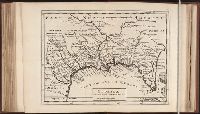
- Beinecke Rare Book and Manuscript Library > Florida called by ye French Louisiana & c. By H. Moll geographer.
- Creator:
- Moll, Herman, d. 1732
- Published / Created:
- [1732]
- Call Number:
- E1015 M66 1732
- Collection Title:
- Atlas minor: or a set of sixty-two new and correct maps, of all parts of the world. All composed
- Image Count:
- 1
- Found in:
- Beinecke Rare Book and Manuscript Library > A map of the West-Indies & c. Mexico or New Spain. Also ye trade winds, and ye several tracts made by ye galeons and flota from place to place. By H. Moll geographer.
- Creator:
- Clark, William, 1770-1838
Lewis, Samuel, 1753 or 4-1822
- Published / Created:
- [ca. 1814]
- Call Number:
- Zc10 814Le
- Collection Title:
- History of the expedition under the command of Captains Lewis and Clark, to the sources of the
- Image Count:
- 2
- Resource Type:
- Maps, Atlases & Globes
- Found in:
- Beinecke Rare Book and Manuscript Library > A map of Lewis and Clark's track, across the western portion of North America fom the Mississippi to the Pacific Ocean; by order of the Executive of the United States . In 1804, 5 & 6
- Creator:
- Moll, Herman, d. 1732
- Published / Created:
- [1732]
- Call Number:
- E1015 M66 1732
- Collection Title:
- Atlas minor: or a set of sixty-two new and correct maps, of all parts of the world. All composed
- Image Count:
- 1
- Found in:
- Beinecke Rare Book and Manuscript Library > A description of the Bay of Fundy showing ye coast, islands, harbours, creeks, coves, rocks, sholes, soundings & anchorings &c... Observed by Nat. Blackmore in ye yeare 1711 and 1712 ...
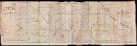
- Published / Created:
- [1748]
- Call Number:
- OSB MSS 4
- Collection Title:
- Joseph Spence papers
- Container / Volume:
- Box 6 | Folder 190
- Image Count:
- 2
- Resource Type:
- Archives or Manuscripts
- Found in:
- Beinecke Rare Book and Manuscript Library > Oatlands, in Surrey, and adjacent lands: Henry Fiennes Clinton, 2nd duke of Newcastle, 1720-1794
- Call Number:
- Mexico Ct +h780cg
- Collection Title:
- The history of Mexico. Collected from Spanish and Mexican historians, from manuscripts and ancient
- Image Count:
- 27
- Found in:
- Beinecke Rare Book and Manuscript Library > The history of Mexico. Collected from Spanish and Mexican historians, from manuscripts and ancient paintings of the Indians ...
- Call Number:
- Mexico Ct +h780cg
- Collection Title:
- The history of Mexico. Collected from Spanish and Mexican historians, from manuscripts and ancient
- Image Count:
- 3
- Found in:
- Beinecke Rare Book and Manuscript Library > The history of Mexico. Collected from Spanish and Mexican historians, from manuscripts and ancient paintings of the Indians ...
- Call Number:
- CF2041 +L54
- Collection Title:
- A true & exact history of the island of Barbados. Illustrated with a mapp of the island, as also
- Image Count:
- 1
- Resource Type:
- Maps, Atlases & Globes
- Found in:
- Beinecke Rare Book and Manuscript Library > A topographicall description and admeasurement of the yland of Barbados in the West Indyaes with the m.rs names of the seuerall plantacons
- Creator:
- Neele, Samuel John, 1758-1824
- Published / Created:
- 1798
- Call Number:
- Egf +759c
- Collection Title:
- Travels through the middle settlements in North America, : in the years 1759 and 1760; with
- Image Count:
- 1
- Resource Type:
- Books, Journals & Pamphlets
- Found in:
- Beinecke Rare Book and Manuscript Library > Map of Dr. Burnaby's travels through the middle settlements of North America
- Call Number:
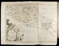
- 2003 310
- Collection Title:
- The journal of Major George Washington, : sent by the Hon. Robert Dinwiddie, Esq; His Majesty’s
- Image Count:
- 1
- Resource Type:
- Books, Journals & Pamphlets
- Found in:
- Beinecke Rare Book and Manuscript Library > Map of the western parts of the colony of Virginia, as far as the Mississipi [sic]
- Published / Created:
- 1850
- Call Number:
- 1976 Folio 96
- Collection Title:
- A new universal atlas containing maps of the various empires, kingdoms, states and republics of the
- Image Count:
- 1
- Resource Type:
- Maps, Atlases & Globes
- Found in:
- Beinecke Rare Book and Manuscript Library > 10. Map of Connecticut
- Published / Created:
- 1846
- Call Number:
- 1976 Folio 93
- Collection Title:
- A new universal atlas containing maps of the various empires, kingdoms, states and republics of the
- Image Count:
- 1
- Resource Type:
- Maps, Atlases & Globes
- Found in:
- Beinecke Rare Book and Manuscript Library > 9. Connecticut
- Call Number:
- Lxe 784m
- Collection Title:
- Geography made easy : being a short, but comprehensive system of that very useful and agreeable
- Image Count:
- 1
- Resource Type:
- Books, Journals & Pamphlets
- Found in:
- Beinecke Rare Book and Manuscript Library > [Placement of the divisions of South America]
- Creator:
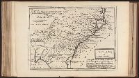
- Aitken, Robert, 1735-1802
- Published / Created:
- 1775 September
- Call Number:
- A89 P384
- Collection Title:
- The Pennsylvania magazine: or, American monthly museum
- Image Count:
- 1
- Resource Type:
- Books, Journals & Pamphlets
- Found in:
- Beinecke Rare Book and Manuscript Library > A new map of North & South Carolina, & Georgia
- Call Number:
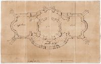
- Ik P810 +Z745
- Collection Title:
- A plan of Mr. Pope’s garden : as it was left at his death, with a plan and perspective view of the
- Image Count:
- 1
- Resource Type:
- Books, Journals & Pamphlets
- Found in:
- Beinecke Rare Book and Manuscript Library > A plan of Mr. Pope's garden as it was left at his death
- Creator:
- Cook, James, 1728-1779
Gulielmus Whitchurch
- Published / Created:
- 1776
- Call Number:
- 1977 +300
- Collection Title:
- A voyage towards the South pole, and round the world. Performed in His Majesty’s ships the
- Image Count:
- 1
- Resource Type:
- Maps, Atlases & Globes
- Found in:
- Beinecke Rare Book and Manuscript Library > A chart of the southern hemisphere; shewing the tracks of some of the most distinguished navigators
- Creator:
- Dawes, William, 1762-1836
- Published / Created:
- 1791 March
- Call Number:
- DU170 H85+ Oversize
- Collection Title:
- An historical journal of the transactions at Port Jackson and Norfolk island, with the discoveries
- Image Count:
- 1
- Resource Type:
- Books, Journals & Pamphlets
- Found in:
- Beinecke Rare Book and Manuscript Library > A map of all those parts of the territory of New South Wales which have been seen by any person belonging to the settlement established at Port Jackson, in the said territory ...
- Creator:
- Des Barres, Joseph F. W. (Joseph Frederick Wallet), 1722-1824
- Published / Created:
- 1775?-1781?]
- Call Number:
- 1983 Folio 25
- Image Count:
- 3
- Resource Type:
- Maps, Atlases & Globes
- Found in:
- Beinecke Rare Book and Manuscript Library > [The Atlantic Neptune : published for the use of the Royal Navy Great Britain / by Joseph F.W. Des Barres, esq.].
- Published / Created:
- [1759-1771] and 1763 May
- Call Number:
- Z17 289q
- Image Count:
- 1
- Resource Type:
- Books, Journals & Pamphlets
- Found in:
- Beinecke Rare Book and Manuscript Library > Royal magazine; or, Gentleman's monthly companion.
- Creator:
- Moll, Herman, d. 1732
Salmon, Thomas, 1679-1767
- Published / Created:
- 1739
- Call Number:
- 1996 +91
- Image Count:
- 3
- Resource Type:
- Books, Journals & Pamphlets
- Found in:
- Beinecke Rare Book and Manuscript Library > Modern history: or, The present state of all nations. Describing their respective situations, persons, habits, ... animals and minerals. ... By Mr. Salmon. Illustrated with cuts and maps ... by Herman Moll ...
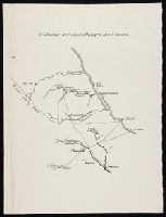
- Published / Created:
- undated
- Call Number:
- WA MSS S-1316
- Collection Title:
- Friedrich Armand Strubberg collection
- Container / Volume:
- Box 3 | Folder 44
- Image Count:
- 1
- Found in:
- Beinecke Rare Book and Manuscript Library > Zeichnung der ansiedlungen des vereins
- Creator:
- Hays, John Coffee, 1817-1883
- Published / Created:
- undated
- Call Number:
- WA MSS S-1316
- Collection Title:
- Friedrich Armand Strubberg collection
- Container / Volume:
- Box 3 | Folder 44
- Image Count:
- 2
- Found in:
- Beinecke Rare Book and Manuscript Library > Plat of the Comal Tract
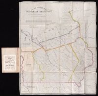
- Creator:
- Kramm, Gustavus
Lea, Albert Miller, 1808-1891
Lehman & Duval Lithrs
- Published / Created:
- 1836
- Call Number:
- Zc29 836Le
- Image Count:
- 1
- Found in:
- Beinecke Rare Book and Manuscript Library > Notes on Wisconsin Territory : with a map / by Lieutenant Albert M. Lea.
- Creator:
- Kramm, Gustavus
Lea, Albert Miller, 1808-1891
Lehman & Duval Lithrs
- Published / Created:
- 1935
- Call Number:
- Zc29 836Leb
- Image Count:
- 1
- Found in:
- Beinecke Rare Book and Manuscript Library > The book that gave to Iowa its name, a reprint.
- Creator:
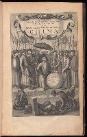
- Nieuhof, Johannes, 1618-1672
- Published / Created:
- 1673
- Call Number:
- 1998 Folio 71
- Image Count:
- 1
- Resource Type:
- Books, Journals & Pamphlets
- Found in:
- Beinecke Rare Book and Manuscript Library > An embassy from the East-India Company of the United Provinces, to the Grand Tartar Cham, Emperor of China : deliverd by their excellencies, Peter de Goyer and Jacob de Keyzer, at his imperial city of Peking : wherein the cities, towns, villages, ports, r
- Creator:
- Visscher, Nicolaes, 1649-1702
- Published / Created:
- Undated
- Call Number:
- 1973 Folio 71
- Collection Title:
- [Atlas nouveau contenant toutes les parties du monde ou sont exactement marques les empires
- Image Count:
- 1
- Resource Type:
- Maps, Atlases & Globes
- Found in:
- Beinecke Rare Book and Manuscript Library > A new mapp of the kingdome of England, representing the princedome of Wales, and other provinces, cities, market towns, with the roads from town to town and the number of reputed miles between them, are given by inspection without scale or compass
- Published / Created:
- 1774 November 29
- Call Number:
- 1975 Folio 51
- Collection Title:
- The American atlas; or, A geographical description of the whole continent of America; wherein are
- Image Count:
- 1
- Resource Type:
- Maps, Atlases & Globes
- Found in:
- Beinecke Rare Book and Manuscript Library > A map of the most inhabited part of New England, containing the provinces of Massachusets Bay and New Hampshire, with the colonies of Conecticut and Rhode Island, divided into counties and townships: the whole composed from actual surveys and its situatio
- Creator:
- Moll, Herman, d. 1732
- Published / Created:
- [1732]
- Call Number:
- E1015 M66 1732
- Collection Title:
- Atlas minor: or a set of sixty-two new and correct maps, of all parts of the world. All composed
- Image Count:
- 1
- Resource Type:
- Maps, Atlases & Globes
- Found in:
- Beinecke Rare Book and Manuscript Library > A general map of Great Britain and Ireland with part of Germany, Holland, Flanders, France &c. agreeable to modern history
- Creator:
- Rogers, William, b. ca. 1545, engraver
- Published / Created:
- Undated
- Call Number:
- Taylor 216A
- Collection Title:
- Iohn Huighen van Linschoten, his Discours of Voyages into ye Easte & West Indies : deuided into
- Image Count:
- 1
- Found in:
- Beinecke Rare Book and Manuscript Library > [Map of southern Africa and Madagascar]
- Published / Created:
- 1612
- Call Number:
- Pequot G325
- Collection Title:
- Descriptio ac delineatio geographica detectionis freti, sive, transitus ad occasum supra terras
- Image Count:
- 1
- Found in:
- Beinecke Rare Book and Manuscript Library > Tabula nautica ...
- Creator:
- Waghenaer, Lucas Janszoon, 1534 or 5-1606
- Published / Created:
- ann. 1605.
- Call Number:
- 1976 Folio 46
- Image Count:
- 1
- Resource Type:
- Maps, Atlases & Globes
- Found in:
- Beinecke Rare Book and Manuscript Library > The mariners mirrovr wherin may playnly be seen the courses, heights, distances, depths, sounding, flouds and ebs, risings of lands, rocks ... of the harbouroughs, havens and ports of the greatest part of Europe: ... together w.th the rules and instrumeíÄ
- Published / Created:
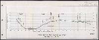
- [195-]
- Call Number:
- WA MSS S-2613
- Collection Title:
- Lawrence Pratt collection concerning Arizona v. California and the Colorado River
- Container / Volume:
- Box 1 | Folder 2
- Image Count:
- 1
- Found in:
- Beinecke Rare Book and Manuscript Library > Cross-section from Gulf of California through Salton Sea
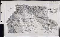
- Published / Created:
- 1956
- Call Number:
- WA MSS S-2613
- Collection Title:
- Lawrence Pratt collection concerning Arizona v. California and the Colorado River
- Container / Volume:
- Box 1 | Folder 2
- Image Count:
- 1
- Found in:
- Beinecke Rare Book and Manuscript Library > Imperial irrigation district perspective map, Imperial Valley and vicinity, 1956
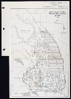
- Creator:
- California. Dept. of State
- Published / Created:
- 1957
- Call Number:
- WA MSS S-2613
- Collection Title:
- Lawrence Pratt collection concerning Arizona v. California and the Colorado River
- Container / Volume:
- Box 1 | Folder 6
- Image Count:
- 1
- Found in:
- Beinecke Rare Book and Manuscript Library > Imperial irrigation district water distribution system, 1922
- Published / Created:
- 1763 April
- Call Number:
- Z17 299b
- Collection Title:
- Universal museum; or, Gentleman's and ladies polite magazine of history politicks and literature.
- Image Count:
- 1
- Resource Type:
- Books, Journals & Pamphlets
- Found in:
- Beinecke Rare Book and Manuscript Library > Theodolite's Pattern, shewing the advantages obtained by the peace to England, particularly in North America.
- Creator:
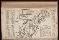
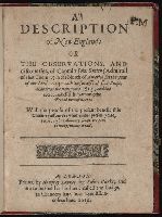
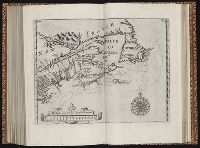
- Smith, John, 1580-1631
- Published / Created:
- 1616
- Call Number:
- Taylor 269
- Image Count:
- 3
- Resource Type:
- Books, Journals & Pamphlets
- Found in:
- Beinecke Rare Book and Manuscript Library > A description of New-England: or The observations and discoueries, of Captain Iohn Smith, (admirall of that country) in the north of America in the year of our Lord 1614, with the successe of sixe ships that went the next yeare 1615; and the accidents befell him among the French men of warre: with the proofe of the present benefit this countrey affoords: whither this present yeare, 1616, eight voluntary ships are gone to make further tryall.
- Creator:
- Elstracke, Renold, fl. 1590-1630
Erpenius, Thomas, 1584-1624
Featherstone, Henry, d. 1647
Methold, William, 1590-1653
Purchas, Samuel, 1577?-1626
Stansby, William, fl. 1597-1638
- Published / Created:
- 1625
- Call Number:
- Pequot +P978
- Image Count:
- 1
- Found in:
- Beinecke Rare Book and Manuscript Library > Purchas his pilgrimes : In fiue bookes. The first, contayning the voyages and peregrinations made by ancient kings, patriarkes, apostles, philosophers, and others, to and thorow the remoter parts of the knowne world: enquiries also of languages and religions, especially of the moderne diuersified professions of Christianitie. The second, a description of all the circum-nauigations of the globe. The third, nauigations and voyages of English-men, alongst the coasts of Africa ... The fourth, English voyages beyond the East Indies, to the ilands of Iapan, China, Cauchinchina, the Philippinæ[32]with others ... The fifth, nauigations, voyages, traffiques, discoueries, of the English nation in the easterne parts of the world ... The first part.
- Creator:
- Elstracke, Renold, fl. 1590-1630
- Published / Created:
- 1625
- Call Number:
- Pequot +P978
- Collection Title:
- Purchas his pilgrimes : In fiue bookes. The first, contayning the voyages and peregrinations made
- Image Count:
- 1
- Found in:
- Beinecke Rare Book and Manuscript Library > Description of East India
- Published / Created:
- [ca. 1625]
- Call Number:
- Pequot +P978
- Collection Title:
- Purchas his pilgrimes : In fiue bookes. The first, contayning the voyages and peregrinations made
- Image Count:
- 1
- Found in:
- Beinecke Rare Book and Manuscript Library > The map of China
- Creator:
- Elstracke, Renold, fl. 1590-1630
- Published / Created:
- [ca. 1625]
- Call Number:
- Pequot +P978
- Collection Title:
- Purchas his pilgrimes : In fiue bookes. The first, contayning the voyages and peregrinations made
- Image Count:
- 1
- Found in:
- Beinecke Rare Book and Manuscript Library > The north part of America
- Published / Created:
- [1625]
- Call Number:
- Pequot +P978
- Collection Title:
- Purchas his pilgrimes : In fiue bookes. The first, contayning the voyages and peregrinations made
- Image Count:
- 1
- Found in:
- Beinecke Rare Book and Manuscript Library > Virginia
- Published / Created:
- 1625
- Call Number:
- Pequot +P978
- Collection Title:
- Purchas his pilgrimes : In fiue bookes. The first, contayning the voyages and peregrinations made
- Image Count:
- 1
- Found in:
- Beinecke Rare Book and Manuscript Library > New France
- Creator:
- Bry, Theodor de, 1528-1598
- Call Number:
- 1976 Folio 110
- Collection Title:
- The mariners mirrovr wherin may playnly be seen the courses, heights, distances, depths, sounding
- Image Count:
- 1
- Resource Type:
- Maps, Atlases & Globes
- Found in:
- Beinecke Rare Book and Manuscript Library > The sea coastes of Portugal betwene Camino & Montego eue as the countrie there aboutes is lying and situated with all the havens thereof exactly done, and corected with great dilligence
- Creator:
- Bry, Theodor de, 1528-1598
- Call Number:
- 1976 Folio 110
- Collection Title:
- The mariners mirrovr wherin may playnly be seen the courses, heights, distances, depths, sounding
- Image Count:
- 1
- Resource Type:
- Maps, Atlases & Globes
- Found in:
- Beinecke Rare Book and Manuscript Library > The sea coastes of England, from the Sorlinges by the landes end to Plymouth with the hauens and harbrowghes
- Creator:
- Bry, Theodor de, 1528-1598
- Call Number:
- 1976 Folio 110
- Collection Title:
- The mariners mirrovr wherin may playnly be seen the courses, heights, distances, depths, sounding
- Image Count:
- 1
- Resource Type:
- Maps, Atlases & Globes
- Found in:
- Beinecke Rare Book and Manuscript Library > The sea coastes of England betweene the Ile of Wight & Douer, with the principal hauens thereof according to their situation and appearing
- Published / Created:
- Undated
- Call Number:
- 1973 Folio 56
- Collection Title:
- The American pilot, containing the navigation of the sea coast of North America, from the Streights
- Image Count:
- 1
- Resource Type:
- Maps, Atlases & Globes
- Found in:
- Beinecke Rare Book and Manuscript Library > A chart of South Carolina and Georgia
- Published / Created:
- 1833
- Call Number:
- 2002 Folio 97
- Collection Title:
- Tanner’s universal atlas : subscription price $1.00 a number, seperate [sic] numbers $1.50 each
- Image Count:
- 1
- Resource Type:
- Maps, Atlases & Globes
- Found in:
- Beinecke Rare Book and Manuscript Library > A new map of Maine
- Creator:
- Humphrys, F
- Published / Created:
- 1850
- Call Number:
- 1975 Folio 26
- Collection Title:
- A new universal atlas containing maps of the various empires, kingdoms, states and republics of the
- Image Count:
- 1
- Resource Type:
- Maps, Atlases & Globes
- Found in:
- Beinecke Rare Book and Manuscript Library > Lengths of the principal rivers in the world
- Published / Created:
- 1850
- Call Number:
- 1975 Folio 26
- Collection Title:
- A new universal atlas containing maps of the various empires, kingdoms, states and republics of the
- Image Count:
- 1
- Resource Type:
- Maps, Atlases & Globes
- Found in:
- Beinecke Rare Book and Manuscript Library > A new map of Maine
- Published / Created:
- 1846
- Call Number:
- 1976 Folio 93
- Collection Title:
- Mitchell’s universal atlas
- Image Count:
- 1
- Resource Type:
- Maps, Atlases & Globes
- Found in:
- Beinecke Rare Book and Manuscript Library > A new map of Maine
- Published / Created:
- 1833
- Call Number:
- 1976 Folio 98
- Collection Title:
- A new universal atlas, containing maps of the various empires, kingdoms, states and republics of
- Image Count:
- 1
- Resource Type:
- Maps, Atlases & Globes
- Found in:
- Beinecke Rare Book and Manuscript Library > A new map of Maine
- Published / Created:
- 1850
- Call Number:
- 1976 Folio 96
- Collection Title:
- A new universal atlas containing maps of the various empires, kingdoms, states and republics of the
- Image Count:
- 1
- Resource Type:
- Maps, Atlases & Globes
- Found in:
- Beinecke Rare Book and Manuscript Library > A new map of Maine
- Call Number:
- 1976 Folio 94
- Collection Title:
- A new universal atlas containing maps of the various empires, kingdoms, states and republics of the
- Image Count:
- 1
- Resource Type:
- Maps, Atlases & Globes
- Found in:
- Beinecke Rare Book and Manuscript Library > A new map of Maine
- Published / Created:
- 1719
- Call Number:
- Defoe 50 719db 1
- Collection Title:
- The life and strange surprizing adventures of Robinson Crusoe, of York, mariner : who lived eight
- Image Count:
- 1
- Resource Type:
- Maps, Atlases & Globes
- Found in:
- Beinecke Rare Book and Manuscript Library > A Map of the world, on wch is delineated the voyages of Robinson Cruso
- Creator:
- Russell, J.C
- Call Number:
- Defoe 57 W99 g816
- Collection Title:
- The Swiss family Ro
- Image Count:
- 1
- Resource Type:
- Maps, Atlases & Globes
- Found in:
- Beinecke Rare Book and Manuscript Library > Settlements of the Swiss pastor & his family in the desert island
- Call Number:
- 1978 +73
- Collection Title:
- The ecclesiastical history of New-England from its first planting in the year 1620 unto the year of
- Image Count:
- 1
- Resource Type:
- Books, Journals & Pamphlets
- Found in:
- Beinecke Rare Book and Manuscript Library > An exact mapp of New England and New York
- Creator:
- Adams, A[r]thur
- Call Number:
- Cg4 35
- Collection Title:
- A compendious history of New England : designed for schools and private families / By Jedidiah
- Image Count:
- 1
- Found in:
- Beinecke Rare Book and Manuscript Library > New England
- Published / Created:
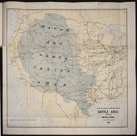
- 1884
- Call Number:
- Zc10 885up
- Collection Title:
- Range and ranch cattle
- Image Count:
- 1
- Resource Type:
- Maps, Atlases & Globes
- Found in:
- Beinecke Rare Book and Manuscript Library > The range and ranch cattle area of the United States
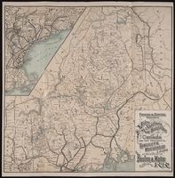
- Creator:
- Boston and Maine Railroad
- Published / Created:
- 1897 May 3
- Call Number:
- 2002 550
- Image Count:
- 1
- Resource Type:
- Maps, Atlases & Globes
- Found in:
- Beinecke Rare Book and Manuscript Library > The direct route to the fishing and hunting resorts of New Hampshire, Maine, and Canada : Lake Winnipesaukee, Rangeley Lakes, Lake St. John, Lake Megantic ...
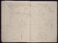
- Call Number:
- 1973 Folio 114
- Collection Title:
- The English pilot: describing the West-India navigation, from Hudson's-Bay to the river Amazones
- Image Count:
- 1
- Resource Type:
- Maps, Atlases & Globes
- Found in:
- Beinecke Rare Book and Manuscript Library > A new and correct chart of the western and southern oceans ...
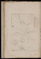
- Creator:
- Pearson, Robert
- Published / Created:
- 1729
- Call Number:
- 1973 Folio 116
- Collection Title:
- The English pilot: describing the West-India navigation, from Hudson's-Bay to the river Amazones
- Image Count:
- 1
- Found in:
- Beinecke Rare Book and Manuscript Library > A new and correct draught of the Bay of Matanzas, on ye north side of ye island Cuba done from a survey in the year 1729.
- Call Number:
- 1973 Folio 114
- Collection Title:
- The English pilot: describing the West-India navigation, from Hudson's-Bay to the river Amazones
- Image Count:
- 1
- Resource Type:
- Maps, Atlases & Globes
- Found in:
- Beinecke Rare Book and Manuscript Library > A new and correct chart of the north part of America from New Found Land to Hudsons Bay
- Call Number:
- 1973 Folio 114
- Collection Title:
- The English pilot: describing the West-India navigation, from Hudson's-Bay to the river Amazones
- Image Count:
- 2
- Resource Type:
- Maps, Atlases & Globes
- Found in:
- Beinecke Rare Book and Manuscript Library > A new generall chart for the West Indies
- Call Number:
- 1973 Folio 114
- Collection Title:
- The English pilot: describing the West-India navigation, from Hudson's-Bay to the river Amazones
- Image Count:
- 1
- Resource Type:
- Maps, Atlases & Globes
- Found in:
- Beinecke Rare Book and Manuscript Library > A chart of the sea coast of Newfoundland, New Scotland, New England, New York, New Jersey, with Virginia and Maryland
- Call Number:
- 1973 Folio 114
- Collection Title:
- The English pilot: describing the West-India navigation, from Hudson's-Bay to the river Amazones
- Image Count:
- 1
- Resource Type:
- Maps, Atlases & Globes
- Found in:
- Beinecke Rare Book and Manuscript Library > A general chart of the western ocean
- Creator:
- Bowen, Emanuel, d. 1767
- Published / Created:
- 1720
- Call Number:
- 1973 Folio 114
- Collection Title:
- The English pilot: describing the West-India navigation, from Hudson's-Bay to the river Amazones
- Image Count:
- 1
- Resource Type:
- Maps, Atlases & Globes
- Found in:
- Beinecke Rare Book and Manuscript Library > The harbour of Casco Bay and islands adjacent
- Call Number:
- 1973 Folio 114
- Collection Title:
- The English pilot: describing the West-India navigation, from Hudson's-Bay to the river Amazones
- Image Count:
- 1
- Resource Type:
- Maps, Atlases & Globes
- Found in:
- Beinecke Rare Book and Manuscript Library > A new and correct chart of the coast of New Foundland from Cape Raze to Cape Bonavista
- Creator:
- Gaudy Iohn
Parker, S
- Call Number:
- 1973 Folio 114
- Collection Title:
- The English pilot: describing the West-India navigation, from Hudson's-Bay to the river Amazones
- Image Count:
- 1
- Resource Type:
- Maps, Atlases & Globes
- Found in:
- Beinecke Rare Book and Manuscript Library > A chart shewing part of the sea coast of New Foundland from ye Bay of Bulls to little Plecentia ...
- Call Number:
- 1973 Folio 114
- Collection Title:
- The English pilot: describing the West-India navigation, from Hudson's-Bay to the river Amazones
- Image Count:
- 1
- Resource Type:
- Maps, Atlases & Globes
- Found in:
- Beinecke Rare Book and Manuscript Library > Harbor Grace
- Call Number:
- 1973 Folio 114
- Collection Title:
- The English pilot: describing the West-India navigation, from Hudson's-Bay to the river Amazones
- Image Count:
- 1
- Resource Type:
- Maps, Atlases & Globes
- Found in:
- Beinecke Rare Book and Manuscript Library > Bay Bulls, part of Newfoundland
- Call Number:
- 1973 Folio 114
- Collection Title:
- The English pilot: describing the West-India navigation, from Hudson's-Bay to the river Amazones
- Image Count:
- 1
- Resource Type:
- Maps, Atlases & Globes
- Found in:
- Beinecke Rare Book and Manuscript Library > Cattalina Harbor
- Call Number:
- 1973 Folio 114
- Collection Title:
- The English pilot: describing the West-India navigation, from Hudson's-Bay to the river Amazones
- Image Count:
- 1
- Resource Type:
- Maps, Atlases & Globes
- Found in:
- Beinecke Rare Book and Manuscript Library > Port Bonavista
- Call Number:
- 1973 Folio 114
- Collection Title:
- The English pilot: describing the West-India navigation, from Hudson's-Bay to the river Amazones
- Image Count:
- 1
- Resource Type:
- Maps, Atlases & Globes
- Found in:
- Beinecke Rare Book and Manuscript Library > Island of St. Peters
- Creator:
- Tiddeman, Mark
- Call Number:
- 1973 Folio 114
- Collection Title:
- The English pilot: describing the West-India navigation, from Hudson's-Bay to the river Amazones
- Image Count:
- 1
- Resource Type:
- Maps, Atlases & Globes
- Found in:
- Beinecke Rare Book and Manuscript Library > A draught of New York from the Hook to New Yorktown
- Call Number:
- 1973 Folio 114
- Collection Title:
- The English pilot: describing the West-India navigation, from Hudson's-Bay to the river Amazones
- Image Count:
- 1
- Resource Type:
- Maps, Atlases & Globes
- Found in:
- Beinecke Rare Book and Manuscript Library > Virginia, Maryland, Pennsilvania, east & west New Jarsey
- Creator:
- Tiddeman, Mark
- Call Number:
- 1973 Folio 114
- Collection Title:
- The English pilot: describing the West-India navigation, from Hudson's-Bay to the river Amazones
- Image Count:
- 1
- Resource Type:
- Maps, Atlases & Globes
- Found in:
- Beinecke Rare Book and Manuscript Library > A draught of Virginia from the capes to York in York River and to Kuiquotan or Hamton in James River
- Call Number:
- 1973 Folio 114
- Collection Title:
- The English pilot: describing the West-India navigation, from Hudson's-Bay to the river Amazones
- Image Count:
- 1
- Resource Type:
- Maps, Atlases & Globes
- Found in:
- Beinecke Rare Book and Manuscript Library > Barbados
- Call Number:
- 1973 Folio 114
- Collection Title:
- The English pilot: describing the West-India navigation, from Hudson's-Bay to the river Amazones
- Image Count:
- 1
- Resource Type:
- Maps, Atlases & Globes
- Found in:
- Beinecke Rare Book and Manuscript Library > A large draft of the island Antegua
- Call Number:
- 1973 Folio 114
- Collection Title:
- The English pilot: describing the West-India navigation, from Hudson's-Bay to the river Amazones
- Image Count:
- 1
- Resource Type:
- Maps, Atlases & Globes
- Found in:
- Beinecke Rare Book and Manuscript Library > A large draft of South Carolina from Cape Roman to Port Royall
- Call Number:
- 1973 Folio 114
- Collection Title:
- The English pilot: describing the West-India navigation, from Hudson's-Bay to the river Amazones
- Image Count:
- 1
- Resource Type:
- Maps, Atlases & Globes
- Found in:
- Beinecke Rare Book and Manuscript Library > A correct chart of the Caribbee Islands
- Creator:
- Price, Charles, fl. 1700-1707
- Call Number:
- 1973 Folio 114
- Collection Title:
- The English pilot: describing the West-India navigation, from Hudson's-Bay to the river Amazones
- Image Count:
- 1
- Resource Type:
- Maps, Atlases & Globes
- Found in:
- Beinecke Rare Book and Manuscript Library > A correct chart of Hispaniola with the Windward Passage