
Search


Limit your search
- Unspecified✖[remove]741
- Public✖[remove]741
- Beinecke Rare Book and Manuscript Library✖[remove]741
- Engravings✖[remove]741
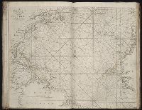
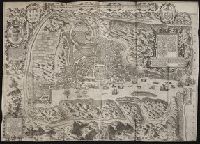
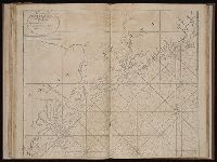
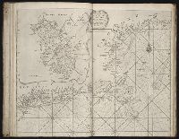
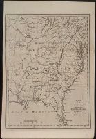
- Maps411
- Maps in books388
- Illustrations304
- Prints (Visual works)169
- Hand coloring126
- Woodcuts46
- Atlases44
- Title pages43
- Intaglio prints36
- Webber, John, 1752-179317
- Faden, William, 1749-1836, creator13
- Catherwood, Frederick11
- Faden, William, 1749-18369
- Thornton, John, 1641-17088
- Anville, Jean Baptiste Bourguignon d', 1697-17827
- Langren, Arnold Florent van, 1580-16447
- Sayer, Robert, 1725-17947
- Berger, D. (Daniel), 1744-18256
- Delarochette, L. (Louis), 1731-1802, creator6
- Pilot guides --Caribbean Area --Early works to 1800129
- Navigation --Early works to 1800105
- Pilot guides --Atlantic Coast (U.S.) --Early works to 1800102
- Atlases --Early works to 180067
- Indians of North America --Florida44
- Voyages and travels --Early works to 180032
- Harbors --Atlantic Coast (North America) --Maps --Early works to 180027
- Nautical charts --Atlantic Coast (North America) --Early works to 180027
- Nautical charts --Caribbean Area --Early works to 180027
- Nautical charts --West Indies --Early works to 180027
- Nicholson, John, d. ca. 1717, bookseller66
- Le Moyne de Morgues, Jacques, d. 1588. Brevis narratio44
- Barker, B. (Benjamin), d. 1764, bookseller24
- Clements, Henry, d. 1719, bookseller24
- King, Charles, d. 1735, bookseller24
- Parker, Richard, fl. 1692-1725, bookseller24
- Tooke, Benjamin, d. 1716, bookseller24
- Bry, Theodor de, 1528-159819
- Chauveton, Urbain, d. ca. 161617
- Exposition universelle de 1889 (Paris, France)16