Search
You Searched For
Search Results
- Published / Created:
- [1782]
- Call Number:
- BrSides Folio 2017 24
- Image Count:
- 1
- Resource Type:
- Maps, Atlases & Globes
- Found in:
- Beinecke Rare Book and Manuscript Library > An accurate map of the islands of St. Christophers and Nevis in the West Indies / by an officer ; with the position of the English and French fleets, February 7th, 1782 ; J. Cary, sc.
- Creator:
- Bowen, Emanuel, 1693 or 1694-1767, creator.
- Published / Created:
- [1749]
- Call Number:
- 2016 1346
- Image Count:
- 1
- Resource Type:
- Maps, Atlases & Globes
- Found in:
- Beinecke Rare Book and Manuscript Library > An accurate map of the county of Huntingdon divided into its hundreds : drawn from surveys and illustrated with various additional improvements ; also historical extracts relating to its trade, manufactures, natural history &c. not extant in any other map
- Creator:
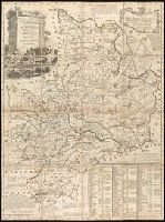
- Kiepert, Heinrich, 1818-1899, cartographer.
- Published / Created:
- 1875
- Call Number:
- BrSides Double Folio 2017 7
- Image Count:
- 1
- Resource Type:
- Maps, Atlases & Globes
- Found in:
- Beinecke Rare Book and Manuscript Library > Operations- und marschrouten-karte zu Lt. H. Stumm's Russischer Feldzug nach Chiwa 1873 / vorzüglich nach Russischen Originalkarten zusammengestellt von H. Kiepert.
- Creator:
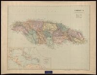
- Edward Stanford Ltd.
- Published / Created:
- [192-?]
- Call Number:
- 8555 1920
- Container / Volume:
- BRBL_00642
- Image Count:
- 1
- Resource Type:
- Maps, Atlases & Globes
- Found in:
- Beinecke Rare Book and Manuscript Library > Jamaica [cartographic material] / Stanford's Geographical Establishment.
- Creator:
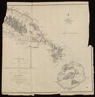
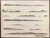
- Vancouver, George, 1757-1798
- Published / Created:
- [1798]
- Call Number:
- BrSides Folio 2017 59
- Collection Title:
- Voyage of discovery to the North Pacific ocean, and round the world.
- Image Count:
- 1
- Resource Type:
- Maps, Atlases & Globes
- Found in:
- Beinecke Rare Book and Manuscript Library > Views of the headlands and islands on the coasts of North West and South America / W. Alexander, delt. from sketches made on the spot ; J. Fittler, sculp.
- Creator:
- Lapie, M. (Pierre), 1779-1850
- Published / Created:
- 1808
- Call Number:
- BrSides Folio 2017 80
- Image Count:
- 1
- Resource Type:
- Maps, Atlases & Globes
- Found in:
- Beinecke Rare Book and Manuscript Library > Carte de la Finlande / dressée par P. Lapie, Capp. Ing. Géogr. ; gravé par Tardieu ainé ; écrit par Giraldon.
- Creator:
- J.H. Colton & Co
- Published / Created:
- 1855
- Call Number:
- BrSides Folio 2017 60
- Image Count:
- 1
- Resource Type:
- Maps, Atlases & Globes
- Found in:
- Beinecke Rare Book and Manuscript Library > The United States of America.
- Creator:
- Bonne, Rigobert, 1727-1794, cartographer.
- Published / Created:
- 1771
- Call Number:
- BrSides Folio 2017 8
- Image Count:
- 1
- Resource Type:
- Maps, Atlases & Globes
- Found in:
- Beinecke Rare Book and Manuscript Library > Partie orientale de l'empire de Russie : extrait de l'Atlas Russien et d'autres cartes / projetée et assujetie aux observations astronomiques posterieures, par Mr. Bonne m.tre de mathémat. ; Arrivet inv. & sculp.
- Creator:
- Vancouver, George, 1757-1798
- Published / Created:
- [1798]
- Call Number:
- BrSides Folio 2017 56
- Collection Title:
- Voyage of discovery to the North Pacific ocean, and round the world.
- Image Count:
- 1
- Resource Type:
- Maps, Atlases & Globes
- Found in:
- Beinecke Rare Book and Manuscript Library > Views of parts of the coast of North West America / W. Alexander delt. from sketches made on the spot ; engraved by B.T. Pouncy.
- Creator:
- Vancouver, George, 1757-1798
- Published / Created:
- [1798]
- Call Number:
- BrSides Folio 2017 58
- Collection Title:
- Voyage of discovery to the North Pacific ocean, and round the world.
- Image Count:
- 1
- Resource Type:
- Maps, Atlases & Globes
- Found in:
- Beinecke Rare Book and Manuscript Library > Views of parts of the coast of North West America / W. Alexander, delt. from sketches made on the spot ; engraved by B.T. Pouncy.
- Creator:
- Robert de Vaugondy, Gilles, 1688-1766.
- Published / Created:
- 1750
- Call Number:
- BrSides Double Folio 2017 6
- Image Count:
- 1
- Resource Type:
- Maps, Atlases & Globes
- Found in:
- Beinecke Rare Book and Manuscript Library > Archipel des Indes Orientales qui comprend les isles de la Sonde, Moluques et Philippines [cartographic material] : tirées des cartes du Neptune oriental / par le Sr. Robert, Géographe ordinaire du Roy ; Guill. Delahaye sculp.
- Creator:
- Anville, Jean Baptiste Bourguignon d', 1697-1782, cartographer.
- Published / Created:
- 1781
- Call Number:
- BrSides Folio 2017 19
- Image Count:
- 1
- Resource Type:
- Maps, Atlases & Globes
- Found in:
- Beinecke Rare Book and Manuscript Library > Carta della bassa Guinea tra il capo tres puntas, e l'equatore / di Mr. d'Anville.
- Creator:
- Phillips, R. (Richard), Sir, 1767-1840
- Published / Created:
- [1806]
- Call Number:
- BrSides Folio 2017 61
- Image Count:
- 1
- Resource Type:
- Maps, Atlases & Globes
- Found in:
- Beinecke Rare Book and Manuscript Library > A map of the country from Rariton River in East Jersey, to Elk Head in Maryland [cartographic material] : shewing the several operations of the American & British armies, in 1776 & 1777 / Neele sc., Strand.
- Creator:
- Levasseur, V. (Victor)
- Published / Created:
- [1846]
- Call Number:
- BrSides Folio 2017 14
- Image Count:
- 1
- Resource Type:
- Maps, Atlases & Globes
- Found in:
- Beinecke Rare Book and Manuscript Library > Colonies françaises (en Afrique) [cartographic material] / géographie et statistique par V. Levasseur ; illustré par Raimond Bonheur ; grave par Laguillermie.
- Creator:
- Mitchell, Samuel P.
- Published / Created:
- [1861]
- Call Number:
- BrSides Folio 2017 83
- Image Count:
- 1
- Resource Type:
- Maps, Atlases & Globes
- Found in:
- Beinecke Rare Book and Manuscript Library > Sketch of the country occupied by the Federal & Confederate Armies on the 18th & 21st July 1861 [cartographic material] / taken by Capt. Saml. P. Mitchell, of 1st Virginia Regiment ; lithographed by F.W. Bornemann.
- Creator:
- Merian, Matthaeus, 1593-1650, creator.
- Published / Created:
- [1644?]
- Call Number:
- BrSides Folio 2017 28
- Image Count:
- 1
- Resource Type:
- Maps, Atlases & Globes
- Found in:
- Beinecke Rare Book and Manuscript Library > Saltzburg.
- Creator:
- Bibliographisches Institut Leipzig, cartographer.
- Published / Created:
- [between 1893 and 1901?]
- Call Number:
- BrSides Folio 2017 17
- Image Count:
- 1
- Resource Type:
- Maps, Atlases & Globes
- Found in:
- Beinecke Rare Book and Manuscript Library > Ober-Guinea und West-Sudan.
- Creator:
- Pacheco, Carlos, 1839-1891.
- Published / Created:
- 1885
- Call Number:
- BrSides Folio 2017 53
- Image Count:
- 1
- Resource Type:
- Maps, Atlases & Globes
- Found in:
- Beinecke Rare Book and Manuscript Library > Map of the city of Mexico authorized for publication with the Mexican guide [cartographic material] / by General Carlos Pacheco, Minister of Public Works, 1885.
- Creator:
- Levasseur, V. (Victor)
- Published / Created:
- [1847?]
- Call Number:
- BrSides Folio 2017 18
- Image Count:
- 1
- Resource Type:
- Maps, Atlases & Globes
- Found in:
- Beinecke Rare Book and Manuscript Library > Ile de la Reunion, Colonie Francaise (Ocean indien) [cartographic material] / geographie et statistique par V. Levasseur Ingr. Geographe.
- Creator:
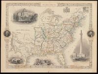
- Rapkin, J
- Published / Created:
- [1857]
- Call Number:
- BrSides 2017 60
- Image Count:
- 1
- Resource Type:
- Maps, Atlases & Globes
- Found in:
- Beinecke Rare Book and Manuscript Library > United States / map drawn & engraved by J. Rapkin.
- Creator:
- Lapie, M. (Pierre), 1779-1850
- Published / Created:
- [1814?]
- Call Number:
- BrSides Folio 2017 79
- Image Count:
- 1
- Resource Type:
- Maps, Atlases & Globes
- Found in:
- Beinecke Rare Book and Manuscript Library > Le royaume de Danemark : avec une partie de la Súede / par Mr. Lapiel ; Tardieu jeune sculp., Pelicier scrip.
- Creator:
- Cram, George Franklin, 1841-1928
- Published / Created:
- [between 1920 and 1929?]
- Call Number:
- BrSides Folio 2017 3
- Image Count:
- 1
- Resource Type:
- Maps, Atlases & Globes
- Found in:
- Beinecke Rare Book and Manuscript Library > Connecticut.
- Creator:
- Blankaart, Nikolaas, 1624-1703, cartographer.
- Published / Created:
- [1652?]
- Call Number:
- BrSides Folio 2017 6
- Image Count:
- 1
- Resource Type:
- Maps, Atlases & Globes
- Found in:
- Beinecke Rare Book and Manuscript Library > Asia antiqua cum finitimis Africae et Europae regionibus / Nicolaus Blancardus Belga, Leidensis, ad lucem aevi veteris delineabat.
- Creator:
- Neele, Samuel John, 1758-1824, cartographer.
- Published / Created:
- [1803]
- Call Number:
- BrSides Folio 2017 15
- Image Count:
- 1
- Resource Type:
- Maps, Atlases & Globes
- Found in:
- Beinecke Rare Book and Manuscript Library > Map of the course of the Nile from Thebes to Cairo : with the track of the Indian Army / S.I. Neele, sc., 352 Strand.
- Creator:
- Fer, Nicolas de, 1646-1720, cartographer.
- Published / Created:
- [approximately 1710]
- Call Number:
- 3887 1710
- Container / Volume:
- BRBL_00183
- Image Count:
- 1
- Resource Type:
- Maps, Atlases & Globes
- Found in:
- Beinecke Rare Book and Manuscript Library > Le Roussillon, subdivisé en Cerdagne, Capsir, Conflans, Vals de Carol et de Spir, ou se trouve encore le Lampourdan, faisant partie de la Catalogne / mis au jour par N. de Fer, Geographe de sa Majeste Catolique ; H. van Loon sculp.
- Creator:
- Homann, Johann Baptist, 1663-1724.
- Published / Created:
- between 1716 and 1737?]
- Call Number:
- 71 1705
- Container / Volume:
- BRBL_00687
- Image Count:
- 1
- Resource Type:
- Maps, Atlases & Globes
- Found in:
- Beinecke Rare Book and Manuscript Library > Regni Mexicani seu Novae Hispaniae, Ludovicianae, N. Angliae, Carolinae, Virginiae et Pensylvaniae necnon insularum archipelagi Mexicani in America Septentrionali / accurata tabula exhibita â Ioh. Baptista Homanno.
- Creator:
- Jode, Cornelis de, 1568-1600.
- Published / Created:
- [1593?]
- Call Number:
- BrSides Folio 2017 35
- Image Count:
- 1
- Resource Type:
- Maps, Atlases & Globes
- Found in:
- Beinecke Rare Book and Manuscript Library > China regnvm.
- Creator:
- France. Corps d'état-major, cartographer.
- Published / Created:
- [1901]
- Call Number:
- 38 V61 1901
- Container / Volume:
- BRBL_00167
- Image Count:
- 1
- Resource Type:
- Maps, Atlases & Globes
- Found in:
- Beinecke Rare Book and Manuscript Library > Paris S.O.
- Creator:
- Krevelt, A. van
- Published / Created:
- 1779
- Call Number:
- BrSides Folio 2017 81
- Image Count:
- 1
- Resource Type:
- Maps, Atlases & Globes
- Found in:
- Beinecke Rare Book and Manuscript Library > Carte qui indique la route des vaisseaux de roi le Race-Horse et la Carcasse : pendant l'expedition vers le Pole Boreal en 1773, pour servir à l'Histoire Générale des Voyages / A. v. Krevelt sculps.
- Published / Created:
- [1886?]
- Call Number:
- BrSides Folio 2017 52
- Image Count:
- 1
- Resource Type:
- Maps, Atlases & Globes
- Found in:
- Beinecke Rare Book and Manuscript Library > Map of the environs of the City of Mexico [cartographic material] / authorized for publication with the Mexican guide by General Carlos Pacheco, Minister of Public Works, 1886.
- Creator:
- Homann Erben (Firm)
- Published / Created:
- 1749
- Call Number:
- BrSides Double Folio 2017 5
- Image Count:
- 1
- Resource Type:
- Maps, Atlases & Globes
- Found in:
- Beinecke Rare Book and Manuscript Library > Tatariae sinensis mappa geographica [cartographic material] / ex tabuli specialibus R.R.P.P. Iesuitarum nec non relationibus R.P. Gerbillon per Dom D'Anville geographum parisiensem primum Ao. 1732 nunc secundam LL. projectionis stereographicae in usum tra
- Creator:
- Kino, Eusebio Francisco,--1644-1711
- Published / Created:
- [1705?]
- Call Number:
- BrSides 2017 45
- Collection Title:
- Letters from missions. Lettres édifiantes et curieuses, écrites des missions étrangères.
- Image Count:
- 1
- Resource Type:
- Maps, Atlases & Globes
- Found in:
- Beinecke Rare Book and Manuscript Library > Passage par terre a la Californie decouverte par le R.P. Eusebe- François Kino, Jesuite depuis 1698 jusqu'a 1701 ou l'on voit encore les Nouvelles Missions des PP. de la Compag.e de Jesus [cartographic material] / gravée par Inselin.
- Creator:
- Anville, Jean Baptiste Bourguignon d', 1697-1782.
- Published / Created:
- [between 1743-1747?]
- Call Number:
- BrSides Folio 2017 16
- Image Count:
- 1
- Resource Type:
- Maps, Atlases & Globes
- Found in:
- Beinecke Rare Book and Manuscript Library > A general map of the River Sanaga, from the falls of Govina to the Ocean / taken by a French Engineer in 1718, & drawn by Sr. d'Anville, from his particular draughts ; G. Child, sculpt.
- Creator:
- Lodge, John, -1796
- Published / Created:
- [1778?]
- Call Number:
- BrSides 2017 62
- Image Count:
- 1
- Resource Type:
- Maps, Atlases & Globes
- Found in:
- Beinecke Rare Book and Manuscript Library > A general map of North America ; from the latest observations / engrav'd by Jno. Lodge from the late Mr. Jefferys, geographer to the King.
- Creator:
- Mitchell, S. Augustus (Samuel Augustus), 1792-1868
- Published / Created:
- 1847
- Call Number:
- BrSides 2017 63
- Image Count:
- 1
- Resource Type:
- Maps, Atlases & Globes
- Found in:
- Beinecke Rare Book and Manuscript Library > City of Washington [cartographic material].
- Creator:
- Jefferys, Thomas, -1771.
- Published / Created:
- [1748]
- Call Number:
- BrSides Folio 2017 11
- Image Count:
- 1
- Resource Type:
- Maps, Atlases & Globes
- Found in:
- Beinecke Rare Book and Manuscript Library > Africa [cartographic material] / drawn from the best maps by T. Jefferys, Geographer to his Royal Highness the Prince of Wales.
- Creator:
- Wit, Frederik de
- Published / Created:
- [170-?]
- Call Number:
- BrSides Double Folio 2019 113
- Image Count:
- 1
- Resource Type:
- Maps, Atlases & Globes
- Found in:
- Beinecke Rare Book and Manuscript Library > Nova et accurate divisa in regna et regiones praecipuas Europae descriptio / per F. de Witt ; F. de wit excudit.
- Call Number:
- BrSides Double Folio 2017 38
- Image Count:
- 1
- Resource Type:
- Maps, Atlases & Globes
- Found in:
- Beinecke Rare Book and Manuscript Library > The theatre of war in North America, with the roads, and tables, of the superficial contents, distances, & ca. / by an American.
- Creator:
- Goos, Pieter, approximately 1616-1675
- Call Number:
- Lanman 27 1666
- Image Count:
- 1
- Resource Type:
- Maps, Atlases & Globes
- Found in:
- Beinecke Rare Book and Manuscript Library > Paskaerte zynde t'Oosterdeel van Oost Indien : met alle de Eylanden daer ontrendt geleegen van C. Comorin tot aen Iapan / by Pieter Goos, op't Waeter in de Vergulde Zeespiegel.
- Creator:
- Ortelius, Abraham, 1527-1598
- Call Number:
- Lanman 343 1587
- Image Count:
- 1
- Resource Type:
- Maps, Atlases & Globes
- Found in:
- Beinecke Rare Book and Manuscript Library > Islandia.
- Creator:
- Wilbrecht, Alexander
- Published / Created:
- [1793?] and [1795?]
- Call Number:
- Lada-Mocarski 352 1793
- Image Count:
- 1
- Resource Type:
- Maps, Atlases & Globes
- Found in:
- Beinecke Rare Book and Manuscript Library > Chertezhʺ novoprīobri︠e︡tennymʺ otʺ Polʹshi Rossīei︠u︡ zemli︠a︡mʺ vʺ 1793 godu / soch: A. Vilbrekhtʺ.
- Creator:
- Wit, Frederik de
- Call Number:
- BrSides Double Folio 2019 115
- Image Count:
- 1
- Resource Type:
- Maps, Atlases & Globes
- Found in:
- Beinecke Rare Book and Manuscript Library > Novissima et accuratissima septentrionalis ac meridionalis Americae : descriptio, multis locis recentibus aucta et correcté divisa in omnes partes hodiernas / per Fredericum de Witt ; F. de Wit excudit.
- Creator:
- Pownall, Thomas, 1722-1805
- Published / Created:
- 1776
- Call Number:
- Franklin 131 1776-5
- Image Count:
- 1
- Resource Type:
- Maps, Atlases & Globes
- Found in:
- Beinecke Rare Book and Manuscript Library > The provinces of New York and New Jersey [cartographic material] : with part of Pensilvania, and the Province of Quebec / drawn by Major Holland, Surveyor General, of the Northern District in America ; corrected and improved, from the original materials, by Governr. Pownall, Member of Parliament, 1776.
- Creator:
- Kino, Eusebio Francisco, 1644-1711
- Published / Created:
- [1726]
- Call Number:
- Lanman 844 1702
- Image Count:
- 1
- Resource Type:
- Maps, Atlases & Globes
- Found in:
- Beinecke Rare Book and Manuscript Library > Tabula Californiae, anno 1702 [cartographic material] : ex autoptica observatione delineata a R.P. Chino è S.I.
- Creator:
- National Railway Publication Company
- Call Number:
- BrSides Zc19 N82h 870na
- Image Count:
- 1
- Resource Type:
- Maps, Atlases & Globes
- Found in:
- Beinecke Rare Book and Manuscript Library > Map of the Northern Pacific Railway and tributary country.
- Published / Created:
- [1852?]
- Call Number:
- 40 V55 1850A
- Image Count:
- 1
- Resource Type:
- Maps, Atlases & Globes
- Found in:
- Beinecke Rare Book and Manuscript Library > Governo di Venezia, provincia de Venezia.
- Creator:
- L'Isle, Guillaume de, 1675-1726.
- Published / Created:
- 1730
- Call Number:
- 60 1730
- Image Count:
- 1
- Resource Type:
- Maps, Atlases & Globes
- Found in:
- Beinecke Rare Book and Manuscript Library > Carte d'Afrique / dressée pour l'usage du Roy par Guillaume Delisle, premier geographe de sa Majesté, de l'aacademie [sic] royale des sciences.
- Creator:
- Wit, Frederik de
- Published / Created:
- [1688?]
- Call Number:
- BrSides Double Folio 2019 114
- Image Count:
- 1
- Resource Type:
- Maps, Atlases & Globes
- Found in:
- Beinecke Rare Book and Manuscript Library > Totius Africae accuratissima tabula [cartographic material] : denuo correcte revisa multis locis aucta, in partes tam maiores quam minores divisa / per F. de Witt.
- Published / Created:
- [1842?]
- Call Number:
- 361 1845B
- Image Count:
- 1
- Resource Type:
- Maps, Atlases & Globes
- Found in:
- Beinecke Rare Book and Manuscript Library > Abtheilung [sic] II, die nicht zum deutschen bunde gehörigen östlichen provinzen des Preussischen Staats.
- Creator:
- Payne, John, active 1800, cartographer.
- Call Number:
- 3614 1792
- Image Count:
- 1
- Resource Type:
- Maps, Atlases & Globes
- Found in:
- Beinecke Rare Book and Manuscript Library > The Kingdom of Bohemia, 1792 / Ferguson sculp.