Search
You Searched For
Search Results
- Creator:
- R.P. Studley Co
- Published / Created:
- [1871?]
- Call Number:
- 806ae C43 1871A
- Container / Volume:
- BRBL_00549
- Image Count:
- 1
- Resource Type:
- Maps, Atlases & Globes
- Found in:
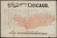
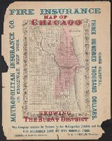
- Beinecke Rare Book and Manuscript Library > Map showing the burnt district in Chicago / published by the R.P. Studley Company, St. Louis.
- Published / Created:
- 1860
- Call Number:
- 806gme C43 1860
- Container / Volume:
- BRBL_00549
- Image Count:
- 1
- Resource Type:
- Maps, Atlases & Globes
- Found in:
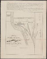
- Beinecke Rare Book and Manuscript Library > Plat exhibiting the location of the Southern Michigan and Rock Island R.R. depots and adjacent grounds. / lithographed by Ed Mendel.
- Published / Created:
- 1860
- Call Number:
- 806gme 1860B
- Container / Volume:
- BRBL_00549
- Image Count:
- 1
- Resource Type:
- Maps, Atlases & Globes
- Found in:
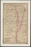
- Beinecke Rare Book and Manuscript Library > Map of the Illinois River Railroad / W.G. Wheaton, civil engineer.
- Creator:
- Union News Company (Boston, Mass.)
- Published / Created:
- 1893]
- Call Number:
- 806 C43 1893
- Container / Volume:
- BRBL_00548
- Image Count:
- 1
- Resource Type:
- Maps, Atlases & Globes
- Found in:
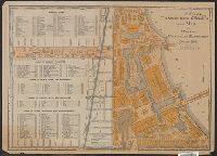
- Beinecke Rare Book and Manuscript Library > The Union News Company's indexed map of the Worlds Columbian exposition at Chicago, 1893 [cartographic material].
- Published / Created:
- 1853
- Call Number:
- 806gme G132 1853A
- Container / Volume:
- BRBL_00549
- Image Count:
- 1
- Resource Type:
- Maps, Atlases & Globes
- Found in:
- Beinecke Rare Book and Manuscript Library > Map showing the Galena & Chicago Union Railroad and its connections.
- Creator:
- United States. General Land Office
- Published / Created:
- 1866
- Call Number:
- 806gbc 1866
- Container / Volume:
- BRBL_00549
- Image Count:
- 1
- Resource Type:
- Maps, Atlases & Globes
- Found in:
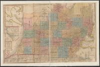
- Beinecke Rare Book and Manuscript Library > Map of the state of Illinois [cartographic material].
- Published / Created:
- 1855
- Call Number:
- 811ca 1855
- Container / Volume:
- BRBL_00554
- Image Count:
- 1
- Resource Type:
- Maps, Atlases & Globes
- Found in:
- Beinecke Rare Book and Manuscript Library > [Western part of upper peninsula, Michigan].
- Creator:
- Colton, G. Woolworth (George Woolworth), 1827-1901
- Published / Created:
- 1861
- Call Number:
- 806gme 1861
- Container / Volume:
- BRBL_00549
- Image Count:
- 1
- Resource Type:
- Maps, Atlases & Globes
- Found in:
- Beinecke Rare Book and Manuscript Library > G. Woolworth Colton's railroad map of Illinois.
- Published / Created:
- 1887
- Call Number:
- 806gme C43 1887
- Container / Volume:
- BRBL_00549
- Image Count:
- 1
- Resource Type:
- Maps, Atlases & Globes
- Found in:
- Beinecke Rare Book and Manuscript Library > Map showing location of the Chicago and Calumet terminal railway : around Chicago, Illinois 1887 / Office of chief engineer, C. & C.T. Ry. Co. Hammond Ind.
- Call Number:
- 8075cea 1848
- Container / Volume:
- BRBL_00551
- Image Count:
- 1
- Resource Type:
- Maps, Atlases & Globes
- Found in:
- Beinecke Rare Book and Manuscript Library > A Chart of Lake Erie ... Buffalo, A. Burke, 1848.
- Published / Created:
- [1860?]
- Call Number:
- 806 C43 1860
- Container / Volume:
- BRBL_00548
- Image Count:
- 1
- Resource Type:
- Maps, Atlases & Globes
- Found in:
- Beinecke Rare Book and Manuscript Library > Map of Hyde Park, Calumet, Thorntorn, South Chicago and Northern Portion of Lake County, Ind.
- Creator:
- G.W. & C.B. Colton & Co
- Published / Created:
- [1871]
- Call Number:
- 806 C43 1871
- Container / Volume:
- BRBL_00548
- Image Count:
- 1
- Resource Type:
- Maps, Atlases & Globes
- Found in:
- Beinecke Rare Book and Manuscript Library > The city of Chicago, Illinois.
- Creator:
- G.W. & C.B. Colton & Co
- Published / Created:
- [1871]
- Call Number:
- 806 C43 1871A
- Container / Volume:
- BRBL_00548
- Image Count:
- 1
- Resource Type:
- Maps, Atlases & Globes
- Found in:
- Beinecke Rare Book and Manuscript Library > The city of Chicago, Illinois.
- Published / Created:
- 1900
- Call Number:
- 806 Ev17 1900
- Container / Volume:
- BRBL_00548
- Image Count:
- 1
- Resource Type:
- Maps, Atlases & Globes
- Found in:
- Beinecke Rare Book and Manuscript Library > [Map of Evanston, Illinois].
- Published / Created:
- 1892
- Call Number:
- 806 C43 1892
- Container / Volume:
- BRBL_00548
- Image Count:
- 1
- Resource Type:
- Maps, Atlases & Globes
- Found in:
- Beinecke Rare Book and Manuscript Library > Rand McNally and Co.'s new map of Chicago and suburbs / showing the location of the World's Columbian Exposition, streets, parks, boulevards, railroads, street car lines, etc.
- Published / Created:
- 1887
- Call Number:
- 806 C43 1887A
- Container / Volume:
- BRBL_00548
- Image Count:
- 1
- Resource Type:
- Maps, Atlases & Globes
- Found in:
- Beinecke Rare Book and Manuscript Library > Map showing the boulevards and park system : and twelve miles of lake frontage of the City of Chicago.
- Creator:
- Blanchard, Rufus, 1821-1904
- Published / Created:
- 1893
- Call Number:
- 806 C43 1893A
- Container / Volume:
- BRBL_00548
- Image Count:
- 1
- Resource Type:
- Maps, Atlases & Globes
- Found in:
- Beinecke Rare Book and Manuscript Library > Map of Chicago and suburbs.
- Published / Created:
- 1948
- Call Number:
- 807 1948
- Container / Volume:
- BRBL_00551
- Image Count:
- 1
- Resource Type:
- Maps, Atlases & Globes
- Found in:
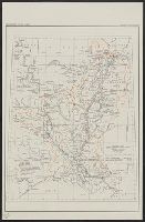
- Beinecke Rare Book and Manuscript Library > Division map : Lower Mississippi valley division / Major Gen. R.W. Crawford, Division Engineer.
- Published / Created:
- 1870
- Call Number:
- 806 C43 1870
- Container / Volume:
- BRBL_00548
- Image Count:
- 1
- Resource Type:
- Maps, Atlases & Globes
- Found in:
- Beinecke Rare Book and Manuscript Library > Map of Chicago and environs.
- Published / Created:
- 1857
- Call Number:
- 806 C43 1857
- Container / Volume:
- BRBL_00548
- Image Count:
- 1
- Resource Type:
- Maps, Atlases & Globes
- Found in:
- Beinecke Rare Book and Manuscript Library > Map of Chicago.
- Published / Created:
- 1857
- Call Number:
- 806 C43 1857B
- Container / Volume:
- BRBL_00548
- Image Count:
- 1
- Resource Type:
- Maps, Atlases & Globes
- Found in:
- Beinecke Rare Book and Manuscript Library > Map of Chicago.
- Published / Created:
- 1834
- Call Number:
- 806gmb C43 1834
- Container / Volume:
- BRBL_00549
- Image Count:
- 1
- Resource Type:
- Maps, Atlases & Globes
- Found in:
- Beinecke Rare Book and Manuscript Library > Chicago. Drwn by J.S.Wright, according to survey.
- Published / Created:
- 1913
- Call Number:
- 825 L487 1913
- Container / Volume:
- BRBL_00574
- Image Count:
- 1
- Resource Type:
- Maps, Atlases & Globes
- Found in:
- Beinecke Rare Book and Manuscript Library > General map of vicinity of Leavenworth.
- Published / Created:
- 1879?]
- Call Number:
- 825 K134 1879
- Container / Volume:
- BRBL_00574
- Image Count:
- 1
- Resource Type:
- Maps, Atlases & Globes
- Found in:
- Beinecke Rare Book and Manuscript Library > Riverview, Wyandott County, Kansas / surveyed April 2nd 1879 by Dan'l OFlaherty, civil eng'r. Kansas City and surroundings / compiled and drawn by D.M. Smith, Wyandott, Kansas ; Ramsey, Millett & Hudson, map engravers, Kns. City Mo.
- Creator:
- Midcontinent Map Company
- Published / Created:
- [1950?]
- Call Number:
- 827ad C245 1950
- Container / Volume:
- BRBL_00578
- Image Count:
- 1
- Resource Type:
- Maps, Atlases & Globes
- Found in:
- Beinecke Rare Book and Manuscript Library > Carter County, Okla.
- Published / Created:
- 1922?]
- Call Number:
- 825ad An23 1922
- Container / Volume:
- BRBL_00575
- Image Count:
- 1
- Resource Type:
- Maps, Atlases & Globes
- Found in:
- Beinecke Rare Book and Manuscript Library > [Map of sections in townships 20 S and 21 S, and ranges 19 E and 20 E, Anderson County, Kansas] / F.S.T. 3/25/'22, Garnett, Kas.
- Published / Created:
- c1888.
- Call Number:
- 825gme 1888
- Container / Volume:
- BRBL_00576
- Image Count:
- 1
- Resource Type:
- Maps, Atlases & Globes
- Found in:
- Beinecke Rare Book and Manuscript Library > Map of Kansas / issued by the State Board of Railroad Commissioners.
- Published / Created:
- 1889
- Call Number:
- 827 G984 1889
- Container / Volume:
- BRBL_00577
- Image Count:
- 1
- Resource Type:
- Maps, Atlases & Globes
- Found in:
- Beinecke Rare Book and Manuscript Library > Map of the city of Guthrie, Oklahoma, Indian Territory.
- Published / Created:
- 1874
- Call Number:
- 831 1874A
- Container / Volume:
- BRBL_00579
- Image Count:
- 1
- Resource Type:
- Maps, Atlases & Globes
- Found in:
- Beinecke Rare Book and Manuscript Library > Asher & Adams' Montana : eastern portion.
- Creator:
- United States. Census Office
- Published / Created:
- 1890
- Call Number:
- 826 1890
- Container / Volume:
- BRBL_00577
- Image Count:
- 1
- Resource Type:
- Maps, Atlases & Globes
- Found in:
- Beinecke Rare Book and Manuscript Library > Map of Indian Territory and Oklahoma.
- Published / Created:
- 1889
- Call Number:
- 827 1889
- Container / Volume:
- BRBL_00577
- Image Count:
- 1
- Resource Type:
- Maps, Atlases & Globes
- Found in:
- Beinecke Rare Book and Manuscript Library > Indian territory / compiled under the direction of the Hon. John H. Oberly, Commissioner of Indian Affairs, by C.A. Maxwell ; John Olberg, draftsman.
- Creator:
- De Lacy, W. W. (Walter Washington), 1819-1892
- Published / Created:
- 1871
- Call Number:
- 831 1871
- Container / Volume:
- BRBL_00579
- Image Count:
- 1
- Resource Type:
- Maps, Atlases & Globes
- Found in:
- Beinecke Rare Book and Manuscript Library > Map of the territory of Montana with portions of the adjoining territories / compiled and drawn by W.W. De Lacy of the Surveyor General's Office.
- Creator:
- Triangle Blue Print & Supply Co
- Published / Created:
- [1923]
- Call Number:
- 827 T829 1923
- Container / Volume:
- BRBL_00578
- Image Count:
- 1
- Resource Type:
- Maps, Atlases & Globes
- Found in:
- Beinecke Rare Book and Manuscript Library > Tulsa and vicinity.
- Creator:
- United States. General Land Office
- Published / Created:
- 1860?
- Call Number:
- 825fcm 1860
- Container / Volume:
- BRBL_00575
- Image Count:
- 1
- Resource Type:
- Maps, Atlases & Globes
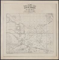
- Found in:
- Beinecke Rare Book and Manuscript Library > Map showing the progress of the public surveys in the territories of Kansas and Nebraska : to accompany annual report of the Surveyor General, 1860.
- Creator:
- Topeka (Kan.). City Engineer
- Published / Created:
- 1938]
- Call Number:
- 825gmb T621 1938
- Container / Volume:
- BRBL_00576
- Image Count:
- 1
- Resource Type:
- Maps, Atlases & Globes
- Found in:
- Beinecke Rare Book and Manuscript Library > Official line map of the city of Topeka, Kansas : March 1, 1938 / W.E. Baldry, C.E., City Engineer.
- Creator:
- Everts, L. H. (Louis H.)
- Published / Created:
- [between 1877 and 1883?]
- Call Number:
- 825fac 1883
- Container / Volume:
- BRBL_00575
- Image Count:
- 1
- Resource Type:
- Maps, Atlases & Globes
- Found in:
- Beinecke Rare Book and Manuscript Library > Official topographical map of Kansas / compiled from government surveys, official records, and personal investigations.
- Published / Created:
- [between 1900 and 1907?]
- Call Number:
- 826 1900
- Container / Volume:
- BRBL_00577
- Image Count:
- 1
- Resource Type:
- Maps, Atlases & Globes
- Found in:
- Beinecke Rare Book and Manuscript Library > Classification map of the Cherokee Nation, Indian Territory : compiled from official records of the United States Geological Survey / prepared for the Bradley Realty Bank and Trust Co.
- Creator:
- Hunnius, Ado
- Published / Created:
- 1876
- Call Number:
- 825gmb L487 1876
- Container / Volume:
- BRBL_00576
- Image Count:
- 1
- Resource Type:
- Maps, Atlases & Globes
- Found in:
- Beinecke Rare Book and Manuscript Library > Plan of the city of Leavenworth, Kansas / by Ado Hunnius.
- Creator:
- De Lacy, W. W. (Walter Washington), 1819-1892
- Published / Created:
- 1878
- Call Number:
- 831 1878
- Container / Volume:
- BRBL_00579
- Image Count:
- 1
- Resource Type:
- Maps, Atlases & Globes
- Found in:
- Beinecke Rare Book and Manuscript Library > Map of the territory of Montana with portions of the adjoining territories / compiled and drawn by W.W. De Lacy, civil engineer & surveyor, Helena, M.T.
- Published / Created:
- c1889.
- Call Number:
- 825fb K134 1889
- Container / Volume:
- BRBL_00575
- Image Count:
- 1
- Resource Type:
- Maps, Atlases & Globes
- Found in:
- Beinecke Rare Book and Manuscript Library > Kansas City, Kansas / Everts & Howell, engravers, Phila., Pa.
- Creator:
- Rand McNally and Company
- Published / Created:
- 1911
- Call Number:
- 827 1911
- Container / Volume:
- BRBL_00577
- Image Count:
- 1
- Resource Type:
- Maps, Atlases & Globes
- Found in:
- Beinecke Rare Book and Manuscript Library > Oklahoma.
- Creator:
- Johnson, A. J. (Alvin Jewett), 1827-1884
- Published / Created:
- 1858
- Call Number:
- 825fb 1858
- Container / Volume:
- BRBL_00575
- Image Count:
- 1
- Resource Type:
- Maps, Atlases & Globes
- Found in:
- Beinecke Rare Book and Manuscript Library > Johnson's county, township, and sectional Kansas and Nebraska.
- Published / Created:
- 188-?]
- Call Number:
- 825 K134 188X
- Container / Volume:
- BRBL_00574
- Image Count:
- 1
- Resource Type:
- Maps, Atlases & Globes
- Found in:
- Beinecke Rare Book and Manuscript Library > Map of the vicinity of Kansas City in Kansas and Missouri / compliments of H.C. Lloyd & Co., real estate brokers and builders ... Kansas City, Mo. ; MacCormac eng. Phila.
- Published / Created:
- 1945?]
- Call Number:
- 825am C654 1945
- Container / Volume:
- BRBL_00575
- Image Count:
- 1
- Resource Type:
- Maps, Atlases & Globes
- Found in:
- Beinecke Rare Book and Manuscript Library > [Aerial photo of Coffeyville, Kansas].
- Creator:
- U.S. Army Command and General Staff College
- Published / Created:
- [1907?]
- Call Number:
- 825 L487 1907
- Container / Volume:
- BRBL_00574
- Image Count:
- 1
- Resource Type:
- Maps, Atlases & Globes
- Found in:
- Beinecke Rare Book and Manuscript Library > Map of Fort Leavenworth, Kas. and vicinity / compiled from surveys made by the staff class of 1904-05, 1905-06 ; under the direction of the commandant of the Infantry and Cavalry School, Signal School and Staff College.
- Published / Created:
- 1909?]
- Call Number:
- 825 L487 1909
- Container / Volume:
- BRBL_00574
- Image Count:
- 1
- Resource Type:
- Maps, Atlases & Globes
- Found in:
- Beinecke Rare Book and Manuscript Library > Map of Fort Leavenworth, Kansas and vicinity.
- Creator:
- U.S. Army Command and General Staff College
- Published / Created:
- [1907?]
- Call Number:
- 825 L487 1907
- Container / Volume:
- BRBL_00574
- Image Count:
- 1
- Resource Type:
- Maps, Atlases & Globes
- Found in:
- Beinecke Rare Book and Manuscript Library > Map of Fort Leavenworth, Kas. and vicinity / compiled from surveys made by the staff class of 1904-05, 1905-06 ; under the direction of the commandant of the Infantry and Cavalry School, Signal School and Staff College.
- Creator:
- United States. General Land Office
- Published / Created:
- 1866
- Call Number:
- 825fcm 1866
- Container / Volume:
- BRBL_00575
- Image Count:
- 1
- Resource Type:
- Maps, Atlases & Globes
- Found in:
- Beinecke Rare Book and Manuscript Library > Map showing the progress of the public surveys in Kansas and Nebraska / Surveyor General's Office ; Department of the Interior, General Land Office, Oct. 2nd, 1866.
- Creator:
- United States. Surveyor General
- Published / Created:
- 1862?]
- Call Number:
- 825fcm 1862
- Container / Volume:
- BRBL_00575
- Image Count:
- 1
- Resource Type:
- Maps, Atlases & Globes
- Found in:
- Beinecke Rare Book and Manuscript Library > Map showing the progress of the public surveys in Kansas and Nebraska : to accompany annual report of the Surveyor General, 1862 / Surveyor General's Office, Leavenworth, Kansas.
- Creator:
- Tulsa (Okla.). Office of the City Engineer
- Published / Created:
- [1950]
- Call Number:
- 827 T829 1950A
- Container / Volume:
- BRBL_00578
- Image Count:
- 1
- Resource Type:
- Maps, Atlases & Globes
- Found in:
- Beinecke Rare Book and Manuscript Library > Tulsa, Oklahoma / Office of the City Engineer.
- Creator:
- Rand McNally and Company
- Published / Created:
- 1891
- Call Number:
- 831 1891
- Container / Volume:
- BRBL_00580
- Image Count:
- 1
- Resource Type:
- Maps, Atlases & Globes
- Found in:
- Beinecke Rare Book and Manuscript Library > Rand McNally & Co.'s Montana.
- Creator:
- American Publishing Co. (Milwaukee, Wis.)
- Published / Created:
- 1890
- Call Number:
- 831 H36 1890
- Container / Volume:
- BRBL_00580
- Image Count:
- 1
- Resource Type:
- Maps, Atlases & Globes
- Found in:
- Beinecke Rare Book and Manuscript Library > Perspective map of the city of Helena, Mont. : capital of state, county seat of Lewis & Clarke Co. / compliments of Kessler's Brewery.
- Creator:
- La Fromboise, Conrad
- Published / Created:
- 1979
- Call Number:
- 831 1979
- Container / Volume:
- BRBL_00580
- Image Count:
- 1
- Resource Type:
- Maps, Atlases & Globes
- Found in:
- Beinecke Rare Book and Manuscript Library > Si-ksi-kay-tsi-ta-pi, sin-na-ki-sin, nita-ta-tsi ki mi-sta-ki-tsi : Blackfeet language map, rivers and mountains / compiled by Conrad La Fromboise.
- Published / Created:
- 1882
- Call Number:
- 831 J89 1882
- Container / Volume:
- BRBL_00580
- Image Count:
- 1
- Resource Type:
- Maps, Atlases & Globes
- Found in:
- Beinecke Rare Book and Manuscript Library > Map of Judith Basin, Montana Ter. / Northern Transcontinental Survey, Raphael Pumpelly, director ; Department of Topography, A.D. Wilson, chief topographer ; lettering by F.D. Owen.
- Creator:
- United States. Bureau of the Census
- Published / Created:
- 1934
- Call Number:
- 831fb 1930
- Container / Volume:
- BRBL_00581
- Image Count:
- 1
- Resource Type:
- Maps, Atlases & Globes
- Found in:
- Beinecke Rare Book and Manuscript Library > Montana, minor civil divisions : 1930 / Bureau of the Census.
- Creator:
- United States. General Land Office
- Published / Created:
- c1939.
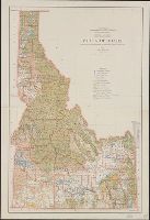
- Call Number:
- 832cbf 1939
- Container / Volume:
- BRBL_00583
- Image Count:
- 1
- Resource Type:
- Maps, Atlases & Globes
- Found in:
- Beinecke Rare Book and Manuscript Library > State of Idaho / compiled from the official records of the General Land Office and other sources ; compiled and drawn by H. Ruh ; revised by T.W. Gales ; relief by D.E. Walker.
- Creator:
- Rand McNally and Company
- Published / Created:
- [1932]
- Call Number:
- 831 1932A
- Container / Volume:
- BRBL_00580
- Image Count:
- 1
- Resource Type:
- Maps, Atlases & Globes
- Found in:
- Beinecke Rare Book and Manuscript Library > Rand McNally standard map of Montana with air trails ; Rand McNally standard map of Montana.
- Creator:
- Rand McNally and Company
- Published / Created:
- 1911
- Call Number:
- 831 1911
- Container / Volume:
- BRBL_00580
- Image Count:
- 1
- Resource Type:
- Maps, Atlases & Globes
- Found in:
- Beinecke Rare Book and Manuscript Library > Montana.
- Creator:
- Nicholson, W. L
- Published / Created:
- 1882?]
- Call Number:
- 831 1882
- Container / Volume:
- BRBL_00579
- Image Count:
- 1
- Resource Type:
- Maps, Atlases & Globes
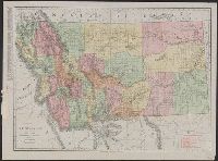
- Found in:
- Beinecke Rare Book and Manuscript Library > Preliminary post route map of the territories of Montana, Idaho, Wyoming, Utah, Arizona, New Mexico and state of Colorado, with parts of adjacent states and territories / designed and constructed under the orders of Postmaster General D.M. Key by W.L. Nic
- Creator:
- Woodruff, Thomas Mayhew, d. 1899
- Published / Created:
- 187-?]
- Call Number:
- 831 1878B
- Container / Volume:
- BRBL_00579
- Image Count:
- 1
- Resource Type:
- Maps, Atlases & Globes
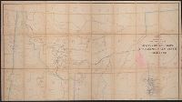
- Found in:
- Beinecke Rare Book and Manuscript Library > Map showing a portion of the marches of troops under Genl. N.A. Miles command 1876-1878 / drawn by Thom. M. Woodruff, Lt. 5th Inftry A.A.D.C., March 1st 1878.
- Creator:
- Reeder & Helmick
- Published / Created:
- [18--?]
- Call Number:
- 831 H36 18XX
- Container / Volume:
- BRBL_00580
- Image Count:
- 1
- Resource Type:
- Maps, Atlases & Globes
- Found in:
- Beinecke Rare Book and Manuscript Library > Map showing property adjacent to the city of Helena / compiled by Jno. S.M. Neil ; drawn by Reeder & Helmick.
- Creator:
- United States. General Land Office
- Published / Created:
- 1879
- Call Number:
- 831 1879
- Container / Volume:
- BRBL_00579
- Image Count:
- 1
- Resource Type:
- Maps, Atlases & Globes
- Found in:
- Beinecke Rare Book and Manuscript Library > Montana Territory / compiled from the official records of the General Land Office and other sources by C. Roeser, principal draughtsman G.L.O.
- Creator:
- Reeder & Helmick
- Published / Created:
- 1890
- Call Number:
- 831 1890
- Container / Volume:
- BRBL_00580
- Image Count:
- 1
- Resource Type:
- Maps, Atlases & Globes
- Found in:
- Beinecke Rare Book and Manuscript Library > Ide's map of Montana / compiled & drawn by Reeder & Helmick.
- Published / Created:
- [1830?]
- Call Number:
- 96 1830
- Container / Volume:
- BRBL_00676
- Image Count:
- 1
- Resource Type:
- Maps, Atlases & Globes
- Found in:
- Beinecke Rare Book and Manuscript Library > Chili.
- Published / Created:
- 1775
- Call Number:
- 966 1775
- Container / Volume:
- BRBL_00676
- Image Count:
- 1
- Resource Type:
- Maps, Atlases & Globes
- Found in:
- Beinecke Rare Book and Manuscript Library > A chart of the Straits of Magellan. Inlarged from a chart published at Madrid in 1769, by Don Juan de la Cruz Cano y Olmedilla ... and improved from the observations and surveys of Captns. Byron, Wallis and Carteret ...
- Creator:
- Buenos Aires (Argentina). Dept. of Public Works
- Published / Created:
- 1910
- Call Number:
- 94 B86 1910
- Container / Volume:
- BRBL_00675
- Image Count:
- 1
- Resource Type:
- Maps, Atlases & Globes
- Found in:
- Beinecke Rare Book and Manuscript Library > Plan of the city of Buenos Aires, capital of the Argentine Republic [cartographic material] : with the general deliniation of squares / Department of Public Works of the municipality.
- Published / Created:
- [1830?]
- Call Number:
- 97 1830
- Container / Volume:
- BRBL_00677
- Image Count:
- 1
- Resource Type:
- Maps, Atlases & Globes
- Found in:
- Beinecke Rare Book and Manuscript Library > Peru
- Published / Created:
- [1748?]
- Call Number:
- 935cea 1748
- Container / Volume:
- BRBL_00674
- Image Count:
- 1
- Resource Type:
- Maps, Atlases & Globes
- Found in:
- Beinecke Rare Book and Manuscript Library > A chart of the Southern Part of South America With the Track of the Centurion from the Island of St. Catherines to the Island of Juan Fernandes In which is inserted the Variation and Soundings observ'd on board her, Together with her Deviation from her es
- Published / Created:
- [1830?]
- Call Number:
- 94 1830
- Container / Volume:
- BRBL_00675
- Image Count:
- 1
- Resource Type:
- Maps, Atlases & Globes
- Found in:
- Beinecke Rare Book and Manuscript Library > United Provinces of South America.
- Creator:
- Edward Stanford Ltd
- Published / Created:
- [1912?]
- Call Number:
- 96 1912
- Container / Volume:
- BRBL_00676
- Image Count:
- 1
- Resource Type:
- Maps, Atlases & Globes
- Found in:
- Beinecke Rare Book and Manuscript Library > Chile.
- Creator:
- American Geographical Society of New York
- Published / Created:
- 1929
- Call Number:
- 923 1929
- Container / Volume:
- BRBL_00673
- Image Count:
- 1
- Resource Type:
- Maps, Atlases & Globes
- Found in:
- Beinecke Rare Book and Manuscript Library > Map of the Chaco Boreal [cartographic material] / compiled by the American Geographical Society of New York.
- Published / Created:
- [1830?]
- Call Number:
- 911 1830
- Container / Volume:
- BRBL_00669
- Image Count:
- 1
- Resource Type:
- Maps, Atlases & Globes
- Found in:
- Beinecke Rare Book and Manuscript Library > Brazil.
- Published / Created:
- [1902?]
- Call Number:
- 911gmc 1890
- Container / Volume:
- BRBL_00672
- Image Count:
- 1
- Resource Type:
- Maps, Atlases & Globes
- Found in:
- Beinecke Rare Book and Manuscript Library > Brazil, provincial railroads [cartographic material].
- Published / Created:
- [1920?].
- Call Number:
- 911 1920
- Container / Volume:
- BRBL_00669
- Image Count:
- 1
- Resource Type:
- Maps, Atlases & Globes
- Found in:
- Beinecke Rare Book and Manuscript Library > Official map of Brazil / by Joao Chrockatt de Sa, John Pereira de Castro and Eduardo A.G. Thompson.
- Published / Created:
- 1900
- Call Number:
- 935 1900
- Container / Volume:
- BRBL_00674
- Image Count:
- 1
- Resource Type:
- Maps, Atlases & Globes
- Found in:
- Beinecke Rare Book and Manuscript Library > Map of Argentina and adjoining states : to illustrate "Argentina" by W.A. Hirst.
- Published / Created:
- [1913?]
- Call Number:
- 94gme 1913
- Container / Volume:
- BRBL_00675
- Image Count:
- 1
- Resource Type:
- Maps, Atlases & Globes
- Found in:
- Beinecke Rare Book and Manuscript Library > Railway map of Argentine Republic.
- Published / Created:
- 1835
- Call Number:
- 97 L62 1685
- Container / Volume:
- BRBL_00678
- Image Count:
- 1
- Resource Type:
- Maps, Atlases & Globes
- Found in:
- Beinecke Rare Book and Manuscript Library > View of Lima. "The City of Kings." before its destruction by the great earthquake of 1746.
- Creator:
- Bingham, Hiram, 1875-1956
- Published / Created:
- 1915]
- Call Number:
- 97 1915
- Container / Volume:
- BRBL_00678
- Image Count:
- 1
- Resource Type:
- Maps, Atlases & Globes
- Found in:
- Beinecke Rare Book and Manuscript Library > Field map of the Peruvian expeditions of Yale University and the National Geographic Society [cartographic material] / Hiram Bingham, Director.
- Published / Created:
- 1755
- Call Number:
- 97 L62 1755
- Container / Volume:
- BRBL_00678
- Image Count:
- 1
- Resource Type:
- Maps, Atlases & Globes
- Found in:
- Beinecke Rare Book and Manuscript Library > A Scenographic Plan of the City of the Kings, otherwise called Lima, the capital of the Kingdonm of Peru ... as it was before the late earthquakes.
- Published / Created:
- [1910]
- Call Number:
- 97 1910
- Container / Volume:
- BRBL_00678
- Image Count:
- 1
- Resource Type:
- Maps, Atlases & Globes
- Found in:
- Beinecke Rare Book and Manuscript Library > South Peru and north Bolivia [cartographic material] : including the rubber yielding montaña.
- Published / Created:
- [1910]
- Call Number:
- 97 1910A
- Container / Volume:
- BRBL_00678
- Image Count:
- 1
- Resource Type:
- Maps, Atlases & Globes
- Found in:
- Beinecke Rare Book and Manuscript Library > South Peru and north Bolivia [cartographic material] : including the rubber yielding montaña.
- Published / Created:
- [1910]
- Call Number:
- 97 1910
- Container / Volume:
- BRBL_00678
- Image Count:
- 1
- Resource Type:
- Maps, Atlases & Globes
- Found in:
- Beinecke Rare Book and Manuscript Library > South Peru and north Bolivia [cartographic material] : including the rubber yielding montaña.
- Creator:
- Geological Survey of California
- Published / Created:
- 1989
- Call Number:
- 844gcr Si17 1867
- Container / Volume:
- BRBL_00615
- Image Count:
- 1
- Resource Type:
- Maps, Atlases & Globes
- Found in:
- Beinecke Rare Book and Manuscript Library > Map of a portion of the Sierra Nevada adjacent to the Yosemite Valley / from surveys made by Chs. F. Hoffmann and J.T. Gardner, 1863-1867 ; Geological Survey of California ; J.D. Whitney, State Geologist.
- Creator:
- Ringgold, Cadwalader, 1802-1867
- Published / Created:
- [1851?]
- Call Number:
- 844cea Sa52 1850D
- Container / Volume:
- BRBL_00614
- Image Count:
- 1
- Resource Type:
- Maps, Atlases & Globes
- Found in:
- Beinecke Rare Book and Manuscript Library > Chart of the Sacramento River from Suisun City to the American River : California / by Cadwalader Ringgold, Commander, U.S. Navy ; assisted by Edwin Cullberg, Lieut. of the Hydrotechnic Corps, Swedish Navy, and T.A. Emmet, civil engineer, 1850.
- Creator:
- Ord, Edward Otho Cresap, 1818-1883
- Published / Created:
- 1848
- Call Number:
- 844gbc 1848
- Container / Volume:
- BRBL_00615
- Image Count:
- 1
- Resource Type:
- Maps, Atlases & Globes
- Found in:
- Beinecke Rare Book and Manuscript Library > Topographical sketch of the gold & quicksilver district of California.
- Creator:
- Fairbanks, Harold W. (Harold Wellman), b. 1860
- Published / Created:
- [1892]
- Call Number:
- 844ca Sh24 1892
- Container / Volume:
- BRBL_00613
- Image Count:
- 1
- Resource Type:
- Maps, Atlases & Globes
- Found in:
- Beinecke Rare Book and Manuscript Library > Geological map of Shasta County [Calif.] / prepared for the 11th report of the State Mineralogist, Wm. Irelan Jr., by H.W. Fairbanks.
- Creator:
- Gibbon, Lardner
- Published / Created:
- [1854]
- Call Number:
- 98 1854A
- Container / Volume:
- BRBL_00679
- Image Count:
- 1
- Resource Type:
- Maps, Atlases & Globes
- Found in:
- Beinecke Rare Book and Manuscript Library > Map of the Andes drawn by Lieut. Lardner Gibbon, U.S. Navy, to accompany his report. 1854.
- Creator:
- United States. Bureau of the Census
- Published / Created:
- 1934
- Call Number:
- 844fb 1930
- Container / Volume:
- BRBL_00614
- Image Count:
- 1
- Resource Type:
- Maps, Atlases & Globes
- Found in:
- Beinecke Rare Book and Manuscript Library > California : minor civil divisions / Bureau of the Census, 1930.
- Creator:
- Ringgold, Cadwalader, 1802-1867
- Published / Created:
- [1851?]
- Call Number:
- 844cea Sa52 1850A
- Container / Volume:
- BRBL_00614
- Image Count:
- 1
- Resource Type:
- Maps, Atlases & Globes
- Found in:
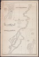
- Beinecke Rare Book and Manuscript Library > Chart of the Farallones and entrance to the bay of San Francisco : California / by Cadwalader Ringgold, Commander, U.S. Navy ; assisted by Simon F. Blunt, Lieut., U.S. Navy, 1850.
- Published / Created:
- 1849
- Call Number:
- 844cea 1849
- Container / Volume:
- BRBL_00613
- Image Count:
- 1
- Resource Type:
- Maps, Atlases & Globes
- Found in:
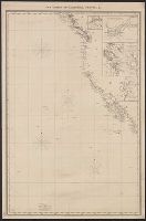
- Beinecke Rare Book and Manuscript Library > The coasts of California, Oregon, &c.
- Creator:
- United States. Surveyor General
- Published / Created:
- 1860
- Call Number:
- 844fcm 1860
- Container / Volume:
- BRBL_00614
- Image Count:
- 1
- Resource Type:
- Maps, Atlases & Globes
- Found in:
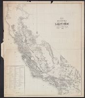
- Beinecke Rare Book and Manuscript Library > Map of public surveys in California : to accompany report of Surveyor Genl., 1860.
- Creator:
- Fairbanks, Harold W. (Harold Wellman), b. 1860
- Published / Created:
- [1892]
- Call Number:
- 844ca Sa517 1892
- Container / Volume:
- BRBL_00613
- Image Count:
- 1
- Resource Type:
- Maps, Atlases & Globes
- Found in:
- Beinecke Rare Book and Manuscript Library > Geological map of portions of San Diego, Orange and San Bernardino counties, [Calif.] / prepared for the 11th report of the State Mineralogist, Wm. Ireland Jr., by H.W. Fairbanks.
- Creator:
- Ringgold, Cadwalader, 1802-1867
- Published / Created:
- [1851?]
- Call Number:
- 844cea Sa52 1850B
- Container / Volume:
- BRBL_00614
- Image Count:
- 1
- Resource Type:
- Maps, Atlases & Globes
- Found in:
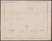
- Beinecke Rare Book and Manuscript Library > Chart of the bay of San Pablo, Straits of Carquines, and part of the bay of San Francisco : California / by Cadwalader Ringgold, Commander, U.S. Navy ; assisted by Simon F. Blunt, Lieut., U.S.N., 1850.
- Creator:
- Fairbanks, Harold W. (Harold Wellman), b. 1860
- Published / Created:
- [1892]
- Call Number:
- 844ca Sh24 1892
- Container / Volume:
- BRBL_00613
- Image Count:
- 1
- Resource Type:
- Maps, Atlases & Globes
- Found in:
- Beinecke Rare Book and Manuscript Library > Geological map of Shasta County [Calif.] / prepared for the 11th report of the State Mineralogist, Wm. Irelan Jr., by H.W. Fairbanks.
- Creator:
- Del Monte Properties Company
- Published / Created:
- c1927.
- Call Number:
- 844an M764 1927
- Container / Volume:
- BRBL_00612
- Image Count:
- 1
- Resource Type:
- Maps, Atlases & Globes
- Found in:
- Beinecke Rare Book and Manuscript Library > California's playground / Jo Mora, fecit.
- Creator:
- Hall, Wm. Ham. (William Hammond)
- Published / Created:
- 1892?]
- Call Number:
- 844cbf Sa51 1892
- Container / Volume:
- BRBL_00613
- Image Count:
- 1
- Resource Type:
- Maps, Atlases & Globes
- Found in:
- Beinecke Rare Book and Manuscript Library > Plan for town of Alessandro, San Bernardino, County, Cal. / Wm. Ham. Hall, Dec. 10th, 1892.
- Creator:
- Ringgold, Cadwalader, 1802-1867
- Published / Created:
- 1851?]
- Call Number:
- 844cea Sa52 1850
- Container / Volume:
- BRBL_00614
- Image Count:
- 1
- Resource Type:
- Maps, Atlases & Globes
- Found in:
- Beinecke Rare Book and Manuscript Library > General chart embracing surveys of the Farallones entrance to the Bay of San Francisco, Bays of San Francisco and San Pablo, Straits of Carquines and Suisun Bay, and the Sacramento and San Joaquin Rivers to the cities of Sacramento and San Joaquin : Calif
- Creator:
- Nusbaumer, George L. (George Lewis)
- Published / Created:
- 1887
- Call Number:
- 844ad Al11 1887
- Container / Volume:
- BRBL_00612
- Image Count:
- 1
- Resource Type:
- Maps, Atlases & Globes
- Found in:
- Beinecke Rare Book and Manuscript Library > Map of the Black & Rose tracts, Alameda Co., Cal. / Geo. L. Nusbaumer, county surveyor.
- Creator:
- Ringgold, Cadwalader, 1802-1867
- Published / Created:
- [1851?]
- Call Number:
- 844cea Sa52 1850C
- Container / Volume:
- BRBL_00614
- Image Count:
- 1
- Resource Type:
- Maps, Atlases & Globes
- Found in:
- Beinecke Rare Book and Manuscript Library > Chart of Suisun & Vallejo Bays, with the confluence of the rivers Sacramento and San Joaquin : California / by Cadwalader Ringgold, Commander, U.S. Navy ; assisted by Sam. R. Knox, Lieut., U.S.N. and Wm. P. Humphreys & J.H. Rowe, engineers, 1850.
- Creator:
- Geological Survey (U.S.)
- Published / Created:
- [1958]
- Call Number:
- 844fcm Y83 1958
- Container / Volume:
- BRBL_00615
- Image Count:
- 1
- Resource Type:
- Maps, Atlases & Globes
- Found in:
- Beinecke Rare Book and Manuscript Library > Yosemite National Park, and vicinity, California / mapped, edited, and published by the Geological Survey.