Skip to search
Skip to main content
Skip to first result
Search
You Searched For
Access
Public
Genre
Maps
New Search
Search Results
Creator:
Published / Created:
1974]
Call Number:
844 L89 1974
Container / Volume:
BRBL_00606
Image Count:
1
Resource Type:
Maps, Atlases & Globes
Found in:
Beinecke Rare Book and Manuscript Library > Map of county of Los Angeles / Harvey T. Brandt, County Engineer.
Creator:
Published / Created:
c1974.
Call Number:
844 1974
Container / Volume:
BRBL_00603
Image Count:
2
Resource Type:
Maps, Atlases & Globes
Found in:
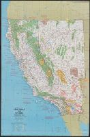
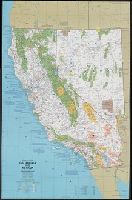
Beinecke Rare Book and Manuscript Library > Close-up: U.S.A., California and Nevada. Produced by the Cartographic Division, National Geographic Society. William T. Peele, chief cartographer, David W. Cook, associate chief cartographer.
Creator:
Published / Created:
c1974.
Call Number:
8101 1974
Container / Volume:
BRBL_00552
Image Count:
2
Resource Type:
Maps, Atlases & Globes
Found in:
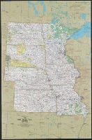
Beinecke Rare Book and Manuscript Library > Close-up: U.S.A., the North Central States. Produced by the Cartographic Division, National Geographic Society. William T. Peele, chief cartographer; David W. Cook, associate chief cartographer.
Creator:
Published / Created:
1974
Call Number:
234 1974
Container / Volume:
BRBL_00020
Image Count:
1
Resource Type:
Maps, Atlases & Globes
Found in:
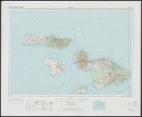
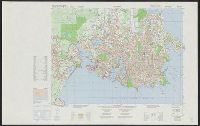
Beinecke Rare Book and Manuscript Library > Maui, Hawaii. / prepared by the Army Map Service (AMLD).
Creator:
Published / Created:
1975
Call Number:
848 1975
Container / Volume:
BRBL_00631
Image Count:
2
Resource Type:
Maps, Atlases & Globes
Found in:
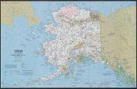
Beinecke Rare Book and Manuscript Library > Close-up: U.S.A., Alaska. Produced by the Cartographic Division, National Geographic Society. William T. Peele, chief cartographer, David W. Cook, associate chief cartographer.
Creator:
Published / Created:
c1975.
Call Number:
832 B574 1975
Container / Volume:
BRBL_00582
Image Count:
1
Resource Type:
Maps, Atlases & Globes
Found in:
Beinecke Rare Book and Manuscript Library > Blaine County, Idaho.
Creator:
Published / Created:
1976-1983, undated
Call Number:
WA MSS S-2609
Collection Title:
Richard Erdoes papers
Container / Volume:
Box 46 | Plains Indian History II
Image Count:
40
Found in:
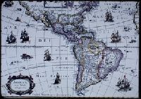
Beinecke Rare Book and Manuscript Library > 18th Century Maps
Creator:
Published / Created:
1976-1983, undated
Call Number:
WA MSS S-2609
Collection Title:
Richard Erdoes papers
Container / Volume:
Box 46 | Plains Indian History II
Image Count:
39
Found in:
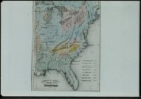
Beinecke Rare Book and Manuscript Library > 19th Century Maps
Creator:
Published / Created:
1976, undated
Call Number:
WA MSS S-2609
Collection Title:
Richard Erdoes papers
Container / Volume:
Box 46 | Plains Indian History II
Image Count:
15
Found in:
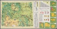
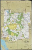
Beinecke Rare Book and Manuscript Library > Modern Maps
Creator:
Published / Created:
1976]
Call Number:
796 1976
Container / Volume:
BRBL_00526
Image Count:
2
Resource Type:
Maps, Atlases & Globes
Found in:
Beinecke Rare Book and Manuscript Library > Latest and correct map of the State of Texas illustrating the Lone Star Bicycle Route / the Lone Star Bicycle Route was planned and researched by George B. Ward ... and John Gaynor ... 1976 ; drawn by James P. Weiler, T. B. Samsel ... 1976.
Creator:
Published / Created:
1976]
Call Number:
737gme C12 1976
Container / Volume:
BRBL_00386
Image Count:
2
Resource Type:
Maps, Atlases & Globes
Found in:
Beinecke Rare Book and Manuscript Library > Calgary bus map.
Creator:
Published / Created:
1977
Call Number:
847gmb T119 1978
Container / Volume:
BRBL_00629
Image Count:
2
Resource Type:
Maps, Atlases & Globes
Found in:
Beinecke Rare Book and Manuscript Library > Tacoma : 1978 street map & guide / presented by the Tacoma Area Chamber of Commerce ; produced and published by Landmark Publishing Co., Inc.
Creator:
Published / Created:
1977
Call Number:
833gmb 1977
Container / Volume:
BRBL_00586
Image Count:
2
Resource Type:
Maps, Atlases & Globes
Found in:
Beinecke Rare Book and Manuscript Library > Wyoming, 1977, official highway map / prepared by The A.B. Hirschfeld Press.
Creator:
Published / Created:
c1977.
Call Number:
7821 1977
Container / Volume:
BRBL_00506
Image Count:
2
Resource Type:
Maps, Atlases & Globes
Found in:
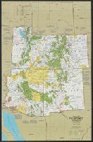
Beinecke Rare Book and Manuscript Library > Close-up: U.S.A., the Southwest / produced by the Cartographic Division, National Geographic Society ; William T. Peele, chief cartographer ; Richard K. Rogers, assistant chief cartographer.
Creator:
Published / Created:
c1977.
Call Number:
738 R26 1977A
Container / Volume:
BRBL_00387
Image Count:
2
Resource Type:
Maps, Atlases & Globes
Found in:
Beinecke Rare Book and Manuscript Library > Regina, Saskatchewan, complimentary city guide and map 1977 / produced by the city of Regina Development and Public Relations Department.
Creator:
Published / Created:
c1978.
Call Number:
844 1978
Container / Volume:
BRBL_00603
Image Count:
2
Resource Type:
Maps, Atlases & Globes
Found in:
Beinecke Rare Book and Manuscript Library > Close-up: U.S.A., California and Nevada / produced by the Cartographic Division, National Geographic Society ; William T. Peele, chief cartographer, David W. Cook, associate chief cartographer.
Creator:
Published / Created:
c1978.
Call Number:
8101 1978A
Container / Volume:
BRBL_00552
Image Count:
2
Resource Type:
Maps, Atlases & Globes
Found in:
Beinecke Rare Book and Manuscript Library > Close-up: U.S.A., the North Central States. Produced by the Cartographic Division, National Geographic Society. William T. Peele, chief cartographer; Richard K. Rogers, associate chief cartographer.
Creator:
Published / Created:
1978
Call Number:
7821 1978A
Container / Volume:
BRBL_00506
Image Count:
2
Resource Type:
Maps, Atlases & Globes
Found in:
Beinecke Rare Book and Manuscript Library > Close-up U.S.A., the Southwest / produced by the Cartographic Division, National Geographic Society ; William T. Peele, chief cartographer ; Richard K. Rogers, assistant chief cartographer.
Creator:
Published / Created:
1978
Call Number:
739 1978
Container / Volume:
BRBL_00389
Image Count:
2
Resource Type:
Maps, Atlases & Globes
Found in:
Beinecke Rare Book and Manuscript Library > Close-up: Canada, British Columbia, Alberta, and the Yukon Territory / produced by the Cartographic Division, National Geographic Society ; William T. Peele, chief cartographer ; Richard K. Rogers, assistant chief cartographer.
Creator:
Published / Created:
1978
Call Number:
231 1978
Container / Volume:
BRBL_00020
Image Count:
2
Resource Type:
Maps, Atlases & Globes
Found in:
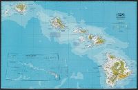
Beinecke Rare Book and Manuscript Library > Close-up: U.S.A., Hawaii / produced by the Cartographic Division, National Geographic Society.
Published / Created:
1979
Call Number:
846gm P837 1979
Container / Volume:
BRBL_00624
Image Count:
2
Resource Type:
Maps, Atlases & Globes
Found in:
Beinecke Rare Book and Manuscript Library > Portland bicycle map / City of Portland, Oregon, Connie McCready, Commissioner of Public Works, Citizens Bicycle and Pedestrian Advisory Committee ; direction, Bicycle and Pedestrian Program ; graphics design, Scott McIntire ; production, Robin Locke.
Creator:
Published / Created:
1979
Call Number:
831 1979
Container / Volume:
BRBL_00580
Image Count:
1
Resource Type:
Maps, Atlases & Globes
Found in:
Beinecke Rare Book and Manuscript Library > Si-ksi-kay-tsi-ta-pi, sin-na-ki-sin, nita-ta-tsi ki mi-sta-ki-tsi : Blackfeet language map, rivers and mountains / compiled by Conrad La Fromboise.
Creator:
Published / Created:
[1979?]
Call Number:
825 C617 1979
Container / Volume:
BRBL_00574
Image Count:
2
Resource Type:
Maps, Atlases & Globes
Found in:
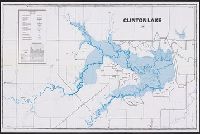
Beinecke Rare Book and Manuscript Library > Clinton Lake : contour fishing and information map.
Creator:
Published / Created:
c1979.
Call Number:
739 V66 1976
Container / Volume:
BRBL_00391
Image Count:
2
Resource Type:
Maps, Atlases & Globes
Found in:
Beinecke Rare Book and Manuscript Library > Military city map 1:25 000. Victoria [map] / produced by the Mapping and Charting Establishment, Department of National Defence, Canada = Carte militaire de la ville 1:25 000. Victoria / publiée par le Service de la cartographie, Ministére de la défens
Creator:
Published / Created:
c1979.
Call Number:
738 R26 1977B
Container / Volume:
BRBL_00387
Image Count:
2
Resource Type:
Maps, Atlases & Globes
Found in:
Beinecke Rare Book and Manuscript Library > Regina, military city map = Carte militaire de la ville [map] / produced by the Mapping and Charting Establishment, Department of National Defence, Canada.
Creator:
Published / Created:
1979
Call Number:
738 1979
Container / Volume:
BRBL_00387
Image Count:
2
Resource Type:
Maps, Atlases & Globes
Found in:
Beinecke Rare Book and Manuscript Library > Close-up, Canada, Saskatchewan and Manitoba / produced by the Cartographic Division, National Geographic Society ; Richard J. Darley, chief cartographer ; John F. Shupe, associate chief cartographer.
Creator:
Published / Created:
[1980]
Call Number:
836 B51 1980
Container / Volume:
BRBL_00592
Image Count:
2
Resource Type:
Maps, Atlases & Globes
Found in:
Beinecke Rare Book and Manuscript Library > Bryce Canyon National Park, Utah / National Park Service, U.S. Department of the Interior.
Creator:
Published / Created:
1982
Call Number:
7821 1982
Container / Volume:
BRBL_00506
Image Count:
2
Resource Type:
Maps, Atlases & Globes
Found in:
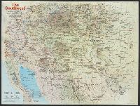
Beinecke Rare Book and Manuscript Library > The Southwest / produced by the Cartographic Division, National Geographic Society ; John B. Garver, Jr., chief cartographer.
Creator:
Published / Created:
[1982]
Call Number:
56 K962 1982
Container / Volume:
BRBL_00296
Image Count:
2
Resource Type:
Maps, Atlases & Globes
Found in:
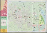
Beinecke Rare Book and Manuscript Library > [Kʻun-ming tao yu tʻu] = Kunming tourist map.
Published / Created:
1983
Call Number:
32 L84 1682/1983
Container / Volume:
BRBL_00739
Image Count:
2
Resource Type:
Maps, Atlases & Globes
Found in:
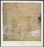
Beinecke Rare Book and Manuscript Library > The Tower of London 1682.
Creator:
Published / Created:
1983
Call Number:
32 L84 1694/1983
Container / Volume:
BRBL_00739
Image Count:
2
Resource Type:
Maps, Atlases & Globes
Found in:
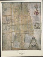
Beinecke Rare Book and Manuscript Library > A Survey of Hatton Garden : a suruey of Hatton-Garden belonging to ... Barron Hatton of Kirby / by Abraham Arlidge.
Creator:
Published / Created:
1983
Call Number:
848 1983
Container / Volume:
BRBL_00631
Image Count:
2
Resource Type:
Maps, Atlases & Globes
Found in:
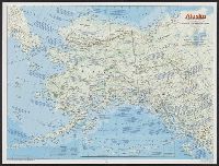
Beinecke Rare Book and Manuscript Library > Alaska / produced by the Cartographic Division, National Geographic Society.
Creator:
Published / Created:
1984
Call Number:
80 1984
Container / Volume:
BRBL_00536
Image Count:
2
Resource Type:
Maps, Atlases & Globes
Found in:
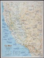
Beinecke Rare Book and Manuscript Library > Far West / produced by the Cartographic Division, National Geographic Society.
Creator:
Published / Created:
1985
Call Number:
738 Sa78 1982
Container / Volume:
BRBL_00387
Image Count:
1
Resource Type:
Maps, Atlases & Globes
Found in:
Beinecke Rare Book and Manuscript Library > Military city map, Saskatoon = Carte militaire de la ville, Saskatoon / produced by the Mapping and Charting Establishment.
Creator:
Published / Created:
1986
Call Number:
8101 1986
Container / Volume:
BRBL_00552
Image Count:
2
Resource Type:
Maps, Atlases & Globes
Found in:
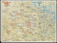
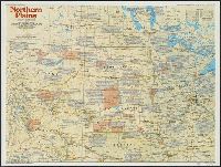
Beinecke Rare Book and Manuscript Library > Northern Plains / produced by the Cartographic Division, National Geographic Society ... ; John B. Garver, Jr., chief cartographer ; John F. Shupe, associate chief.
Creator:
Published / Created:
1986
Call Number:
8101 1986
Container / Volume:
BRBL_00552
Image Count:
2
Resource Type:
Maps, Atlases & Globes
Found in:
Beinecke Rare Book and Manuscript Library > Northern Plains / produced by the Cartographic Division, National Geographic Society ... ; John B. Garver, Jr., chief cartographer ; John F. Shupe, associate chief.
Creator:
Published / Created:
1986
Call Number:
796 1986
Container / Volume:
BRBL_00526
Image Count:
2
Resource Type:
Maps, Atlases & Globes
Found in:
Beinecke Rare Book and Manuscript Library > Texas / produced by the Cartographic Division, National Geographic Society.
Creator:
Published / Created:
c1986.
Call Number:
739 1986
Container / Volume:
BRBL_00389
Image Count:
1
Resource Type:
Maps, Atlases & Globes
Found in:
Beinecke Rare Book and Manuscript Library > British Columbia's coast, the Canadian inside passage / cartographics by Steven Fisher.
Creator:
Published / Created:
c1986.
Call Number:
51 H125 1986A
Container / Volume:
BRBL_00280
Image Count:
2
Resource Type:
Maps, Atlases & Globes
Found in:
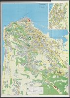
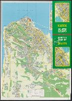
Beinecke Rare Book and Manuscript Library > Carta's map of Haifa.
Creator:
Published / Created:
c1986.
Call Number:
51 H125 1986
Container / Volume:
BRBL_00280
Image Count:
2
Resource Type:
Maps, Atlases & Globes
Found in:
Beinecke Rare Book and Manuscript Library > Carta's Map of Haifa / compiled, designed & drawn by Carta, Jerusalem.
Creator:
Published / Created:
c1989.
Call Number:
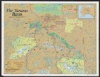
848 T154 1989
Container / Volume:
BRBL_00634
Image Count:
1
Resource Type:
Maps, Atlases & Globes
Found in:
Beinecke Rare Book and Manuscript Library > The Tanana Basin / cartographics by Steven Fisher.
Creator:
Published / Created:
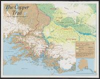
c1989.
Call Number:
848 1989
Container / Volume:
BRBL_00631
Image Count:
1
Resource Type:
Maps, Atlases & Globes
Found in:
Beinecke Rare Book and Manuscript Library > The Copper trail / Alaska Geographic Society ; cartographics by Steven Fisher.
Published / Created:
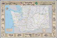
1989
Call Number:
847j 1989
Container / Volume:
BRBL_00629
Image Count:
2
Resource Type:
Maps, Atlases & Globes
Found in:
Beinecke Rare Book and Manuscript Library > Washington at statehood 1889-1989 : a map celebrating 100 years of progress and statehood / cartographers: Eric Phillips ... [et al.].
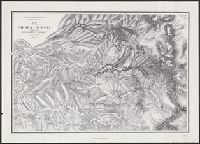
Creator:
Published / Created:
1989
Call Number:
844gcr Si17 1867
Container / Volume:
BRBL_00615
Image Count:
1
Resource Type:
Maps, Atlases & Globes
Found in:
Beinecke Rare Book and Manuscript Library > Map of a portion of the Sierra Nevada adjacent to the Yosemite Valley / from surveys made by Chs. F. Hoffmann and J.T. Gardner, 1863-1867 ; Geological Survey of California ; J.D. Whitney, State Geologist.
Creator:
Published / Created:
c1989.
Call Number:
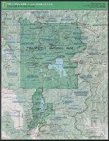
833 Y38 1989
Container / Volume:
BRBL_00584
Image Count:
2
Resource Type:
Maps, Atlases & Globes
Found in:
Beinecke Rare Book and Manuscript Library > Yellowstone and Grand Teton / produce by the Cartographic Division, National Geographic Society ; John B. Garver, Jr., chief cartographer.
Creator:
Published / Created:
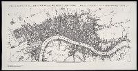
[United States : and 1989]
Call Number:
BrSides Folio 2005 20
Image Count:
1
Resource Type:
Maps, Atlases & Globes
Found in:
Beinecke Rare Book and Manuscript Library > A new and exact plan of the cities of London and Westminster, and borough of Southwark, with the additional buildings to the year 1756
Creator:
Published / Created:
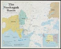
c1990.
Call Number:
848 1990
Container / Volume:
BRBL_00631
Image Count:
1
Resource Type:
Maps, Atlases & Globes
Found in:
Beinecke Rare Book and Manuscript Library > The Nushagak Basin / Alaska Geographic Society.
Creator:
Published / Created:
c1991.
Call Number:
844 Al16 1971
Container / Volume:
BRBL_00604
Image Count:
2
Resource Type:
Maps, Atlases & Globes
Found in:
Beinecke Rare Book and Manuscript Library > Alcatraz / published in cooperation with Golden Gate National Park Association ; design, Reineck & Reineck.
Creator:
Published / Created:
c1992.
Call Number:
739 1992
Container / Volume:
BRBL_00389
Image Count:
2
Resource Type:
Maps, Atlases & Globes
Found in:
Beinecke Rare Book and Manuscript Library > The making of Canada. British Columbia / produced by the Cartographic Division, National Geographic Society ; John F. Shupe, chief cartographer.
Creator:
Published / Created:
1992
Call Number:
358 1992
Container / Volume:
BRBL_00116
Image Count:
1
Resource Type:
Maps, Atlases & Globes
Found in:
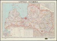
Beinecke Rare Book and Manuscript Library > Latvijas Republika.
Branch:v1.60.98 ,Deployed:2024-04-24T10:14:30-04:00