Skip to search
Skip to main content
Skip to first result
Search
You Searched For
Genre
Maps
New Search
Search Results
Published / Created:
1822
Call Number:
774 C426 1822
Container / Volume:
BRBL_00499
Image Count:
1
Resource Type:
Maps, Atlases & Globes
Found in:
Beinecke Rare Book and Manuscript Library > A map of Chester County Constructed by virtue of an Act of the Legislature of Pennsylvania, Passed march 19, 1816 by James Hindman,
Call Number:
1976 1233
Collection Title:
Forty-two new maps of Asia, Africa, and America ... : all engrav’d, according to the latest
Image Count:
1
Found in:
Beinecke Rare Book and Manuscript Library > A map of Chili, Patagonia, part of La Plata &c
Creator:
Published / Created:
Jany. 1st, 1795.
Call Number:
1977 Folio 177
Image Count:
2
Resource Type:
Maps, Atlases & Globes
Found in:
Beinecke Rare Book and Manuscript Library > A map of China : with the surrounding states, correctly copied from Monsr. d'Anville : engraved for Monsr. de Paun's Philosophical dissertations on the Egyptians & Chinese.
Creator:
Published / Created:
1911
Call Number:
56 1911
Container / Volume:
BRBL_00296
Image Count:
1
Resource Type:
Maps, Atlases & Globes
Found in:
Beinecke Rare Book and Manuscript Library > A map of China [cartographic material] : prepared for the China Inland Mission.
Published / Created:
1774
Call Number:
565 1774
Container / Volume:
BRBL_00299
Image Count:
1
Resource Type:
Maps, Atlases & Globes
Found in:
Beinecke Rare Book and Manuscript Library > A map of Chinese Tartary with Corea by Samuel Dunn.
Published / Created:
1776]
Call Number:
766 1776
Container / Volume:
BRBL_00690
Image Count:
1
Resource Type:
Maps, Atlases & Globes
Found in:
Beinecke Rare Book and Manuscript Library > A map of Connecticut and Rhode Island with Long Island Sound, &c.
Published / Created:
1776]
Call Number:
766 1776
Container / Volume:
BRBL_00690
Image Count:
1
Resource Type:
Maps, Atlases & Globes
Found in:
Beinecke Rare Book and Manuscript Library > A map of Connecticut and Rhode Island with Long Island Sound, &c.
Published / Created:
1805
Call Number:
3238 1805
Container / Volume:
BRBL_00065
Image Count:
1
Resource Type:
Maps, Atlases & Globes
Found in:
Beinecke Rare Book and Manuscript Library > A map of Cumberland ... Engraved by J. Cary.
Call Number:
776 1801
Container / Volume:
BRBL_00502
Image Count:
1
Resource Type:
Maps, Atlases & Globes
Found in:
Beinecke Rare Book and Manuscript Library > A map of Delaware and eastern shore of Maryland with the soundings of the Bay of Delaware from actual survey & soundings made in 1799, 1800 & 1801 by the Author.
Published / Created:
1795
Call Number:
32gma 1795
Container / Volume:
BRBL_00076
Image Count:
1
Resource Type:
Maps, Atlases & Globes
Found in:
Beinecke Rare Book and Manuscript Library > A map of England showing the lines of all the Navigable Canals; and those which have been proposed ...1795.
Published / Created:
[1845?]
Call Number:
3191 1845
Container / Volume:
BRBL_00041
Image Count:
1
Resource Type:
Maps, Atlases & Globes
Found in:
Beinecke Rare Book and Manuscript Library > A map of England, Wales, & Scotland ...
Published / Created:
1823
Call Number:
774 F854 1823
Container / Volume:
BRBL_00499
Image Count:
1
Resource Type:
Maps, Atlases & Globes
Found in:
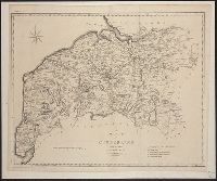
Beinecke Rare Book and Manuscript Library > A map of Franklin County ... by W.S. Davis.
Call Number:
1976 1233
Collection Title:
Forty-two new maps of Asia, Africa, and America ... : all engrav’d, according to the latest
Image Count:
1
Found in:
Beinecke Rare Book and Manuscript Library > A map of Guinea Loango &c
Published / Created:
1798
Call Number:
3258 1798
Container / Volume:
BRBL_00069
Image Count:
1
Resource Type:
Maps, Atlases & Globes
Found in:
Beinecke Rare Book and Manuscript Library > A map of Hartfordshire.
Published / Created:
1774
Call Number:
542 1774
Container / Volume:
BRBL_00290
Image Count:
1
Resource Type:
Maps, Atlases & Globes
Found in:
Beinecke Rare Book and Manuscript Library > A map of Independent Tartary ... Tibet by Samuel Dunn ...
Published / Created:
[1795?]
Call Number:
327 1795
Container / Volume:
BRBL_00072
Image Count:
1
Resource Type:
Maps, Atlases & Globes
Found in:
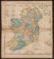
Beinecke Rare Book and Manuscript Library > A map of Ireland ... J.T. Scott. Sculp.
Published / Created:
[1852?]
Call Number:
327 1852
Container / Volume:
BRBL_00073
Image Count:
1
Resource Type:
Maps, Atlases & Globes
Found in:
Beinecke Rare Book and Manuscript Library > A map of Ireland ... with the distances of the principal towns from Dublin ...
Creator:
Published / Created:
[1769]
Call Number:
40 1777
Container / Volume:
BRBL_00198
Image Count:
1
Resource Type:
Maps, Atlases & Globes
Found in:
Beinecke Rare Book and Manuscript Library > A map of Italy / by Mr. Palairet with improvements & additions from the best authorities by L. Delarochette ; Tho Kitchin sculpt.
Published / Created:
1797
Call Number:
3213 1797
Container / Volume:
BRBL_00055
Image Count:
1
Resource Type:
Maps, Atlases & Globes
Found in:
Beinecke Rare Book and Manuscript Library > A map of Kent.
Published / Created:
[1794?]
Call Number:
802 1794B
Container / Volume:
BRBL_00542
Image Count:
1
Resource Type:
Maps, Atlases & Globes
Found in:
Beinecke Rare Book and Manuscript Library > A map of Kentucky from actual survey by Elihu Barker.
Creator:
Published / Created:
c1907.
Call Number:
762 W73 1907
Container / Volume:
BRBL_00451
Image Count:
1
Resource Type:
Maps, Atlases & Globes
Found in:
Beinecke Rare Book and Manuscript Library > A map of Lake Winnipesaukee, New Hampshire / author, Elliot Noël Burwell.
Published / Created:
1805
Call Number:
3235 1805
Container / Volume:
BRBL_00064
Image Count:
1
Resource Type:
Maps, Atlases & Globes
Found in:
Beinecke Rare Book and Manuscript Library > A map of Lancashire ... Engraved by J. Cary.
Creator:
Published / Created:
1814
Call Number:
80 1814
Container / Volume:
BRBL_00532
Image Count:
1
Resource Type:
Maps, Atlases & Globes
Found in:
Beinecke Rare Book and Manuscript Library > A map of Lewis and Clark's track across the western portion of North America, from the Mississippi to the Pacific Ocean : by order of the executive of the United States in 1804, 5 & 6 / copied by Samuel Lewis from the original drawing of Wm. Clark ; Neele
Creator:
Published / Created:
[ca. 1814]
Call Number:
Zc10 814Le
Collection Title:
History of the expedition under the command of Captains Lewis and Clark, to the sources of the
Image Count:
2
Resource Type:
Maps, Atlases & Globes
Found in:
Beinecke Rare Book and Manuscript Library > A map of Lewis and Clark's track, across the western portion of North America fom the Mississippi to the Pacific Ocean; by order of the Executive of the United States . In 1804, 5 & 6
Creator:
Published / Created:
1721]
Call Number:
755 1715A
Container / Volume:
BRBL_00425
Image Count:
1
Resource Type:
Maps, Atlases & Globes
Found in:
Beinecke Rare Book and Manuscript Library > A map of Louisiana and of the river Mississipi [i.e. Mississippi] : this map of the Mississipi [i.e. Mississippi] is most humbly inscribed to William Law of Lanreston, esq. / by Iohn Senex.
Creator:
Published / Created:
[1757]
Call Number:
777 1758
Container / Volume:
BRBL_00690
Image Count:
1
Resource Type:
Maps, Atlases & Globes
Found in:
Beinecke Rare Book and Manuscript Library > A map of Maryland with the Delaware counties and the southern part of New Jersey &c / [cartographic material] / by T. Kitchin geogr.
Published / Created:
1819
Call Number:
76 1819
Container / Volume:
BRBL_00443
Image Count:
1
Resource Type:
Maps, Atlases & Globes
Found in:
Beinecke Rare Book and Manuscript Library > A map of Massachusetts, Connecticut, and Rhodeisland humbly sumitted to the Citizens thereof by ... E. Ruggles.
Call Number:
771 ON8 1797
Container / Volume:
BRBL_00490
Image Count:
1
Resource Type:
Maps, Atlases & Globes
Found in:
Beinecke Rare Book and Manuscript Library > A map of Messrs. Gorham and Phelp's Purchase; now the County of Ontario in the State of New York From actual survey by A. Porter Engraved by A. Doolitle, New Haven.
Call Number:
1976 1233
Collection Title:
Forty-two new maps of Asia, Africa, and America ... : all engrav’d, according to the latest
Image Count:
1
Found in:
Beinecke Rare Book and Manuscript Library > A map of Mexico or New Spain Florida now called Louisiana and part of California &c
Published / Created:
1798
Call Number:
3217 1798
Container / Volume:
BRBL_00057
Image Count:
1
Resource Type:
Maps, Atlases & Globes
Found in:
Beinecke Rare Book and Manuscript Library > A map of Middlesex.
Creator:
Published / Created:
[1676]
Call Number:
755 1672A
Container / Volume:
BRBL_00423
Image Count:
2
Resource Type:
Maps, Atlases & Globes
Found in:
Beinecke Rare Book and Manuscript Library > A map of New England and New York / F. Lamb sculp.
Creator:
Published / Created:
[1676?]
Call Number:
755 1675E
Container / Volume:
BRBL_00423
Image Count:
1
Resource Type:
Maps, Atlases & Globes
Found in:
Beinecke Rare Book and Manuscript Library > A map of New England, New Yorke, New Jersey, Mary-land & Virginia / Gr. King sculpsit.
Creator:
Published / Created:
[1749]
Call Number:
BrSides 2019 63
Image Count:
1
Resource Type:
Maps, Atlases & Globes
Found in:
Beinecke Rare Book and Manuscript Library > A map of New Scotland with its dependencies and a succint account of the country.
Published / Created:
1677
Call Number:
Pequot H91
Collection Title:
A narrative of the troubles with the Indians in New-England, : from the first planting thereof in
Image Count:
1
Found in:
Beinecke Rare Book and Manuscript Library > A map of New-England, being the first that ever was cut, and done by the best pattern that could be had, which being in some places defective, it made the other less exact : yet doth it sufficiently shew the scituation of the country, and conveniently wel
Published / Created:
undated
Call Number:
Vanderbilt 74
Collection Title:
The present state of New-England ; being a narrative of the troubles with the Indians in New
Image Count:
2
Found in:
Beinecke Rare Book and Manuscript Library > A map of New-England, being the first that ever was here cut, and done by the best pattern that could be had, which being in some places defective, it made the other less exact, yet it doth sufficiently shew the scituation of the countrey, and convenientl
Creator:
Published / Created:
1765
Call Number:
2003 Folio 85
Image Count:
1
Found in:
Beinecke Rare Book and Manuscript Library > A map of North America
Creator:
Published / Created:
1765
Call Number:
71 1765
Container / Volume:
BRBL_00364
Image Count:
1
Resource Type:
Maps, Atlases & Globes
Found in:
Beinecke Rare Book and Manuscript Library > A map of North America / by J. Palairet, with considerable alterations & improvements from d'Anville, Mitchell & Bellin, by L. Delarochette.
Creator:
Published / Created:
[1822 or 1823]
Call Number:
71 1822
Container / Volume:
BRBL_00369
Image Count:
4
Resource Type:
Maps, Atlases & Globes
Found in:
Beinecke Rare Book and Manuscript Library > A map of North America : constructed according to the latest information / engraved & published by H.S. Tanner, Philadelphia 1822.
Creator:
Published / Created:
17--?]
Call Number:
71 1769A
Container / Volume:
BRBL_00364
Image Count:
1
Resource Type:
Maps, Atlases & Globes
Found in:
Beinecke Rare Book and Manuscript Library > A map of North America : from D'Anville, 1769.
Creator:
Published / Created:
1791?]
Call Number:
71 1791
Container / Volume:
BRBL_00367
Image Count:
1
Resource Type:
Maps, Atlases & Globes
Found in:
Beinecke Rare Book and Manuscript Library > A map of North America : published under the patronage of the Duke of Orleans by d'Anville / drawn and engraved for J. Harrison, No. 115 Newgate Street, January 1, 1791.
Creator:
Published / Created:
1745?]
Call Number:
71 1746
Container / Volume:
BRBL_00362
Image Count:
1
Resource Type:
Maps, Atlases & Globes
Found in:
Beinecke Rare Book and Manuscript Library > A map of North America : with the European settlements & whatever else is remarkable in ye West Indies, from the latest and best observations / R.W. Seale, delin. et sculp.
Creator:
Published / Created:
1st of March 1789.
Call Number:
71 1789
Container / Volume:
BRBL_00366
Image Count:
4
Resource Type:
Maps, Atlases & Globes
Found in:
Beinecke Rare Book and Manuscript Library > A map of North America and the West Indies / by L.S. de la Rochette.
Creator:
Published / Created:
176-?]
Call Number:
71 1760B
Container / Volume:
BRBL_00364
Image Count:
1
Resource Type:
Maps, Atlases & Globes
Found in:
Beinecke Rare Book and Manuscript Library > A map of North America, from the latest surveys and maps / by John Blair as a supplement to his Tables of chronology ; Thos. Kitchin, sculpsit.
Published / Created:
1742
Call Number:
1976 1232
Collection Title:
Chorographia Britanniæ, or, A set of maps of all the counties in England and Wales ... : to the
Image Count:
1
Found in:
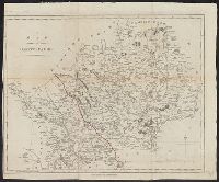
Beinecke Rare Book and Manuscript Library > A map of Northampton Shire
Creator:
Published / Created:
1941
Call Number:
80 1941
Container / Volume:
BRBL_00536
Image Count:
1
Resource Type:
Maps, Atlases & Globes
Found in:
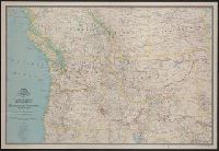
Beinecke Rare Book and Manuscript Library > A map of Northwestern United States and neighboring Canadian Provinces / prepared in the Cartographic Section of the National Geographic Society for the National geographic magazine ; James M. Darley, chief cartographer.
Creator:
Call Number:
766 N835 1833
Container / Volume:
BRBL_00474
Image Count:
1
Resource Type:
Maps, Atlases & Globes
Found in:
Beinecke Rare Book and Manuscript Library > A map of Norwich from actual survey / by William Lester Jr.
Published / Created:
[1700?]
Call Number:
3218 1700
Container / Volume:
BRBL_00057
Image Count:
1
Resource Type:
Maps, Atlases & Globes
Found in:
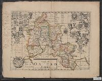
Beinecke Rare Book and Manuscript Library > A map of Oxfordshire ...
Published / Created:
1787
Call Number:
3218 1787
Container / Volume:
BRBL_00058
Image Count:
1
Resource Type:
Maps, Atlases & Globes
Found in:
Beinecke Rare Book and Manuscript Library > A map of Oxfordshire... Heywood Delt. Sudlow fc.
Creator:
Published / Created:
[1747]
Call Number:
BrSides 2019 80
Image Count:
1
Resource Type:
Maps, Atlases & Globes
Found in:
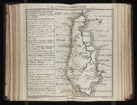
Beinecke Rare Book and Manuscript Library > A map of Paradise mount Ararat and the city of Babel : according to the three different hypotheses mentioned in this work.
Creator:
Published / Created:
1792]
Call Number:
774 1792B
Container / Volume:
BRBL_00498
Image Count:
1
Resource Type:
Maps, Atlases & Globes
Found in:
Beinecke Rare Book and Manuscript Library > A map of Pennsylvania & the parts connected therewith, relating to the roads and inland navigation, especially as proposed to be improved the the late proceedings of Assembly / [cartographic material] / (copied from his larger map) by Reading Howell ; J.
Call Number:
1976 1233
Collection Title:
Forty-two new maps of Asia, Africa, and America ... : all engrav’d, according to the latest
Image Count:
1
Found in:
Beinecke Rare Book and Manuscript Library > A map of Peru and the west part of the country of the Amazones
Published / Created:
[1752]
Call Number:
774 P53 1752
Container / Volume:
BRBL_00499
Image Count:
1
Resource Type:
Maps, Atlases & Globes
Found in:
Beinecke Rare Book and Manuscript Library > A map of Philadelphia and part adjacent with a perspective view of the state-house. By N. Scull and G. Heap.
Creator:
Published / Created:
[1753]
Call Number:
BrSides 2019 60
Image Count:
1
Resource Type:
Maps, Atlases & Globes
Found in:
Beinecke Rare Book and Manuscript Library > A map of Philadelphia and parts adjacent / by N. Scull and G. Heap.
Creator:
Published / Created:
[1753]
Call Number:
BrSides 2019 61
Image Count:
1
Resource Type:
Maps, Atlases & Globes
Found in:
Beinecke Rare Book and Manuscript Library > A map of Philadelphia and parts adjacent / by N. Scull and G. Heap.
Published / Created:
1777
Call Number:
326 1777
Container / Volume:
BRBL_00069
Image Count:
1
Resource Type:
Maps, Atlases & Globes
Found in:
Beinecke Rare Book and Manuscript Library > A map of Scotland the Hebrides and part of England adapted to Mr. Pennant's Tours. J. Bayly Sculp.
Creator:
Published / Created:
1934]
Call Number:
ZZa L588 G934
Image Count:
2
Resource Type:
Maps, Atlases & Globes
Found in:
Beinecke Rare Book and Manuscript Library > A map of Sinclair Lewis United States as it appears in his novels
Creator:
Published / Created:
1787 July 1
Call Number:
1982 Folio 10
Image Count:
2
Found in:
Beinecke Rare Book and Manuscript Library > A map of South America : containing Tierra-Firma, Guayana, New Granada, Amazonia, Brasil, Peru, Paraguay, Chaco, Tucuman, Chili and Patagonia : from Mr. d'Anville with several improvements and additions, and the newest discoveries
Creator:
Published / Created:
July the 1st, 1787.
Call Number:
90 1787
Container / Volume:
BRBL_00661
Image Count:
2
Resource Type:
Maps, Atlases & Globes
Found in:
Beinecke Rare Book and Manuscript Library > A map of South America : containing Tierra-Firma, Guayana, New Granada, Amazonia, Brasil, Peru, Paraguay, Chaco, Tucuman, Chili and Patagonia : from Mr. d'Anville with several improvements and additions, and the newest discoveries.
Creator:
Published / Created:
31st July, 1780.
Call Number:
90 1780C
Container / Volume:
BRBL_00698
Image Count:
1
Resource Type:
Maps, Atlases & Globes
Found in:
Beinecke Rare Book and Manuscript Library > A map of South America [cartographic material] : drawn from the latest and best authorities / Jn. Lodge, sculp.
Call Number:
1976 1233
Collection Title:
Forty-two new maps of Asia, Africa, and America ... : all engrav’d, according to the latest
Image Count:
1
Found in:
Beinecke Rare Book and Manuscript Library > A map of South America according to ye newest and most exact observations
Creator:
Published / Created:
1779
Call Number:
90 1779
Container / Volume:
BRBL_00661
Image Count:
2
Resource Type:
Maps, Atlases & Globes
Found in:
Beinecke Rare Book and Manuscript Library > A map of South America containing Tierra-Firma, Guayana, New Granada, Amazonia, Brasil, Peru, Paraguay, Chaco, Tucuman, Chili and Patagonia [cartographic material] : from Mr. d'Anville, with several improvements and additions, and the newest discoveries /
Published / Created:
1822
Call Number:
786 1822
Container / Volume:
BRBL_00515
Image Count:
2
Resource Type:
Maps, Atlases & Globes
Found in:
Beinecke Rare Book and Manuscript Library > A map of South Carolina constructed and drawn from the district surveys ordered by the legislature by John Wilson ...
Call Number:
1977 +392
Collection Title:
A survey of the cities of London and Westminster : containing the original, antiquity, increase
Image Count:
1
Found in:
Beinecke Rare Book and Manuscript Library > A map of St. Giles Cripple Gate without. With large additions and corrections
Call Number:
1976 1233
Collection Title:
Forty-two new maps of Asia, Africa, and America ... : all engrav’d, according to the latest
Image Count:
1
Found in:
Beinecke Rare Book and Manuscript Library > A map of Terra Firma, Guiana and the Antilles Islands
Published / Created:
1774
Call Number:
501 1774
Container / Volume:
BRBL_00275
Image Count:
1
Resource Type:
Maps, Atlases & Globes
Found in:
Beinecke Rare Book and Manuscript Library > A map of Turkey in Asia ... by Samuel Dunn ...
Creator:
Published / Created:
1711
Call Number:
53 1711
Container / Volume:
BRBL_00684
Image Count:
1
Resource Type:
Maps, Atlases & Globes
Found in:
Beinecke Rare Book and Manuscript Library > A map of Turky [sic] Arabia & Persia : corrected from the latest travels and from the observations of the Royal Societys of London and Paris / by G. De L'Isle.
Creator:
Published / Created:
[1676]
Call Number:
783 1680
Container / Volume:
BRBL_00691
Image Count:
2
Resource Type:
Maps, Atlases & Globes
Found in:
Beinecke Rare Book and Manuscript Library > A map of Virginia and Maryland / F. Lamb sculp.
Creator:
Published / Created:
[1676]
Call Number:
755 1676D
Container / Volume:
BRBL_00423
Image Count:
2
Resource Type:
Maps, Atlases & Globes
Found in:
Beinecke Rare Book and Manuscript Library > A map of Virginia and Maryland / F. Lamb sculp.
Published / Created:
1755
Call Number:
75 1755
Container / Volume:
BRBL_00689
Image Count:
1
Resource Type:
Maps, Atlases & Globes
Found in:
Beinecke Rare Book and Manuscript Library > A map of Virginia, North and South Carolina, Georgia, Maryland with part of New Jersey &c [cartographic material].
Creator:
Published / Created:
1814
Call Number:
774fb W367 1814A
Container / Volume:
BRBL_00501
Image Count:
1
Resource Type:
Maps, Atlases & Globes
Found in:
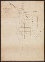
Beinecke Rare Book and Manuscript Library > A map of Wayne & Pike counties, Pennsylvania [cartographic material] : shewing the situations & forms of the warrantee tracts, with the numbers by which the respective tracts are distinguished in the maps & books in the Office of the Commissioners of plac
Creator:
Published / Created:
1899
Call Number:
784ca 1899
Container / Volume:
BRBL_00512
Image Count:
1
Resource Type:
Maps, Atlases & Globes
Found in:
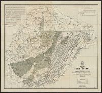
Beinecke Rare Book and Manuscript Library > A map of West Virginia / compiled by Russell L. Morris, C.E., from county atlases, government and other surveys, showing the coal, oil, and gas developments, prominent anticlinal axes, and the outcrops of the different coal series by I. C. White.
Published / Created:
1805
Call Number:
3253 1805
Container / Volume:
BRBL_00067
Image Count:
1
Resource Type:
Maps, Atlases & Globes
Found in:
Beinecke Rare Book and Manuscript Library > A map of Westmoreland ... Engraved by J. Cary.
Published / Created:
1833
Call Number:
764 W89 1833
Container / Volume:
BRBL_00460
Image Count:
1
Resource Type:
Maps, Atlases & Globes
Found in:
Beinecke Rare Book and Manuscript Library > A map of Worcester shire town of the County of Worcester. By H. Stebbins.
Call Number:
1976 1233
Collection Title:
Forty-two new maps of Asia, Africa, and America ... : all engrav’d, according to the latest
Image Count:
1
Found in:
Beinecke Rare Book and Manuscript Library > A map of Zaara or the Desart, Negroland & Cape Virde Islands &c
Call Number:
Zc20 697heg
Collection Title:
A new discovery of a vast country in America : extending above four thousand miles, between New
Image Count:
1
Found in:
Beinecke Rare Book and Manuscript Library > A map of a large country newly discovered in the northern America situated between New Mexico and the frozen sea, together with the course of the Great River Meschasipi. Dedicated to His Ma.ty William III King of Great Britain. By Father Lewis Hennepin, m
Call Number:
Zc20 697heg
Collection Title:
A new discovery of a vast country in America : extending above four thousand miles, between New
Image Count:
1
Found in:
Beinecke Rare Book and Manuscript Library > A map of a new world between New Mexico and the frozen sea newly discovered by Father Lewis Hennepin, missionary recollect and native of Aht in Hainault. Dedicated to his majesty of Great Britain William III
Published / Created:
1873
Call Number:
583 1873
Container / Volume:
BRBL_00314
Image Count:
1
Resource Type:
Maps, Atlases & Globes
Found in:
Beinecke Rare Book and Manuscript Library > A map of a part of the Malay Peninsula belonging to Siam : copied from a map of the Siamese government in 1870.
Published / Created:
1835
Call Number:
755 1835A
Container / Volume:
BRBL_00440
Image Count:
1
Resource Type:
Maps, Atlases & Globes
Found in:
Beinecke Rare Book and Manuscript Library > A map of a portion of the Indian Country lying east and west of the Mississippi river to the forty sixth degree of north latitude from ... observation ... 1835 ... U.S. Top. Bureau.
Creator:
Published / Created:
1791 March
Call Number:
DU170 H85+ Oversize
Collection Title:
An historical journal of the transactions at Port Jackson and Norfolk island, with the discoveries
Image Count:
1
Resource Type:
Books, Journals & Pamphlets
Found in:
Beinecke Rare Book and Manuscript Library > A map of all those parts of the territory of New South Wales which have been seen by any person belonging to the settlement established at Port Jackson, in the said territory ...
Call Number:
1976 1233
Collection Title:
Forty-two new maps of Asia, Africa, and America ... : all engrav’d, according to the latest
Image Count:
1
Found in:
Beinecke Rare Book and Manuscript Library > A map of independent Tartary containing the territories of Usbeck, Gasgar, Tibet, Lassa &c
Creator:
Published / Created:
1828
Call Number:
796ad 1828
Container / Volume:
BRBL_00716
Image Count:
2
Resource Type:
Maps, Atlases & Globes
Found in:
Beinecke Rare Book and Manuscript Library > A map of northern part of Mexico, including Exter and Wilson's Grant / made from Legrand's notes and other documents by S. McL. Staples, A.M., surveyor general of Chihuahua.
Creator:
Published / Created:
[1710]
Call Number:
392 1710
Container / Volume:
BRBL_00684
Image Count:
1
Resource Type:
Maps, Atlases & Globes
Found in:
Beinecke Rare Book and Manuscript Library > A map of old & new Castile : from the observations of Rodrigo Mendes Silva and others.
Published / Created:
[1710?]
Call Number:
392 1710
Container / Volume:
BRBL_00193
Image Count:
1
Resource Type:
Maps, Atlases & Globes
Found in:
Beinecke Rare Book and Manuscript Library > A map of old and new Castile : from the observations of Rodrigo Mendes Silva and others.
Published / Created:
[1710?]
Call Number:
392 1710
Container / Volume:
BRBL_00193
Image Count:
1
Resource Type:
Maps, Atlases & Globes
Found in:
Beinecke Rare Book and Manuscript Library > A map of old and new Castile : from the observations of Rodrigo Mendes Silva and others.
Published / Created:
1836
Call Number:
755gme 1836
Container / Volume:
BRBL_00442
Image Count:
1
Resource Type:
Maps, Atlases & Globes
Found in:
Beinecke Rare Book and Manuscript Library > A map of part of Alabama & Florida, showing the route of the proposed Columbus & Pensacola R.R.
Published / Created:
1796
Call Number:
755 1796A
Container / Volume:
BRBL_00436
Image Count:
1
Resource Type:
Maps, Atlases & Globes
Found in:
Beinecke Rare Book and Manuscript Library > A map of part of the N.W. Territory of the United States ... by Samuel Lewis, 1796.
Published / Created:
1796
Call Number:
755 1796A
Container / Volume:
BRBL_00436
Image Count:
1
Resource Type:
Maps, Atlases & Globes
Found in:
Beinecke Rare Book and Manuscript Library > A map of part of the N.W. Territory of the United States ... by Samuel Lewis, 1796.
Creator:
Published / Created:
1887].
Call Number:
71 1806A
Container / Volume:
BRBL_00368
Image Count:
1
Resource Type:
Maps, Atlases & Globes
Found in:
Beinecke Rare Book and Manuscript Library > A map of part of the continent of North America : between the 35th and 51st degrees of north latitude, and extending from 80 degrees of west longitude to the Pacific Ocean / compiled from the authorities of the best informed travellers by M. Lewis ; copie
Published / Created:
ca 1810]
Call Number:
773 J487 1810
Container / Volume:
BRBL_00496
Image Count:
1
Resource Type:
Maps, Atlases & Globes
Found in:
Beinecke Rare Book and Manuscript Library > A map of that part of the town of Jersey, commonly called Aharsimus.
Published / Created:
1804
Call Number:
773 J487 1804
Container / Volume:
BRBL_00496
Image Count:
1
Resource Type:
Maps, Atlases & Globes
Found in:
Beinecke Rare Book and Manuscript Library > A map of that part of the town of Jersey, commonly called Powles Hook / surveyed by Joseph F. Mangin.
Published / Created:
[1760?]
Call Number:
488 1760
Container / Volume:
BRBL_00266
Image Count:
1
Resource Type:
Maps, Atlases & Globes
Found in:
Beinecke Rare Book and Manuscript Library > A map of the Aegaean Sea or Archipelago. With the coasts of Europe & Asia, and part of Asia Minor ... By Thos. Kitchin Geogr ...
Creator:
Published / Created:
[1874?]
Call Number:
632 AL14 1873
Container / Volume:
BRBL_00336
Image Count:
1
Resource Type:
Maps, Atlases & Globes
Found in:
Beinecke Rare Book and Manuscript Library > A map of the Albert N'yanza and the routes of Sir Samuel White Baker, Pacha : to illustrate Ismailïa / Stanford's Geographical Establishment, London.
Call Number:
Pequot Ad12
Collection Title:
The history of the American Indians; particularly those nations adjoining to the Missisippi
Image Count:
1
Found in:
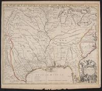
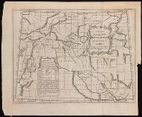
Beinecke Rare Book and Manuscript Library > A map of the American Indian nations, adjoining to the Missisippi, west & east Florida, Georgia, S. & N. Carolina, Virginia, & c
Published / Created:
1789
Call Number:
33 1789
Container / Volume:
BRBL_00077
Image Count:
1
Resource Type:
Maps, Atlases & Globes
Found in:
Beinecke Rare Book and Manuscript Library > A map of the Austrian possessions in the Netherlands or Low Countries with the principalities of Liege and Stavelo, &ca. : reduced from the trigonometric survey made by order of H.R.H. the Prince Charles of Lorraine.
Creator:
Published / Created:
1789 January 1
Call Number:
1982 Folio 10
Image Count:
1
Found in:
Beinecke Rare Book and Manuscript Library > A map of the Austrian possessions in the Netherlands or Low Countries, with the principalities of Liege and Stavelo, & ca : reduced from the trigonometric survey made by order of H.R.H. the Prince Charles of Lorraine
Published / Created:
1755]
Call Number:
755 1755A
Container / Volume:
BRBL_00690
Image Count:
1
Resource Type:
Maps, Atlases & Globes
Found in:
Beinecke Rare Book and Manuscript Library > A map of the British & French Plantations in North America.
Creator:
Published / Created:
1754
Call Number:
75 1720
Container / Volume:
BRBL_00689
Image Count:
1
Resource Type:
Maps, Atlases & Globes
Found in:
Beinecke Rare Book and Manuscript Library > A map of the British American plantations [cartographic material] : extending from Boston in New England to Georgia, including all the back settlements in the respective provinces, as far as the Mississippi / by Eman. Bowen Geogr. to His Majesty ; Tho. Bo
Creator:
Published / Created:
1733
Call Number:
89 1720
Container / Volume:
BRBL_00697
Image Count:
1
Resource Type:
Maps, Atlases & Globes
Found in:
Beinecke Rare Book and Manuscript Library > A map of the British Empire in America, with the French and Spanish settlements adjacent thereto / by Henry Popple.
Creator:
Published / Created:
[ca. 1741]
Call Number:
89 1733
Container / Volume:
BRBL_00697
Image Count:
1
Resource Type:
Maps, Atlases & Globes
Found in:
Beinecke Rare Book and Manuscript Library > A map of the British Empire in America, with the French, Spanish and Hollandish settlements adjacent thereto / by Henry Popple.
Branch:v1.60.98 ,Deployed:2024-05-15T10:28:31-04:00