Search
You Searched For
Search Results
- Published / Created:
- 1863
- Call Number:
- 783 C899 1863
- Container / Volume:
- BRBL_00510
- Image Count:
- 1
- Resource Type:
- Maps, Atlases & Globes
- Found in:
- Beinecke Rare Book and Manuscript Library > [Military and topographic map of region about Culpepper Courthouse, Va.].
- Published / Created:
- 1945?]
- Call Number:
- 11hd 1945G-3
- Container / Volume:
- BRBL_00010ZF
- Image Count:
- 1
- Resource Type:
- Maps, Atlases & Globes
- Found in:
- Beinecke Rare Book and Manuscript Library > [Karte des Deutschen Reiches 1:100,000, Ulm and vicinity]
- Published / Created:
- [1918]
- Call Number:
- 38hc R283 1918
- Container / Volume:
- BRBL_00173
- Image Count:
- 10
- Resource Type:
- Maps, Atlases & Globes
- Found in:
- Beinecke Rare Book and Manuscript Library > [Collection of maps related to raid of the Second Battalion Infantry Regiment 134 near Remenauville during the night of April 27/28 1918].
- Creator:
- United States. Army Map Service
- Published / Created:
- 1945
- Call Number:
- 273 T171 1945
- Container / Volume:
- BRBL_00023B
- Image Count:
- 1
- Resource Type:
- Maps, Atlases & Globes
- Found in:
- Beinecke Rare Book and Manuscript Library > [Air support charts, Tarakan] / prepared and reproduced by Army Map Service.
- Published / Created:
- 1942?]
- Call Number:
- 11hc 1942
- Container / Volume:
- BRBL_00010I
- Image Count:
- 2
- Resource Type:
- Maps, Atlases & Globes
- Found in:
- Beinecke Rare Book and Manuscript Library > Up-to-date map of the world war.
- Published / Created:
- 1940
- Call Number:
- 11hd 1945G-1
- Container / Volume:
- BRBL_00010ZF
- Image Count:
- 1
- Resource Type:
- Maps, Atlases & Globes
- Found in:
- Beinecke Rare Book and Manuscript Library > Topographische Karte, 1:25,000. 7322, Kirchheim.
- Published / Created:
- 2 Septr. 1775.
- Call Number:
- 764 B65 1775D
- Container / Volume:
- BRBL_00454
- Image Count:
- 1
- Resource Type:
- Maps, Atlases & Globes
- Found in:
- Beinecke Rare Book and Manuscript Library > The seat of war in New England : with the marches of the several corps sent by the colonies towards Boston, with the attack on Bunkers-Hill / by an American volunteer.
- Creator:
- United States. Office of Strategic Services. Reproduction Branch
United States. Office of Strategic Services. Research and Analysis Branch
- Published / Created:
- 1945
- Call Number:
- 11hd 1945K-21
- Container / Volume:
- BRBL_00010ZG
- Image Count:
- 1
- Resource Type:
- Maps, Atlases & Globes
- Found in:
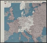
- Beinecke Rare Book and Manuscript Library > The European fronts [cartographic material] : week ending 9 January / R & A, OSS.
- Creator:
- United States. Army. Engineer Base Topographic Battalion, 64th
- Published / Created:
- 1944
- Call Number:
- 27291CBF 1944
- Container / Volume:
- BRBL_00023B
- Image Count:
- 1
- Resource Type:
- Maps, Atlases & Globes
- Found in:
- Beinecke Rare Book and Manuscript Library > Special air and gunnery target map [Rota Island] / prepared ... by 64th Engr. Top. Bn. USAFICPA.
- Creator:
- Great Britain. Secret Intelligence Service. MI9
- Published / Created:
- 1944?]
- Call Number:
- 27 1944B
- Container / Volume:
- BRBL_00023B
- Image Count:
- 2
- Resource Type:
- Maps, Atlases & Globes
- Found in:
- Beinecke Rare Book and Manuscript Library > Sheet G, Sumatra (south), Java (extreme north west) ; Sheet H, Borneo (south west), Sumatra (extreme south), Java (east & west).
- Creator:
- Rand McNally and Company
- Published / Created:
- [1945?]
- Call Number:
- 11hd 1941R
- Image Count:
- 1
- Resource Type:
- Maps, Atlases & Globes
- Found in:
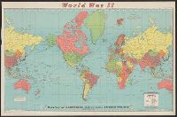
- Beinecke Rare Book and Manuscript Library > Rand McNally war map.
- Creator:
- Rand McNally and Company
- Published / Created:
- [1945?]
- Call Number:
- 11hc 1945
- Container / Volume:
- BRBL_00010I
- Image Count:
- 1
- Resource Type:
- Maps, Atlases & Globes
- Found in:
- Beinecke Rare Book and Manuscript Library > Rand McNally war map.
- Published / Created:
- [1788?]
- Call Number:
- BrSides Folio 2019 52
- Image Count:
- 1
- Resource Type:
- Maps, Atlases & Globes
- Found in:
- Beinecke Rare Book and Manuscript Library > Plan der Festung Bender : A. nachdem die russisch kaiserliche Truppen unter Commando des General Kamenskoy in 3 Colonnen die Türke bey B. in Gangura und bey C. Salkuza den 20 December 1788 überfallen und in die Flucht geschlagen ...
- Published / Created:
- [1709?]
- Call Number:
- 3531hc 1709
- Container / Volume:
- BRBL_00111
- Image Count:
- 1
- Resource Type:
- Maps, Atlases & Globes
- Found in:
- Beinecke Rare Book and Manuscript Library > Plan de la bataille de Pultowa, le 27 Juin U.S. 1709.
- Creator:
- Allied Forces. South West Pacific Area
United States. Army. Corps of Engineers. Engineer Co (Topo), 67th
- Published / Created:
- 1945
- Call Number:
- 11hd 1945D
- Container / Volume:
- BRBL_00010ZF
- Image Count:
- 1
- Resource Type:
- Maps, Atlases & Globes
- Found in:
- Beinecke Rare Book and Manuscript Library > Philippine campaign / reproduced by 67th Engineer Topo Co, SWPA.
- Published / Created:
- 1918?]
- Call Number:
- 38hc 1918E
- Container / Volume:
- BRBL_00172
- Image Count:
- 1
- Resource Type:
- Maps, Atlases & Globes
- Found in:
- Beinecke Rare Book and Manuscript Library > Minenwerfer-Karte, Div. "H".
- Creator:
- Rand McNally and Company
- Published / Created:
- [1944?]
- Call Number:
- 11hc 1944C
- Image Count:
- 2
- Resource Type:
- Maps, Atlases & Globes
- Found in:
- Beinecke Rare Book and Manuscript Library > Military map of the world.
- Call Number:
- 783 C899 1863B
- Container / Volume:
- BRBL_00510
- Image Count:
- 1
- Resource Type:
- Maps, Atlases & Globes
- Found in:
- Beinecke Rare Book and Manuscript Library > Military and topographic map of region about Culpepper Courthouse, Va.
- Published / Created:
- 1945]
- Call Number:
- 11hd 1945H
- Container / Volume:
- BRBL_00010ZF
- Image Count:
- 2
- Resource Type:
- Maps, Atlases & Globes
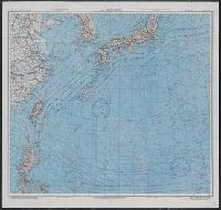
- Found in:
- Beinecke Rare Book and Manuscript Library > Japan, Honshu - South Coast : Iseno Umi or Ise Wan and Mikawa Wan with approaches, from Japanese surveys to 1927, with additions to 1935.
- Creator:
- United States. Army Map Service
- Published / Created:
- 1945
- Call Number:
- 57 1945A
- Container / Volume:
- BRBL_00303
- Image Count:
- 2
- Resource Type:
- Maps, Atlases & Globes
- Found in:
- Beinecke Rare Book and Manuscript Library > Japan and South China Seas / prepared at the direction of the commanding general, Army Air Forces, for the Aeronautical Chart Service by the Lake Survey Branch, Army Map Service, Detroit, Michigan, March 1945.
- Creator:
- United States. Army Map Service
- Published / Created:
- 1945
- Call Number:
- 50 1945D
- Container / Volume:
- BRBL_00273
- Image Count:
- 2
- Resource Type:
- Maps, Atlases & Globes
- Found in:
- Beinecke Rare Book and Manuscript Library > Japan and South China Seas / prepared at the direction of the commanding general, Army Air Forces, for the Aeronautical Chart Service by the Lake Survey Branch, Army Map Service, Detroit, Michigan, March 1945.
- Creator:
- C.S. Hammond & Company
- Published / Created:
- c1917.
- Call Number:
- 11 1917
- Container / Volume:
- BRBL_00010
- Image Count:
- 1
- Resource Type:
- Maps, Atlases & Globes
- Found in:
- Beinecke Rare Book and Manuscript Library > Hammond's large scale war map of the Western Front [cartographic material].
- Published / Created:
- 1918?]
- Call Number:
- 38hc 1918D
- Container / Volume:
- BRBL_00172
- Image Count:
- 2
- Resource Type:
- Maps, Atlases & Globes
- Found in:
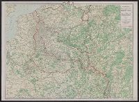
- Beinecke Rare Book and Manuscript Library > Gruppe Gorz, Ic/IId No. 62 geh. Artillerie-Wochenkarte mit Truppen und Fliegerbilderkundung.
- Published / Created:
- 1918?]
- Call Number:
- 38hc 1918B
- Container / Volume:
- BRBL_00172
- Image Count:
- 6
- Resource Type:
- Maps, Atlases & Globes
- Found in:
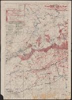
- Beinecke Rare Book and Manuscript Library > Grabenkarten.
- Published / Created:
- 1918?]
- Call Number:
- 38hc 1918C
- Container / Volume:
- BRBL_00172
- Image Count:
- 1
- Resource Type:
- Maps, Atlases & Globes
- Found in:
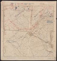
- Beinecke Rare Book and Manuscript Library > Grabenkarte.
- Creator:
- Seutter, Matthaeus, 1678-1756
- Published / Created:
- [1736]
- Call Number:
- BrSides Double Folio 2019 19
- Image Count:
- 1
- Resource Type:
- Maps, Atlases & Globes
- Found in:
- Beinecke Rare Book and Manuscript Library > Charte der Kriegs Operationen am Donn u. Dnieper Ihro russich kayserl. Majestaet glorieusen Armeen A. 1736 / gestochen bey der Kayserl. Wissensch. Acad. in St. Petersburg.
- Call Number:
- BrSides Folio 2019 53
- Image Count:
- 1
- Resource Type:
- Maps, Atlases & Globes
- Found in:
- Beinecke Rare Book and Manuscript Library > Charte der Krieges operation am Donn und Dniper ihro Russisch Kayserl. Maist. glorieusen Armeen, 1736.
- Published / Created:
- [c1760]
- Call Number:
- 7345 Q31 1760
- Container / Volume:
- BRBL_00734
- Image Count:
- 1
- Resource Type:
- Maps, Atlases & Globes
- Found in:
- Beinecke Rare Book and Manuscript Library > An authentic plan of the River St. Laurence from Sillery, to the fall of Montmorenci : with the operations of the siege of Quebec under the command of Vice-Adml. Saunders & Major Genl. Wolfe down to the 5. Sepr. 1759 / drawn by a captain in His Majesties navy.
- Published / Created:
- ca. 1760]
- Call Number:
- 7345 Q31 1759
- Container / Volume:
- BRBL_00380
- Image Count:
- 1
- Resource Type:
- Maps, Atlases & Globes
- Found in:
- Beinecke Rare Book and Manuscript Library > An authentic plan of the River St. Laurence from Sillery, to the fall of Montmorenci : with the operations of the siege of Quebec under the command of Vice-Adml. Saunders & Major Genl. Wolfe down to the 5. Sepr. 1759 / drawn by a captain in His Majesties
- Creator:
- United States. Army Map Service
- Published / Created:
- 1945
- Call Number:
- 50 1945H
- Container / Volume:
- BRBL_00273
- Image Count:
- 2
- Resource Type:
- Maps, Atlases & Globes
- Found in:
- Beinecke Rare Book and Manuscript Library > AAF cloth map. Asiatic series. South Burma / compiled for the U.S. Army Air Forces by the Army Map Service.
- Creator:
- United States. Army Map Service
- Published / Created:
- 1945
- Call Number:
- 50 1945G
- Container / Volume:
- BRBL_00273
- Image Count:
- 2
- Resource Type:
- Maps, Atlases & Globes
- Found in:
- Beinecke Rare Book and Manuscript Library > AAF cloth map. Asiatic series. French Indo China / compiled for the U.S. Army Air Forces by the Army Map Service.
- Creator:
- United States. Army Map Service
- Published / Created:
- 1944
- Call Number:
- 50 1945F
- Container / Volume:
- BRBL_00273
- Image Count:
- 2
- Resource Type:
- Maps, Atlases & Globes
- Found in:
- Beinecke Rare Book and Manuscript Library > AAF cloth map. Asiatic series. French Indo China / compiled for the U.S. Army Air Forces by the Army Map Service.
- Creator:
- United States. Army Map Service
- Published / Created:
- 1944
- Call Number:
- 56gms 1944
- Container / Volume:
- BRBL_00299
- Image Count:
- 2
- Resource Type:
- Maps, Atlases & Globes
- Found in:
- Beinecke Rare Book and Manuscript Library > AAF cloth map [cartographic material] / prepared under the direction of the Commanding General, Army Air Forces, by the Aeronautical Chart Service.
- Creator:
- United States. Army Map Service
- Published / Created:
- 1944
- Call Number:
- 50 1945E
- Container / Volume:
- BRBL_00273
- Image Count:
- 2
- Resource Type:
- Maps, Atlases & Globes
- Found in:
- Beinecke Rare Book and Manuscript Library > AAF cloth map [cartographic material] / prepared under the direction of the Commanding General, Army Air Forces, by the Aeronautical Chart Service.
- Creator:
- U.S. Lake Survey
- Published / Created:
- 1945
- Call Number:
- 50 1945
- Container / Volume:
- BRBL_00273
- Image Count:
- 2
- Resource Type:
- Maps, Atlases & Globes
- Found in:
- Beinecke Rare Book and Manuscript Library > AAF cloth chart. No. C-48 West Java / reproduced under the direction of the Commanding General, Army Air Forces for the Aeronautical Chart Service by the Army Map Service, Washington D.C. ; copied by Lake Survey Branch, A.M.S., Detroit, Michigan, July 194
- Published / Created:
- 1945
- Call Number:
- 50 1945A
- Container / Volume:
- BRBL_00273
- Image Count:
- 2
- Resource Type:
- Maps, Atlases & Globes
- Found in:
- Beinecke Rare Book and Manuscript Library > AAF cloth chart. C-800, We Island / Prepared at the direction of the Commanding General, Army Air Forces, by the Aeronautical Chart Service, Washington, D.C., from existing Aeronautical Charts, March 1945, Base No. 1.
- Creator:
- United States. Army Air Forces
- Published / Created:
- 1944
- Call Number:
- 50 1945B
- Container / Volume:
- BRBL_00273
- Image Count:
- 2
- Resource Type:
- Maps, Atlases & Globes
- Found in:
- Beinecke Rare Book and Manuscript Library > AAF cloth chart [cartographic material] : no. C40, Luzon Island / Army Map Service U.S. Army.
- Creator:
- United States. Army Map Service
- Published / Created:
- 1944
- Call Number:
- 50 1945O
- Container / Volume:
- BRBL_00273
- Image Count:
- 2
- Resource Type:
- Maps, Atlases & Globes
- Found in:
- Beinecke Rare Book and Manuscript Library > AAF cloth chart [cartographic material] : Eastern Asia / Army Map Service.
- Creator:
- De Costa, J
- Published / Created:
- July 29th, 1775.
- Call Number:
- 764 B65 1775
- Container / Volume:
- BRBL_00454
- Image Count:
- 1
- Resource Type:
- Maps, Atlases & Globes
- Found in:
- Beinecke Rare Book and Manuscript Library > A plan of the town and harbour of Boston and the country adjacent, with the road from Boston to Concord : shewing the place of the late engagement between the King's troops & the provincials, together with the several encampments of both armies in & about
- Published / Created:
- 27 Novr. 1775.
- Call Number:
- 764 B65 1775G
- Container / Volume:
- BRBL_00454
- Image Count:
- 1
- Resource Type:
- Maps, Atlases & Globes
- Found in:
- Beinecke Rare Book and Manuscript Library > A plan of the battle on Bunkers Hill : fought on the 17th of June 1775, by an officer on the spot.
- Creator:
- Encyclopaedia Britannica, inc
Matthews-Northrup Works
- Published / Created:
- 1918?]
- Call Number:
- 11hc 1918J-2
- Container / Volume:
- BRBL_00010F
- Image Count:
- 1
- Resource Type:
- Maps, Atlases & Globes
- Found in:
- Beinecke Rare Book and Manuscript Library > A geographical and historical guide to the world's wars, 4000 B.C. to 1918 [cartographic material] : No. 1, north-western Europe, showing the "Western Front" / engraved and printed at the Matthews-Northrup Works, Buffalo, N.Y.
- Creator:
- Encyclopaedia Britannica, inc
Matthews-Northrup Works
- Published / Created:
- 1918?]
- Call Number:
- 11hc 1917R
- Container / Volume:
- BRBL_00010E
- Image Count:
- 1
- Resource Type:
- Maps, Atlases & Globes
- Found in:
- Beinecke Rare Book and Manuscript Library > A geographical and historical guide to the world's wars, 4000 B.C. to 1918 [cartographic material] : No. 1, north-western Europe, showing the "Western Front" / engraved and printed at the Matthews-Northrup Works, Buffalo, N.Y.