Search
You Searched For
Search Results
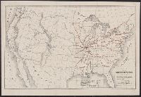
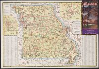
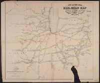
- Creator:
- Hutawa, Julius
- Published / Created:
- 1854?]
- Call Number:
- 75 1854A
- Container / Volume:
- BRBL_00401
- Image Count:
- 1
- Resource Type:
- Maps, Atlases & Globes
- Alternative Title:
- Missouri republican.
- Description:
- "Compiled for the Missouri Republican
- Publisher:
- Missouri Republican,
- Subject (Topic):
- Railroads--Missouri--Saint Louis--Maps
- Found in:
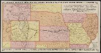
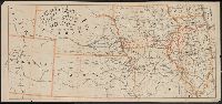
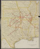
- Beinecke Rare Book and Manuscript Library > Map of the United States, shewing the principal steamboat routes and projected railroads connecting with St. Louis / Juls. Hutawa, lithr.
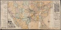
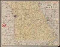
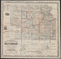
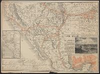
- Creator:
- Rand McNally and Company
- Published / Created:
- (Chicago : and [1886], c1883
- Call Number:
- 75gme 1883B
- Container / Volume:
- BRBL_00413
- Image Count:
- 2
- Resource Type:
- Maps, Atlases & Globes
- Alternative Title:
- Missouri Pacific Railway for Kansas
- Publisher:
- Missouri Pacific Railway,
- Subject (Name):
- Missouri Pacific Railway Company
- Found in:
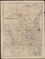
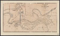
- Beinecke Rare Book and Manuscript Library > Map of the South West railway system : Missouri Pacific Ry., Central Branch U.P.R.R., Missouri, Kansas & Texas Ry., Texas and Pacific Ry., St. Louis, Iron Mountn. and Southern Ry., International and Great Northern Ry. and their connections / Rand McNally
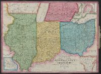
- Published / Created:
- 1843
- Call Number:
- 811 1843
- Container / Volume:
- BRBL_00552
- Image Count:
- 1
- Resource Type:
- Maps, Atlases & Globes
- Description:
- Insets: 1. Missouri 2. Wisconsin Tery.
- Found in:
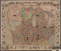
- Beinecke Rare Book and Manuscript Library > Traveller's map of Michigan, Indiana & Ohio.
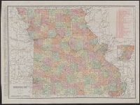
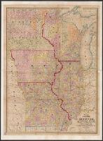
- Creator:
- Rand McNally and Company
- Published / Created:
- 1911
- Call Number:
- 816 1911
- Container / Volume:
- BRBL_00561
- Image Count:
- 1
- Resource Type:
- Maps, Atlases & Globes
- Alternative Title:
- atlas map of Missouri.
- Description:
- business atlas map of Missouri. Copyright 1911
- Subject (Geographic):
- Missouri--Maps
- Subject (Topic):
- Railroads--Missouri--Maps
- Found in:
- Beinecke Rare Book and Manuscript Library > Missouri.
- Creator:
- Missouri. State Highway Commission
- Published / Created:
- [1940]
- Call Number:
- 816gmb 1940
- Container / Volume:
- BRBL_00564
- Image Count:
- 2
- Resource Type:
- Maps, Atlases & Globes
- Publisher:
- Missouri State Highway Commission,
- Subject (Geographic):
- Missouri--Maps
- Subject (Topic):
- Roads--Missouri--Maps
- Found in:
- Beinecke Rare Book and Manuscript Library > Missouri : 1940 highway map / compliments Missouri State Highway Commission.
- Creator:
- Missouri. State Highway Commission
- Published / Created:
- [1941]
- Call Number:
- 816gmb 1941
- Container / Volume:
- BRBL_00564
- Image Count:
- 2
- Resource Type:
- Maps, Atlases & Globes
- Publisher:
- Missouri State Highway Commission,
- Subject (Geographic):
- Missouri--Maps
- Subject (Topic):
- Roads--Missouri--Maps
- Found in:
- Beinecke Rare Book and Manuscript Library > Missouri : 1941 highway map / compliments Missouri State Highway Commission.
- Creator:
- Rand McNally and Company
- Published / Created:
- [1932?]
- Call Number:
- 816gmb 1932
- Container / Volume:
- BRBL_00564
- Image Count:
- 2
- Resource Type:
- Maps, Atlases & Globes
- Alternative Title:
- Missouri
- Subject (Geographic):
- Missouri--Maps
- Subject (Topic):
- Roads--Missouri--Maps
- Found in:
- Beinecke Rare Book and Manuscript Library > Texaco road map, Missouri.
- Published / Created:
- 1913
- Call Number:
- 825 L487 1913
- Container / Volume:
- BRBL_00574
- Image Count:
- 1
- Resource Type:
- Maps, Atlases & Globes
- Description:
- of Nebraska, Iowa, Kansas, and Missouri.
- Found in:
- Beinecke Rare Book and Manuscript Library > General map of vicinity of Leavenworth.
- Creator:
- Good Roads Association of Greater Kansas City
- Published / Created:
- 1921
- Call Number:
- 816 K134 1921
- Container / Volume:
- BRBL_00562
- Image Count:
- 2
- Resource Type:
- Maps, Atlases & Globes
- Description:
- map of Missouri.
- Subject (Topic):
- Roads--Missouri--Kansas City Region
- Found in:
- Beinecke Rare Book and Manuscript Library > Boulevards and streets, named and numbered, connecting with all highways radiating from greater Kansas City ; The official routes of twenty-five trail highways, named and numbered, radiating from greater Kansas City / by Good Roads Association of Greater
- Creator:
- H.M. Gousha Company
- Published / Created:
- [1938]
- Call Number:
- 816gmb 1938
- Container / Volume:
- BRBL_00564
- Image Count:
- 2
- Resource Type:
- Maps, Atlases & Globes
- Alternative Title:
- Missouri
- Subject (Geographic):
- Missouri--Maps
- Subject (Topic):
- Roads--Missouri--Maps
- Found in:
- Beinecke Rare Book and Manuscript Library > Official road map of Missouri / [prepared for] Shell.
- Creator:
- Rand McNally and Company
- Published / Created:
- [1941]
- Call Number:
- 816gmb 1941A
- Container / Volume:
- BRBL_00564
- Image Count:
- 2
- Resource Type:
- Maps, Atlases & Globes
- Alternative Title:
- Highway map, Missouri
- Subject (Geographic):
- Missouri--Maps
- Subject (Topic):
- Roads--Missouri--Maps
- Found in:
- Beinecke Rare Book and Manuscript Library > Road map, Missouri / compliments of Standard Oil Company of Indiana.
- Creator:
- H.M. Gousha Company
- Published / Created:
- [1929]
- Call Number:
- 816gmb 1929
- Container / Volume:
- BRBL_00564
- Image Count:
- 2
- Resource Type:
- Maps, Atlases & Globes
- Alternative Title:
- 1929 road map of Missouri
- Subject (Geographic):
- Missouri--Maps
- Subject (Topic):
- Roads--Missouri--Maps
- Found in:
- Beinecke Rare Book and Manuscript Library > Continental Oil Co. official road map, Missouri / compliments of Continental Oil Co.
- Creator:
- Carey, Mathew, 1760-1839
- Published / Created:
- 1814]
- Call Number:
- 80 1814D
- Container / Volume:
- BRBL_00532
- Image Count:
- 1
- Resource Type:
- Maps, Atlases & Globes
- Description:
- Shows boundaries of Missouri Territory.
- Found in:
- Beinecke Rare Book and Manuscript Library > Missouri Territory formerly Louisiana / Lewis, del. ; Bower, sc.
- Creator:
- Missouri. Board of Immigration
- Published / Created:
- c1879.
- Call Number:
- 816 1879A
- Container / Volume:
- BRBL_00561
- Image Count:
- 1
- Resource Type:
- Maps, Atlases & Globes
- Found in:
- Beinecke Rare Book and Manuscript Library > Map of the state of Missouri.
- Creator:
- Parker, Nathan H. (Nathan Howe)
- Published / Created:
- 1865
- Call Number:
- 816ca 1865
- Container / Volume:
- BRBL_00563
- Image Count:
- 1
- Resource Type:
- Maps, Atlases & Globes
- Subject (Topic):
- Geology--Missouri--Maps
- Found in:
- Beinecke Rare Book and Manuscript Library > Parker's geological map of the state of Missouri : showing the location of the principal deposits of iron, lead, zinc, tin, copper, diamonds, gold, silver, platina, nickel, manganese, alabaster, kaolin, coal, oil springs, &c. / by Nathan H. Parker ; Macke
- Published / Created:
- 1914?]
- Call Number:
- 816gme Oz1 1914
- Container / Volume:
- BRBL_00564
- Image Count:
- 1
- Resource Type:
- Maps, Atlases & Globes
- Subject (Topic):
- Railroads--Missouri--Maps
- Found in:
- Beinecke Rare Book and Manuscript Library > Map of the Ozark country along the Frisco lines in Missouri / Parker-eng. co., St. Louis, Mo.
- Creator:
- St. Louis Public Service Company
- Published / Created:
- c1944.
- Call Number:
- 816 Sa24 1944
- Container / Volume:
- BRBL_00562
- Image Count:
- 2
- Resource Type:
- Maps, Atlases & Globes
- Subject (Topic):
- Local transit--Missouri--Saint Louis
- Found in:
- Beinecke Rare Book and Manuscript Library > Guide-map St. Louis and vicinity / St. Louis Public Service Company.
- Creator:
- Hood, Washington, 1808-1840
- Published / Created:
- before 1835
- Call Number:
- WA MSS S-2687
- Collection Title:
- Washington Hood papers
- Container / Volume:
- 5 Broadside
- Image Count:
- 1
- Resource Type:
- Maps, Atlases & Globes
- Description:
- and Missouri.
- Found in:
- Beinecke Rare Book and Manuscript Library > Manuscript map of Nebraska and Iowa
- Published / Created:
- 1877?]
- Call Number:
- 80gme 1877B
- Container / Volume:
- BRBL_00539
- Image Count:
- 2
- Resource Type:
- Maps, Atlases & Globes
- Found in:
- Beinecke Rare Book and Manuscript Library > A geographically correct map of the Kansas Pacific Railway : showing the only direct route to Denver and all the popular Rocky Mountain resorts, also to the Black Hills country and the famous San Juan mines in Colorado / Woodward, Tiernan & Hale, map engr
- Creator:
- Heubach, Emil
- Published / Created:
- c1904.
- Call Number:
- 816 Sa24 1904A
- Container / Volume:
- BRBL_00562
- Image Count:
- 1
- Resource Type:
- Maps, Atlases & Globes
- Subject (Topic):
- Railroads--Missouri--Saint Louis--Maps
- Found in:
- Beinecke Rare Book and Manuscript Library > Comprehensive map of the traction system of St. Louis : practical for the use in passenger traffic.
- Creator:
- Travilla, James C
- Published / Created:
- 1907
- Call Number:
- 816 Sa24 1907
- Container / Volume:
- BRBL_00562
- Image Count:
- 1
- Resource Type:
- Maps, Atlases & Globes
- Subject (Topic):
- Parks--Missouri--Saint Louis--Maps
- Found in:
- Beinecke Rare Book and Manuscript Library > Map of St. Louis city & county : prepared for City Plan Report of The Civic League showing proposed improvements / map prepared by Jas. C. Travilla.
- Published / Created:
- 1850
- Call Number:
- 754gme 1850
- Container / Volume:
- BRBL_00419
- Image Count:
- 1
- Resource Type:
- Maps, Atlases & Globes
- Description:
- Mississippi, Missouri, Ohio, Allegheny and
- Found in:
- Beinecke Rare Book and Manuscript Library > [Railroads of the Lake States, from Great Lakes to Ohio River]
- Creator:
- G.W. & C.B. Colton & Co
- Published / Created:
- 1872
- Call Number:
- 80gme 1872
- Container / Volume:
- BRBL_00539
- Image Count:
- 1
- Resource Type:
- Maps, Atlases & Globes
- Description:
- Wisconsin to southern Kansas, Missouri, and
- Found in:
- Beinecke Rare Book and Manuscript Library > Colton's railroad and express map of the northwestern states : showing the counties, towns, railroads, station, distances, etc.
- Creator:
- Chamber of Commerce (Independence, Mo.)
- Published / Created:
- [19--]
- Call Number:
- 816gmb In2 1950
- Container / Volume:
- BRBL_00564
- Image Count:
- 2
- Resource Type:
- Maps, Atlases & Globes
- Subject (Geographic):
- Roads--Missouri--Independence
- Subject (Topic):
- Streets--Missouri--Independence--Maps
- Found in:
- Beinecke Rare Book and Manuscript Library > Map and street guide of greater Independence, Missouri.
- Creator:
- Watson, Gaylord
- Published / Created:
- 1871?]
- Call Number:
- 80gme 1871
- Container / Volume:
- BRBL_00538
- Image Count:
- 1
- Resource Type:
- Maps, Atlases & Globes
- Description:
- Logansport, Ind. through Iowa and Missouri into
- Found in:
- Beinecke Rare Book and Manuscript Library > Map of the Burlington and South Western Railway : and connections / prepared at Gaylord Watson's map establishment, 16 Beckman St., N.Y.
- Creator:
- Rand McNally and Company
- Published / Created:
- [1939?]
- Call Number:
- 30 1939A
- Container / Volume:
- BRBL_00032B
- Image Count:
- 2
- Resource Type:
- Maps, Atlases & Globes
- Description:
- Missouri.
- Found in:
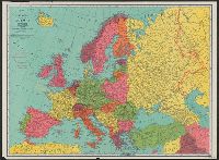
- Beinecke Rare Book and Manuscript Library > Rand McNally standard map of Europe.
- Creator:
- Hunnius, Ado
- Published / Created:
- 1875
- Call Number:
- 826 1857
- Container / Volume:
- BRBL_00577
- Image Count:
- 4
- Resource Type:
- Maps, Atlases & Globes
- Publisher:
- Dept. of the Missouri?],
- Subject (Name):
- Missouri
- Found in:
- Beinecke Rare Book and Manuscript Library > Military map of the Indian Territory / compiled under the direction of 1st Lieut. E.H. Ruffner, Engineers, Chief Engineer, Department of the Missouri ; drawn and engraved by Ado Hunnius.
- Creator:
- Gross, Herman W
- Published / Created:
- [19--?]
- Call Number:
- 816gmb Sa24 1946
- Container / Volume:
- BRBL_00564
- Image Count:
- 2
- Resource Type:
- Maps, Atlases & Globes
- Subject (Topic):
- Roads--Missouri--Saint Louis
- Found in:
- Beinecke Rare Book and Manuscript Library > Map of Greater St. Louis and suburbs / H.W. Gross.
- Creator:
- Rand McNally and Company
- Published / Created:
- [1942]
- Call Number:
- 816gmb Sa24 1942
- Container / Volume:
- BRBL_00564
- Image Count:
- 2
- Resource Type:
- Maps, Atlases & Globes
- Subject (Topic):
- Central business districts--Missouri
- Found in:
- Beinecke Rare Book and Manuscript Library > Road map, St. Louis and vicinity / compliments of Standard Oil Company of Indiana.
- Creator:
- Rand McNally and Company
- Published / Created:
- [1939]
- Call Number:
- 816gmb Sa24 1939A
- Container / Volume:
- BRBL_00564
- Image Count:
- 2
- Resource Type:
- Maps, Atlases & Globes
- Subject (Topic):
- Central business districts--Missouri
- Found in:
- Beinecke Rare Book and Manuscript Library > Road map, St. Louis and vicinity / compliments of Standard Oil Company of Indiana.
- Creator:
- H.M. Gousha Company
- Published / Created:
- [1939]
- Call Number:
- 816gmb K134 1939
- Container / Volume:
- BRBL_00564
- Image Count:
- 2
- Resource Type:
- Maps, Atlases & Globes
- Subject (Topic):
- Central business districts--Missouri
- Found in:
- Beinecke Rare Book and Manuscript Library > Official road map, Kansas City and vicinity / compliments of Standard Oil Company of Indiana.
- Creator:
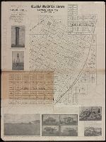
- Tuttle-Ayers-Woodward Co
- Call Number:
- 816ad K134 1925
- Container / Volume:
- BRBL_00563
- Image Count:
- 29
- Resource Type:
- Maps, Atlases & Globes
- Subject (Topic):
- Real property--Missouri--Jackson County
- Found in:
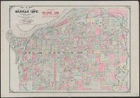
- Beinecke Rare Book and Manuscript Library > Atlas of Kansas City, Missouri, and environs, 1925.
- Creator:
- Chamber of Commerce (Kansas City, Mo.)
- Published / Created:
- 1940
- Call Number:
- 816 K134 1940
- Container / Volume:
- BRBL_00562
- Image Count:
- 2
- Resource Type:
- Maps, Atlases & Globes
- Subject (Topic):
- Central business districts--Missouri
- Found in:
- Beinecke Rare Book and Manuscript Library > Map of greater Kansas City / issued by the Convention & Visitors Bureau, Chamber of Commerce, Kansas City, Missouri.
- Creator:
- Johnson, A. J. (Alvin Jewett), 1827-1884
- Published / Created:
- 1866]
- Call Number:
- 816 1866
- Container / Volume:
- BRBL_00561
- Image Count:
- 2
- Resource Type:
- Maps, Atlases & Globes
- Alternative Title:
- Missouri and Kansas
- Subject (Geographic):
- Missouri--Maps
- Found in:
- Beinecke Rare Book and Manuscript Library > Johnson's Missouri and Kansas.
- Creator:
- Finley, A. (Anthony)
- Published / Created:
- [1831]
- Call Number:
- 816 1831
- Container / Volume:
- BRBL_00561
- Image Count:
- 1
- Resource Type:
- Maps, Atlases & Globes
- Subject (Geographic):
- Missouri--Maps
- Found in:
- Beinecke Rare Book and Manuscript Library > Missouri / Young & Delleker sc.
- Creator:
- United States. General Land Office
- Published / Created:
- 1878
- Call Number:
- 816 1878
- Container / Volume:
- BRBL_00561
- Image Count:
- 1
- Resource Type:
- Maps, Atlases & Globes
- Subject (Geographic):
- Missouri--Maps
- Found in:
- Beinecke Rare Book and Manuscript Library > State of Missouri : 1878.
- Creator:
- La Rocque, George A., 1908-
- Published / Created:
- 1966
- Call Number:
- 817cbj 1966
- Container / Volume:
- BRBL_00564
- Image Count:
- 1
- Resource Type:
- Maps, Atlases & Globes
- Alternative Title:
- Missouri River Basin
- Subject (Geographic):
- Missouri River Watershed--Maps
- Subject (Topic):
- Groundwater--Missouri River Watershed
- Found in:
- Beinecke Rare Book and Manuscript Library > General availability of ground water and depth to water level in the Missouri River Basin / by G.A. La Rocque, Jr.
- Published / Created:
- [1858]
- Call Number:
- 807 1858B
- Container / Volume:
- BRBL_00717
- Image Count:
- 1
- Resource Type:
- Maps, Atlases & Globes
- Description:
- . James Ward agst. The Mississippi & Missouri
- Found in:
- Beinecke Rare Book and Manuscript Library > Map of the lower part of the Rock Island chain of rapids.
- Published / Created:
- 1900?]
- Call Number:
- 80gme 1900
- Container / Volume:
- BRBL_00540
- Image Count:
- 1
- Resource Type:
- Maps, Atlases & Globes
- Description:
- , through Nebraska, Iowa, Kansas, and Missouri.
- Found in:
- Beinecke Rare Book and Manuscript Library > Map of the Chicago, Burlington and Quincy R.R. and its connections.
- Published / Created:
- c1886.
- Call Number:
- Zc35 886th
- Image Count:
- 2
- Resource Type:
- Maps, Atlases & Globes
- Alternative Title:
- Fremont, Elkhorn & Missouri Valley R.R
- Subject (Name):
- Fremont, Elkhorn, and Missouri Valley
- Found in:
- Beinecke Rare Book and Manuscript Library > Through northern Nebraska to the Black Hills : Elkhorn Valley Line : free homes for the 1,000,000 ...
- Creator:
- Union Pacific Railroad Company
- Published / Created:
- 1867?]
- Call Number:
- 824 Om1 1867
- Container / Volume:
- BRBL_00571
- Image Count:
- 1
- Resource Type:
- Maps, Atlases & Globes
- Subject (Topic):
- Railroad bridges--Missouri River--Maps
- Found in:
- Beinecke Rare Book and Manuscript Library > Map to accompany report of J.L. Williams on the bridging of the Missouri River / Union Pacific Rail Road.
- Published / Created:
- 1876?]
- Call Number:
- 816 Sa24 1876
- Container / Volume:
- BRBL_00562
- Image Count:
- 1
- Resource Type:
- Maps, Atlases & Globes
- Subject (Topic):
- Streets--Missouri--Saint Louis--Maps
- Found in:
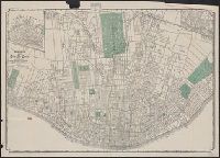
- Beinecke Rare Book and Manuscript Library > Gould's official map of the city of St. Louis, Mo.
- Creator:
- Gothe de Grote, Carl
- Published / Created:
- 1882
- Call Number:
- 816gmb K134 1882
- Container / Volume:
- BRBL_00564
- Image Count:
- 1
- Resource Type:
- Maps, Atlases & Globes
- Subject (Topic):
- Streets--Missouri--Kansas City--Maps
- Found in:
- Beinecke Rare Book and Manuscript Library > Wright's map of Kansas City / compiled and drawn by Carl Gothe de Grote
- Creator:
- A.C. Shewey & Co
- Published / Created:
- c1890.
- Call Number:
- 816 Sa24 1890
- Container / Volume:
- BRBL_00562
- Image Count:
- 1
- Resource Type:
- Maps, Atlases & Globes
- Subject (Topic):
- Streets--Missouri--Saint Louis--Maps
- Found in:
- Beinecke Rare Book and Manuscript Library > Shewey's map, city St. Louis.
- Creator:
- St. Louis Lithographing & Printing Co
- Published / Created:
- [190-?]
- Call Number:
- 816 Sa24 1900
- Container / Volume:
- BRBL_00562
- Image Count:
- 1
- Resource Type:
- Maps, Atlases & Globes
- Subject (Topic):
- Streets--Missouri--Saint Louis--Maps
- Found in:
- Beinecke Rare Book and Manuscript Library > Map of the city of St. Louis.
- Creator:
- Rand McNally and Company
- Published / Created:
- 1899
- Call Number:
- 80gme 1899
- Container / Volume:
- BRBL_00539
- Image Count:
- 1
- Resource Type:
- Maps, Atlases & Globes
- Description:
- northern Kansas and Missouri.
- Found in:
- Beinecke Rare Book and Manuscript Library > Chicago, Burlington & Quincy railroad system.
- Creator:
- Burr, David H., 1803-1875
- Published / Created:
- [1839?]
- Call Number:
- 806 1839
- Container / Volume:
- BRBL_00547
- Image Count:
- 4
- Resource Type:
- Maps, Atlases & Globes
- Subject (Topic):
- Canals--Missouri--Maps
- Found in:
- Beinecke Rare Book and Manuscript Library > Map of Illinois & Missouri : exhibiting the post offices, post roads, canals, rail roads &c. / by David H. Burr.
- Creator:
- Hutawa, Julius
- Published / Created:
- [1848?]
- Call Number:
- 816fb Sa24 1848
- Container / Volume:
- BRBL_00563
- Image Count:
- 1
- Resource Type:
- Maps, Atlases & Globes
- Description:
- U.S. District Court of Missouri, June 1848
- Found in:
- Beinecke Rare Book and Manuscript Library > Sectional map of the county of St. Louis, Missouri / compiled by the publisher, Julius Hutawa.
- Creator:
- Wells, John G. (John Gaylord), 1821-1880
- Published / Created:
- 1857
- Call Number:
- 825 1857B
- Container / Volume:
- BRBL_00573
- Image Count:
- 1
- Resource Type:
- Maps, Atlases & Globes
- Description:
- Minnesota, Wisconsin, Iowa, Illinois, Missouri
- Found in:
- Beinecke Rare Book and Manuscript Library > Kansas & Nebraska.
- Published / Created:
- 187-?]
- Call Number:
- 825gme 1870
- Container / Volume:
- BRBL_00576
- Image Count:
- 1
- Resource Type:
- Maps, Atlases & Globes
- Subject (Name):
- Missouri River, Fort Scott & Gulf
- Found in:
- Beinecke Rare Book and Manuscript Library > Map of eastern Kansas : showing the lines of the Mo.R.F.S. & G.R.R. and connections.
- Published / Created:
- 183-?]
- Call Number:
- 816 Ir6 1837A
- Container / Volume:
- BRBL_00562
- Image Count:
- 1
- Resource Type:
- Maps, Atlases & Globes
- Subject (Topic):
- Real property--Missouri--Iron Mountain
- Found in:
- Beinecke Rare Book and Manuscript Library > Iron Mountain City.
- Published / Created:
- 188-?]
- Call Number:
- 816 K134 188XG
- Container / Volume:
- BRBL_00562
- Image Count:
- 1
- Resource Type:
- Maps, Atlases & Globes
- Subject (Topic):
- Real property--Missouri--Kansas City
- Found in:
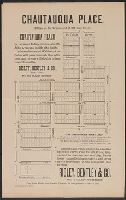
- Beinecke Rare Book and Manuscript Library > Chautauqua Place / Risley, Bentley & Co., sole agents, No. 812 Main Street.
- Creator:
- Long, T. M
- Published / Created:
- [1888]
- Call Number:
- 816 Sa23 1888
- Container / Volume:
- BRBL_00562
- Image Count:
- 1
- Resource Type:
- Maps, Atlases & Globes
- Subject (Topic):
- Real property--Missouri--Saint Joseph
- Found in:
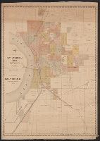
- Beinecke Rare Book and Manuscript Library > Map of St. Joseph, Mo. and vicinity / by T.M. Long, c.e.
- Creator:
- Kansas City Public Service Company
- Published / Created:
- [1940]
- Call Number:
- 816gme K134 1940
- Container / Volume:
- BRBL_00564
- Image Count:
- 2
- Resource Type:
- Maps, Atlases & Globes
- Subject (Topic):
- Bus lines--Missouri--Kansas City
- Found in:
- Beinecke Rare Book and Manuscript Library > Street car, trolley bus and motor bus lines serving greater Kansas City / Kansas City Public Service Co.
- Published / Created:
- 1847 or 1848?]
- Call Number:
- 816fcm 1847
- Container / Volume:
- BRBL_00563
- Image Count:
- 1
- Resource Type:
- Maps, Atlases & Globes
- Description:
- lands in the states of Illinois and Missouri."
- Subject (Geographic):
- Missouri--Maps
- Found in:
- Beinecke Rare Book and Manuscript Library > Diagram of the state of Missouri.
- Creator:
- G.W. & C.B. Colton & Co
- Published / Created:
- 1867
- Call Number:
- 816 1867
- Container / Volume:
- BRBL_00561
- Image Count:
- 1
- Resource Type:
- Maps, Atlases & Globes
- Alternative Title:
- Sectional map of the state of Missouri
- Subject (Geographic):
- Missouri--Maps
- Found in:
- Beinecke Rare Book and Manuscript Library > Colton's sectional map of the state of Missouri : compiled from the United States surveys & other authentic sources, exhibiting the sections, fractional sections, counties, cities, towns, villages, post offices, rail roads & other internal improvements.
- Creator:
- United States. General Land Office
- Published / Created:
- 1850?]
- Call Number:
- 816 1850
- Container / Volume:
- BRBL_00561
- Image Count:
- 1
- Resource Type:
- Maps, Atlases & Globes
- Subject (Geographic):
- Missouri--Maps
- Found in:
- Beinecke Rare Book and Manuscript Library > Diagram of the state of Missouri : accompanying report of 20th Novr. 1850 / Office of the Surveyor General for Illinois and Missouri, St. Louis, 20th Novr. 1850.
- Creator:
- United States. General Land Office
- Published / Created:
- 1891
- Call Number:
- 816 1891
- Container / Volume:
- BRBL_00561
- Image Count:
- 1
- Resource Type:
- Maps, Atlases & Globes
- Subject (Geographic):
- Missouri--Maps
- Found in:
- Beinecke Rare Book and Manuscript Library > State of Missouri / compiled from the official records of the General Land Office, under the supervision of A.F. Dinsmore, Principal Draughtsman.
- Published / Created:
- April 15, 1832.
- Call Number:
- 816 1832
- Container / Volume:
- BRBL_00561
- Image Count:
- 1
- Resource Type:
- Maps, Atlases & Globes
- Alternative Title:
- Missouri and Illinois [cartographic
- Subject (Geographic):
- Missouri--Maps
- Found in:
- Beinecke Rare Book and Manuscript Library > Map of the states of Missouri and Illinois / engraved & printed by Fenner Sears & Co.
- Creator:
- Geographisches Institut (Weimar, Thuringia, Germany)
- Published / Created:
- 1826
- Call Number:
- 816 1826
- Container / Volume:
- BRBL_00561
- Image Count:
- 1
- Resource Type:
- Maps, Atlases & Globes
- Subject (Geographic):
- Missouri--Maps
- Found in:
- Beinecke Rare Book and Manuscript Library > Missuri.
- Creator:
- Woodruff, Thomas Mayhew, d. 1899
- Published / Created:
- 187-?]
- Call Number:
- 831 1878B
- Container / Volume:
- BRBL_00579
- Image Count:
- 1
- Resource Type:
- Maps, Atlases & Globes
- Description:
- near Missouri and Yellowstone rivers in
- Found in:
- Beinecke Rare Book and Manuscript Library > Map showing a portion of the marches of troops under Genl. N.A. Miles command 1876-1878 / drawn by Thom. M. Woodruff, Lt. 5th Inftry A.A.D.C., March 1st 1878.
- Creator:
- Darling, Orlando
- Published / Created:
- [1857?]
- Call Number:
- 825gmb F779 1857
- Container / Volume:
- BRBL_00576
- Image Count:
- 1
- Resource Type:
- Maps, Atlases & Globes
- Description:
- Kansas and Missouri.
- Found in:
- Beinecke Rare Book and Manuscript Library > Fort Scott : county seat of Bourbon County, Kansas Territory / Orlando Darling, surveyor.
- Creator:
- Gunn, O.B. (Otis Berthoude), 1828-1901
- Published / Created:
- 1862
- Call Number:
- 825 1862
- Container / Volume:
- BRBL_00573
- Image Count:
- 1
- Resource Type:
- Maps, Atlases & Globes
- Alternative Title:
- Routes from the Missouri River to the
- Description:
- "Routes from the Missouri River to the Kansas
- Found in:
- Beinecke Rare Book and Manuscript Library > Gunn & Mitchell's new map of Kansas and the gold mines embracing all the public surveys up to 1862 / compiled from the original field notes by O.B. Gunn & D.T. Mitchell, LeCompton, K., 1862.
- Creator:
- Bloomer, W. L
- Published / Created:
- c1887
- Call Number:
- 816 K134 1887
- Container / Volume:
- BRBL_00562
- Image Count:
- 1
- Resource Type:
- Maps, Atlases & Globes
- Alternative Title:
- , Missouri
- Found in:
- Beinecke Rare Book and Manuscript Library > Case & Norman's stranger's guide to Kansas City, Missouri : showing principal points of interest correctly drawn and located, including most of the public buildings and many of the prominent business houses and manufacturing establishments / W.L. Bloomer.
- Creator:
- Gunn, O. B. (Otis Berthoude), 1828-1901
- Published / Created:
- 1866
- Call Number:
- 825 1866
- Container / Volume:
- BRBL_00573
- Image Count:
- 1
- Resource Type:
- Maps, Atlases & Globes
- Alternative Title:
- Routes from the Missouri River to the
- Description:
- "Routes from the Missouri River to the Kansas
- Found in:
- Beinecke Rare Book and Manuscript Library > Gunn & Mitchell's new map of Kansas and the gold mines : embracing all the public surveys up to 1866, principal meridian / compiled from the original field notes by O.B. Gunn & D.T. Mitchell.
- Creator:
- National Geographic Society (U.S.). Cartographic Division
- Published / Created:
- c1978.
- Call Number:
- 8101 1978A
- Container / Volume:
- BRBL_00552
- Image Count:
- 2
- Resource Type:
- Maps, Atlases & Globes
- Description:
- , Iowa, Missouri.
- Found in:
- Beinecke Rare Book and Manuscript Library > Close-up: U.S.A., the North Central States. Produced by the Cartographic Division, National Geographic Society. William T. Peele, chief cartographer; Richard K. Rogers, associate chief cartographer.
- Creator:
- H.M. Gousha Company
- Published / Created:
- [1942]
- Call Number:
- 818gmb 1942
- Container / Volume:
- BRBL_00565
- Image Count:
- 2
- Resource Type:
- Maps, Atlases & Globes
- Description:
- region, Arkansas-Missouri," text, and ill. on
- Found in:
- Beinecke Rare Book and Manuscript Library > Official road map of Arkansas / Conoco Travel Bureau.
- Creator:
- Featherstonhaugh, George William, 1780-1866
- Published / Created:
- 1835]
- Call Number:
- 814 M667 1835
- Container / Volume:
- BRBL_00558
- Image Count:
- 1
- Resource Type:
- Maps, Atlases & Globes
- Alternative Title:
- of the Missouri.
- Description:
- ; or Great Hills of the Missouri," and
- Found in:
- Beinecke Rare Book and Manuscript Library > A reconnoissance of the Minnay Sotor Watapāh; or St. Peter's River to its sources / made in the year 1835 by G.W. Featherstonhaugh, U.S. geologist.
- Creator:
- Colton, G. Woolworth (George Woolworth), 1827-1901
- Published / Created:
- 1862
- Call Number:
- 754gme 1860A
- Container / Volume:
- BRBL_00420
- Image Count:
- 1
- Resource Type:
- Maps, Atlases & Globes
- Alternative Title:
- map of Wisconsin, Illinois, Missouri
- Subject (Geographic):
- Missouri--Maps
- Subject (Topic):
- Railroads--Missouri--Maps
- Found in:
- Beinecke Rare Book and Manuscript Library > Colton's county and township rail road map of Wisconsin, Illinois, Missouri, & Iowa / Drawn, engraved & published by G. Woolworth Colton
- Creator:
- Colton, G. Woolworth (George Woolworth), 1827-1901
- Published / Created:
- 1861
- Call Number:
- 754 1861A
- Container / Volume:
- BRBL_00416
- Image Count:
- 1
- Resource Type:
- Maps, Atlases & Globes
- Description:
- Insets: [Map of Illinois, Missouri
- Found in:
- Beinecke Rare Book and Manuscript Library > G. Woolworth Colton's map of the country 500 miles around Cairo : showing the seat of the war in the west / Drawn, engraved & published by G. Woolworth Colton.
- Published / Created:
- 1852?]
- Call Number:
- 811gme 1852
- Container / Volume:
- BRBL_00554
- Image Count:
- 1
- Resource Type:
- Maps, Atlases & Globes
- Description:
- , Ohio, Indiana, Illinois, Missouri, Iowa
- Found in:
- Beinecke Rare Book and Manuscript Library > Map of Michigan Southern, Northern Indiana and Chicago and Rock Island railroads : with their connections from Council Bluffs to New York / lith. by F. Michelin & Geo. Leefe.
- Creator:
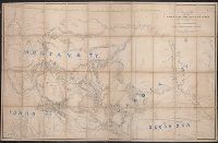
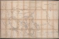
- Raynolds, W. F. (William Franklin), 1820-1894
- Published / Created:
- [1860]
- Call Number:
- 80 1860A
- Container / Volume:
- BRBL_00535
- Image Count:
- 1
- Resource Type:
- Maps, Atlases & Globes
- Description:
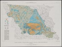
- . Missouri, engineer office, official: [illegible
- Subject (Geographic):
- Missouri River Watershed--Maps
- Subject (Topic):
- Geology--Missouri River Watershed--Maps
- Found in:
- Beinecke Rare Book and Manuscript Library > Map of the Yellowstone and Missouri Rivers and their tributaries / explored by Capt. W.F. Raynolds and 1st Lieut. H.E. Maynadier, 1859-1860.
- Creator:
- Raynolds, W. F. (William Franklin), 1820-1894
- Published / Created:
- [1860]
- Call Number:
- 80 1860A
- Container / Volume:
- BRBL_00535
- Image Count:
- 1
- Resource Type:
- Maps, Atlases & Globes
- Description:
- . Missouri, engineer office, official: [illegible
- Subject (Geographic):
- Missouri River Watershed--Maps
- Subject (Topic):
- Geology--Missouri River Watershed--Maps
- Found in:
- Beinecke Rare Book and Manuscript Library > Map of the Yellowstone and Missouri Rivers and their tributaries / explored by Capt. W.F. Raynolds and 1st Lieut. H.E. Maynadier, 1859-1860.
- Creator:
- National Geographic Society (U.S.). Cartographic Division
- Published / Created:
- c1974.
- Call Number:
- 8101 1974
- Container / Volume:
- BRBL_00552
- Image Count:
- 2
- Resource Type:
- Maps, Atlases & Globes
- Description:
- , Iowa, Missouri.
- Found in:
- Beinecke Rare Book and Manuscript Library > Close-up: U.S.A., the North Central States. Produced by the Cartographic Division, National Geographic Society. William T. Peele, chief cartographer; David W. Cook, associate chief cartographer.
- Creator:
- J.H. Colton & Co
- Published / Created:
- [1855 or 1856?]
- Call Number:
- 814 1855H
- Container / Volume:
- BRBL_00557
- Image Count:
- 1
- Resource Type:
- Maps, Atlases & Globes
- Description:
- to White Earth and Missouri rivers to the
- Found in:
- Beinecke Rare Book and Manuscript Library > Minnesota.
- Creator:
- J.H. Colton & Co
- Published / Created:
- [1855 or 1856?]
- Call Number:
- 814 1855F
- Container / Volume:
- BRBL_00557
- Image Count:
- 1
- Resource Type:
- Maps, Atlases & Globes
- Description:
- Chippewa areas, with Missouri River and White
- Found in:
- Beinecke Rare Book and Manuscript Library > Minnesota.
- Creator:
- Mitchell, S. Augustus (Samuel Augustus), 1792-1868
- Published / Created:
- 1833
- Call Number:
- 80 1833
- Container / Volume:
- BRBL_00532
- Image Count:
- 1
- Resource Type:
- Maps, Atlases & Globes
- Subject (Geographic):
- Missouri--Maps
- Found in:
- Beinecke Rare Book and Manuscript Library > Map of the state of Missouri and territory of Arkansas / compiled from the latest authorities ; J.H. Young, sc.
- Creator:
- Clark, William, 1770-1838
- Published / Created:
- [ca. 1814]
- Call Number:
- Zc10 814Le
- Collection Title:
- Missouri : thence across the Rocky mountains and down the river Columbia to the Pacific Ocean ; performed
- Image Count:
- 1
- Resource Type:
- Maps, Atlases & Globes
- Subject (Geographic):
- Missouri River.
- Found in:
- Beinecke Rare Book and Manuscript Library > Fortification
- Creator:
- J.H. Colton & Co.
- Published / Created:
- 1858
- Call Number:
- 754gme 1858
- Container / Volume:
- BRBL_00420
- Image Count:
- 1
- Resource Type:
- Maps, Atlases & Globes
- Found in:
- Beinecke Rare Book and Manuscript Library > Map of the Mississippi and Missouri Railroad : and its connections.
- Creator:
- Society for the Diffusion of Useful Knowledge (Great Britain)
- Published / Created:
- July. 1st 1833.
- Call Number:
- 806 1833
- Container / Volume:
- BRBL_00547
- Image Count:
- 1
- Resource Type:
- Maps, Atlases & Globes
- Found in:
- Beinecke Rare Book and Manuscript Library > North America sheet IX : Parts of Missouri, Illinois and Indiana.
- Creator:
- J.H. Colton & Co
- Published / Created:
- [1855 or 1856?]
- Call Number:
- 814 1855E
- Container / Volume:
- BRBL_00557
- Image Count:
- 2
- Resource Type:
- Maps, Atlases & Globes
- Description:
- Chippewa areas, with Missouri River and White
- Found in:
- Beinecke Rare Book and Manuscript Library > Minnesota.
- Creator:
- J.H. Colton & Co
- Published / Created:
- 1857
- Call Number:
- 824 1857D
- Container / Volume:
- BRBL_00570
- Image Count:
- 1
- Resource Type:
- Maps, Atlases & Globes
- Description:
- , Iowa, and Missouri, and map of "Territory
- Found in:
- Beinecke Rare Book and Manuscript Library > Nebraska and Kansas.
- Creator:
- United States. Bureau of the Census
- Published / Created:
- 1934
- Call Number:
- 816fb 1930
- Container / Volume:
- BRBL_00563
- Image Count:
- 1
- Resource Type:
- Maps, Atlases & Globes
- Subject (Geographic):
- Missouri--Administrative and political
- Found in:
- Beinecke Rare Book and Manuscript Library > Missouri : minor civil divisions / Department of Commerce, Bureau of the Census.
- Creator:
- Rand McNally and Company
- Published / Created:
- 1900
- Call Number:
- 80gme 1900A
- Container / Volume:
- BRBL_00540
- Image Count:
- 1
- Resource Type:
- Maps, Atlases & Globes
- Subject (Name):
- Missouri Pacific Railway Company--Maps
- Found in:
- Beinecke Rare Book and Manuscript Library > Map of the Missouri Pacific Railway : St. Louis, Iron Mt. & Southern Ry, leased, operated & independent lines & connections.
- Creator:
- J.H. Colton & Co
- Published / Created:
- [1855 or 1856?]
- Call Number:
- 814 1855G
- Container / Volume:
- BRBL_00557
- Image Count:
- 1
- Resource Type:
- Maps, Atlases & Globes
- Description:
- Chippewa areas, with Missouri River and White
- Found in:
- Beinecke Rare Book and Manuscript Library > Minnesota.
- Creator:
- Chapman, Silas
- Published / Created:
- 1859
- Call Number:
- 754gme 1859
- Container / Volume:
- BRBL_00420
- Image Count:
- 1
- Resource Type:
- Maps, Atlases & Globes
- Found in:
- Beinecke Rare Book and Manuscript Library > Chapman's rail road map of Ohio, Indiana, Michigan, Illinois, Missouri, Minnesota, & Wisconsin.
- Creator:
- Rand McNally and Company
- Published / Created:
- [1886?]
- Call Number:
- 80gme 1885A
- Container / Volume:
- BRBL_00539
- Image Count:
- 2
- Resource Type:
- Maps, Atlases & Globes
- Found in:
- Beinecke Rare Book and Manuscript Library > The Santa Fé route and connections : Missouri River to Pacific Coast & Mexico.
- Creator:
- Drake, Ira S
- Published / Created:
- 1850, c1849.
- Call Number:
- 754 1850
- Container / Volume:
- BRBL_00416
- Image Count:
- 1
- Resource Type:
- Maps, Atlases & Globes
- Alternative Title:
- Map of the states of Missouri, Illinois
- Found in:
- Beinecke Rare Book and Manuscript Library > Map of the states of Missouri, Illinois, Iowa and Wisconsin : the territory of Minnesota, and the mineral lands of Lake Superior / compiled by I.S. Drake ; engraved by Ira S. Drake and J.L. Hazzard.
- Published / Created:
- 1844
- Call Number:
- 755 1844
- Container / Volume:
- BRBL_00441
- Image Count:
- 1
- Resource Type:
- Maps, Atlases & Globes
- Found in:
- Beinecke Rare Book and Manuscript Library > Guide through Ohio, Michigan, Indiana, Illinois, Missouri, Wisconsin & Iowa by J. Calvin Smith ...
- Creator:
- United States. Army. Corps of Engineers. Memphis District
- Published / Created:
- 1954
- Call Number:
- 816gfa W192 1954
- Container / Volume:
- BRBL_00564
- Image Count:
- 2
- Resource Type:
- Maps, Atlases & Globes
- Found in:
- Beinecke Rare Book and Manuscript Library > Lake Wappapello, Missouri / Corps of Engineers, U.S. Army, Mississipi River Commission, Memphis District.
- Creator:
- Semple, Charles C
- Published / Created:
- [between 1900 and 1910]
- Call Number:
- Zc41 900se
- Image Count:
- 2
- Resource Type:
- Maps, Atlases & Globes
- Alternative Title:
- the Missouri, Kansas & Texas lines
- Found in:
- Beinecke Rare Book and Manuscript Library > Original townsite of Caddo, Okla. and additions / Chas. C. Semple, surveyor.
- Creator:
- Parker Eng. Co
- Published / Created:
- 1918
- Call Number:
- 80gme 1918
- Container / Volume:
- BRBL_00540
- Image Count:
- 1
- Resource Type:
- Maps, Atlases & Globes
- Subject (Topic):
- Railroads--Missouri--Maps
- Found in:
- Beinecke Rare Book and Manuscript Library > St. Louis-San Francisco Railway and auxiliary lines : December 31, 1918 / Parker Engraving Company.
- Creator:
- Clark, William, 1770-1838
Lewis, Samuel, 1753 or 4-1822
- Published / Created:
- [ca. 1814]
- Call Number:
- Zc10 814Le
- Collection Title:
- Missouri : thence across the Rocky mountains and down the river Columbia to the Pacific Ocean ; performed
- Image Count:
- 2
- Resource Type:
- Maps, Atlases & Globes
- Subject (Geographic):
- Missouri River
- Found in:
- Beinecke Rare Book and Manuscript Library > A map of Lewis and Clark's track, across the western portion of North America fom the Mississippi to the Pacific Ocean; by order of the Executive of the United States . In 1804, 5 & 6
- Published / Created:
- 1886
- Call Number:
- WA MSS S-2962
- Collection Title:
- Northern Pacific Railway Company maps and drawings
- Container / Volume:
- Box 1 | Map 31
- Image Count:
- 1
- Resource Type:
- Maps, Atlases & Globes
- Subject (Geographic):
- Missouri River
- Found in:
- Beinecke Rare Book and Manuscript Library > (MONTANA) [Anon.] Map of a Portion of Montana Territory.
- Creator:
- Hopkins, Griffith Morgan, Jr
- Published / Created:
- [1887?]
- Call Number:
- 816 K134 1887A
- Container / Volume:
- BRBL_00562
- Image Count:
- 1
- Resource Type:
- Maps, Atlases & Globes
- Found in:
- Beinecke Rare Book and Manuscript Library > Map of Kansas City, Missouri and vicinity : compiled from official records and actual surveys.
- Creator:
- Atwood, John M., b. ca. 1818
- Published / Created:
- 1848
- Call Number:
- 80 1848C
- Container / Volume:
- BRBL_00533
- Image Count:
- 1
- Resource Type:
- Maps, Atlases & Globes
- Alternative Title:
- , Illinois, Missouri, Iowa, and Wisconsin.
- Description:
- , Michigan, Indiana, Illinois, Missouri, Iowa
- Found in:
- Beinecke Rare Book and Manuscript Library > Map of the western states / drawn & engraved by J.M. Atwood.
- Creator:
- Gillespie, G. L
- Published / Created:
- 1876
- Call Number:
- 80 1876A
- Container / Volume:
- BRBL_00535
- Image Count:
- 1
- Resource Type:
- Maps, Atlases & Globes
- Subject (Geographic):
- Missouri River Watershed--Maps
- Found in:
- Beinecke Rare Book and Manuscript Library > Map of the Yellowstone and Missouri Rivers and their tributaries / explored by W.F. Raynolds and H.E. Maynadier, 1859-60 ; revised and enlarged by G.L. Gillespie ; engraved in the Office of the Chief of Engineers.
- Published / Created:
- [1890?]
- Call Number:
- 796gme 1890
- Container / Volume:
- BRBL_00531
- Image Count:
- 1
- Resource Type:
- Maps, Atlases & Globes
- Description:
- ., Missouri Pacific Railway Co., Houston & Texas
- Found in:
- Beinecke Rare Book and Manuscript Library > A geographically correct map of the state of Texas.