Skip to search
Skip to main content
Skip to first result
Search
You Searched For
Extent of Digitization
Unspecified
Format
cartographic
New Search
Search Results
Creator:
Published / Created:
1931
Call Number:
766 N472 1931
Image Count:
11
Resource Type:
Maps, Atlases & Globes
Found in:
Beinecke Rare Book and Manuscript Library > New Milford, Litchfield County, Connecticut.
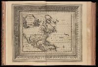
Creator:
Published / Created:
[1729?]
Call Number:
1973 +32
Image Count:
13
Resource Type:
Maps, Atlases & Globes
Found in:
Beinecke Rare Book and Manuscript Library > La galerie agreable du monde, ouíÛ l'on voit en un grand nombre de cartes tres-exactes et de belles tailles-douces, les principaux empires, roiíöaumes, republiques, provinces, villes, bourgs et forteresses ... dans les quatre parties de l'univers. Diviseí
Creator:
Published / Created:
1887
Call Number:
1978 Folio 3
Image Count:
31
Found in:
Beinecke Rare Book and Manuscript Library > Uchebnyií atlas po russkoií istoriíãi / sostavlen i izdan pod red. E. Zamyslovskago.
Creator:
Published / Created:
1926
Call Number:
766 M31 1926
Image Count:
36
Resource Type:
Maps, Atlases & Globes
Found in:
Beinecke Rare Book and Manuscript Library > Insurance maps of Manchester, including part of Highland Park and Manchester Green, Hartford Co., Connecticut.
Creator:
Published / Created:
1925
Call Number:
766 M59 1925
Image Count:
31
Resource Type:
Maps, Atlases & Globes
Found in:
Beinecke Rare Book and Manuscript Library > Insurance maps of Milford, New Haven County, Connecticut, including Woodmont, Merwin's Point, Bay View, Fort Trumbull Beach, Silver Sands, Seaside, Myrtle Beach, Meadows End, Walnut Beach, Wildmere Beach, Laurel Beach, Cedar Beach, Devon and Rivercliff.
Creator:
Published / Created:
July 1941
Call Number:
766 M54 1901
Image Count:
5
Resource Type:
Maps, Atlases & Globes
Found in:
Beinecke Rare Book and Manuscript Library > Insurance maps of Meriden, New Haven, Connecticut., Insurance maps of Meriden, New Haven, Connecticut: [New sheets and correction slips].
Creator:
Published / Created:
M.DCC.LV. [1755]
Call Number:
BrSides Zc10 755be
Image Count:
1
Found in:
Beinecke Rare Book and Manuscript Library > Carte de l'Amerique Septentrionale : depuis le 28 degré de latitude jusqu'au 72 / par M. Bellin, Ingenieur de la Marine et du Dêpost des Plans, Censeur Royal, de l'Academie de Marine, et de la Societé Royale de Londres.
Creator:
Published / Created:
1849
Call Number:
Zc72 849ro
Collection Title:
California and its gold regions; with a geographical and topographical view of the country, its
Image Count:
1
Found in:
Beinecke Rare Book and Manuscript Library > Map of the United States The British Provinces Mexico & c. Showing the Routes of the U.S. Mail Steam Packets to California, and a Plan of the Gold Region
Published / Created:
[1866?]
Call Number:
Zc72 866sa
Collection Title:
Prospectus of the San Saba Iron Mining Co., Sierra County, state of California, with report of
Image Count:
1
Found in:
Beinecke Rare Book and Manuscript Library > [Folded map of the area surrounding the San Saba Iron Mining co, Sierra County, California.]
Published / Created:
undated
Call Number:
WA MSS S-2962
Collection Title:
Northern Pacific Railway Company maps and drawings
Container / Volume:
Box 1 | Map 11
Image Count:
1
Resource Type:
Maps, Atlases & Globes
Found in:
Beinecke Rare Book and Manuscript Library > (IDAHO & WASHINGTON) [Anon.] [Untitled map of northwestern Idaho and northeastern Washington].
Creator:
Published / Created:
1890
Call Number:
WA MSS S-2962
Collection Title:
Northern Pacific Railway Company maps and drawings
Container / Volume:
Box 1 | Map 10
Image Count:
2
Resource Type:
Maps, Atlases & Globes
Found in:
Beinecke Rare Book and Manuscript Library > (IDAHO) Kendrick, J. W., Surveyor. Map Showing Definite Location of the Spokane & Palouse Ry. (Lewiston Extension). From Julietta to Lewiston Idaho Territory. Distance 24-1/lO Miles. Drawn by J. M. Gibboney. Assistant Engineer's Office, Tacoma, Washington. Scale 1 in.=2000 ft.
Creator:
Published / Created:
1891 April 6
Call Number:
WA MSS S-2962
Collection Title:
Northern Pacific Railway Company maps and drawings
Container / Volume:
Box 1 | Map 34
Image Count:
1
Resource Type:
Maps, Atlases & Globes
Found in:
Beinecke Rare Book and Manuscript Library > (MONTANA) Bischoff, A. Map of North- West part of Montana...Great Northern Line St. Paul, Minneapolis & Manitoba Ry. Pacific Extension. Elbridge H. Beckler, Chief Engineer. Helena, Mont. Scale 1 in.= 2 miles.
Published / Created:
1886
Call Number:
WA MSS S-2962
Collection Title:
Northern Pacific Railway Company maps and drawings
Container / Volume:
Box 1 | Map 31
Image Count:
1
Resource Type:
Maps, Atlases & Globes
Found in:
Beinecke Rare Book and Manuscript Library > (MONTANA) [Anon.] Map of a Portion of Montana Territory.
Creator:
Published / Created:
1887 August
Call Number:
WA MSS S-2962
Collection Title:
Northern Pacific Railway Company maps and drawings
Container / Volume:
Box 1 | Map 33
Image Count:
2
Resource Type:
Maps, Atlases & Globes
Found in:
Beinecke Rare Book and Manuscript Library > (MONTANA) Roberts, E. J. Montana Extension. The Saint Paul, Minneapolis and Manitoba Ry. Co. Scale 12 miles to 1 inch.
Published / Created:
1891 September 10
Call Number:
WA MSS S-2962
Collection Title:
Northern Pacific Railway Company maps and drawings
Container / Volume:
Box 1 | Map 40
Image Count:
1
Resource Type:
Maps, Atlases & Globes
Found in:
Beinecke Rare Book and Manuscript Library > (WASHINGTON) [Anon.] Sketch of Country North of Spokane Wash. Helena Mont.
Published / Created:
undated
Call Number:
WA MSS S-2962
Collection Title:
Northern Pacific Railway Company maps and drawings
Container / Volume:
Box 1 | Map 36
Image Count:
1
Resource Type:
Maps, Atlases & Globes
Found in:
Beinecke Rare Book and Manuscript Library > (MONTANA) [Anon.] [Untitled map of a part of north central Montana.]
Published / Created:
undated
Call Number:
WA MSS S-2962
Collection Title:
Northern Pacific Railway Company maps and drawings
Container / Volume:
3 (Roll) | Map 24
Image Count:
1
Resource Type:
Maps, Atlases & Globes
Found in:
Beinecke Rare Book and Manuscript Library > (MONTANA & IDAHO) [Anon.] [Untitled map of far northwestern Montana and a part of the Idaho panhandle.]
Creator:
Published / Created:
1869
Call Number:
WA MSS S-1964 C613
Image Count:
2
Found in:
Beinecke Rare Book and Manuscript Library > Exploration for wagon road from Fort Ellis, M.T., to mouth of Muscleshell River / by Capt. E.W. Clift, 13th Infty. ; Office of Engineers, H'd. Q'rs., Dep't of Dakota ; reduced from field notes of Geo. B. Foote, C.E., 1869 Nov 9
Call Number:
1977 +392
Collection Title:
A survey of the cities of London and Westminster : containing the original, antiquity, increase
Image Count:
1
Resource Type:
Maps, Atlases & Globes
Found in:
Beinecke Rare Book and Manuscript Library > Spittle Fields and places adjacent taken from the last survey with corrections
Call Number:
1993 +44
Collection Title:
Topographia provinciarum austriacaru, Austriæ, Striæ, Carinthiæ, Carniolæ, Tyrolis. etc.: das ist
Image Count:
1
Found in:
Beinecke Rare Book and Manuscript Library > [Topographia provinciarum Austriacarum]
Call Number:
1977 +392
Collection Title:
A survey of the cities of London and Westminster : containing the original, antiquity, increase
Image Count:
1
Found in:
Beinecke Rare Book and Manuscript Library > The city of London as in Q Elisabeth's time
Call Number:
CC68 21
Collection Title:
Views of ancient monuments in Central America : Chiapas and Yucatan / by F. Catherwood ...
Image Count:
1
Found in:
Beinecke Rare Book and Manuscript Library > Outline map of Central America and Yucatan showing the situation of the ruined cities & monuments
Published / Created:
ca. 1855
Call Number:
WA Prints +3
Container / Volume:
Report of explorations for railroad routes from San Francisco Bay to Los Angeles...and from the Pimas Villages to the Rio Grande...by Lieutenant John G. Parke 1854-1855. Volume VII from Reports of explorations and surveys, to ascertain the most practicab
Image Count:
1
Found in:
Beinecke Rare Book and Manuscript Library > Geological plan of the coast range of California from San Francisco bay to Los Angeles along the route explored by Lieut. John G. Parke, corps of topl. Engrs. To connect with the routes near the 35o & 32o parallels of north latitude. 1855-56. Prepared to
Published / Created:
ca. 1855
Call Number:
WA Prints +4
Container / Volume:
Report of explorations for railroad routes from San Francisco Bay to Los Angeles...and from the Pimas Villages to the Rio Grande...by Lieutenant John G. Parke 1854-1855. Volume VII from Reports of explorations and surveys, to ascertain the most practicab
Image Count:
1
Found in:
Beinecke Rare Book and Manuscript Library > Geological Plan & Section from Rio Grande to the Pimas Villages along the route explored by Lieut. John G. Parke, Corps of Topl. Engrs. near the 32o north latitude. 1856. Prepared to accompany the report of Thomas Antiselol M.D. geologist of the expediti
Creator:
Published / Created:
1873-1884
Call Number:
WA Prints +8
Container / Volume:
Report upon United States Geographical surveys west of the one hundredth meridian in charge of First Lieut. Geo. M. Wheeler ... Vol. 1. Geographical report (Washington, Govt. Print. Off., 1875).
Image Count:
1
Found in:
Beinecke Rare Book and Manuscript Library > U.S. geographical surveys west of the 100th meridian. Vol. II. Astronomy. Plate no. 2. Topographical sketch showing observatory site and surroundings at Odgen, Utah. Surveyed 1877. Prepared under the direction of 1st Lt. Geo. M. Wheeler, corps of engrs. U
Creator:
Published / Created:
1873-1884
Call Number:
WA Prints +9
Container / Volume:
Report upon United States Geographical surveys west of the one hundredth meridian in charge of First Lieut. Geo. M. Wheeler ... Vol. 1. Geographical report (Washington, Govt. Print. Off., 1875).
Image Count:
1
Found in:
Beinecke Rare Book and Manuscript Library > U.S. geographical surveys west of the 100th meridian. Vol. II. Astronomy. Plate no. 4. [six sketches of towns or sites in Nevada.] Expeditions of 1871, 1872, 1873, & 1874, under the command of 1st Lieut. Geo. M. Wheeler, corps of engineers, U.S. army
Creator:
Published / Created:
ca. 1855
Call Number:
WA Prints Folio 1
Container / Volume:
Report of explorations in California for railroad routes, to connect with the routes near the 35th and 32nd parallels of north latitude by Lieutenant R. S. Williamson1853. Volume V from Reports of explorations and surveys, to ascertain the most practicab
Image Count:
1
Found in:
Beinecke Rare Book and Manuscript Library > U.S.P.R.R. Exp. & Surveys Cal. Section 4_Sheet II. [Four] Geological Section[s] of the Coast Mountains and Sierra Nevada Explored by Lieut. R.S. Williamson, U.S. Top Engrs. in 1853 from San Francisco to the Great Basin Prepared in Office of P.R.R. Exp. &
Creator:
Published / Created:
ca. 1855
Call Number:
WA Prints Folio 2
Container / Volume:
Report of explorations in California for railroad routes, to connect with the routes near the 35th and 32nd parallels of north latitude by Lieutenant R. S. Williamson1853. Volume V from Reports of explorations and surveys, to ascertain the most practicab
Image Count:
1
Found in:
Beinecke Rare Book and Manuscript Library > [U.S.P.R.R. Exp. & Surveys. CAL.] Section 5, Sheet III. Geological Section of the Sierra Nevada at the Tejon Pass Explored by Lieut. R.S. Williamson Corps of Topl. Engrs. 1853 Prepared in the Office of Pacific Rail Road Explorations & Surveys War Departm
Creator:
Published / Created:
ca. 1855
Call Number:
WA Prints Folio 3
Container / Volume:
Report of explorations in California for railroad routes, to connect with the routes near the 35th and 32nd parallels of north latitude by Lieutenant R. S. Williamson1853. Volume V from Reports of explorations and surveys, to ascertain the most practicab
Image Count:
1
Found in:
Beinecke Rare Book and Manuscript Library > [U.S.P.R.R. Exp. & Surveys. Cal.] Section 5, Sheet III. Geological Section of the Sierra Nevada at the Tejon Pass Explored by Lieut. R.S. Williamson Corps of Top. Engrs. 1853 Prepared in the Office of Pacific Rail Road Explorations & Surveys War Departme
Creator:
Published / Created:
ca. 1855
Call Number:
WA Prints Folio 4
Container / Volume:
Report of explorations in California for railroad routes, to connect with the routes near the 35th and 32nd parallels of north latitude by Lieutenant R. S. Williamson1853. Volume V from Reports of explorations and surveys, to ascertain the most practicab
Image Count:
1
Found in:
Beinecke Rare Book and Manuscript Library > [U.S.P.R.R. Exp. & Surveys. Ca.] Section 6. Sheet IV. Geological Section Along the Tejon Ravine Explored by Lieut R.S. Williamson Corps of Topl. Engrs. 1853 from the Tulare Valley and the Tejon Depot Camp to Taheechaypah Prairie Prepared in the Office of
Creator:
Published / Created:
ca. 1855
Call Number:
WA Prints Folio 5
Container / Volume:
Report of explorations in California for railroad routes, to connect with the routes near the 35th and 32nd parallels of north latitude by Lieutenant R. S. Williamson1853. Volume V from Reports of explorations and surveys, to ascertain the most practicab
Image Count:
1
Found in:
Beinecke Rare Book and Manuscript Library > U.S.P.R.R. Exp. & Surveys. Cal. Sections 8. Sheet V. Geological Section of the Bernardino Sierra Explored by Lieut R.S. Williamson, U.S. Top. Engrs. in 1853 from the Great Basin to the Pacific Ocean at San Pedro. Prepared in the Office of Pacific Rail Ro
Creator:
Published / Created:
ca. 1855
Call Number:
WA Prints Folio 6
Container / Volume:
Report of explorations in California for railroad routes, to connect with the routes near the 35th and 32nd parallels of north latitude by Lieutenant R. S. Williamson1853. Volume V from Reports of explorations and surveys, to ascertain the most practicab
Image Count:
1
Found in:
Beinecke Rare Book and Manuscript Library > [U.S.P.R.R. Exp. & Surveys. Cal.] Section 9 Sheet VI Geological Section from the Colorado River to the Pacific Ocean Explored by Lieut. R.S. Williamson Corps of Topl. Engrs. 1853 Constructed from Observations in the Vicinity of the Route from the Mouth of
Published / Created:
1879
Call Number:
WA Prints Folio 12
Container / Volume:
Report upon United States Geographical surveys west of the one hundredth meridian in charge of First Lieut. Geo. M. Wheeler ... Vol. 1. Geographical report (Washington, Govt. Print. Off., 1875).
Image Count:
1
Found in:
Beinecke Rare Book and Manuscript Library > U.S. Geographical Surveys Volume 1. Geogrl. Report. West of the 100th Meridian. Seasons of 1869,-71,-72,-73,-74,-75,-76,-77,-78. 1st. Lieut. Geo. M. Wheller, Corps of Engineers, U.S. Army in Charge. Sketch Indicating a Distribution of the Territorial D
Creator:
Published / Created:
"Issued Feb. 4th 1878."
Call Number:
WA Prints +10
Container / Volume:
Report upon United States Geographical surveys west of the one hundredth meridian in charge of First Lieut. Geo. M. Wheeler ... Vol. 1. Geographical report (Washington, Govt. Print. Off., 1875).
Image Count:
1
Found in:
Beinecke Rare Book and Manuscript Library > U.S. geographical surveys west of the 100th meridian. Map showing routes of the river and land parties engaged in exploring the Grand Canyon of the Ccolorado. Under the command of 1st. Lieut. Geo. M. Wheller, corps of engineers, U.S. army. 1871. P.W. Hamm
Call Number:
Zc20 697heg
Collection Title:
A new discovery of a vast country in America : extending above four thousand miles, between New
Image Count:
1
Found in:
Beinecke Rare Book and Manuscript Library > A map of a large country newly discovered in the northern America situated between New Mexico and the frozen sea, together with the course of the Great River Meschasipi. Dedicated to His Ma.ty William III King of Great Britain. By Father Lewis Hennepin, m
Call Number:
Zc20 697heg
Collection Title:
A new discovery of a vast country in America : extending above four thousand miles, between New
Image Count:
1
Found in:
Beinecke Rare Book and Manuscript Library > A map of a new world between New Mexico and the frozen sea newly discovered by Father Lewis Hennepin, missionary recollect and native of Aht in Hainault. Dedicated to his majesty of Great Britain William III
Call Number:
Taylor 125
Collection Title:
De i commentarii del viaggio in Persia di m. Caterino Zeno il K. & delle guerre fatte nell’ imperio
Image Count:
1
Found in:
Beinecke Rare Book and Manuscript Library > Carta da navegar
Creator:
Published / Created:
1614-16
Call Number:
Zd 176
Collection Title:
Path-way to experience to erect a plantation
Image Count:
1
Found in:
Beinecke Rare Book and Manuscript Library > New England: the most remarqueable parts thus named by the high and mighty Prince Charles, Prince of Great Britaine
Call Number:
Taylor 176
Collection Title:
De orbe novo Petri Martyris Anglerii Mediolanensis, protonotarij, & Caroli quinti Senatoris decades
Image Count:
1
Found in:
Beinecke Rare Book and Manuscript Library > Novus Orbis
Published / Created:
1802
Call Number:
Zc20 805peb
Collection Title:
Voyage dans les deux Lousiianes, et chez les nations sauvages du Missouri, par les Etats-Unis, l
Image Count:
1
Found in:
Beinecke Rare Book and Manuscript Library > Carte du Missouri levee ou rectifiee dans toute son etendue. Par F.ois Perrin du Lac
Creator:
Call Number:
Cn 105
Collection Title:
Map: Carte de la Nouuelle France et de la Louisiane, nouuellement decouuerte, dediée au roy, l'an
Image Count:
1
Found in:
Beinecke Rare Book and Manuscript Library > Carte de la nouvelle France et de la Louisiane nouvellement decouverte dediee au Roy l'An 1683. Par le Reverend Pere Louis Hennepin missionaire recollect et notaire apostolique
Call Number:
Zc90 +744do
Collection Title:
An account of the countries adjoining to Hudson's Bay, in the North-west part of America
Image Count:
1
Found in:
Beinecke Rare Book and Manuscript Library > A new map of part of North America from the latitude of 40 to 68 degrees. Including the late discoveries made on board the Furnace Bomb Ketch in 1742. And the western rivers & lakes falling into Nelson River in Hudson's Bay, as described by Joseph La Fran
Published / Created:
1793
Call Number:
CF352 I54 1793
Collection Title:
The discovery, settlement, and present state of Kentucky: and an essay towards the topography and
Image Count:
1
Found in:
Beinecke Rare Book and Manuscript Library > A map of the state of Kentucky, drawn from the best authorities
Creator:
Call Number:
Z6 70
Collection Title:
An enquiry into the causes of the alienation of the Delaware and Shawanese Indians from the British
Image Count:
1
Found in:
Beinecke Rare Book and Manuscript Library > A map of the province of Pensylvania. intended chiefly to illustrate the account of the several Indian purchases made by the proprietaries of the said province the claims made by the Indians, on lands settled and not purchased of them and the tract they n
Call Number:
Egf 778Hb
Collection Title:
A topographical description of Virginia, Pennsylvania, Maryland and North Carolina : comprehending
Image Count:
1
Found in:
Beinecke Rare Book and Manuscript Library > A plan of the several villages in the Illinois country, with part of the river Mississippi &c. by Thos. Hutchins
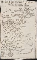
Call Number:
Taylor 322
Collection Title:
Nevv Englands prospect; a true, lively, and experimentall description of that part of America
Image Count:
1
Found in:
Beinecke Rare Book and Manuscript Library > The south part of New-England, as it is planted this yeare, 1634
Call Number:
Zc20 720so
Collection Title:
Some considerations on the consequences of the French settling colonies on the Mississippi, with
Image Count:
1
Found in:
Beinecke Rare Book and Manuscript Library > A new map of Louisiana and the River Mississipi
Call Number:
Pequot Ad12
Collection Title:
The history of the American Indians; particularly those nations adjoining to the Missisippi
Image Count:
1
Found in:
Beinecke Rare Book and Manuscript Library > A map of the American Indian nations, adjoining to the Missisippi, west & east Florida, Georgia, S. & N. Carolina, Virginia, & c
Call Number:
Taylor 58
Collection Title:
Praeclara Ferdinadi. Cortesii de noua maris Oceani Hyspania narratio ... Carolo Romanoru imperatori
Image Count:
1
Found in:
Beinecke Rare Book and Manuscript Library > [Untitled map of Tenochtitlan]
Call Number:
C55 025
Collection Title:
Voyages and travels of an Indian interpreter and trader, describing the manners and customs of the
Image Count:
1
Found in:
Beinecke Rare Book and Manuscript Library > Sketch of the western countries of Canada 1791
Call Number:
Egi M6 722
Collection Title:
A description of the English province of Carolana, by the Spaniards call'd Florida, and by the
Image Count:
1
Found in:
Beinecke Rare Book and Manuscript Library > A map of Carolana and of the River Meschacebe & c.
Creator:
Published / Created:
[ca. 1606]
Call Number:
Taylor 301
Collection Title:
The generall historie of Virginia, New-England, and the Summer Iles : with the names of the
Image Count:
1
Found in:
Beinecke Rare Book and Manuscript Library > Virginia
Published / Created:
1801
Call Number:
Zc90 801mab
Collection Title:
Voyages from Montreal, on the river St. Laurence, through the continent of North America, to the
Image Count:
1
Found in:
Beinecke Rare Book and Manuscript Library > A map of America, between latitudes 40 and 70 north and longitudes 45 and 180 west, exhibiting Mackenzie's track from Montreal to Fort Chipewyan & from thence to the North Sea In 1789 & to the West Pacific Ocean in 1793
Published / Created:
1783
Call Number:
Cb21 35B
Collection Title:
History of the war with America, France, Spain, and Holland; commencing in 1775 and ending in 1783
Image Count:
1
Found in:
Beinecke Rare Book and Manuscript Library > A Map of the United States of America, as settled by the peace of 1783
Call Number:
CE143 A28
Collection Title:
An account of the Spanish settlements in America. In four parts ... To which is annexed, a succinct
Image Count:
1
Found in:
Beinecke Rare Book and Manuscript Library > A New general map of America drawn from several accurate particular maps and charts and regulated by astronomical observations
Call Number:
Zd 147
Collection Title:
The history of the Five Indian nations of Canada : which are dependent on the province of New-York
Image Count:
1
Found in:
Beinecke Rare Book and Manuscript Library > A Map of the country of the Five Nations, belonging to the province of New York; and of the lakes near which the nations of far Indians live, with part of Canada
Creator:
Published / Created:
[1609]
Call Number:
Taylor 245
Collection Title:
Histoire de la Novvelle France
Image Count:
1
Found in:
Beinecke Rare Book and Manuscript Library > Figure de la terre neuue, grande riuiere de Canada, et cotes de l�ocean en la Nouuelle France
Creator:
Published / Created:
1609
Call Number:
Taylor 245
Collection Title:
Histoire de la Novvelle France
Image Count:
1
Found in:
Beinecke Rare Book and Manuscript Library > Figure du Port Royal en la Nouuelle France
Creator:
Published / Created:
1774
Call Number:
Cb23 27
Collection Title:
The American military pocket atlas : being an approved collection of correct maps, both general and
Image Count:
1
Found in:
Beinecke Rare Book and Manuscript Library > North America as divided amongst the European powers
Published / Created:
1776
Call Number:
Cb23 27
Collection Title:
The American military pocket atlas : being an approved collection of correct maps, both general and
Image Count:
1
Found in:
Beinecke Rare Book and Manuscript Library > A General map of the northern British colonies in America. which comprehends the province of Quebec, the government of Newfoundland, Nova-Scotia, New-England and New-York. From the maps published by the Admiralty and Board of Trade regulated by the astronomic and trigonometric observations of M. von Holland and corrected from Governor Pownall's late map 1776.
Published / Created:
1776
Call Number:
Cb23 27
Collection Title:
The American military pocket atlas : being an approved collection of correct maps, both general and
Image Count:
1
Found in:
Beinecke Rare Book and Manuscript Library > A general map of the middle British colonies in America. Containing Virginia, Maryland, the Delaware counties, Pennsylvania and New Jersey. With the addition of New York, and of the greatest part of New England, as also of the bordering parts of the province of Quebec, improved from several surveys made after the late war, and corrected from Governor Pownall's late map 1776.
Creator:
Published / Created:
1776
Call Number:
Cb23 27
Collection Title:
The American military pocket atlas : being an approved collection of correct maps, both general and
Image Count:
1
Found in:
Beinecke Rare Book and Manuscript Library > A General map of the southern British colonies, in America, comprehending North and South Carolina, Georgia, east and west Florida, with the neighbouring Indian countries. From the modern surveys of engineer de Brahm, Capt. Collet, Mouzon & others; and from the large hydrographical survey of the coasts of east and west Florida
Creator:
Published / Created:
1776
Call Number:
Cb23 27
Collection Title:
The American military pocket atlas : being an approved collection of correct maps, both general and
Image Count:
1
Found in:
Beinecke Rare Book and Manuscript Library > A Survey of Lake Champlain, including Lake George, Crown Point and St. John. Surveyed by order of His Excellency Major General Sr. Jeffery Amherst, knight of the most honble. Order of the Bath, Commander in Chief of His Majesty's forces in North America (now Lord Amherst) by William Brassier, draughtsman, 1762
Published / Created:
Undated
Call Number:
Taylor 355
Collection Title:
America painted to the life. The true history of the Spaniards proceedings in the conquests of the
Image Count:
1
Found in:
Beinecke Rare Book and Manuscript Library > Americae descrip
Published / Created:
Undated
Call Number:
Ck44 23
Collection Title:
Kort beskrifning om provincien Nya Swerige uti America : som nu foertjden af the Engelske kallas
Image Count:
1
Found in:
Beinecke Rare Book and Manuscript Library > Totius Americae descriptio
Call Number:
Ck44 23
Collection Title:
Kort beskrifning om provincien Nya Swerige uti America : som nu foertjden af the Engelske kallas
Image Count:
1
Found in:
Beinecke Rare Book and Manuscript Library > Nova Suecia hodie dicta Pensylvania
Call Number:
Ck44 23
Collection Title:
Kort beskrifning om provincien Nya Swerige uti America : som nu foertjden af the Engelske kallas
Image Count:
1
Found in:
Beinecke Rare Book and Manuscript Library > Virginiae N. Angliae N. Hollandiae nec non Nova Sueviae delineatio
Call Number:
Cm87 48th
Collection Title:
Histoire de Kentucke : nouvelle colonie a l'ouest de al Virginie: contenant, 1o, La decouverte
Image Count:
1
Found in:
Beinecke Rare Book and Manuscript Library > Carte de Kentucke, d'apres les observations actuelles: dediee a L'Honorable Congres des Etats-Unis de l'Amerique et a Son Excellence George Washington, Commandant en chef de ses armees par leur tres humble serviteur, John Filson
Call Number:
Taylor 376
Collection Title:
The discoveries of John Lederer : in three several marches from Virginia, to the west of Carolina
Image Count:
1
Found in:
Beinecke Rare Book and Manuscript Library > A Map of the whole territory traversed by John Lederer in his three marches
Creator:
Call Number:
CF352 I54 1793
Collection Title:
A topographical description of the Western territory of North America; containing a succinct
Image Count:
1
Found in:
Beinecke Rare Book and Manuscript Library > New map of the states of Georgia South and North Carolina Virginia and Maryland including the Spanish provinces of west and east Florida from the latest surveys
Call Number:
CF352 I54 1793
Collection Title:
A topographical description of the Western territory of North America; containing a succinct
Image Count:
1
Found in:
Beinecke Rare Book and Manuscript Library > A plan of the rapids of the Ohio
Creator:
Published / Created:
1822 March
Call Number:
Egk30 Ed9 820W
Collection Title:
Two years' residence in the settlement on the English prairie, in the Illinois country ... : with
Image Count:
1
Found in:
Beinecke Rare Book and Manuscript Library > Map of Illinois
Creator:
Published / Created:
1822 March
Call Number:
Egk30 Ed9 820W
Collection Title:
Two years' residence in the settlement on the English prairie, in the Illinois country ... : with
Image Count:
1
Found in:
Beinecke Rare Book and Manuscript Library > Map of the allotments
Creator:
Call Number:
Zc90 859ka
Collection Title:
Wanderings of an artist among the Indians of North America : from Canada to Vancouver's Island and
Image Count:
1
Found in:
Beinecke Rare Book and Manuscript Library > Map to illustrate Mr. Kane's travels in the territory of the Hudson's Bay Company
Creator:
Call Number:
Zc70 +802ea
Collection Title:
Relacion del viage hecho por las goletas Sutil y Mexicana en el ano de 1792, para reconocer el
Image Count:
1
Found in:
Beinecke Rare Book and Manuscript Library > Carta esferica de los reconocimientos hechos en la costa N.O. de America en 1791 y 92 por las goletas Sutil y Mexicana y otros buques de S.M. Map No. 1
Creator:
Call Number:
Zc70 +802ea
Collection Title:
Relacion del viage hecho por las goletas Sutil y Mexicana en el ano de 1792, para reconocer el
Image Count:
1
Found in:
Beinecke Rare Book and Manuscript Library > Carta esferica de los reconocimientos hechos en la costa N.O. de America en 1791 y 92 por las goletas Sutil y Mexicana y otros buques de S.M. Map no. 2
Creator:
Call Number:
Zc70 +802ea
Collection Title:
Relacion del viage hecho por las goletas Sutil y Mexicana en el ano de 1792, para reconocer el
Image Count:
1
Found in:
Beinecke Rare Book and Manuscript Library > Contiuacion de los reconocimientos hechos en la costa NO. de America por los buques de S.M. en varias campanas desde 1774 a 1792. Map no. 3
Creator:
Call Number:
Zc70 +802ea
Collection Title:
Relacion del viage hecho por las goletas Sutil y Mexicana en el ano de 1792, para reconocer el
Image Count:
1
Found in:
Beinecke Rare Book and Manuscript Library > Plano del puerto de S. Diego en la costa setentl. de Californs. Levantado por el 2o. piloto de la armada D. Juan Pantoja ano 1782. Map no. 5
Creator:
Call Number:
Zc70 +802ea
Collection Title:
Relacion del viage hecho por las goletas Sutil y Mexicana en el ano de 1792, para reconocer el
Image Count:
1
Found in:
Beinecke Rare Book and Manuscript Library > Plano del puerto y bahia de Monte Rey situado en la costa de Californs. Trabajado a bordo de las corvetas descubierta y atrevida. Ano 1791. Map no. 6
Creator:
Published / Created:
1624
Call Number:
2003 +39
Collection Title:
The generall historie of Virginia, New-England, and the Summer Iles ...
Image Count:
1
Found in:
Beinecke Rare Book and Manuscript Library > New England
Creator:
Call Number:
Zm Sp79
Collection Title:
Allgemeines historisches Taschenbuch, oder, Abriss der merkwurdigsten neuen Welt-Begebenheiten
Image Count:
1
Found in:
Beinecke Rare Book and Manuscript Library > Die Vereinigten Staaten von Nord America. nach der von Wm Faden 1783
Creator:
Call Number:
1998 2141
Collection Title:
Der ausfuehrlichen nachrichten von der koeniglich-gross-britannischen colonie saltzburgischer
Image Count:
1
Found in:
Beinecke Rare Book and Manuscript Library > A Map of the county of Savannah
Creator:
Call Number:
Taylor 388
Collection Title:
The English empire in America: or A prospect of His Majesties dominions in the West-Indies ... By R
Image Count:
1
Found in:
Beinecke Rare Book and Manuscript Library > The English empire in America
Creator:
Published / Created:
1794 July 26
Call Number:
1986 102
Collection Title:
An historical, geographical, commercial, and philosophical view of the American United States, and
Image Count:
1
Found in:
Beinecke Rare Book and Manuscript Library > A General map of North America drawn from the best sources
Creator:
Published / Created:
1794 October 18
Call Number:
1986 102
Collection Title:
An historical, geographical, commercial, and philosophical view of the American United States, and
Image Count:
1
Found in:
Beinecke Rare Book and Manuscript Library > An Accurate map of the United States of America. according to the Treaty of Peace of 1783
Creator:
Published / Created:
1795 February 7
Call Number:
1986 102
Collection Title:
An historical, geographical, commercial, and philosophical view of the American United States, and
Image Count:
1
Found in:
Beinecke Rare Book and Manuscript Library > Map of the northern, or, New England states of America. Comprehending Vermont, New Hampshire, District of Main, Massachusetts, Rhode-Island, and Connecticut
Creator:
Published / Created:
1788
Call Number:
Egf 789
Collection Title:
The American geography; or, A view of the present situation of the United States of America
Image Count:
1
Found in:
Beinecke Rare Book and Manuscript Library > A Map of the states of Virginia, North Carolina South Carolina and Georgia comprehending the Spanish provinces of east and west Florida exhibiting the boundaries as fixed by the late Treaty of Peace between the United States and the Spanish dominions comp
Call Number:
Egf 789
Collection Title:
The American geography; or, A view of the present situation of the United States of America
Image Count:
1
Found in:
Beinecke Rare Book and Manuscript Library > A Map of the northern and middle states; comprehending the western Territory and the British dominions in North America. Compiled from the best authorities
Call Number:
Ck3 35p
Collection Title:
Missive van William Penn ... : Geschreven aan de commissarissen van de Vrye Societeyt der
Image Count:
1
Found in:
Beinecke Rare Book and Manuscript Library > Afteykeninge van de Stadt Philadelphia in de Provinstie van Penn-sylvania in Americae na de Copie tot London. en intneder duyts laeten Snyden door Jacob Claus
Call Number:
Z6 4e
Collection Title:
Summario de la generale historia de l’Indie Occidentali. Part 1
Image Count:
1
Found in:
Beinecke Rare Book and Manuscript Library > Isola Spagnvola
Published / Created:
1565
Call Number:
Taylor 115 3
Collection Title:
Terzo volume delle nauigationi et viaggi ...
Image Count:
1
Found in:
Beinecke Rare Book and Manuscript Library > Il Cuscho Citta Principale della Provincia del Peru, Map no. 411-412
Creator:
Call Number:
Vanderbilt 147
Collection Title:
An historical account of the expedition against the Ohio Indians, in the year 1764. Under the
Image Count:
1
Found in:
Beinecke Rare Book and Manuscript Library > A General map of the country on the Ohio and Mushkingham shewing the situation of the Indian-towns with respect to the army under the command of Colonel Bouquet by Thos. Hutchins. Asst. Engineer
Call Number:
Taylor 257
Collection Title:
Les voyages dv sievr de Champlain Xaintongeois, capitaine ordinaire pour le Roy, en la marine
Image Count:
1
Found in:
Beinecke Rare Book and Manuscript Library > Port Royal
Call Number:
Taylor 257
Collection Title:
Les voyages dv sievr de Champlain Xaintongeois, capitaine ordinaire pour le Roy, en la marine
Image Count:
1
Found in:
Beinecke Rare Book and Manuscript Library > Carte geographique de la nouelle Franse en son vray mondia
Call Number:
Taylor 257
Collection Title:
Les voyages dv sievr de Champlain Xaintongeois, capitaine ordinaire pour le Roy, en la marine
Image Count:
1
Found in:
Beinecke Rare Book and Manuscript Library > Quebec
Call Number:
Taylor 257
Collection Title:
Les voyages dv sievr de Champlain Xaintongeois, capitaine ordinaire pour le Roy, en la marine
Image Count:
1
Found in:
Beinecke Rare Book and Manuscript Library > Champlain Saint Tongois Cappitaine Ordinaire povr le Roy en la Marine
Call Number:
Taylor 257
Collection Title:
Les voyages dv sievr de Champlain Xaintongeois, capitaine ordinaire pour le Roy, en la marine
Image Count:
1
Found in:
Beinecke Rare Book and Manuscript Library > Carte Geographiqve de la Novvelle Franse Faictte Par Le Sievr de [Champlain]
Creator:
Published / Created:
1761
Call Number:
1998 966
Collection Title:
Traité du Deluge / par l'Auteur de La methode du thermometre universel
Image Count:
1
Found in:
Beinecke Rare Book and Manuscript Library > Plan ideal de l'etat de Montagnes et des plaines de l'armenic aavant let deluge ...
Published / Created:
1705
Call Number:
1977 +394
Collection Title:
Navigantium atque itinerantium bibliotheca: or, A compleat collection of voyages and travels
Container / Volume:
Volume 2
Image Count:
1
Found in:
Beinecke Rare Book and Manuscript Library > [Map of] Asia
Published / Created:
An VIII [1800]
Call Number:
1978 +173
Collection Title:
Recueil de cartes géographiques, pour la description de l'Indostan; par le Major J. Rennell
Image Count:
1
Found in:
Beinecke Rare Book and Manuscript Library > [Map of] Thibet
Branch:v1.60.98 ,Deployed:2024-04-24T10:14:36-04:00