Skip to search
Skip to main content
Skip to first result
Search
You Searched For
Resource Type
Maps, Atlases & Globes
New Search
Search Results
Published / Created:
[1780?]
Call Number:
786 1780A
Container / Volume:
BRBL_00515
Image Count:
1
Resource Type:
Maps, Atlases & Globes
Found in:
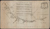
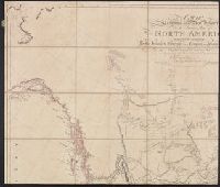
Beinecke Rare Book and Manuscript Library > A draught of South Carolina and Georgia from Sewee to St. Estaca / by Andrew Hughes
Creator:
Published / Created:
[1780?]
Call Number:
786 1780A
Image Count:
1
Resource Type:
Maps, Atlases & Globes
Found in:
Beinecke Rare Book and Manuscript Library > A draught of South Carolina and Georgia from Sewee to St. Estaca / by Andrew Hughes.
Published / Created:
ca. 1705]
Call Number:
732cea C413 1705
Container / Volume:
BRBL_00709
Image Count:
1
Resource Type:
Maps, Atlases & Globes
Found in:
Beinecke Rare Book and Manuscript Library > A draught of Southacks Bay in America [cartographic material].
Creator:
Call Number:
1973 Folio 114
Collection Title:
The English pilot: describing the West-India navigation, from Hudson's-Bay to the river Amazones
Image Count:
1
Resource Type:
Maps, Atlases & Globes
Found in:
Beinecke Rare Book and Manuscript Library > A draught of Virginia from the capes to York in York River and to Kuiquotan or Hamton in James River
Call Number:
1973 Folio 114
Collection Title:
The English pilot: describing the West-India navigation, from Hudson's-Bay to the river Amazones
Image Count:
1
Resource Type:
Maps, Atlases & Globes
Found in:
Beinecke Rare Book and Manuscript Library > A draught of the coast of Guiana from the river Oronoque to the river Amazones
Published / Created:
Decemr. 1766.
Call Number:
732cea 1766
Container / Volume:
BRBL_00377
Image Count:
1
Resource Type:
Maps, Atlases & Globes
Found in:
Beinecke Rare Book and Manuscript Library > A draught of the harbour of Hallifax, and the adjacent coast in Nova Scotia / survey'd by order of Commodore Spry by James Cook, when master of His Majesty's ship the Mars ; Emanl. Bowen, sculpt.
Published / Created:
1673?]
Call Number:
3218 1673A
Container / Volume:
BRBL_00057
Image Count:
1
Resource Type:
Maps, Atlases & Globes
Found in:
Beinecke Rare Book and Manuscript Library > A general Map of the County of Oxford ... by Ric. Blome ...
Creator:
Published / Created:
1773
Call Number:
1979 Folio 59
Image Count:
2
Resource Type:
Maps, Atlases & Globes
Found in:
Beinecke Rare Book and Manuscript Library > A general atlas, describing the whole universe. Being a compleat and new collection of the most approved maps extant; corrected with the utmost care, and augmented from the latest discoveries: the whole being an improvement of the maps of d'Anville and Robert ... By Thomas Kitchen, senior, and others ...
Creator:
Published / Created:
1785
Call Number:
1977 Folio 177
Image Count:
2
Resource Type:
Maps, Atlases & Globes
Found in:
Beinecke Rare Book and Manuscript Library > A general chart exhibiting the discoveries made by Captn. James Cook in this and his two preceeding voyages with the tracks of the ships under his command / by Lieutt. Roberts of His Majesty's Royal Navy ; Jn. Lodge sc.
Creator:
Published / Created:
September 22d, 1796.
Call Number:
85 1796A
Container / Volume:
BRBL_00693
Image Count:
1
Resource Type:
Maps, Atlases & Globes
Found in:
Beinecke Rare Book and Manuscript Library > A general chart of the West India Islands with the adjacent coasts of the Spanish continent [cartographic material] / by L.S. de la Rochette.
Creator:
Published / Created:
10th, May 1775.
Call Number:
72 1775
Container / Volume:
BRBL_00688
Image Count:
1
Resource Type:
Maps, Atlases & Globes
Found in:
Beinecke Rare Book and Manuscript Library > A general chart of the island of Newfoundland with the rocks & soundings / [cartographic material] / drawn from surveys taken by order of the Right Honourable the Lords Commissioners of the Admiralty by James Cook and Michael Lane, surveyors, and others.
Call Number:
1973 Folio 114
Collection Title:
The English pilot: describing the West-India navigation, from Hudson's-Bay to the river Amazones
Image Count:
1
Resource Type:
Maps, Atlases & Globes
Found in:
Beinecke Rare Book and Manuscript Library > A general chart of the western ocean
Creator:
Published / Created:
[1732]
Call Number:
E1015 M66 1732
Collection Title:
Atlas minor: or a set of sixty-two new and correct maps, of all parts of the world. All composed
Image Count:
1
Resource Type:
Maps, Atlases & Globes
Found in:
Beinecke Rare Book and Manuscript Library > A general map of Great Britain and Ireland with part of Germany, Holland, Flanders, France &c. agreeable to modern history
Creator:
Published / Created:
[188-]
Call Number:
327 1875
Container / Volume:
BRBL_00073
Image Count:
4
Resource Type:
Maps, Atlases & Globes
Found in:
Beinecke Rare Book and Manuscript Library > A general map of Ireland : showing the county and barony boundaries, the rivers, railways, canals, leading roads and principal demesnes ... (New Edition).
Creator:
Published / Created:
[1796?]
Call Number:
71 1795
Container / Volume:
BRBL_00367
Image Count:
1
Resource Type:
Maps, Atlases & Globes
Found in:
Beinecke Rare Book and Manuscript Library > A general map of North America : drawn from the best surveys, 1795 / Scoles sc.
Creator:
Published / Created:
[1778?]
Call Number:
BrSides 2017 62
Image Count:
1
Resource Type:
Maps, Atlases & Globes
Found in:
Beinecke Rare Book and Manuscript Library > A general map of North America ; from the latest observations / engrav'd by Jno. Lodge from the late Mr. Jefferys, geographer to the King.
Creator:
Call Number:
755 1776G
Container / Volume:
BRBL_00430
Image Count:
1
Resource Type:
Maps, Atlases & Globes
Found in:
Beinecke Rare Book and Manuscript Library > A general map of the Northern British Colonies in America, which comprehends the Province of Quebec, the government of Newfoundland, Nova-Scotia, New-England and New York : from the surveys of Capt. Cook & Capt. Carver, regulated by the astronomic & trigo
Creator:
Published / Created:
[between 1743-1747?]
Call Number:
BrSides Folio 2017 16
Image Count:
1
Resource Type:
Maps, Atlases & Globes
Found in:
Beinecke Rare Book and Manuscript Library > A general map of the River Sanaga, from the falls of Govina to the Ocean / taken by a French Engineer in 1718, & drawn by Sr. d'Anville, from his particular draughts ; G. Child, sculpt.
Creator:
Published / Created:
1755
Call Number:
391 +1755h
Collection Title:
Geographical, historical, political, philosophical and mechanical essays : the first, containing an
Image Count:
1
Resource Type:
Maps, Atlases & Globes
Found in:
Beinecke Rare Book and Manuscript Library > A general map of the middle British colonies in America
Creator:
Published / Created:
1771
Call Number:
755 1771C
Container / Volume:
BRBL_00429
Image Count:
1
Resource Type:
Maps, Atlases & Globes
Found in:
Beinecke Rare Book and Manuscript Library > A general map of the middle British colonies in America : viz. Virginia, Maryland, Delaware, Pensilvania, New-Jersey, New York, Connecticut & Rhode-Island : of Aquanishuonigy the country of the confederate Indians comprehending Aquanishuonigy proper, thei
Creator:
Published / Created:
1758
Call Number:
755 1758
Container / Volume:
BRBL_00428
Image Count:
1
Resource Type:
Maps, Atlases & Globes
Found in:
Beinecke Rare Book and Manuscript Library > A general map of the middle British colonies in America : viz. Virginia, Maryland, Delaware, Pensilvania, New-Jersey, New-York, Connecticut and Rhode-Island : of Aquanishuonigy the country of the confederate Indians comprehending Aquanishuonigy proper, th
Creator:
Published / Created:
1775 June 15
Call Number:
755 1775D
Container / Volume:
BRBL_00429
Image Count:
1
Resource Type:
Maps, Atlases & Globes
Found in:
Beinecke Rare Book and Manuscript Library > A general map of the middle British colonies in America : viz. Virginia, Maryland, Delaware, Pensilvania, New-Jersey, New-York, Connecticut, and Rhode-Island : of Aquanishuonîgy the country of the Confederate Indians comprehending Aquanishuonigy proper,
Creator:
Published / Created:
1771
Call Number:
755 1771B
Container / Volume:
BRBL_00429
Image Count:
1
Resource Type:
Maps, Atlases & Globes
Found in:
Beinecke Rare Book and Manuscript Library > A general map of the middle British colonies in America, viz. Virginia, Maryland, Delaware, Pensilvania, New-Jersey, New York, Connecticut & Rhode Island: Of Aquanishuonigy the country of the confederate Indians comprehending Aquanishuonigy proper, their
Creator:
Published / Created:
1776
Call Number:
755 1776
Container / Volume:
BRBL_00430
Image Count:
1
Resource Type:
Maps, Atlases & Globes
Found in:
Beinecke Rare Book and Manuscript Library > A general map of the middle British colonies, in America [cartographic material] : Containing Virginia, Maryland, the Delaware counties, Pennsylvania and New Jersey. With the addition of New York, and the greatest part of New England, as also of the borde
Creator:
Published / Created:
1755
Call Number:
755 1755
Container / Volume:
BRBL_00427
Image Count:
1
Resource Type:
Maps, Atlases & Globes
Found in:
Beinecke Rare Book and Manuscript Library > A general map of the middle British colonies, in America; viz. Virginia, Mariland, Delaware, Pensilvania, New-Jersey, New-York, Connecticut, and Rhode Island: Of Aquanishuonîgy, the country of the Confederate Indians; comprehending Aquanishuonîgy proper
Creator:
Call Number:
755 1776K
Container / Volume:
BRBL_00430
Image Count:
1
Resource Type:
Maps, Atlases & Globes
Found in:
Beinecke Rare Book and Manuscript Library > A general map of the northern British colonies in America : which comprehends the province of Quebec, the government of Newfoundland, Nova-Scotia, New-England and New-York, from the maps published by the Admiralty and Board of Trade, regulated by the astr
Creator:
Published / Created:
[1968?]
Call Number:
739 1857
Container / Volume:
BRBL_00388
Image Count:
1
Resource Type:
Maps, Atlases & Globes
Found in:
Beinecke Rare Book and Manuscript Library > A general map of the routes in British North America : explored by the expedition under Captain Palliser, during the years 1857, 1858, 1859, 1860 / compiled from the observations and reports of Captain Palliser and his officers, including the map construc
Published / Created:
1816]
Call Number:
795hc 1815
Container / Volume:
BRBL_00523
Image Count:
1
Resource Type:
Maps, Atlases & Globes
Found in:
Beinecke Rare Book and Manuscript Library > A general map of the seat of war in Louisiana & West Florida : shewing all the fortified points and encampments of both the American and British armies, also the march of Genl. Jackson's army on his expedition against Pensacola.
Published / Created:
1794
Call Number:
11 1794
Container / Volume:
BRBL_00724
Image Count:
2
Resource Type:
Maps, Atlases & Globes
Found in:
Beinecke Rare Book and Manuscript Library > A general map of the world, or terraqueous globe ... / by Saml. Dunn, mathematician.
Creator:
Published / Created:
1918?]
Call Number:
11hc 1917R
Container / Volume:
BRBL_00010E
Image Count:
1
Resource Type:
Maps, Atlases & Globes
Found in:
Beinecke Rare Book and Manuscript Library > A geographical and historical guide to the world's wars, 4000 B.C. to 1918 [cartographic material] : No. 1, north-western Europe, showing the "Western Front" / engraved and printed at the Matthews-Northrup Works, Buffalo, N.Y.
Creator:
Published / Created:
1918?]
Call Number:
11hc 1918J-2
Container / Volume:
BRBL_00010F
Image Count:
1
Resource Type:
Maps, Atlases & Globes
Found in:
Beinecke Rare Book and Manuscript Library > A geographical and historical guide to the world's wars, 4000 B.C. to 1918 [cartographic material] : No. 1, north-western Europe, showing the "Western Front" / engraved and printed at the Matthews-Northrup Works, Buffalo, N.Y.
Creator:
Published / Created:
1918?]
Call Number:
11hc 1918J
Container / Volume:
BRBL_00010F
Image Count:
1
Resource Type:
Maps, Atlases & Globes
Found in:
Beinecke Rare Book and Manuscript Library > A geographical and historical guide to the world's wars, 4000 B.C. to 1918 [cartographic material] : No. 3, Showing the Italian, Balkan and Turkish Fronts / engraved and printed at the Matthews-Northrup Works, Buffalo, N.Y.
Published / Created:
1877?]
Call Number:
80gme 1877B
Container / Volume:
BRBL_00539
Image Count:
2
Resource Type:
Maps, Atlases & Globes
Found in:
Beinecke Rare Book and Manuscript Library > A geographically correct map of the Kansas Pacific Railway : showing the only direct route to Denver and all the popular Rocky Mountain resorts, also to the Black Hills country and the famous San Juan mines in Colorado / Woodward, Tiernan & Hale, map engr
Published / Created:
1860?]
Call Number:
796gme 1860
Container / Volume:
BRBL_00531
Image Count:
1
Resource Type:
Maps, Atlases & Globes
Found in:
Beinecke Rare Book and Manuscript Library > A geographically correct map of the Red River, Sabine & Western Railway (under construction) and connections : showing distribution of pine forests (compiled from maps of U.S. government), also location of coal, iron, and oil deposits.
Published / Created:
[1890?]
Call Number:
796gme 1890
Container / Volume:
BRBL_00531
Image Count:
1
Resource Type:
Maps, Atlases & Globes
Found in:
Beinecke Rare Book and Manuscript Library > A geographically correct map of the state of Texas.
Creator:
Published / Created:
1889
Call Number:
774ca Sch89 1889
Container / Volume:
BRBL_00501
Image Count:
1
Resource Type:
Maps, Atlases & Globes
Found in:
Beinecke Rare Book and Manuscript Library > A geological and topographical map of the New Boston and Morea coal lands, in Schuylkill County, Penn'a.; by Benj. Smith Lyman ... aided by Amos P. Brown and J. S. Elverson.
Published / Created:
[1840.]
Call Number:
765CA 1840
Container / Volume:
BRBL_00464
Image Count:
1
Resource Type:
Maps, Atlases & Globes
Found in:
Beinecke Rare Book and Manuscript Library > A geological map of Rhode-Island. By Charles T. Jackson. 1840.
Creator:
Published / Created:
[1845?]
Call Number:
BrSides 2019 8
Image Count:
1
Resource Type:
Maps, Atlases & Globes
Found in:
Beinecke Rare Book and Manuscript Library > A geological map of the N-W. portion of Georgia / from a survey made in 1844-5 by F. Schreiber of Hesse Casse, G.
Published / Created:
March 15, 1832
Call Number:
75 1850
Container / Volume:
BRBL_00689
Image Count:
2
Resource Type:
Maps, Atlases & Globes
Found in:
Beinecke Rare Book and Manuscript Library > A geological map of the United States [cartographic material].
Published / Created:
1846
Call Number:
32 L84 1846
Container / Volume:
BRBL_00050
Image Count:
1
Resource Type:
Maps, Atlases & Globes
Found in:
Beinecke Rare Book and Manuscript Library > A guide through London and the surrounding boroughs. Engraved S.I. Russell.
Published / Created:
[1926?]
Call Number:
774 P53 1926
Container / Volume:
BRBL_00730
Image Count:
1
Resource Type:
Maps, Atlases & Globes
Found in:
Beinecke Rare Book and Manuscript Library > A kite view of Philadelphia and the Sesquicentennial international exposition ... / designed, drawn and colored by Edwin Olsen and Blake Clark.
Creator:
Published / Created:
[1878]
Call Number:
BrSides Folio 2019 91
Image Count:
1
Resource Type:
Maps, Atlases & Globes
Found in:
Beinecke Rare Book and Manuscript Library > A language map of further India and the Indian archipelago [cartographic material].
Call Number:
1973 Folio 114
Collection Title:
The English pilot: describing the West-India navigation, from Hudson's-Bay to the river Amazones
Image Count:
1
Resource Type:
Maps, Atlases & Globes
Found in:
Beinecke Rare Book and Manuscript Library > A large draft of South Carolina from Cape Roman to Port Royall
Call Number:
1973 Folio 114
Collection Title:
The English pilot: describing the West-India navigation, from Hudson's-Bay to the river Amazones
Image Count:
1
Resource Type:
Maps, Atlases & Globes
Found in:
Beinecke Rare Book and Manuscript Library > A large draft of the island Antegua
Published / Created:
[1715?]
Call Number:
53 1700
Container / Volume:
BRBL_00707
Image Count:
1
Resource Type:
Maps, Atlases & Globes
Found in:
Beinecke Rare Book and Manuscript Library > A large draught of the Red Sea from Mount Felix to Judda.
Published / Created:
[1795?]
Call Number:
761cea 1795
Container / Volume:
BRBL_00449
Image Count:
1
Resource Type:
Maps, Atlases & Globes
Found in:
Beinecke Rare Book and Manuscript Library > A map & Chart of ... Passamaquoddy & Machias ... Island of Grand Manan ... by B.R. Jones, Surveyor.
Published / Created:
1768
Call Number:
755FD 1768
Container / Volume:
BRBL_00442
Image Count:
1
Resource Type:
Maps, Atlases & Globes
Found in:
Beinecke Rare Book and Manuscript Library > A map ... of the English rights relative to the Ancient limits of Acadia ...
Creator:
Published / Created:
[1791]
Call Number:
BrSides Folio 2009 68
Image Count:
2
Resource Type:
Maps, Atlases & Globes
Found in:
Beinecke Rare Book and Manuscript Library > A map exhibiting a general view of the roads and inland navigation of Pennsylvania, and part of the adjacent states : respectfully inscribed to Thomas Mifflin, governor, and the General Assembly of the commonwealth of Pennsylvania / by John Adlum, and John Wallis
Creator:
Published / Created:
[1818]
Call Number:
71 1818A
Container / Volume:
BRBL_00368
Image Count:
4
Resource Type:
Maps, Atlases & Globes
Found in:
Beinecke Rare Book and Manuscript Library > A map exhibiting all the new discoveries in the interior parts of North America : inscribed by permission to the honourable governor and company of adventurers of England trading into Hudsons Bay in testimony of their liberal communications to their most
Creator:
Call Number:
71 1811
Image Count:
4
Resource Type:
Maps, Atlases & Globes
Found in:
Beinecke Rare Book and Manuscript Library > A map exhibiting all the new discoveries in the interior parts of North America [cartographic material] / inscribed by permission to the honorable governor and company of the adventurers of England trading into Hudsons Bay, in testimony of their liberal communications to their most obedient and very humble servant A. Arrowsmith, hydrographer to H.R.H. the Prince of Wales, January 1st 1795 ; Puke, sc.
Published / Created:
1775]
Call Number:
76 1740
Container / Volume:
BRBL_00690
Image Count:
1
Resource Type:
Maps, Atlases & Globes
Found in:
Beinecke Rare Book and Manuscript Library > A map of 100 miles round Boston [cartographic material].
Published / Created:
1771
Call Number:
32 B32 1771
Container / Volume:
BRBL_00046
Image Count:
1
Resource Type:
Maps, Atlases & Globes
Found in:
Beinecke Rare Book and Manuscript Library > A map of 5 miles round the city of Bath ...
Published / Created:
1852
Call Number:
766 N46 1852B
Container / Volume:
BRBL_00470
Image Count:
1
Resource Type:
Maps, Atlases & Globes
Found in:
Beinecke Rare Book and Manuscript Library > A map of 60 building lots in the city of New Haven belonging to C.T. Shelton, Esq.
Creator:
Published / Created:
1801
Call Number:
73 1801
Container / Volume:
BRBL_00374
Image Count:
1
Resource Type:
Maps, Atlases & Globes
Found in:
Beinecke Rare Book and Manuscript Library > A map of America between latitudes 40 and 70 north and longitudes 45 and 180 west exhibiting Mackenzie's track from Montreal to Fort Chipewyan & from thence to the north sea in 1789 & to the west Pacific Ocean in 1793.
Published / Created:
178-?]
Call Number:
71 1780C
Container / Volume:
BRBL_00366
Image Count:
1
Resource Type:
Maps, Atlases & Globes
Found in:
Beinecke Rare Book and Manuscript Library > A map of America between latitudes 40 and 70 north, and longitudes 45 and 180 west : exhibiting the principal trading stations of the North West Company.
Published / Created:
1797
Call Number:
70 1797
Container / Volume:
BRBL_00725
Image Count:
1
Resource Type:
Maps, Atlases & Globes
Found in:
Beinecke Rare Book and Manuscript Library > A map of America, or the new world, wherein are introduced all the known parts of the western hemisphere, from the map of d'Anville ...
Creator:
Published / Created:
1903
Call Number:
2732 1903
Container / Volume:
BRBL_00023B
Image Count:
1
Resource Type:
Maps, Atlases & Globes
Found in:
Beinecke Rare Book and Manuscript Library > A map of British North Borneo / compiled from the English Admiralty charts and from the surveys and explorations of F.X. Witti, W.B. Pryer, F. Hatton, Henry Walker, D.D. Daly, and R.D. Beeston in the service of the British North Borneo Company.
Call Number:
774 B856 1820
Container / Volume:
BRBL_00499
Image Count:
1
Resource Type:
Maps, Atlases & Globes
Found in:
Beinecke Rare Book and Manuscript Library > A map of Buck Mountain coal company mines exhibiting their relative position to the Lehigh slack water navigation and the different coal mines now opened in the region. Drawn by A.L. Foster of J. Collins 1820 (?) Lith.
Creator:
Published / Created:
1954
Call Number:
844 1954
Container / Volume:
BRBL_00603
Image Count:
1
Resource Type:
Maps, Atlases & Globes
Found in:
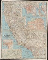
Beinecke Rare Book and Manuscript Library > A map of California : with descriptive notes / compiled and drawn in the Cartographic Section of the National Geographic Society ; James M. Darley, chief cartographer.
Creator:
Published / Created:
1954
Call Number:
844 1954
Container / Volume:
BRBL_00603
Image Count:
1
Resource Type:
Maps, Atlases & Globes
Found in:
Beinecke Rare Book and Manuscript Library > A map of California : with descriptive notes / compiled and drawn in the Cartographic Section of the National Geographic Society ; James M. Darley, chief cartographer.
Creator:
Published / Created:
[184-?]
Call Number:
73 1849
Container / Volume:
BRBL_00374
Image Count:
1
Resource Type:
Maps, Atlases & Globes
Found in:
Beinecke Rare Book and Manuscript Library > A map of Canada / compiled from the latest authorities by Edward Stavely ; engd. by W. & A.K. Johnston ....
Published / Created:
1822
Call Number:
774 C426 1822
Container / Volume:
BRBL_00499
Image Count:
1
Resource Type:
Maps, Atlases & Globes
Found in:
Beinecke Rare Book and Manuscript Library > A map of Chester County Constructed by virtue of an Act of the Legislature of Pennsylvania, Passed march 19, 1816 by James Hindman,
Creator:
Published / Created:
Jany. 1st, 1795.
Call Number:
1977 Folio 177
Image Count:
2
Resource Type:
Maps, Atlases & Globes
Found in:
Beinecke Rare Book and Manuscript Library > A map of China : with the surrounding states, correctly copied from Monsr. d'Anville : engraved for Monsr. de Paun's Philosophical dissertations on the Egyptians & Chinese.
Creator:
Published / Created:
1911
Call Number:
56 1911
Container / Volume:
BRBL_00296
Image Count:
1
Resource Type:
Maps, Atlases & Globes
Found in:
Beinecke Rare Book and Manuscript Library > A map of China [cartographic material] : prepared for the China Inland Mission.
Published / Created:
1774
Call Number:
565 1774
Container / Volume:
BRBL_00299
Image Count:
1
Resource Type:
Maps, Atlases & Globes
Found in:
Beinecke Rare Book and Manuscript Library > A map of Chinese Tartary with Corea by Samuel Dunn.
Published / Created:
1776]
Call Number:
766 1776
Container / Volume:
BRBL_00690
Image Count:
1
Resource Type:
Maps, Atlases & Globes
Found in:
Beinecke Rare Book and Manuscript Library > A map of Connecticut and Rhode Island with Long Island Sound, &c.
Published / Created:
1776]
Call Number:
766 1776
Container / Volume:
BRBL_00690
Image Count:
1
Resource Type:
Maps, Atlases & Globes
Found in:
Beinecke Rare Book and Manuscript Library > A map of Connecticut and Rhode Island with Long Island Sound, &c.
Published / Created:
1805
Call Number:
3238 1805
Container / Volume:
BRBL_00065
Image Count:
1
Resource Type:
Maps, Atlases & Globes
Found in:
Beinecke Rare Book and Manuscript Library > A map of Cumberland ... Engraved by J. Cary.
Call Number:
776 1801
Container / Volume:
BRBL_00502
Image Count:
1
Resource Type:
Maps, Atlases & Globes
Found in:
Beinecke Rare Book and Manuscript Library > A map of Delaware and eastern shore of Maryland with the soundings of the Bay of Delaware from actual survey & soundings made in 1799, 1800 & 1801 by the Author.
Published / Created:
1795
Call Number:
32gma 1795
Container / Volume:
BRBL_00076
Image Count:
1
Resource Type:
Maps, Atlases & Globes
Found in:
Beinecke Rare Book and Manuscript Library > A map of England showing the lines of all the Navigable Canals; and those which have been proposed ...1795.
Published / Created:
[1845?]
Call Number:
3191 1845
Container / Volume:
BRBL_00041
Image Count:
1
Resource Type:
Maps, Atlases & Globes
Found in:
Beinecke Rare Book and Manuscript Library > A map of England, Wales, & Scotland ...
Published / Created:
1823
Call Number:
774 F854 1823
Container / Volume:
BRBL_00499
Image Count:
1
Resource Type:
Maps, Atlases & Globes
Found in:
Beinecke Rare Book and Manuscript Library > A map of Franklin County ... by W.S. Davis.
Published / Created:
1798
Call Number:
3258 1798
Container / Volume:
BRBL_00069
Image Count:
1
Resource Type:
Maps, Atlases & Globes
Found in:
Beinecke Rare Book and Manuscript Library > A map of Hartfordshire.
Published / Created:
1774
Call Number:
542 1774
Container / Volume:
BRBL_00290
Image Count:
1
Resource Type:
Maps, Atlases & Globes
Found in:
Beinecke Rare Book and Manuscript Library > A map of Independent Tartary ... Tibet by Samuel Dunn ...
Published / Created:
[1795?]
Call Number:
327 1795
Container / Volume:
BRBL_00072
Image Count:
1
Resource Type:
Maps, Atlases & Globes
Found in:
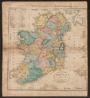
Beinecke Rare Book and Manuscript Library > A map of Ireland ... J.T. Scott. Sculp.
Published / Created:
[1852?]
Call Number:
327 1852
Container / Volume:
BRBL_00073
Image Count:
1
Resource Type:
Maps, Atlases & Globes
Found in:
Beinecke Rare Book and Manuscript Library > A map of Ireland ... with the distances of the principal towns from Dublin ...
Published / Created:
April 1759.
Call Number:
773 C884 1759
Container / Volume:
BRBL_00714
Image Count:
1
Resource Type:
Maps, Atlases & Globes
Found in:
Beinecke Rare Book and Manuscript Library > A map of Isaac Cowgill's plantation : contain two hundred & seven acres and twenty perches / by Jno. Oliver.
Creator:
Published / Created:
[1769]
Call Number:
40 1777
Container / Volume:
BRBL_00198
Image Count:
1
Resource Type:
Maps, Atlases & Globes
Found in:
Beinecke Rare Book and Manuscript Library > A map of Italy / by Mr. Palairet with improvements & additions from the best authorities by L. Delarochette ; Tho Kitchin sculpt.
Published / Created:
1797
Call Number:
3213 1797
Container / Volume:
BRBL_00055
Image Count:
1
Resource Type:
Maps, Atlases & Globes
Found in:
Beinecke Rare Book and Manuscript Library > A map of Kent.
Published / Created:
[1794?]
Call Number:
802 1794B
Container / Volume:
BRBL_00542
Image Count:
1
Resource Type:
Maps, Atlases & Globes
Found in:
Beinecke Rare Book and Manuscript Library > A map of Kentucky from actual survey by Elihu Barker.
Creator:
Published / Created:
c1907.
Call Number:
762 W73 1907
Container / Volume:
BRBL_00451
Image Count:
1
Resource Type:
Maps, Atlases & Globes
Found in:
Beinecke Rare Book and Manuscript Library > A map of Lake Winnipesaukee, New Hampshire / author, Elliot Noël Burwell.
Published / Created:
1805
Call Number:
3235 1805
Container / Volume:
BRBL_00064
Image Count:
1
Resource Type:
Maps, Atlases & Globes
Found in:
Beinecke Rare Book and Manuscript Library > A map of Lancashire ... Engraved by J. Cary.
Creator:
Published / Created:
1814
Call Number:
80 1814
Container / Volume:
BRBL_00532
Image Count:
1
Resource Type:
Maps, Atlases & Globes
Found in:
Beinecke Rare Book and Manuscript Library > A map of Lewis and Clark's track across the western portion of North America, from the Mississippi to the Pacific Ocean : by order of the executive of the United States in 1804, 5 & 6 / copied by Samuel Lewis from the original drawing of Wm. Clark ; Neele
Creator:
Published / Created:
[ca. 1814]
Call Number:
Zc10 814Le
Collection Title:
History of the expedition under the command of Captains Lewis and Clark, to the sources of the
Image Count:
2
Resource Type:
Maps, Atlases & Globes
Found in:
Beinecke Rare Book and Manuscript Library > A map of Lewis and Clark's track, across the western portion of North America fom the Mississippi to the Pacific Ocean; by order of the Executive of the United States . In 1804, 5 & 6
Creator:
Published / Created:
1721]
Call Number:
755 1715A
Container / Volume:
BRBL_00425
Image Count:
1
Resource Type:
Maps, Atlases & Globes
Found in:
Beinecke Rare Book and Manuscript Library > A map of Louisiana and of the river Mississipi [i.e. Mississippi] : this map of the Mississipi [i.e. Mississippi] is most humbly inscribed to William Law of Lanreston, esq. / by Iohn Senex.
Creator:
Published / Created:
[1757]
Call Number:
777 1758
Container / Volume:
BRBL_00690
Image Count:
1
Resource Type:
Maps, Atlases & Globes
Found in:
Beinecke Rare Book and Manuscript Library > A map of Maryland with the Delaware counties and the southern part of New Jersey &c / [cartographic material] / by T. Kitchin geogr.
Published / Created:
1819
Call Number:
76 1819
Container / Volume:
BRBL_00443
Image Count:
1
Resource Type:
Maps, Atlases & Globes
Found in:
Beinecke Rare Book and Manuscript Library > A map of Massachusetts, Connecticut, and Rhodeisland humbly sumitted to the Citizens thereof by ... E. Ruggles.
Call Number:
771 ON8 1797
Container / Volume:
BRBL_00490
Image Count:
1
Resource Type:
Maps, Atlases & Globes
Found in:
Beinecke Rare Book and Manuscript Library > A map of Messrs. Gorham and Phelp's Purchase; now the County of Ontario in the State of New York From actual survey by A. Porter Engraved by A. Doolitle, New Haven.
Published / Created:
1798
Call Number:
3217 1798
Container / Volume:
BRBL_00057
Image Count:
1
Resource Type:
Maps, Atlases & Globes
Found in:
Beinecke Rare Book and Manuscript Library > A map of Middlesex.
Creator:
Published / Created:
[1676]
Call Number:
755 1672A
Container / Volume:
BRBL_00423
Image Count:
2
Resource Type:
Maps, Atlases & Globes
Found in:
Beinecke Rare Book and Manuscript Library > A map of New England and New York / F. Lamb sculp.
Creator:
Published / Created:
[1676?]
Call Number:
755 1675E
Container / Volume:
BRBL_00423
Image Count:
1
Resource Type:
Maps, Atlases & Globes
Found in:
Beinecke Rare Book and Manuscript Library > A map of New England, New Yorke, New Jersey, Mary-land & Virginia / Gr. King sculpsit.
Creator:
Published / Created:
[1749]
Call Number:
BrSides 2019 63
Image Count:
1
Resource Type:
Maps, Atlases & Globes
Found in:
Beinecke Rare Book and Manuscript Library > A map of New Scotland with its dependencies and a succint account of the country.
Creator:
Published / Created:
1765
Call Number:
71 1765
Container / Volume:
BRBL_00364
Image Count:
1
Resource Type:
Maps, Atlases & Globes
Found in:
Beinecke Rare Book and Manuscript Library > A map of North America / by J. Palairet, with considerable alterations & improvements from d'Anville, Mitchell & Bellin, by L. Delarochette.
Creator:
Published / Created:
[1822 or 1823]
Call Number:
71 1822
Container / Volume:
BRBL_00369
Image Count:
4
Resource Type:
Maps, Atlases & Globes
Found in:
Beinecke Rare Book and Manuscript Library > A map of North America : constructed according to the latest information / engraved & published by H.S. Tanner, Philadelphia 1822.
Creator:
Published / Created:
17--?]
Call Number:
71 1769A
Container / Volume:
BRBL_00364
Image Count:
1
Resource Type:
Maps, Atlases & Globes
Found in:
Beinecke Rare Book and Manuscript Library > A map of North America : from D'Anville, 1769.
Creator:
Published / Created:
1791?]
Call Number:
71 1791
Container / Volume:
BRBL_00367
Image Count:
1
Resource Type:
Maps, Atlases & Globes
Found in:
Beinecke Rare Book and Manuscript Library > A map of North America : published under the patronage of the Duke of Orleans by d'Anville / drawn and engraved for J. Harrison, No. 115 Newgate Street, January 1, 1791.
Creator:
Published / Created:
1745?]
Call Number:
71 1746
Container / Volume:
BRBL_00362
Image Count:
1
Resource Type:
Maps, Atlases & Globes
Found in:
Beinecke Rare Book and Manuscript Library > A map of North America : with the European settlements & whatever else is remarkable in ye West Indies, from the latest and best observations / R.W. Seale, delin. et sculp.
Creator:
Published / Created:
1st of March 1789.
Call Number:
71 1789
Container / Volume:
BRBL_00366
Image Count:
4
Resource Type:
Maps, Atlases & Globes
Found in:
Beinecke Rare Book and Manuscript Library > A map of North America and the West Indies / by L.S. de la Rochette.
Branch:v1.60.98 ,Deployed:2024-05-15T10:28:41-04:00