Search
You Searched For
Search Results
- Creator:
- Geographical Surveys West of the 100th Meridian (U.S.)
- Published / Created:
- 1879
- Call Number:
- 834 1879B
- Container / Volume:
- BRBL_00587
- Image Count:
- 1
- Resource Type:
- Maps, Atlases & Globes
- Found in:
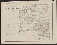
- Beinecke Rare Book and Manuscript Library > Land classification map of part of south western Colorado [cartographic material] : atlas sheet No. 61 (D).
- Creator:
- Geographical Surveys West of the 100th Meridian (U.S.)
- Published / Created:
- 1879
- Call Number:
- 841 1879A
- Container / Volume:
- BRBL_00596
- Image Count:
- 1
- Resource Type:
- Maps, Atlases & Globes
- Found in:
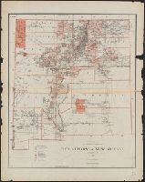
- Beinecke Rare Book and Manuscript Library > U.S. geographical surveys west of the 100th meridian land classification map of part of southern New Mexico, atlas sheet no. 84 (B) [cartographic material] / under the command of 1st. Lieut. Geo. M. Wheeler, Corps of Engineer, U.S. Army.
- Creator:
- Geographical Surveys West of the 100th Meridian (U.S.)
- Published / Created:
- [1878]
- Call Number:
- 832 1878
- Container / Volume:
- BRBL_00582
- Image Count:
- 1
- Resource Type:
- Maps, Atlases & Globes
- Found in:
- Beinecke Rare Book and Manuscript Library > Land classification map of part of South Eastern Idaho : atlas sheet no. 41(B) / U.S. Geographical Surveys West of the 100th Meridian.
- Creator:
- Geographical Surveys West of the 100th Meridian (U.S.)
- Published / Created:
- [1878]
- Call Number:
- 841 1878B
- Container / Volume:
- BRBL_00596
- Image Count:
- 1
- Resource Type:
- Maps, Atlases & Globes
- Found in:
- Beinecke Rare Book and Manuscript Library > U.S. geographical surveys west of the 100th meridian part of southern New Mexico, atlas sheet no. 84 (B) [cartographic material] / under the command of 1st. Lieut. Geo. M. Wheeler, Corps of Engineer, U.S. Army.
- Creator:
- Geographical Surveys West of the 100th Meridian (U.S.)
- Published / Created:
- [1876]
- Call Number:
- 842 1876C
- Container / Volume:
- BRBL_00598
- Image Count:
- 1
- Resource Type:
- Maps, Atlases & Globes
- Found in:
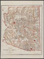
- Beinecke Rare Book and Manuscript Library > Parts of eastern and southeastern Arizona, western and southwestern New Mexico, Parts of eastern and southeastern Arizona, western and southwestern New Mexico / U.S. Geographical Surveys West of the 100th Meridian.
- Creator:
- Geographical Surveys West of the 100th Meridian (U.S.)
- Published / Created:
- 1876
- Call Number:
- 842 1876A
- Container / Volume:
- BRBL_00598
- Image Count:
- 1
- Resource Type:
- Maps, Atlases & Globes
- Found in:
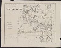
- Beinecke Rare Book and Manuscript Library > Parts of Central and Western Arizona [cartographic material] : atlas sheet no. 75.
- Creator:
- Geographical Surveys West of the 100th Meridian (U.S.)
- Published / Created:
- [approximately 1876]
- Call Number:
- 834 1876C
- Container / Volume:
- BRBL_00587
- Image Count:
- 1
- Resource Type:
- Maps, Atlases & Globes
- Found in:
- Beinecke Rare Book and Manuscript Library > Southwestern Colorado [cartographic material] / U.S. Geographical Surveys West of the 100th Meridian.
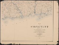
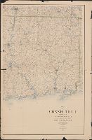
- Creator:
- Geological Survey (U.S.)
- Published / Created:
- 1893
- Call Number:
- 766 1893
- Container / Volume:
- BRBL_00467
- Image Count:
- 4
- Resource Type:
- Maps, Atlases & Globes
- Found in:
- Beinecke Rare Book and Manuscript Library > Map of Connecticut / prepared by the U.S. Geological Survey in co-operation with the State of Connecticut.
- Creator:
- Freyhold, Edward
- Published / Created:
- [1868]
- Call Number:
- 80 1868
- Container / Volume:
- BRBL_00535
- Image Count:
- 4
- Resource Type:
- Maps, Atlases & Globes
- Found in:
- Beinecke Rare Book and Manuscript Library > Territory of the United States from the Mississippi River to the Pacific Ocean : originally prepared to accompany the reports of the explorations for a Pacific railroad route / compiled from authorized explorations and other reliable data by G. K. Warren
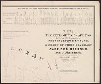
- Creator:
- Graham, J. D. (James Duncan), 1799-1865
- Published / Created:
- 1836
- Call Number:
- 764 C172 1836
- Container / Volume:
- BRBL_00456A
- Image Count:
- 4
- Resource Type:
- Maps, Atlases & Globes
- Found in:
- Beinecke Rare Book and Manuscript Library > A map of the extremity of Cape Cod : including the townships of Provincetown & Truro, with a chart of their sea coast and of Cape Cod Harbour, State of Massachusetts / executed under the direction of Major J.D. Graham ... 1833, '34, & '35.
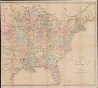
- Creator:
- Freyhold, Edward
- Published / Created:
- 1870
- Call Number:
- 75 1870A
- Container / Volume:
- BRBL_00404
- Image Count:
- 4
- Resource Type:
- Maps, Atlases & Globes
- Found in:
- Beinecke Rare Book and Manuscript Library > Military map of the United States / compiled and drawn by E. Freyhold.
- Creator:
- Winship, W. W
- Published / Created:
- 1889
- Call Number:
- 75 1889
- Container / Volume:
- BRBL_00407
- Image Count:
- 4
- Resource Type:
- Maps, Atlases & Globes
- Found in:
- Beinecke Rare Book and Manuscript Library > Map of the United States / prepared in the Office of the Chief of Engineers, U.S.A., by W.W. Winship, under the direction of Brig. Gen. John Newton, Chief of Eng., Bvt. Major General, U.S.A.
- Creator:
- United States. Office of Strategic Services. Research and Analysis Branch
- Published / Created:
- 1944
- Call Number:
- 356 Sw64 1944
- Container / Volume:
- BRBL_00114
- Image Count:
- 2
- Resource Type:
- Maps, Atlases & Globes
- Found in:
- Beinecke Rare Book and Manuscript Library > Ports of Stettin and Swinemünde.
- Creator:
- United States. Office of Strategic Services. Research and Analysis Branch
- Published / Created:
- [1944]
- Call Number:
- 36 K54 1944
- Container / Volume:
- BRBL_00124
- Image Count:
- 2
- Resource Type:
- Maps, Atlases & Globes
- Found in:
- Beinecke Rare Book and Manuscript Library > Port of Kiel.
- Creator:
- United States. Office of Strategic Services. Research and Analysis Branch
- Published / Created:
- 1944
- Call Number:
- 36 L96 1944
- Container / Volume:
- BRBL_00125
- Image Count:
- 2
- Resource Type:
- Maps, Atlases & Globes
- Found in:
- Beinecke Rare Book and Manuscript Library > Ports of Lübeck and Travemünde.
- Creator:
- United States. Foreign Economic Administration. Far East Enemy Division
- Published / Created:
- 1944
- Call Number:
- 56gm 1944A
- Container / Volume:
- BRBL_00298
- Image Count:
- 2
- Resource Type:
- Maps, Atlases & Globes
- Found in:
- Beinecke Rare Book and Manuscript Library > China transportation [cartographic material] / Foreign Economic Administration, Far East Enemy Division.
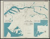
- Creator:
- United States. Office of Strategic Services. Research and Analysis Branch
- Published / Created:
- 1944
- Call Number:
- 352 K125 1944
- Container / Volume:
- BRBL_00107
- Image Count:
- 2
- Resource Type:
- Maps, Atlases & Globes
- Found in:
- Beinecke Rare Book and Manuscript Library > Port of Königsberg / lithographed in the Reproduction Branch, OSS.
- Creator:
- U.S. Coast and Geodetic Survey
- Published / Created:
- 1880
- Call Number:
- 75AK 1880
- Container / Volume:
- BRBL_00407A
- Image Count:
- 1
- Resource Type:
- Maps, Atlases & Globes
- Found in:
- Beinecke Rare Book and Manuscript Library > Base-map of the United States / Drawn and engraved by A. and H. Lindenkohl.
- Creator:
- United States. General Land Office
- Published / Created:
- 1866
- Call Number:
- 75 1866
- Container / Volume:
- BRBL_00403
- Image Count:
- 1
- Resource Type:
- Maps, Atlases & Globes
- Found in:
- Beinecke Rare Book and Manuscript Library > Map of the United States and territories : shewing the extent of public surveys and other details / constructed from the plats and official sources of the General Land Office, under the direction of Hon. Jos. S. Wilson, Commissioner, by Theodore Franks, d
- Creator:
- Geological Survey (U.S.)
- Published / Created:
- [1897]
- Call Number:
- 75BF 1897
- Container / Volume:
- BRBL_00407A
- Image Count:
- 1
- Resource Type:
- Maps, Atlases & Globes
- Found in:
- Beinecke Rare Book and Manuscript Library > Map showing condition and progress of astronomic location, primary triangulation, primary traverse and precise leveling, for the fiscal year 1896-7.
- Published / Created:
- [1884]
- Call Number:
- 785cbf 1884
- Container / Volume:
- BRBL_00514
- Image Count:
- 1
- Resource Type:
- Maps, Atlases & Globes
- Found in:
- Beinecke Rare Book and Manuscript Library > Mountain region of North Carolina and Tennessee / compiled by direction of A.D. Bache, 1865 ; corrected to June 1884, J.E. Hilgard.
- Creator:
- United States Coast Survey
- Published / Created:
- [ca. 1864]
- Call Number:
- 783hc 1864A
- Container / Volume:
- BRBL_00512
- Image Count:
- 1
- Resource Type:
- Maps, Atlases & Globes
- Found in:
- Beinecke Rare Book and Manuscript Library > Middle Virginia and North Carolina / compiled at the U.S. Coast Survey Office, drawn by H. Lindenkohl ; Chas. G. Krebs, lith.
- Creator:
- United States Coast Survey
- Published / Created:
- 1863
- Call Number:
- 787 1863
- Container / Volume:
- BRBL_00516
- Image Count:
- 1
- Resource Type:
- Maps, Atlases & Globes
- Found in:
- Beinecke Rare Book and Manuscript Library > Northern Georgia with portions of adjacent states / U.S. Coast Survey, A.D. Bache, supt.
- Creator:
- Raynolds, W. F. (William Franklin), 1820-1894
- Published / Created:
- [1860]
- Call Number:
- 80 1860A
- Container / Volume:
- BRBL_00535
- Image Count:
- 1
- Resource Type:
- Maps, Atlases & Globes
- Found in:
- Beinecke Rare Book and Manuscript Library > Map of the Yellowstone and Missouri Rivers and their tributaries / explored by Capt. W.F. Raynolds and 1st Lieut. H.E. Maynadier, 1859-1860.
- Creator:
- Dixon, Joseph
- Published / Created:
- 1860
- Call Number:
- 80 1859
- Container / Volume:
- BRBL_00534
- Image Count:
- 1
- Resource Type:
- Maps, Atlases & Globes
- Found in:
- Beinecke Rare Book and Manuscript Library > Map exhibiting the routes between Fort Dalles and the Great Salt Lake / by Bvt. 2d Lieut. Joseph Dixon, Topl. Engrs.
- Creator:
- United States. Grazing Service
- Published / Created:
- 1940
- Call Number:
- 80gcg 1940
- Container / Volume:
- BRBL_00537
- Image Count:
- 1
- Resource Type:
- Maps, Atlases & Globes
- Found in:
- Beinecke Rare Book and Manuscript Library > Grazing districts under Taylor Grazing Act / United States Department of the Interior, Grazing Service.
- Creator:
- Geological and Geographical Survey of the Territories (U.S.)
- Published / Created:
- 1879
- Call Number:
- 80cbj 1879
- Container / Volume:
- BRBL_00537
- Image Count:
- 1
- Resource Type:
- Maps, Atlases & Globes
- Found in:
- Beinecke Rare Book and Manuscript Library > Drainage map showing portions of Wyoming, Idaho and Utah / primary triangulation by A.D. Wilson ; topography by Henry Gannett, G.B. Chittenden, G.R. Bechler and F.A. Clark ; F.V. Hayden, U.S. Geologist in charge.
- Creator:
- Selden, Henry S
- Published / Created:
- 1899
- Call Number:
- 80 1899
- Container / Volume:
- BRBL_00536
- Image Count:
- 1
- Resource Type:
- Maps, Atlases & Globes
- Found in:
- Beinecke Rare Book and Manuscript Library > Map of Texas and parts of adjoining territories / compiled by and under the direction of Robert T. Hill ; drawn by Henry S. Selden and Willard D. Johnson.
- Creator:
- Raynolds, W. F. (William Franklin), 1820-1894
- Published / Created:
- [1860]
- Call Number:
- 80 1860A
- Container / Volume:
- BRBL_00535
- Image Count:
- 1
- Resource Type:
- Maps, Atlases & Globes
- Found in:
- Beinecke Rare Book and Manuscript Library > Map of the Yellowstone and Missouri Rivers and their tributaries / explored by Capt. W.F. Raynolds and 1st Lieut. H.E. Maynadier, 1859-1860.
- Creator:
- Gillespie, G. L
- Published / Created:
- 1876
- Call Number:
- 80 1876A
- Container / Volume:
- BRBL_00535
- Image Count:
- 1
- Resource Type:
- Maps, Atlases & Globes
- Found in:
- Beinecke Rare Book and Manuscript Library > Map of the Yellowstone and Missouri Rivers and their tributaries / explored by W.F. Raynolds and H.E. Maynadier, 1859-60 ; revised and enlarged by G.L. Gillespie ; engraved in the Office of the Chief of Engineers.
- Creator:
- Dinsmore, A. F
- Published / Created:
- 1919
- Call Number:
- 841fcm 1919
- Container / Volume:
- BRBL_00597
- Image Count:
- 1
- Resource Type:
- Maps, Atlases & Globes
- Found in:
- Beinecke Rare Book and Manuscript Library > State of New Mexico / compiled by A.F. Dinsmore ; traced and lettered by Wm. Bauman ; engraved and printed by the U.S. Geological Survey.
- Creator:
- United States. General Land Office
- Published / Created:
- 1902
- Call Number:
- 842 1902
- Container / Volume:
- BRBL_00599
- Image Count:
- 1
- Resource Type:
- Maps, Atlases & Globes
- Found in:
- Beinecke Rare Book and Manuscript Library > Territory of Arizona / compiled from the official records of the General Land Office and other sources under the direction of Harry King, C.E.
- Creator:
- Roeser, C. (Charles)
- Published / Created:
- 1879
- Call Number:
- 842 1879A
- Container / Volume:
- BRBL_00598
- Image Count:
- 1
- Resource Type:
- Maps, Atlases & Globes
- Found in:
- Beinecke Rare Book and Manuscript Library > Territory of Arizona / compiled from the official records of the General Land Office and other sources by C. Roeser, principal draughtsman, G.L.O.
- Creator:
- United States. General Land Office
- Published / Created:
- 1896
- Call Number:
- 842 1896
- Container / Volume:
- BRBL_00598
- Image Count:
- 1
- Resource Type:
- Maps, Atlases & Globes
- Found in:
- Beinecke Rare Book and Manuscript Library > Territory of Arizona / revised and reconstructed by R.H. Morton ; compiled from the official records of the General Land Office and other sources under supervision of Harry King, C.E. ; lettered by M. Hendges and R.M. Towson.
- Creator:
- Roeser, C. (Charles)
- Published / Created:
- 1876
- Call Number:
- 842 1876
- Container / Volume:
- BRBL_00598
- Image Count:
- 1
- Resource Type:
- Maps, Atlases & Globes
- Found in:
- Beinecke Rare Book and Manuscript Library > Territory of Arizona / compiled from the official records of the General Land Office and other sources by C. Roeser, principal draughtsman, G.L.O.
- Creator:
- Roeser, C. (Charles)
- Published / Created:
- 1879
- Call Number:
- 841 1879
- Container / Volume:
- BRBL_00596
- Image Count:
- 1
- Resource Type:
- Maps, Atlases & Globes
- Found in:
- Beinecke Rare Book and Manuscript Library > Territory of New Mexico / compiled from the official records of the General Land Office and other sources by C. Roeser, principal draughtsman, G.L.O.
- Creator:
- Geological Survey (U.S.)
- Published / Created:
- [1900]
- Call Number:
- 846gc C786 1896
- Container / Volume:
- BRBL_00623
- Image Count:
- 1
- Resource Type:
- Maps, Atlases & Globes
- Found in:
- Beinecke Rare Book and Manuscript Library > Oregon, Coos Bay quadrangle : land classification and density of standing timber / U.S. Geological Survey ; R.U. Goode, geographer in charge ; triangulation by W.T. Griswold ; topography by E.C. Barnard ; Henry Gannett, geographer in charge ; land classif
- Creator:
- Geological Survey (U.S.)
- Published / Created:
- [1900].
- Call Number:
- 846gc R72 1895
- Container / Volume:
- BRBL_00623
- Image Count:
- 1
- Resource Type:
- Maps, Atlases & Globes
- Found in:
- Beinecke Rare Book and Manuscript Library > Oregon, Roseburg quadrangle : land classification and density of standing timber / U.S. Geological Survey ; Henry Gannett, chief topographer ; R.U. Goode, geographer in charge ; triangulation by W.T. Griswold ; topography by E.C. Barnard ; Henry Gannett,
- Creator:
- Geological Survey (U.S.)
- Published / Created:
- [1900].
- Call Number:
- 846gc P838 1898
- Container / Volume:
- BRBL_00623
- Image Count:
- 1
- Resource Type:
- Maps, Atlases & Globes
- Found in:
- Beinecke Rare Book and Manuscript Library > Oregon, Port Orford quadrangle : land classification and density of standing timber / U.S. Geological Survey ; R.U. Goode, geographer in charge ; triangulation by W.T. Griswold ; topography by A.E. Murlin ; Henry Gannett, geographer in charge ; land class
- Creator:
- Geological Survey (U.S.)
- Published / Created:
- [1900].
- Call Number:
- 847gc El54 1899
- Container / Volume:
- BRBL_00628
- Image Count:
- 1
- Resource Type:
- Maps, Atlases & Globes
- Found in:
- Beinecke Rare Book and Manuscript Library > Washington, Ellensburg quadrangle : land classification and density of standing timber / U.S. Geological Survey ; R.U. Goode, geographer in charge ; triangulation by S.S. Gannett and A.H. Sylvester ; topography by A.E. Murlin ; Henry Gannett, geographer i
- Creator:
- Geological Survey (U.S.)
- Published / Created:
- [1900].
- Call Number:
- 847gc M865 1897
- Container / Volume:
- BRBL_00628
- Image Count:
- 1
- Resource Type:
- Maps, Atlases & Globes
- Found in:
- Beinecke Rare Book and Manuscript Library > Washington, Mount Stuart quadrangle : land classification and density of standing timber / U.S. Geological Survey ; R.U. Goode, geographer in charge ; triangulation by S.S. Gannett ; topography by G.E. Hyde ; Henry Gannett, geographer in charge ; land cla
- Creator:
- Geological Survey (U.S.)
- Published / Created:
- [1900]
- Call Number:
- 847gc Se18 1897
- Container / Volume:
- BRBL_00628
- Image Count:
- 1
- Resource Type:
- Maps, Atlases & Globes
- Found in:
- Beinecke Rare Book and Manuscript Library > Land classification and density of standing timber, Washington, Seattle quadrangle / U.S. Geological Survey.
- Creator:
- Geological Survey (U.S.)
- Published / Created:
- [1898].
- Call Number:
- 847gc 1898
- Container / Volume:
- BRBL_00628
- Image Count:
- 1
- Resource Type:
- Maps, Atlases & Globes
- Found in:
- Beinecke Rare Book and Manuscript Library > Map of Western Washington showing density of merchantable timber / U.S. Geological Survey.
- Creator:
- Geological Survey (U.S.)
- Published / Created:
- [1901].
- Call Number:
- 847gc C417 1898
- Container / Volume:
- BRBL_00628
- Image Count:
- 1
- Resource Type:
- Maps, Atlases & Globes
- Found in:
- Beinecke Rare Book and Manuscript Library > Washington, Chelan quadrangle : land classification and density of standing timber / U.S. Geological Survey ; R.U. Goode, geographer in charge ; triangulation by W.T. Griswold ; topography by R.A. Farmer and W.T. Griswold ; Henry Gannett, geographer in ch
- Creator:
- Hendges, M
- Published / Created:
- 1898
- Call Number:
- 848 1898J
- Container / Volume:
- BRBL_00630
- Image Count:
- 1
- Resource Type:
- Maps, Atlases & Globes
- Found in:
- Beinecke Rare Book and Manuscript Library > Map of Alaska / compiled from the official records of the General Land Office, U.S. Coast & Geodetic Survey, U.S. Geological Survey, Canadian and other sources, under the direction of Harry King ; compiled and drawn by M. Hendges.
- Creator:
- United States. General Land Office
- Published / Created:
- 1897
- Call Number:
- 847 1897C
- Container / Volume:
- BRBL_00625
- Image Count:
- 1
- Resource Type:
- Maps, Atlases & Globes
- Found in:
- Beinecke Rare Book and Manuscript Library > Map of the state of Washington / compiled from the official records of the General Land Office and other sources under the direction of Harry King, C.E., Chief of Drafting Division, G.L.O. ; revised and drawn by Daniel O'Hare ; compiled by Robt. H. Morton
- Creator:
- United States. Department of Commerce and Labor. Bureau of Statistics
- Published / Created:
- [1904]
- Call Number:
- 50 1904A
- Container / Volume:
- BRBL_00273
- Image Count:
- 1
- Resource Type:
- Maps, Atlases & Globes
- Found in:
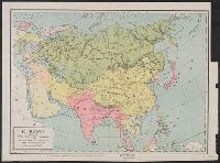
- Beinecke Rare Book and Manuscript Library > Eurasia showing the Russian empire and the trans-Siberian railroad / U.S. Bureau of Statistics, Department of Commerce and Labor.
- Published / Created:
- [1898]
- Call Number:
- 855hc 1898R
- Container / Volume:
- BRBL_00765
- Image Count:
- 1
- Resource Type:
- Maps, Atlases & Globes
- Found in:
- Beinecke Rare Book and Manuscript Library > Sketch of a reconnaisance made by Major T.H. Belt, U.S. Vol. Engr. : accompanied by Major L.H Strother, U.S. Vol. Engr. Lieut. R.W. Means, 1st Colo. Inf. Aug. 10, 1898.
- Creator:
- United States. Army. Corps of Engineers, author
- Published / Created:
- [1834]
- Call Number:
- 761 1834
- Container / Volume:
- BRBL_00447
- Image Count:
- 1
- Resource Type:
- Maps, Atlases & Globes
- Found in:
- Beinecke Rare Book and Manuscript Library > The Kennebec River and adjacent country : shewing the routes examined for a road from Augusta to the Canada line in the direction of Quebec / reconnaissance made in 1834 by Hartman Bache, T.E. & B.T. Major, assisted by G.W. Ward, 2nd Lt. 2nd Arty. and J.F
- Published / Created:
- [1898]
- Call Number:
- 855hc 1898H
- Container / Volume:
- BRBL_00765
- Image Count:
- 1
- Resource Type:
- Maps, Atlases & Globes
- Found in:
- Beinecke Rare Book and Manuscript Library > [Map showing fortifications around the mouth of the San Juan River, Cuba during the War of 1898.]
- Creator:
- United States. General Land Office
- Published / Created:
- 1906
- Call Number:
- 846 1906
- Container / Volume:
- BRBL_00621
- Image Count:
- 1
- Resource Type:
- Maps, Atlases & Globes
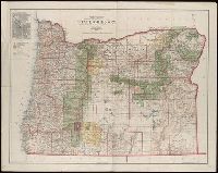
- Found in:
- Beinecke Rare Book and Manuscript Library > State of Oregon / compiled from the official records of the General Land Office and other sources under the direction of Frank Bond ; compiled by M. Hendges ; revised by A.F. Dinsmore ; traced and lettered by Wm. Bauman Jr.
- Creator:
- United States. Forest Service
- Published / Created:
- 1911
- Call Number:
- 90gcr 1911
- Container / Volume:
- BRBL_00664
- Image Count:
- 1
- Resource Type:
- Maps, Atlases & Globes
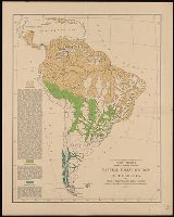
- Found in:
- Beinecke Rare Book and Manuscript Library > Natural forest regions of South America and their characteristic tree growth.
- Creator:
- Geological Survey (U.S.)
- Published / Created:
- 1915
- Call Number:
- 766C Sa99 1915
- Container / Volume:
- BRBL_00474
- Image Count:
- 1
- Resource Type:
- Maps, Atlases & Globes
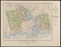
- Found in:
- Beinecke Rare Book and Manuscript Library > Map of Saybrook area, Connecticut, showing rock outcrops, wooded areas, and ground-water conditions.
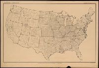
- Creator:
- United States. Department of Agriculture. Division of Publications
- Published / Created:
- 1915
- Call Number:
- 75eb 1910B
- Container / Volume:
- BRBL_00410
- Image Count:
- 1
- Resource Type:
- Maps, Atlases & Globes
- Found in:
- Beinecke Rare Book and Manuscript Library > Outline map of the United States by counties / engraved and printed by the U.S. Geological Survey.
- Creator:
- Richardson, G. B
- Published / Created:
- 1921
- Call Number:
- 774gbc 1921
- Container / Volume:
- BRBL_00501A
- Image Count:
- 1
- Resource Type:
- Maps, Atlases & Globes
- Found in:
- Beinecke Rare Book and Manuscript Library > Oil and gas fields of Pennsylvania / compiled under the direction of G.B. Richardson.
- Creator:
- Nicholson, W. L
- Published / Created:
- [1879?]
- Call Number:
- 796gmd 1879
- Container / Volume:
- BRBL_00531
- Image Count:
- 2
- Resource Type:
- Maps, Atlases & Globes
- Found in:
- Beinecke Rare Book and Manuscript Library > Post route map of the state of Texas : with adjacent parts of Louisiana, Arkansas, Indian Territory, and of the Republic of Mexico / designed and constructed under the orders of Postmaster General D.M. Key by W.L. Nicholson.
- Creator:
- United States. National Park Service
- Published / Created:
- [1941]
- Call Number:
- 80ex 1941
- Container / Volume:
- BRBL_00537
- Image Count:
- 2
- Resource Type:
- Maps, Atlases & Globes
- Found in:
- Beinecke Rare Book and Manuscript Library > Southwestern national monuments / United States Department of the Interior, National Park Service ; J.J. Black, 1939.
- Creator:
- Rakowicz, E. H
- Published / Created:
- 1886
- Call Number:
- 821 1886A
- Container / Volume:
- BRBL_00566
- Image Count:
- 2
- Resource Type:
- Maps, Atlases & Globes
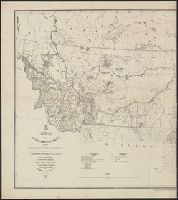
- Found in:
- Beinecke Rare Book and Manuscript Library > Map of the Department of Dakota : including Minnesota, Dakota and Montana / compiled and drawn under the direction of John Biddle by E.H. Rakowicz.
- Creator:
- United States. National Park Service
- Published / Created:
- [2001]
- Call Number:
- 823 B14 2001
- Container / Volume:
- BRBL_00568
- Image Count:
- 2
- Resource Type:
- Maps, Atlases & Globes
- Found in:
- Beinecke Rare Book and Manuscript Library > Badlands National Park, South Dakota / National Park Service, U.S. Department of the Interior.
- Published / Created:
- [1843]
- Call Number:
- 807 1843
- Container / Volume:
- BRBL_00731
- Image Count:
- 2
- Resource Type:
- Maps, Atlases & Globes
- Found in:
- Beinecke Rare Book and Manuscript Library > Hydrographical basin of the upper Mississippi River ... / by J.N. Nicollet ...
- Creator:
- United States. Post Office Dept
- Published / Created:
- 1883
- Call Number:
- 842gmd 1883
- Container / Volume:
- BRBL_00600
- Image Count:
- 2
- Resource Type:
- Maps, Atlases & Globes
- Found in:
- Beinecke Rare Book and Manuscript Library > Post route map of the territories of New Mexico and Arizona : with parts of adjacent states and territories, showing post offices with the intermediate distances between them and mail routes in operation on 1st October 1883 / published by order of Postmas
- Creator:
- Geological Survey (U.S.)
- Published / Created:
- 1907
- Call Number:
- 783 N765 1907
- Container / Volume:
- BRBL_00510
- Image Count:
- 2
- Resource Type:
- Maps, Atlases & Globes
- Found in:
- Beinecke Rare Book and Manuscript Library > Virginia, Norfolk special map / topography by U.S. Geological Survey ; control and shore topography by Coast and Geodetic Survey.
- Creator:
- Geological Survey (U.S.)
- Published / Created:
- 1917
- Call Number:
- 814 1917
- Container / Volume:
- BRBL_00557
- Image Count:
- 2
- Resource Type:
- Maps, Atlases & Globes
- Found in:
- Beinecke Rare Book and Manuscript Library > State of Minnesota / Department of the Interior, Franklin K. Lane, Secretary, Geological Survey, George Otis Smith, Director ; R.B. Marshall, Chief Geographer ; A.F. Hassan, Cartographer.
- Creator:
- Steiger, W. T
- Published / Created:
- 1854
- Call Number:
- 75gme 1854
- Container / Volume:
- BRBL_00411
- Image Count:
- 2
- Resource Type:
- Maps, Atlases & Globes
- Found in:
- Beinecke Rare Book and Manuscript Library > Diagram of the United States of America, Mexico, the West India Islands and Isthmus of Darien : showing proposed routes of the Pacific Rail Road ... / by W. T. Steiger, General Land Office ; Lith. by A. Hoen & Co. Baltimore.
- Creator:
- United States. General Land Office
- Published / Created:
- [1868]
- Call Number:
- 75 1868C
- Container / Volume:
- BRBL_00404
- Image Count:
- 2
- Resource Type:
- Maps, Atlases & Globes
- Found in:
- Beinecke Rare Book and Manuscript Library > Map of the United States and territories, showing the extent of public surveys and other details / constructed from the plats and official sources of the General Land Office, under the direction of the Hon. Jos. S. Wilson, commissioner, by Joseph Gorlinsk
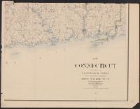
- Creator:
- Geological Survey (U.S.)
- Published / Created:
- 1893 (1899 printing)
- Call Number:
- 766 1893C
- Container / Volume:
- BRBL_00467
- Image Count:
- 2
- Resource Type:
- Maps, Atlases & Globes
- Found in:
- Beinecke Rare Book and Manuscript Library > Map of Connecticut / prepared by the U.S. Geological Survey in co-operation with the State of Connecticut.
- Creator:
- Geological Survey (U.S.)
- Published / Created:
- 1893 (1899 printing)
- Call Number:
- 766 1893C
- Container / Volume:
- BRBL_00467
- Image Count:
- 3
- Resource Type:
- Maps, Atlases & Globes
- Found in:
- Beinecke Rare Book and Manuscript Library > Map of Connecticut / prepared by the U.S. Geological Survey in co-operation with the State of Connecticut.
- Creator:
- Julius Bien & Co
United States. Adjutant-General's Office. Military Information Division
- Published / Created:
- 1898
- Call Number:
- 281 1898
- Container / Volume:
- BRBL_00024
- Image Count:
- 1
- Resource Type:
- Maps, Atlases & Globes
- Found in:
- Beinecke Rare Book and Manuscript Library > Military map of the Isle of Luzon / prepared in the War Department, Adjutant General's Office, Military Information Division ... ; drawn by C.H. Ourand, D.H. Blakelock & E.H. Stück ; Julius Bien & Co., photo. lith., 140 6th Ave. N.Y.
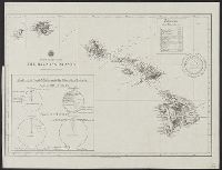
- Creator:
- Mitchell, John Murray, 1858-1905
Norris Peters Co
United States. Hydrographic Office
- Published / Created:
- [1896?]
- Call Number:
- 231 1896
- Container / Volume:
- BRBL_00020
- Image Count:
- 1
- Resource Type:
- Maps, Atlases & Globes
- Found in:
- Beinecke Rare Book and Manuscript Library > The Hawaiian Islands [cartographic material] : compiled from the latest information.
- Creator:
- United States. Office of Strategic Services. Research and Analysis Branch
- Published / Created:
- [1945?]
- Call Number:
- 11hd 1945K-1
- Container / Volume:
- BRBL_00010ZG
- Image Count:
- 1
- Resource Type:
- Maps, Atlases & Globes
- Found in:
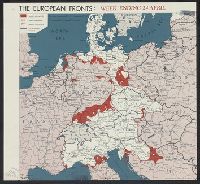
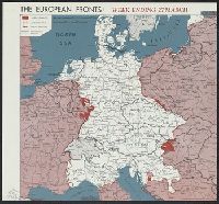
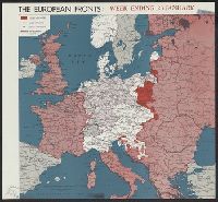
- Beinecke Rare Book and Manuscript Library > The European fronts [cartographic material] : week ending 24 April.
- Creator:
- United States. Office of Strategic Services. Research and Analysis Branch
- Published / Created:
- [1945?]
- Call Number:
- 11hd 1945K-10
- Container / Volume:
- BRBL_00010ZG
- Image Count:
- 1
- Resource Type:
- Maps, Atlases & Globes
- Found in:
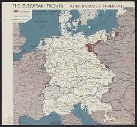
- Beinecke Rare Book and Manuscript Library > The European fronts [cartographic material] : week ending 6 February.
- Creator:
- United States. Office of Strategic Services. Research and Analysis Branch
- Published / Created:
- [1944?]
- Call Number:
- 11hd 1945K-13
- Container / Volume:
- BRBL_00010ZG
- Image Count:
- 1
- Resource Type:
- Maps, Atlases & Globes
- Found in:
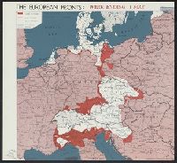
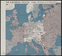
- Beinecke Rare Book and Manuscript Library > The European fronts [cartographic material] : week ending 24 October.
- Creator:
- United States. Office of Strategic Services. Research and Analysis Branch
- Published / Created:
- [1945?]
- Call Number:
- 11hd 1945K-12
- Container / Volume:
- BRBL_00010ZG
- Image Count:
- 1
- Resource Type:
- Maps, Atlases & Globes
- Found in:
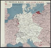
- Beinecke Rare Book and Manuscript Library > The European fronts [cartographic material] : week ending 20 February.
- Creator:
- United States. Office of Strategic Services. Research and Analysis Branch
- Published / Created:
- [1945?]
- Call Number:
- 11hd 1945K-11
- Container / Volume:
- BRBL_00010ZG
- Image Count:
- 1
- Resource Type:
- Maps, Atlases & Globes
- Found in:
- Beinecke Rare Book and Manuscript Library > The European fronts [cartographic material] : week ending 1 May.
- Creator:
- United States. Office of Strategic Services. Research and Analysis Branch
- Published / Created:
- [1945?]
- Call Number:
- 11hd 1945K-6
- Container / Volume:
- BRBL_00010ZG
- Image Count:
- 1
- Resource Type:
- Maps, Atlases & Globes
- Found in:
- Beinecke Rare Book and Manuscript Library > The European fronts [cartographic material] : week ending 13 March.
- Creator:
- United States. Office of Strategic Services. Research and Analysis Branch
- Published / Created:
- [1945?]
- Call Number:
- 11hd 1945K-4
- Container / Volume:
- BRBL_00010ZG
- Image Count:
- 1
- Resource Type:
- Maps, Atlases & Globes
- Found in:
- Beinecke Rare Book and Manuscript Library > The European fronts [cartographic material] : week ending 3 April.
- Creator:
- United States. Office of Strategic Services. Reproduction Branch
United States. Office of Strategic Services. Research and Analysis Branch
- Published / Created:
- [1944]
- Call Number:
- 352gme 1944A
- Container / Volume:
- BRBL_00110
- Image Count:
- 1
- Resource Type:
- Maps, Atlases & Globes
- Found in:
- Beinecke Rare Book and Manuscript Library > Railroads of western U.S.S.R. : showing railroad administrative divisions, southern section.
- Creator:
- United States. Office of Strategic Services. Research and Analysis Branch
- Published / Created:
- 1945
- Call Number:
- 36eb 1939A
- Container / Volume:
- BRBL_00127
- Image Count:
- 1
- Resource Type:
- Maps, Atlases & Globes
- Found in:
- Beinecke Rare Book and Manuscript Library > "Greater" Germany, population dependent upon commercial and service occupations (by Kreise 1939).
- Creator:
- United States. Office of Strategic Services. Research and Analysis Branch
- Published / Created:
- 1945
- Call Number:
- 36cb 1945A
- Container / Volume:
- BRBL_00127
- Image Count:
- 1
- Resource Type:
- Maps, Atlases & Globes
- Found in:
- Beinecke Rare Book and Manuscript Library > Germany eastern border regions : surface configuration.
- Creator:
- United States. Office of Strategic Services. Research and Analysis Branch
- Published / Created:
- 1945
- Call Number:
- 36f R857 1945
- Container / Volume:
- BRBL_00128
- Image Count:
- 1
- Resource Type:
- Maps, Atlases & Globes
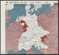
- Found in:
- Beinecke Rare Book and Manuscript Library > Germany, Western border regions, critical
- Published / Created:
- 1945
- Call Number:
- 362 1945
- Image Count:
- 1
- Resource Type:
- Maps, Atlases & Globes
- Found in:
- Beinecke Rare Book and Manuscript Library > Major trade areas and trade centers in part of Northwestern Germany.
- Creator:
- United States. Office of Strategic Services. Research and Analysis Branch
- Published / Created:
- 1943
- Call Number:
- 364g 1943
- Container / Volume:
- BRBL_00144
- Image Count:
- 1
- Resource Type:
- Maps, Atlases & Globes
- Found in:
- Beinecke Rare Book and Manuscript Library > Zones of intensive urban land use in the Ruhr [cartographic material] / compiled and drawn in the Branch of Research and Analysis, OSS.
- Creator:
- United States. Office of Strategic Services. Research and Analysis Branch
- Published / Created:
- 1943
- Call Number:
- 38gme 1943B
- Container / Volume:
- BRBL_00171
- Image Count:
- 1
- Resource Type:
- Maps, Atlases & Globes
- Found in:
- Beinecke Rare Book and Manuscript Library > France, national railroads [cartographic material] / compiled and drawn in the Branch of Research and Analysis, OSS.
- Creator:
- United States. Army Map Service
- Published / Created:
- 1943
- Call Number:
- 38 V66 1943
- Container / Volume:
- BRBL_00167
- Image Count:
- 1
- Resource Type:
- Maps, Atlases & Globes
- Found in:
- Beinecke Rare Book and Manuscript Library > Vichy [cartographic material] : City plan.
- Creator:
- United States. Army Map Service
- Published / Created:
- 1943
- Call Number:
- 38 St81 1943
- Container / Volume:
- BRBL_00165
- Image Count:
- 1
- Resource Type:
- Maps, Atlases & Globes
- Found in:
- Beinecke Rare Book and Manuscript Library > Strasbourg (Strassburg) [cartographic material] : city plan.
- Creator:
- United States. Office of Strategic Services. Research and Analysis Branch
- Published / Created:
- 1944
- Call Number:
- 38gm 1944B
- Container / Volume:
- BRBL_00170
- Image Count:
- 1
- Resource Type:
- Maps, Atlases & Globes
- Found in:
- Beinecke Rare Book and Manuscript Library > Southern France and northern Italy [cartographic material] / compiled and drawn in the Branch of Research and Analysis, OSS.
- Creator:
- United States. Office of Strategic Services
- Published / Created:
- 1943
- Call Number:
- 38gma 1943
- Container / Volume:
- BRBL_00170
- Image Count:
- 1
- Resource Type:
- Maps, Atlases & Globes
- Found in:
- Beinecke Rare Book and Manuscript Library > France Navigable Waterways [cartographic material].
- Creator:
- United States. Office of Strategic Services. Research and Analysis Branch
- Published / Created:
- [1944?]
- Call Number:
- 11hd 1945K-36
- Container / Volume:
- BRBL_00010ZG
- Image Count:
- 1
- Resource Type:
- Maps, Atlases & Globes
- Found in:
- Beinecke Rare Book and Manuscript Library > The European fronts [cartographic material] : week ending 26 December.
- Creator:
- United States. Office of Strategic Services. Research and Analysis Branch
- Published / Created:
- [1945?]
- Call Number:
- 11hd 1945K-8
- Container / Volume:
- BRBL_00010ZG
- Image Count:
- 1
- Resource Type:
- Maps, Atlases & Globes
- Found in:
- Beinecke Rare Book and Manuscript Library > The European fronts [cartographic material] : week ending 27 February.
- Creator:
- United States. Office of Strategic Services. Research and Analysis Branch
- Published / Created:
- [1945?]
- Call Number:
- 11hd 1945K-9
- Container / Volume:
- BRBL_00010ZG
- Image Count:
- 1
- Resource Type:
- Maps, Atlases & Globes
- Found in:
- Beinecke Rare Book and Manuscript Library > The European fronts [cartographic material] : week ending 13 February.
- Creator:
- United States. Office of Strategic Services. Research and Analysis Branch
- Published / Created:
- [1944?]
- Call Number:
- 11hd 1945K-35
- Container / Volume:
- BRBL_00010ZG
- Image Count:
- 1
- Resource Type:
- Maps, Atlases & Globes
- Found in:
- Beinecke Rare Book and Manuscript Library > The European fronts [cartographic material] : week ending 19 December.
- Creator:
- United States. Office of Strategic Services. Research and Analysis Branch
- Published / Created:
- [1945?]
- Call Number:
- 11hd 1945K-7
- Container / Volume:
- BRBL_00010ZG
- Image Count:
- 1
- Resource Type:
- Maps, Atlases & Globes
- Found in:
- Beinecke Rare Book and Manuscript Library > The European fronts [cartographic material] : week ending 27 March.
- Creator:
- Pathfinder (Ship)
United States. Hydrographic Office
- Published / Created:
- 1944
- Call Number:
- 258 1944
- Container / Volume:
- BRBL_00022
- Image Count:
- 1
- Resource Type:
- Maps, Atlases & Globes
- Found in:
- Beinecke Rare Book and Manuscript Library > South Pacific Ocean Solomon Islands : Malaita Island North Coast, Suaba Harbor / U.S. Navy, Hydrographic Office.
- Creator:
- United States. Army Map Service
- Published / Created:
- 1945
- Call Number:
- 273 T171 1945
- Container / Volume:
- BRBL_00023B
- Image Count:
- 1
- Resource Type:
- Maps, Atlases & Globes
- Found in:
- Beinecke Rare Book and Manuscript Library > [Air support charts, Tarakan] / prepared and reproduced by Army Map Service.
- Creator:
- United States. Office of Strategic Services. Reproduction Branch
United States. Office of Strategic Services. Research and Analysis Branch
- Published / Created:
- 1945
- Call Number:
- 273 1945
- Container / Volume:
- BRBL_00023B
- Image Count:
- 1
- Resource Type:
- Maps, Atlases & Globes
- Found in:
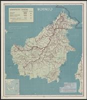
- Beinecke Rare Book and Manuscript Library > Borneo : administrative divisions / R & A, OSS.
- Creator:
- United States. Office of Strategic Services. Research and Analysis Branch
- Published / Created:
- [1944?]
- Call Number:
- 11hd 1945K-15
- Container / Volume:
- BRBL_00010ZG
- Image Count:
- 1
- Resource Type:
- Maps, Atlases & Globes
- Found in:
- Beinecke Rare Book and Manuscript Library > The European fronts [cartographic material] : week ending 12 December.
- Creator:
- United States. Office of Strategic Services. Research and Analysis Branch
- Published / Created:
- [1944?]
- Call Number:
- 11hd 1945K-14
- Container / Volume:
- BRBL_00010ZG
- Image Count:
- 1
- Resource Type:
- Maps, Atlases & Globes
- Found in:
- Beinecke Rare Book and Manuscript Library > The European fronts [cartographic material] : week ending 14 November.
- Creator:
- United States. Office of Strategic Services. Research and Analysis Branch
- Published / Created:
- [1944?]
- Call Number:
- 11hd 1945K-19
- Container / Volume:
- BRBL_00010ZG
- Image Count:
- 1
- Resource Type:
- Maps, Atlases & Globes
- Found in:
- Beinecke Rare Book and Manuscript Library > The European fronts [cartographic material] : week ending 10 October.
- Creator:
- United States. Office of Strategic Services. Research and Analysis Branch
- Published / Created:
- [1945?]
- Call Number:
- 11hd 1945K-20
- Container / Volume:
- BRBL_00010ZG
- Image Count:
- 1
- Resource Type:
- Maps, Atlases & Globes
- Found in:
- Beinecke Rare Book and Manuscript Library > The European fronts [cartographic material] : week ending 23 January.