Search
You Searched For
Search Results
- Creator:
- United States. General Land Office
- Call Number:
- 833 1879
- Container / Volume:
- BRBL_00584
- Image Count:
- 1
- Resource Type:
- Maps, Atlases & Globes
- Found in:
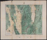
- Beinecke Rare Book and Manuscript Library > Territory of Wyoming : 1879 / compiled from the official records of the General Land Office and other sources by C. Roeser, Principal Draughtsman, G.L.O.
- Published / Created:
- .
- Call Number:
- 75H 1895
- Container / Volume:
- BRBL_00414A
- Image Count:
- 1
- Resource Type:
- Maps, Atlases & Globes
- Found in:
- Beinecke Rare Book and Manuscript Library > Map of the United States showing Military Posts and Principal Lines of Communication / Prepared by direction of the Secretary of War in the Office of the Chief of Engineers U.S.A.
- Creator:
- United States. Army. Corps of Engineers, author
- Published / Created:
- [1834]
- Call Number:
- 761 1834
- Container / Volume:
- BRBL_00447
- Image Count:
- 1
- Resource Type:
- Maps, Atlases & Globes
- Found in:
- Beinecke Rare Book and Manuscript Library > The Kennebec River and adjacent country : shewing the routes examined for a road from Augusta to the Canada line in the direction of Quebec / reconnaissance made in 1834 by Hartman Bache, T.E. & B.T. Major, assisted by G.W. Ward, 2nd Lt. 2nd Arty. and J.F
- Creator:
- Gallatin, Albert, 1761-1849
- Published / Created:
- [1836]
- Call Number:
- 71ed 1836
- Container / Volume:
- BRBL_00371
- Image Count:
- 1
- Resource Type:
- Maps, Atlases & Globes
- Found in:
- Beinecke Rare Book and Manuscript Library > Map of the Indian tribes of North America, about 1600 A.D. along the Atlantic, & about 1800 A.D. westwardly / published by the Amer. Antiq. Soc. from a drawing by Hon. A. Gallatin.
- Creator:
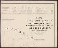
- Graham, J. D. (James Duncan), 1799-1865
- Published / Created:
- 1836
- Call Number:
- 764 C172 1836
- Container / Volume:
- BRBL_00456A
- Image Count:
- 4
- Resource Type:
- Maps, Atlases & Globes
- Found in:
- Beinecke Rare Book and Manuscript Library > A map of the extremity of Cape Cod : including the townships of Provincetown & Truro, with a chart of their sea coast and of Cape Cod Harbour, State of Massachusetts / executed under the direction of Major J.D. Graham ... 1833, '34, & '35.
- Published / Created:
- [1843]
- Call Number:
- 807 1843
- Container / Volume:
- BRBL_00731
- Image Count:
- 2
- Resource Type:
- Maps, Atlases & Globes
- Found in:
- Beinecke Rare Book and Manuscript Library > Hydrographical basin of the upper Mississippi River ... / by J.N. Nicollet ...
- Creator:
- Steiger, W. T
- Published / Created:
- 1854
- Call Number:
- 75gme 1854
- Container / Volume:
- BRBL_00411
- Image Count:
- 2
- Resource Type:
- Maps, Atlases & Globes
- Found in:
- Beinecke Rare Book and Manuscript Library > Diagram of the United States of America, Mexico, the West India Islands and Isthmus of Darien : showing proposed routes of the Pacific Rail Road ... / by W. T. Steiger, General Land Office ; Lith. by A. Hoen & Co. Baltimore.
- Creator:
- United States Coast Survey
- Published / Created:
- 1857
- Call Number:
- 764cea W86 1857
- Container / Volume:
- BRBL_00461
- Image Count:
- 1
- Resource Type:
- Maps, Atlases & Globes
- Found in:
- Beinecke Rare Book and Manuscript Library > The Harbor of Wood's Hole, Massachusetts / from a trigonometrical survey under the direction of A.D. Bache, superintendent of the Survey of the Coast of the United States. Triangulation by C.M. Eakin, assist. ; topography by W.M. Boyce assist. ; hydrograp
- Creator:
- Medary, Samuel A
- Published / Created:
- 1858
- Call Number:
- 8101 1858
- Container / Volume:
- BRBL_00552
- Image Count:
- 1
- Resource Type:
- Maps, Atlases & Globes
- Found in:
- Beinecke Rare Book and Manuscript Library > Map of the Fort Ridgely & South Pass road / by Samuel A. Medary ; drawn by John R. Key.
- Creator:
- Raynolds, W. F. (William Franklin), 1820-1894
- Published / Created:
- [1860]
- Call Number:
- 80 1860A
- Container / Volume:
- BRBL_00535
- Image Count:
- 1
- Resource Type:
- Maps, Atlases & Globes
- Found in:
- Beinecke Rare Book and Manuscript Library > Map of the Yellowstone and Missouri Rivers and their tributaries / explored by Capt. W.F. Raynolds and 1st Lieut. H.E. Maynadier, 1859-1860.
- Creator:
- Dixon, Joseph
- Published / Created:
- 1860
- Call Number:
- 80 1859
- Container / Volume:
- BRBL_00534
- Image Count:
- 1
- Resource Type:
- Maps, Atlases & Globes
- Found in:
- Beinecke Rare Book and Manuscript Library > Map exhibiting the routes between Fort Dalles and the Great Salt Lake / by Bvt. 2d Lieut. Joseph Dixon, Topl. Engrs.
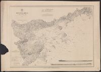
- Creator:
- U.S. Coast and Geodetic Survey
- Published / Created:
- [1861?]
- Call Number:
- 754 1861C
- Container / Volume:
- BRBL_00416
- Image Count:
- 1
- Resource Type:
- Maps, Atlases & Globes
- Found in:
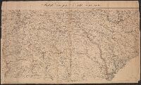
- Beinecke Rare Book and Manuscript Library > Middle Georgia & South Carolina.
- Creator:
- United States Coast Survey
- Published / Created:
- 1863
- Call Number:
- 787 1863
- Container / Volume:
- BRBL_00516
- Image Count:
- 1
- Resource Type:
- Maps, Atlases & Globes
- Found in:
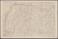
- Beinecke Rare Book and Manuscript Library > Northern Georgia with portions of adjacent states / U.S. Coast Survey, A.D. Bache, supt.
- Creator:
- United States Coast Survey
- Published / Created:
- [ca. 1864]
- Call Number:
- 783hc 1864A
- Container / Volume:
- BRBL_00512
- Image Count:
- 1
- Resource Type:
- Maps, Atlases & Globes
- Found in:
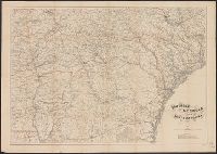
- Beinecke Rare Book and Manuscript Library > Middle Virginia and North Carolina / compiled at the U.S. Coast Survey Office, drawn by H. Lindenkohl ; Chas. G. Krebs, lith.
- Creator:
- Bache, A. D. (Alexander Dallas), 1806-1867
- Published / Created:
- 1865
- Call Number:
- 754 1865B
- Container / Volume:
- BRBL_00417
- Image Count:
- 1
- Resource Type:
- Maps, Atlases & Globes
- Found in:
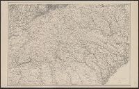
- Beinecke Rare Book and Manuscript Library > [Northern Mississippi, Alabama, and a small part of southern Tennessee] / U.S. Coast Survey, A.D. Bache, supdt.; drawn by A. Lindenkohl; H. Lindenkohl & Chas. G. Krebs, lith.
- Creator:
- United States Coast Survey
- Published / Created:
- 1865
- Call Number:
- 754 1865C
- Container / Volume:
- BRBL_00417
- Image Count:
- 1
- Resource Type:
- Maps, Atlases & Globes
- Found in:
- Beinecke Rare Book and Manuscript Library > Southern Georgia and part of South Carolina / U.S. Coast Survey, A.D. Bache, supdt. ; drawn by A. Lindenkohl; Chas. G. Krebs, lith.
- Creator:
- United States Coast Survey
- Published / Created:
- 1865
- Call Number:
- 754 1865A
- Container / Volume:
- BRBL_00417
- Image Count:
- 1
- Resource Type:
- Maps, Atlases & Globes
- Found in:
- Beinecke Rare Book and Manuscript Library > Southern Georgia and part of South Carolina / U.S. Coast Survey, A.D. Bache, supdt. ; drawn by A. Lindenkohl.
- Creator:
- Bache, A. D. (Alexander Dallas), 1806-1867
- Published / Created:
- 1865
- Call Number:
- 754 1865
- Container / Volume:
- BRBL_00417
- Image Count:
- 1
- Resource Type:
- Maps, Atlases & Globes
- Found in:
- Beinecke Rare Book and Manuscript Library > [Northern Georgia and part of South Carolina].
- Creator:
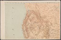
- United States. General Land Office
- Published / Created:
- 1866
- Call Number:
- 844fcm 1866
- Container / Volume:
- BRBL_00615
- Image Count:
- 1
- Resource Type:
- Maps, Atlases & Globes
- Found in:
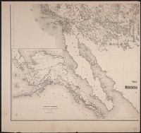
- Beinecke Rare Book and Manuscript Library > Map of public surveys in California & Nevada : to accompany report of Commissioner of the General Land Office, 1866.
- Creator:
- United States. General Land Office
- Published / Created:
- 1866
- Call Number:
- 806gbc 1866
- Container / Volume:
- BRBL_00549
- Image Count:
- 1
- Resource Type:
- Maps, Atlases & Globes
- Found in:
- Beinecke Rare Book and Manuscript Library > Map of the state of Illinois [cartographic material].
- Creator:
- United States. General Land Office
- Published / Created:
- 1866
- Call Number:
- 75 1866
- Container / Volume:
- BRBL_00403
- Image Count:
- 1
- Resource Type:
- Maps, Atlases & Globes
- Found in:
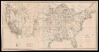
- Beinecke Rare Book and Manuscript Library > Map of the United States and territories : shewing the extent of public surveys and other details / constructed from the plats and official sources of the General Land Office, under the direction of Hon. Jos. S. Wilson, Commissioner, by Theodore Franks, d
- Creator:
- Freyhold, Edward
- Published / Created:
- [1868]
- Call Number:
- 80 1868
- Container / Volume:
- BRBL_00535
- Image Count:
- 4
- Resource Type:
- Maps, Atlases & Globes
- Found in:
- Beinecke Rare Book and Manuscript Library > Territory of the United States from the Mississippi River to the Pacific Ocean : originally prepared to accompany the reports of the explorations for a Pacific railroad route / compiled from authorized explorations and other reliable data by G. K. Warren
- Creator:
- United States. General Land Office
- Published / Created:
- [1868]
- Call Number:
- 75 1868C
- Container / Volume:
- BRBL_00404
- Image Count:
- 2
- Resource Type:
- Maps, Atlases & Globes
- Found in:
- Beinecke Rare Book and Manuscript Library > Map of the United States and territories, showing the extent of public surveys and other details / constructed from the plats and official sources of the General Land Office, under the direction of the Hon. Jos. S. Wilson, commissioner, by Joseph Gorlinsk
- Creator:
- United States Coast Survey
- Published / Created:
- 1869
- Call Number:
- 848 1869
- Container / Volume:
- BRBL_00630
- Image Count:
- 1
- Resource Type:
- Maps, Atlases & Globes
- Found in:
- Beinecke Rare Book and Manuscript Library > Alaska and adjoining territory / drawn by H. Lindenkohl.
- Creator:
- United States Coast Survey
- Published / Created:
- 1869
- Call Number:
- 844 Sa52 1869A
- Container / Volume:
- BRBL_00608
- Image Count:
- 1
- Resource Type:
- Maps, Atlases & Globes
- Found in:
- Beinecke Rare Book and Manuscript Library > San Francisco Peninsula / U.S. Coast Survey.
- Creator:
- United States Coast Survey
- Published / Created:
- 1869
- Call Number:
- 844 Sa52 1869
- Container / Volume:
- BRBL_00608
- Image Count:
- 1
- Resource Type:
- Maps, Atlases & Globes
- Found in:
- Beinecke Rare Book and Manuscript Library > San Francisco Peninsula / U.S. Coast Survey.
- Creator:
- Freyhold, Edward
- Published / Created:
- 1870
- Call Number:
- 75 1870A
- Container / Volume:
- BRBL_00404
- Image Count:
- 4
- Resource Type:
- Maps, Atlases & Globes
- Found in:
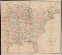
- Beinecke Rare Book and Manuscript Library > Military map of the United States / compiled and drawn by E. Freyhold.
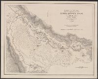
- Creator:
- Hergesheimer, E. (Edwin)
- Published / Created:
- 1871
- Call Number:
- 833 Y38 1871D
- Container / Volume:
- BRBL_00584
- Image Count:
- 1
- Resource Type:
- Maps, Atlases & Globes
- Found in:
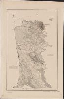
- Beinecke Rare Book and Manuscript Library > Upper Geyser Basin, Fire Hole River, Wyoming Territory / surveyed by the party in charge of F.V. Hayden ; compiled and drawn from field notes and sketches of A. Schönborn by E. Hergesheimer.
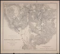
- Creator:
- Geological Survey of the Territories (U.S.)
- Published / Created:
- 1871
- Call Number:
- 80 1871
- Container / Volume:
- BRBL_00535
- Image Count:
- 1
- Resource Type:
- Maps, Atlases & Globes
- Found in:
- Beinecke Rare Book and Manuscript Library > Parts of Idaho, Montana and Wyoming territories / from surveys made under the direction of F.V. Hayden and other authorities ; compiled and drawn by E. Hergesheimer.
- Creator:
- Hergesheimer, E. (Edwin)
- Published / Created:
- [1872]
- Call Number:
- 833 Y38 1871B
- Container / Volume:
- BRBL_00584
- Image Count:
- 1
- Resource Type:
- Maps, Atlases & Globes
- Found in:
- Beinecke Rare Book and Manuscript Library > Yellowstone Lake, Wyoming Territory / surveyed by the party in charge of F.V. Hayden ; compiled and drawn by E. Hergesheimer from field notes and sketches of A. Schönborn & H.W. Elliott.
- Creator:
- United States Coast Survey
- Published / Created:
- [1875]
- Call Number:
- 764cea SA32 1875
- Container / Volume:
- BRBL_00461
- Image Count:
- 1
- Resource Type:
- Maps, Atlases & Globes
- Found in:
- Beinecke Rare Book and Manuscript Library > Salem harbor, Massachusetts / United States Coast Survey ; topography by F. Dankworth ; sand by H.M. Knight ; lettering by J. Knight & S.E. Stull ; views by G. McCoy.
- Creator:
- U.S. Lake Survey
- Published / Created:
- 1875
- Call Number:
- 7345cea 1875
- Container / Volume:
- BRBL_00381
- Image Count:
- 1
- Resource Type:
- Maps, Atlases & Globes
- Found in:
- Beinecke Rare Book and Manuscript Library > Saint Lawrence River chart no. 3 : projected from trigonometrical surveys / executed under the orders of Major C. B. Comstock, Corps of Engineers, Brvt. Brigadier Gen. U.S.A. in 1871, 1872 and 1873 ; Hydrography of Galop Rapids by Lieut. W.R. Livermore, U
- Creator:
- Geographical Surveys West of the 100th Meridian (U.S.)
- Published / Created:
- [1876]
- Call Number:
- 842 1876C
- Container / Volume:
- BRBL_00598
- Image Count:
- 1
- Resource Type:
- Maps, Atlases & Globes
- Found in:
- Beinecke Rare Book and Manuscript Library > Parts of eastern and southeastern Arizona, western and southwestern New Mexico, Parts of eastern and southeastern Arizona, western and southwestern New Mexico / U.S. Geographical Surveys West of the 100th Meridian.
- Creator:
- Wheeler, George M. (George Montague), 1842-1905
- Published / Created:
- 1876
- Call Number:
- 842 1876B
- Container / Volume:
- BRBL_00598
- Image Count:
- 1
- Resource Type:
- Maps, Atlases & Globes
- Found in:
- Beinecke Rare Book and Manuscript Library > U.S. geographical surveys west of the 100th meridian [cartographic material] : parts of eastern Arizona and western New Mexico, atlas sheet no. 76 / under the command of 1st. Lieut. Geo. M. Wheeler.
- Creator:
- Geographical Surveys West of the 100th Meridian (U.S.)
- Published / Created:
- 1876
- Call Number:
- 842 1876A
- Container / Volume:
- BRBL_00598
- Image Count:
- 1
- Resource Type:
- Maps, Atlases & Globes
- Found in:
- Beinecke Rare Book and Manuscript Library > Parts of Central and Western Arizona [cartographic material] : atlas sheet no. 75.
- Creator:
- Geographical Surveys West of the 100th Meridian (U.S.)
- Published / Created:
- [approximately 1876]
- Call Number:
- 834 1876C
- Container / Volume:
- BRBL_00587
- Image Count:
- 1
- Resource Type:
- Maps, Atlases & Globes
- Found in:
- Beinecke Rare Book and Manuscript Library > Southwestern Colorado [cartographic material] / U.S. Geographical Surveys West of the 100th Meridian.
- Creator:
- Roeser, C. (Charles)
- Published / Created:
- 1876
- Call Number:
- 842 1876
- Container / Volume:
- BRBL_00598
- Image Count:
- 1
- Resource Type:
- Maps, Atlases & Globes
- Found in:
- Beinecke Rare Book and Manuscript Library > Territory of Arizona / compiled from the official records of the General Land Office and other sources by C. Roeser, principal draughtsman, G.L.O.
- Creator:
- United States. General Land Office
- Published / Created:
- 1876
- Call Number:
- 833 1876
- Container / Volume:
- BRBL_00584
- Image Count:
- 1
- Resource Type:
- Maps, Atlases & Globes
- Found in:
- Beinecke Rare Book and Manuscript Library > Territory of Wyoming / compiled from the official records of the General Land Office and other sources by C. Roeser, Principal Draughtsman, G.L.O.
- Creator:
- United States. General Land Office
- Published / Created:
- 1876
- Call Number:
- 832 1876
- Container / Volume:
- BRBL_00582
- Image Count:
- 1
- Resource Type:
- Maps, Atlases & Globes
- Found in:
- Beinecke Rare Book and Manuscript Library > Territory of Idaho, 1876 / compiled from the official records of the General Land Office and other sources by C. Roeser, Principal Draughtsman, General Land Office.
- Creator:
- Gillespie, G. L
- Published / Created:
- 1876
- Call Number:
- 80 1876A
- Container / Volume:
- BRBL_00535
- Image Count:
- 1
- Resource Type:
- Maps, Atlases & Globes
- Found in:
- Beinecke Rare Book and Manuscript Library > Map of the Yellowstone and Missouri Rivers and their tributaries / explored by W.F. Raynolds and H.E. Maynadier, 1859-60 ; revised and enlarged by G.L. Gillespie ; engraved in the Office of the Chief of Engineers.
- Creator:
- U.S. Lake Survey
- Published / Created:
- 1876
- Call Number:
- 7345cea 1876B
- Container / Volume:
- BRBL_00381
- Image Count:
- 1
- Resource Type:
- Maps, Atlases & Globes
- Found in:
- Beinecke Rare Book and Manuscript Library > Saint Lawrence River chart no. 6 : projected from trigonometrical surveys / executed under the orders of Major C. B. Comstock, Corps of Engineers, Brvt. Brigadier Gen. U.S.A. in 1871, 1872 and 1873 ; Topography and hydrography by Assistant Engineers J.R.
- Creator:
- U.S. Lake Survey
- Published / Created:
- 1876
- Call Number:
- 7345cea 1876A
- Container / Volume:
- BRBL_00381
- Image Count:
- 1
- Resource Type:
- Maps, Atlases & Globes
- Found in:
- Beinecke Rare Book and Manuscript Library > Saint Lawrence River chart no. 5 : projected from trigonometrical surveys / executed under the orders of Major C. B. Comstock, Corps of Engineers, Brvt. Brigadier Gen. U.S.A. in 1871, 1872 and 1873 ; Topography and hydrography by Assistant Engineers A.C.
- Creator:
- U.S. Lake Survey
- Published / Created:
- 1876
- Call Number:
- 7345cea 1876
- Container / Volume:
- BRBL_00381
- Image Count:
- 1
- Resource Type:
- Maps, Atlases & Globes
- Found in:
- Beinecke Rare Book and Manuscript Library > Saint Lawrence River chart no. 4 : projected from trigonometrical surveys / executed under the orders of Major C. B. Comstock, Corps of Engineers, Brvt. Brigadier Gen. U.S.A. in 1871, 1872 and 1873 ; Topography and rest of hydrography by Assistants A.C. L
- Creator:
- Geological and Geographical Survey of the Territories (U.S.)
- Published / Created:
- [1877]
- Call Number:
- 833ca 1878AB
- Container / Volume:
- BRBL_00585
- Image Count:
- 1
- Resource Type:
- Maps, Atlases & Globes
- Found in:
- Beinecke Rare Book and Manuscript Library > Parts of western Wyoming, southeastern Idaho and northeastern Utah [cartographic material] / F.V. Hayden, U.S. geologist in charge ; Harry Gannett, M.E., topographical assistant ; Julius Bien, lith., New York.
- Creator:
- Geographical Surveys West of the 100th Meridian (U.S.)
- Published / Created:
- [1878]
- Call Number:
- 841 1878B
- Container / Volume:
- BRBL_00596
- Image Count:
- 1
- Resource Type:
- Maps, Atlases & Globes
- Found in:
- Beinecke Rare Book and Manuscript Library > U.S. geographical surveys west of the 100th meridian part of southern New Mexico, atlas sheet no. 84 (B) [cartographic material] / under the command of 1st. Lieut. Geo. M. Wheeler, Corps of Engineer, U.S. Army.
- Creator:
- Geographical Surveys West of the 100th Meridian (U.S.)
- Published / Created:
- [1878]
- Call Number:
- 834 1878
- Container / Volume:
- BRBL_00587
- Image Count:
- 1
- Resource Type:
- Maps, Atlases & Globes
- Found in:
- Beinecke Rare Book and Manuscript Library > Part of south western Colorado [cartographic material] / U.S. Geographical Surveys West of the 100th Meridian.
- Creator:
- Geographical Surveys West of the 100th Meridian (U.S.)
- Published / Created:
- [1878]
- Call Number:
- 832 1878
- Container / Volume:
- BRBL_00582
- Image Count:
- 1
- Resource Type:
- Maps, Atlases & Globes
- Found in:
- Beinecke Rare Book and Manuscript Library > Land classification map of part of South Eastern Idaho : atlas sheet no. 41(B) / U.S. Geographical Surveys West of the 100th Meridian.
- Creator:
- United States. General Land Office
- Published / Created:
- 1878
- Call Number:
- 815 1878
- Container / Volume:
- BRBL_00560
- Image Count:
- 1
- Resource Type:
- Maps, Atlases & Globes
- Found in:
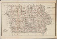
- Beinecke Rare Book and Manuscript Library > State of Iowa / Department of the Interior, General Land Office, J.A. Williamson, Commissioner ; compiled from the official records of the General Land Office and other sources by C. Roeser, Principal Draughtsman, G.L.O.
- Creator:
- United States. General Land Office
- Published / Created:
- 1878
- Call Number:
- 812 1878
- Container / Volume:
- BRBL_00555
- Image Count:
- 1
- Resource Type:
- Maps, Atlases & Globes
- Found in:
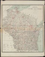
- Beinecke Rare Book and Manuscript Library > State of Wisconsin / Department of the Interior, General Land Office, J.A. Williamson, commissioner ; compiled from the official records of the General Land Office and other sources by C. Roeser, Principal Draughtsman, G.L.O.