Search
You Searched For
Search Results
- Published / Created:
- 1857
- Call Number:
- 75gme 1857
- Container / Volume:
- BRBL_00412
- Image Count:
- 2
- Resource Type:
- Maps, Atlases & Globes
- Found in:
- Beinecke Rare Book and Manuscript Library > A new and complete Rail Road map of the United States / compiled from reliable sources by William Perris ; presented by the Home Insurance Company of New York ; Korff Brothers, Practical Lithographers, New York.
- Published / Created:
- 1900
- Call Number:
- Za C591 W900M
- Image Count:
- 7
- Resource Type:
- Books, Journals & Pamphlets
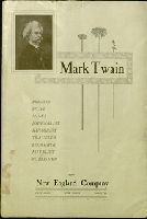
- Publisher:
- New England Company
- Found in:
- Beinecke Rare Book and Manuscript Library > Mark Twain, printer, pilot, miner, journalist, humorist, traveler, lecturer, novelist [and] publisher.
- Published / Created:
- 1776]
- Call Number:
- 766 1776
- Container / Volume:
- BRBL_00690
- Image Count:
- 1
- Resource Type:
- Maps, Atlases & Globes
- Found in:
- Beinecke Rare Book and Manuscript Library > A map of Connecticut and Rhode Island with Long Island Sound, &c.
- Published / Created:
- 1776]
- Call Number:
- 766 1776
- Container / Volume:
- BRBL_00690
- Image Count:
- 1
- Resource Type:
- Maps, Atlases & Globes
- Found in:
- Beinecke Rare Book and Manuscript Library > A map of Connecticut and Rhode Island with Long Island Sound, &c.
- Creator:
- Robert Sayer and John Bennett (Firm)
- Call Number:
- 755 1776K
- Container / Volume:
- BRBL_00430
- Image Count:
- 1
- Resource Type:
- Maps, Atlases & Globes
- Alternative Title:
- , Nova-Scotia, New-England, New-York, New
- Subject (Geographic):
- New England--Maps--Early works to 1800
- Found in:
- Beinecke Rare Book and Manuscript Library > A general map of the northern British colonies in America : which comprehends the province of Quebec, the government of Newfoundland, Nova-Scotia, New-England and New-York, from the maps published by the Admiralty and Board of Trade, regulated by the astr
- Published / Created:
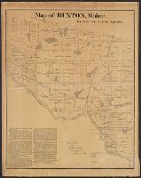
- 1871
- Call Number:
- 761 B98 1870
- Container / Volume:
- BRBL_00448
- Image Count:
- 1
- Resource Type:
- Maps, Atlases & Globes
- Publisher:
- New England Lith. Co. ,
- Found in:
- Beinecke Rare Book and Manuscript Library > Map of Buxton, Maine / by Daniel Dennet, 1870.
- Published / Created:
- [1774]
- Call Number:
- 76 1774
- Container / Volume:
- BRBL_00729
- Image Count:
- 1
- Resource Type:
- Maps, Atlases & Globes
- Abstract:
- Subject: Map of New England and Long
- Subject (Geographic):
- New England--Maps
- Found in:
- Beinecke Rare Book and Manuscript Library > A Map of the most inhabited part of New England [cartographic material] : containing the provinces of Massachusets Bay and New Hampshire with the colonies of Conecticut and Rhode Island divided into counties and townships : The whole composed from actual
- Published / Created:
- [1774]
- Call Number:
- 76 1774
- Container / Volume:
- BRBL_00729
- Image Count:
- 2
- Resource Type:
- Maps, Atlases & Globes
- Abstract:
- Subject: Map of New England and Long
- Subject (Geographic):
- New England--Maps
- Found in:
- Beinecke Rare Book and Manuscript Library > A Map of the most inhabited part of New England [cartographic material] : containing the provinces of Massachusets Bay and New Hampshire with the colonies of Conecticut and Rhode Island divided into counties and townships : The whole composed from actual
- Published / Created:
- [1774]
- Call Number:
- 76 1774
- Container / Volume:
- BRBL_00443
- Image Count:
- 2
- Resource Type:
- Maps, Atlases & Globes
- Abstract:
- Subject: Map of New England and Long
- Subject (Geographic):
- New England--Maps
- Found in:
- Beinecke Rare Book and Manuscript Library > A Map of the most inhabited part of New England [cartographic material] : containing the provinces of Massachusets Bay and New Hampshire with the colonies of Conecticut and Rhode Island divided into counties and townships : The whole composed from actual
- Creator:
- From the Collection: Dreier, Katherine S. (Katherine Sophie), 1877-1952
- Published / Created:
- undated
- Call Number:
- YCAL MSS 101
- Container / Volume:
- Box 70, folder 1808
- Image Count:
- 20
- Found in:
- Beinecke Rare Book and Manuscript Library > Katherine S. Dreier papers / Société Anonyme archive (YCAL MSS 101) > Series V: Katherine S. Dreier: Photographs & Artwork > > PHOTOGRAPHS > Katherine S. Dreier > Haven (West Redding, Conn.) > Main entrance, front view (2 prints taped together); From main entrance looking toward Long Ridge Methodist Episcopal Church (West Redding, Conn.); From main entrance looking toward garden; Trellises in garden; Fountain in garden; Pond in garden; Stone wall in garden; Brancusi's "Leda" in garden; West porch; West porch and old section of house
- Creator:
- Kitchin, Thomas, d. 1784
- Published / Created:
- 1778
- Call Number:
- 76 1778
- Container / Volume:
- BRBL_00690
- Image Count:
- 2
- Resource Type:
- Maps, Atlases & Globes
- Subject (Geographic):
- New England--Maps--Early works to 1800
- Found in:
- Beinecke Rare Book and Manuscript Library > A map of the colony of Rhode Island [cartographic material] : with the adjacent parts of Connecticut, Massachusetts Bay, & c / by Thos. Kitchin Senr., Hydrographer to His Majesty.
- Creator:
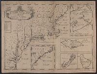
- Bowen, Emanuel, d. 1767
- Published / Created:
- 1754
- Call Number:
- 75 1720
- Container / Volume:
- BRBL_00689
- Image Count:
- 1
- Resource Type:
- Maps, Atlases & Globes
- Found in:
- Beinecke Rare Book and Manuscript Library > A map of the British American plantations [cartographic material] : extending from Boston in New England to Georgia, including all the back settlements in the respective provinces, as far as the Mississippi / by Eman. Bowen Geogr. to His Majesty ; Tho. Bo
- Published / Created:
- ca. 1747?]
- Call Number:
- 771 1760
- Container / Volume:
- BRBL_00690
- Image Count:
- 1
- Resource Type:
- Maps, Atlases & Globes
- Found in:
- Beinecke Rare Book and Manuscript Library > Map of Hudson's River, with the adjacent country [cartographic material].
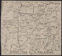
- Published / Created:
- 1917
- Call Number:
- 762gmb 1917
- Container / Volume:
- BRBL_00451
- Image Count:
- 1
- Resource Type:
- Maps, Atlases & Globes
- Description:
- Inset: Key map of New England showing
- Found in:
- Beinecke Rare Book and Manuscript Library > Through trails in the White Mountains : maintained by the organizations comprising the New England Trail Conference.
- Creator:
- From the Collection: Dunbar, Rudolph, 1899-1988
- Published / Created:
- 1978
- Call Number:
- JWJ MSS 174
- Container / Volume:
- Box 2, folder 48
- Image Count:
- 6
- Found in:
- Beinecke Rare Book and Manuscript Library > Rudolph Dunbar Papers (JWJ MSS 174) > Series II: Professional Papers > Periodical New England
- Creator:
- Wells, Edward, 1667-1727
- Published / Created:
- 1722?]
- Call Number:
- 755 1722
- Container / Volume:
- BRBL_00425
- Image Count:
- 1
- Resource Type:
- Maps, Atlases & Globes
- Found in:
- Beinecke Rare Book and Manuscript Library > A new map of the most considerable plantations of the English in America : dedicated to His Highness William Duke of Glocester / Sutton Nichols sculp.
- Creator:
- Ely, William Watson
- Published / Created:
- 1878
- Call Number:
- 771 Ad47 1878
- Container / Volume:
- BRBL_00480
- Image Count:
- 1
- Resource Type:
- Maps, Atlases & Globes
- Description:
- Inset map of New York State and New
- Subject (Geographic):
- New England--Maps
- Found in:
- Beinecke Rare Book and Manuscript Library > Map of the New York Wilderness and the Adirondacks.
- Creator:
- Overton, Henry, 1675 or 6-1751
- Published / Created:
- [1755?]
- Call Number:
- 755 1756F
- Container / Volume:
- BRBL_00428
- Image Count:
- 1
- Resource Type:
- Maps, Atlases & Globes
- Found in:
- Beinecke Rare Book and Manuscript Library > An accurate map of the British colonies in North America bordering on the river Ohio.
- Creator:
- Thornton, John, fl. 1652-1701
- Published / Created:
- [1673?]
- Call Number:
- 755 1682B
- Container / Volume:
- BRBL_00424
- Image Count:
- 1
- Resource Type:
- Maps, Atlases & Globes
- Alternative Title:
- , New-York & New England
- Description:
- Inset: "A mapp of New England".
- Subject (Geographic):
- New England--Maps--Early works to 1800
- Found in:
- Beinecke Rare Book and Manuscript Library > A mapp of Virginia, Mary-land, New-Jarsey, New-York, & New England.