Skip to search
Skip to main content
Skip to first result
Search
You Searched For
Extent of Digitization
Unspecified
Genre
Maps
New Search
Search Results
Creator:
Call Number:
A52 030 1
Collection Title:
Ancient monuments of the Mississippi Valley: comprising the results of extensive original surveys
Image Count:
1
Found in:
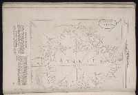
Beinecke Rare Book and Manuscript Library > "The serpent;" (Entry 1014) Adams County Ohio. Pl. XXXV [35]
Published / Created:
undated
Call Number:
WA MSS S-2962
Collection Title:
Northern Pacific Railway Company maps and drawings
Container / Volume:
Box 1 | Map 11
Image Count:
1
Resource Type:
Maps, Atlases & Globes
Found in:
Beinecke Rare Book and Manuscript Library > (IDAHO & WASHINGTON) [Anon.] [Untitled map of northwestern Idaho and northeastern Washington].
Creator:
Published / Created:
1890
Call Number:
WA MSS S-2962
Collection Title:
Northern Pacific Railway Company maps and drawings
Container / Volume:
Box 1 | Map 10
Image Count:
2
Resource Type:
Maps, Atlases & Globes
Found in:
Beinecke Rare Book and Manuscript Library > (IDAHO) Kendrick, J. W., Surveyor. Map Showing Definite Location of the Spokane & Palouse Ry. (Lewiston Extension). From Julietta to Lewiston Idaho Territory. Distance 24-1/lO Miles. Drawn by J. M. Gibboney. Assistant Engineer's Office, Tacoma, Washington. Scale 1 in.=2000 ft.
Published / Created:
undated
Call Number:
WA MSS S-2962
Collection Title:
Northern Pacific Railway Company maps and drawings
Container / Volume:
3 (Roll) | Map 24
Image Count:
1
Resource Type:
Maps, Atlases & Globes
Found in:
Beinecke Rare Book and Manuscript Library > (MONTANA & IDAHO) [Anon.] [Untitled map of far northwestern Montana and a part of the Idaho panhandle.]
Creator:
Published / Created:
1891 April 6
Call Number:
WA MSS S-2962
Collection Title:
Northern Pacific Railway Company maps and drawings
Container / Volume:
Box 1 | Map 34
Image Count:
1
Resource Type:
Maps, Atlases & Globes
Found in:
Beinecke Rare Book and Manuscript Library > (MONTANA) Bischoff, A. Map of North- West part of Montana...Great Northern Line St. Paul, Minneapolis & Manitoba Ry. Pacific Extension. Elbridge H. Beckler, Chief Engineer. Helena, Mont. Scale 1 in.= 2 miles.
Creator:
Published / Created:
1887 August
Call Number:
WA MSS S-2962
Collection Title:
Northern Pacific Railway Company maps and drawings
Container / Volume:
Box 1 | Map 33
Image Count:
2
Resource Type:
Maps, Atlases & Globes
Found in:
Beinecke Rare Book and Manuscript Library > (MONTANA) Roberts, E. J. Montana Extension. The Saint Paul, Minneapolis and Manitoba Ry. Co. Scale 12 miles to 1 inch.
Published / Created:
1886
Call Number:
WA MSS S-2962
Collection Title:
Northern Pacific Railway Company maps and drawings
Container / Volume:
Box 1 | Map 31
Image Count:
1
Resource Type:
Maps, Atlases & Globes
Found in:
Beinecke Rare Book and Manuscript Library > (MONTANA) [Anon.] Map of a Portion of Montana Territory.
Published / Created:
undated
Call Number:
WA MSS S-2962
Collection Title:
Northern Pacific Railway Company maps and drawings
Container / Volume:
Box 1 | Map 36
Image Count:
1
Resource Type:
Maps, Atlases & Globes
Found in:
Beinecke Rare Book and Manuscript Library > (MONTANA) [Anon.] [Untitled map of a part of north central Montana.]
Published / Created:
1891 September 10
Call Number:
WA MSS S-2962
Collection Title:
Northern Pacific Railway Company maps and drawings
Container / Volume:
Box 1 | Map 40
Image Count:
1
Resource Type:
Maps, Atlases & Globes
Found in:
Beinecke Rare Book and Manuscript Library > (WASHINGTON) [Anon.] Sketch of Country North of Spokane Wash. Helena Mont.
Creator:
Published / Created:
1810
Call Number:
GA405 +W44 (LC)
Collection Title:
Mapping the transmississippi West, 1540-1861
Image Count:
1
Found in:
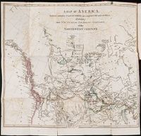
Beinecke Rare Book and Manuscript Library > A Chart of the Internal Part of Louisiana, Including all the hitherto unexplored Countries, lying between the River La Platte of the Missouri on the N: and the Red River on the S: the Mississippi East and the Mountains of Mexico West; with a Part of New M
Creator:
Published / Created:
1796?
Call Number:
1978 Folio 150
Collection Title:
Carey's General atlas : containing: 1. Map of the world ... 45. Captain Cook's discoveries
Image Count:
1
Found in:
Beinecke Rare Book and Manuscript Library > A Chart of the World, according to Mercators Projection, shewing the latest Discoveries of Capt. Cook
Creator:
Published / Created:
1794 July 26
Call Number:
1986 102
Collection Title:
An historical, geographical, commercial, and philosophical view of the American United States, and
Image Count:
1
Found in:
Beinecke Rare Book and Manuscript Library > A General map of North America drawn from the best sources
Creator:
Call Number:
Vanderbilt 147
Collection Title:
An historical account of the expedition against the Ohio Indians, in the year 1764. Under the
Image Count:
1
Found in:
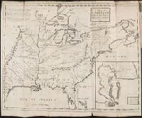
Beinecke Rare Book and Manuscript Library > A General map of the country on the Ohio and Mushkingham shewing the situation of the Indian-towns with respect to the army under the command of Colonel Bouquet by Thos. Hutchins. Asst. Engineer
Published / Created:
1776
Call Number:
Cb23 27
Collection Title:
The American military pocket atlas : being an approved collection of correct maps, both general and
Image Count:
1
Found in:
Beinecke Rare Book and Manuscript Library > A General map of the northern British colonies in America. which comprehends the province of Quebec, the government of Newfoundland, Nova-Scotia, New-England and New-York. From the maps published by the Admiralty and Board of Trade regulated by the astronomic and trigonometric observations of M. von Holland and corrected from Governor Pownall's late map 1776.
Creator:
Published / Created:
1776
Call Number:
Cb23 27
Collection Title:
The American military pocket atlas : being an approved collection of correct maps, both general and
Image Count:
1
Found in:
Beinecke Rare Book and Manuscript Library > A General map of the southern British colonies, in America, comprehending North and South Carolina, Georgia, east and west Florida, with the neighbouring Indian countries. From the modern surveys of engineer de Brahm, Capt. Collet, Mouzon & others; and from the large hydrographical survey of the coasts of east and west Florida
Creator:
Published / Created:
April 1, 1824 [i.e. 1825?]
Call Number:
1977 Folio 65
Collection Title:
A general atlas of modern geography, consisting of a complete collection of the most approved maps ...
Image Count:
1
Found in:
Beinecke Rare Book and Manuscript Library > A Map of Bengal, Bahar, Oude & Allahabad with Part of Agra and Delhi exhibiting the Course of the Ganges from Hurdwar to the Sea
Creator:
Published / Created:
1822
Call Number:
2003 Folio 81
Collection Title:
The New American Atlas ...
Container / Volume:
No. IV [4]
Image Count:
1
Found in:
Beinecke Rare Book and Manuscript Library > A Map of North America, Constructed According to the Latest Information by H. S. Tanner
Published / Created:
1783
Call Number:
Cb21 35B
Collection Title:
History of the war with America, France, Spain, and Holland; commencing in 1775 and ending in 1783
Image Count:
1
Found in:
Beinecke Rare Book and Manuscript Library > A Map of the United States of America, as settled by the peace of 1783
Call Number:
Zd 147
Collection Title:
The history of the Five Indian nations of Canada : which are dependent on the province of New-York
Image Count:
1
Found in:
Beinecke Rare Book and Manuscript Library > A Map of the country of the Five Nations, belonging to the province of New York; and of the lakes near which the nations of far Indians live, with part of Canada
Creator:
Call Number:
1998 2141
Collection Title:
Der ausfuehrlichen nachrichten von der koeniglich-gross-britannischen colonie saltzburgischer
Image Count:
1
Found in:
Beinecke Rare Book and Manuscript Library > A Map of the county of Savannah
Call Number:
Egf 789
Collection Title:
The American geography; or, A view of the present situation of the United States of America
Image Count:
1
Found in:
Beinecke Rare Book and Manuscript Library > A Map of the northern and middle states; comprehending the western Territory and the British dominions in North America. Compiled from the best authorities
Creator:
Published / Created:
1788
Call Number:
Egf 789
Collection Title:
The American geography; or, A view of the present situation of the United States of America
Image Count:
1
Found in:
Beinecke Rare Book and Manuscript Library > A Map of the states of Virginia, North Carolina South Carolina and Georgia comprehending the Spanish provinces of east and west Florida exhibiting the boundaries as fixed by the late Treaty of Peace between the United States and the Spanish dominions comp
Call Number:
Taylor 376
Collection Title:
The discoveries of John Lederer : in three several marches from Virginia, to the west of Carolina
Image Count:
1
Found in:
Beinecke Rare Book and Manuscript Library > A Map of the whole territory traversed by John Lederer in his three marches
Call Number:
CE143 A28
Collection Title:
An account of the Spanish settlements in America. In four parts ... To which is annexed, a succinct
Image Count:
1
Found in:
Beinecke Rare Book and Manuscript Library > A New general map of America drawn from several accurate particular maps and charts and regulated by astronomical observations
Published / Created:
[1823?]
Call Number:
1978 Folio 104
Collection Title:
A new and elegant imperial atlas: comprehending general and particular maps of every part of the
Image Count:
1
Found in:
Beinecke Rare Book and Manuscript Library > A New general map of the East Indies, exhibiting in the Peninsula on this side of the Ganges or Hindoostan, the several partitions of the Mogul's Empire ...
Published / Created:
1784]
Call Number:
784.00.00.78+
Image Count:
1
Found in:
Lewis Walpole Library > A Representation, of the sea fight, on the 5th of Sepr. 1781, between Rear Admiral Graves and the Count de Grasse
Creator:
Published / Created:
1776
Call Number:
Cb23 27
Collection Title:
The American military pocket atlas : being an approved collection of correct maps, both general and
Image Count:
1
Found in:
Beinecke Rare Book and Manuscript Library > A Survey of Lake Champlain, including Lake George, Crown Point and St. John. Surveyed by order of His Excellency Major General Sr. Jeffery Amherst, knight of the most honble. Order of the Bath, Commander in Chief of His Majesty's forces in North America (now Lord Amherst) by William Brassier, draughtsman, 1762
Creator:
Published / Created:
1766. NB. With a book of directions
Call Number:
2003 Folio 85
Image Count:
1
Found in:
Beinecke Rare Book and Manuscript Library > A chart of part of the south coast of Newfoundland: including the islands St. Peters and Miquelon : from an actual survey taken by order of Commodore Pallisser, Governor of Newfoundland, Labrador, &c
Creator:
Published / Created:
1784 March 1
Call Number:
1982 Folio 10
Image Count:
1
Found in:
Beinecke Rare Book and Manuscript Library > A chart of the Antilles, or, Charibbee, or, Caribs Islands, with the Virgin Isles
Creator:
Published / Created:
1780 June 17
Call Number:
1982 Folio 10
Image Count:
1
Found in:
Beinecke Rare Book and Manuscript Library > A chart of the British Channel and the Bay of Biscay with a part of the North Sea, and the entrance of St. George's Channel
Call Number:
1978 Folio 10
Collection Title:
The English pilot: describing the West-India navigation, from Hudson's-Bay to the river Amazones
Image Count:
2
Found in:
Beinecke Rare Book and Manuscript Library > A chart of the Caribe Islands
Call Number:
1973 Folio 76
Collection Title:
The English pilot: describing the sea-coasts, capes, head-lands, rivers, bays, roads, havens
Image Count:
1
Found in:
Beinecke Rare Book and Manuscript Library > A chart of the Caribe ilands
Call Number:
1976 1233
Collection Title:
Forty-two new maps of Asia, Africa, and America ... : all engrav’d, according to the latest
Image Count:
1
Found in:
Beinecke Rare Book and Manuscript Library > A chart of the South Sea coast from the Steights [sic] of Magellan to Arica
Creator:
Published / Created:
1766
Call Number:
2003 Folio 85
Image Count:
1
Found in:
Beinecke Rare Book and Manuscript Library > A chart of the Straights of Bellisle: with part of the coast of Newfoundland and Labradore from actual surveys. Taken by order of Commodore Pallisser, Governor of Newfoundland, Labrador, &ca
Call Number:
1976 1233
Collection Title:
Forty-two new maps of Asia, Africa, and America ... : all engrav’d, according to the latest
Image Count:
1
Found in:
Beinecke Rare Book and Manuscript Library > A chart of the Streights of Magellan
Creator:
Call Number:
1973 Folio 116
Collection Title:
The English pilot: describing the West-India navigation, from Hudson's-Bay to the river Amazones
Image Count:
1
Found in:
Beinecke Rare Book and Manuscript Library > A chart of the coast of Guayana, from the entrance of the River Orinoco ...
Call Number:
1976 1233
Collection Title:
Forty-two new maps of Asia, Africa, and America ... : all engrav’d, according to the latest
Image Count:
1
Found in:
Beinecke Rare Book and Manuscript Library > A chart of the coasts of Peru, Quito, Popayan and the isthmus of Darien
Creator:
Published / Created:
1780 June 28
Call Number:
1982 Folio 10
Image Count:
1
Found in:
Beinecke Rare Book and Manuscript Library > A chart of the coasts of Spain and Portugal, with the Balearic Islands, and part of the coast of Barbary
Call Number:
1973 Folio 76
Collection Title:
The English pilot: describing the sea-coasts, capes, head-lands, rivers, bays, roads, havens
Image Count:
1
Found in:
Beinecke Rare Book and Manuscript Library > A chart of the iland of Hispaniola
Call Number:
1978 Folio 10
Collection Title:
The English pilot: describing the West-India navigation, from Hudson's-Bay to the river Amazones
Image Count:
1
Found in:
Beinecke Rare Book and Manuscript Library > A chart of the island of Hispaniola
Creator:
Published / Created:
1781 January 1
Call Number:
1982 Folio 10
Image Count:
1
Found in:
Beinecke Rare Book and Manuscript Library > A chart of the islands of Jersey and Guernsey, Sark, Herm and Alderney, with the adjacent coast of France
Call Number:
1978 Folio 10
Collection Title:
The English pilot: describing the West-India navigation, from Hudson's-Bay to the river Amazones
Image Count:
1
Found in:
Beinecke Rare Book and Manuscript Library > A chart of the sea coast of New Found Land, New Scotland, New England, New York, New Jersey, with Virginia and Maryland
Call Number:
1973 Folio 116
Collection Title:
The English pilot: describing the West-India navigation, from Hudson's-Bay to the river Amazones
Image Count:
1
Found in:
Beinecke Rare Book and Manuscript Library > A chart of the sea coast of Newfoundland, New Scotland, New England, New York, New Jersey, with Virginia and Maryland
Call Number:
1974 Folio 72
Collection Title:
The English pilot: describing the West-India navigation, from Hudson's-Bay to the river Amazones
Image Count:
1
Found in:
Beinecke Rare Book and Manuscript Library > A chart of the sea coast of Newfoundland, New Scotland, New England, New York, New Jersey, with Virginia and Maryland
Creator:
Call Number:
1973 Folio 76
Collection Title:
The English pilot: describing the sea-coasts, capes, head-lands, rivers, bays, roads, havens
Image Count:
1
Found in:
Beinecke Rare Book and Manuscript Library > A chart of ye iland of New Found Land
Creator:
Call Number:
1973 Folio 76
Collection Title:
The English pilot: describing the sea-coasts, capes, head-lands, rivers, bays, roads, havens
Image Count:
1
Found in:
Beinecke Rare Book and Manuscript Library > A chart of ye north part of America
Creator:
Call Number:
1973 Folio 116
Collection Title:
The English pilot: describing the West-India navigation, from Hudson's-Bay to the river Amazones
Image Count:
1
Found in:
Beinecke Rare Book and Manuscript Library > A chart shewing part of the sea coast of New Foundland from ye Bay of Bulls to little Plecentia ...
Published / Created:
1715
Call Number:
1978 Folio 10
Collection Title:
The English pilot: describing the West-India navigation, from Hudson's-Bay to the river Amazones
Image Count:
1
Found in:
Beinecke Rare Book and Manuscript Library > A chart shewing part of the sea coast of New Foundland from ye Bay of Bulls to little Plecentia ...
Creator:
Call Number:
1974 Folio 72
Collection Title:
The English pilot: describing the West-India navigation, from Hudson's-Bay to the river Amazones
Image Count:
1
Found in:
Beinecke Rare Book and Manuscript Library > A chart shewing part of the sea coast of New Foundland from ye Bay of Bulls to little Plecentia ...
Published / Created:
MDCI [1601]
Call Number:
Taylor 193 3
Collection Title:
Tertia pars Indiae Orientalis ... / de Germanico in Latinum translata, & bono ordine disposita a
Image Count:
1
Found in:
Beinecke Rare Book and Manuscript Library > A cidade de Angra na ilhade ...
Call Number:
1973 Folio 116
Collection Title:
The English pilot: describing the West-India navigation, from Hudson's-Bay to the river Amazones
Image Count:
1
Found in:
Beinecke Rare Book and Manuscript Library > A correct chart of Hispaniola with the Windward Passage
Call Number:
1974 Folio 72
Collection Title:
The English pilot: describing the West-India navigation, from Hudson's-Bay to the river Amazones
Image Count:
1
Found in:
Beinecke Rare Book and Manuscript Library > A correct chart of Hispaniola with the Windward Passage
Call Number:
1973 Folio 116
Collection Title:
The English pilot: describing the West-India navigation, from Hudson's-Bay to the river Amazones
Image Count:
1
Found in:
Beinecke Rare Book and Manuscript Library > A correct chart of the Caribbee Islands
Call Number:
1974 Folio 72
Collection Title:
The English pilot: describing the West-India navigation, from Hudson's-Bay to the river Amazones
Image Count:
1
Found in:
Beinecke Rare Book and Manuscript Library > A correct chart of the Caribbee Islands
Call Number:
1973 Folio 116
Collection Title:
The English pilot: describing the West-India navigation, from Hudson's-Bay to the river Amazones
Image Count:
1
Found in:
Beinecke Rare Book and Manuscript Library > A correct map of the coast of New England
Call Number:
1974 Folio 72
Collection Title:
The English pilot: describing the West-India navigation, from Hudson's-Bay to the river Amazones
Image Count:
1
Found in:
Beinecke Rare Book and Manuscript Library > A correct map of the coast of New England
Creator:
Published / Created:
[1768]
Call Number:
2003 Folio 85
Image Count:
1
Found in:
Beinecke Rare Book and Manuscript Library > A correct plan of the environs of Quebec, and of the battle fought on the 13th September, 1759: together with a particular detail of the French lines and batteries, and also of the encampments, batteries and attacks of the British army, and the investitur
Creator:
Published / Created:
1624
Call Number:
Pequot +Sm4
Collection Title:
The generall historie of Virginia, New-England, and the Summer Isles : with the names of the
Image Count:
1
Found in:
Beinecke Rare Book and Manuscript Library > A description of part of the adventures of Cap. Smith in Virginia
Creator:
Published / Created:
1624
Call Number:
2003 +39
Collection Title:
The generall historie of Virginia, New-England, and the Summer Iles ...
Image Count:
1
Found in:
Beinecke Rare Book and Manuscript Library > A description of part of the adventures of Cap. Smith in Virginia
Call Number:
1973 Folio 116
Collection Title:
The English pilot: describing the West-India navigation, from Hudson's-Bay to the river Amazones
Image Count:
1
Found in:
Beinecke Rare Book and Manuscript Library > A description of the ports and islands upon the coast between the Amazones and Cape Florida
Call Number:
1978 Folio 10
Collection Title:
The English pilot: describing the West-India navigation, from Hudson's-Bay to the river Amazones
Image Count:
1
Found in:
Beinecke Rare Book and Manuscript Library > A description of the ports and islands upon the coast between the Amazons and Cape Florida
Call Number:
1974 Folio 72
Collection Title:
The English pilot: describing the West-India navigation, from Hudson's-Bay to the river Amazones
Image Count:
1
Found in:
Beinecke Rare Book and Manuscript Library > A description of the ports and islands upon the coast between the Amazons and Cape Florida
Published / Created:
[1598?]
Call Number:
Taylor 216A
Collection Title:
John Huighen van Linschoten, his Discours of Voyages into ye Easte & West Indies
Image Count:
1
Found in:
Beinecke Rare Book and Manuscript Library > A discripsion of Aegipt from Cair downeward
Creator:
Call Number:
1973 Folio 116
Collection Title:
The English pilot: describing the West-India navigation, from Hudson's-Bay to the river Amazones
Image Count:
1
Found in:
Beinecke Rare Book and Manuscript Library > A draught of New York from the Hook to New Yorktown
Creator:
Call Number:
1974 Folio 72
Collection Title:
The English pilot: describing the West-India navigation, from Hudson's-Bay to the river Amazones
Image Count:
1
Found in:
Beinecke Rare Book and Manuscript Library > A draught of New York from the Hook to New Yorktown
Creator:
Published / Created:
Decr. 1766
Call Number:
2003 Folio 85
Image Count:
1
Found in:
Beinecke Rare Book and Manuscript Library > A draught of Port Royal Harbour in South Carolina: with the marks for going in : most humbly inscribed to the publick
Creator:
Call Number:
1973 Folio 116
Collection Title:
The English pilot: describing the West-India navigation, from Hudson's-Bay to the river Amazones
Image Count:
2
Found in:
Beinecke Rare Book and Manuscript Library > A draught of Virginia from the capes to York in York River and to Kuiquotan or Hamton in James River
Creator:
Call Number:
1974 Folio 72
Collection Title:
The English pilot: describing the West-India navigation, from Hudson's-Bay to the river Amazones
Image Count:
1
Found in:
Beinecke Rare Book and Manuscript Library > A draught of Virginia from the capes to York in York River and to Kuiquotan or Hamton in James River
Call Number:
1978 Folio 10
Collection Title:
The English pilot: describing the West-India navigation, from Hudson's-Bay to the river Amazones
Image Count:
1
Found in:
Beinecke Rare Book and Manuscript Library > A draught of the coast of Guiana from the river Oronoque to the river Amazones
Call Number:
1974 Folio 72
Collection Title:
The English pilot: describing the West-India navigation, from Hudson's-Bay to the river Amazones
Image Count:
1
Found in:
Beinecke Rare Book and Manuscript Library > A draught of the coast of Guiana from the river Oronoque to the river Amazones
Creator:
Published / Created:
Decem'r. 1766
Call Number:
2003 Folio 85
Image Count:
1
Found in:
Beinecke Rare Book and Manuscript Library > A draught of the harbour of Halifax and the adjacent coast in Nova Scotia: surveyed by order of Commodore Spry
Call Number:
1973 Folio 116
Collection Title:
The English pilot: describing the West-India navigation, from Hudson's-Bay to the river Amazones
Image Count:
1
Found in:
Beinecke Rare Book and Manuscript Library > A draught of the island of Beata, on the south side of Hispaniola
Creator:
Published / Created:
December 1766
Call Number:
2003 Folio 85
Image Count:
1
Found in:
Beinecke Rare Book and Manuscript Library > A draught of west Florida : with part of the river Mississippi
Creator:
Published / Created:
1785
Call Number:
1977 Folio 177
Image Count:
2
Resource Type:
Maps, Atlases & Globes
Found in:
Beinecke Rare Book and Manuscript Library > A general chart exhibiting the discoveries made by Captn. James Cook in this and his two preceeding voyages with the tracks of the ships under his command / by Lieutt. Roberts of His Majesty's Royal Navy ; Jn. Lodge sc.
Call Number:
1973 Folio 116
Collection Title:
The English pilot: describing the West-India navigation, from Hudson's-Bay to the river Amazones
Image Count:
1
Found in:
Beinecke Rare Book and Manuscript Library > A general chart of the western ocean
Creator:
Published / Created:
1755
Call Number:
391 +1755h
Collection Title:
Geographical, historical, political, philosophical and mechanical essays : the first, containing an
Image Count:
1
Resource Type:
Maps, Atlases & Globes
Found in:
Beinecke Rare Book and Manuscript Library > A general map of the middle British colonies in America
Creator:
Published / Created:
1771
Call Number:
Franklin 391 1755e
Collection Title:
Geographical, historical, political, philosophical and mechanical essays : the first, containing an
Image Count:
1
Found in:
Beinecke Rare Book and Manuscript Library > A general map of the middle British colonies in America
Published / Created:
1776
Call Number:
Cb23 27
Collection Title:
The American military pocket atlas : being an approved collection of correct maps, both general and
Image Count:
1
Found in:
Beinecke Rare Book and Manuscript Library > A general map of the middle British colonies in America. Containing Virginia, Maryland, the Delaware counties, Pennsylvania and New Jersey. With the addition of New York, and of the greatest part of New England, as also of the bordering parts of the province of Quebec, improved from several surveys made after the late war, and corrected from Governor Pownall's late map 1776.
Creator:
Published / Created:
1758
Call Number:
2003 Folio 85
Image Count:
1
Found in:
Beinecke Rare Book and Manuscript Library > A general map of the middle British colonies in America: viz. Virginia, Maryland, Delaware, Pensilvania, New-Jersey, New-York, Connecticut and Rhode-Island : of Aquanishuonigy the country of the confederate Indians comprehending Aquanishuonigy proper, the
Creator:
Call Number:
1973 Folio 76
Collection Title:
The English pilot: describing the sea-coasts, capes, head-lands, rivers, bays, roads, havens
Image Count:
1
Found in:
Beinecke Rare Book and Manuscript Library > A generall chart of the West Indies
Call Number:
1978 Folio 10
Collection Title:
The English pilot: describing the West-India navigation, from Hudson's-Bay to the river Amazones
Image Count:
1
Found in:
Beinecke Rare Book and Manuscript Library > A generall chart of the western ocean
Call Number:
1974 Folio 72
Collection Title:
The English pilot: describing the West-India navigation, from Hudson's-Bay to the river Amazones
Image Count:
2
Found in:
Beinecke Rare Book and Manuscript Library > A generall chart of the western ocean
Creator:
Published / Created:
1595
Call Number:
Z3 017
Collection Title:
John Huighen van Linschoten, his Discours of Voyages into ye Easte & West Indies
Image Count:
1
Found in:
Beinecke Rare Book and Manuscript Library > A ilha e cidade de Goa metropolitana da India e partes orientais que esta en 15 graos da Banda do Norte
Published / Created:
MDCI [1601]
Call Number:
Taylor 193 3
Collection Title:
Tertia pars Indiae Orientalis ... / de Germanico in Latinum translata, & bono ordine disposita a
Image Count:
1
Found in:
Beinecke Rare Book and Manuscript Library > A ilhae cidade de Goa metropolitana da Indiae partes orientais ...
Call Number:
1973 Folio 116
Collection Title:
The English pilot: describing the West-India navigation, from Hudson's-Bay to the river Amazones
Image Count:
1
Found in:
Beinecke Rare Book and Manuscript Library > A large draft of South Carolina from Cape Roman to Port Royall
Call Number:
1974 Folio 72
Collection Title:
The English pilot: describing the West-India navigation, from Hudson's-Bay to the river Amazones
Image Count:
1
Found in:
Beinecke Rare Book and Manuscript Library > A large draft of South Carolina from Cape Roman to Port Royall
Call Number:
1973 Folio 116
Collection Title:
The English pilot: describing the West-India navigation, from Hudson's-Bay to the river Amazones
Image Count:
1
Found in:
Beinecke Rare Book and Manuscript Library > A large draft of the island Antegua
Call Number:
1978 Folio 10
Collection Title:
The English pilot: describing the West-India navigation, from Hudson's-Bay to the river Amazones
Image Count:
1
Found in:
Beinecke Rare Book and Manuscript Library > A large draft of the island Antegua
Call Number:
1974 Folio 72
Collection Title:
The English pilot: describing the West-India navigation, from Hudson's-Bay to the river Amazones
Image Count:
1
Found in:
Beinecke Rare Book and Manuscript Library > A large draft of the island of Antegua
Call Number:
1978 Folio 10
Collection Title:
The English pilot: describing the West-India navigation, from Hudson's-Bay to the river Amazones
Image Count:
1
Found in:
Beinecke Rare Book and Manuscript Library > A large draught of New England, New York, and Long Island
Call Number:
1976 1233
Collection Title:
Forty-two new maps of Asia, Africa, and America ... : all engrav’d, according to the latest
Image Count:
1
Found in:
Beinecke Rare Book and Manuscript Library > A map of America according to ye newest and most exact observations
Published / Created:
1801
Call Number:
Zc90 801mab
Collection Title:
Voyages from Montreal, on the river St. Laurence, through the continent of North America, to the
Image Count:
1
Found in:
Beinecke Rare Book and Manuscript Library > A map of America, between latitudes 40 and 70 north and longitudes 45 and 180 west, exhibiting Mackenzie's track from Montreal to Fort Chipewyan & from thence to the North Sea In 1789 & to the West Pacific Ocean in 1793
Call Number:
Zc91 M32 817maa
Collection Title:
Notice respecting the boundary between His Majesty's possessions in North America and the United
Image Count:
1
Found in:
Beinecke Rare Book and Manuscript Library > A map of America, between latitudes 40 and 70 north, and longitudes 80 and 150 west, exhibiting the principal trading stations of the Northwest Company
Creator:
Published / Created:
1786 January 1
Call Number:
1982 Folio 10
Image Count:
1
Found in:
Beinecke Rare Book and Manuscript Library > A map of Bengal, Bahar, Oude & Allahabad with part of Agra and Delhi : exhibiting the course of the Ganges from Hurdwar to the sea
Call Number:
1976 1233
Collection Title:
Forty-two new maps of Asia, Africa, and America ... : all engrav’d, according to the latest
Image Count:
1
Found in:
Beinecke Rare Book and Manuscript Library > A map of Brasil and part of La Plata &c
Call Number:
Egi M6 722
Collection Title:
A description of the English province of Carolana, by the Spaniards call'd Florida, and by the
Image Count:
1
Found in:
Beinecke Rare Book and Manuscript Library > A map of Carolana and of the River Meschacebe & c.
Call Number:
SS55 75
Collection Title:
The natural history of Carolina, Florida, and the Bahama Islands : containing the figures of birds
Image Count:
1
Found in:
Beinecke Rare Book and Manuscript Library > A map of Carolina, Florida and the Bahama Islands with the adjacent parts
Call Number:
1976 1233
Collection Title:
Forty-two new maps of Asia, Africa, and America ... : all engrav’d, according to the latest
Image Count:
1
Found in:
Beinecke Rare Book and Manuscript Library > A map of Chili, Patagonia, part of La Plata &c
Creator:
Published / Created:
Jany. 1st, 1795.
Call Number:
1977 Folio 177
Image Count:
2
Resource Type:
Maps, Atlases & Globes
Found in:
Beinecke Rare Book and Manuscript Library > A map of China : with the surrounding states, correctly copied from Monsr. d'Anville : engraved for Monsr. de Paun's Philosophical dissertations on the Egyptians & Chinese.
Call Number:
1976 1233
Collection Title:
Forty-two new maps of Asia, Africa, and America ... : all engrav’d, according to the latest
Image Count:
1
Found in:
Beinecke Rare Book and Manuscript Library > A map of Guinea Loango &c
Branch:v1.60.98 ,Deployed:2024-04-24T10:14:35-04:00