Skip to search
Skip to main content
Skip to first result
Search
You Searched For
Format
cartographic
Genre
Maps in books
Language
English
New Search
Search Results
Creator:
Published / Created:
[178-?]
Call Number:
1973 Folio 113
Image Count:
2
Resource Type:
Maps, Atlases & Globes
Found in:
Beinecke Rare Book and Manuscript Library > Atlas minor: or A new and curious set of sixty two maps, in which are shewn all the empires, kingdoms, countries, states in all the known parts of the earth ... by Herman Moll ...
Creator:
Published / Created:
1629
Call Number:
Z64 058
Image Count:
2
Resource Type:
Books, Journals & Pamphlets
Found in:
Beinecke Rare Book and Manuscript Library > Eight bookes of the Peloponnesian Warre / written by Thucydides the sonne of Olorus. ; Interpreted with faith and diligence immediately out of the Greeke, by Thomas Hobbes ...
Creator:
Published / Created:
[1732]
Call Number:
E1015 M66 1732
Image Count:
1
Found in:
Beinecke Rare Book and Manuscript Library > Atlas minor: or a set of sixty-two new and correct maps, of all parts of the world. All composed and done by Herman Moll, geographer ...
Creator:
Published / Created:
17--]
Call Number:
1978 47
Collection Title:
Atlas minor.
Image Count:
1
Found in:
Beinecke Rare Book and Manuscript Library > The Island of St. Christophers By Her. Moll Geographer
Creator:
Published / Created:
[1732]
Call Number:
E1015 M66 1732
Collection Title:
Atlas minor: or a set of sixty-two new and correct maps, of all parts of the world. All composed
Image Count:
1
Found in:
Beinecke Rare Book and Manuscript Library > The Island of St. Christophers, alias St. Kitts By H. Moll Geographer
Call Number:
CC68 21
Collection Title:
Views of ancient monuments in Central America : Chiapas and Yucatan / by F. Catherwood ...
Image Count:
1
Found in:
Beinecke Rare Book and Manuscript Library > Outline map of Central America and Yucatan showing the situation of the ruined cities & monuments
Call Number:
Zc20 697heg
Collection Title:
A new discovery of a vast country in America : extending above four thousand miles, between New
Image Count:
1
Found in:
Beinecke Rare Book and Manuscript Library > A map of a large country newly discovered in the northern America situated between New Mexico and the frozen sea, together with the course of the Great River Meschasipi. Dedicated to His Ma.ty William III King of Great Britain. By Father Lewis Hennepin, m
Call Number:
Zc20 697heg
Collection Title:
A new discovery of a vast country in America : extending above four thousand miles, between New
Image Count:
1
Found in:
Beinecke Rare Book and Manuscript Library > A map of a new world between New Mexico and the frozen sea newly discovered by Father Lewis Hennepin, missionary recollect and native of Aht in Hainault. Dedicated to his majesty of Great Britain William III
Creator:
Published / Created:
1614-16
Call Number:
Zd 176
Collection Title:
Path-way to experience to erect a plantation
Image Count:
1
Found in:
Beinecke Rare Book and Manuscript Library > New England: the most remarqueable parts thus named by the high and mighty Prince Charles, Prince of Great Britaine
Call Number:
Zc90 +744do
Collection Title:
An account of the countries adjoining to Hudson's Bay, in the North-west part of America
Image Count:
1
Found in:
Beinecke Rare Book and Manuscript Library > A new map of part of North America from the latitude of 40 to 68 degrees. Including the late discoveries made on board the Furnace Bomb Ketch in 1742. And the western rivers & lakes falling into Nelson River in Hudson's Bay, as described by Joseph La Fran
Published / Created:
1793
Call Number:
CF352 I54 1793
Collection Title:
The discovery, settlement, and present state of Kentucky: and an essay towards the topography and
Image Count:
1
Found in:
Beinecke Rare Book and Manuscript Library > A map of the state of Kentucky, drawn from the best authorities
Creator:
Call Number:
Z6 70
Collection Title:
An enquiry into the causes of the alienation of the Delaware and Shawanese Indians from the British
Image Count:
1
Found in:
Beinecke Rare Book and Manuscript Library > A map of the province of Pensylvania. intended chiefly to illustrate the account of the several Indian purchases made by the proprietaries of the said province the claims made by the Indians, on lands settled and not purchased of them and the tract they n
Call Number:
Egf 778Hb
Collection Title:
A topographical description of Virginia, Pennsylvania, Maryland and North Carolina : comprehending
Image Count:
1
Found in:
Beinecke Rare Book and Manuscript Library > A plan of the several villages in the Illinois country, with part of the river Mississippi &c. by Thos. Hutchins
Call Number:
Taylor 322
Collection Title:
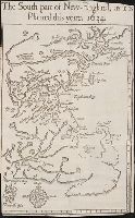
Nevv Englands prospect; a true, lively, and experimentall description of that part of America
Image Count:
1
Found in:
Beinecke Rare Book and Manuscript Library > The south part of New-England, as it is planted this yeare, 1634
Call Number:
Zc20 720so
Collection Title:
Some considerations on the consequences of the French settling colonies on the Mississippi, with
Image Count:
1
Found in:
Beinecke Rare Book and Manuscript Library > A new map of Louisiana and the River Mississipi
Call Number:
C55 025
Collection Title:
Voyages and travels of an Indian interpreter and trader, describing the manners and customs of the
Image Count:
1
Found in:
Beinecke Rare Book and Manuscript Library > Sketch of the western countries of Canada 1791
Call Number:
Egi M6 722
Collection Title:
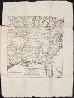
A description of the English province of Carolana, by the Spaniards call'd Florida, and by the
Image Count:
1
Found in:
Beinecke Rare Book and Manuscript Library > A map of Carolana and of the River Meschacebe & c.
Creator:
Published / Created:
[ca. 1606]
Call Number:
Taylor 301
Collection Title:
The generall historie of Virginia, New-England, and the Summer Iles : with the names of the
Image Count:
1
Found in:
Beinecke Rare Book and Manuscript Library > Virginia
Published / Created:
1801
Call Number:
Zc90 801mab
Collection Title:
Voyages from Montreal, on the river St. Laurence, through the continent of North America, to the
Image Count:
1
Found in:
Beinecke Rare Book and Manuscript Library > A map of America, between latitudes 40 and 70 north and longitudes 45 and 180 west, exhibiting Mackenzie's track from Montreal to Fort Chipewyan & from thence to the North Sea In 1789 & to the West Pacific Ocean in 1793
Published / Created:
1783
Call Number:
Cb21 35B
Collection Title:
History of the war with America, France, Spain, and Holland; commencing in 1775 and ending in 1783
Image Count:
1
Found in:
Beinecke Rare Book and Manuscript Library > A Map of the United States of America, as settled by the peace of 1783
Call Number:
CE143 A28
Collection Title:
An account of the Spanish settlements in America. In four parts ... To which is annexed, a succinct
Image Count:
1
Found in:
Beinecke Rare Book and Manuscript Library > A New general map of America drawn from several accurate particular maps and charts and regulated by astronomical observations
Call Number:
Zd 147
Collection Title:
The history of the Five Indian nations of Canada : which are dependent on the province of New-York
Image Count:
1
Found in:
Beinecke Rare Book and Manuscript Library > A Map of the country of the Five Nations, belonging to the province of New York; and of the lakes near which the nations of far Indians live, with part of Canada
Call Number:
Taylor 376
Collection Title:
The discoveries of John Lederer : in three several marches from Virginia, to the west of Carolina
Image Count:
1
Found in:
Beinecke Rare Book and Manuscript Library > A Map of the whole territory traversed by John Lederer in his three marches
Creator:
Call Number:
CF352 I54 1793
Collection Title:
A topographical description of the Western territory of North America; containing a succinct
Image Count:
1
Found in:
Beinecke Rare Book and Manuscript Library > New map of the states of Georgia South and North Carolina Virginia and Maryland including the Spanish provinces of west and east Florida from the latest surveys
Call Number:
CF352 I54 1793
Collection Title:
A topographical description of the Western territory of North America; containing a succinct
Image Count:
1
Found in:
Beinecke Rare Book and Manuscript Library > A plan of the rapids of the Ohio
Creator:
Published / Created:
1822 March
Call Number:
Egk30 Ed9 820W
Collection Title:
Two years' residence in the settlement on the English prairie, in the Illinois country ... : with
Image Count:
1
Found in:
Beinecke Rare Book and Manuscript Library > Map of Illinois
Creator:
Published / Created:
1822 March
Call Number:
Egk30 Ed9 820W
Collection Title:
Two years' residence in the settlement on the English prairie, in the Illinois country ... : with
Image Count:
1
Found in:
Beinecke Rare Book and Manuscript Library > Map of the allotments
Creator:
Published / Created:
1848
Call Number:
Zc12 +841cabj
Image Count:
7
Found in:
Beinecke Rare Book and Manuscript Library > Illustrations of the manners, customs, and condition of the North American Indians : in a series of letters and notes written during eight years of travel and adventure among the wildest and most remarkable tribes now existing. : with three hundred and si
Creator:
Call Number:
Zc90 859ka
Collection Title:
Wanderings of an artist among the Indians of North America : from Canada to Vancouver's Island and
Image Count:
1
Found in:
Beinecke Rare Book and Manuscript Library > Map to illustrate Mr. Kane's travels in the territory of the Hudson's Bay Company
Creator:
Call Number:
Zm Sp79
Collection Title:
Allgemeines historisches Taschenbuch, oder, Abriss der merkwurdigsten neuen Welt-Begebenheiten
Image Count:
1
Found in:
Beinecke Rare Book and Manuscript Library > Die Vereinigten Staaten von Nord America. nach der von Wm Faden 1783
Creator:
Call Number:
1998 2141
Collection Title:
Der ausfuehrlichen nachrichten von der koeniglich-gross-britannischen colonie saltzburgischer
Image Count:
1
Found in:
Beinecke Rare Book and Manuscript Library > A Map of the county of Savannah
Creator:
Call Number:
Taylor 388
Collection Title:
The English empire in America: or A prospect of His Majesties dominions in the West-Indies ... By R
Image Count:
1
Found in:
Beinecke Rare Book and Manuscript Library > The English empire in America
Creator:
Published / Created:
1794 July 26
Call Number:
1986 102
Collection Title:
An historical, geographical, commercial, and philosophical view of the American United States, and
Image Count:
1
Found in:
Beinecke Rare Book and Manuscript Library > A General map of North America drawn from the best sources
Creator:
Published / Created:
1794 October 18
Call Number:
1986 102
Collection Title:
An historical, geographical, commercial, and philosophical view of the American United States, and
Image Count:
1
Found in:
Beinecke Rare Book and Manuscript Library > An Accurate map of the United States of America. according to the Treaty of Peace of 1783
Creator:
Published / Created:
1795 February 7
Call Number:
1986 102
Collection Title:
An historical, geographical, commercial, and philosophical view of the American United States, and
Image Count:
1
Found in:
Beinecke Rare Book and Manuscript Library > Map of the northern, or, New England states of America. Comprehending Vermont, New Hampshire, District of Main, Massachusetts, Rhode-Island, and Connecticut
Creator:
Published / Created:
1788
Call Number:
Egf 789
Collection Title:
The American geography; or, A view of the present situation of the United States of America
Image Count:
1
Found in:
Beinecke Rare Book and Manuscript Library > A Map of the states of Virginia, North Carolina South Carolina and Georgia comprehending the Spanish provinces of east and west Florida exhibiting the boundaries as fixed by the late Treaty of Peace between the United States and the Spanish dominions comp
Call Number:
Egf 789
Collection Title:
The American geography; or, A view of the present situation of the United States of America
Image Count:
1
Found in:
Beinecke Rare Book and Manuscript Library > A Map of the northern and middle states; comprehending the western Territory and the British dominions in North America. Compiled from the best authorities
Creator:
Call Number:
Vanderbilt 147
Collection Title:
An historical account of the expedition against the Ohio Indians, in the year 1764. Under the
Image Count:
1
Found in:
Beinecke Rare Book and Manuscript Library > A General map of the country on the Ohio and Mushkingham shewing the situation of the Indian-towns with respect to the army under the command of Colonel Bouquet by Thos. Hutchins. Asst. Engineer
Creator:
Published / Created:
[1732]
Call Number:
E1015 M66 1732
Collection Title:
Atlas minor: or a set of sixty-two new and correct maps, of all parts of the world. All composed
Image Count:
1
Found in:
Beinecke Rare Book and Manuscript Library > A new map of the whole world with the trade winds according to ye latest and most exact observations by H. Moll geographer.
Creator:
Published / Created:
[1732]
Call Number:
E1015 M66 1732
Collection Title:
Atlas minor: or a set of sixty-two new and correct maps, of all parts of the world. All composed
Image Count:
1
Found in:
Beinecke Rare Book and Manuscript Library > A new map of ye north parts of America claimed by France under ye names of Louisiana. Mississipi, Canada & New France, with the adjoyning territories of England & Spain. By H. Moll geographer.
Creator:
Published / Created:
[1732]
Call Number:
E1015 M66 1732
Collection Title:
Atlas minor: or a set of sixty-two new and correct maps, of all parts of the world. All composed
Image Count:
1
Found in:
Beinecke Rare Book and Manuscript Library > New Foundland St. Laurence Bay, the fishing banks, Acadia, and part of New Scotland. By H. Moll geographer.
Creator:
Published / Created:
[1732]
Call Number:
E1015 M66 1732
Collection Title:
Atlas minor: or a set of sixty-two new and correct maps, of all parts of the world. All composed
Image Count:
1
Found in:
Beinecke Rare Book and Manuscript Library > New England, New York, New Jersey and Pensilvania. By H. Moll geographer.
Creator:
Published / Created:
[1732]
Call Number:
E1015 M66 1732
Collection Title:
Atlas minor: or a set of sixty-two new and correct maps, of all parts of the world. All composed
Image Count:
1
Found in:
Beinecke Rare Book and Manuscript Library > Virginia and Maryland by H. Moll geographer.
Creator:
Published / Created:
[1732]
Call Number:
E1015 M66 1732
Collection Title:
Atlas minor: or a set of sixty-two new and correct maps, of all parts of the world. All composed
Image Count:
1
Found in:
Beinecke Rare Book and Manuscript Library > Carolina by H. Moll geographer.
Creator:
Published / Created:
[1732]
Call Number:
E1015 M66 1732
Collection Title:
Atlas minor: or a set of sixty-two new and correct maps, of all parts of the world. All composed
Image Count:
1
Found in:
Beinecke Rare Book and Manuscript Library > Florida called by ye French Louisiana & c. By H. Moll geographer.
Creator:
Published / Created:
[1732]
Call Number:
E1015 M66 1732
Collection Title:
Atlas minor: or a set of sixty-two new and correct maps, of all parts of the world. All composed
Image Count:
1
Found in:
Beinecke Rare Book and Manuscript Library > A map of the West-Indies & c. Mexico or New Spain. Also ye trade winds, and ye several tracts made by ye galeons and flota from place to place. By H. Moll geographer.
Creator:
Call Number:
A52 030 1
Collection Title:
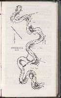
Ancient monuments of the Mississippi Valley: comprising the results of extensive original surveys
Image Count:
1
Found in:
Beinecke Rare Book and Manuscript Library > Map of a section of twelve miles of the Scioto Valley with its ancient monuments, Pl. II [2]
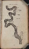
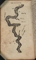
Creator:
Call Number:
A52 030 1
Collection Title:
Ancient monuments of the Mississippi Valley: comprising the results of extensive original surveys
Image Count:
1
Found in:
Beinecke Rare Book and Manuscript Library > "The serpent;" (Entry 1014) Adams County Ohio. Pl. XXXV [35]
Creator:
Call Number:
EEg 671P
Collection Title:
America: being the latest, and most accurate description of the New world; containing the original
Image Count:
1
Found in:
Beinecke Rare Book and Manuscript Library > A new discription of Carolina by order of the Lords proprietors
Creator:
Published / Created:
1838
Call Number:
Zc74 Or4
Collection Title:
The Oregonian, and Indian's advocate
Image Count:
1
Found in:
Beinecke Rare Book and Manuscript Library > Map of Oregon Territory
Call Number:
Zc20 802crc
Collection Title:
The navigator; or, The traders' useful guide in navigating the Monongahela, Allegheny, Ohio, and
Image Count:
1
Found in:
Beinecke Rare Book and Manuscript Library > [A portion of the Mississippi River, including Chickasaw Bluffs]
Call Number:
Zc20 802crc
Collection Title:
The navigator; or, The traders' useful guide in navigating the Monongahela, Allegheny, Ohio, and
Image Count:
1
Found in:
Beinecke Rare Book and Manuscript Library > [A portion of the Mississippi River, including Natchez]
Creator:
Call Number:
Zc10 845fr
Collection Title:
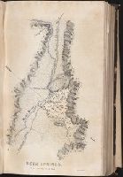
Report of the exploring expedition to the Rocky Mountains in the year 1842, and to Oregon and north
Image Count:
1
Found in:
Beinecke Rare Book and Manuscript Library > Beer Springs
Creator:
Call Number:
Zc10 845fr
Collection Title:
Report of the exploring expedition to the Rocky Mountains in the year 1842, and to Oregon and north
Image Count:
1
Found in:
Beinecke Rare Book and Manuscript Library > Map of an exploring expedition to the Rocky Mountains in the year 1842, and to Oregon & North California in the years 1843-44
Creator:
Call Number:
Zc20 822cui
Collection Title:
The Western pilot : containing charts of the Ohio River and of the Mississippi, from the mouth of
Image Count:
1
Found in:
Beinecke Rare Book and Manuscript Library > Mississippi
Creator:
Call Number:
Zc20 822cui
Collection Title:
The Western pilot : containing charts of the Ohio River and of the Mississippi, from the mouth of
Image Count:
1
Found in:
Beinecke Rare Book and Manuscript Library > Mississippi
Creator:
Call Number:
Zc52 844keb
Collection Title:
Narrative of the Texan Santa Fe expedition. Comprising a description of a tour through Texas, and
Image Count:
1
Found in:
Beinecke Rare Book and Manuscript Library > Texas and part of Mexico & the United States, showing the route of the first Santa Fe expedition
Call Number:
Zc10 846sa
Collection Title:
Scenes in the Rocky Mountains, and in Oregon, California, New Mexico, Texas, and the grand prairies
Image Count:
1
Found in:
Beinecke Rare Book and Manuscript Library > Map of Oregon, California, New Mexico, N.W. Texas, & the proposed territory of Ne_Bras_Ka
Published / Created:
[1724?]
Call Number:
2003 +64
Collection Title:
Papers relating to an act of the Assembly of the province of New-York, for encouragement of the
Image Count:
1
Found in:
Beinecke Rare Book and Manuscript Library > A map of the countrey of the Five Nations belonging to the province of New York and of the lakes near which the nations of far Indians live with part of Canada taken from the map of the Louisiane done by Mr. DeLisle in 1718
Call Number:
SS55 75
Collection Title:
The natural history of Carolina, Florida, and the Bahama Islands : containing the figures of birds
Image Count:
1
Found in:
Beinecke Rare Book and Manuscript Library > A map of Carolina, Florida and the Bahama Islands with the adjacent parts
Creator:
Call Number:
Zc58 +876uo
Collection Title:
Report of explorations across the great basin of the territory of Utah for a direct wagon-route
Image Count:
1
Found in:
Beinecke Rare Book and Manuscript Library > Map of wagon routes in Utah Territory explored & opened by Capt. J. H. Simpson ...
Creator:
Published / Created:
[ca. 1814]
Call Number:
Zc10 814Le
Collection Title:
History of the expedition under the command of Captains Lewis and Clark, to the sources of the
Image Count:
2
Resource Type:
Maps, Atlases & Globes
Found in:
Beinecke Rare Book and Manuscript Library > A map of Lewis and Clark's track, across the western portion of North America fom the Mississippi to the Pacific Ocean; by order of the Executive of the United States . In 1804, 5 & 6
Creator:
Published / Created:
[1732]
Call Number:
E1015 M66 1732
Collection Title:
Atlas minor: or a set of sixty-two new and correct maps, of all parts of the world. All composed
Image Count:
1
Found in:
Beinecke Rare Book and Manuscript Library > A description of the Bay of Fundy showing ye coast, islands, harbours, creeks, coves, rocks, sholes, soundings & anchorings &c... Observed by Nat. Blackmore in ye yeare 1711 and 1712 ...
Call Number:
Mexico Ct +h780cg
Collection Title:
The history of Mexico. Collected from Spanish and Mexican historians, from manuscripts and ancient
Image Count:
27
Found in:
Beinecke Rare Book and Manuscript Library > The history of Mexico. Collected from Spanish and Mexican historians, from manuscripts and ancient paintings of the Indians ...
Call Number:
Mexico Ct +h780cg
Collection Title:
The history of Mexico. Collected from Spanish and Mexican historians, from manuscripts and ancient
Image Count:
3
Found in:
Beinecke Rare Book and Manuscript Library > The history of Mexico. Collected from Spanish and Mexican historians, from manuscripts and ancient paintings of the Indians ...
Call Number:
CF2041 +L54
Collection Title:
A true & exact history of the island of Barbados. Illustrated with a mapp of the island, as also
Image Count:
1
Resource Type:
Maps, Atlases & Globes
Found in:
Beinecke Rare Book and Manuscript Library > A topographicall description and admeasurement of the yland of Barbados in the West Indyaes with the m.rs names of the seuerall plantacons
Creator:
Published / Created:
c1870.
Call Number:
Zc10 870hac
Image Count:
67
Found in:
Beinecke Rare Book and Manuscript Library > The traveler's own book, a panorama of overland travel, from Chicago to San Francisco via the great and attractive route, Chicago Burlington & Quincy R.R. ... Burlington & Missouri River R.R. ... Union Pacific Railroad ... Utah Central Railroad ... Central Pacific Railroad ... Western Pacific Railroad ... containing complete traveler's maps ... By Alfred A. Hart.
Creator:
Published / Created:
1798
Call Number:
Egf +759c
Collection Title:
Travels through the middle settlements in North America, : in the years 1759 and 1760; with
Image Count:
1
Resource Type:
Books, Journals & Pamphlets
Found in:
Beinecke Rare Book and Manuscript Library > Map of Dr. Burnaby's travels through the middle settlements of North America
Creator:
Published / Created:
[1710-1786]
Call Number:
1983 Folio 23
Image Count:
2
Found in:
Beinecke Rare Book and Manuscript Library > [Atlas factice of 50 maps, primarily by Johann Baptist Homann and/or issued by the Homann Erben firm]
Creator:
Published / Created:
[172-?]
Call Number:
1983 Folio 23
Collection Title:
[Atlas factice of 50 maps, primarily by Johann Baptist Homann and/or issued by the Homann Erben
Image Count:
1
Found in:
Beinecke Rare Book and Manuscript Library > Magnae Britanniae pars meridionalis in qua regnum Angliae tam in septem antiqua Anglo-Saxonum regna quom in omnes Hodiernas regiones accurate divisum hic ostenditur quam tabula ab archetypo Vischeriano desumptam exhibet [cartographic material] / Ioh. Bapt
Creator:
Published / Created:
1715?
Call Number:
1975 Folio 31
Collection Title:
[Atlas factice of 42 maps, produced by the Homann Erben firm]
Image Count:
1
Found in:
Beinecke Rare Book and Manuscript Library > Hiberniae regnum tam in praecipuas Ultoniae, Connaciae, Laceniae et Momoniae [cartographic material] : quam in minores earundem provincias et ditiones divisum ex prototype Guil. Petty-Vischeriano deductu et exhibitum / a Joh. Bapt. Homanno
Creator:
Published / Created:
1729
Call Number:
1975 Folio 31
Collection Title:
[Atlas factice of 42 maps, produced by the Homann Erben firm]
Image Count:
1
Found in:
Beinecke Rare Book and Manuscript Library > Magna Britannia complectens Angliae, Scotiae, et Hyberniae regn [cartographic material] : in suas prov. et comitat. divisa et ex mappis Londinensibus designata / per Homannum
Creator:
Published / Created:
1715?
Call Number:
1975 Folio 31
Collection Title:
[Atlas factice of 42 maps, produced by the Homann Erben firm]
Image Count:
1
Found in:
Beinecke Rare Book and Manuscript Library > Magnae Britanniae pars meridionalis in qua regnum Angliae tam in septem antiqua Anglo-Saxonum regna quom in omnes Hodiernas regiones accurate divisum hic ostenditur quam tabula ab archetypo Vischeriano desumptam exhibet / [cartographic material] / Ioh. Ba
Creator:
Published / Created:
1715?
Call Number:
1975 Folio 31
Collection Title:
[Atlas factice of 42 maps, produced by the Homann Erben firm]
Image Count:
1
Found in:
Beinecke Rare Book and Manuscript Library > Magnae Britanniae pars septentrionalis qua regnum Scotiae [cartographic material] : in suas partes et subjacentes insulas divisum : accurata tabula ex archetypo Vischeriano desumta exhibetur imitatore / Johan. Bapt. Homanno
Creator:
Published / Created:
1749
Call Number:
1973 Folio 30
Collection Title:
[Atlas factice of 32 maps and 1 distance table, produced by the Homann Erben firm]
Image Count:
1
Found in:
Beinecke Rare Book and Manuscript Library > Regnorum Magnae Britanniae et Hiberniae mappa geographica : iuxta observationes astronomicas recentiores denuo correcta et ad formam legitimae projectionis reducta a Tobia Majero
Call Number:
2003 310
Collection Title:
The journal of Major George Washington, : sent by the Hon. Robert Dinwiddie, Esq; His Majesty’s
Image Count:
1
Resource Type:
Books, Journals & Pamphlets
Found in:
Beinecke Rare Book and Manuscript Library > Map of the western parts of the colony of Virginia, as far as the Mississipi [sic]
Published / Created:
1850
Call Number:
1976 Folio 96
Collection Title:
A new universal atlas containing maps of the various empires, kingdoms, states and republics of the
Image Count:
1
Resource Type:
Maps, Atlases & Globes
Found in:
Beinecke Rare Book and Manuscript Library > 10. Map of Connecticut
Published / Created:
1846
Call Number:
1976 Folio 93
Collection Title:
A new universal atlas containing maps of the various empires, kingdoms, states and republics of the
Image Count:
1
Resource Type:
Maps, Atlases & Globes
Found in:
Beinecke Rare Book and Manuscript Library > 9. Connecticut
Call Number:
Za P752 ZzP17
Collection Title:
Incidents of travel in Central America, Chiapas, and Yucatan / by John L. Stephens
Image Count:
1
Found in:
Beinecke Rare Book and Manuscript Library > Map of journey in Central America, Chiapas & Yucatan
Call Number:
Lxe 784m
Collection Title:
Geography made easy : being a short, but comprehensive system of that very useful and agreeable
Image Count:
1
Resource Type:
Books, Journals & Pamphlets
Found in:
Beinecke Rare Book and Manuscript Library > [Placement of the divisions of South America]
Creator:
Published / Created:
1775 September
Call Number:
A89 P384
Collection Title:
The Pennsylvania magazine: or, American monthly museum
Image Count:
1
Resource Type:
Books, Journals & Pamphlets
Found in:
Beinecke Rare Book and Manuscript Library > A new map of North & South Carolina, & Georgia
Call Number:
Ik P810 +Z745
Collection Title:
A plan of Mr. Pope’s garden : as it was left at his death, with a plan and perspective view of the
Image Count:
1
Resource Type:
Books, Journals & Pamphlets
Found in:
Beinecke Rare Book and Manuscript Library > A plan of Mr. Pope's garden as it was left at his death
Creator:
Published / Created:
1776
Call Number:
1977 +300
Collection Title:
A voyage towards the South pole, and round the world. Performed in His Majesty’s ships the
Image Count:
1
Resource Type:
Maps, Atlases & Globes
Found in:
Beinecke Rare Book and Manuscript Library > A chart of the southern hemisphere; shewing the tracks of some of the most distinguished navigators
Creator:
Published / Created:
1791 March
Call Number:
DU170 H85+ Oversize
Collection Title:
An historical journal of the transactions at Port Jackson and Norfolk island, with the discoveries
Image Count:
1
Resource Type:
Books, Journals & Pamphlets
Found in:
Beinecke Rare Book and Manuscript Library > A map of all those parts of the territory of New South Wales which have been seen by any person belonging to the settlement established at Port Jackson, in the said territory ...
Creator:
Published / Created:
1775?-1781?]
Call Number:
1983 Folio 25
Image Count:
3
Resource Type:
Maps, Atlases & Globes
Found in:
Beinecke Rare Book and Manuscript Library > [The Atlantic Neptune : published for the use of the Royal Navy Great Britain / by Joseph F.W. Des Barres, esq.].
Published / Created:
[1759-1771] and 1763 May
Call Number:
Z17 289q
Image Count:
1
Resource Type:
Books, Journals & Pamphlets
Found in:
Beinecke Rare Book and Manuscript Library > Royal magazine; or, Gentleman's monthly companion.
Creator:
Published / Created:
1739
Call Number:
1996 +91
Image Count:
3
Resource Type:
Books, Journals & Pamphlets
Found in:
Beinecke Rare Book and Manuscript Library > Modern history: or, The present state of all nations. Describing their respective situations, persons, habits, ... animals and minerals. ... By Mr. Salmon. Illustrated with cuts and maps ... by Herman Moll ...
Creator:
Published / Created:
ann. 1605.
Call Number:
1976 Folio 46
Image Count:
125
Resource Type:
Books, Journals & Pamphlets
Found in:
Beinecke Rare Book and Manuscript Library > The mariners mirrovr wherin may playnly be seen the courses, heights, distances, depths, sounding, flouds and ebs, risings of lands, rocks ... of the harbouroughs, havens and ports of the greatest part of Europe: ... together w.th the rules and instrumeíÄ
Creator:
Published / Created:
1836
Call Number:
Zc29 836Le
Image Count:
1
Found in:
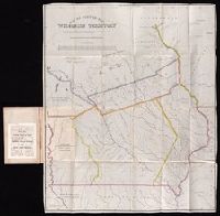
Beinecke Rare Book and Manuscript Library > Notes on Wisconsin Territory : with a map / by Lieutenant Albert M. Lea.
Creator:
Published / Created:
1935
Call Number:
Zc29 836Leb
Image Count:
1
Found in:
Beinecke Rare Book and Manuscript Library > The book that gave to Iowa its name, a reprint.
Published / Created:
[1610]
Call Number:
Taylor 251
Collection Title:
Certaine errors in nauigation / detected and corrected by Edw. Wright ; with many additions that
Image Count:
1
Found in:
Beinecke Rare Book and Manuscript Library > A particular sea chart for the islands Azores
Published / Created:
Undated
Call Number:
1976 1233
Collection Title:
Twenty four new and accurate maps of the several parts of Europe ... : all (except the last) new
Image Count:
1
Found in:
Beinecke Rare Book and Manuscript Library > A new map of the world according to the new observations
Published / Created:
Undated
Call Number:
1976 1233
Collection Title:
Twenty four new and accurate maps of the several parts of Europe ... : all (except the last) new
Image Count:
1
Found in:
Beinecke Rare Book and Manuscript Library > A new map of Europe according to ye newest observations
Published / Created:
Undated
Call Number:
1976 1233
Collection Title:
Twenty four new and accurate maps of the several parts of Europe ... : all (except the last) new
Image Count:
1
Found in:
Beinecke Rare Book and Manuscript Library > Sweden and Norway according to the newest observations
Published / Created:
Undated
Call Number:
1976 1233
Collection Title:
Twenty four new and accurate maps of the several parts of Europe ... : all (except the last) new
Image Count:
1
Found in:
Beinecke Rare Book and Manuscript Library > Denmark according to the newest observations
Published / Created:
Undated
Call Number:
1976 1233
Collection Title:
Twenty four new and accurate maps of the several parts of Europe ... : all (except the last) new
Image Count:
1
Found in:
Beinecke Rare Book and Manuscript Library > The dominions of Moscovy or Russia
Published / Created:
Undated
Call Number:
1976 1233
Collection Title:
Twenty four new and accurate maps of the several parts of Europe ... : all (except the last) new
Image Count:
1
Found in:
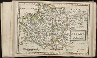
Beinecke Rare Book and Manuscript Library > Poland according to ye newest observations
Published / Created:
Undated
Call Number:
1976 1233
Collection Title:
Twenty four new and accurate maps of the several parts of Europe ... : all (except the last) new
Image Count:
1
Found in:
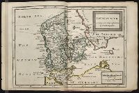
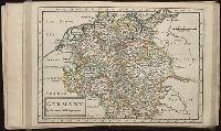
Beinecke Rare Book and Manuscript Library > Germany
Published / Created:
Undated
Call Number:
1976 1233
Collection Title:
Twenty four new and accurate maps of the several parts of Europe ... : all (except the last) new
Image Count:
1
Found in:
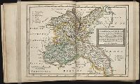
Beinecke Rare Book and Manuscript Library > The north east part of Germany: containing the dutchies of Meklenburg and Pomerania; the marq: and electorate of Brandenburg; the dukedom and electorate of Saxony; the dukedom of Silesia, the marquisate of Lusatia &c
Published / Created:
Undated
Call Number:
1976 1233
Collection Title:
Twenty four new and accurate maps of the several parts of Europe ... : all (except the last) new
Image Count:
1
Found in:
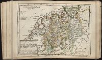
Beinecke Rare Book and Manuscript Library > The north west part of Germany; containing ye dominions of ye arch: and el: of Cologne, Westphalia, (vitz the d's of Iuliers, Cleves, &c. ye b's of Munster, Osnabrug, &c. ye C of Emden, &c) ye d's of Holstein and Bremen, the d. and elec: of Hannover with
Branch:v1.60.98 ,Deployed:2024-04-24T10:14:36-04:00