Search
You Searched For
Search Results
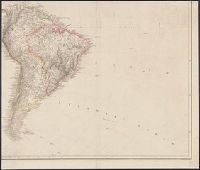
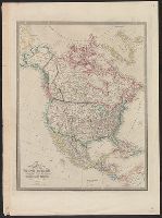
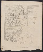
- Creator:
- Arrowsmith, Aaron, 1750-1823
- Published / Created:
- [betw. 1804 and 1811?]
- Call Number:
- 70 1808
- Container / Volume:
- BRBL_00358
- Image Count:
- 4
- Resource Type:
- Maps, Atlases & Globes
- Found in:
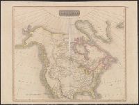
- Beinecke Rare Book and Manuscript Library > Map of America / by A. Arrowsmith ; engraved by W. West, the hills by H. Wilson.
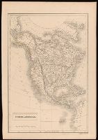
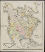
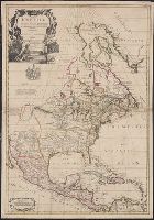
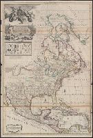
- Creator:
- Hall, Sidney
- Published / Created:
- [between 1825 and 1845]
- Call Number:
- BrSides 2018 137
- Image Count:
- 1
- Resource Type:
- Maps, Atlases & Globes
- Subject (Geographic):
- North America--Maps
- Subject (Topic):
- Indians of North America--Maps
- Found in:
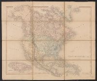
- Beinecke Rare Book and Manuscript Library > North America / engraved by Sidney Hall.
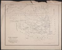
- Published / Created:
- [1867?]
- Call Number:
- 826 1866
- Container / Volume:
- BRBL_00577
- Image Count:
- 1
- Resource Type:
- Maps, Atlases & Globes
- Subject (Topic):
- Indians of North America--Maps
- Found in:
- Beinecke Rare Book and Manuscript Library > Indian territory with part of the adjoining state of Kansas &c. / Engineer Bureau War Dept., October 1866.
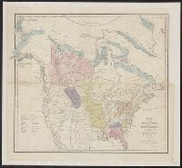
- Creator:
- Gallatin, Albert, 1761-1849
- Published / Created:
- [1836]
- Call Number:
- 71ed 1836
- Container / Volume:
- BRBL_00371
- Image Count:
- 1
- Resource Type:
- Maps, Atlases & Globes
- Subject (Topic):
- Indians of North America--Maps
- Found in:
- Beinecke Rare Book and Manuscript Library > Map of the Indian tribes of North America, about 1600 A.D. along the Atlantic, & about 1800 A.D. westwardly / published by the Amer. Antiq. Soc. from a drawing by Hon. A. Gallatin.
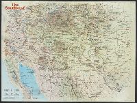
- Creator:
- National Geographic Society (U.S.). Cartographic Division
- Published / Created:
- 1982
- Call Number:
- 7821 1982
- Container / Volume:
- BRBL_00506
- Image Count:
- 2
- Resource Type:
- Maps, Atlases & Globes
- Subject (Topic):
- Indians of North America--Maps
- Found in:
- Beinecke Rare Book and Manuscript Library > The Southwest / produced by the Cartographic Division, National Geographic Society ; John B. Garver, Jr., chief cartographer.
- Published / Created:
- 19--?]
- Call Number:
- 71ED 1850
- Container / Volume:
- BRBL_00371
- Image Count:
- 1
- Resource Type:
- Maps, Atlases & Globes
- Subject (Topic):
- Indians of North America--Maps
- Found in:
- Beinecke Rare Book and Manuscript Library > [Map of Indian tribes of North America].
- Creator:
- Powell, John Wesley, 1834-1902
- Published / Created:
- 1891]
- Call Number:
- 71ef 1890
- Container / Volume:
- BRBL_00371
- Image Count:
- 1
- Resource Type:
- Maps, Atlases & Globes
- Subject (Topic):
- Indians of North America--Maps
- Found in:
- Beinecke Rare Book and Manuscript Library > Linguistic stocks of American Indians north of Mexico / by J.W. Powell.
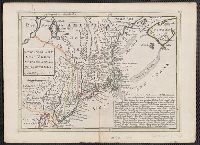
- Published / Created:
- [1756?]
- Call Number:
- 755 1756C
- Container / Volume:
- BRBL_00428
- Image Count:
- 1
- Resource Type:
- Maps, Atlases & Globes
- Subject (Geographic):
- North America--Maps--Early works to
- Subject (Topic):
- British--North America--Maps--Early
- Found in:
- Beinecke Rare Book and Manuscript Library > The British & French dominions in North America : particularly shewing the French encroachments through all the British plantations from Nova Scotia down to the Gulf of Mexico.
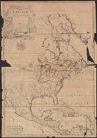
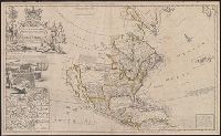
- Creator:
- Arrowsmith, Aaron, 1750-1823
- Published / Created:
- [1818]
- Call Number:
- 71 1818A
- Container / Volume:
- BRBL_00368
- Image Count:
- 4
- Resource Type:
- Maps, Atlases & Globes
- Subject (Geographic):
- North America--Maps
- Found in:
- Beinecke Rare Book and Manuscript Library > A map exhibiting all the new discoveries in the interior parts of North America : inscribed by permission to the honourable governor and company of adventurers of England trading into Hudsons Bay in testimony of their liberal communications to their most
- Creator:
- Johnson and Ward
- Published / Created:
- 1866?]
- Call Number:
- 71 1866
- Container / Volume:
- BRBL_00371
- Image Count:
- 2
- Resource Type:
- Maps, Atlases & Globes
- Subject (Geographic):
- North America--Maps
- Found in:
- Beinecke Rare Book and Manuscript Library > Johnson's North America / by Johnson and Ward.
- Creator:
- Smith, J. Calvin (John Calvin)
- Published / Created:
- 1849
- Call Number:
- 71 1849A
- Container / Volume:
- BRBL_00370
- Image Count:
- 1
- Resource Type:
- Maps, Atlases & Globes
- Subject (Geographic):
- North America--Maps
- Found in:
- Beinecke Rare Book and Manuscript Library > Map of North America / by J. Calvin Smith.
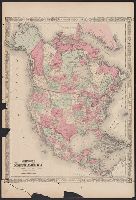
- Creator:
- Smith, J. Calvin (John Calvin)
- Published / Created:
- 1850
- Call Number:
- 71 1850A
- Container / Volume:
- BRBL_00370
- Image Count:
- 1
- Resource Type:
- Maps, Atlases & Globes
- Subject (Geographic):
- North America--Maps
- Found in:
- Beinecke Rare Book and Manuscript Library > Map of North America / by J. Calvin Smith.
- Creator:
- Smith, J. Calvin (John Calvin)
- Published / Created:
- 1851
- Call Number:
- 71 1851A
- Container / Volume:
- BRBL_00370
- Image Count:
- 1
- Resource Type:
- Maps, Atlases & Globes
- Subject (Geographic):
- North America--Maps
- Found in:
- Beinecke Rare Book and Manuscript Library > Map of North America / by J. Calvin Smith.
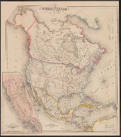
- Creator:
- Wyld, James, 1812-1887
- Published / Created:
- [1854?]
- Call Number:
- 71 1854A
- Container / Volume:
- BRBL_00371
- Image Count:
- 1
- Resource Type:
- Maps, Atlases & Globes
- Subject (Geographic):
- North America--Maps
- Found in:
- Beinecke Rare Book and Manuscript Library > Map of North America : exhibiting the recent discoveries, geographical & nautical / by James Wyld, Geographer to Her Majesty ; J.W. del. ; Stockley fc.
- Creator:
- Wyld, James, 1812-1887
- Published / Created:
- [1828]
- Call Number:
- 71 1828
- Container / Volume:
- BRBL_00369
- Image Count:
- 7
- Resource Type:
- Maps, Atlases & Globes
- Subject (Geographic):
- North America--Maps
- Found in:
- Beinecke Rare Book and Manuscript Library > Map of North America : exhibiting the recent discoveries, geographical and nautical; drawn chiefly from the authorities of M. de Humbolt, Lieutt. Pike, Messrs. Lewis and Clarke, Sir Alexr. Mackenzie, Mr. Hearne, Coll. Bouchette, Captns. Vancouver, Ross, P
- Creator:
- Wyld, James, 1812-1887
- Published / Created:
- [187-?]
- Call Number:
- 71 1870A
- Container / Volume:
- BRBL_00371
- Image Count:
- 1
- Resource Type:
- Maps, Atlases & Globes
- Subject (Geographic):
- North America--Maps
- Found in:
- Beinecke Rare Book and Manuscript Library > Map of North America : exhibiting the recent discoveries, geographical and nautical; drawn chiefly from the authorities of M. de Humbolt, Lieutt. Pike, Messrs. Lewis and Clarke, Sir Alexr. Mackenzie, Mr. Hearne, Coll. Bouchette, Captns. Vancouver, Ross, P
- Creator:
- Geological Survey (U.S.)
- Published / Created:
- 1912
- Call Number:
- 71 1912
- Container / Volume:
- BRBL_00371
- Image Count:
- 1
- Resource Type:
- Maps, Atlases & Globes
- Subject (Geographic):
- North America--Maps
- Found in:
- Beinecke Rare Book and Manuscript Library > Map of North America : reduced from map on scale of 1:5,000,000 / compiled by the U.S. Geological Survey.
- Creator:
- National Railway Publication Company
- Call Number:
- BrSides Zc19 N82h 870na
- Image Count:
- 1
- Resource Type:
- Maps, Atlases & Globes
- Subject (Geographic):
- North America--Maps.
- Found in:
- Beinecke Rare Book and Manuscript Library > Map of the Northern Pacific Railway and tributary country.
- Creator:
- Colton, G. Woolworth (George Woolworth), 1827-1901
- Published / Created:
- 1854
- Call Number:
- 71 1854B
- Container / Volume:
- BRBL_00371
- Image Count:
- 2
- Resource Type:
- Maps, Atlases & Globes
- Subject (Geographic):
- North America--Maps
- Found in:
- Beinecke Rare Book and Manuscript Library > Map of the United States of America, the British provinces, Mexico, the West Indies, and Central America, with part of New Granada and Venezuela / map drawn by Geo. W. Colton ; engraved by John M. Atwood ; border desig'd. & eng'd. by W.S. Barnard.
- Creator:
- Atwood, John M., b. ca. 1818
- Published / Created:
- 1851
- Call Number:
- 75 1851B
- Container / Volume:
- BRBL_00400
- Image Count:
- 1
- Resource Type:
- Maps, Atlases & Globes
- Subject (Geographic):
- North America--Maps
- Found in:
- Beinecke Rare Book and Manuscript Library > Map of the United States, Canada, Mexico, Central America, and the West India Islands : with a portion of Venezuela & New Granada; showing the routes overland and by the Isthmus to California & Oregon, also the new boundaries of California, Utah, & New Me
- Creator:
- Wilkinson, Robert, -approximately 1825
- Published / Created:
- 1823 August 12
- Call Number:
- 71 1823
- Container / Volume:
- BRBL_00369
- Image Count:
- 1
- Resource Type:
- Maps, Atlases & Globes
- Subject (Geographic):
- North America--Maps
- Found in:
- Beinecke Rare Book and Manuscript Library > North America / E. Bourne sculp.
- Creator:
- Thomson, John, geographer
- Published / Created:
- 1814
- Call Number:
- 71 1814
- Container / Volume:
- BRBL_00368
- Image Count:
- 1
- Resource Type:
- Maps, Atlases & Globes
- Subject (Geographic):
- North America--Maps
- Found in:
- Beinecke Rare Book and Manuscript Library > North America / N.R. Hewitt, sc.
- Creator:
- Betts, John, fl. 1844-1863
- Published / Created:
- [18--?]
- Call Number:
- 71 18XX
- Container / Volume:
- BRBL_00371
- Image Count:
- 2
- Resource Type:
- Maps, Atlases & Globes
- Subject (Geographic):
- North America--Maps
- Found in:
- Beinecke Rare Book and Manuscript Library > North America.
- Creator:
- Morse, Sidney E. (Sidney Edwards), 1794-1871
- Published / Created:
- c1842-[45]
- Call Number:
- 1977 Folio 77
- Image Count:
- 1
- Subject (Geographic):
- North America--Maps
- Found in:
- Beinecke Rare Book and Manuscript Library > North American atlas
- Creator:
- Wyld, James, 1812-1887
- Published / Created:
- March 2nd 1857.
- Call Number:
- 71 1857
- Container / Volume:
- BRBL_00371
- Image Count:
- 2
- Resource Type:
- Maps, Atlases & Globes
- Subject (Geographic):
- North America--Maps
- Found in:
- Beinecke Rare Book and Manuscript Library > The British possessions in North America and the United States with the Hudson's Bay territories / by James Wyld, geographer to the Queen & H.R.H. Prince Albert.
- Creator:
- Kitchin, Thomas, d. 1784
- Published / Created:
- 1766?]
- Call Number:
- 755 1763A
- Container / Volume:
- BRBL_00428
- Image Count:
- 1
- Resource Type:
- Maps, Atlases & Globes
- Subject (Geographic):
- North America--Maps--Early works to
- Subject (Topic):
- British--North America--Maps--Early
- Found in:
- Beinecke Rare Book and Manuscript Library > A new and accurate map of the British dominions in America, according to the Treaty of 1763, divided into the several provinces and jurisdictions : projected upon the best authorities and astronomical observations / by Thos. Kitchin, geographer.
- Creator:
- Hendges, M
- Published / Created:
- 1904
- Call Number:
- 70gme 1904
- Container / Volume:
- BRBL_00359
- Image Count:
- 1
- Resource Type:
- Maps, Atlases & Globes
- Subject (Topic):
- Railroads--North America--Maps
- Found in:
- Beinecke Rare Book and Manuscript Library > Intercontinental railway map : prepared under the direction of the permanent Pan American Railway Committee authorized by the Second International Conference of American States / M. Hendges.
- Creator:
- Steiger, W. T
- Published / Created:
- 1854
- Call Number:
- 75gme 1854
- Container / Volume:
- BRBL_00411
- Image Count:
- 2
- Resource Type:
- Maps, Atlases & Globes
- Subject (Topic):
- Railroads--North America--Maps
- Found in:
- Beinecke Rare Book and Manuscript Library > Diagram of the United States of America, Mexico, the West India Islands and Isthmus of Darien : showing proposed routes of the Pacific Rail Road ... / by W. T. Steiger, General Land Office ; Lith. by A. Hoen & Co. Baltimore.
- Creator:
- Kitchin, Thomas, d. 1784
- Published / Created:
- 1780?]
- Call Number:
- 755 1760
- Container / Volume:
- BRBL_00428
- Image Count:
- 1
- Resource Type:
- Maps, Atlases & Globes
- Subject (Geographic):
- North America--Maps--Early works to
- Subject (Topic):
- Indians of North America--Maps--Early
- Found in:
- Beinecke Rare Book and Manuscript Library > British dominions in America : drawn from the latest and best authorities / by Thos. Kitchin, hydrographer to his majesty.
- Creator:
- Gibson, J. (John)
- Published / Created:
- 1763]
- Call Number:
- 75 1778
- Collection Title:
- Gentleman's magazine.
- Container / Volume:
- BRBL_00689
- Image Count:
- 1
- Resource Type:
- Maps, Atlases & Globes
- Subject (Geographic):
- North America--Maps--Early works to
- Subject (Topic):
- Indians of North America--Maps--Early
- Found in:
- Beinecke Rare Book and Manuscript Library > [Map of Louisiana and the western parts of Virginia and Carolina] / [cartographic material] / J. Gibson, sculp.
- Creator:
- G.W. & C.B. Colton & Co
- Published / Created:
- 1870
- Call Number:
- 80 1870
- Container / Volume:
- BRBL_00535
- Image Count:
- 1
- Resource Type:
- Maps, Atlases & Globes
- Subject (Topic):
- Indians of North America--Maps
- Found in:
- Beinecke Rare Book and Manuscript Library > Colton's map of the states and territories west of the Mississippi River to the Pacific Ocean : showing the overland routes, projected rail road lines, &c.
- Creator:
- G.W. & C.B. Colton & Co
- Published / Created:
- 1870
- Call Number:
- 80 1881
- Container / Volume:
- BRBL_00536
- Image Count:
- 1
- Resource Type:
- Maps, Atlases & Globes
- Subject (Topic):
- Indians of North America--Maps
- Found in:
- Beinecke Rare Book and Manuscript Library > Colton's map of the states and territories west of the Mississippi River to the Pacific Ocean : showing the overland routes, projected rail road lines, &c.
- Creator:
- United States. Office of Indian Affairs
- Published / Created:
- 1909
- Call Number:
- 75ed 1909
- Container / Volume:
- BRBL_00410
- Image Count:
- 1
- Resource Type:
- Maps, Atlases & Globes
- Subject (Topic):
- Indians of North America--Maps
- Found in:
- Beinecke Rare Book and Manuscript Library > Map showing Indian reservations within the limits of the United States, 1909 / [Department of the Interior, Office of Indian Affairs] ; compiled under the direction of R. G. Valentine.
- Creator:
- U.S. Lake Survey
- Published / Created:
- 1885
- Call Number:
- 8075cea 1885
- Container / Volume:
- BRBL_00551
- Image Count:
- 1
- Resource Type:
- Maps, Atlases & Globes
- Subject (Geographic):
- Great Lakes (North America)--Maps.
- Found in:
- Beinecke Rare Book and Manuscript Library > Index chart of the northern and northwestern lakes : compiled from the data of the U.S. Survey and showing the names and limits of the published charts / compiled and drawn by Edward Molitor.
- Published / Created:
- 1852
- Call Number:
- 8075gme 1852
- Container / Volume:
- BRBL_00551
- Image Count:
- 1
- Resource Type:
- Maps, Atlases & Globes
- Subject (Geographic):
- Great Lakes (North America)--Maps
- Found in:
- Beinecke Rare Book and Manuscript Library > Map showing the several lines of R.R. : leading from the Lakes to the MIssissippi River together with the route surveyed by the St. C. & L.S. R.R. Co.
- Creator:
- Rand McNally and Company
- Published / Created:
- c1914.
- Call Number:
- 88hc 1914
- Container / Volume:
- BRBL_00649
- Image Count:
- 2
- Resource Type:
- Maps, Atlases & Globes
- Alternative Title:
- New commercial atlas map of North
- Description:
- North America" (scale [1:20,592,000]) on
- Subject (Geographic):
- North America--Maps
- Found in:
- Beinecke Rare Book and Manuscript Library > The Rand McNally new commercial atlas map of Mexico.
- Published / Created:
- 1849
- Call Number:
- 844cea 1849
- Container / Volume:
- BRBL_00613
- Image Count:
- 1
- Resource Type:
- Maps, Atlases & Globes
- Subject (Geographic):
- Pacific Coast (North America)--Maps
- Found in:
- Beinecke Rare Book and Manuscript Library > The coasts of California, Oregon, &c.
- Published / Created:
- 1850
- Call Number:
- 754gme 1850
- Container / Volume:
- BRBL_00419
- Image Count:
- 1
- Resource Type:
- Maps, Atlases & Globes
- Subject (Geographic):
- Great Lakes (North America)--Maps
- Found in:
- Beinecke Rare Book and Manuscript Library > [Railroads of the Lake States, from Great Lakes to Ohio River]
- Creator:
- Rider, Sidney S. (Sidney Smith), 1833-1917
- Published / Created:
- 1903
- Call Number:
- 765 1904
- Container / Volume:
- BRBL_00463
- Image Count:
- 1
- Resource Type:
- Maps, Atlases & Globes
- Subject (Topic):
- Names, Indian--North America--Maps
- Found in:
- Beinecke Rare Book and Manuscript Library > Map of the Colony of Rhode Island : giving the Indian names of locations and the locations of great events in Indian history with present political divisions indicated / by Sidney S. Rider.
- Creator:
- United States. Bureau of Indian Affairs
- Published / Created:
- 1907
- Call Number:
- 75ea 1907A
- Container / Volume:
- BRBL_00409
- Image Count:
- 1
- Resource Type:
- Maps, Atlases & Globes
- Subject (Topic):
- Indian reservations--North America
- Found in:
- Beinecke Rare Book and Manuscript Library > Map showing Indian reservations within the limits of the United States / compiled under the direction of the Hon. F.E. Leupp, Commissioner of Indian Affairs.
- Creator:
- United States. Bureau of Indian Affairs
- Published / Created:
- 1904
- Call Number:
- 75ed 1904
- Container / Volume:
- BRBL_00410
- Image Count:
- 1
- Resource Type:
- Maps, Atlases & Globes
- Subject (Topic):
- Indian reservations--North America
- Found in:
- Beinecke Rare Book and Manuscript Library > Map showing Indian reservations within the limits of the United States / compiled under the direction of the Hon. W.A. Jones, Commissioner of Indian Affairs.
- Creator:
- Tanner, Henry Schenck, 1786-1858
- Published / Created:
- [1822 or 1823]
- Call Number:
- 71 1822
- Container / Volume:
- BRBL_00369
- Image Count:
- 4
- Resource Type:
- Maps, Atlases & Globes
- Subject (Geographic):
- North America--Maps
- Found in:
- Beinecke Rare Book and Manuscript Library > A map of North America : constructed according to the latest information / engraved & published by H.S. Tanner, Philadelphia 1822.
- Creator:
- G.W. & C.B. Colton & Co
- Published / Created:
- 1869
- Call Number:
- 75 1869A
- Container / Volume:
- BRBL_00404
- Image Count:
- 2
- Resource Type:
- Maps, Atlases & Globes
- Subject (Geographic):
- North America--Maps
- Found in:
- Beinecke Rare Book and Manuscript Library > Colton's map of the United States of America, the British provinces, Mexico and the West Indies : showing the country from the Atlantic to the Pacific Ocean.
- Creator:
- Carey, Henry Charles, 1793-1879
- Published / Created:
- 1822]
- Call Number:
- 70 1822C
- Container / Volume:
- BRBL_00358
- Image Count:
- 1
- Resource Type:
- Maps, Atlases & Globes
- Subject (Geographic):
- North America--Maps
- Found in:
- Beinecke Rare Book and Manuscript Library > Geographical, statistical and historical map of America / Young & Delleker sc.
- Creator:
- Rosa, R
- Published / Created:
- 1868, c1864.
- Call Number:
- 75 1868B
- Container / Volume:
- BRBL_00404
- Image Count:
- 2
- Resource Type:
- Maps, Atlases & Globes
- Subject (Geographic):
- North America--Maps
- Found in:
- Beinecke Rare Book and Manuscript Library > The American continent : topographical and railroad map of the United States, British possessions, West Indies, Mexico, and Central America / compiled from the best authorities by R. Rosa, late Col. 46th Regiment N.Y.V. ; Haasis & Lubrecht, publishers, Li
- Creator:
- Middleton, Strobridge & Co
- Published / Created:
- [1857].
- Call Number:
- 753gme 1858
- Container / Volume:
- BRBL_00415
- Image Count:
- 1
- Resource Type:
- Maps, Atlases & Globes
- Subject (Geographic):
- Great Lakes (North America)--Maps
- Subject (Topic):
- Railroads--Great Lakes (North America
- Found in:
- Beinecke Rare Book and Manuscript Library > Map illustrating the Canada Pacific and Northern Pacific and other proposed Railroads, connecting at Straits of Mackinaw : Also showing the position of Mackinaw City.
- Creator:
- Scoles, John, 1772?-1853
- Published / Created:
- [1796?]
- Call Number:
- 71 1795
- Container / Volume:
- BRBL_00367
- Image Count:
- 1
- Resource Type:
- Maps, Atlases & Globes
- Subject (Geographic):
- North America--Maps--Early works to
- Found in:
- Beinecke Rare Book and Manuscript Library > A general map of North America : drawn from the best surveys, 1795 / Scoles sc.
- Creator:
- Bowles, Carington, 1724-1793
Bowles, John, 1701-1779
Delarochette, L. (Louis), 1731-1802, creator
Palairet, Jean, 1697-1774
- Published / Created:
- 1765
- Call Number:
- 2003 Folio 85
- Image Count:
- 1
- Description:
- LC Maps of North America, 1750-1789,
- Subject (Geographic):
- North America -- Maps -- Early works to
- Found in:
- Beinecke Rare Book and Manuscript Library > A map of North America
- Creator:
- Delarochette, L. (Louis), 1731-1802
- Published / Created:
- 1765
- Call Number:
- 71 1765
- Container / Volume:
- BRBL_00364
- Image Count:
- 1
- Resource Type:
- Maps, Atlases & Globes
- Subject (Geographic):
- North America--Maps--Early works to
- Found in:
- Beinecke Rare Book and Manuscript Library > A map of North America / by J. Palairet, with considerable alterations & improvements from d'Anville, Mitchell & Bellin, by L. Delarochette.
- Creator:
- Anville, Jean Baptiste Bourguignon d', 1697-1782
- Published / Created:
- 17--?]
- Call Number:
- 71 1769A
- Container / Volume:
- BRBL_00364
- Image Count:
- 1
- Resource Type:
- Maps, Atlases & Globes
- Subject (Geographic):
- North America--Maps--Early works to
- Found in:
- Beinecke Rare Book and Manuscript Library > A map of North America : from D'Anville, 1769.
- Creator:
- Harrison, John, fl. 1784-1792
- Published / Created:
- 1791?]
- Call Number:
- 71 1791
- Container / Volume:
- BRBL_00367
- Image Count:
- 1
- Resource Type:
- Maps, Atlases & Globes
- Subject (Geographic):
- North America--Maps--Early works to
- Found in:
- Beinecke Rare Book and Manuscript Library > A map of North America : published under the patronage of the Duke of Orleans by d'Anville / drawn and engraved for J. Harrison, No. 115 Newgate Street, January 1, 1791.
- Creator:
- Seale, Richard William
- Published / Created:
- 1745?]
- Call Number:
- 71 1746
- Container / Volume:
- BRBL_00362
- Image Count:
- 1
- Resource Type:
- Maps, Atlases & Globes
- Subject (Geographic):
- North America--Maps--Early works to
- Found in:
- Beinecke Rare Book and Manuscript Library > A map of North America : with the European settlements & whatever else is remarkable in ye West Indies, from the latest and best observations / R.W. Seale, delin. et sculp.
- Creator:
- Delarochette, L. (Louis), 1731-1802
- Published / Created:
- 1st of March 1789.
- Call Number:
- 71 1789
- Container / Volume:
- BRBL_00366
- Image Count:
- 4
- Resource Type:
- Maps, Atlases & Globes
- Subject (Geographic):
- North America--Maps--Early works to
- Found in:
- Beinecke Rare Book and Manuscript Library > A map of North America and the West Indies / by L.S. de la Rochette.
- Creator:
- Blair, John, d. 1782
- Published / Created:
- 176-?]
- Call Number:
- 71 1760B
- Container / Volume:
- BRBL_00364
- Image Count:
- 1
- Resource Type:
- Maps, Atlases & Globes
- Subject (Geographic):
- North America--Maps--Early works to
- Found in:
- Beinecke Rare Book and Manuscript Library > A map of North America, from the latest surveys and maps / by John Blair as a supplement to his Tables of chronology ; Thos. Kitchin, sculpsit.
- Creator:
- Popple, Henry, -1743
- Published / Created:
- [ca. 1741]
- Call Number:
- 755 1734A
- Container / Volume:
- BRBL_00426
- Image Count:
- 1
- Resource Type:
- Maps, Atlases & Globes
- Subject (Geographic):
- North America--Maps--Early works to
- Found in:
- Beinecke Rare Book and Manuscript Library > A map of the British Empire in America, with the French, Spanish and Hollandish settlements adjacent thereto / by Henry Popple.
- Creator:
- Popple, Henry, -1743
- Published / Created:
- [ca. 1741]
- Call Number:
- 71 1741
- Container / Volume:
- BRBL_00687
- Image Count:
- 1
- Resource Type:
- Maps, Atlases & Globes
- Subject (Geographic):
- North America--Maps--Early works to
- Found in:
- Beinecke Rare Book and Manuscript Library > A map of the British Empire in America, with the French, Spanish and Hollandish settlements adjacent thereto / by Henry Popple.
- Creator:
- Popple, Henry, -1743
- Published / Created:
- [ca. 1741]
- Call Number:
- 85 1760A
- Container / Volume:
- BRBL_00693
- Image Count:
- 1
- Resource Type:
- Maps, Atlases & Globes
- Subject (Geographic):
- North America--Maps--Early works to
- Found in:
- Beinecke Rare Book and Manuscript Library > A map of the British Empire in America, with the French, Spanish and Hollandish settlements adjacent thereto / by Henry Popple.
- Creator:
- Popple, Henry, -1743
- Published / Created:
- [ca. 1741]
- Call Number:
- 89 1733
- Container / Volume:
- BRBL_00697
- Image Count:
- 1
- Resource Type:
- Maps, Atlases & Globes
- Subject (Geographic):
- North America--Maps--Early works to
- Found in:
- Beinecke Rare Book and Manuscript Library > A map of the British Empire in America, with the French, Spanish and Hollandish settlements adjacent thereto / by Henry Popple.
- Creator:
- Popple, Henry, -1743
- Published / Created:
- [ca. 1741]
- Call Number:
- 85 1734
- Container / Volume:
- BRBL_00636
- Image Count:
- 1
- Resource Type:
- Maps, Atlases & Globes
- Subject (Geographic):
- North America--Maps--Early works to
- Found in:
- Beinecke Rare Book and Manuscript Library > A map of the British Empire in America, with the French, Spanish and Hollandish settlements adjacent thereto / by Henry Popple.
- Creator:
- Popple, Henry, -1743
- Published / Created:
- [ca. 1741]
- Call Number:
- 755 1734B
- Container / Volume:
- BRBL_00426
- Image Count:
- 1
- Resource Type:
- Maps, Atlases & Globes
- Subject (Geographic):
- North America--Maps--Early works to
- Found in:
- Beinecke Rare Book and Manuscript Library > A map of the British Empire in America, with the French, Spanish and Hollandish settlements adjacent thereto / by Henry Popple.
- Creator:
- Dunn, Samuel, d. 1794
- Call Number:
- 71 1776
- Container / Volume:
- BRBL_00687
- Image Count:
- 1
- Resource Type:
- Maps, Atlases & Globes
- Subject (Geographic):
- North America--Maps--Early works to
- Found in:
- Beinecke Rare Book and Manuscript Library > A map of the British Empire, in North America / by Samuel Dunn, mathematician, improved from the surveys of Capt. Carver.
- Creator:
- Mitchell, John, 1711-1768
- Published / Created:
- [1755]
- Call Number:
- 71 1755D
- Container / Volume:
- BRBL_00363
- Image Count:
- 8
- Resource Type:
- Maps, Atlases & Globes
- Subject (Geographic):
- North America--Maps--Early works to
- Found in:
- Beinecke Rare Book and Manuscript Library > A map of the British and French dominions in North America : with the roads, distances, limits, and extent of the settlements, humbly inscribed to the Right Honourable the Earl of Halifax, and the other Right Honourable the Lords Commissioners for Trade &
- Creator:
- Mitchell, John, 1711-1768
- Published / Created:
- [1773]
- Call Number:
- 71 1773
- Container / Volume:
- BRBL_00365
- Image Count:
- 4
- Resource Type:
- Maps, Atlases & Globes
- Subject (Geographic):
- North America--Maps--Early works to
- Found in:
- Beinecke Rare Book and Manuscript Library > A map of the British and French dominions in North America : with the roads, distances, limits, and extent of the settlements, humbly inscribed to the Right Honourable the Earl of Halifax, and the other Right Honourable the Lords Commissioners for Trade &
- Creator:
- Mitchell, John, 1711-1768
- Published / Created:
- [1775?]
- Call Number:
- 71 1755A
- Container / Volume:
- BRBL_00363
- Image Count:
- 8
- Resource Type:
- Maps, Atlases & Globes
- Subject (Geographic):
- North America--Maps--Early works to
- Found in:
- Beinecke Rare Book and Manuscript Library > A map of the British colonies in North America : with the roads, distances, limits, and extent of the settlements, humbly inscribed to the Right Honourable the Earl of Halifax, and the other Right Honourable the Lords Commissioners for Trade & Plantations
- Published / Created:
- 1776
- Call Number:
- 71 1776M
- Container / Volume:
- BRBL_00726
- Image Count:
- 1
- Resource Type:
- Maps, Atlases & Globes
- Subject (Geographic):
- North America--Maps--Early works to
- Found in:
- Beinecke Rare Book and Manuscript Library > A map of the British empire in North America / by Samuel Dunn, mathematician ; improved from the surveys of Capt. Carver.
- Published / Created:
- 1774
- Call Number:
- 71 1774
- Container / Volume:
- BRBL_00726
- Image Count:
- 1
- Resource Type:
- Maps, Atlases & Globes
- Subject (Geographic):
- North America--Maps--Early works to
- Found in:
- Beinecke Rare Book and Manuscript Library > A map of the British empire in North America / by Samuel Dunn, mathematician.
- Creator:
- Herbert, William, 1718-1795
- Published / Created:
- 1755
- Call Number:
- 755 1755W
- Container / Volume:
- BRBL_00427
- Image Count:
- 1
- Resource Type:
- Maps, Atlases & Globes
- Subject (Geographic):
- North America--Maps--Early works to
- Found in:
- Beinecke Rare Book and Manuscript Library > A new and accurate map of the English empire in North America : representing their rightful claim as confirm'd by charters, and the formal surrender of their Indian friends; likewise the encroachments of the French, with the several forts they have unjust
- Creator:
- Pownall, Thomas, 1722-1805
- Published / Created:
- 1777
- Call Number:
- 71 1777B
- Container / Volume:
- BRBL_00365
- Image Count:
- 1
- Resource Type:
- Maps, Atlases & Globes
- Subject (Geographic):
- North America--Maps--Early works to
- Found in:
- Beinecke Rare Book and Manuscript Library > A new and correct map of North America, with the West India Islands : divided according to the last treaty of peace, concluded at Paris. 10th. Feby. 1763, wherein are particularly distinguished, the several provinces and colonies, which compose the Britis
- Creator:
- Pownall, Thomas, 1722-1805
- Published / Created:
- [1783?]
- Call Number:
- 71 1783B
- Container / Volume:
- BRBL_00366
- Image Count:
- 2
- Resource Type:
- Maps, Atlases & Globes
- Subject (Geographic):
- North America--Maps--Early works to
- Found in:
- Beinecke Rare Book and Manuscript Library > A new and correct map of North America, with the West India Islands : divided according to the preliminary articles of peace, concluded at Versailles, 20 Jan. 1783, wherein are particularly distinguished, the United States & the several provinces and colo
- Call Number:
- 1976 1233
- Collection Title:
- Forty-two new maps of Asia, Africa, and America ... : all engrav’d, according to the latest
- Image Count:
- 1
- Subject (Geographic):
- North America --Maps --Early works to
- Found in:
- Beinecke Rare Book and Manuscript Library > A new map of North America according to the newest observations
- Creator:
- Pownall, Thomas, 1722-1805
- Published / Created:
- 1794 May 12
- Call Number:
- 71 1794
- Container / Volume:
- BRBL_00367
- Image Count:
- 2
- Resource Type:
- Maps, Atlases & Globes
- Subject (Geographic):
- North America--Maps--Early works to
- Found in:
- Beinecke Rare Book and Manuscript Library > A new map of North America with the West India Islands : divided according to the preliminary articles of peace, signed at Versailles, 20 Jan. 1783, wherein are particularly distinguished the United States, and the several provinces, governments &ca which
- Creator:
- Pownall, Thomas, 1722-1805
- Published / Created:
- 12th May 1794.
- Call Number:
- 71 1794P
- Container / Volume:
- BRBL_00726
- Image Count:
- 2
- Resource Type:
- Maps, Atlases & Globes
- Subject (Geographic):
- North America--Maps--Early works to
- Found in:
- Beinecke Rare Book and Manuscript Library > A new map of North America with the West India Islands : divided according to the preliminary articles of peace, signed at Versailles, 20 Jan. 1783, wherein are particularly distinguished the United States, and the several provinces, governments &ca which
- Creator:
- Pownall, Thomas, 1722-1805
- Published / Created:
- 1794 May 12
- Call Number:
- 71 1794
- Container / Volume:
- BRBL_00367
- Image Count:
- 1
- Resource Type:
- Maps, Atlases & Globes
- Subject (Geographic):
- North America--Maps--Early works to
- Found in:
- Beinecke Rare Book and Manuscript Library > A new map of North America with the West India Islands : divided according to the preliminary articles of peace, signed at Versailles, 20 Jan. 1783, wherein are particularly distinguished the United States, and the several provinces, governments &ca which
- Creator:
- Pownall, Thomas, 1722-1805
- Published / Created:
- 1786
- Call Number:
- 71 1783
- Container / Volume:
- BRBL_00366
- Image Count:
- 2
- Resource Type:
- Maps, Atlases & Globes
- Subject (Geographic):
- North America--Maps--Early works to
- Found in:
- Beinecke Rare Book and Manuscript Library > A new map of North America, with the West India Islands : divided according to the preliminary articles of peace, signed at Versailles, 20, Jan. 1783. Wherein are particularly distinguished the United States and the several provinces, governments &ca. whi
- Published / Created:
- 1783
- Call Number:
- 71 1783P
- Container / Volume:
- BRBL_00726
- Image Count:
- 2
- Resource Type:
- Maps, Atlases & Globes
- Subject (Geographic):
- North America--Maps--Early works to
- Found in:
- Beinecke Rare Book and Manuscript Library > A new map of North America, with the West India islands ... laid down according to the latest surveys, and corrected from the original materials, of Goverr. Pownall.
- Creator:
- Kitchin, Thomas, d. 1784
- Published / Created:
- [1782]
- Call Number:
- 755 1760A
- Container / Volume:
- BRBL_00428
- Image Count:
- 1
- Resource Type:
- Maps, Atlases & Globes
- Subject (Geographic):
- North America--Maps--Early works to
- Found in:
- Beinecke Rare Book and Manuscript Library > A new map of the British Empire in Nth. America / drawn from the latest authorities by Thos. Kitchin, geor., hydrographer to His Majesty.
- Creator:
- Moll, Herman, -1732
- Published / Created:
- 1720
- Call Number:
- 71 1720C
- Container / Volume:
- BRBL_00687
- Image Count:
- 1
- Resource Type:
- Maps, Atlases & Globes
- Subject (Geographic):
- North America--Maps--Early works to
- Found in:
- Beinecke Rare Book and Manuscript Library > A new map of the north parts of America claimed by France under ye names of Louisiana, Mississipi, Canada and New France with ye adjoyning territories of England and Spain ... : the projection of this map is call'd Mercator's, and it is laid down accordin
- Creator:
- Moll, Herman, -1732
- Published / Created:
- 1720
- Call Number:
- 71 1720C
- Container / Volume:
- BRBL_00361
- Image Count:
- 1
- Resource Type:
- Maps, Atlases & Globes
- Subject (Geographic):
- North America--Maps--Early works to
- Found in:
- Beinecke Rare Book and Manuscript Library > A new map of the north parts of America claimed by France under ye names of Louisiana, Mississipi, Canada and New France with ye adjoyning territories of England and Spain ... : the projection of this map is call'd Mercator's, and it is laid down accordin
- Creator:
- Blome, Richard, d. 1705
- Published / Created:
- [1669]
- Call Number:
- 71 1669
- Container / Volume:
- BRBL_00360
- Image Count:
- 1
- Resource Type:
- Maps, Atlases & Globes
- Subject (Geographic):
- North America--Maps--Early works to
- Found in:
- Beinecke Rare Book and Manuscript Library > A new mapp of America Septentrionale / designed by Mousieur Sanson, geographer to the French King and rendred into English, and illustrated by Richard Blome by His Majesties especiall command ; Francis Lamb sculp.
- Creator:
- Thornton, John, fl. 1652-1701
- Published / Created:
- [ca. 1673?]
- Call Number:
- 71 1673
- Container / Volume:
- BRBL_00360
- Image Count:
- 1
- Resource Type:
- Maps, Atlases & Globes
- Subject (Geographic):
- North America--Maps--Early works to
- Found in:
- Beinecke Rare Book and Manuscript Library > A new mapp of the north part of America : from Hudson Straights commanly call'd the Norwest Passage, including Newfoundland, New Scotland, New England, Virginia, Maryland & Carolena / made and sold by John Thornton at the signe of England, Scotland & Irel
- Creator:
- Bowen, Emanuel, -1767
- Published / Created:
- 2d. July 1772.
- Call Number:
- 71 1763
- Container / Volume:
- BRBL_00364
- Image Count:
- 4
- Resource Type:
- Maps, Atlases & Globes
- Subject (Geographic):
- North America--Maps--Early works to
- Found in:
- Beinecke Rare Book and Manuscript Library > An accurate map of North America [cartographic material] : Describing and distinguishing the British and Spanish dominions on this great continent; according to the definitive treaty concluded at Paris 10th Feby. 1763. Also all the West India Islands belo
- Creator:
- Bowen, Emanuel, d. 1767
Gibson, J. (John)
Overton, Henry, fl. 1706-1764
Sayer, Robert, 1725-1794
- Published / Created:
- [between 1755 and 1775?]
- Call Number:
- 2003 Folio 85
- Image Count:
- 1
- Subject (Geographic):
- North America -- Maps -- Early works to
- Found in:
- Beinecke Rare Book and Manuscript Library > An accurate map of North America: describing and distinguishing the British, Spanish and French dominions on this great continent; exhibiting the present seat of war, and the French encroachments. Also all the West India Islands belonging to, and possesse
- Creator:
- Delarochette, L. (Louis), 1731-1802
- Published / Created:
- [ca. 1771]
- Call Number:
- 71 1771
- Container / Volume:
- BRBL_00365
- Image Count:
- 1
- Resource Type:
- Maps, Atlases & Globes
- Subject (Geographic):
- North America--Maps--Early works to
- Found in:
- Beinecke Rare Book and Manuscript Library > Bowles's new pocket map of North America : divided into its provinces, colonies, &c. / by J. Palairet, geographer ; lately revised and improved with many additions, from d'Anville, Mitchel, & Bellin, by L. Delarochette.
- Published / Created:
- [1736?]
- Call Number:
- 755 1736
- Container / Volume:
- BRBL_00728
- Image Count:
- 1
- Resource Type:
- Maps, Atlases & Globes
- Subject (Geographic):
- North America--Maps--Early works to
- Found in:
- Beinecke Rare Book and Manuscript Library > New England, New York, New Jersey and Pensylvania.
- Creator:
- Gibson, J. (John)
- Published / Created:
- 1753?]
- Call Number:
- 71 1753A
- Container / Volume:
- BRBL_00362
- Image Count:
- 1
- Resource Type:
- Maps, Atlases & Globes
- Subject (Geographic):
- North America--Maps--Early works to
- Found in:
- Beinecke Rare Book and Manuscript Library > North America / J. Gibson sculpt.
- Creator:
- Kitchin, Thomas, d. 1784
- Published / Created:
- 178-?]
- Call Number:
- 71 1784B
- Container / Volume:
- BRBL_00366
- Image Count:
- 1
- Resource Type:
- Maps, Atlases & Globes
- Subject (Geographic):
- North America--Maps--Early works to
- Found in:
- Beinecke Rare Book and Manuscript Library > North America / drawn from the latest & best authorities by Thos. Kitchin.
- Creator:
- Senex, John, d. 1740
- Published / Created:
- 1710]
- Call Number:
- 71 1714
- Container / Volume:
- BRBL_00687
- Image Count:
- 1
- Resource Type:
- Maps, Atlases & Globes
- Subject (Geographic):
- North America--Maps--Early works to
- Found in:
- Beinecke Rare Book and Manuscript Library > North America : corrected from the observations communicated to the Royal Society at London and the Royal Academy at Paris / by Iohn Senex and John Maxwell, geographers.
- Creator:
- Senex, John, d. 1740
- Published / Created:
- 1710]
- Call Number:
- 71 1710A
- Container / Volume:
- BRBL_00361
- Image Count:
- 1
- Resource Type:
- Maps, Atlases & Globes
- Subject (Geographic):
- North America--Maps--Early works to
- Found in:
- Beinecke Rare Book and Manuscript Library > North America : corrected from the observations communicated to the Royal Society at London and the Royal Academy at Paris / by Iohn Senex and John Maxwell, geographers.
- Creator:
- Senex, John, d. 1740
- Published / Created:
- 1710]
- Call Number:
- 71 1710B
- Container / Volume:
- BRBL_00687
- Image Count:
- 1
- Resource Type:
- Maps, Atlases & Globes
- Subject (Geographic):
- North America--Maps--Early works to
- Found in:
- Beinecke Rare Book and Manuscript Library > North America : corrected from the observations communicated to the Royal Society at London and the Royal Academy at Paris / by Iohn Senex, Cha. Price & John Maxwell, geographers.
- Creator:
- Senex, John, d. 1740
- Published / Created:
- 1710]
- Call Number:
- 71 1710
- Container / Volume:
- BRBL_00687
- Image Count:
- 1
- Resource Type:
- Maps, Atlases & Globes
- Subject (Geographic):
- North America--Maps--Early works to
- Found in:
- Beinecke Rare Book and Manuscript Library > North America : corrected from the observations communicated to the Royal Society at London and the Royal Academy at Paris / by Iohn Senex, F.R.S.
- Creator:
- Senex, John, -1740
- Published / Created:
- [between 1750 and 1769?]
- Call Number:
- 71 1755B
- Container / Volume:
- BRBL_00363
- Image Count:
- 1
- Resource Type:
- Maps, Atlases & Globes
- Subject (Geographic):
- North America--Maps--Early works to
- Found in:
- Beinecke Rare Book and Manuscript Library > North America : corrected from the observations communicated to the Royal Society at London and the Royal Academy at Paris / by John Senex F.R.S., 1710.
- Creator:
- Bolton, Solomon, d. ca. 1768
- Published / Created:
- 1766]
- Call Number:
- 71 1766B
- Container / Volume:
- BRBL_00364
- Image Count:
- 4
- Resource Type:
- Maps, Atlases & Globes
- Subject (Geographic):
- North America--Maps--Early works to
- Found in:
- Beinecke Rare Book and Manuscript Library > North America : performed under the patronage of Louis Duke of Orleans, First Prince of the Blood / by the Sieur d'Anville, greatly improved by Mr. Bolton ; engraved by R.W. Seale ; Gravelot, delin. ; Walker, sculp.
- Creator:
- Kitchin, Thomas, d. 1784
- Published / Created:
- Sepr. 29th 1787.
- Call Number:
- 71 1787D
- Container / Volume:
- BRBL_00366
- Image Count:
- 1
- Resource Type:
- Maps, Atlases & Globes
- Alternative Title:
- Map of North America (1787)
- Description:
- . with label titled "Map of North America
- Subject (Geographic):
- North America--Maps--Early works to
- Found in:
- Beinecke Rare Book and Manuscript Library > North America drawn from the latest and best authorities / T. Kitchin, del. ; engrav'd by G. Terry.
- Creator:
- Conder, Thomas, 1746 or 1747-1831
- Published / Created:
- 1782?]
- Call Number:
- 71 1782A
- Container / Volume:
- BRBL_00366
- Image Count:
- 1
- Resource Type:
- Maps, Atlases & Globes
- Subject (Geographic):
- North America--Maps--Early works to
- Found in:
- Beinecke Rare Book and Manuscript Library > North America, agreeable to the most approved maps and charts / by Thos. Conder.
- Creator:
- Terasson, H., fl. 1715
- Published / Created:
- [1720?]
- Call Number:
- 71 1720A
- Container / Volume:
- BRBL_00361
- Image Count:
- 1
- Resource Type:
- Maps, Atlases & Globes
- Alternative Title:
- This map of North America (corrected
- Description:
- "Note--same map as 'North America. By
- Subject (Geographic):
- North America--Maps--Early works to
- Found in:
- Beinecke Rare Book and Manuscript Library > To his sacred & most exellent majesty George, by the grace of God, King of Great Britain, France, and Ireland &c., this map of North America (corrected from the latest discoveries and observations) is most humbly dedicated / by his Majesty's most obedient
- Creator:
- Moll, Herman, d. 1732
- Published / Created:
- [1720]
- Call Number:
- 71 1720D
- Container / Volume:
- BRBL_00361
- Image Count:
- 1
- Resource Type:
- Maps, Atlases & Globes
- Subject (Geographic):
- North America--Maps--Early works to
- Found in:
- Beinecke Rare Book and Manuscript Library > To the right honourable John Lord Sommers, Baron of Evesham in ye county of Worcester, president of Her Majesty's most honourable Privy Council &c., this map of North America, according to ye newest and most exact observations is most humbly dedicated by
- Creator:
- Pownall, Thomas, 1722-1805
- Published / Created:
- between 1783 and 1799?]
- Call Number:
- 71 1785C
- Container / Volume:
- BRBL_00366
- Image Count:
- 2
- Resource Type:
- Maps, Atlases & Globes
- Alternative Title:
- Map of North America and the West
- Description:
- An issue of the Pownall map of North
- Subject (Geographic):
- North America--Maps--Early works to
- Found in:
- Beinecke Rare Book and Manuscript Library > [Pownall's map of North America and the West Indies].