Search
You Searched For
Search Results
- Published / Created:
- [1774]
- Call Number:
- 76 1774
- Container / Volume:
- BRBL_00729
- Image Count:
- 1
- Resource Type:
- Maps, Atlases & Globes
- Found in:
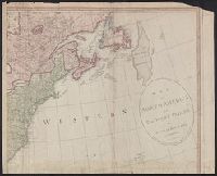
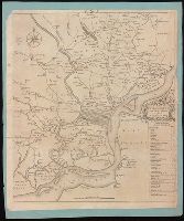
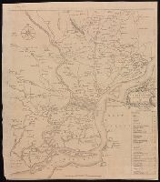
- Beinecke Rare Book and Manuscript Library > A Map of the most inhabited part of New England [cartographic material] : containing the provinces of Massachusets Bay and New Hampshire with the colonies of Conecticut and Rhode Island divided into counties and townships : The whole composed from actual
- Published / Created:
- [1774]
- Call Number:
- 76 1774
- Container / Volume:
- BRBL_00729
- Image Count:
- 2
- Resource Type:
- Maps, Atlases & Globes
- Found in:
- Beinecke Rare Book and Manuscript Library > A Map of the most inhabited part of New England [cartographic material] : containing the provinces of Massachusets Bay and New Hampshire with the colonies of Conecticut and Rhode Island divided into counties and townships : The whole composed from actual
- Published / Created:
- [1774]
- Call Number:
- 76 1774
- Container / Volume:
- BRBL_00443
- Image Count:
- 2
- Resource Type:
- Maps, Atlases & Globes
- Found in:
- Beinecke Rare Book and Manuscript Library > A Map of the most inhabited part of New England [cartographic material] : containing the provinces of Massachusets Bay and New Hampshire with the colonies of Conecticut and Rhode Island divided into counties and townships : The whole composed from actual
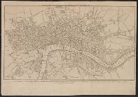
- Published / Created:
- [1780]
- Call Number:
- 32 L84 1780
- Container / Volume:
- BRBL_00048
- Image Count:
- 1
- Resource Type:
- Maps, Atlases & Globes
- Found in:
- Beinecke Rare Book and Manuscript Library > A New & Correct Plan of the Cities of London and Westminister, with the Borough of Southwark ...
- Creator:
- Blodget, Samuel, 1724-1807
- Published / Created:
- February the 2d, 1756.
- Call Number:
- 771hc H864 1756
- Container / Volume:
- BRBL_00495
- Image Count:
- 1
- Resource Type:
- Maps, Atlases & Globes
- Found in:
- Beinecke Rare Book and Manuscript Library > A Prospective view of the battle fought near Lake George, on the 8th of Sepr. 1755 : between 2000 English, with 250 Mohawks, under the command of Gen. Johnson: & 2500 French & indians under the command of Genl. Dieskau in which the English were victorious
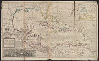
- Published / Created:
- [1783?]
- Call Number:
- 70 1783A
- Container / Volume:
- BRBL_00356
- Image Count:
- 3
- Resource Type:
- Maps, Atlases & Globes
- Found in:
- Beinecke Rare Book and Manuscript Library > A chart of North and South America : including the Atlantic and Pacific Oceans, with the nearest coasts of Europe, Africa and Asia : according to the preliminary articles of peace signed at Versailles, 20 Jany. 1783.
- Published / Created:
- [1783?]
- Call Number:
- 70 1775
- Container / Volume:
- BRBL_00686
- Image Count:
- 3
- Resource Type:
- Maps, Atlases & Globes
- Found in:
- Beinecke Rare Book and Manuscript Library > A chart of North and South America : including the Atlantic and Pacific Oceans, with the nearest coasts of Europe, Africa and Asia : according to the preliminary articles of peace signed at Versailles, 20 Jany. 1783.
- Creator:
- Pine, John, 1690-1756
Rocque, John, d. 1762
Tinney, John
- Published / Created:
- 1746
- Call Number:
- 2002 Folio 94
- Image Count:
- 1
- Resource Type:
- Maps, Atlases & Globes
- Found in:
- Beinecke Rare Book and Manuscript Library > A contracted scetch of the plan of London &c. : printed on 24 sheets of imperial paper, to shew the general appearance of the whole : for the use of those who bind it in a book, and for the better comprehension of the divisions mentioned in the index.
- Creator:
- Elstracke, Renold, active 1590-1630
- Published / Created:
- [1625]
- Call Number:
- BrSides 2019 110
- Image Count:
- 1
- Resource Type:
- Maps, Atlases & Globes
- Found in:
- Beinecke Rare Book and Manuscript Library > A description of East India : conteyning the Empire of the Great Mogoll / R. Elstracke sculpsit.
- Creator:
- Lodge, John, -1796
- Published / Created:
- [1778?]
- Call Number:
- BrSides 2017 62
- Image Count:
- 1
- Resource Type:
- Maps, Atlases & Globes
- Found in:
- Beinecke Rare Book and Manuscript Library > A general map of North America ; from the latest observations / engrav'd by Jno. Lodge from the late Mr. Jefferys, geographer to the King.
- Creator:
- Gibson, J. (John)
- Published / Created:
- 1758
- Call Number:
- 755 1758
- Container / Volume:
- BRBL_00428
- Image Count:
- 1
- Resource Type:
- Maps, Atlases & Globes
- Found in:
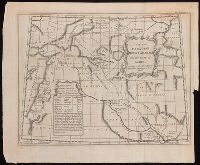
- Beinecke Rare Book and Manuscript Library > A general map of the middle British colonies in America : viz. Virginia, Maryland, Delaware, Pensilvania, New-Jersey, New-York, Connecticut and Rhode-Island : of Aquanishuonigy the country of the confederate Indians comprehending Aquanishuonigy proper, th
- Creator:
- Jefferys, Thomas, d. 1771
- Published / Created:
- 1775 June 15
- Call Number:
- 755 1775D
- Container / Volume:
- BRBL_00429
- Image Count:
- 1
- Resource Type:
- Maps, Atlases & Globes
- Found in:
- Beinecke Rare Book and Manuscript Library > A general map of the middle British colonies in America : viz. Virginia, Maryland, Delaware, Pensilvania, New-Jersey, New-York, Connecticut, and Rhode-Island : of Aquanishuonîgy the country of the Confederate Indians comprehending Aquanishuonigy proper,
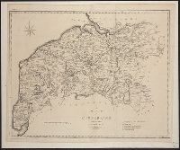
- Published / Created:
- 1805
- Call Number:
- 3238 1805
- Container / Volume:
- BRBL_00065
- Image Count:
- 1
- Resource Type:
- Maps, Atlases & Globes
- Found in:
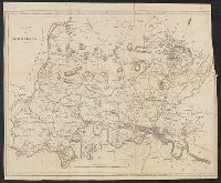
- Beinecke Rare Book and Manuscript Library > A map of Cumberland ... Engraved by J. Cary.
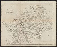
- Published / Created:
- 1798
- Call Number:
- 3258 1798
- Container / Volume:
- BRBL_00069
- Image Count:
- 1
- Resource Type:
- Maps, Atlases & Globes
- Found in:
- Beinecke Rare Book and Manuscript Library > A map of Hartfordshire.
- Published / Created:
- 1797
- Call Number:
- 3213 1797
- Container / Volume:
- BRBL_00055
- Image Count:
- 1
- Resource Type:
- Maps, Atlases & Globes
- Found in:
- Beinecke Rare Book and Manuscript Library > A map of Kent.
- Published / Created:
- 1805
- Call Number:
- 3235 1805
- Container / Volume:
- BRBL_00064
- Image Count:
- 1
- Resource Type:
- Maps, Atlases & Globes
- Found in:
- Beinecke Rare Book and Manuscript Library > A map of Lancashire ... Engraved by J. Cary.
- Creator:
- Kitchin, Thomas, d. 1784
- Published / Created:
- [1757]
- Call Number:
- 777 1758
- Container / Volume:
- BRBL_00690
- Image Count:
- 1
- Resource Type:
- Maps, Atlases & Globes
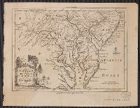
- Found in:
- Beinecke Rare Book and Manuscript Library > A map of Maryland with the Delaware counties and the southern part of New Jersey &c / [cartographic material] / by T. Kitchin geogr.
- Published / Created:
- 1798
- Call Number:
- 3217 1798
- Container / Volume:
- BRBL_00057
- Image Count:
- 1
- Resource Type:
- Maps, Atlases & Globes
- Found in:
- Beinecke Rare Book and Manuscript Library > A map of Middlesex.
- Creator:
- Speed, John, 1552?-1629
- Published / Created:
- [1676]
- Call Number:
- 755 1672A
- Container / Volume:
- BRBL_00423
- Image Count:
- 2
- Resource Type:
- Maps, Atlases & Globes
- Found in:
- Beinecke Rare Book and Manuscript Library > A map of New England and New York / F. Lamb sculp.
- Creator:
- Gibson, J. (John), active 1750-1792
- Published / Created:
- [1749]
- Call Number:
- BrSides 2019 63
- Image Count:
- 1
- Resource Type:
- Maps, Atlases & Globes
- Found in:
- Beinecke Rare Book and Manuscript Library > A map of New Scotland with its dependencies and a succint account of the country.
- Creator:
- Delarochette, L. (Louis), 1731-1802
- Published / Created:
- 1st of March 1789.
- Call Number:
- 71 1789
- Container / Volume:
- BRBL_00366
- Image Count:
- 4
- Resource Type:
- Maps, Atlases & Globes
- Found in:
- Beinecke Rare Book and Manuscript Library > A map of North America and the West Indies / by L.S. de la Rochette.
- Published / Created:
- 1787
- Call Number:
- 3218 1787
- Container / Volume:
- BRBL_00058
- Image Count:
- 1
- Resource Type:
- Maps, Atlases & Globes
- Found in:
- Beinecke Rare Book and Manuscript Library > A map of Oxfordshire... Heywood Delt. Sudlow fc.
- Creator:
- Osborne, Thomas, -1767
- Published / Created:
- [1747]
- Call Number:
- BrSides 2019 80
- Image Count:
- 1
- Resource Type:
- Maps, Atlases & Globes
- Found in:
- Beinecke Rare Book and Manuscript Library > A map of Paradise mount Ararat and the city of Babel : according to the three different hypotheses mentioned in this work.
- Creator:
- Scull, Nicholas, 1686?-1761?
- Published / Created:
- [1753]
- Call Number:
- BrSides 2019 60
- Image Count:
- 1
- Resource Type:
- Maps, Atlases & Globes
- Found in:
- Beinecke Rare Book and Manuscript Library > A map of Philadelphia and parts adjacent / by N. Scull and G. Heap.
- Creator:
- Scull, Nicholas, 1686?-1761?
- Published / Created:
- [1753]
- Call Number:
- BrSides 2019 61
- Image Count:
- 1
- Resource Type:
- Maps, Atlases & Globes
- Found in:
- Beinecke Rare Book and Manuscript Library > A map of Philadelphia and parts adjacent / by N. Scull and G. Heap.
- Creator:
- L'Isle, Guillaume de, 1675-1726
- Published / Created:
- 1711
- Call Number:
- 53 1711
- Container / Volume:
- BRBL_00684
- Image Count:
- 1
- Resource Type:
- Maps, Atlases & Globes
- Found in:
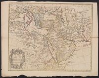
- Beinecke Rare Book and Manuscript Library > A map of Turky [sic] Arabia & Persia : corrected from the latest travels and from the observations of the Royal Societys of London and Paris / by G. De L'Isle.
- Creator:
- Speed, John, 1552?-1629
- Published / Created:
- [1676]
- Call Number:
- 783 1680
- Container / Volume:
- BRBL_00691
- Image Count:
- 2
- Resource Type:
- Maps, Atlases & Globes
- Found in:
- Beinecke Rare Book and Manuscript Library > A map of Virginia and Maryland / F. Lamb sculp.
- Creator:
- Speed, John, 1552?-1629
- Published / Created:
- [1676]
- Call Number:
- 755 1676D
- Container / Volume:
- BRBL_00423
- Image Count:
- 2
- Resource Type:
- Maps, Atlases & Globes
- Found in:
- Beinecke Rare Book and Manuscript Library > A map of Virginia and Maryland / F. Lamb sculp.
- Published / Created:
- 1805
- Call Number:
- 3253 1805
- Container / Volume:
- BRBL_00067
- Image Count:
- 1
- Resource Type:
- Maps, Atlases & Globes
- Found in:
- Beinecke Rare Book and Manuscript Library > A map of Westmoreland ... Engraved by J. Cary.
- Creator:
- Senex, John, d. 1740
- Published / Created:
- [1710]
- Call Number:
- 392 1710
- Container / Volume:
- BRBL_00684
- Image Count:
- 1
- Resource Type:
- Maps, Atlases & Globes
- Found in:
- Beinecke Rare Book and Manuscript Library > A map of old & new Castile : from the observations of Rodrigo Mendes Silva and others.
- Creator:
- Bowen, Thomas, -1790
- Published / Created:
- 1755]
- Call Number:
- BrSides Folio 2019 104
- Image Count:
- 1
- Resource Type:
- Maps, Atlases & Globes
- Found in:
- Beinecke Rare Book and Manuscript Library > A map of the British and French settlements in North America / T. Bowen, sculpt.
- Creator:
- Moll, Herman, -1732
- Published / Created:
- [1736?]
- Call Number:
- 18 1739
- Container / Volume:
- BRBL_00682
- Image Count:
- 1
- Resource Type:
- Maps, Atlases & Globes
- Found in:
- Beinecke Rare Book and Manuscript Library > A map of the North Pole : with all the territories that lye near it, known to us &c. : according to the latest discoveries, and most exact observations : agreeable to modern history / by H. Moll geographer.
- Creator:
- Leach, John, Captain
- Published / Created:
- [approximately 1745]
- Call Number:
- BrSides 2019 87
- Image Count:
- 1
- Resource Type:
- Maps, Atlases & Globes
- Found in:
- Beinecke Rare Book and Manuscript Library > A map of the River Gambra from Eropina to Barrakunda / by Captn. John Leach in 1732 ; Thos. Kitchin sculpt.
- Published / Created:
- [1720?]
- Call Number:
- 85 1720
- Container / Volume:
- BRBL_00636
- Image Count:
- 1
- Resource Type:
- Maps, Atlases & Globes
- Found in:
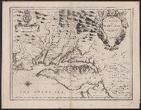
- Beinecke Rare Book and Manuscript Library > A map of the West Indies or the Islands of America ... explaining what belongs to Spain, England, France, Holland & c. also ye trade winds ...
- Published / Created:
- [1720?]
- Call Number:
- 85 1720
- Container / Volume:
- BRBL_00636
- Image Count:
- 1
- Resource Type:
- Maps, Atlases & Globes
- Found in:
- Beinecke Rare Book and Manuscript Library > A map of the West Indies or the Islands of America ... explaining what belongs to Spain, England, France, Holland & c. also ye trade winds ...
- Published / Created:
- [1770]
- Call Number:
- 11 1770
- Container / Volume:
- BRBL_00005
- Image Count:
- 1
- Resource Type:
- Maps, Atlases & Globes
- Found in:
- Beinecke Rare Book and Manuscript Library > A map of the World Corrected from the observations communicated to the Royal Societys of London and Paris by John Senex. H. Hulsbergh Sc.
- Creator:
- Kitchin, Thomas, d. 1784
- Published / Created:
- 1778
- Call Number:
- 76 1778
- Container / Volume:
- BRBL_00690
- Image Count:
- 2
- Resource Type:
- Maps, Atlases & Globes
- Found in:
- Beinecke Rare Book and Manuscript Library > A map of the colony of Rhode Island [cartographic material] : with the adjacent parts of Connecticut, Massachusetts Bay, & c / by Thos. Kitchin Senr., Hydrographer to His Majesty.
- Creator:
- L'Isle, Guillaume de, 1675-1726
- Published / Created:
- [1720?]
- Call Number:
- 3826 1710
- Container / Volume:
- BRBL_00684
- Image Count:
- 1
- Resource Type:
- Maps, Atlases & Globes
- Found in:
- Beinecke Rare Book and Manuscript Library > A map of the county of Flanders / [cartographic material] / by William de l'Isle ...
- Creator:
- Kitchin, Thomas, 1718-1784
- Published / Created:
- 1756
- Call Number:
- 755 1765A
- Container / Volume:
- BRBL_00690
- Image Count:
- 1
- Resource Type:
- Maps, Atlases & Globes
- Found in:
- Beinecke Rare Book and Manuscript Library > A map of the eastern part of the Province of New York : with part of New Jersey &c. / drawn from the best authorities by T. Kitchin geogr.
- Creator:
- Rocque, John, -1762.
- Published / Created:
- [between 1762 and 1773]
- Call Number:
- 327 1785
- Image Count:
- 2
- Resource Type:
- Maps, Atlases & Globes
- Found in:
- Beinecke Rare Book and Manuscript Library > A map of the kingdom of Ireland : divided into provinces, counties and baronies, shewing the archbishopricks, bishopricks, cities, boroughs, market towns, villages, barracks, mountains, lakes, bogs, rivers, bridges, ferries, passes : also, the great, the branch and the by post roads, together with the inland navigation, &c. / by John Rocque ...
- Creator:
- Jefferys, Thomas, -1771.
- Published / Created:
- November 29th 1755.
- Call Number:
- 76 1755A
- Container / Volume:
- BRBL_00443
- Image Count:
- 2
- Resource Type:
- Maps, Atlases & Globes
- Found in:
- Beinecke Rare Book and Manuscript Library > A map of the most inhabited part of New England : containing the provinces of Massachusetts Bay and New Hampshire, with the colonies of Konektikut and Rhode Island, divided into counties and townships: The whole composed from actual surveys and its situat
- Creator:
- L'Isle, Guillaume de, 1675-1726
- Published / Created:
- 1713
- Call Number:
- 38 1713
- Container / Volume:
- BRBL_00684
- Image Count:
- 1
- Resource Type:
- Maps, Atlases & Globes
- Found in:
- Beinecke Rare Book and Manuscript Library > A map of the provostship and vicounty of Paris [cartographic material] : drawn from a great number of particular memoirs made according to the observations of the Royal Academy of Sciences / by G Delisle ...
- Creator:
- Purcell, Joseph (Cartographer)
- Published / Created:
- 1792
- Call Number:
- 755 1792A
- Container / Volume:
- BRBL_00435
- Image Count:
- 1
- Resource Type:
- Maps, Atlases & Globes
- Found in:
- Beinecke Rare Book and Manuscript Library > A map of the states of Virginia, North Carolina, South Carolina and Georgia [cartographic material] : comprehending the Spanish provinces of east and west Florida : exhibiting the boundaries as fixed by the late treaty of peace between the United States a
- Published / Created:
- [1752]
- Call Number:
- BrSides 2019 81
- Image Count:
- 1
- Resource Type:
- Maps, Atlases & Globes
- Found in:
- Beinecke Rare Book and Manuscript Library > A map of the terrestrial Paradise according to Mr. Huet / with improvements from Dr. Wells.
- Creator:
- Kitchin, Thomas, 1718-1784
- Published / Created:
- [1764]
- Call Number:
- BrSides Folio 2019 92
- Collection Title:
- Navigantium atque itinerantium bibliotheca ; Or, A complete collection of voyages and travels
- Image Count:
- 1
- Resource Type:
- Maps, Atlases & Globes
- Found in:
- Beinecke Rare Book and Manuscript Library > A new & accurate map of China : drawn from surveys made by the Jesuit Missionaries, by order of the Emperor, regulated by numerous astronomical observations / by Thos. Kitchin Geogr.
- Creator:
- Bowen, Emanuel, 1693 or 1694-1767, cartographer.
- Published / Created:
- [1747]
- Call Number:
- 655 1747
- Container / Volume:
- BRBL_00345
- Image Count:
- 1
- Resource Type:
- Maps, Atlases & Globes
- Found in:
- Beinecke Rare Book and Manuscript Library > A new & accurate map of Negroland and the adjacent countries : also Upper Guinea, shewing the principal European settlements, & distinguishing w[hi]ch belong to England, Denmark, Holland &c., the sea coast & some of the rivers being drawn from surveys & t
- Published / Created:
- [1708?]
- Call Number:
- 38 1708
- Container / Volume:
- BRBL_00151
- Image Count:
- 1
- Resource Type:
- Maps, Atlases & Globes
- Found in:
- Beinecke Rare Book and Manuscript Library > A new and Exact map of France ... H. Moll Geographer.
- Published / Created:
- 1711
- Call Number:
- 39 1711
- Container / Volume:
- BRBL_00185
- Image Count:
- 1
- Resource Type:
- Maps, Atlases & Globes
- Found in:
- Beinecke Rare Book and Manuscript Library > A new and Exact map of Spanish & Portugal ... H. Moll, Geographer.