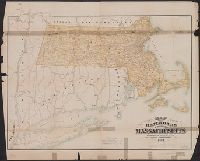
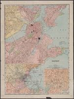
Search
You Searched For
Search Results
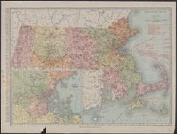
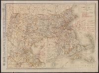
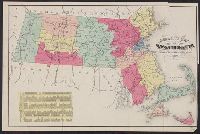
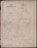
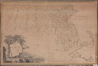
- Creator:
- Rand McNally and Company
- Published / Created:
- [1911]
- Call Number:
- 764 1911
- Container / Volume:
- BRBL_00453
- Image Count:
- 1
- Resource Type:
- Maps, Atlases & Globes
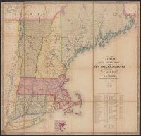
- Description:
- principal cities, list of Massachusetts
- Subject (Geographic):
- Massachusetts--Maps
- Subject (Topic):
- Railroads--Massachusetts--Maps
- Found in:
- Beinecke Rare Book and Manuscript Library > Massachusetts.
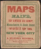
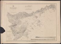
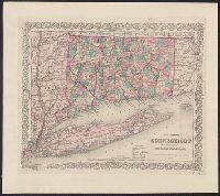
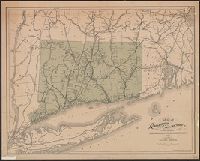
- Published / Created:
- 1846
- Call Number:
- 76 1846A
- Container / Volume:
- BRBL_00445
- Image Count:
- 7
- Resource Type:
- Maps, Atlases & Globes
- Found in:
- Beinecke Rare Book and Manuscript Library > Maps of Maine, New Hampshire and Vermont, Massachusetts & Rhode Island, Connecticut, New York and New York City.
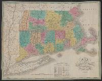
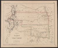
- Creator:
- Massachusetts. Board of Railroad Commissioners
- Published / Created:
- 1882
- Call Number:
- 764gme 1882
- Container / Volume:
- BRBL_00462
- Image Count:
- 1
- Resource Type:
- Maps, Atlases & Globes
- Description:
- Shows railroads in Massachusetts and
- Subject (Geographic):
- Massachusetts--Maps
- Subject (Topic):
- Railroads--Massachusetts--Maps
- Found in:
- Beinecke Rare Book and Manuscript Library > Map of the railroads of the state of Massachusetts : accompanying the report of the Railroad Commissioners.
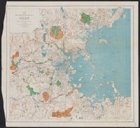
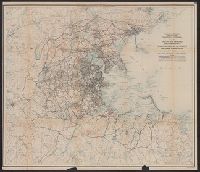
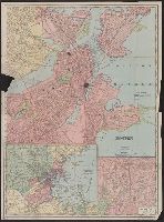
- Creator:
- Massachusetts. Metropolitan Park Commission
- Published / Created:
- 1908
- Call Number:
- 764 B65 1908
- Container / Volume:
- BRBL_00456
- Image Count:
- 1
- Resource Type:
- Maps, Atlases & Globes
- Subject (Geographic):
- Massachusetts--Maps
- Subject (Topic):
- Recreation areas--Massachusetts
- Found in:
- Beinecke Rare Book and Manuscript Library > Plan for proposed park and parkways : from Charles River Reservation to West Roxbury Parkway connecting the northern and southern group of metropolitan parks.
- Creator:
- Massachusetts. Metropolitan Park Commission
- Published / Created:
- 1893
- Call Number:
- 764 B65 1893
- Container / Volume:
- BRBL_00456
- Image Count:
- 1
- Resource Type:
- Maps, Atlases & Globes
- Subject (Topic):
- Open spaces--Massachusetts--Boston
- Found in:
- Beinecke Rare Book and Manuscript Library > Map of the metropolitan district of Boston, Massachusetts : showing the existing public reservations and such new open spaces as are proposed by Charles Eliot, Landscape Architect, in his report to the Metropolitan Park Commission.
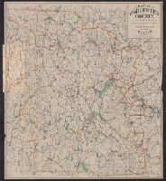
- Creator:
- Geo. H. Walker & Co
- Published / Created:
- c1904.
- Call Number:
- 764 W89 1904
- Container / Volume:
- BRBL_00460
- Image Count:
- 1
- Resource Type:
- Maps, Atlases & Globes
- Alternative Title:
- Worcester County, Massachusetts
- Description:
- , Massachusetts.
- Subject (Topic):
- Cycling--Massachusetts--Worcester
- Found in:
- Beinecke Rare Book and Manuscript Library > Map of Worcester County, Mass. / published by Geo. H. Walker & Co.
- Published / Created:
- 1884
- Call Number:
- 764gme 1884
- Container / Volume:
- BRBL_00462
- Image Count:
- 1
- Resource Type:
- Maps, Atlases & Globes
- Description:
- Shows railroads in Massachusetts and
- Subject (Geographic):
- Massachusetts--Maps
- Found in:
- Beinecke Rare Book and Manuscript Library > Map of the railroads of the state of Massachusetts : accompanying the report of the Railroad Commissioners.
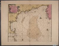
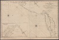
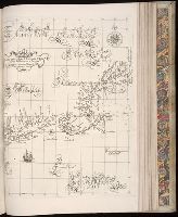
- Published / Created:
- [1684?]
- Call Number:
- 755 1684B
- Container / Volume:
- BRBL_00424
- Image Count:
- 1
- Resource Type:
- Maps, Atlases & Globes
- Description:
- Massachusetts and Nova Scotia.
- Found in:
- Beinecke Rare Book and Manuscript Library > Pas-Kaart. Vande Zee Kusten inde Boght van Niew Engeland Tusschen de Staaten Hoek en C. de Sable. Door vooght Geometra ... Boek en zee Kaart Verkoper met Privlegie voor 15 Iaaren.
- Published / Created:
- c1891
- Call Number:
- 764 P74 1891
- Container / Volume:
- BRBL_00459
- Image Count:
- 1
- Resource Type:
- Maps, Atlases & Globes
- Description:
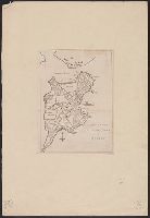
- Massachusetts. [Unknown ed.] p. 102-103.
- Subject (Geographic):
- Massachusetts--Maps
- Found in:
- Beinecke Rare Book and Manuscript Library > Massachusetts atlas plate no. 6 [Southern Norfolk and Plymouth counties].
- Creator:
- Shurtleff, Arthur A. (Arthur Asahel), 1870-1957
- Published / Created:
- [1909]
- Call Number:
- 764 B65 1909E
- Container / Volume:
- BRBL_00456A
- Image Count:
- 1
- Resource Type:
- Maps, Atlases & Globes
- Publisher:
- Commonwealth of Massachusetts
- Subject (Name):
- Massachusetts. Metropolitan
- Subject (Topic):
- City planning--Massachusetts--Boston
- Found in:
- Beinecke Rare Book and Manuscript Library > [Boston, Mass., Cambridge Bridge to North Station : proposed redevelopment] / Arthur A. Shurtleff.
- Creator:
- Shurtleff, Arthur A. (Arthur Asahel), 1870-1957
- Published / Created:
- [1909]
- Call Number:
- 764 B65 1909D
- Container / Volume:
- BRBL_00456A
- Image Count:
- 1
- Resource Type:
- Maps, Atlases & Globes
- Publisher:
- Commonwealth of Massachusetts
- Subject (Name):
- Massachusetts. Metropolitan
- Subject (Topic):
- City planning--Massachusetts--Boston
- Found in:
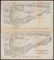
- Beinecke Rare Book and Manuscript Library > [Boston, Mass., Providence R.R. property : proposed redevelopment] / Arthur A. Shurtleff.
- Creator:
- Shurtleff, Arthur A. (Arthur Asahel), 1870-1957
- Published / Created:
- 1909
- Call Number:
- 764 B65 1909B
- Container / Volume:
- BRBL_00456
- Image Count:
- 1
- Resource Type:
- Maps, Atlases & Globes
- Publisher:
- Commonwealth of Massachusetts
- Subject (Name):
- Massachusetts. Metropolitan
- Subject (Topic):
- Highway planning--Massachusetts--Boston
- Found in:
- Beinecke Rare Book and Manuscript Library > Map of the existing and proposed circumferential thoroughfares of the district / Arthur A. Shurtleff.
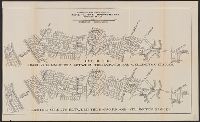
- Creator:
- Shurtleff, Arthur A. (Arthur Asahel), 1870-1957
- Published / Created:
- [1909]
- Call Number:
- 764 B65 1909G
- Container / Volume:
- BRBL_00456A
- Image Count:
- 1
- Resource Type:
- Maps, Atlases & Globes
- Publisher:
- Commonwealth of Massachusetts
- Subject (Name):
- Massachusetts. Metropolitan
- Subject (Topic):
- Highway planning--Massachusetts--Boston
- Found in:
- Beinecke Rare Book and Manuscript Library > [Boston, Mass., between Allston and Somerville : proposed redevelopment] / Arthur A. Shurtleff.
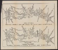
- Creator:
- Shurtleff, Arthur A. (Arthur Asahel), 1870-1957
- Published / Created:
- [1909]
- Call Number:
- 764 B65 1909F
- Container / Volume:
- BRBL_00456A
- Image Count:
- 1
- Resource Type:
- Maps, Atlases & Globes
- Publisher:
- Commonwealth of Massachusetts
- Subject (Name):
- Massachusetts. Metropolitan
- Subject (Topic):
- Highway planning--Massachusetts--Boston
- Found in:
- Beinecke Rare Book and Manuscript Library > [Boston, Mass., streets between Harvard and Wellington Bridges : proposed redevelopment] / Arthur A. Shurtleff.
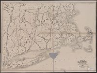
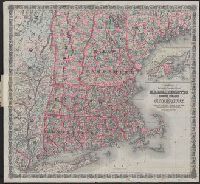
- Creator:
- Rand McNally and Company
- Published / Created:
- [1921]
- Call Number:
- 764 1921
- Container / Volume:
- BRBL_00453
- Image Count:
- 2
- Resource Type:
- Maps, Atlases & Globes
- Alternative Title:
- Standard map of Massachusetts
- Description:
- principal cities, list of Massachusetts
- Subject (Geographic):
- Massachusetts--Maps
- Subject (Topic):
- Railroads--Massachusetts--Maps
- Found in:
- Beinecke Rare Book and Manuscript Library > Rand McNally standard map of Massachusetts.
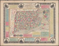
- Published / Created:
- 1825
- Call Number:
- 76 1825A
- Container / Volume:
- BRBL_00444
- Image Count:
- 1
- Resource Type:
- Maps, Atlases & Globes
- Abstract:
- Massachusetts, Connecticut and Rhode Island, divided
- Alternative Title:
- Massachusetts Connecticut & Rhode
- Description:
- Cover title: Massachusetts Connecticut
- Subject (Geographic):
- Massachusetts--Maps.
- Found in:
- Beinecke Rare Book and Manuscript Library > Map of Massachusetts Connecticut and Rhode Island [cartographic material] : constructed from the latest authorities. 1825. / Drawn by D.H. Vance. Engraved by J.H. Young.
- Creator:
- Walker, O. W. (Oscar W.)
- Published / Created:
- c1896.
- Call Number:
- 764 1896
- Container / Volume:
- BRBL_00453
- Image Count:
- 1
- Resource Type:
- Maps, Atlases & Globes
- Description:
- Massachusetts, p. 26-27.
- Found in:
- Beinecke Rare Book and Manuscript Library > Massachusetts atlas plate no. 2 [part of Essex County including Cape Ann].
- Creator:
- Massachusetts. Board of Railroad Commissioners
- Published / Created:
- 1874
- Call Number:
- 764gme 1874
- Container / Volume:
- BRBL_00462
- Image Count:
- 1
- Resource Type:
- Maps, Atlases & Globes
- Subject (Geographic):
- Massachusetts--Maps
- Subject (Topic):
- Railroads--Massachusetts--Maps
- Found in:
- Beinecke Rare Book and Manuscript Library > Map of the railroads of the state of Massachusetts : accompanying the report of the railroad commissioners. 1874.
- Published / Created:
- [1815].
- Call Number:
- 755cea 1815
- Container / Volume:
- BRBL_00442
- Image Count:
- 1
- Resource Type:
- Maps, Atlases & Globes
- Found in:
- Beinecke Rare Book and Manuscript Library > A new chart of the coast of Connecticut. New York, New Jersey and the Delaware ... by Samuel Lambert, Salem. Wightman Sculpsit.
- Creator:
- Oliver, William T
- Published / Created:
- c1893.
- Call Number:
- 764gmb 1893
- Container / Volume:
- BRBL_00462
- Image Count:
- 10
- Resource Type:
- Maps, Atlases & Globes
- Subject (Geographic):
- Massachusetts--Maps
- Subject (Name):
- . Massachusetts Division
- Subject (Topic):
- Bicycle trails--Massachusetts--Maps
- Found in:
- Beinecke Rare Book and Manuscript Library > Cyclists' road map of Massachusetts / prepared expressly for the Mass. Div. L.A.W., by William T. Oliver.
- Creator:
- Ensign, Bridgman & Fanning
- Published / Created:
- 1855
- Call Number:
- 76 1855
- Container / Volume:
- BRBL_00445
- Image Count:
- 1
- Resource Type:
- Maps, Atlases & Globes
- Alternative Title:
- Massachusetts, Connecticut and Rhode
- Subject (Geographic):
- Massachusetts--Maps
- Subject (Topic):
- Cities and towns--Massachusetts--Maps
- Found in:
- Beinecke Rare Book and Manuscript Library > Township map of Massachusetts, Connecticut and Rhode Island.
- Creator:
- Russell, B. B. (Benjamin B.)
- Published / Created:
- 1874
- Call Number:
- 764 1874R
- Container / Volume:
- BRBL_00453
- Image Count:
- 1
- Resource Type:
- Maps, Atlases & Globes
- Found in:
- Beinecke Rare Book and Manuscript Library > Russell's map of Massachusetts.
- Creator:
- Geo. H. Walker & Co
- Published / Created:
- 1893
- Call Number:
- 764 M32 1893
- Container / Volume:
- BRBL_00458
- Image Count:
- 1
- Resource Type:
- Maps, Atlases & Globes
- Alternative Title:
- Latest map of Marblehead, Massachusetts
- Subject (Geographic):
- Massachusetts--Maps
- Found in:
- Beinecke Rare Book and Manuscript Library > Map of Marblehead, Mass.
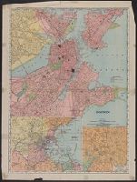
- Creator:
- Rand McNally and Company
- Published / Created:
- 1907
- Call Number:
- 764 B65 1907A
- Container / Volume:
- BRBL_00456
- Image Count:
- 2
- Resource Type:
- Maps, Atlases & Globes
- Description:
- Verso: Trolley map of Massachusetts
- Subject (Geographic):
- Massachusetts--Maps
- Found in:
- Beinecke Rare Book and Manuscript Library > Boston.
- Creator:
- Kitchin, Thomas, d. 1784
- Published / Created:
- 1778
- Call Number:
- 76 1778
- Container / Volume:
- BRBL_00690
- Image Count:
- 2
- Resource Type:
- Maps, Atlases & Globes
- Abstract:
- ; Massachusetts as far north as Boston, including Cape
- Found in:
- Beinecke Rare Book and Manuscript Library > A map of the colony of Rhode Island [cartographic material] : with the adjacent parts of Connecticut, Massachusetts Bay, & c / by Thos. Kitchin Senr., Hydrographer to His Majesty.
- Published / Created:
- 1857
- Call Number:
- 75gme 1857
- Container / Volume:
- BRBL_00412
- Image Count:
- 2
- Resource Type:
- Maps, Atlases & Globes
- Description:
- Massachusetts, Connecticut and Rhode Island, ca. 1
- Found in:
- Beinecke Rare Book and Manuscript Library > A new and complete Rail Road map of the United States / compiled from reliable sources by William Perris ; presented by the Home Insurance Company of New York ; Korff Brothers, Practical Lithographers, New York.
- Creator:
- G.W. & C.B. Colton & Co
- Published / Created:
- 1886
- Call Number:
- 76 1886
- Container / Volume:
- BRBL_00445
- Image Count:
- 1
- Resource Type:
- Maps, Atlases & Globes
- Alternative Title:
- Massachusetts, Rhode Island, and
- Found in:
- Beinecke Rare Book and Manuscript Library > Colton's railroad & township map of Massachusetts, Rhode Island and Connecticut : with parts of Maine, New Hampshire, Vermont & New York.
- Creator:
- Colton, J. H. (Joseph Hutchins), 1800-1893
- Published / Created:
- 1860
- Call Number:
- 764 1860
- Container / Volume:
- BRBL_00453
- Image Count:
- 1
- Resource Type:
- Maps, Atlases & Globes
- Found in:
- Beinecke Rare Book and Manuscript Library > Colton's Massachusetts and Rhode Island.
- Creator:
- Geo. H. Walker & Co
- Published / Created:
- c1891.
- Call Number:
- 764 1891A
- Container / Volume:
- BRBL_00453
- Image Count:
- 1
- Resource Type:
- Maps, Atlases & Globes
- Found in:
- Beinecke Rare Book and Manuscript Library > Massachusetts atlas plate no. 26.
- Creator:
- Geo. H. Walker & Co
- Published / Created:
- c1891.
- Call Number:
- 764 1891W
- Container / Volume:
- BRBL_00453
- Image Count:
- 1
- Resource Type:
- Maps, Atlases & Globes
- Found in:
- Beinecke Rare Book and Manuscript Library > Massachusetts atlas plate no. 27.
- Creator:
- Rand McNally and Company
- Published / Created:
- 1891
- Call Number:
- 764 1891
- Container / Volume:
- BRBL_00453
- Image Count:
- 1
- Resource Type:
- Maps, Atlases & Globes
- Found in:
- Beinecke Rare Book and Manuscript Library > Rand McNally & Co.'s Massachusetts.
- Creator:
- Ferguson, W. E
- Published / Created:
- 1850
- Call Number:
- 764gme 1850
- Container / Volume:
- BRBL_00462
- Image Count:
- 1
- Resource Type:
- Maps, Atlases & Globes
- Abstract:
- Map of eastern Massachusetts covering
- Subject (Topic):
- Railroads--Massachusetts--Maps
- Found in:
- Beinecke Rare Book and Manuscript Library > Map of the Old Colony Rail Road with its branches & connecting roads, prepared under the direction of the Committee of Investigation, Jany. 1850, S. Dwight Eaton, Engr.
- Creator:
- Dearborn, Benjamin, 1754-1838
- Published / Created:
- [1814]
- Call Number:
- 764 B65 1814A
- Container / Volume:
- BRBL_00455
- Image Count:
- 2
- Resource Type:
- Maps, Atlases & Globes
- Description:
- Removed from Massachusetts House
- Subject (Topic):
- Drainage--Massachusetts--Boston
- Found in:
- Beinecke Rare Book and Manuscript Library > A plan of those parts of Boston and the towns in its vicinity : with the waters and flats adjacent which are immediately or remotely connected with the contemplated design of erecting perpetual tide-mills.
- Creator:
- United States Coast Survey
- Published / Created:
- [1875]
- Call Number:
- 764cea SA32 1875
- Container / Volume:
- BRBL_00461
- Image Count:
- 1
- Resource Type:
- Maps, Atlases & Globes
- Subject (Topic):
- Harbors--Massachusetts--Salem--Maps
- Found in:
- Beinecke Rare Book and Manuscript Library > Salem harbor, Massachusetts / United States Coast Survey ; topography by F. Dankworth ; sand by H.M. Knight ; lettering by J. Knight & S.E. Stull ; views by G. McCoy.
- Creator:
- Geo. H. Walker & Co
- Published / Created:
- c1904.
- Call Number:
- 764gmb T193 1904
- Container / Volume:
- BRBL_00462
- Image Count:
- 1
- Resource Type:
- Maps, Atlases & Globes
- Alternative Title:
- Massachusetts
- Found in:
- Beinecke Rare Book and Manuscript Library > City of Taunton.
- Creator:
- Appalachian Mountain Club
- Published / Created:
- 1890
- Call Number:
- 764 B65 1890A
- Container / Volume:
- BRBL_00456
- Image Count:
- 1
- Resource Type:
- Maps, Atlases & Globes
- Publisher:
- Massachusetts,
- Subject (Name):
- Massachusetts. Topographical Survey
- Found in:
- Beinecke Rare Book and Manuscript Library > Map of the country about Boston / Geo. S. Harris & Sons, lith.
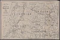
- Creator:
- Walling, Henry Francis, 1825-1888
- Published / Created:
- 1858
- Call Number:
- 764 B45 1858
- Container / Volume:
- BRBL_00454
- Image Count:
- 6
- Resource Type:
- Maps, Atlases & Globes
- Subject (Topic):
- Cities and towns--Massachusetts
- Found in:
- Beinecke Rare Book and Manuscript Library > Map of the county of Berkshire, Massachusetts : based upon the trigonometrical survey of the state / the details from actual surveys under the direction of Henry F. Walling, supt. of the state map.
- Creator:
- United States Coast Survey
- Published / Created:
- 1857
- Call Number:
- 764cea W86 1857
- Container / Volume:
- BRBL_00461
- Image Count:
- 1
- Resource Type:
- Maps, Atlases & Globes
- Subject (Topic):
- Harbors--Massachusetts--Woods Hole
- Found in:
- Beinecke Rare Book and Manuscript Library > The Harbor of Wood's Hole, Massachusetts / from a trigonometrical survey under the direction of A.D. Bache, superintendent of the Survey of the Coast of the United States. Triangulation by C.M. Eakin, assist. ; topography by W.M. Boyce assist. ; hydrograp
- Creator:
- Watson, Walter, civil engineer
- Published / Created:
- [1896].
- Call Number:
- 764 B45 1896
- Container / Volume:
- BRBL_00454
- Image Count:
- 1
- Resource Type:
- Maps, Atlases & Globes
- Subject (Topic):
- Railroads--Massachusetts--Berkshire
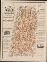
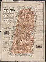
- Found in:
- Beinecke Rare Book and Manuscript Library > Railway and highway map of the famous Berkshire Hills region, showing also villages and points of interest : from official records and other information / by Walter Watson, C.E. for the Berkshire Life Insurance Co. of Pittsfield, Mass., 1883 (Corrected 18
- Creator:
- Watson, Walter, civil engineer
- Published / Created:
- [1896].
- Call Number:
- 764 B45 1896
- Container / Volume:
- BRBL_00454
- Image Count:
- 1
- Resource Type:
- Maps, Atlases & Globes
- Subject (Topic):
- Railroads--Massachusetts--Berkshire
- Found in:
- Beinecke Rare Book and Manuscript Library > Railway and highway map of the famous Berkshire Hills region, showing also villages and points of interest : from official records and other information / by Walter Watson, C.E. for the Berkshire Life Insurance Co. of Pittsfield, Mass., 1883 (Corrected 18
- Creator:
- Watson, Walter, civil engineer
- Published / Created:
- c1883.
- Call Number:
- 764 B45 1883
- Container / Volume:
- BRBL_00454
- Image Count:
- 1
- Resource Type:
- Maps, Atlases & Globes
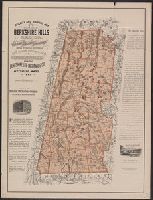
- Subject (Topic):
- Railroads--Massachusetts--Berkshire
- Found in:
- Beinecke Rare Book and Manuscript Library > Railway and highway map of the famous Berkshire Hills region, showing also villages and points of interest : from official records and other information / by Walter Watson, C.E. for the Berkshire Life Insurance Co. of Pittsfield, Mass., 1883.
- Creator:
- Watson, Walter, civil engineer
- Published / Created:
- c1883.
- Call Number:
- 764 B45 1883
- Container / Volume:
- BRBL_00454
- Image Count:
- 1
- Resource Type:
- Maps, Atlases & Globes
- Subject (Topic):
- Railroads--Massachusetts--Berkshire
- Found in:
- Beinecke Rare Book and Manuscript Library > Railway and highway map of the famous Berkshire Hills region, showing also villages and points of interest : from official records and other information / by Walter Watson, C.E. for the Berkshire Life Insurance Co. of Pittsfield, Mass., 1883.
- Creator:
- Swett and Powers (Firm)
- Published / Created:
- [ca. 1851?]
- Call Number:
- 76gme 1850
- Container / Volume:
- BRBL_00446A
- Image Count:
- 1
- Resource Type:
- Maps, Atlases & Globes
- Description:
- , Massachusetts, and part of New York.
- Found in:
- Beinecke Rare Book and Manuscript Library > Map of the New York & Boston Railway : with its connections with other railways.
- Published / Created:
- 1909
- Call Number:
- 764 B65 1909A
- Container / Volume:
- BRBL_00456
- Image Count:
- 1
- Resource Type:
- Maps, Atlases & Globes
- Subject (Name):
- Massachusetts. Metropolitan
- Subject (Topic):
- Highway planning--Massachusetts--Boston
- Found in:
- Beinecke Rare Book and Manuscript Library > Map of the existing and proposed radial thoroughfares : of the district and their connections / Commonwealth of Massachusetts Metropolitan Improvements Commission.
- Published / Created:
- [1833?]
- Call Number:
- 764CA 1833
- Container / Volume:
- BRBL_00460
- Image Count:
- 1
- Resource Type:
- Maps, Atlases & Globes
- Subject (Geographic):
- Massachusetts--Maps
- Found in:
- Beinecke Rare Book and Manuscript Library > Geological map of Massachusetts By Edw. D. Hitchcock 1833 ...
- Published / Created:
- [1886].
- Call Number:
- 764gme D86 1886
- Container / Volume:
- BRBL_00462
- Image Count:
- 1
- Resource Type:
- Maps, Atlases & Globes
- Subject (Geographic):
- Massachusetts--Maps
- Found in:
- Beinecke Rare Book and Manuscript Library > Location of the Providence, Webster, and Springfield Railroad Extension in Dudley [Massachusetts].
- Published / Created:
- [1886?].
- Call Number:
- 764gme 1886
- Container / Volume:
- BRBL_00462
- Image Count:
- 2
- Resource Type:
- Maps, Atlases & Globes
- Subject (Geographic):
- Massachusetts--Maps
- Found in:
- Beinecke Rare Book and Manuscript Library > [Maps of the locations of the Providence, Webster, and Springfield Railroad Company within Massachusetts].
- Published / Created:
- 1801
- Call Number:
- 764FB 1801
- Container / Volume:
- BRBL_00462
- Image Count:
- 1
- Resource Type:
- Maps, Atlases & Globes
- Subject (Geographic):
- Massachusetts--Maps
- Found in:
- Beinecke Rare Book and Manuscript Library > Map of Massachusetts proper compiled from actual surveys made by Order of the General Court. And under the inspection of Agents of their Appointment. By Osgood Carleton.
- Creator:
- Geological Survey (U.S.)
- Published / Created:
- 1921
- Call Number:
- 766gfb 1921
- Container / Volume:
- BRBL_00475
- Image Count:
- 1
- Resource Type:
- Maps, Atlases & Globes
- Alternative Title:
- States of Massachusetts, Rhode Island
- Subject (Topic):
- Electric lines--Massachusetts--Maps
- Found in:
- Beinecke Rare Book and Manuscript Library > Stations and transmission lines used in public service : [Massachusetts, Rhode Island and Connecticut] / Department of the Interior, U.S. Geological Survey ; compiled by G.D. Thomas.
- Creator:
- G.W. & C.B. Colton & Co
- Published / Created:
- 1878, c1855.
- Call Number:
- 766 1878
- Container / Volume:
- BRBL_00466
- Image Count:
- 1
- Resource Type:
- Maps, Atlases & Globes
- Description:
- portions of Massachusetts, Rhode Island, and
- Found in:
- Beinecke Rare Book and Manuscript Library > Colton's Connecticut : with portions of New York & Rhode Island.
- Creator:
- Tilden, S. D
- Published / Created:
- 1879
- Call Number:
- 766 1879
- Container / Volume:
- BRBL_00467
- Image Count:
- 1
- Resource Type:
- Maps, Atlases & Globes
- Description:
- adjacent areas of Massachusetts and New York
- Found in:
- Beinecke Rare Book and Manuscript Library > Map of the railroads of Connecticut : to accompany the report of the railroad commissioners / prepared by S. D. Tilden.
- Published / Created:
- 1837
- Call Number:
- 764gme 1837
- Container / Volume:
- BRBL_00462
- Image Count:
- 2
- Resource Type:
- Maps, Atlases & Globes
- Subject (Geographic):
- Massachusetts--Maps
- Found in:
- Beinecke Rare Book and Manuscript Library > Route of the Western Rail Road ... Enlarged from the Map of the State.
- Creator:
- American Association for the Advancement of Science
- Published / Created:
- 1880
- Call Number:
- 764 B65 1880A
- Container / Volume:
- BRBL_00456
- Image Count:
- 1
- Resource Type:
- Maps, Atlases & Globes
- Subject (Topic):
- Maps--Massachusetts--Boston--1880
- Found in:
- Beinecke Rare Book and Manuscript Library > Map of Boston and vicinity. Prepared for the use of members of the American Association for the Advancement of Science at the Boston meeting, August, 1880.
- Creator:
- Walling, Henry Francis, 1825-1888
- Published / Created:
- 1858
- Call Number:
- 764 N76 1858
- Container / Volume:
- BRBL_00458
- Image Count:
- 6
- Resource Type:
- Maps, Atlases & Globes
- Subject (Topic):
- Buildings--Massachusetts--Norfolk
- Found in:
- Beinecke Rare Book and Manuscript Library > Map of the county of Norfolk, Massachusetts / based upon the details of the trigonometrical survey of the state; the details from actual surveys under the direction of Henry F. Walling. Supt. of the state map.
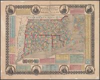
- Published / Created:
- 1848
- Call Number:
- 76 1848
- Container / Volume:
- BRBL_00445
- Image Count:
- 1
- Resource Type:
- Maps, Atlases & Globes
- Found in:
- Beinecke Rare Book and Manuscript Library > Map of Massachusetts, Rhode Island and Connecticut.
- Creator:
- Rand McNally and Company
- Published / Created:
- 1909
- Call Number:
- 764 B65 1909M
- Container / Volume:
- BRBL_00456A
- Image Count:
- 2
- Resource Type:
- Maps, Atlases & Globes
- Description:
- On verso: Trolley maps of Massachusetts
- Subject (Geographic):
- Massachusetts--Maps
- Subject (Topic):
- --Massachusetts--Boston--Maps
- Found in:
- Beinecke Rare Book and Manuscript Library > Boston.
- Published / Created:
- 1835
- Call Number:
- 764 B65 1835
- Container / Volume:
- BRBL_00455
- Image Count:
- 1
- Resource Type:
- Maps, Atlases & Globes
- Subject (Topic):
- City planning--Massachusetts--Boston
- Found in:
- Beinecke Rare Book and Manuscript Library > The South Cove territory, comprising every part which is coloured on this map.
- Published / Created:
- ca. 1747?]
- Call Number:
- 771 1760
- Container / Volume:
- BRBL_00690
- Image Count:
- 1
- Resource Type:
- Maps, Atlases & Globes
- Description:
- Connecticut, Massachusetts, Vermont, and part of
- Found in:
- Beinecke Rare Book and Manuscript Library > Map of Hudson's River, with the adjacent country [cartographic material].
- Published / Created:
- 1889?].
- Call Number:
- 764 B65 1889A
- Container / Volume:
- BRBL_00456
- Image Count:
- 1
- Resource Type:
- Maps, Atlases & Globes
- Subject (Geographic):
- Massachusetts--Boston--Maps
- Found in:
- Beinecke Rare Book and Manuscript Library > Boston and adjacent cities.
- Published / Created:
- 1661
- Call Number:
- 1976 Folio 152
- Collection Title:
- Arcano del mare di D. Rvberto Dvdleo dvca di Nortvmbria, e conte di VVarvich. Diviso in libri sei ...
- Container / Volume:
- Volume 2
- Image Count:
- 1
- Subject (Geographic):
- Massachusetts.
- Found in:
- Beinecke Rare Book and Manuscript Library > Carta particolare della nuova Belgia e parte della nuova Anglia
- Creator:
- Rand McNally and Company
- Published / Created:
- c1903.
- Call Number:
- 764 B65 1903
- Container / Volume:
- BRBL_00456
- Image Count:
- 1
- Resource Type:
- Maps, Atlases & Globes
- Subject (Topic):
- --Massachusetts--Boston--Maps
- Found in:
- Beinecke Rare Book and Manuscript Library > Boston.
- Creator:
- Johnson, A. J. (Alvin Jewett), 1827-1884
- Published / Created:
- [1866?]
- Call Number:
- 76 1866
- Container / Volume:
- BRBL_00445
- Image Count:
- 2
- Resource Type:
- Maps, Atlases & Globes
- Subject (Topic):
- Counties--Massachusetts--Maps
- Found in:
- Beinecke Rare Book and Manuscript Library > Johnson's Vermont, New Hampshire, Massachusetts, Rhode Island, and Connecticut.
- Creator:
- Sotzmann, D. F
- Published / Created:
- [ca. 1797?]
- Call Number:
- 764 1796
- Container / Volume:
- BRBL_00729
- Image Count:
- 1
- Resource Type:
- Maps, Atlases & Globes
- Subject (Geographic):
- Massachusetts--Administrative and
- Found in:
- Beinecke Rare Book and Manuscript Library > Massachusetts / entworfen von D.F. Sotzmann ; gestochen v. Paulus Schmidt.
- Creator:
- Price & Lee Co
- Published / Created:
- c1919.
- Call Number:
- 764 Sp84 1919
- Container / Volume:
- BRBL_00460
- Image Count:
- 2
- Resource Type:
- Maps, Atlases & Globes
- Alternative Title:
- New map of Springfield Massachusetts
- Found in:
- Beinecke Rare Book and Manuscript Library > The Price & Lee Co's new map of Springfield Massachusetts.
- Creator:
- Mitchell, John, 1711-1768
- Published / Created:
- [1755]
- Call Number:
- 71 1755D
- Container / Volume:
- BRBL_00363
- Image Count:
- 8
- Resource Type:
- Maps, Atlases & Globes
- Description:
- . Two cities in Massachusetts are named
- Found in:
- Beinecke Rare Book and Manuscript Library > A map of the British and French dominions in North America : with the roads, distances, limits, and extent of the settlements, humbly inscribed to the Right Honourable the Earl of Halifax, and the other Right Honourable the Lords Commissioners for Trade &
- Published / Created:
- 1783
- Call Number:
- 771 1783
- Container / Volume:
- BRBL_00477
- Image Count:
- 2
- Resource Type:
- Maps, Atlases & Globes
- Description:
- later becomes Vermont; Massachusetts, Rhode
- Found in:
- Beinecke Rare Book and Manuscript Library > Map of the State of New York and Parts adjacent. Will Cockburn, 1780. With the improvements in the year 1783.
- Creator:
- Colton, G. Woolworth (George Woolworth), 1827-1901
- Published / Created:
- 1866, c1860.
- Call Number:
- 753 1866C
- Container / Volume:
- BRBL_00415
- Image Count:
- 1
- Resource Type:
- Maps, Atlases & Globes
- Subject (Geographic):
- Massachusetts--Maps
- Subject (Topic):
- Railroads--Massachusetts--Maps
- Found in:
- Beinecke Rare Book and Manuscript Library > G. Woolworth Colton's railroad, township & distance map of New England : with adjacent portions of New York, Canada & New Brunswick.
- Published / Created:
- 1852?]
- Call Number:
- 811gme 1852
- Container / Volume:
- BRBL_00554
- Image Count:
- 1
- Resource Type:
- Maps, Atlases & Globes
- Description:
- Includes: Massachusetts, Rhode Island
- Found in:
- Beinecke Rare Book and Manuscript Library > Map of Michigan Southern, Northern Indiana and Chicago and Rock Island railroads : with their connections from Council Bluffs to New York / lith. by F. Michelin & Geo. Leefe.
- Creator:
- Smith, J. Calvin (John Calvin)
- Call Number:
- 771 1858
- Container / Volume:
- BRBL_00479
- Image Count:
- 1
- Resource Type:
- Maps, Atlases & Globes
- Description:
- & Massachusetts.
- Found in:
- Beinecke Rare Book and Manuscript Library > Map of the state of New York, showing the boundaries of counties & townships, the location of cities, towns and villages, the courses of rail roads, canals & state roads / by J. Calvin Smith ; engraved on steel by Sherman & Smith.
- Creator:
- Boynton, George W., d. 1884
- Published / Created:
- 1838]
- Call Number:
- 85 1838
- Container / Volume:
- BRBL_00694
- Image Count:
- 1
- Resource Type:
- Maps, Atlases & Globes
- Description:
- ... District Court of Massachusetts."
- Found in:
- Beinecke Rare Book and Manuscript Library > West Indies / [cartographic material] / engraved by G.W. Boynton.
- Creator:
- Horace Thayer & Co
- Published / Created:
- 1853
- Call Number:
- 76 1853
- Container / Volume:
- BRBL_00445
- Image Count:
- 1
- Resource Type:
- Maps, Atlases & Globes
- Alternative Title:
- Massachusetts, Connecticut and Rhode Island
- Subject (Geographic):
- Massachusetts--Maps
- Found in:
- Beinecke Rare Book and Manuscript Library > Rail-road & township map of Massachusetts, Connecticut and Rhode Island.
- Published / Created:
- 1774
- Call Number:
- Pequot Sm95
- Collection Title:
- An examination of the Connecticut claim to lands in Pennsylvania : with an appendix, containing
- Image Count:
- 1
- Subject (Geographic):
- Massachusetts.
- Found in:
- Beinecke Rare Book and Manuscript Library > [Untitled map depicting southern New England and the coastline]
- Published / Created:
- [1812?]
- Call Number:
- 76cea 1812
- Container / Volume:
- BRBL_00446
- Image Count:
- 2
- Resource Type:
- Maps, Atlases & Globes
- Found in:
- Beinecke Rare Book and Manuscript Library > New Chart of Massachusetts Bay ... by S. Lambert, Salem, 1812.
- Creator:
- E.P. Dutton (Firm)
- Published / Created:
- 1865
- Call Number:
- 764 B65 1865
- Container / Volume:
- BRBL_00455
- Image Count:
- 1
- Resource Type:
- Maps, Atlases & Globes
- Description:
- Massachusetts.
- Subject (Geographic):
- Massachusetts--Maps
- Found in:
- Beinecke Rare Book and Manuscript Library > Chart of Boston Harbor and Massachusetts Bay : with map of the adjacent country / published at the Boston Map Store.
- Call Number:
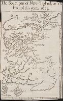
- Taylor 322
- Collection Title:
- Nevv Englands prospect; a true, lively, and experimentall description of that part of America
- Image Count:
- 1
- Subject (Geographic):
- Massachusetts --Description and travel
- Subject (Topic):
- --Massachusetts
- Found in:
- Beinecke Rare Book and Manuscript Library > The south part of New-England, as it is planted this yeare, 1634
- Creator:
- Boardman, Harvey
- Published / Created:
- c1858.
- Call Number:
- 762 W588 1858
- Container / Volume:
- BRBL_00451
- Image Count:
- 1
- Resource Type:
- Maps, Atlases & Globes
- Description:
- District Court of Massachusetts."
- Found in:
- Beinecke Rare Book and Manuscript Library > Map of the White Mountains, New Hampshire : from original surveys / by Harvey Boardman, 1858 / engraved by Smith Knight & Tappan, Boston.
- Creator:
- Aitken, Robert, 1735-1802
- Published / Created:
- 1775]
- Call Number:
- 764 B65 1775N
- Container / Volume:
- BRBL_00455
- Image Count:
- 1
- Resource Type:
- Maps, Atlases & Globes
- Subject (Topic):
- Fortification--Massachusetts--Boston
- Found in:
- Beinecke Rare Book and Manuscript Library > A new and correct plan of the town of Boston.
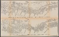
- Creator:
- Geo. W. Stadly & Co., cartographer
- Published / Created:
- ©1896.
- Call Number:
- 764 B65 +1896
- Image Count:
- 1
- Resource Type:
- Maps, Atlases & Globes
- Subject (Geographic):
- Massachusetts--Boston
- Subject (Topic):
- --Massachusetts--Boston--Maps
- Found in:
- Beinecke Rare Book and Manuscript Library > Map of the Central Business District of Boston [cartographic material] / from actual surveys and official plans.
- Creator:
- Rogers, Henry D. (Henry Darwin), 1808-1866
- Published / Created:
- [1857?]
- Call Number:
- 825 1857A
- Container / Volume:
- BRBL_00573
- Image Count:
- 1
- Resource Type:
- Maps, Atlases & Globes
- Description:
- District Court of Massachusetts."
- Found in:
- Beinecke Rare Book and Manuscript Library > Territory of Kansas and Indian Territory / by H.D. Rogers & A. Keith Johnston ; engraved by W. & A.K. Johnston, Edinburgh.
- Creator:
- Williams, Alexander
- Published / Created:
- 1852
- Call Number:
- 76GM 1852
- Container / Volume:
- BRBL_00446
- Image Count:
- 1
- Resource Type:
- Maps, Atlases & Globes
- Description:
- Massachusetts.
- Found in:
- Beinecke Rare Book and Manuscript Library > Williams' telegraph and rail road map of the New England states : Eastern portion of New York state and Canada/ compiled from the most authentic sources by Alexander Williams.
- Published / Created:
- 186-]
- Call Number:
- 754gme 1860B
- Container / Volume:
- BRBL_00420
- Image Count:
- 1
- Resource Type:
- Maps, Atlases & Globes
- Found in:
- Beinecke Rare Book and Manuscript Library > [Railroads of the Northern United States from Iowa to Boston, Massachusetts]
- Creator:
- Rogers, Henry D. (Henry Darwin), 1808-1866
- Published / Created:
- [1857?]
- Call Number:
- 824 1857B
- Container / Volume:
- BRBL_00570
- Image Count:
- 1
- Resource Type:
- Maps, Atlases & Globes
- Description:
- the District Court of Massachusetts."
- Found in:
- Beinecke Rare Book and Manuscript Library > Territory of Nebraska / by H.D. Rogers & A. Keith Johnston ; engraved by W. & A.K. Johnston.
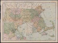
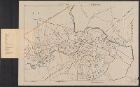
- Published / Created:
- 1889
- Call Number:
- 764 1889
- Container / Volume:
- BRBL_00453
- Image Count:
- 4
- Resource Type:
- Maps, Atlases & Globes
- Found in:
- Beinecke Rare Book and Manuscript Library > Massachusetts / compiled from the original sheets of a map made under the auspices of the United States and the Commonwealth of Massachusetts in 1884 to 1887.
- Creator:
- Hobbs, C. W
- Published / Created:
- 1901
- Call Number:
- 764 B65 1901
- Container / Volume:
- BRBL_00456
- Image Count:
- 2
- Resource Type:
- Maps, Atlases & Globes
- Subject (Geographic):
- Massachusetts--Maps
- Found in:
- Beinecke Rare Book and Manuscript Library > Guide map of Boston.
- Creator:
- Walker Lith. & Pub. Co
- Published / Created:
- 1909
- Call Number:
- 764 B65 1909
- Container / Volume:
- BRBL_00456
- Image Count:
- 1
- Resource Type:
- Maps, Atlases & Globes
- Subject (Geographic):
- Massachusetts--Maps
- Found in:
- Beinecke Rare Book and Manuscript Library > Map of Boston proper.
- Creator:
- Brown, Charles D
- Published / Created:
- 1897
- Call Number:
- 764 G515 1897
- Container / Volume:
- BRBL_00457
- Image Count:
- 1
- Resource Type:
- Maps, Atlases & Globes
- Subject (Geographic):
- Massachusetts--Maps
- Found in:
- Beinecke Rare Book and Manuscript Library > Map of Gloucester & vicinity / published for Chas. D. Brown, Gloucester, Mass.
- Creator:
- Walker, Alexander
- Published / Created:
- c1889.
- Call Number:
- 764 W6752 1889
- Container / Volume:
- BRBL_00460
- Image Count:
- 1
- Resource Type:
- Maps, Atlases & Globes
- Subject (Geographic):
- Massachusetts--Maps
- Found in:
- Beinecke Rare Book and Manuscript Library > Map of Williamstown, Mass. / compiled from town records and surveys by Alexander Walker, C.E.
- Creator:
- Sampson, Murdock & Co
- Published / Created:
- 1910
- Call Number:
- 764 L43 1910
- Container / Volume:
- BRBL_00457
- Image Count:
- 1
- Resource Type:
- Maps, Atlases & Globes
- Subject (Geographic):
- Massachusetts--Maps
- Found in:
- Beinecke Rare Book and Manuscript Library > Map of the city of Lawrence and vicinity / by Sampson & Murdock Co.
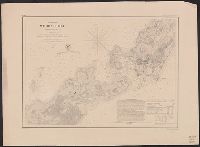
- Published / Created:
- 1877
- Call Number:
- 764 H76 1877
- Container / Volume:
- BRBL_00457
- Image Count:
- 1
- Resource Type:
- Maps, Atlases & Globes
- Subject (Geographic):
- Massachusetts--Maps
- Found in:
- Beinecke Rare Book and Manuscript Library > Profile of Hoosac Mountain showing tunnel, 1877.
- Creator:
- Rand McNally and Company
- Published / Created:
- c1891.
- Call Number:
- 764 B65 1891
- Container / Volume:
- BRBL_00456
- Image Count:
- 1
- Resource Type:
- Maps, Atlases & Globes
- Subject (Geographic):
- Massachusetts--Maps
- Found in:
- Beinecke Rare Book and Manuscript Library > Rand, McNally & Co.'s indexed atlas of the world map of Boston.
- Published / Created:
- 1847
- Call Number:
- 76 1847M
- Container / Volume:
- BRBL_00445
- Image Count:
- 1
- Resource Type:
- Maps, Atlases & Globes
- Found in:
- Beinecke Rare Book and Manuscript Library > Map of Massachusetts, Connecticut and Rhode Island Constructed from the latest Authorities.
- Published / Created:
- [1827]
- Call Number:
- 76 1827A
- Container / Volume:
- BRBL_00444
- Image Count:
- 1
- Resource Type:
- Maps, Atlases & Globes
- Found in:
- Beinecke Rare Book and Manuscript Library > Map of Massachusetts, Connecticut and Rhode Island. Constructed from the Latest Authorities.
- Published / Created:
- 1833
- Call Number:
- 76 1833
- Container / Volume:
- BRBL_00444
- Image Count:
- 1
- Resource Type:
- Maps, Atlases & Globes
- Found in:
- Beinecke Rare Book and Manuscript Library > Map of Massachusetts, Connecticut and Rhode Island. Constructed from the latest Authorities.
- Published / Created:
- [1795?]
- Call Number:
- 764 1795B
- Container / Volume:
- BRBL_00452
- Image Count:
- 1
- Resource Type:
- Maps, Atlases & Globes
- Found in:
- Beinecke Rare Book and Manuscript Library > The state of Massachusetts. Compiled from the best authorities by Samuel Lewis.
- Creator:
- Muzzey, George E
- Published / Created:
- [1864?]
- Call Number:
- 754hc 1864
- Container / Volume:
- BRBL_00421
- Image Count:
- 1
- Resource Type:
- Maps, Atlases & Globes
- Subject (Name):
- United States.--Army.--Massachusetts
- Found in:
- Beinecke Rare Book and Manuscript Library > Marches of Webster regiment, 12th Mass. Vol. Infantry, July, 1861 to June, 1864 : the country copied from U.S. Engineers' map. Route traced from pocket-map of Geo. E. Muzzey, 1st Lieut. & Quartermaster.
- Published / Created:
- 1781
- Call Number:
- 764cea C17 1781
- Container / Volume:
- BRBL_00461
- Image Count:
- 1
- Resource Type:
- Maps, Atlases & Globes
- Subject (Geographic):
- Massachusetts--Maps--Early works to
- Found in:
- Beinecke Rare Book and Manuscript Library > [A chart of the harbours of Hampton, Newbury, Ipswick, Jebeka, Squam, Cape Ann, Manchester, Beverly, Salem, Marblehead &c. Surveyed by Samuel Holland.
- Creator:
- Barnes, Oliver W
- Published / Created:
- 1868
- Call Number:
- 771 1868A
- Container / Volume:
- BRBL_00479
- Image Count:
- 1
- Resource Type:
- Maps, Atlases & Globes
- Subject (Geographic):
- Massachusetts--Maps
- Subject (Topic):
- Railroads--Massachusetts--Maps
- Found in:
- Beinecke Rare Book and Manuscript Library > Map of portions of New York and New England showing the routes of the Dutchess and Columbia & Connecticut Western Rail Roads / Oliver W. Barnes.
- Creator:
- Thoreau, Henry David, 1817-1862
- Published / Created:
- 1854
- Call Number:
- Za T391 854
- Image Count:
- 2
- Found in:
- Beinecke Rare Book and Manuscript Library > Walden, or, life in the woods / by Henry D. Thoreau ...