Search
You Searched For
Search Results
- Creator:
- Sanborn Map Company, cartographer.
- Published / Created:
- June, 1948.
- Call Number:
- 804ae El64 1948
- Container / Volume:
- BRBL_00717
- Image Count:
- 4
- Resource Type:
- Maps, Atlases & Globes
- Found in:
- Beinecke Rare Book and Manuscript Library > Elmore, Ottowa County Ohio.
- Published / Created:
- [1890?]
- Call Number:
- 773gme 1890
- Container / Volume:
- BRBL_00497
- Image Count:
- 1
- Resource Type:
- Maps, Atlases & Globes
- Found in:
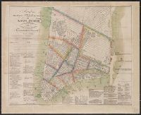
- Beinecke Rare Book and Manuscript Library > Erie Railroad suburban lines.
- Published / Created:
- 1908
- Call Number:
- 754gme 1908
- Container / Volume:
- BRBL_00420
- Image Count:
- 1
- Resource Type:
- Maps, Atlases & Globes
- Found in:
- Beinecke Rare Book and Manuscript Library > Erie Railroad with branches and connections / Office of Chief Engineer.
- Creator:
- General Drafting Company
- Published / Created:
- 1944?
- Call Number:
- 57hd 1944
- Container / Volume:
- BRBL_00307
- Image Count:
- 2
- Resource Type:
- Maps, Atlases & Globes
- Found in:
- Beinecke Rare Book and Manuscript Library > Esso war map III featuring the Pacific Theater : a third war map / edited, drafted and printed by the makers of the peace-time Esso road maps.
- Creator:
- General Drafting Company
- Published / Created:
- 1944?
- Call Number:
- 57 1942
- Container / Volume:
- BRBL_00303
- Image Count:
- 2
- Resource Type:
- Maps, Atlases & Globes
- Found in:
- Beinecke Rare Book and Manuscript Library > Esso war map III featuring the Pacific Theater : a third war map / edited, drafted and printed by the makers of the peace-time Esso road maps.
- Creator:
- General Drafting Company
- Published / Created:
- 1944?
- Call Number:
- 57hd 1944
- Container / Volume:
- BRBL_00307
- Image Count:
- 2
- Resource Type:
- Maps, Atlases & Globes
- Found in:
- Beinecke Rare Book and Manuscript Library > Esso war map III featuring the Pacific Theater : a third war map / edited, drafted and printed by the makers of the peace-time Esso road maps.
- Creator:
- Esso Marketers
General Drafting Company
- Published / Created:
- 1944?
- Call Number:
- 11hd 1940E
- Container / Volume:
- BRBL_00010ZB
- Image Count:
- 2
- Resource Type:
- Maps, Atlases & Globes
- Found in:
- Beinecke Rare Book and Manuscript Library > Esso war map III featuring the Pacific Theater : a third war map / edited, drafted and printed by the makers of the peace-time Esso road maps.
- Creator:
- Esso Marketers
General Drafting Company
- Published / Created:
- 1944?
- Call Number:
- 23hc 1942
- Container / Volume:
- BRBL_00021
- Image Count:
- 2
- Resource Type:
- Maps, Atlases & Globes
- Found in:
- Beinecke Rare Book and Manuscript Library > Esso war map III featuring the Pacific Theater : a third war map / edited, drafted and printed by the makers of the peace-time Esso road maps.
- Creator:
- Gross, Alexander, 1879-1958
- Published / Created:
- [1939?]
- Call Number:
- 30 1939B
- Container / Volume:
- BRBL_00032B
- Image Count:
- 2
- Resource Type:
- Maps, Atlases & Globes
- Found in:
- Beinecke Rare Book and Manuscript Library > Europe / produced under the direction of Alexander Gross, F.R.G.S.
- Published / Created:
- 1840
- Call Number:
- 30 1840A
- Container / Volume:
- BRBL_00031
- Image Count:
- 1
- Resource Type:
- Maps, Atlases & Globes
- Found in:
- Beinecke Rare Book and Manuscript Library > Europe with part of Asia and Africa.
- Creator:
- C.S. Hammond & Company
- Published / Created:
- 1915
- Call Number:
- 30 1915B
- Container / Volume:
- BRBL_00032
- Image Count:
- 1
- Resource Type:
- Maps, Atlases & Globes
- Found in:
- Beinecke Rare Book and Manuscript Library > Europe.
- Published / Created:
- 1863
- Call Number:
- 774hc G33 1863D
- Container / Volume:
- BRBL_00502
- Image Count:
- 1
- Resource Type:
- Maps, Atlases & Globes
- Found in:
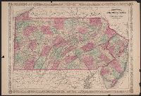
- Beinecke Rare Book and Manuscript Library > Field of Gettysburg, July 1st, 2nd & 3rd, 1863 / Prepared by T. Ditterline.
- Creator:
- General Drafting Company
- Published / Created:
- c1940
- Call Number:
- 348 1940
- Container / Volume:
- BRBL_00099
- Image Count:
- 2
- Resource Type:
- Maps, Atlases & Globes
- Found in:
- Beinecke Rare Book and Manuscript Library > Finland (Suomi) / Finnish Relief Fund.
- Published / Created:
- [1864?]
- Call Number:
- 754hc 1864A
- Container / Volume:
- BRBL_00421
- Image Count:
- 1
- Resource Type:
- Maps, Atlases & Globes
- Found in:
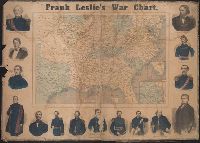
- Beinecke Rare Book and Manuscript Library > Frank Leslie's war chart : map of the southern and border states, showing the actual positions of the National and Rebel forces, and of the blockading fleets and vessels, the positions of the various fortifications that have been erected, and the localiti
- Creator:
- Leslie, Frank, 1821-1880
- Published / Created:
- [1862]
- Call Number:
- 754hc 1862A
- Container / Volume:
- BRBL_00421
- Image Count:
- 2
- Resource Type:
- Maps, Atlases & Globes
- Found in:
- Beinecke Rare Book and Manuscript Library > Frank Leslie's war maps and companion to the newspaper.
- Creator:
- Colton, G. Woolworth (George Woolworth), 1827-1901
- Published / Created:
- 1861
- Call Number:
- 754 1861A
- Container / Volume:
- BRBL_00416
- Image Count:
- 1
- Resource Type:
- Maps, Atlases & Globes
- Found in:
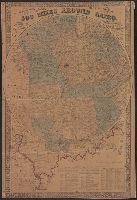
- Beinecke Rare Book and Manuscript Library > G. Woolworth Colton's map of the country 500 miles around Cairo : showing the seat of the war in the west / Drawn, engraved & published by G. Woolworth Colton.
- Creator:
- Colton, G. Woolworth (George Woolworth), 1827-1901
- Published / Created:
- 1862, c1861.
- Call Number:
- 75 1862C
- Container / Volume:
- BRBL_00403
- Image Count:
- 1
- Resource Type:
- Maps, Atlases & Globes
- Found in:
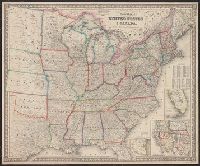
- Beinecke Rare Book and Manuscript Library > G. Woolworth Colton's new guide map of the United States & Canada : with railroads, counties etc. / drawn, engraved & published by G. Woolworth Colton.
- Creator:
- Colton, G. Woolworth (George Woolworth), 1827-1901
- Published / Created:
- 1866, c1860.
- Call Number:
- 753 1866C
- Container / Volume:
- BRBL_00415
- Image Count:
- 1
- Resource Type:
- Maps, Atlases & Globes
- Found in:
- Beinecke Rare Book and Manuscript Library > G. Woolworth Colton's railroad, township & distance map of New England : with adjacent portions of New York, Canada & New Brunswick.
- Creator:
- Safford, James M. (James Merrill), 1822-1907
- Published / Created:
- 1869
- Call Number:
- 801ca 1869
- Container / Volume:
- BRBL_00541
- Image Count:
- 1
- Resource Type:
- Maps, Atlases & Globes
- Found in:
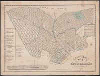
- Beinecke Rare Book and Manuscript Library > Geological map of Tennessee / by J.M. Safford.
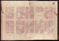
- Creator:
- Sanborn Map Company
- Published / Created:
- October, 1919.
- Call Number:
- 776 G295 1919
- Container / Volume:
- BRBL_00502
- Image Count:
- 7
- Resource Type:
- Maps, Atlases & Globes
- Found in:
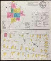
- Beinecke Rare Book and Manuscript Library > Georgetown, Sussex County, Delaware.
- Published / Created:
- [ca. 1867]
- Call Number:
- 771 R98 1867
- Container / Volume:
- BRBL_00490
- Image Count:
- 1
- Resource Type:
- Maps, Atlases & Globes
- Found in:
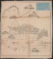
- Beinecke Rare Book and Manuscript Library > Glendale [Rye] Westchester Co., N.Y. / Laid off by Andrew Wilson, Jr. surveyed and platted by A. Steinacter. etc.
- Creator:
- Goldthwait, J. H
- Published / Created:
- 1861
- Call Number:
- 75 1861D
- Container / Volume:
- BRBL_00402
- Image Count:
- 1
- Resource Type:
- Maps, Atlases & Globes
- Found in:
- Beinecke Rare Book and Manuscript Library > Goldthwait's map of the United States & Canada : exhibiting the railroads with their distances, single and double tracks and width of gauge, and the time compared with noon at Washington & Greenwich / by J.H. Goldthwait.
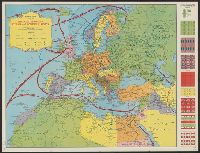
- Creator:
- British Information Services
- Published / Created:
- [1945?]
- Call Number:
- 3191g 1945
- Container / Volume:
- BRBL_00041
- Image Count:
- 1
- Resource Type:
- Maps, Atlases & Globes
- Found in:
- Beinecke Rare Book and Manuscript Library > Great Britain, her natural & industrial resources.
- Published / Created:
- 1844
- Call Number:
- 755 1844
- Container / Volume:
- BRBL_00441
- Image Count:
- 1
- Resource Type:
- Maps, Atlases & Globes
- Found in:
- Beinecke Rare Book and Manuscript Library > Guide through Ohio, Michigan, Indiana, Illinois, Missouri, Wisconsin & Iowa by J. Calvin Smith ...
- Creator:
- C.S. Hammond & Company
- Published / Created:
- [1918]
- Call Number:
- 11hc 1918Z-6
- Container / Volume:
- BRBL_00010H
- Image Count:
- 2
- Resource Type:
- Maps, Atlases & Globes
- Found in:
- Beinecke Rare Book and Manuscript Library > Hammond's large scale war map of the Western Front ; Hammond's large scale war map Italian Front [cartographic material].
- Creator:
- C.S. Hammond & Company
- Published / Created:
- c1917.
- Call Number:
- 11 1917
- Container / Volume:
- BRBL_00010
- Image Count:
- 1
- Resource Type:
- Maps, Atlases & Globes
- Found in:
- Beinecke Rare Book and Manuscript Library > Hammond's large scale war map of the Western Front [cartographic material].
- Creator:
- C.S. Hammond & Company
- Published / Created:
- 1917
- Call Number:
- 11hc 1917G
- Container / Volume:
- BRBL_00010D
- Image Count:
- 1
- Resource Type:
- Maps, Atlases & Globes
- Found in:
- Beinecke Rare Book and Manuscript Library > Hammond's large scale war map of the Western Front.
- Creator:
- C.S. Hammond & Company
- Published / Created:
- [1943]
- Call Number:
- 11hd 1940R
- Image Count:
- 2
- Resource Type:
- Maps, Atlases & Globes
- Found in:
- Beinecke Rare Book and Manuscript Library > Hammond's map of the Mediterranean, Europe and Northern Africa [cartographic material].
- Creator:
- C.S. Hammond & Company
- Published / Created:
- c1916.
- Call Number:
- 766gmb 1916H
- Container / Volume:
- BRBL_00475
- Image Count:
- 1
- Resource Type:
- Maps, Atlases & Globes
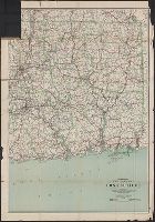
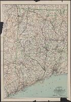
- Found in:
- Beinecke Rare Book and Manuscript Library > Hammond's new road map of Connecticut (Eastern part) / based on the surveys of the United States Geological Survey, United States Coast and Geodetic Survey and the various local surveys, revised and corrected ... C.S. Hammond & Company.
- Creator:
- C.S. Hammond & Company
- Published / Created:
- 1916
- Call Number:
- 766gmb 1916H
- Container / Volume:
- BRBL_00475
- Image Count:
- 1
- Resource Type:
- Maps, Atlases & Globes
- Found in:
- Beinecke Rare Book and Manuscript Library > Hammond's new road map of Connecticut (Western part) / based on the surveys of the United States Geological Survey, United States Coast and Geodetic Survey and the various local surveys, revised and corrected ... C.S. Hammond & Company.
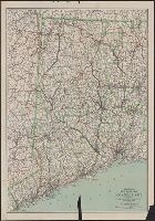
- Creator:
- C.S. Hammond & Company.
- Published / Created:
- ©1913.
- Call Number:
- BrSides Double Folio 2017 10
- Image Count:
- 1
- Resource Type:
- Maps, Atlases & Globes
- Found in:
- Beinecke Rare Book and Manuscript Library > Hammond's new road map of Connecticut [cartographic material] / based on the surveys of the United States Geological Survey, United States Coast and Geodetic Survey and the various local surveys, revised and corrected ... C.S. Hammond & Company.
- Creator:
- C.S. Hammond & Company
- Published / Created:
- [1917].
- Call Number:
- 76gmb 1917
- Container / Volume:
- BRBL_00446
- Image Count:
- 1
- Resource Type:
- Maps, Atlases & Globes
- Found in:
- Beinecke Rare Book and Manuscript Library > Hammond's new road map of Rhode Island and southeastern Massachusetts.
- Creator:
- C.S. Hammond & Company
- Published / Created:
- c1906.
- Call Number:
- 773gmb 1906
- Container / Volume:
- BRBL_00497
- Image Count:
- 1
- Resource Type:
- Maps, Atlases & Globes
- Found in:
- Beinecke Rare Book and Manuscript Library > Hammond's road map of northern New Jersey / C.S. Hammond & Company.
- Published / Created:
- 1917
- Call Number:
- 764gmb 1917
- Container / Volume:
- BRBL_00462
- Image Count:
- 1
- Resource Type:
- Maps, Atlases & Globes
- Found in:
- Beinecke Rare Book and Manuscript Library > Hammonds New road map of eastern Massachusetts and southern New Hampshire.
- Published / Created:
- 1843
- Call Number:
- 771 B796 1843
- Container / Volume:
- BRBL_00481
- Image Count:
- 1
- Resource Type:
- Maps, Atlases & Globes
- Found in:
- Beinecke Rare Book and Manuscript Library > Hayward's map of the City of Brooklyn, ... 1843.
- Creator:
- Hooker, William, 1782-1856
- Call Number:
- 771 N49 1828
- Container / Volume:
- BRBL_00485
- Image Count:
- 1
- Resource Type:
- Maps, Atlases & Globes
- Found in:
- Beinecke Rare Book and Manuscript Library > Hooker's new pocket plan of the city of New York / compiled & surveyed by William Hooker, A.C.S.A., hydrographer & engraver.
- Creator:
- Scarlett & Scarlett, civil engineers & surveyors
- Published / Created:
- c1890.
- Call Number:
- 773 N42 1890
- Container / Volume:
- BRBL_00496
- Image Count:
- 1
- Resource Type:
- Maps, Atlases & Globes
- Found in:
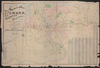
- Beinecke Rare Book and Manuscript Library > Indexed commercial map of Newark, Harrison, Kearney, New Jersey. : from latest official and special surveys / made by Scarlett & Scarlett, civil engineers & surveyors, 800 Broad St. Verified by Ernest Adam, City Surveyor.
- Creator:
- Sanborn Map Company
- Published / Created:
- 1920
- Call Number:
- 783 P83 1920
- Container / Volume:
- BRBL_00510
- Image Count:
- 30
- Resource Type:
- Maps, Atlases & Globes
- Found in:
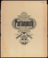
- Beinecke Rare Book and Manuscript Library > Insurance maps of Portsmouth, Virginia.
- Creator:
- Sanborn Map Company.
- Published / Created:
- 1881-
- Call Number:
- 1997 Folio 77
- Image Count:
- 2
- Found in:
- Beinecke Rare Book and Manuscript Library > Insurance maps of San Francisco, California.
- Creator:
- J.H. Colton & Co., cartographer.
- Published / Created:
- 1863
- Call Number:
- 754 1863A
- Image Count:
- 2
- Resource Type:
- Maps, Atlases & Globes
- Found in:
- Beinecke Rare Book and Manuscript Library > J.H. Colton's map of the Southern states : Maryland, Delaware, Virginia, Kentucky, Tennessee, Missouri, North Carolina, South Carolina, Georgia, Alabama, Mississippi, Arkansas, Louisiana, and Texas showing also part of adjoining states & territories locating the forts & military stations of the U. States & showing all the rail roads, R. R. stations, & other internal improvements / published by J.H. Colton.
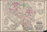
- Creator:
- Johnson, A. J. (Alvin Jewett), 1827-1884
- Published / Created:
- 1866
- Call Number:
- 44 1866
- Container / Volume:
- BRBL_00255
- Image Count:
- 2
- Resource Type:
- Maps, Atlases & Globes
- Found in:
- Beinecke Rare Book and Manuscript Library > Johnson's Austria, Turkey in Europe and Greece.
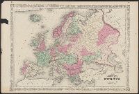
- Creator:
- Johnson, A. J. (Alvin Jewett), 1827-1884
- Published / Created:
- 1864
- Call Number:
- 30 1866
- Container / Volume:
- BRBL_00032
- Image Count:
- 2
- Resource Type:
- Maps, Atlases & Globes
- Found in:
- Beinecke Rare Book and Manuscript Library > Johnson's Europe.
- Creator:
- Johnson, A. J. (Alvin Jewett), 1827-1884
- Published / Created:
- 1865
- Call Number:
- 38 1866
- Container / Volume:
- BRBL_00154
- Image Count:
- 2
- Resource Type:
- Maps, Atlases & Globes
- Found in:
- Beinecke Rare Book and Manuscript Library > Johnson's France Spain and Portugal [cartographic material].
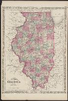
- Creator:
- Johnson, A. J. (Alvin Jewett), 1827-1884
- Published / Created:
- [1866]
- Call Number:
- 806 1866
- Container / Volume:
- BRBL_00547
- Image Count:
- 2
- Resource Type:
- Maps, Atlases & Globes
- Found in:
- Beinecke Rare Book and Manuscript Library > Johnson's Illinois.
- Published / Created:
- 1866
- Call Number:
- 805 1866
- Container / Volume:
- BRBL_00546
- Image Count:
- 1
- Resource Type:
- Maps, Atlases & Globes
- Found in:
- Beinecke Rare Book and Manuscript Library > Johnson's Indiana.
- Creator:
- Johnson, A. J. (Alvin Jewett), 1827-1884
- Published / Created:
- [between 1866 and 1879]
- Call Number:
- 802 1866
- Container / Volume:
- BRBL_00542
- Image Count:
- 2
- Resource Type:
- Maps, Atlases & Globes
- Found in:
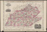
- Beinecke Rare Book and Manuscript Library > Johnson's Kentucky and Tennessee / published by A. J. Johnson.
- Creator:
- Johnson, A. J. (Alvin Jewett), 1827-1884
- Published / Created:
- [187-?]
- Call Number:
- 824 187X
- Container / Volume:
- BRBL_00570
- Image Count:
- 1
- Resource Type:
- Maps, Atlases & Globes
- Found in:
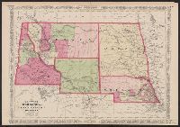
- Beinecke Rare Book and Manuscript Library > Johnson's Nebraska, Dakota, Idaho, Montana, and Wyoming.
- Creator:
- Johnson, A. J. (Alvin Jewett), 1827-1884
- Published / Created:
- [between 1865 and 1868?]
- Call Number:
- 824fac 1865
- Container / Volume:
- BRBL_00572
- Image Count:
- 2
- Resource Type:
- Maps, Atlases & Globes
- Found in:
- Beinecke Rare Book and Manuscript Library > Johnson's Nebraska, Dakota, Idaho, Montana, and Wyoming.
- Creator:
- Johnson, A. J. (Alvin Jewett), 1827-1884
- Published / Created:
- c1865.
- Call Number:
- 824 1865
- Container / Volume:
- BRBL_00570
- Image Count:
- 1
- Resource Type:
- Maps, Atlases & Globes
- Found in:
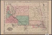
- Beinecke Rare Book and Manuscript Library > Johnson's Nebraska, Dakota, Idaho, and Montana.
- Creator:
- Johnson, A. J. (Alvin Jewett), 1827-1884
- Published / Created:
- [1866].
- Call Number:
- 771 1866
- Container / Volume:
- BRBL_00479
- Image Count:
- 2
- Resource Type:
- Maps, Atlases & Globes
- Found in:
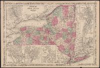
- Beinecke Rare Book and Manuscript Library > Johnson's New York.
- Published / Created:
- 1866
- Call Number:
- 804 1866
- Container / Volume:
- BRBL_00543
- Image Count:
- 2
- Resource Type:
- Maps, Atlases & Globes
- Found in:
- Beinecke Rare Book and Manuscript Library > Johnson's Ohio.
- Creator:
- Johnson, A. J. (Alvin Jewett), 1827-1884
- Published / Created:
- [1864].
- Call Number:
- 774 1866A
- Container / Volume:
- BRBL_00498
- Image Count:
- 2
- Resource Type:
- Maps, Atlases & Globes
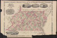
- Found in:
- Beinecke Rare Book and Manuscript Library > Johnson's Pennsylvania and New Jersey.
- Creator:
- Johnson, A. J. (Alvin Jewett), 1827-1884
- Published / Created:
- [1864]
- Call Number:
- 75 1864E
- Container / Volume:
- BRBL_00403
- Image Count:
- 1
- Resource Type:
- Maps, Atlases & Globes
- Found in:
- Beinecke Rare Book and Manuscript Library > Johnson's United States.
- Creator:
- Johnson, A. J. (Alvin Jewett), 1827-1884
- Published / Created:
- [1866?]
- Call Number:
- 76 1866
- Container / Volume:
- BRBL_00445
- Image Count:
- 2
- Resource Type:
- Maps, Atlases & Globes
- Found in:
- Beinecke Rare Book and Manuscript Library > Johnson's Vermont, New Hampshire, Massachusetts, Rhode Island, and Connecticut.
- Creator:
- Johnson, A. J. (Alvin Jewett), 1827-1884
- Published / Created:
- [between 1866 and 1879]
- Call Number:
- 783 1866A
- Container / Volume:
- BRBL_00509
- Image Count:
- 2
- Resource Type:
- Maps, Atlases & Globes
- Found in:
- Beinecke Rare Book and Manuscript Library > Johnson's Virginia, Delaware, Maryland and West Virginia.
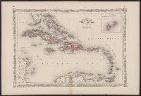
- Creator:
- Johnson, A. J. (Alvin Jewett), 1827-1884
- Published / Created:
- 1864
- Call Number:
- 85 1866
- Container / Volume:
- BRBL_00638
- Image Count:
- 2
- Resource Type:
- Maps, Atlases & Globes
- Found in:
- Beinecke Rare Book and Manuscript Library > Johnson's West Indies.
- Published / Created:
- 1862
- Call Number:
- 783 1874
- Container / Volume:
- BRBL_00509
- Image Count:
- 1
- Resource Type:
- Maps, Atlases & Globes
- Found in:
- Beinecke Rare Book and Manuscript Library > Johnson's map of the vicinity of Richmond and Peninsular Campaign in Virginia : showing also the interesting localities along the James, Chickahominy and York Rivers / by A.J. Johnson ; compiled from the official maps of the War Department.
- Creator:
- Johnson, A. J. (Alvin Jewett), 1827-1884
- Published / Created:
- 1859
- Call Number:
- 825 1859
- Container / Volume:
- BRBL_00573
- Image Count:
- 1
- Resource Type:
- Maps, Atlases & Globes
- Found in:
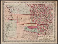
- Beinecke Rare Book and Manuscript Library > Johnson's new rail road and county copper plate map of Kansas gold region and the Great West, from the latest and best authorities.
- Creator:
- Wells, John G. (John Gaylord), 1821-1880
- Published / Created:
- 1857
- Call Number:
- 825 1857B
- Container / Volume:
- BRBL_00573
- Image Count:
- 1
- Resource Type:
- Maps, Atlases & Globes
- Found in:
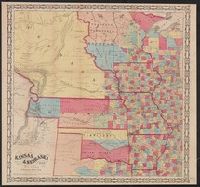
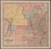
- Beinecke Rare Book and Manuscript Library > Kansas & Nebraska.
- Creator:
- Morse & Gaston (Firm)
- Published / Created:
- 1856
- Call Number:
- 80 1856A
- Container / Volume:
- BRBL_00534
- Image Count:
- 1
- Resource Type:
- Maps, Atlases & Globes
- Found in:
- Beinecke Rare Book and Manuscript Library > Kansas & Nebraska.
- Creator:
- Kibbe, A. F
- Published / Created:
- 1881
- Call Number:
- 834 1881A
- Container / Volume:
- BRBL_00587
- Image Count:
- 1
- Resource Type:
- Maps, Atlases & Globes
- Found in:
- Beinecke Rare Book and Manuscript Library > Kibbe's geographical and geological map of the San Juan Mining Region, Colorado / A.F. Kibbe.
- Creator:
- C.S. Hammond & Company
- Published / Created:
- c1918.
- Call Number:
- 352 1918
- Container / Volume:
- BRBL_00105
- Image Count:
- 1
- Resource Type:
- Maps, Atlases & Globes
- Found in:
- Beinecke Rare Book and Manuscript Library > Large scale map of Russia in Europe.
- Creator:
- Lago, J. M
- Published / Created:
- 1898
- Call Number:
- 856 1898
- Container / Volume:
- BRBL_00643
- Image Count:
- 1
- Resource Type:
- Maps, Atlases & Globes
- Found in:
- Beinecke Rare Book and Manuscript Library > Latest map of island of Porto[sic] Rico, new territory U.S.A. / by J. M. Lago.
- Published / Created:
- 1848
- Call Number:
- 75EG 1848L
- Container / Volume:
- BRBL_00410
- Image Count:
- 1
- Resource Type:
- Maps, Atlases & Globes
- Found in:
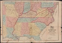
- Beinecke Rare Book and Manuscript Library > Lewis' free soil, slavery, and territorial map of the United States.
- Creator:
- Lewis, George W
- Published / Created:
- [1858?]
- Call Number:
- 80 1858A
- Container / Volume:
- BRBL_00534
- Image Count:
- 1
- Resource Type:
- Maps, Atlases & Globes
- Found in:
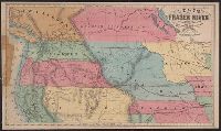
- Beinecke Rare Book and Manuscript Library > Lewis' map of Fraser River : showing the surrounding country and also the various overland routes leading to it, compiled from government surveys.
- Published / Created:
- [1862?].
- Call Number:
- 754 1862A
- Container / Volume:
- BRBL_00416
- Image Count:
- 1
- Resource Type:
- Maps, Atlases & Globes
- Found in:
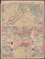
- Beinecke Rare Book and Manuscript Library > Lloyd's Military Map of the United States : showing the Grand Divisions of the Military Departments of the Army of the United States ...
- Creator:
- H.H. Lloyd & Co
- Published / Created:
- c1855.
- Call Number:
- 753 1855
- Container / Volume:
- BRBL_00415
- Image Count:
- 1
- Resource Type:
- Maps, Atlases & Globes
- Found in:
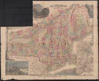
- Beinecke Rare Book and Manuscript Library > Lloyd's map of the Canadas, New York, & New England.
- Creator:
- H.H. Lloyd & Co
- Published / Created:
- 1861
- Call Number:
- 777hc 1861
- Container / Volume:
- BRBL_00504A
- Image Count:
- 1
- Resource Type:
- Maps, Atlases & Globes
- Found in:
- Beinecke Rare Book and Manuscript Library > Lloyd's military maps : showing the principal places of interest / compiled from official data by Egbert L. Viele and Charles Haskins.
- Published / Created:
- 1870
- Call Number:
- 807 1870
- Container / Volume:
- BRBL_00550
- Image Count:
- 1
- Resource Type:
- Maps, Atlases & Globes
- Found in:
- Beinecke Rare Book and Manuscript Library > Lloyd's new map of the Mississippi river : from Cairo to its mouth / Waters & Son engravers.
- Creator:
- Lloyd, James T
- Published / Created:
- 1861
- Call Number:
- 783 1861L
- Container / Volume:
- BRBL_00508
- Image Count:
- 1
- Resource Type:
- Maps, Atlases & Globes
- Found in:
- Beinecke Rare Book and Manuscript Library > Lloyd's official map of the state of Virginia : from actual surveys by order of the Executive, 1828 & 1859 / corrected and revised by J.T. Lloyd to 1861.
- Creator:
- Lloyd, James T
- Published / Created:
- [1862], c1861.
- Call Number:
- 783 1862L
- Container / Volume:
- BRBL_00508
- Image Count:
- 2
- Resource Type:
- Maps, Atlases & Globes
- Found in:
- Beinecke Rare Book and Manuscript Library > Lloyd's official map of the state of Virginia from actual surveys by order of the executive, 1828 & 1859 / corrected and revised by J.T. Lloyd to 1862, from surveys made by Capt. W. Angelo Powell, of the U.S. Topographical Engineers.
- Creator:
- Hooker, William, 1782-1856
- Published / Created:
- 1841
- Call Number:
- BrSides 2019 100
- Image Count:
- 1
- Resource Type:
- Maps, Atlases & Globes
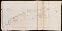
- Found in:
- Beinecke Rare Book and Manuscript Library > Long Island Sound : reduced from the large chart as surveyed by E. Blunt / engraved for Blunt's American coast pilot by W. Hooker.
- Published / Created:
- 1912
- Call Number:
- 773gmb 1912
- Container / Volume:
- BRBL_00497
- Image Count:
- 2
- Resource Type:
- Maps, Atlases & Globes
- Found in:
- Beinecke Rare Book and Manuscript Library > Main traveled routes through New Jersey.
- Published / Created:
- [1831?]
- Call Number:
- 761 1831
- Container / Volume:
- BRBL_00447
- Image Count:
- 1
- Resource Type:
- Maps, Atlases & Globes
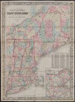
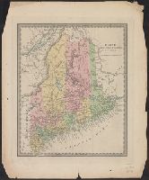
- Found in:
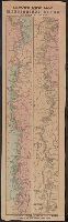
- Beinecke Rare Book and Manuscript Library > Maine.
- Creator:
- Northern Transcontinental Survey. Agricultural Dept
- Published / Created:
- 1883
- Call Number:
- 847gc Y12 1883
- Container / Volume:
- BRBL_00628
- Image Count:
- 5
- Resource Type:
- Maps, Atlases & Globes
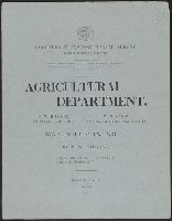
- Found in:
- Beinecke Rare Book and Manuscript Library > Map bulletin no. 1 / by E.W. Hilgard ; Northern Transcontinental Survey, Agricultural Department.
- Published / Created:
- [1843?]
- Call Number:
- 755 1843A
- Container / Volume:
- BRBL_00441
- Image Count:
- 1
- Resource Type:
- Maps, Atlases & Globes
- Found in:
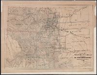
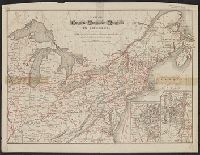
- Beinecke Rare Book and Manuscript Library > Map exhibiting the country between Lakes Michigan and Erie and the contested boundary lines.
- Published / Created:
- 1877
- Call Number:
- 787hc 1864A
- Container / Volume:
- BRBL_00517A
- Image Count:
- 1
- Resource Type:
- Maps, Atlases & Globes
- Found in:
- Beinecke Rare Book and Manuscript Library > Map illustrating the military operations of the Atlanta campaign. Map II. / compiled by authority of the Hon. the Secretary of War in the Office of the Chief of Engineers, U.S.A.
- Published / Created:
- 1876
- Call Number:
- 787hc 1864A
- Container / Volume:
- BRBL_00517A
- Image Count:
- 1
- Resource Type:
- Maps, Atlases & Globes
- Found in:
- Beinecke Rare Book and Manuscript Library > Map illustrating the military operations of the Atlanta campaign. Map III. / compiled by authority of the Hon. the Secretary of War in the Office of the Chief of Engineers, U.S.A.
- Published / Created:
- 1874
- Call Number:
- 787hc 1864A
- Container / Volume:
- BRBL_00517A
- Image Count:
- 1
- Resource Type:
- Maps, Atlases & Globes
- Found in:
- Beinecke Rare Book and Manuscript Library > Map illustrating the military operations of the Atlanta campaign. Map IV. / compiled by authority of the Hon. the Secretary of War in the Office of the Chief of Engineers, U.S.A.
- Published / Created:
- 1877
- Call Number:
- 787hc 1864A
- Container / Volume:
- BRBL_00517A
- Image Count:
- 1
- Resource Type:
- Maps, Atlases & Globes
- Found in:
- Beinecke Rare Book and Manuscript Library > Map illustrating the military operations of the Atlanta campaign. Map V. / compiled by authority of the Hon. the Secretary of War in the Office of the Chief of Engineers, U.S.A.
- Creator:
- Allen, W. F
- Published / Created:
- 1883
- Call Number:
- 75bk 1883A
- Container / Volume:
- BRBL_00407A
- Image Count:
- 1
- Resource Type:
- Maps, Atlases & Globes
- Found in:
- Beinecke Rare Book and Manuscript Library > Map illustrating the proposed system of standard time as reported to the General and Southern Railway Time conventions : at their meetings held on April 11th and 18th, 1883, and unanimously recommended by the conventions for adoption by the railway lines
- Published / Created:
- 1836
- Call Number:
- 771 H154 1836
- Container / Volume:
- BRBL_00482A
- Image Count:
- 1
- Resource Type:
- Maps, Atlases & Globes
- Found in:
- Beinecke Rare Book and Manuscript Library > Map of 134 Building at Hallett's Cove, L.I. For sale by order of the Ct. of Chancery at the store of F.H. Blackwell & Co. at Hallet's Cove on the 7th of May, 1836.
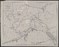
- Published / Created:
- [1936]
- Call Number:
- 848 1936
- Container / Volume:
- BRBL_00631
- Image Count:
- 1
- Resource Type:
- Maps, Atlases & Globes
- Found in:
- Beinecke Rare Book and Manuscript Library > Map of Alaska and western Yukon Territory : showing route of American Museum Palaeontological Expedition, 1936 / D.F. Levett Bradley.
- Published / Created:
- 1858
- Call Number:
- 771 B796 1776
- Container / Volume:
- BRBL_00481
- Image Count:
- 1
- Resource Type:
- Maps, Atlases & Globes
- Found in:
- Beinecke Rare Book and Manuscript Library > Map of Brooklyn at the time of the Revolutionary war drawn by Genl. Geremish Johnson.
- Creator:
- Tanner, Henry Schenck, 1786-1858
- Published / Created:
- 1849
- Call Number:
- 844 1849D
- Container / Volume:
- BRBL_00601
- Image Count:
- 1
- Resource Type:
- Maps, Atlases & Globes
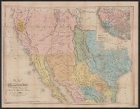
- Found in:
- Beinecke Rare Book and Manuscript Library > Map of California, New Mexico, Texas &c.
- Creator:
- Colton, J. H. (Joseph Hutchins), 1800-1893
- Published / Created:
- 1849
- Call Number:
- 844 1849G
- Container / Volume:
- BRBL_00601
- Image Count:
- 1
- Resource Type:
- Maps, Atlases & Globes
- Found in:
- Beinecke Rare Book and Manuscript Library > Map of California, Oregon, Texas, and the territories adjoining, with routes &c.
- Creator:
- Hood, E. B
- Published / Created:
- [1857?]
- Call Number:
- 814 C386 1857
- Container / Volume:
- BRBL_00558
- Image Count:
- 1
- Resource Type:
- Maps, Atlases & Globes
- Found in:
- Beinecke Rare Book and Manuscript Library > Map of Chaska and Fullers Addition : county seat of Carver County, Minnesota / surveyed, drawn & published for Fuller & Co. by E.B. Hood, C.E., New York.
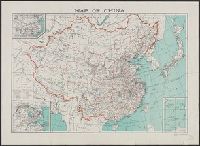
- Creator:
- China. Xing zheng yuan. Xin wen ju
- Published / Created:
- [1943?]
- Call Number:
- 56 1937
- Container / Volume:
- BRBL_00296
- Image Count:
- 1
- Resource Type:
- Maps, Atlases & Globes
- Found in:
- Beinecke Rare Book and Manuscript Library > Map of China [cartographic material] / compiled by the Chinese Ministry of Information.
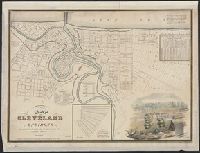
- Published / Created:
- 1835
- Call Number:
- 804 C599 1835
- Container / Volume:
- BRBL_00544
- Image Count:
- 1
- Resource Type:
- Maps, Atlases & Globes
- Found in:
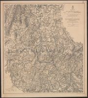
- Beinecke Rare Book and Manuscript Library > Map of Cleveland and its Environs. Surveyed and Published gy Ahaz Merchant.
- Creator:
- Hollister, Ovando James, 1834-1892
- Published / Created:
- 1866
- Call Number:
- 834 1866
- Container / Volume:
- BRBL_00587
- Image Count:
- 1
- Resource Type:
- Maps, Atlases & Globes
- Found in:
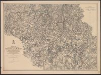
- Beinecke Rare Book and Manuscript Library > Map of Colorado Territory to accompany Hollisters "Mines of Colorado" corrected from the Public Surveys of 1866.
- Creator:
- Thomas Cook (Firm), cartographer.
- Published / Created:
- [1896]
- Call Number:
- BrSides Folio 2017 10
- Image Count:
- 2
- Resource Type:
- Maps, Atlases & Globes
- Found in:
- Beinecke Rare Book and Manuscript Library > Map of Cook's tours in Europe.
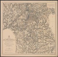
- Creator:
- Fisk & Co
Thomas Cook Ltd
- Published / Created:
- c1881.
- Call Number:
- 304ag 1881
- Container / Volume:
- BRBL_00034A
- Image Count:
- 2
- Resource Type:
- Maps, Atlases & Globes
- Found in:
- Beinecke Rare Book and Manuscript Library > Map of Cook's tours in central Europe / Fisk & Co., engs.
- Published / Created:
- [1880?]
- Call Number:
- 855 1880
- Container / Volume:
- BRBL_00641
- Image Count:
- 1
- Resource Type:
- Maps, Atlases & Globes
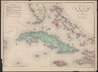
- Found in:
- Beinecke Rare Book and Manuscript Library > Map of Cuba : "The Gem of the Antilles".
- Published / Created:
- 1916
- Call Number:
- 855gck 1916
- Container / Volume:
- BRBL_00642
- Image Count:
- 1
- Resource Type:
- Maps, Atlases & Globes
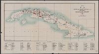
- Found in:
- Beinecke Rare Book and Manuscript Library > Map of Cuba : showing all working sugar estates.
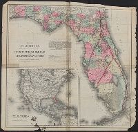
- Creator:
- G.W. & C.B. Colton & Co
- Published / Created:
- c1884.
- Call Number:
- 792gm 1883
- Container / Volume:
- BRBL_00520
- Image Count:
- 1
- Resource Type:
- Maps, Atlases & Globes
- Found in:
- Beinecke Rare Book and Manuscript Library > Map of Florida : showing the main line and branches of the International Railroad and Steamship Company of Florida.