Search
You Searched For
Search Results
- Creator:
- Maury, Matthew Fontaine, 1806-1873
- Published / Created:
- [1847?]-1853.
- Call Number:
- 11cfk 1850A-3
- Container / Volume:
- BRBL_00768
- Image Count:
- 4
- Resource Type:
- Maps, Atlases & Globes
- Found in:
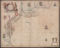
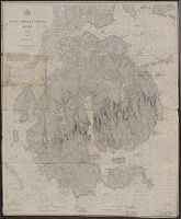
- Beinecke Rare Book and Manuscript Library > Wind and current chart of the South Atlantic [cartographic material] / by M.F. Maury, L.L.D.U.S. Navy, Superindt. of U.S.N. Observatory ; compiled from materials in the Bureau of Ordnance and Hydrography, Commodore Charles Morris, Chief of Bureau.
- Creator:
- Maury, Matthew Fontaine, 1806-1873
- Published / Created:
- 1852
- Call Number:
- 11cfk 1850D-2
- Container / Volume:
- BRBL_00773
- Image Count:
- 4
- Resource Type:
- Maps, Atlases & Globes
- Found in:
- Beinecke Rare Book and Manuscript Library > Wind and current chart of the South Atlantic [cartographic material] / by M.F. Maury, L.L.D. Lieut. U.S. Navy, Superint'dt. of U.S.N. Observatory ; compiled from materials in the Bureau of Ordnance and Hydrography, Commodore Charles Morris, Chief of Bureau.
- Creator:
- Maury, Matthew Fontaine, 1806-1873
- Published / Created:
- 1852-[1859?]
- Call Number:
- 11cfk 1850A-2
- Container / Volume:
- BRBL_00767
- Image Count:
- 4
- Resource Type:
- Maps, Atlases & Globes
- Found in:
- Beinecke Rare Book and Manuscript Library > Maury's wind and current chart [cartographic material] : South Pacific / drawn by Lardner Gibbon, P.M. U.S.N.
- Creator:
- Maury, Matthew Fontaine, 1806-1873
- Published / Created:
- 1852
- Call Number:
- 11cfk 1850D-2
- Container / Volume:
- BRBL_00773
- Image Count:
- 4
- Resource Type:
- Maps, Atlases & Globes
- Found in:
- Beinecke Rare Book and Manuscript Library > Wind and current chart of the South Atlantic [cartographic material] / by M.F. Maury, L.L.D. Lieut. U.S. Navy, Superint'dt. of U.S.N. Observatory ; compiled from materials in the Bureau of Ordnance and Hydrography, Commodore Charles Morris, Chief of Bureau.
- Creator:
- Maury, Matthew Fontaine, 1806-1873
- Published / Created:
- 1850
- Call Number:
- 11cfk 1850D-1
- Container / Volume:
- BRBL_00773
- Image Count:
- 4
- Resource Type:
- Maps, Atlases & Globes
- Found in:
- Beinecke Rare Book and Manuscript Library > Wind and current chart of the North Atlantic [cartographic material] : thermal sheet / by M.F. Maury, A.M. Lieut. U.S. Navy, Superint'dt. of U.S.N. Observatory ; compiled from materials in the Bureau of Ordnance and Hydrography, Commodore Lewis Warrington, Chief of Bureau ; drawn by Lt. Benjn. S. Gantt, U.S.N.
- Creator:
- Maury, Matthew Fontaine, 1806-1873
- Published / Created:
- 1850
- Call Number:
- 11cfk 1850D-1
- Container / Volume:
- BRBL_00773
- Image Count:
- 8
- Resource Type:
- Maps, Atlases & Globes
- Found in:
- Beinecke Rare Book and Manuscript Library > Wind and current chart of the North Atlantic [cartographic material] : thermal sheet / by M.F. Maury, A.M. Lieut. U.S. Navy, Superint'dt. of U.S.N. Observatory ; compiled from materials in the Bureau of Ordnance and Hydrography, Commodore Lewis Warrington, Chief of Bureau ; drawn by Lt. Benjn. S. Gantt, U.S.N.
- Creator:
- Maury, Matthew Fontaine, 1806-1873
- Published / Created:
- [1854?]-1856.
- Call Number:
- 11cfk 1850A-5
- Container / Volume:
- BRBL_00769
- Image Count:
- 8
- Resource Type:
- Maps, Atlases & Globes
- Found in:
- Beinecke Rare Book and Manuscript Library > Maury's wind and current chart, Indian Ocean [cartographic material].
- Creator:
- Maury, Matthew Fontaine, 1806-1873
- Published / Created:
- 1849-[1856?]
- Call Number:
- 11cfk 1850A-1
- Container / Volume:
- BRBL_00767
- Image Count:
- 10
- Resource Type:
- Maps, Atlases & Globes
- Found in:
- Beinecke Rare Book and Manuscript Library > Wind and current chart of the North Pacific [cartographic material] / by M.F. Maury, A.M. Lieut. U.S. Navy, Superint'dt. of U.S.N. Observatory ; compiled from materials in the Bureau of Ordnance and Hydrography, Commodore Lewis Warrington ; drawn by P.M. Lardner Gibbon, U.S.N. ; tracks projected by Lieut. A.W. Johnson, U.S. Navy.
- Creator:
- Maury, Matthew Fontaine, 1806-1873
- Published / Created:
- 1851-1859.
- Call Number:
- 11cfk 1850C-6
- Container / Volume:
- BRBL_00771
- Image Count:
- 10
- Resource Type:
- Maps, Atlases & Globes
- Found in:
- Beinecke Rare Book and Manuscript Library > Pilot chart of the South Pacific [cartographic material] / by M.F. Maury, L.L.D., Lieut. U.S. Navy ; Superin'dt. of U.S.N. Observatory ; compiled from materials in the Bureau of Ordnance and Hydrography, Commodre Charles Morris, Chief of Bureau.
- Creator:
- Great Britain. Hydrographic Department, author
- Call Number:
- 254cea 1886
- Container / Volume:
- BRBL_00021
- Image Count:
- 1
- Resource Type:
- Maps, Atlases & Globes
- Found in:
- Beinecke Rare Book and Manuscript Library > Australia, Coral Sea and Great Barrier Reefs, showing the Inner and Outer routes to Torres Strait. Sheet 2 / engraved by Edwd. Weller.
- Creator:
- Jefferys, Thomas, -1771
- Published / Created:
- 20 Feby., 1775.
- Call Number:
- 792cea 1775C
- Container / Volume:
- BRBL_00519
- Image Count:
- 1
- Resource Type:
- Maps, Atlases & Globes
- Found in:
- Beinecke Rare Book and Manuscript Library > The island of Cuba with part of the Bahama banks & the Martyrs / by Thos. Jefferys.
- Creator:
- United States. Mississippi River Commission
- Published / Created:
- 1879-
- Call Number:
- BrSides Double Folio 2018 85
- Image Count:
- 1
- Resource Type:
- Maps, Atlases & Globes
- Found in:
- Beinecke Rare Book and Manuscript Library > Survey of the Mississippi River / made under the direction of the Mississippi River Commission.
- Creator:
- E. & G.W. Blunt (Firm)
- Published / Created:
- 1861
- Call Number:
- 754cea 1854
- Container / Volume:
- BRBL_00418
- Image Count:
- 1
- Resource Type:
- Maps, Atlases & Globes
- Found in:
- Beinecke Rare Book and Manuscript Library > The coast of the United States sheet no. 1. : From Point Judith to Cape Lookout, from the U.S. Coast Surveys.
- Published / Created:
- 19--]
- Call Number:
- 76cea 1887
- Container / Volume:
- BRBL_00446
- Image Count:
- 1
- Resource Type:
- Maps, Atlases & Globes
- Found in:
- Beinecke Rare Book and Manuscript Library > Portion of a map of New England in the Public Record Office, London, Eng. : Copied for Chas. Hervey Townshend, Esq. of "Raynham," New Haven, Connecticut, U.S.A. by L.M. Byrne, April, 1887.
- Creator:
- Speer, Joseph Smith
- Published / Created:
- May 20th, 1774.
- Call Number:
- 85 1774A
- Container / Volume:
- BRBL_00637
- Image Count:
- 1
- Resource Type:
- Maps, Atlases & Globes
- Found in:
- Beinecke Rare Book and Manuscript Library > To His Royal Highness. George Augustus Frederick. Prince of Wales &c. &c. &c. this chart of the West Indies is humbly inscribed by His Royal Highness faithful & obedient servant Joseph Smith Speer, Thos. Bowen sculpt.
- Creator:
- United States. Hydrographic Office
- Published / Created:
- 1904
- Call Number:
- 57 1904
- Container / Volume:
- BRBL_00302
- Image Count:
- 1
- Resource Type:
- Maps, Atlases & Globes
- Found in:
- Beinecke Rare Book and Manuscript Library > Asia, Japan and Korea : with the surrounding seas and the adjacent coastal region of China / published at Washington, D.C. Feb. 1904, at the Hydrographic Office. H.M. Hodges, Lieutenant Commander, U.S.N. Hydrographer.
- Creator:
- Great Britain. Hydrographic Department, cartographer
- Published / Created:
- March 23rd 1846.
- Call Number:
- BrSides 2019 97
- Image Count:
- 1
- Resource Type:
- Maps, Atlases & Globes
- Found in:
- Beinecke Rare Book and Manuscript Library > South Australia, St. Vincent Gulf, Port Adelaide and Holdfast Bay / surveyed by Commr. Stokes, H.M.S. Beagle, 1841 ; J. & C. Walker, sculpt.
- Creator:
- Jefferys, Thomas, d. 1771
- Published / Created:
- 20 Feby. 1775.
- Call Number:
- 792cea 1775
- Container / Volume:
- BRBL_00519
- Image Count:
- 1
- Resource Type:
- Maps, Atlases & Globes
- Found in:
- Beinecke Rare Book and Manuscript Library > The coast of West Florida and Louisiana [cartographic material] : the Peninsula and Gulf of Florida or Channel of Bahama with the Bahama Islands / by Thos. Jefferys ...
- Creator:
- Bowen, Emanuel, d. 1767
- Published / Created:
- 1747]
- Call Number:
- 8555 1747
- Container / Volume:
- BRBL_00642
- Image Count:
- 1
- Resource Type:
- Maps, Atlases & Globes
- Found in:
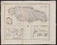
- Beinecke Rare Book and Manuscript Library > A new & accurate map of the Island of Jamaica [cartographic material] : divided into its principal parishes / drawn from surveys, and regulated by astronl. observatns. by Eman. Bowen.
- Creator:
- Hawkesworth, John, 1715?-1773
- Published / Created:
- [1773]
- Call Number:
- 282 1767
- Collection Title:
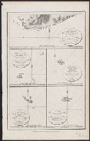
- Account of the voyages undertaken by the order of His present Majesty for making discoveries in the
- Container / Volume:
- BRBL_00683
- Image Count:
- 1
- Resource Type:
- Maps, Atlases & Globes
- Found in:
- Beinecke Rare Book and Manuscript Library > A dangerous shoal seen Septr. the 28, 1767 [cartographic material] : The south end of Mindanao ; Joseph Freewills Islands.
- Creator:
- Jefferys, Thomas, -1771
- Published / Created:
- 25th March, 1775.
- Call Number:
- 7345cea 1775A
- Container / Volume:
- BRBL_00689
- Image Count:
- 1
- Resource Type:
- Maps, Atlases & Globes
- Found in:
- Beinecke Rare Book and Manuscript Library > A chart of the Gulf of St. Laurence [cartographic material] : composed from a great number of actual surveys and other materials, regulated and connected by astronomical observations.
- Creator:
- Chabert, Joseph Bernard, marquis de, 1724-1805
- Published / Created:
- 25th, March 1775.
- Call Number:
- 72cea 1775
- Container / Volume:
- BRBL_00688
- Image Count:
- 1
- Resource Type:
- Maps, Atlases & Globes
- Found in:
- Beinecke Rare Book and Manuscript Library > A chart of the Banks of Newfoundland / drawn from a great number of hydrographical surveys, chiefly from those of Chabert, Cook, and Fleurieu, connected and ascertained by astronomical observations.
- Published / Created:
- [between 1743 and 1770]
- Call Number:
- 755 1730A
- Container / Volume:
- BRBL_00690
- Image Count:
- 1
- Resource Type:
- Maps, Atlases & Globes
- Found in:
- Beinecke Rare Book and Manuscript Library > Virginia, Maryland, Pennsilvania, east & west New Jarsey [cartographic material].
- Creator:
- Jefferys, Thomas, d. 1771
- Published / Created:
- 25 May, 1775.
- Call Number:
- 7345cea 1775
- Container / Volume:
- BRBL_00689
- Image Count:
- 1
- Resource Type:
- Maps, Atlases & Globes
- Found in:
- Beinecke Rare Book and Manuscript Library > An exact chart of the river St. Laurence : from Fort Frontenac to the island of Anticosti shewing the soundings, rocks, shoals & c with views of the lands and all necessary instructions for navigating that river to Quebec / by ... Thos. Jefferys.
- Creator:
- Jefferys, Thomas, d. 1771
- Published / Created:
- April 6, 1775.
- Call Number:
- 7311 1775
- Container / Volume:
- BRBL_00688
- Image Count:
- 1
- Resource Type:
- Maps, Atlases & Globes
- Found in:
- Beinecke Rare Book and Manuscript Library > A map of the island of St. John in the Gulf of St. Laurence [cartographic material] : divided into counties & parishes and the lots as granted by government : to which are added the soundings round the coast & harbours / improv'd from the late survey of C
- Creator:
- Jefferys, Thomas, d. 1771
- Published / Created:
- 10th, May 1775.
- Call Number:
- 72 1775
- Container / Volume:
- BRBL_00688
- Image Count:
- 1
- Resource Type:
- Maps, Atlases & Globes
- Found in:
- Beinecke Rare Book and Manuscript Library > A general chart of the island of Newfoundland with the rocks & soundings / [cartographic material] / drawn from surveys taken by order of the Right Honourable the Lords Commissioners of the Admiralty by James Cook and Michael Lane, surveyors, and others.
- Published / Created:
- [1749?]
- Call Number:
- 755 1749
- Container / Volume:
- BRBL_00426
- Image Count:
- 1
- Resource Type:
- Maps, Atlases & Globes
- Found in:
- Beinecke Rare Book and Manuscript Library > Virginia, Maryland, Pennsilvania, east & west New Jarsey [cartographic material].
- Creator:
- Jefferys, Thomas, -1771, cartographer
- Published / Created:
- 20th Feby. 1775.
- Call Number:
- 792cea 1775C
- Container / Volume:
- BRBL_00519
- Image Count:
- 1
- Resource Type:
- Maps, Atlases & Globes
- Found in:
- Beinecke Rare Book and Manuscript Library > The coast of Yucatán from Campeche to Baha del Ascencion, with the west end of Cuba / by Thos. Jefferys, geographer to His Majesty.
- Creator:
- Lodge, John, -1796
- Published / Created:
- 31 Augst. 1780.
- Call Number:
- 8555 1780A
- Container / Volume:
- BRBL_00695
- Image Count:
- 1
- Resource Type:
- Maps, Atlases & Globes
- Found in:
- Beinecke Rare Book and Manuscript Library > A chart of the island of Jamaica [cartographic material] : with its bays, harbours, rocks, soundings, &c. / Jno. Lodge, sculp.
- Published / Created:
- 1762]
- Call Number:
- 855 1762A
- Container / Volume:
- BRBL_00695
- Image Count:
- 1
- Resource Type:
- Maps, Atlases & Globes
- Found in:
- Beinecke Rare Book and Manuscript Library > A new chart of the seas surrounding the island of Cuba with the soundings, currents, ships, courses &c. and a map of the island itself lately made by an officer in the Navy [cartographic material].
- Creator:
- Bowen, Emanuel, d. 1767
- Published / Created:
- 1747]
- Call Number:
- 8555 1752A
- Container / Volume:
- BRBL_00695
- Image Count:
- 1
- Resource Type:
- Maps, Atlases & Globes
- Found in:
- Beinecke Rare Book and Manuscript Library > A new & accurate map of the Island of Jamaica [cartographic material] : divided into its principal parishes / drawn from surveys, and regulated by astronl. observatns. by Eman. Bowen.
- Creator:
- Jefferys, Thomas, -1771
- Published / Created:
- 1794 May 12
- Call Number:
- 8555 1794
- Container / Volume:
- BRBL_00695
- Image Count:
- 1
- Resource Type:
- Maps, Atlases & Globes
- Found in:
- Beinecke Rare Book and Manuscript Library > Jamaica from the latest surveys / [cartographic material] / improved and engraved by Thomas Jefferys, Geographer to the King.
- Creator:
- Bellin, Jacques Nicolas, 1703-1772
- Published / Created:
- 1764
- Call Number:
- 85 1764
- Container / Volume:
- BRBL_00693
- Image Count:
- 1
- Resource Type:
- Maps, Atlases & Globes
- Found in:
- Beinecke Rare Book and Manuscript Library > Carte reduite des costes de la Louisiane et de la Floride / [cartographic material] / dressée au Dépost des cartes, plans et journaux de la Marine pour le service des vaisseaux du roy par ordre de M. Le Duc de Choisel, colonel général des Suisses et G
- Creator:
- Delarochette, L. (Louis), 1731-1802
- Published / Created:
- September 22d, 1796.
- Call Number:
- 85 1796A
- Container / Volume:
- BRBL_00693
- Image Count:
- 1
- Resource Type:
- Maps, Atlases & Globes
- Found in:
- Beinecke Rare Book and Manuscript Library > A general chart of the West India Islands with the adjacent coasts of the Spanish continent [cartographic material] / by L.S. de la Rochette.
- Creator:
- Bowen, Emanuel, d. 1767
- Published / Created:
- 1747]
- Call Number:
- 8612 1747
- Container / Volume:
- BRBL_00696
- Image Count:
- 1
- Resource Type:
- Maps, Atlases & Globes
- Found in:
- Beinecke Rare Book and Manuscript Library > A new and accurate map of the island of Antigua or Antego [cartographic material] : taken from surveys, and adjusted by astronl. observations : containing all the towns, parish churches, forts, castles, windmills, roads &c. / by Eman. Bowen.
- Creator:
- Jefferys, Thomas, d. 1771
- Published / Created:
- 20, Feby. 1775.
- Call Number:
- 894 1775
- Container / Volume:
- BRBL_00697
- Image Count:
- 1
- Resource Type:
- Maps, Atlases & Globes
- Found in:
- Beinecke Rare Book and Manuscript Library > The Bay of Honduras [cartographic material] / by Thos. Jefferys, Geographer to His Majesty.
- Creator:
- Jefferys, Thomas, -1771, cartographer
- Published / Created:
- 20 Feby. 1775.
- Call Number:
- 792cea 1775B
- Container / Volume:
- BRBL_00730
- Image Count:
- 1
- Resource Type:
- Maps, Atlases & Globes
- Found in:
- Beinecke Rare Book and Manuscript Library > The coast of West Florida and Louisiana : the Peninsula and Gulf of Florida or Channel of Bahama with the Bahama Islands / by Thos. Jefferys ...
- Creator:
- Seller, John, fl. 1658-1698
- Published / Created:
- 1675?]
- Call Number:
- 755cea 1675
- Container / Volume:
- BRBL_00441
- Image Count:
- 1
- Resource Type:
- Maps, Atlases & Globes
- Found in:
- Beinecke Rare Book and Manuscript Library > A chart of the sea coasts of New-England, New-Jarsey, Virginia, Maryland and Carolina : from C. Cod to C. Hatteras / by John Seller, hydrogr. to the King ; Iames Clerk sculpsit.
- Published / Created:
- 1883
- Call Number:
- 764cea B98 1883
- Container / Volume:
- BRBL_00461
- Image Count:
- 1
- Resource Type:
- Maps, Atlases & Globes
- Found in:
- Beinecke Rare Book and Manuscript Library > Buzzard's Bay [Massachusetts] / United States Coast Survey.
- Creator:
- United States Coast Survey
- Published / Created:
- 1883
- Call Number:
- 7645cea 1883
- Container / Volume:
- BRBL_00463
- Image Count:
- 1
- Resource Type:
- Maps, Atlases & Globes
- Found in:
- Beinecke Rare Book and Manuscript Library > Entrance to Nantucket Sound / United States Coast Survey.
- Creator:
- United States Coast Survey
- Published / Created:
- 1883
- Call Number:
- 7645cea 1883B
- Container / Volume:
- BRBL_00463
- Image Count:
- 1
- Resource Type:
- Maps, Atlases & Globes
- Found in:
- Beinecke Rare Book and Manuscript Library > Nantucket and Vineyard Sounds : from Cross Rip to Nobska Point / United States Coast Survey.
- Published / Created:
- 1883
- Call Number:
- 764cea V75 1883
- Container / Volume:
- BRBL_00461
- Image Count:
- 1
- Resource Type:
- Maps, Atlases & Globes
- Found in:
- Beinecke Rare Book and Manuscript Library > Vineyard Sound [Massachusetts] : from Woods Hole to Cuttyhunk / United States Coast Survey.
- Creator:
- Eldridge, George, 1821-1879
- Published / Created:
- 1891
- Call Number:
- 764cea B65 1891E
- Container / Volume:
- BRBL_00461
- Image Count:
- 1
- Resource Type:
- Maps, Atlases & Globes
- Found in:
- Beinecke Rare Book and Manuscript Library > Eldridge's new chart of Boston Harbor : compiled from the latest surveys / engraved by G.W. Boynton.
- Published / Created:
- 1883
- Call Number:
- 764cea B65 1883A
- Container / Volume:
- BRBL_00461
- Image Count:
- 1
- Resource Type:
- Maps, Atlases & Globes
- Found in:
- Beinecke Rare Book and Manuscript Library > Boston Bay and Harbor, Massachusetts. / United States Coast Survey.
- Creator:
- United States Coast Survey
- Published / Created:
- 1883
- Call Number:
- 7645cea 1883A
- Container / Volume:
- BRBL_00463
- Image Count:
- 1
- Resource Type:
- Maps, Atlases & Globes
- Found in:
- Beinecke Rare Book and Manuscript Library > Nantucket Sound Western Part / United States Coast Survey.
- Published / Created:
- ca. 1705]
- Call Number:
- 732cea C413 1705
- Container / Volume:
- BRBL_00709
- Image Count:
- 1
- Resource Type:
- Maps, Atlases & Globes
- Found in:
- Beinecke Rare Book and Manuscript Library > A draught of Southacks Bay in America [cartographic material].
- Creator:
- Morris, Charles, fl. 1749, cartographer
- Published / Created:
- 1751
- Call Number:
- 732 H13 1751
- Container / Volume:
- BRBL_00708
- Image Count:
- 1
- Resource Type:
- Maps, Atlases & Globes
- Found in:
- Beinecke Rare Book and Manuscript Library > A plan of the harbour of Halifax / by Charles Morris, chf. surveyr.
- Creator:
- United States Coast Survey
- Published / Created:
- 1883
- Call Number:
- 761CEB 1883
- Container / Volume:
- BRBL_00449
- Image Count:
- 1
- Resource Type:
- Maps, Atlases & Globes
- Found in:
- Beinecke Rare Book and Manuscript Library > Gulf of Maine, current stations / United States Coast Survey.
- Creator:
- U.S. Coast and Geodetic Survey
- Published / Created:
- 1886
- Call Number:
- 761cea M86 1882
- Container / Volume:
- BRBL_00449
- Image Count:
- 1
- Resource Type:
- Maps, Atlases & Globes
- Found in:
- Beinecke Rare Book and Manuscript Library > Mount Desert Island, Maine, 1882.
- Published / Created:
- 1861
- Call Number:
- 90cea 1861
- Container / Volume:
- BRBL_00664
- Image Count:
- 1
- Resource Type:
- Maps, Atlases & Globes
- Found in:
- Beinecke Rare Book and Manuscript Library > River La Plata : from the English, French, and Spanish Surveys.
- Creator:
- Garella, Napoléon, 1809-1858
- Published / Created:
- 1867]
- Call Number:
- 89 1866B
- Container / Volume:
- BRBL_00658
- Image Count:
- 1
- Resource Type:
- Maps, Atlases & Globes
- Found in:
- Beinecke Rare Book and Manuscript Library > Map of the Isthmus between Chagres and Panama : (Panama Rail Road added.) / by Chief Engineer Napoleon Garella, 1845; drawn by E. Hergesheimer.
- Creator:
- Maury, Matthew Fontaine, 1806-1873
- Published / Created:
- 1852-1853.
- Call Number:
- 11cfk 1850C-5
- Container / Volume:
- BRBL_00771
- Image Count:
- 5
- Resource Type:
- Maps, Atlases & Globes
- Found in:
- Beinecke Rare Book and Manuscript Library > Pilot chart of the North Pacific [cartographic material] / by M.F. Maury, L.L.D. Lieut. U.S. Navy, superin'dt. of U.S.N. Observatory ; compiled from materials in the Bureau of Ordnance and Hydrography, Commodore Charles Morris, Chief of Bureau.
- Creator:
- Imray, James F. (James Frederick), 1829?-1891, cartographer
James Imray and Son, issuing body
- Call Number:
- 23cea 1886
- Container / Volume:
- BRBL_00021
- Image Count:
- 2
- Resource Type:
- Maps, Atlases & Globes
- Found in:
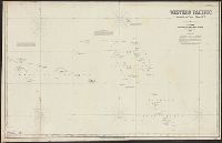
- Beinecke Rare Book and Manuscript Library > Western Pacific. Chart No. 2 / compiled by James F. Imray F.R.G.S.
- Creator:
- Imray, James F. (James Frederick), 1829?-1891, author
James Imray and Son, publisher
- Call Number:
- 23cea 1884
- Container / Volume:
- BRBL_00021
- Image Count:
- 2
- Resource Type:
- Maps, Atlases & Globes
- Found in:
- Beinecke Rare Book and Manuscript Library > South and east coasts of Australia [in four charts]. Chart no. 2, Cape Northumberland to Cape Howe / compiled by James F. Imray F.R.G.S.
- Creator:
- Peirce, Benjamin, 1809-1880
United States Coast Survey
- Published / Created:
- 1869
- Call Number:
- 846cea Or4 1869
- Container / Volume:
- BRBL_00623
- Image Count:
- 1
- Resource Type:
- Maps, Atlases & Globes
- Found in:
- Beinecke Rare Book and Manuscript Library > Cape Orford and reef, Oregon / U.S. Coast Survey, Benjamin Peirce, superintendant ; triangulation by A.W. Chase, sub-assistant in 1869 ; topography by A.M. Harrison, assist. and A.W. Chase, sub-assistant in 1851 & '69 ; hydrography by Commander J. Alden U
- Creator:
- Jefferys, Thomas, -1771, cartographer
- Published / Created:
- 20 Feby. 1775.
- Call Number:
- 792cea 1775A
- Container / Volume:
- BRBL_00691
- Image Count:
- 1
- Resource Type:
- Maps, Atlases & Globes
- Found in:
- Beinecke Rare Book and Manuscript Library > The coast of West Florida and Louisiana : the Peninsula and Gulf of Florida or Channel of Bahama with the Bahama Islands / by Thos. Jefferys ...
- Creator:
- United States. Hydrographic Office
- Published / Created:
- 1904
- Call Number:
- 556cea 1904
- Container / Volume:
- BRBL_00293
- Image Count:
- 1
- Resource Type:
- Maps, Atlases & Globes
- Found in:
- Beinecke Rare Book and Manuscript Library > Asia, Japan and Korea : with the surrounding seas and the adjacent coastal region of China / published at Washington, D.C. Feb. 1904, at the Hydrographic Office. H.M. Hodges, Lieutenant Commander, U.S.N. Hydrographer.
- Creator:
- Maury, Matthew Fontaine, 1806-1873
- Published / Created:
- 1852-[1859?]
- Call Number:
- 11cfk 1850A-2
- Container / Volume:
- BRBL_00767
- Image Count:
- 1
- Resource Type:
- Maps, Atlases & Globes
- Found in:
- Beinecke Rare Book and Manuscript Library > Maury's wind and current chart [cartographic material] : South Pacific / drawn by Lardner Gibbon, P.M. U.S.N.
- Creator:
- Maury, Matthew Fontaine, 1806-1873
- Published / Created:
- 1851
- Call Number:
- 11cfk 1850B-1
- Container / Volume:
- BRBL_00770
- Image Count:
- 1
- Resource Type:
- Maps, Atlases & Globes
- Found in:
- Beinecke Rare Book and Manuscript Library > Trade wind chart of the Atlantic Ocean [cartographic material] / by M.F. Maury ; compiled by Lt. E.J. Dehaven from materials in the Bureau of Ordnance and Hydrography.
- Creator:
- Maury, Matthew Fontaine, 1806-1873
- Published / Created:
- 1855
- Call Number:
- 11cfk 1850C-11
- Container / Volume:
- BRBL_00772
- Image Count:
- 1
- Resource Type:
- Maps, Atlases & Globes
- Found in:
- Beinecke Rare Book and Manuscript Library > Pilot chart of the north Indian Ocean [cartographic material] / by M.F. Maury, L.L.D. Lieut. U.S. Navy, Superin'dt. of U.S.N. Observatory ; compiled from materials in the Bureau of Ordnance and Hydrography by Lieuts. W.B. Fitzgerald & Wm. C. West, U.S.N, Commodore Charles Morris, Chief of Bureau.
- Creator:
- Maury, Matthew Fontaine, 1806-1873
- Published / Created:
- [1847?]-1853.
- Call Number:
- 11cfk 1850A-3
- Container / Volume:
- BRBL_00768
- Image Count:
- 1
- Resource Type:
- Maps, Atlases & Globes
- Found in:
- Beinecke Rare Book and Manuscript Library > Wind and current chart of the South Atlantic [cartographic material] / by M.F. Maury, L.L.D.U.S. Navy, Superindt. of U.S.N. Observatory ; compiled from materials in the Bureau of Ordnance and Hydrography, Commodore Charles Morris, Chief of Bureau.
- Creator:
- Maury, Matthew Fontaine, 1806-1873
- Published / Created:
- 1849
- Call Number:
- 11cfk 1850C-7
- Container / Volume:
- BRBL_00772
- Image Count:
- 1
- Resource Type:
- Maps, Atlases & Globes
- Found in:
- Beinecke Rare Book and Manuscript Library > Pilot chart of the coast of Brazil / by Lieut. M.F. Maury, U.S. Navy.
- Creator:
- Maury, Matthew Fontaine, 1806-1873
- Published / Created:
- 1851
- Call Number:
- 11cfk 1850B-4
- Container / Volume:
- BRBL_00770
- Image Count:
- 1
- Resource Type:
- Maps, Atlases & Globes
- Found in:
- Beinecke Rare Book and Manuscript Library > Trade wind chart of the Atlantic Ocean [cartographic material] / by M.F. Maury, L.L.D. Lieut. U.S.N, Superintendent National Observatory ; compiled by Lt. E.J. Dehaven, U.S.N. from materials in the Bureau of Ordnance and Hydrography, Comdre. Chs. Morris, Chief of Bureau.
- Creator:
- Maury, Matthew Fontaine, 1806-1873
- Published / Created:
- 1854
- Call Number:
- 11cfk 1850E-2
- Container / Volume:
- BRBL_00774
- Image Count:
- 1
- Resource Type:
- Maps, Atlases & Globes
- Found in:
- Beinecke Rare Book and Manuscript Library > Storm and rain chart of the South Atlantic [cartographic material] / by M.F. Maury, L.L.D. Lieut. U.S. Navy, Superin'dt of U.S.N. Observatory, Washington ; compiled from materials in the Bureau of Ordnance and Hydrography by Lieuts. John Julien Guthrie, John C. Beaumont & Passd. Midn. Dulany A. Forrest, U.S.N.
- Creator:
- Maury, Matthew Fontaine, 1806-1873
- Published / Created:
- 1859 [i.e. 1860]
- Call Number:
- 11cfk 1850B-2
- Container / Volume:
- BRBL_00770
- Image Count:
- 1
- Resource Type:
- Maps, Atlases & Globes
- Found in:
- Beinecke Rare Book and Manuscript Library > Monsoon & trade wind chart of the Indian Ocean [cartographic material] / by M.F. Maury, L.L.D. Comr. U.S.N., Superintendent of U.S.N. Observatory ; compiled by Lieuts. J.J. Guthrie ... [et al.] ; and projected by Lt. R.L. May from materials in the Bureau of Ordnance and Hydrography, Captain D.N. Ingraham, Chief of the Bureau.
- Creator:
- Maury, Matthew Fontaine, 1806-1873
- Published / Created:
- 1851
- Call Number:
- 11DB 1851A-1
- Container / Volume:
- BRBL_00774
- Image Count:
- 1
- Resource Type:
- Maps, Atlases & Globes
- Found in:
- Beinecke Rare Book and Manuscript Library > Whale chart [cartographic material] : preliminary sketch / by M.F. Maury, A.M. Lieut., U.S. Navy ; constructed by Lts. Leigh. Herndon & Fleming & Pd. Midn. Jackson.
- Creator:
- Maury, Matthew Fontaine, 1806-1873
- Published / Created:
- 1852
- Call Number:
- 11cfk 1850D-2
- Container / Volume:
- BRBL_00773
- Image Count:
- 1
- Resource Type:
- Maps, Atlases & Globes
- Found in:
- Beinecke Rare Book and Manuscript Library > Wind and current chart of the South Atlantic [cartographic material] / by M.F. Maury, L.L.D. Lieut. U.S. Navy, Superint'dt. of U.S.N. Observatory ; compiled from materials in the Bureau of Ordnance and Hydrography, Commodore Charles Morris, Chief of Bureau.
- Creator:
- Maury, Matthew Fontaine, 1806-1873
- Published / Created:
- 1850
- Call Number:
- 11cfk 1850D-1
- Container / Volume:
- BRBL_00773
- Image Count:
- 1
- Resource Type:
- Maps, Atlases & Globes
- Found in:
- Beinecke Rare Book and Manuscript Library > Wind and current chart of the North Atlantic [cartographic material] : thermal sheet / by M.F. Maury, A.M. Lieut. U.S. Navy, Superint'dt. of U.S.N. Observatory ; compiled from materials in the Bureau of Ordnance and Hydrography, Commodore Lewis Warrington, Chief of Bureau ; drawn by Lt. Benjn. S. Gantt, U.S.N.
- Creator:
- Maury, Matthew Fontaine, 1806-1873
- Published / Created:
- 1853
- Call Number:
- 11cfk 1850E-1
- Container / Volume:
- BRBL_00774
- Image Count:
- 1
- Resource Type:
- Maps, Atlases & Globes
- Found in:
- Beinecke Rare Book and Manuscript Library > Storm and rain chart of the North Atlantic [cartographic material] / by M.F. Maury, L.L.D. Lieut. U.S. Navy, Superin'dt of U.S.N. Observatory, Washington ; compiled from materials in the Bureau of Ordnance and Hydrography by Lieuts. George Minor, William H. Ball, & W. Rodgers Taylor, U.S. Navy ; eng. by Sherman & Smith N.Y.
- Creator:
- Maury, Matthew Fontaine, 1806-1873
- Published / Created:
- 1849
- Call Number:
- 11cfk 1850C-7
- Container / Volume:
- BRBL_00772
- Image Count:
- 1
- Resource Type:
- Maps, Atlases & Globes
- Found in:
- Beinecke Rare Book and Manuscript Library > Pilot chart of the coast of Brazil / by Lieut. M.F. Maury, U.S. Navy.
- Creator:
- Maury, Matthew Fontaine, 1806-1873
- Published / Created:
- 1860
- Call Number:
- 11cfk 1850E-3
- Container / Volume:
- BRBL_00774
- Image Count:
- 1
- Resource Type:
- Maps, Atlases & Globes
- Found in:
- Beinecke Rare Book and Manuscript Library > Storm and rain chart of the North Pacific. Sheet 1 / by M.F. Maury, L.L.D. Commander U.S. Navy, Superin'd't of U.S.N. Observatory, Washington ; compiled from materials in the Bureau of Ordnance and Hydrography by Lieuts. James D. Johnston and A.F. Warley, U.S. Navy [cartographic material].
- Creator:
- Maury, Matthew Fontaine, 1806-1873
- Published / Created:
- 1855
- Call Number:
- 11cfk 1850C-11
- Container / Volume:
- BRBL_00772
- Image Count:
- 1
- Resource Type:
- Maps, Atlases & Globes
- Found in:
- Beinecke Rare Book and Manuscript Library > Pilot chart of the north Indian Ocean [cartographic material] / by M.F. Maury, L.L.D. Lieut. U.S. Navy, Superin'dt. of U.S.N. Observatory ; compiled from materials in the Bureau of Ordnance and Hydrography by Lieuts. W.B. Fitzgerald & Wm. C. West, U.S.N, Commodore Charles Morris, Chief of Bureau.
- Creator:
- Maury, Matthew Fontaine, 1806-1873
- Published / Created:
- 1849
- Call Number:
- 11cfk 1850C-7
- Container / Volume:
- BRBL_00772
- Image Count:
- 1
- Resource Type:
- Maps, Atlases & Globes
- Found in:
- Beinecke Rare Book and Manuscript Library > Pilot chart of the coast of Brazil / by Lieut. M.F. Maury, U.S. Navy.
- Creator:
- U.S. Coast and Geodetic Survey
- Published / Created:
- 1898
- Call Number:
- 855hc 1898Q
- Container / Volume:
- BRBL_00765
- Image Count:
- 1
- Resource Type:
- Maps, Atlases & Globes
- Found in:
- Beinecke Rare Book and Manuscript Library > Cuba : part of chart "E" / Treasury Department, U.S. Coast and Geodetic Survey, Henry S. Pritchett, Superintendent.
- Creator:
- Maury, Matthew Fontaine, 1806-1873
- Published / Created:
- [1847?]-1853.
- Call Number:
- 11cfk 1850A-3
- Container / Volume:
- BRBL_00768
- Image Count:
- 1
- Resource Type:
- Maps, Atlases & Globes
- Found in:
- Beinecke Rare Book and Manuscript Library > Wind and current chart of the South Atlantic [cartographic material] / by M.F. Maury, L.L.D.U.S. Navy, Superindt. of U.S.N. Observatory ; compiled from materials in the Bureau of Ordnance and Hydrography, Commodore Charles Morris, Chief of Bureau.
- Published / Created:
- 1851].
- Call Number:
- 11cfk 1850B-3
- Container / Volume:
- BRBL_00770
- Image Count:
- 1
- Resource Type:
- Maps, Atlases & Globes
- Found in:
- Beinecke Rare Book and Manuscript Library > Chart Of The North East Trade Winds [cartographic material] / National Observatory.
- Creator:
- Maury, Matthew Fontaine, 1806-1873
- Published / Created:
- 1854
- Call Number:
- 11cfk 1850C-8
- Container / Volume:
- BRBL_00772
- Image Count:
- 1
- Resource Type:
- Maps, Atlases & Globes
- Found in:
- Beinecke Rare Book and Manuscript Library > Pilot chart of the coast of Brazil [cartographic material] / by Lieut. M.F. Maury, U.S. Navy, National Observatory ; eng. by Sherman & Smith.
- Creator:
- Maury, Matthew Fontaine, 1806-1873
- Published / Created:
- 1849-[1856?]
- Call Number:
- 11cfk 1850A-1
- Container / Volume:
- BRBL_00767
- Image Count:
- 2
- Resource Type:
- Maps, Atlases & Globes
- Found in:
- Beinecke Rare Book and Manuscript Library > Wind and current chart of the North Pacific [cartographic material] / by M.F. Maury, A.M. Lieut. U.S. Navy, Superint'dt. of U.S.N. Observatory ; compiled from materials in the Bureau of Ordnance and Hydrography, Commodore Lewis Warrington ; drawn by P.M. Lardner Gibbon, U.S.N. ; tracks projected by Lieut. A.W. Johnson, U.S. Navy.
- Creator:
- United States. Hydrographic Office
- Published / Created:
- 1850
- Call Number:
- 11cfk 1850C-4
- Container / Volume:
- BRBL_00770
- Image Count:
- 2
- Resource Type:
- Maps, Atlases & Globes
- Found in:
- Beinecke Rare Book and Manuscript Library > Pilot chart of the South Atlantic [cartographic material] / by M.F. Maury. Series C.
- Creator:
- Maury, Matthew Fontaine, 1806-1873
- Published / Created:
- 1853
- Call Number:
- 11cfk 1850C-3
- Container / Volume:
- BRBL_00770
- Image Count:
- 2
- Resource Type:
- Maps, Atlases & Globes
- Found in:
- Beinecke Rare Book and Manuscript Library > Pilot chart of the South Atlantic [cartographic material] / by M.F. Maury, L.L.D. Lieut. U.S. Navy ; compiled at the National Observatory from materials in the Bureau of Ordnance and Hydrography, Commodore Lewis Warrington, Chief of Bureau.
- Creator:
- Maury, Matthew Fontaine, 1806-1873
- Published / Created:
- 1853 [i.e. 1857]
- Call Number:
- 11cfk 1850C-2
- Container / Volume:
- BRBL_00770
- Image Count:
- 2
- Resource Type:
- Maps, Atlases & Globes
- Found in:
- Beinecke Rare Book and Manuscript Library > Pilot chart of the North Atlantic [cartographic material] / by M.F. Maury, L.L.D. Lieut. U.S. Navy ; superint'dt. of U.S.N. Observatory, Washington ; compiled from materials in the Bureau of Ordnance and Hydrography.
- Creator:
- Maury, Matthew Fontaine, 1806-1873
- Published / Created:
- 1849
- Call Number:
- 11cfk 1850C-1
- Container / Volume:
- BRBL_00770
- Image Count:
- 2
- Resource Type:
- Maps, Atlases & Globes
- Found in:
- Beinecke Rare Book and Manuscript Library > Pilot chart of the North Atlantic [cartographic material].
- Creator:
- United States. Hydrographic Office
- Published / Created:
- 1850
- Call Number:
- 11cfk 1850C-4
- Container / Volume:
- BRBL_00770
- Image Count:
- 2
- Resource Type:
- Maps, Atlases & Globes
- Found in:
- Beinecke Rare Book and Manuscript Library > Pilot chart of the South Atlantic [cartographic material] / by M.F. Maury. Series C.
- Creator:
- Maury, Matthew Fontaine, 1806-1873
- Published / Created:
- 1852-1853.
- Call Number:
- 11cfk 1850C-5
- Container / Volume:
- BRBL_00771
- Image Count:
- 2
- Resource Type:
- Maps, Atlases & Globes
- Found in:
- Beinecke Rare Book and Manuscript Library > Pilot chart of the North Pacific [cartographic material] / by M.F. Maury, L.L.D. Lieut. U.S. Navy, superin'dt. of U.S.N. Observatory ; compiled from materials in the Bureau of Ordnance and Hydrography, Commodore Charles Morris, Chief of Bureau.
- Creator:
- Maury, Matthew Fontaine, 1806-1873
- Published / Created:
- 1852
- Call Number:
- 11cfk 1850C-9
- Container / Volume:
- BRBL_00772
- Image Count:
- 2
- Resource Type:
- Maps, Atlases & Globes
- Found in:
- Beinecke Rare Book and Manuscript Library > Pilot chart for Cape Horn [cartographic material] / by M.F. Maury, L.L.D. Lieut. U.S. Navy, Superin'dt. of U.S.N. Observatory ; compiled from materials in the Bureau of Ordnance and Hydrography, Commodore Charles Morris, Chief of Bureau.
- Creator:
- Maury, Matthew Fontaine, 1806-1873
- Published / Created:
- 1853
- Call Number:
- 11cfk 1850C-3
- Container / Volume:
- BRBL_00770
- Image Count:
- 2
- Resource Type:
- Maps, Atlases & Globes
- Found in:
- Beinecke Rare Book and Manuscript Library > Pilot chart of the South Atlantic [cartographic material] / by M.F. Maury, L.L.D. Lieut. U.S. Navy ; compiled at the National Observatory from materials in the Bureau of Ordnance and Hydrography, Commodore Lewis Warrington, Chief of Bureau.
- Creator:
- Maury, Matthew Fontaine, 1806-1873
- Published / Created:
- 1849
- Call Number:
- 11cfk 1850C-1
- Container / Volume:
- BRBL_00770
- Image Count:
- 2
- Resource Type:
- Maps, Atlases & Globes
- Found in:
- Beinecke Rare Book and Manuscript Library > Pilot chart of the North Atlantic [cartographic material].
- Published / Created:
- 1945]
- Call Number:
- 11hd 1945H
- Container / Volume:
- BRBL_00010ZF
- Image Count:
- 2
- Resource Type:
- Maps, Atlases & Globes
- Found in:
- Beinecke Rare Book and Manuscript Library > Japan, Honshu - South Coast : Iseno Umi or Ise Wan and Mikawa Wan with approaches, from Japanese surveys to 1927, with additions to 1935.
- Published / Created:
- 1880
- Call Number:
- 754cea B98 1880
- Container / Volume:
- BRBL_00418
- Image Count:
- 2
- Resource Type:
- Maps, Atlases & Globes
- Found in:
- Beinecke Rare Book and Manuscript Library > Eldridge's chart no. 10 : Buzzard's Bay, from the United States Coast and George Eldridge's surveys / published by Thaxter & Son. 125 State St. Boston, 1880.
- Creator:
- James Imray and Son
- Published / Created:
- 1864
- Call Number:
- 23cea 1864
- Container / Volume:
- BRBL_00021
- Image Count:
- 3
- Resource Type:
- Maps, Atlases & Globes
- Found in:
- Beinecke Rare Book and Manuscript Library > Western Pacific : Australia to China / James Imray and Son.
- Creator:
- Maury, Matthew Fontaine, 1806-1873
- Published / Created:
- 1859
- Call Number:
- 11cfk 1850C-10
- Container / Volume:
- BRBL_00772
- Image Count:
- 3
- Resource Type:
- Maps, Atlases & Globes
- Found in:
- Beinecke Rare Book and Manuscript Library > Pilot chart of the South Indian Ocean / by M.F. Maury, L.L.D. Comdr. U.S. Navy, Superin'dt. of U.S.N. Observatory, Washington ; compiled from materials in the Bureau of Ordnance and Hydrography by Lieuts. J.J. Guthrie, W.C. West & J.H. Carter, U.S.N.
- Creator:
- Sherman & Smith
- Published / Created:
- 1874?]
- Call Number:
- 19cea 1874
- Container / Volume:
- BRBL_00013
- Image Count:
- 1
- Resource Type:
- Maps, Atlases & Globes
- Found in:
- Beinecke Rare Book and Manuscript Library > Chart of the Antarctic continent : shewing the icy barrier attached to it, discovered by the U.S. Ex. Ex., Charles Wilkes, Esq., Commander, 1840.
- Creator:
- Halley, Edmond, 1656-1742
- Published / Created:
- 1700
- Call Number:
- 11 1700
- Container / Volume:
- BRBL_00004
- Image Count:
- 1
- Resource Type:
- Maps, Atlases & Globes
- Found in:
- Beinecke Rare Book and Manuscript Library > Nova & accuratissima totius terrarum orbis tabula nautica, variationum magneticarum index juxta observationes anno. 1700 ... / per Edm: Halley ; I Harris sculp. = A new and correct sea chart of the whole world shewing the variations of the compass as they
- Creator:
- Lucas, Fielding, 1781-1854
Warr, John, b. ca. 1798
Warr, William W
- Published / Created:
- [1862], c1852
- Call Number:
- 21cea 1862
- Image Count:
- 1
- Resource Type:
- Maps, Atlases & Globes
- Found in:
- Beinecke Rare Book and Manuscript Library > A chart of the Chesapeake and Delaware Bays / compiled and published by Fielding Lucas.
- Creator:
- Faden, William, 1749-1836
Palmer, W. (William), 1739-1812
Roberts, Henry, Lieut
- Published / Created:
- 1784
- Call Number:
- 23 1784
- Container / Volume:
- BRBL_00019
- Image Count:
- 1
- Resource Type:
- Maps, Atlases & Globes
- Found in:
- Beinecke Rare Book and Manuscript Library > Chart of the N.W. coast of America and the N.E. coast of Asia, explored in the years 1778 and 1779 / prepared by Lieut. Heny. Roberts, under the immediate inspection of Capt. Cook ; engraved by W. Palmer.
- Creator:
- La Pérouse, Jean-François de Galaup, comte de, 1741-1788
- Published / Created:
- 1798
- Call Number:
- 23 1798A
- Container / Volume:
- BRBL_00019
- Image Count:
- 1
- Resource Type:
- Maps, Atlases & Globes
- Found in:
- Beinecke Rare Book and Manuscript Library > Part of the Island of Quelpaert.
- Creator:
- Great Britain. Hydrographic Dept
Stokes, J. Lort (John Lort), 1811-1885
- Published / Created:
- Aug. 16th. 1852 [i.e. 1865]
- Call Number:
- 26cea 1851B
- Container / Volume:
- BRBL_00023
- Image Count:
- 1
- Resource Type:
- Maps, Atlases & Globes
- Found in:
- Beinecke Rare Book and Manuscript Library > Australia east coast. Sheet II, Barriga Point to Jervis Bay / from a running survey by Captn. J. Lort Stokes ... 1851 ; engraved by J. & C. Walker.