
Search


Limit your search
- Public349
- cartographic✖[remove]349
- United States. Army Map Service113
- Great Britain. War Office. General Staff. Geographical Section47
- National Geographic Society (U.S.). Cartographic Division20
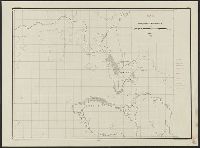
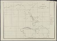
- Maury, Matthew Fontaine, 1806-187318
- National Geographic Society (U.S.). Cartographic Section17
- Great Britain. Inter-service Topographical Dept9
- United States. Army. Corps of Engineers9
- Manila Fire Insurance Association8
- Ringgold, Cadwalader, 1802-18678
- U.S. Coast and Geodetic Survey7
- Military maps10
- Railroads--Soviet Union--Maps8
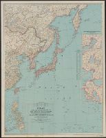
- Aeronautical charts--East China Sea5
- Aeronautical charts--Japan, Sea of5
- Aeronautical charts--South China Sea5
- Ocean currents--China--Maps5
- Spanish-American War, 1898--Campaigns--Puerto Rico--Maps5
- Winds--China--Maps5
- Nautical charts--California--Sacramento River4
- Nautical charts--California--San Francisco Bay4
- United States. Army Map Service46
- Maury, Matthew Fontaine, 1806-1873. Wind and current charts18
- United States. Army Air Forces18
- United States. Bureau of Ordnance and Hydrography18
- United States. Hydrographic Office17
- Darley, James M. (James Morrison)16
- United States Naval Observatory16
- United States. Aeronautical Chart Service15
- Brehm, J. J8
- Graham, C. B. (Curtis B.)8
- Washington, D.C. :✖[remove]349
- [London] :10
- Baltimore, Md. :3
- Baltimore [Md.] :1