
Search


Limit your search
- Public143
- cartographic143
- Great Britain. War Office. General Staff. Geographical Section✖[remove]143
- United States. Army Map Service9
- Allied Forces1
- Generalstabens litografiska anstalt1
- Railroads--Soviet Union--Maps8
- Ethnology--Balkan Peninsula--Maps4
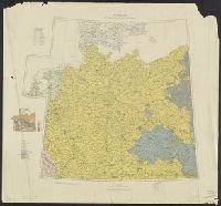
- Ethnology--Europe, Central--Maps4
- Population density--Europe, Central--Maps4
- Ethnology--Italy--Maps2
- Ethnology--Poland--Maps2
- Population density--2
- Population density--Balkan Peninsula--Maps2
- Cables, Submarine--Maps.1
- Ethnology--Europe, Eastern--Maps1
Current results range from 1901 to 1945