Search
You Searched For
Search Results
- Creator:
- United States. Army Map Service
- Published / Created:
- 1943
- Call Number:
- 39 Sa51 1943
- Container / Volume:
- BRBL_00191
- Image Count:
- 1
- Resource Type:
- Maps, Atlases & Globes
- Found in:
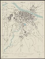
- Beinecke Rare Book and Manuscript Library > Spain 1:10,000. San Carlos de la Rapita city plan / prepared under the direction of the Chief of Engineers, U.S. Army [cartographic material].
- Creator:
- United States. Army Map Service
- Published / Created:
- 1943
- Call Number:
- 39 Z19 1943
- Container / Volume:
- BRBL_00192
- Image Count:
- 1
- Resource Type:
- Maps, Atlases & Globes
- Found in:
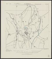
- Beinecke Rare Book and Manuscript Library > Spain 1:10,000. Zaragoza city plan / prepared under the direction of the Chief of Engineers, U.S. Army [cartographic material].
- Creator:
- United States. Army Map Service
- Published / Created:
- 1943
- Call Number:
- 39 Sa54 1943
- Container / Volume:
- BRBL_00191
- Image Count:
- 1
- Resource Type:
- Maps, Atlases & Globes
- Found in:
- Beinecke Rare Book and Manuscript Library > Spain 1:5,000. San Sebastian city plan / prepared under the direction of the Chief of Engineers, U.S. Army [cartographic material].
- Creator:
- United States. Army Map Service
- Published / Created:
- 1943
- Call Number:
- 39 P96 1943
- Container / Volume:
- BRBL_00190
- Image Count:
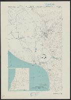
- 1
- Resource Type:
- Maps, Atlases & Globes
- Found in:
- Beinecke Rare Book and Manuscript Library > Spain 1:10,000. Puerto de Palma city plan / prepared under the direction of the Chief of Engineers, U.S. Army [cartographic material].
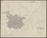
- Creator:
- United States. Army Map Service
- Published / Created:
- 1943
- Call Number:
- 39 V83 1943
- Container / Volume:
- BRBL_00192
- Image Count:
- 1
- Resource Type:
- Maps, Atlases & Globes
- Found in:
- Beinecke Rare Book and Manuscript Library > Spain 1:10,000. Vitoria city plan / prepared under the direction of the Chief of Engineers, U.S. Army [cartographic material].
- Creator:
- United States. Army Map Service
- Published / Created:
- 1943
- Call Number:
- 39 R31 1943
- Container / Volume:
- BRBL_00190
- Image Count:
- 1
- Resource Type:
- Maps, Atlases & Globes
- Found in:
- Beinecke Rare Book and Manuscript Library > Spain 1:10,000. Reus city plan / prepared under the direction of the Chief of Engineers, U.S. Army [cartographic material].
- Creator:
- United States. Army Map Service
- Published / Created:
- 1943
- Call Number:
- 39 Sa59 1943
- Container / Volume:
- BRBL_00191
- Image Count:
- 1
- Resource Type:
- Maps, Atlases & Globes
- Found in:
- Beinecke Rare Book and Manuscript Library > Spain 1:10,000. Santander city plan / prepared under the direction of the Chief of Engineers, U.S. Army [cartographic material].
- Creator:
- United States. Army Map Service
- Published / Created:
- 1943
- Call Number:
- 39 P962 1943
- Container / Volume:
- BRBL_00190
- Image Count:
- 1
- Resource Type:
- Maps, Atlases & Globes
- Found in:
- Beinecke Rare Book and Manuscript Library > Spain 1:10,000. Puigcerda city plan / prepared under the direction of the Chief of Engineers, U.S. Army [cartographic material].
- Creator:
- United States. Army Map Service
- Published / Created:
- 1943
- Call Number:
- 39 Ov4 1943
- Container / Volume:
- BRBL_00190
- Image Count:
- 1
- Resource Type:
- Maps, Atlases & Globes
- Found in:
- Beinecke Rare Book and Manuscript Library > Spain 1:8,000. Oviedo city plan / prepared under the direction of the Chief of Engineers, U.S. Army [cartographic material].
- Creator:
- Great Britain. War Office. General Staff. Geographical Section
- Published / Created:
- 1943
- Call Number:
- 397gmb 1943
- Container / Volume:
- BRBL_00195
- Image Count:
- 1
- Resource Type:
- Maps, Atlases & Globes
- Found in:
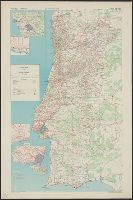
- Beinecke Rare Book and Manuscript Library > Road map of Portugal [cartographic material].
- Creator:
- United States. Army. Corps of Engineers
- Published / Created:
- 1943
- Call Number:
- 40 C442 1943
- Container / Volume:
- BRBL_00206
- Image Count:
- 1
- Resource Type:
- Maps, Atlases & Globes
- Found in:
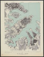
- Beinecke Rare Book and Manuscript Library > Italy 1:7,500. Chioggia city plan / prepared under the direction of the Chief of Engineers, U.S. Army. 1943 [cartographic material].
- Creator:
- Great Britain. War Office. General Staff. Geographical Section
- Published / Created:
- 1943
- Call Number:
- 40 C737 1943
- Container / Volume:
- BRBL_00206
- Image Count:
- 1
- Resource Type:
- Maps, Atlases & Globes
- Found in:
- Beinecke Rare Book and Manuscript Library > Town plan of Como [cartographic material].
- Creator:
- Great Britain. War Office. General Staff. Geographical Section
- Published / Created:
- 1943
- Call Number:
- 40 P67 1943
- Container / Volume:
- BRBL_00214
- Image Count:
- 1
- Resource Type:
- Maps, Atlases & Globes
- Found in:
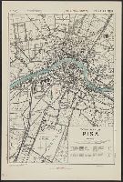
- Beinecke Rare Book and Manuscript Library > Town plan of Pisa [cartographic material].
- Creator:
- Great Britain. War Office. General Staff. Geographical Section
- Published / Created:
- 1943
- Call Number:
- 40 P13 1943
- Container / Volume:
- BRBL_00213
- Image Count:
- 1
- Resource Type:
- Maps, Atlases & Globes
- Found in:
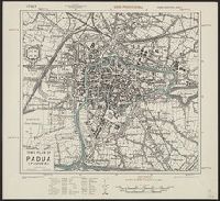
- Beinecke Rare Book and Manuscript Library > Town plan of Padua (Padova) [cartographic material].
- Creator:
- Great Britain. War Office. General Staff. Geographical Section
- Published / Created:
- 1943
- Call Number:
- 40 P19 1942
- Container / Volume:
- BRBL_00213
- Image Count:
- 1
- Resource Type:
- Maps, Atlases & Globes
- Found in:
- Beinecke Rare Book and Manuscript Library > Pantelleria [cartographic material] / drawn by GSGS, War Office 1940.
- Creator:
- Great Britain. War Office. General Staff. Geographical Section
- Published / Created:
- 1943
- Call Number:
- 40 P24 1943
- Container / Volume:
- BRBL_00213
- Image Count:
- 1
- Resource Type:
- Maps, Atlases & Globes
- Found in:
- Beinecke Rare Book and Manuscript Library > Town plan of Parma [cartographic material].
- Creator:
- Great Britain. War Office. General Staff. Geographical Section
- Published / Created:
- 1943
- Call Number:
- 40 P57 1943
- Container / Volume:
- BRBL_00214
- Image Count:
- 1
- Resource Type:
- Maps, Atlases & Globes
- Found in:
- Beinecke Rare Book and Manuscript Library > Town plan of Piacenza [cartographic material].
- Creator:
- Great Britain. War Office. General Staff. Geographical Section
- Published / Created:
- 1943
- Call Number:
- 40 R19 1943
- Container / Volume:
- BRBL_00215
- Image Count:
- 1
- Resource Type:
- Maps, Atlases & Globes
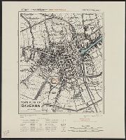
- Found in:
- Beinecke Rare Book and Manuscript Library > Town plan of Ravenna [cartographic material].
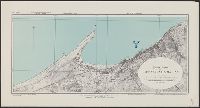
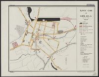
- Creator:
- United States. Army. Corps of Engineers
- Published / Created:
- 1943
- Call Number:
- 40 Sa65 1943
- Image Count:
- 1
- Resource Type:
- Maps, Atlases & Globes
- Found in:
- Beinecke Rare Book and Manuscript Library > Italy 1:10,000. Sapri city plan / prepared under the direction of the Chief of Engineers, U.S. Army, Washington, D.C [cartographic material].
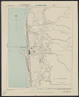
- Creator:
- United States. Army. Corps of Engineers
- Published / Created:
- 1943
- Call Number:
- 40 Sc47 1943
- Container / Volume:
- BRBL_00219
- Image Count:
- 1
- Resource Type:
- Maps, Atlases & Globes
- Found in:
- Beinecke Rare Book and Manuscript Library > Italy 1:7,500. Scilla city plan / prepared under the direction of the Chief of Engineers, U.S. Army, Washington, D.C [cartographic material].
- Creator:
- United States. Army. Corps of Engineers
- Published / Created:
- 1943
- Call Number:
- 40 V65 1943
- Image Count:
- 1
- Resource Type:
- Maps, Atlases & Globes
- Found in:
- Beinecke Rare Book and Manuscript Library > Italy 1:10,000. Viareggio city plan / prepared under the direction of the Chief of Engineers, U.S. Army, Washington, D.C [cartographic material].
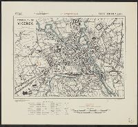
- Creator:
- Great Britain. War Office. General Staff. Geographical Section
- Published / Created:
- 1943
- Call Number:
- 40 V66 1943
- Image Count:
- 1
- Resource Type:
- Maps, Atlases & Globes
- Found in:
- Beinecke Rare Book and Manuscript Library > Town plan of Vicenza [cartographic material].
- Creator:
- Great Britain. Inter-service Topographical Dept
- Published / Created:
- 1943
- Call Number:
- 40 V652 1943
- Image Count:
- 1
- Resource Type:
- Maps, Atlases & Globes
- Found in:
- Beinecke Rare Book and Manuscript Library > Town plan of Vibo Valentia Marina [cartographic material] / compiled and drawn by Inter-Service Topographical Department ; produced under the Superintendence of Vice-Admiral John Edgell, hydrographer.
- Creator:
- Great Britain. Inter-service Topographical Dept
- Published / Created:
- 1943
- Call Number:
- 40 V715 1943
- Image Count:
- 1
- Resource Type:
- Maps, Atlases & Globes
- Found in:
- Beinecke Rare Book and Manuscript Library > Villa San Giovanni [cartographic material] / compiled and drawn by Inter-Service Topographical Department ; produced under the Superintendence of Vice-Admiral John Edgell, hydrographer.
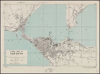
- Creator:
- Great Britain. Army. Royal Engineers. Fd. Survey Coy., 512
- Published / Created:
- 1943
- Call Number:
- 40 T17 1943
- Image Count:
- 1
- Resource Type:
- Maps, Atlases & Globes
- Found in:
- Beinecke Rare Book and Manuscript Library > Town plan of Taranto [cartographic material] / reproduced by 512 Fd. Survey Coy., R.E., June, 1943, from W.O. pulls 1st edition, 1942, with revision from air photographs, dated 1943.
- Creator:
- Great Britain. War Office. General Staff. Geographical Section
- Published / Created:
- 1943
- Call Number:
- 40 T729 1943
- Image Count:
- 1
- Resource Type:
- Maps, Atlases & Globes
- Found in:
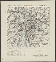
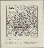
- Beinecke Rare Book and Manuscript Library > Town plan of Treviso [cartographic material].
- Creator:
- Great Britain. War Office. General Staff. Geographical Section
- Published / Created:
- 1943
- Call Number:
- 40 Ud5 1943
- Image Count:
- 1
- Resource Type:
- Maps, Atlases & Globes
- Found in:
- Beinecke Rare Book and Manuscript Library > Town plan of Udine [cartographic material].
- Creator:
- United States. Office of Strategic Services. Research and Analysis Branch
- Published / Created:
- 1943
- Call Number:
- 40gfb 1943
- Container / Volume:
- BRBL_00229
- Image Count:
- 1
- Resource Type:
- Maps, Atlases & Globes
- Found in:
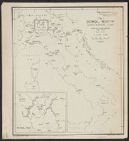
- Beinecke Rare Book and Manuscript Library > Italy Chemical Industry: Location of principal plants / James H. Shoemaker Lt. Col.
- Creator:
- Great Britain. War Office. General Staff. Geographical Section
- Published / Created:
- 1943
- Call Number:
- 408 N84 1943
- Container / Volume:
- BRBL_00239
- Image Count:
- 1
- Resource Type:
- Maps, Atlases & Globes
- Found in:
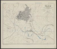
- Beinecke Rare Book and Manuscript Library > Town plan of Noto [cartographic material] / drawn and lithographed by War Office, 1943.
- Creator:
- Great Britain. War Office. General Staff. Geographical Section
- Published / Created:
- 1943
- Call Number:
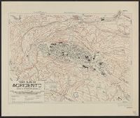
- 408 Ag84 1943
- Container / Volume:
- BRBL_00239
- Image Count:
- 1
- Resource Type:
- Maps, Atlases & Globes
- Found in:
- Beinecke Rare Book and Manuscript Library > Town plan of Agrigento [cartographic material].
- Creator:
- Great Britain. War Office. General Staff. Geographical Section
- Published / Created:
- 1943
- Call Number:
- 408 C27 1943
- Container / Volume:
- BRBL_00239
- Image Count:
- 1
- Resource Type:
- Maps, Atlases & Globes
- Found in:
- Beinecke Rare Book and Manuscript Library > Town plan of Castelvetrano [cartographic material] / drawn and photolithographed by War Office, 1943.
- Creator:
- Great Britain. War Office. General Staff. Geographical Section
- Published / Created:
- 1943
- Call Number:
- 408 L61 1943
- Container / Volume:
- BRBL_00239
- Image Count:
- 1
- Resource Type:
- Maps, Atlases & Globes
- Found in:
- Beinecke Rare Book and Manuscript Library > Town plan of Licata [cartographic material] / drawn and photolithographed by War Office, 1943.
- Creator:
- Great Britain. War Office. General Staff. Geographical Section
- Published / Created:
- 1943
- Call Number:
- 408 M56 1943
- Container / Volume:
- BRBL_00239
- Image Count:
- 1
- Resource Type:
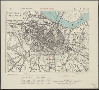
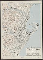
- Maps, Atlases & Globes
- Found in:
- Beinecke Rare Book and Manuscript Library > Town plan of Messina [cartographic material] / photolithographed by the Ordnance Survey, 1943.
- Creator:
- Great Britain. Inter-service Topographical Dept
- Published / Created:
- 1943
- Call Number:
- 408 Sc12 1943
- Container / Volume:
- BRBL_00239
- Image Count:
- 1
- Resource Type:
- Maps, Atlases & Globes
- Found in:
- Beinecke Rare Book and Manuscript Library > Sicily 1:5,200. Sciacca / compiled and drawn by Inter-Service Topographical Dept [cartographic material].
- Creator:
- Great Britain. War Office. General Staff. Geographical Section
- Published / Created:
- 1943
- Call Number:
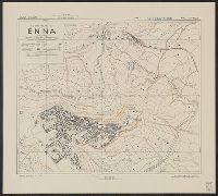
- 408 En61 1943
- Container / Volume:
- BRBL_00239
- Image Count:
- 1
- Resource Type:
- Maps, Atlases & Globes
- Found in:
- Beinecke Rare Book and Manuscript Library > Town plan of Enna [cartographic material] / drawn and photolithographed by War Office, 1943.
- Creator:
- Great Britain. War Office. General Staff. Geographical Section
- Published / Created:
- 1943
- Call Number:
- 408 P17 1943
- Container / Volume:
- BRBL_00239
- Image Count:
- 1
- Resource Type:
- Maps, Atlases & Globes
- Found in:
- Beinecke Rare Book and Manuscript Library > Town plan of Palermo [cartographic material].
- Creator:
- Great Britain. Army. Royal Engineers. Field Survey Coy., 19th
- Published / Created:
- 1943
- Call Number:
- 408 T15 1943
- Container / Volume:
- BRBL_00239
- Image Count:
- 1
- Resource Type:
- Maps, Atlases & Globes
- Found in:
- Beinecke Rare Book and Manuscript Library > Taormina [cartographic material] / drawn by 19th. Fd. Survey Coy. R.E., June, '43, from W.O. Bromide.
- Published / Created:
- 1896
- Call Number:
- 41hc 1896
- Container / Volume:
- BRBL_00243
- Image Count:
- 1
- Resource Type:
- Maps, Atlases & Globes
- Found in:
- Beinecke Rare Book and Manuscript Library > The Austro-Hungarian Maneuvers : September, 1896 / C.H. Ourand.
- Creator:
- Great Britain. War Office. General Staff. Geographical Section
- Published / Created:
- 1943
- Call Number:
- 409 Sa79 1943
- Container / Volume:
- BRBL_00240
- Image Count:
- 1
- Resource Type:
- Maps, Atlases & Globes
- Found in:
- Beinecke Rare Book and Manuscript Library > Town plan of Sassari [cartographic material].
- Creator:
- Great Britain. War Office. General Staff. Geographical Section
- Published / Created:
- 1943
- Call Number:
- 408 Sy76 1943
- Container / Volume:
- BRBL_00239
- Image Count:
- 1
- Resource Type:
- Maps, Atlases & Globes
- Found in:
- Beinecke Rare Book and Manuscript Library > Town plan of Siracusa [cartographic material] / photolithographed by the Ordnance Survey, 1943.
- Creator:
- Great Britain. War Office. General Staff. Geographical Section
- Published / Created:
- 1943
- Call Number:
- 408 V83 1943
- Container / Volume:
- BRBL_00239
- Image Count:
- 1
- Resource Type:
- Maps, Atlases & Globes
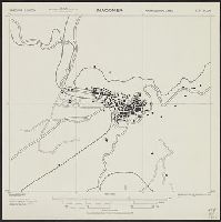
- Found in:
- Beinecke Rare Book and Manuscript Library > Town plan of Vittoria [cartographic material] / drawn and photolithographed by War Office, 1943.
- Creator:
- United States. Army. Corps of Engineers
- Published / Created:
- 1943
- Call Number:
- 409 M11 1943
- Container / Volume:
- BRBL_00240
- Image Count:
- 1
- Resource Type:
- Maps, Atlases & Globes
- Found in:
- Beinecke Rare Book and Manuscript Library > Sardinia 1:10,000. Macomer city plan / prepared under the direction of the Chief of Engineers, U.S. Army, 1943 [cartographic material].
- Creator:
- Great Britain. War Office. General Staff. Geographical Section
- Published / Created:
- 1943
- Call Number:
- 409 C17 1943
- Container / Volume:
- BRBL_00240
- Image Count:
- 1
- Resource Type:
- Maps, Atlases & Globes
- Found in:
- Beinecke Rare Book and Manuscript Library > Carbonia [cartographic material] / photolithographed by War Office, 1943.
- Creator:
- Great Britain. Royal Air Force. Central Interpretation Unit
- Published / Created:
- 1943
- Call Number:
- 475 1944
- Container / Volume:
- BRBL_00262
- Image Count:
- 1
- Resource Type:
- Maps, Atlases & Globes
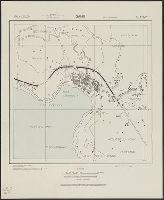
- Found in:
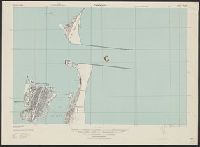
- Beinecke Rare Book and Manuscript Library > Albania 1:10,000. Vlonë (Valona) city plan / compiled and drawn by C.I.U. 1943 [cartographic material].
- Creator:
- United States. Office of Strategic Services. Research and Analysis Branch
- Published / Created:
- 1943
- Call Number:
- 46 l769 1930
- Container / Volume:
- BRBL_00259
- Image Count:
- 1
- Resource Type:
- Maps, Atlases & Globes
- Found in:
- Beinecke Rare Book and Manuscript Library > Town plan of Ljubljana [cartographic material] : date prior to 1930.
- Creator:
- United States. Army Map Service
- Published / Created:
- 1943
- Call Number:
- 493 V24 1943
- Container / Volume:
- BRBL_00270
- Image Count:
- 1
- Resource Type:
- Maps, Atlases & Globes
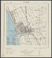
- Found in:
- Beinecke Rare Book and Manuscript Library > Valletta city plan [cartographic material] / prepared under the direction of the Chief of Engineers, U.S. Army 1943.
- Creator:
- United States. Army Map Service
- Published / Created:
- 1944
- Call Number:
- 50 1945M
- Container / Volume:
- BRBL_00273
- Image Count:
- 1
- Resource Type:
- Maps, Atlases & Globes
- Found in:
- Beinecke Rare Book and Manuscript Library > [AAF cloth chart]. Eastern Asia [cartographic material].
- Creator:
- Great Britain. War Office. General Staff. Geographical Section
- Published / Created:
- 1943
- Call Number:
- 501 1943
- Container / Volume:
- BRBL_00276
- Image Count:
- 1
- Resource Type:
- Maps, Atlases & Globes
- Found in:
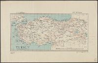
- Beinecke Rare Book and Manuscript Library > Turkey [cartographic material].
- Creator:
- National Geographic Society (U.S.). Cartographic Division
- Published / Created:
- c1944.
- Call Number:
- 556 1944
- Container / Volume:
- BRBL_00293
- Image Count:
- 1
- Resource Type:
- Maps, Atlases & Globes
- Found in:
- Beinecke Rare Book and Manuscript Library > Southeast Asia and Pacific Islands from the Indies and the Philippines to the Solomons [cartographic material] / compiled and drawn in the Cartographic Section of the National Geographic Society ; James M. Darley, chief cartographer.