Search
You Searched For
Search Results
- Creator:
- Lanfiere, Thomas
- Published / Created:
- [1665?]
- Call Number:
- BrSides By6 1665
- Image Count:
- 1
- Found in:
- Beinecke Rare Book and Manuscript Library > A Discription of plain-dealing, time, and death, which all men ought to mind whilst they do live on earth ...
- Published / Created:
- [1774]
- Call Number:
- 76 1774
- Container / Volume:
- BRBL_00729
- Image Count:
- 1
- Resource Type:
- Maps, Atlases & Globes
- Found in:
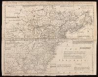
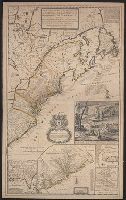
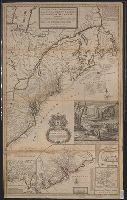
- Beinecke Rare Book and Manuscript Library > A Map of the most inhabited part of New England [cartographic material] : containing the provinces of Massachusets Bay and New Hampshire with the colonies of Conecticut and Rhode Island divided into counties and townships : The whole composed from actual
- Published / Created:
- [1774]
- Call Number:
- 76 1774
- Container / Volume:
- BRBL_00729
- Image Count:
- 2
- Resource Type:
- Maps, Atlases & Globes
- Found in:
- Beinecke Rare Book and Manuscript Library > A Map of the most inhabited part of New England [cartographic material] : containing the provinces of Massachusets Bay and New Hampshire with the colonies of Conecticut and Rhode Island divided into counties and townships : The whole composed from actual
- Published / Created:
- [1774]
- Call Number:
- 76 1774
- Container / Volume:
- BRBL_00443
- Image Count:
- 2
- Resource Type:
- Maps, Atlases & Globes
- Found in:
- Beinecke Rare Book and Manuscript Library > A Map of the most inhabited part of New England [cartographic material] : containing the provinces of Massachusets Bay and New Hampshire with the colonies of Conecticut and Rhode Island divided into counties and townships : The whole composed from actual
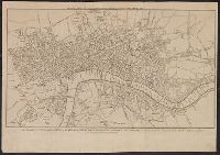
- Published / Created:
- [1780]
- Call Number:
- 32 L84 1780
- Container / Volume:
- BRBL_00048
- Image Count:
- 1
- Resource Type:
- Maps, Atlases & Globes
- Found in:
- Beinecke Rare Book and Manuscript Library > A New & Correct Plan of the Cities of London and Westminister, with the Borough of Southwark ...
- Creator:
- Blodget, Samuel, 1724-1807
- Published / Created:
- February the 2d, 1756.
- Call Number:
- 771hc H864 1756
- Container / Volume:
- BRBL_00495
- Image Count:
- 1
- Resource Type:
- Maps, Atlases & Globes
- Found in:
- Beinecke Rare Book and Manuscript Library > A Prospective view of the battle fought near Lake George, on the 8th of Sepr. 1755 : between 2000 English, with 250 Mohawks, under the command of Gen. Johnson: & 2500 French & indians under the command of Genl. Dieskau in which the English were victorious
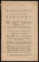
- Creator:
- Langford, Mr. (Abraham), 1711-1774.
- Published / Created:
- [1776]
- Call Number:
- X348 L264 1776
- Image Count:
- 14
- Found in:
- Beinecke Rare Book and Manuscript Library > A catalogue of the valuable library of Mr. Josiah Colebrook, deceased : F.R.S. and late treasurer of the Antiquarian Society, which ... will be sold by auction, by Mess. Langford ... on Tuesday the 20th of this instant February 1776, and the two following evenings ...
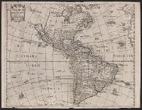
- Published / Created:
- [1783?]
- Call Number:
- 70 1783A
- Container / Volume:
- BRBL_00356
- Image Count:
- 3
- Resource Type:
- Maps, Atlases & Globes
- Found in:
- Beinecke Rare Book and Manuscript Library > A chart of North and South America : including the Atlantic and Pacific Oceans, with the nearest coasts of Europe, Africa and Asia : according to the preliminary articles of peace signed at Versailles, 20 Jany. 1783.
- Published / Created:
- [1783?]
- Call Number:
- 70 1775
- Container / Volume:
- BRBL_00686
- Image Count:
- 3
- Resource Type:
- Maps, Atlases & Globes
- Found in:
- Beinecke Rare Book and Manuscript Library > A chart of North and South America : including the Atlantic and Pacific Oceans, with the nearest coasts of Europe, Africa and Asia : according to the preliminary articles of peace signed at Versailles, 20 Jany. 1783.
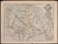
- Creator:
- Pine, John, 1690-1756
Rocque, John, d. 1762
Tinney, John
- Published / Created:
- 1746
- Call Number:
- 2002 Folio 94
- Image Count:
- 1
- Resource Type:
- Maps, Atlases & Globes
- Found in:
- Beinecke Rare Book and Manuscript Library > A contracted scetch of the plan of London &c. : printed on 24 sheets of imperial paper, to shew the general appearance of the whole : for the use of those who bind it in a book, and for the better comprehension of the divisions mentioned in the index.
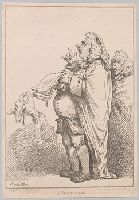
- Creator:
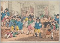
- Rowlandson, Thomas, 1756-1827, printmaker.
- Published / Created:
- [1 January 1801]
- Call Number:
- Auchincloss Rowlandson v. 7
- Image Count:
- 1
- Found in:
- Beinecke Rare Book and Manuscript Library > A counciller [graphic] / Rowlandson.
- Creator:
- Elstracke, Renold, active 1590-1630
- Published / Created:
- [1625]
- Call Number:
- BrSides 2019 110
- Image Count:
- 1
- Resource Type:
- Maps, Atlases & Globes
- Found in:
- Beinecke Rare Book and Manuscript Library > A description of East India : conteyning the Empire of the Great Mogoll / R. Elstracke sculpsit.
- Published / Created:
- 1684
- Call Number:
- BrSides By6 1684
- Image Count:
- 1
- Found in:
- Beinecke Rare Book and Manuscript Library > A dialogue between Bowman the Tory, and Prance the runagado : a new song.
- Creator:
- Lodge, John, -1796
- Published / Created:
- [1778?]
- Call Number:
- BrSides 2017 62
- Image Count:
- 1
- Resource Type:
- Maps, Atlases & Globes
- Found in:
- Beinecke Rare Book and Manuscript Library > A general map of North America ; from the latest observations / engrav'd by Jno. Lodge from the late Mr. Jefferys, geographer to the King.
- Creator:
- Gibson, J. (John)
- Published / Created:
- 1758
- Call Number:
- 755 1758
- Container / Volume:
- BRBL_00428
- Image Count:
- 1
- Resource Type:
- Maps, Atlases & Globes
- Found in:
- Beinecke Rare Book and Manuscript Library > A general map of the middle British colonies in America : viz. Virginia, Maryland, Delaware, Pensilvania, New-Jersey, New-York, Connecticut and Rhode-Island : of Aquanishuonigy the country of the confederate Indians comprehending Aquanishuonigy proper, th
- Creator:
- Jefferys, Thomas, d. 1771
- Published / Created:
- 1775 June 15
- Call Number:
- 755 1775D
- Container / Volume:
- BRBL_00429
- Image Count:
- 1
- Resource Type:
- Maps, Atlases & Globes
- Found in:
- Beinecke Rare Book and Manuscript Library > A general map of the middle British colonies in America : viz. Virginia, Maryland, Delaware, Pensilvania, New-Jersey, New-York, Connecticut, and Rhode-Island : of Aquanishuonîgy the country of the Confederate Indians comprehending Aquanishuonigy proper,
- Creator:
- Rowlandson, Thomas, 1756-1827, printmaker.
- Published / Created:
- [20 March 1809]
- Call Number:
- Auchincloss Rowlandson v. 10
- Image Count:
- 1
- Found in:
- Beinecke Rare Book and Manuscript Library > A mad dog in a coffee house [graphic] / J. Nixon Esqr. delin ; Rowlandson scul.
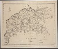
- Published / Created:
- 1805
- Call Number:
- 3238 1805
- Container / Volume:
- BRBL_00065
- Image Count:
- 1
- Resource Type:
- Maps, Atlases & Globes
- Found in:
- Beinecke Rare Book and Manuscript Library > A map of Cumberland ... Engraved by J. Cary.
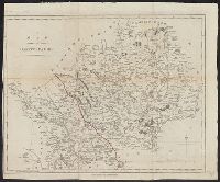
- Published / Created:
- 1798
- Call Number:
- 3258 1798
- Container / Volume:
- BRBL_00069
- Image Count:
- 1
- Resource Type:
- Maps, Atlases & Globes
- Found in:
- Beinecke Rare Book and Manuscript Library > A map of Hartfordshire.
- Published / Created:
- 1805
- Call Number:
- 3235 1805
- Container / Volume:
- BRBL_00064
- Image Count:
- 1
- Resource Type:
- Maps, Atlases & Globes
- Found in:
- Beinecke Rare Book and Manuscript Library > A map of Lancashire ... Engraved by J. Cary.
- Creator:
- Kitchin, Thomas, d. 1784
- Published / Created:
- [1757]
- Call Number:
- 777 1758
- Container / Volume:
- BRBL_00690
- Image Count:
- 1
- Resource Type:
- Maps, Atlases & Globes
- Found in:
- Beinecke Rare Book and Manuscript Library > A map of Maryland with the Delaware counties and the southern part of New Jersey &c / [cartographic material] / by T. Kitchin geogr.
- Published / Created:
- 1798
- Call Number:
- 3217 1798
- Container / Volume:
- BRBL_00057
- Image Count:
- 1
- Resource Type:
- Maps, Atlases & Globes
- Found in:
- Beinecke Rare Book and Manuscript Library > A map of Middlesex.
- Creator:
- Speed, John, 1552?-1629
- Published / Created:
- [1676]
- Call Number:
- 755 1672A
- Container / Volume:
- BRBL_00423
- Image Count:
- 2
- Resource Type:
- Maps, Atlases & Globes
- Found in:
- Beinecke Rare Book and Manuscript Library > A map of New England and New York / F. Lamb sculp.
- Creator:
- Gibson, J. (John), active 1750-1792
- Published / Created:
- [1749]
- Call Number:
- BrSides 2019 63
- Image Count:
- 1
- Resource Type:
- Maps, Atlases & Globes
- Found in:
- Beinecke Rare Book and Manuscript Library > A map of New Scotland with its dependencies and a succint account of the country.
- Creator:
- Delarochette, L. (Louis), 1731-1802
- Published / Created:
- 1st of March 1789.
- Call Number:
- 71 1789
- Container / Volume:
- BRBL_00366
- Image Count:
- 4
- Resource Type:
- Maps, Atlases & Globes
- Found in:
- Beinecke Rare Book and Manuscript Library > A map of North America and the West Indies / by L.S. de la Rochette.
- Published / Created:
- 1787
- Call Number:
- 3218 1787
- Container / Volume:
- BRBL_00058
- Image Count:
- 1
- Resource Type:
- Maps, Atlases & Globes
- Found in:
- Beinecke Rare Book and Manuscript Library > A map of Oxfordshire... Heywood Delt. Sudlow fc.
- Creator:
- Osborne, Thomas, -1767
- Published / Created:
- [1747]
- Call Number:
- BrSides 2019 80
- Image Count:
- 1
- Resource Type:
- Maps, Atlases & Globes
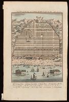
- Found in:
- Beinecke Rare Book and Manuscript Library > A map of Paradise mount Ararat and the city of Babel : according to the three different hypotheses mentioned in this work.
- Creator:
- Scull, Nicholas, 1686?-1761?
- Published / Created:
- [1753]
- Call Number:
- BrSides 2019 60
- Image Count:
- 1
- Resource Type:
- Maps, Atlases & Globes
- Found in:
- Beinecke Rare Book and Manuscript Library > A map of Philadelphia and parts adjacent / by N. Scull and G. Heap.
- Creator:
- Scull, Nicholas, 1686?-1761?
- Published / Created:
- [1753]
- Call Number:
- BrSides 2019 61
- Image Count:
- 1
- Resource Type:
- Maps, Atlases & Globes
- Found in:
- Beinecke Rare Book and Manuscript Library > A map of Philadelphia and parts adjacent / by N. Scull and G. Heap.
- Creator:
- L'Isle, Guillaume de, 1675-1726
- Published / Created:
- 1711
- Call Number:
- 53 1711
- Container / Volume:
- BRBL_00684
- Image Count:
- 1
- Resource Type:
- Maps, Atlases & Globes
- Found in:
- Beinecke Rare Book and Manuscript Library > A map of Turky [sic] Arabia & Persia : corrected from the latest travels and from the observations of the Royal Societys of London and Paris / by G. De L'Isle.
- Creator:
- Speed, John, 1552?-1629
- Published / Created:
- [1676]
- Call Number:
- 783 1680
- Container / Volume:
- BRBL_00691
- Image Count:
- 2
- Resource Type:
- Maps, Atlases & Globes
- Found in:
- Beinecke Rare Book and Manuscript Library > A map of Virginia and Maryland / F. Lamb sculp.
- Creator:
- Speed, John, 1552?-1629
- Published / Created:
- [1676]
- Call Number:
- 755 1676D
- Container / Volume:
- BRBL_00423
- Image Count:
- 2
- Resource Type:
- Maps, Atlases & Globes
- Found in:
- Beinecke Rare Book and Manuscript Library > A map of Virginia and Maryland / F. Lamb sculp.
- Published / Created:
- 1805
- Call Number:
- 3253 1805
- Container / Volume:
- BRBL_00067
- Image Count:
- 1
- Resource Type:
- Maps, Atlases & Globes
- Found in:
- Beinecke Rare Book and Manuscript Library > A map of Westmoreland ... Engraved by J. Cary.
- Creator:
- Senex, John, d. 1740
- Published / Created:
- [1710]
- Call Number:
- 392 1710
- Container / Volume:
- BRBL_00684
- Image Count:
- 1
- Resource Type:
- Maps, Atlases & Globes
- Found in:
- Beinecke Rare Book and Manuscript Library > A map of old & new Castile : from the observations of Rodrigo Mendes Silva and others.
- Creator:
- Bowen, Thomas, -1790
- Published / Created:
- 1755]
- Call Number:
- BrSides Folio 2019 104
- Image Count:
- 1
- Resource Type:
- Maps, Atlases & Globes
- Found in:
- Beinecke Rare Book and Manuscript Library > A map of the British and French settlements in North America / T. Bowen, sculpt.
- Creator:
- Moll, Herman, -1732
- Published / Created:
- [1736?]
- Call Number:
- 18 1739
- Container / Volume:
- BRBL_00682
- Image Count:
- 1
- Resource Type:
- Maps, Atlases & Globes
- Found in:
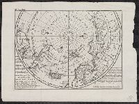
- Beinecke Rare Book and Manuscript Library > A map of the North Pole : with all the territories that lye near it, known to us &c. : according to the latest discoveries, and most exact observations : agreeable to modern history / by H. Moll geographer.
- Creator:
- Leach, John, Captain
- Published / Created:
- [approximately 1745]
- Call Number:
- BrSides 2019 87
- Image Count:
- 1
- Resource Type:
- Maps, Atlases & Globes
- Found in:
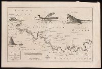
- Beinecke Rare Book and Manuscript Library > A map of the River Gambra from Eropina to Barrakunda / by Captn. John Leach in 1732 ; Thos. Kitchin sculpt.
- Published / Created:
- [1720?]
- Call Number:
- 85 1720
- Container / Volume:
- BRBL_00636
- Image Count:
- 1
- Resource Type:
- Maps, Atlases & Globes
- Found in:
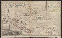
- Beinecke Rare Book and Manuscript Library > A map of the West Indies or the Islands of America ... explaining what belongs to Spain, England, France, Holland & c. also ye trade winds ...
- Published / Created:
- [1720?]
- Call Number:
- 85 1720
- Container / Volume:
- BRBL_00636
- Image Count:
- 1
- Resource Type:
- Maps, Atlases & Globes
- Found in:
- Beinecke Rare Book and Manuscript Library > A map of the West Indies or the Islands of America ... explaining what belongs to Spain, England, France, Holland & c. also ye trade winds ...
- Published / Created:
- [1770]
- Call Number:
- 11 1770
- Container / Volume:
- BRBL_00005
- Image Count:
- 1
- Resource Type:
- Maps, Atlases & Globes
- Found in:
- Beinecke Rare Book and Manuscript Library > A map of the World Corrected from the observations communicated to the Royal Societys of London and Paris by John Senex. H. Hulsbergh Sc.
- Creator:
- Kitchin, Thomas, d. 1784
- Published / Created:
- 1778
- Call Number:
- 76 1778
- Container / Volume:
- BRBL_00690
- Image Count:
- 2
- Resource Type:
- Maps, Atlases & Globes
- Found in:
- Beinecke Rare Book and Manuscript Library > A map of the colony of Rhode Island [cartographic material] : with the adjacent parts of Connecticut, Massachusetts Bay, & c / by Thos. Kitchin Senr., Hydrographer to His Majesty.
- Creator:
- L'Isle, Guillaume de, 1675-1726
- Published / Created:
- [1720?]
- Call Number:
- 3826 1710
- Container / Volume:
- BRBL_00684
- Image Count:
- 1
- Resource Type:
- Maps, Atlases & Globes
- Found in:
- Beinecke Rare Book and Manuscript Library > A map of the county of Flanders / [cartographic material] / by William de l'Isle ...
- Creator:
- Kitchin, Thomas, 1718-1784
- Published / Created:
- 1756
- Call Number:
- 755 1765A
- Container / Volume:
- BRBL_00690
- Image Count:
- 1
- Resource Type:
- Maps, Atlases & Globes
- Found in:
- Beinecke Rare Book and Manuscript Library > A map of the eastern part of the Province of New York : with part of New Jersey &c. / drawn from the best authorities by T. Kitchin geogr.
- Creator:
- Rocque, John, -1762.
- Published / Created:
- [between 1762 and 1773]
- Call Number:
- 327 1785
- Image Count:
- 2
- Resource Type:
- Maps, Atlases & Globes
- Found in:
- Beinecke Rare Book and Manuscript Library > A map of the kingdom of Ireland : divided into provinces, counties and baronies, shewing the archbishopricks, bishopricks, cities, boroughs, market towns, villages, barracks, mountains, lakes, bogs, rivers, bridges, ferries, passes : also, the great, the branch and the by post roads, together with the inland navigation, &c. / by John Rocque ...
- Creator:
- Jefferys, Thomas, -1771.
- Published / Created:
- November 29th 1755.
- Call Number:
- 76 1755A
- Container / Volume:
- BRBL_00443
- Image Count:
- 2
- Resource Type:
- Maps, Atlases & Globes
- Found in:
- Beinecke Rare Book and Manuscript Library > A map of the most inhabited part of New England : containing the provinces of Massachusetts Bay and New Hampshire, with the colonies of Konektikut and Rhode Island, divided into counties and townships: The whole composed from actual surveys and its situat
- Creator:
- L'Isle, Guillaume de, 1675-1726
- Published / Created:
- 1713
- Call Number:
- 38 1713
- Container / Volume:
- BRBL_00684
- Image Count:
- 1
- Resource Type:
- Maps, Atlases & Globes
- Found in:
- Beinecke Rare Book and Manuscript Library > A map of the provostship and vicounty of Paris [cartographic material] : drawn from a great number of particular memoirs made according to the observations of the Royal Academy of Sciences / by G Delisle ...
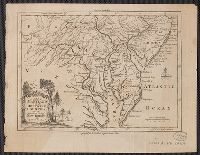
- Creator:
- Purcell, Joseph (Cartographer)
- Published / Created:
- 1792
- Call Number:
- 755 1792A
- Container / Volume:
- BRBL_00435
- Image Count:
- 1
- Resource Type:
- Maps, Atlases & Globes
- Found in:
- Beinecke Rare Book and Manuscript Library > A map of the states of Virginia, North Carolina, South Carolina and Georgia [cartographic material] : comprehending the Spanish provinces of east and west Florida : exhibiting the boundaries as fixed by the late treaty of peace between the United States a
- Published / Created:
- [1752]
- Call Number:
- BrSides 2019 81
- Image Count:
- 1
- Resource Type:
- Maps, Atlases & Globes
- Found in:
- Beinecke Rare Book and Manuscript Library > A map of the terrestrial Paradise according to Mr. Huet / with improvements from Dr. Wells.
- Creator:
- Kitchin, Thomas, 1718-1784
- Published / Created:
- [1764]
- Call Number:
- BrSides Folio 2019 92
- Collection Title:
- Navigantium atque itinerantium bibliotheca ; Or, A complete collection of voyages and travels
- Image Count:
- 1
- Resource Type:
- Maps, Atlases & Globes
- Found in:
- Beinecke Rare Book and Manuscript Library > A new & accurate map of China : drawn from surveys made by the Jesuit Missionaries, by order of the Emperor, regulated by numerous astronomical observations / by Thos. Kitchin Geogr.
- Creator:
- Bowen, Emanuel, 1693 or 1694-1767, cartographer.
- Published / Created:
- [1747]
- Call Number:
- 655 1747
- Container / Volume:
- BRBL_00345
- Image Count:
- 1
- Resource Type:
- Maps, Atlases & Globes
- Found in:
- Beinecke Rare Book and Manuscript Library > A new & accurate map of Negroland and the adjacent countries : also Upper Guinea, shewing the principal European settlements, & distinguishing w[hi]ch belong to England, Denmark, Holland &c., the sea coast & some of the rivers being drawn from surveys & t
- Published / Created:
- [1708?]
- Call Number:
- 38 1708
- Container / Volume:
- BRBL_00151
- Image Count:
- 1
- Resource Type:
- Maps, Atlases & Globes
- Found in:
- Beinecke Rare Book and Manuscript Library > A new and Exact map of France ... H. Moll Geographer.
- Published / Created:
- 1711
- Call Number:
- 39 1711
- Container / Volume:
- BRBL_00185
- Image Count:
- 1
- Resource Type:
- Maps, Atlases & Globes
- Found in:
- Beinecke Rare Book and Manuscript Library > A new and Exact map of Spanish & Portugal ... H. Moll, Geographer.
- Creator:
- Speed, John, 1552?-1629
- Published / Created:
- 1651 [1676 printing]
- Call Number:
- 11 1651
- Container / Volume:
- BRBL_00680
- Image Count:
- 1
- Resource Type:
- Maps, Atlases & Globes
- Found in:
- Beinecke Rare Book and Manuscript Library > A new and accurat map of the world : drawne according to ye truest descriptions, latest discoueries & best obseruations y[e]t have beene made by english or strangers.
- Published / Created:
- [1775?]
- Call Number:
- 3224 1775
- Container / Volume:
- BRBL_00060
- Image Count:
- 1
- Resource Type:
- Maps, Atlases & Globes
- Found in:
- Beinecke Rare Book and Manuscript Library > A new and accurate Map of Warwickshire ... by Thos. Kitchin, Geographer.
- Published / Created:
- [1752?]
- Call Number:
- 755 1752
- Container / Volume:
- BRBL_00426
- Image Count:
- 1
- Resource Type:
- Maps, Atlases & Globes
- Found in:
- Beinecke Rare Book and Manuscript Library > A new and accurate map of New Jersey, Pensilvania, New York and New England, with adjacent countries.
- Published / Created:
- 1755
- Call Number:
- 755 1755V
- Container / Volume:
- BRBL_00427
- Image Count:
- 1
- Resource Type:
- Maps, Atlases & Globes
- Found in:
- Beinecke Rare Book and Manuscript Library > A new and accurate map of North America, (wherein the errors of all preceding British, French, and Dutch maps, respecting the rights of Great Britain, France & Spain & the limits of each of His Majesty's Provinces, are corrected) Tho: Kitchin, Sculpt.
- Creator:
- Herbert, William, 1718-1795
- Published / Created:
- 1755
- Call Number:
- 755 1755W
- Container / Volume:
- BRBL_00427
- Image Count:
- 1
- Resource Type:
- Maps, Atlases & Globes
- Found in:
- Beinecke Rare Book and Manuscript Library > A new and accurate map of the English empire in North America : representing their rightful claim as confirm'd by charters, and the formal surrender of their Indian friends; likewise the encroachments of the French, with the several forts they have unjust
- Creator:
- Speed, John, 1552?-1629.
- Published / Created:
- [1676]
- Call Number:
- 11 1651A
- Container / Volume:
- BRBL_00003
- Image Count:
- 1
- Resource Type:
- Maps, Atlases & Globes
- Found in:
- Beinecke Rare Book and Manuscript Library > A new and accvrat map of the world : drawne according to ye truest descriptions, latest discoveries & best observations yt have beene made by English or strangers, 1651.
- Creator:
- Moll, Herman, -1732
- Published / Created:
- [1729?]
- Call Number:
- 11 1724
- Container / Volume:
- BRBL_00680
- Image Count:
- 1
- Resource Type:
- Maps, Atlases & Globes
- Found in:
- Beinecke Rare Book and Manuscript Library > A new and correct map of the world laid down according to the newest discoveries, and from the most exact observations / [cartographic material] / by Herman Moll, geographer.
- Creator:
- Moll, Herman, d. 1732
- Published / Created:
- 1715
- Call Number:
- 755 1715
- Container / Volume:
- BRBL_00425
- Image Count:
- 1
- Resource Type:
- Maps, Atlases & Globes
- Found in:
- Beinecke Rare Book and Manuscript Library > A new and exact map of the dominions of the King of Great Britain on ye continent of North America : containing Newfoundland, New Scotland, New England, New York, New Jersey, Pensilvania, Maryland, Virginia, and Carolina ... / by Herman Moll, geographer.
- Creator:
- Moll, Herman, d. 1732
- Published / Created:
- 1715 [i.e., 1726?]
- Call Number:
- 755 1715B
- Container / Volume:
- BRBL_00425
- Image Count:
- 1
- Resource Type:
- Maps, Atlases & Globes
- Found in:
- Beinecke Rare Book and Manuscript Library > A new and exact map of the dominions of the King of Great Britain on ye continent of North America : containing Newfoundland, New Scotland, New England, New York, New Jersey, Pensilvania, Maryland, Virginia, and Carolina ... / by Herman Moll, geographer.
- Published / Created:
- 1826
- Call Number:
- 344cea 1826
- Container / Volume:
- BRBL_00095
- Image Count:
- 1
- Resource Type:
- Maps, Atlases & Globes
- Found in:
- Beinecke Rare Book and Manuscript Library > A new chart of the coast of Norway Christiansund to Stadtland ... Engraved by W.R. Pearcey.
- Published / Created:
- [1680?]
- Call Number:
- 7855 1680
- Container / Volume:
- BRBL_00691
- Image Count:
- 2
- Resource Type:
- Maps, Atlases & Globes
- Found in:
- Beinecke Rare Book and Manuscript Library > A new description of Carolina / Francis Lamb sculp.
- Published / Created:
- 1750
- Call Number:
- 3218 1750
- Container / Volume:
- BRBL_00057
- Image Count:
- 1
- Resource Type:
- Maps, Atlases & Globes
- Found in:
- Beinecke Rare Book and Manuscript Library > A new improved map of Oxfordshire ... By Thos. Kitchin Geographer.
- Published / Created:
- [1709?]
- Call Number:
- 34 1708
- Container / Volume:
- BRBL_00090
- Image Count:
- 1
- Resource Type:
- Maps, Atlases & Globes
- Found in:
- Beinecke Rare Book and Manuscript Library > A new map of Denmark and Sweden ... H. Moll. Geographer.
- Creator:
- Senex, John, d. 1740
- Published / Created:
- 1714
- Call Number:
- 3191 1714
- Container / Volume:
- BRBL_00683
- Image Count:
- 2
- Resource Type:
- Maps, Atlases & Globes
- Found in:
- Beinecke Rare Book and Manuscript Library > A new map of Great Britain : corrected from the observations communicated to the Royal Society at London / by John Senex, F.R.S.
- Published / Created:
- 1714
- Call Number:
- 327 1714
- Container / Volume:
- BRBL_00072
- Image Count:
- 1
- Resource Type:
- Maps, Atlases & Globes
- Found in:
- Beinecke Rare Book and Manuscript Library > A new map of Ireland ... Herman Moll, Geographer 1714.
- Published / Created:
- 1714
- Call Number:
- 40 1714A
- Container / Volume:
- BRBL_00197
- Image Count:
- 1
- Resource Type:
- Maps, Atlases & Globes
- Found in:
- Beinecke Rare Book and Manuscript Library > A new map of Italy ... post roads ... / H. Moll, geographer.
- Published / Created:
- 1714
- Call Number:
- 40 1714A
- Container / Volume:
- BRBL_00197
- Image Count:
- 1
- Resource Type:
- Maps, Atlases & Globes
- Found in:
- Beinecke Rare Book and Manuscript Library > A new map of Italy ... post roads ... / H. Moll, geographer.
- Creator:
- Moll, Herman, -1732
- Published / Created:
- 1714
- Call Number:
- 40 1714
- Container / Volume:
- BRBL_00196
- Image Count:
- 1
- Resource Type:
- Maps, Atlases & Globes
- Found in:
- Beinecke Rare Book and Manuscript Library > A new map of Italy : distinguishing all the sovereignties in it, whether states, kingdoms, dutchies, principalities, republicks &c. With the post roads, and many remarks not extant in any map. According to ye newest and most exact observations / by H. Mol
- Creator:
- Pownall, Thomas, 1722-1805
- Published / Created:
- 1786
- Call Number:
- 71 1783
- Container / Volume:
- BRBL_00366
- Image Count:
- 2
- Resource Type:
- Maps, Atlases & Globes
- Found in:
- Beinecke Rare Book and Manuscript Library > A new map of North America, with the West India Islands : divided according to the preliminary articles of peace, signed at Versailles, 20, Jan. 1783. Wherein are particularly distinguished the United States and the several provinces, governments &ca. whi
- Creator:
- Morse, Jedidiah, 1761-1826
- Published / Created:
- Novr. 10th, 1798.
- Call Number:
- 73 1798
- Container / Volume:
- BRBL_00688
- Image Count:
- 1
- Resource Type:
- Maps, Atlases & Globes
- Found in:
- Beinecke Rare Book and Manuscript Library > A new map of Upper & Lower Canada [cartographic material].
- Creator:
- Kitchin, Thomas, d. 1784
- Published / Created:
- [1782]
- Call Number:
- 755 1760A
- Container / Volume:
- BRBL_00428
- Image Count:
- 1
- Resource Type:
- Maps, Atlases & Globes
- Found in:
- Beinecke Rare Book and Manuscript Library > A new map of the British Empire in Nth. America / drawn from the latest authorities by Thos. Kitchin, geor., hydrographer to His Majesty.
- Creator:
- Moll, Herman, -1732
- Published / Created:
- 1720
- Call Number:
- 71 1720C
- Container / Volume:
- BRBL_00687
- Image Count:
- 1
- Resource Type:
- Maps, Atlases & Globes
- Found in:
- Beinecke Rare Book and Manuscript Library > A new map of the north parts of America claimed by France under ye names of Louisiana, Mississipi, Canada and New France with ye adjoyning territories of England and Spain ... : the projection of this map is call'd Mercator's, and it is laid down accordin
- Creator:
- Moll, Herman, -1732
- Published / Created:
- 1720
- Call Number:
- 71 1720C
- Container / Volume:
- BRBL_00361
- Image Count:
- 1
- Resource Type:
- Maps, Atlases & Globes
- Found in:
- Beinecke Rare Book and Manuscript Library > A new map of the north parts of America claimed by France under ye names of Louisiana, Mississipi, Canada and New France with ye adjoyning territories of England and Spain ... : the projection of this map is call'd Mercator's, and it is laid down accordin
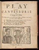
- Published / Created:
- 1641
- Call Number:
- By38a L364 641n
- Image Count:
- 8
- Resource Type:
- Books, Journals & Pamphlets
- Found in:
- Beinecke Rare Book and Manuscript Library > A new play called Canterburie his change of diot : which sheweth variety of wit and mirth: privately acted neare the Palace-yard at Westminster ...
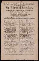
- Published / Created:
- [1683]
- Call Number:
- BrSides By6 1683
- Image Count:
- 1
- Found in:
- Beinecke Rare Book and Manuscript Library > A new-years guift to the templers : on that eminent lawyer Sir Edmond Saunders, his being chosen Lord chief-justice of England ... to the tune of, Joy to the bridegroom ...
- Creator:
- Armstrong, John, d. 1758
- Published / Created:
- 1756
- Call Number:
- 3969 SA25 1756
- Container / Volume:
- BRBL_00194
- Image Count:
- 1
- Resource Type:
- Maps, Atlases & Globes
- Found in:
- Beinecke Rare Book and Manuscript Library > A plan of St. Philips Castle on the island of Minorca : with its fortifications & the entrance of the harbour of Port Mahon / by Jno. Armstrong, Surveyor General to the Honble. Board of Ordnance.
- Published / Created:
- 1766
- Call Number:
- 771 N49 1766
- Container / Volume:
- BRBL_00484
- Image Count:
- 1
- Resource Type:
- Maps, Atlases & Globes
- Found in:
- Beinecke Rare Book and Manuscript Library > A plan of the City of New York and its environs ... John Montresor Engineer.
- Published / Created:
- 1766
- Call Number:
- 771 N49 1766
- Container / Volume:
- BRBL_00484
- Image Count:
- 1
- Resource Type:
- Maps, Atlases & Globes
- Found in:
- Beinecke Rare Book and Manuscript Library > A plan of the City of New York and its environs ... John Montresor Engineer.
- Creator:
- Jefferys, Thomas, d. 1771
- Published / Created:
- 1758
- Call Number:
- 7325 L93 1758
- Container / Volume:
- BRBL_00377
- Image Count:
- 1
- Resource Type:
- Maps, Atlases & Globes
- Found in:
- Beinecke Rare Book and Manuscript Library > A plan of the city and fortifications of Louisburg / from a survey made by Richard Gridley, Lieut. Coll. of the Train of Artillery in 1745.
- Creator:
- Harris, John, 1667?-1719.
- Published / Created:
- [1744]
- Call Number:
- BrSides Folio 2017 33
- Image Count:
- 1
- Resource Type:
- Maps, Atlases & Globes
- Found in:
- Beinecke Rare Book and Manuscript Library > A plan of the city of Canton on the river Ta ho [cartographic material].
- Published / Created:
- 1777
- Call Number:
- 764 B65 1777A
- Container / Volume:
- BRBL_00455
- Image Count:
- 1
- Resource Type:
- Maps, Atlases & Globes
- Found in:
- Beinecke Rare Book and Manuscript Library > A plan of the town of Boston, with the intrechments &c. of His Majestys Forces in 1775: from the observations of Lieut. Page of His Majesty's Corps of Engineers: and from the plans of other Gentlemen.
- Published / Created:
- 1802
- Call Number:
- 34 1802
- Container / Volume:
- BRBL_00091
- Image Count:
- 1
- Resource Type:
- Maps, Atlases & Globes
- Found in:
- Beinecke Rare Book and Manuscript Library > A sketch of the North of Sweden, of Norway, Finland, and Lapland. Describing the rout of J. Acerbis travels to the North Cape.
- Published / Created:
- 1674
- Call Number:
- 36 1674
- Container / Volume:
- BRBL_00117
- Image Count:
- 1
- Resource Type:
- Maps, Atlases & Globes
- Found in:
- Beinecke Rare Book and Manuscript Library > A trew and exact mapp of Germany ... after N. Vischer and others.
- Published / Created:
- [1695?]
- Call Number:
- 2000 Folio 6 313
- Image Count:
- 1
- Found in:
- Beinecke Rare Book and Manuscript Library > A true relation of the life and death of Sir Andrew Barton : a pyrate and rover on the seas : tune is Come follow my love.
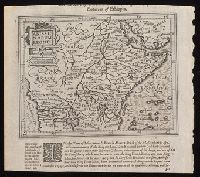
- Creator:
- Hondius, Jodocus, 1563-1612, cartographer.
- Published / Created:
- [1625]
- Call Number:
- BrSides Box 2019 15
- Image Count:
- 2
- Resource Type:
- Maps, Atlases & Globes
- Found in:
- Beinecke Rare Book and Manuscript Library > Abissinorum Regnu[m].
- Creator:
- D'Urfey, Thomas, 1653-1723
- Published / Created:
- 1682
- Call Number:
- BrSides By6 1682
- Image Count:
- 1
- Found in:
- Beinecke Rare Book and Manuscript Library > Advice to the city : sung to the King at Windsor, to a theorbo.
- Creator:
- Jefferys, Thomas, -1771.
- Published / Created:
- [1748]
- Call Number:
- BrSides Folio 2017 11
- Image Count:
- 1
- Resource Type:
- Maps, Atlases & Globes
- Found in:
- Beinecke Rare Book and Manuscript Library > Africa [cartographic material] / drawn from the best maps by T. Jefferys, Geographer to his Royal Highness the Prince of Wales.
- Creator:
- Great Britain. War Office. General Staff. Geographical Section
- Published / Created:
- 1942
- Call Number:
- 66gmb 1942
- Container / Volume:
- BRBL_00348
- Image Count:
- 1
- Resource Type:
- Maps, Atlases & Globes
- Found in:
- Beinecke Rare Book and Manuscript Library > Africa road map 1:2,000,000 and 1:500,000, Maroc-Algerie-Tunisie.
- Published / Created:
- 1919
- Call Number:
- 383 1919
- Container / Volume:
- BRBL_00177
- Image Count:
- 1
- Resource Type:
- Maps, Atlases & Globes
- Found in:
- Beinecke Rare Book and Manuscript Library > Alsace-Lorraine.
- Creator:
- Speed, John, 1552?-1629.
- Published / Created:
- [1676?]
- Call Number:
- 70 1676
- Container / Volume:
- BRBL_00354
- Image Count:
- 2
- Resource Type:
- Maps, Atlases & Globes
- Found in:
- Beinecke Rare Book and Manuscript Library > America with those known parts in that unknowne worlde both people and manner of buildings / Discribed and inlarged by I.S. Ano 1626 ; Abraham Goos ... sculpsit.
- Creator:
- Speed, John, 1552?-1629
- Published / Created:
- [1626 or 1627]
- Call Number:
- 70 1626A
- Container / Volume:
- BRBL_00353
- Image Count:
- 2
- Resource Type:
- Maps, Atlases & Globes
- Found in:
- Beinecke Rare Book and Manuscript Library > America with those known parts in that unknowne worlde both people and manner of buildings / discribed and inlarged by I.S., ano 1626 ; Abraham Goos ... sculpsit.
- Creator:
- Speed, John, 1552?-1629
- Published / Created:
- [1631]
- Call Number:
- 70 1631
- Container / Volume:
- BRBL_00353
- Image Count:
- 2
- Resource Type:
- Maps, Atlases & Globes
- Found in:
- Beinecke Rare Book and Manuscript Library > America with those known parts in that unknowne worlde both people and manner of buildings / discribed and inlarged by I.S., ano 1626 ; Abraham Goos ... sculpsit.
- Creator:
- Seile, Henry, d. ca. 1661
- Published / Created:
- 1652
- Call Number:
- 70 1652
- Container / Volume:
- BRBL_00685
- Image Count:
- 1
- Resource Type:
- Maps, Atlases & Globes
- Found in:
- Beinecke Rare Book and Manuscript Library > Americae descriptio nova / Will. Trevethen, sculp.
- Creator:
- Bowen, Emanuel, 1693 or 1694-1767
- Published / Created:
- [1785?]
- Call Number:
- BrSides Double Folio 2019 91
- Image Count:
- 1
- Resource Type:
- Maps, Atlases & Globes
- Found in:
- Beinecke Rare Book and Manuscript Library > An accurate map of Buckingham Shire divided into its hundreds : drawn from the best authorities assisted by the most approved modern maps with various improvements. Illustrated with historical extracts relative to natural history, produce, trade and manufactures and the present state of the principal towns / by Eman. Bowen, Geogr. to His Majesty.
- Published / Created:
- [between 1743-1747?]
- Call Number:
- BrSides Folio 2017 20
- Image Count:
- 1
- Resource Type:
- Maps, Atlases & Globes
- Found in:
- Beinecke Rare Book and Manuscript Library > An accurate map of Kalbar River (commonly called Kalabar or Rio Real) and adjacent coast drawn on ye spot by several pilots, 1699 / G. Child, sculpt.
- Creator:
- Bowen, Emanuel, 1693 or 1694-1767
- Published / Created:
- [1785]
- Call Number:
- BrSides Double Folio 2019 90
- Image Count:
- 1
- Resource Type:
- Maps, Atlases & Globes
- Found in:
- Beinecke Rare Book and Manuscript Library > An accurate map of Northampton Shire divided into its hundreds : and laid down from the best authorities, assisted by the most approved modern maps, with various improvements, illustrated with historical extracts relative to its natural produce, trade, manufactures & present state of its principal towns / by Eman. Bowen Geogr. to His Majesty.