Search
You Searched For
Search Results
- Creator:
- United States. Army Map Service
- Published / Created:
- 1944
- Call Number:
- 50 1945M
- Container / Volume:
- BRBL_00273
- Image Count:
- 1
- Resource Type:
- Maps, Atlases & Globes
- Found in:
- Beinecke Rare Book and Manuscript Library > [AAF cloth chart]. Eastern Asia [cartographic material].
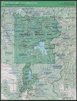
- Creator:
- National Geographic Society (U.S.). Cartographic Division
- Published / Created:
- c1989.
- Call Number:
- 833 Y38 1989
- Container / Volume:
- BRBL_00584
- Image Count:
- 2
- Resource Type:
- Maps, Atlases & Globes
- Found in:
- Beinecke Rare Book and Manuscript Library > Yellowstone and Grand Teton / produce by the Cartographic Division, National Geographic Society ; John B. Garver, Jr., chief cartographer.
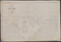
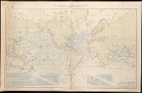
- Creator:
- Maury, Matthew Fontaine, 1806-1873
- Published / Created:
- 1852
- Call Number:
- 11cfk 1850D-2
- Container / Volume:
- BRBL_00773
- Image Count:
- 1
- Resource Type:
- Maps, Atlases & Globes
- Found in:
- Beinecke Rare Book and Manuscript Library > Wind and current chart of the South Atlantic [cartographic material] / by M.F. Maury, L.L.D. Lieut. U.S. Navy, Superint'dt. of U.S.N. Observatory ; compiled from materials in the Bureau of Ordnance and Hydrography, Commodore Charles Morris, Chief of Bureau.
- Creator:
- Maury, Matthew Fontaine, 1806-1873
- Published / Created:
- 1852
- Call Number:
- 11cfk 1850D-2
- Container / Volume:
- BRBL_00773
- Image Count:
- 4
- Resource Type:
- Maps, Atlases & Globes
- Found in:
- Beinecke Rare Book and Manuscript Library > Wind and current chart of the South Atlantic [cartographic material] / by M.F. Maury, L.L.D. Lieut. U.S. Navy, Superint'dt. of U.S.N. Observatory ; compiled from materials in the Bureau of Ordnance and Hydrography, Commodore Charles Morris, Chief of Bureau.
- Creator:
- Maury, Matthew Fontaine, 1806-1873
- Published / Created:
- 1849-[1856?]
- Call Number:
- 11cfk 1850A-1
- Container / Volume:
- BRBL_00767
- Image Count:
- 2
- Resource Type:
- Maps, Atlases & Globes
- Found in:
- Beinecke Rare Book and Manuscript Library > Wind and current chart of the North Pacific [cartographic material] / by M.F. Maury, A.M. Lieut. U.S. Navy, Superint'dt. of U.S.N. Observatory ; compiled from materials in the Bureau of Ordnance and Hydrography, Commodore Lewis Warrington ; drawn by P.M. Lardner Gibbon, U.S.N. ; tracks projected by Lieut. A.W. Johnson, U.S. Navy.
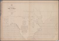
- Creator:
- Maury, Matthew Fontaine, 1806-1873
- Published / Created:
- 1849-[1856?]
- Call Number:
- 11cfk 1850A-1
- Container / Volume:
- BRBL_00767
- Image Count:
- 10
- Resource Type:
- Maps, Atlases & Globes
- Found in:
- Beinecke Rare Book and Manuscript Library > Wind and current chart of the North Pacific [cartographic material] / by M.F. Maury, A.M. Lieut. U.S. Navy, Superint'dt. of U.S.N. Observatory ; compiled from materials in the Bureau of Ordnance and Hydrography, Commodore Lewis Warrington ; drawn by P.M. Lardner Gibbon, U.S.N. ; tracks projected by Lieut. A.W. Johnson, U.S. Navy.
- Creator:
- Maury, Matthew Fontaine, 1806-1873
- Published / Created:
- 1850
- Call Number:
- 11cfk 1850D-1
- Container / Volume:
- BRBL_00773
- Image Count:
- 1
- Resource Type:
- Maps, Atlases & Globes
- Found in:
- Beinecke Rare Book and Manuscript Library > Wind and current chart of the North Atlantic [cartographic material] : thermal sheet / by M.F. Maury, A.M. Lieut. U.S. Navy, Superint'dt. of U.S.N. Observatory ; compiled from materials in the Bureau of Ordnance and Hydrography, Commodore Lewis Warrington, Chief of Bureau ; drawn by Lt. Benjn. S. Gantt, U.S.N.
- Creator:
- Maury, Matthew Fontaine, 1806-1873
- Published / Created:
- 1850
- Call Number:
- 11cfk 1850D-1
- Container / Volume:
- BRBL_00773
- Image Count:
- 4
- Resource Type:
- Maps, Atlases & Globes
- Found in:
- Beinecke Rare Book and Manuscript Library > Wind and current chart of the North Atlantic [cartographic material] : thermal sheet / by M.F. Maury, A.M. Lieut. U.S. Navy, Superint'dt. of U.S.N. Observatory ; compiled from materials in the Bureau of Ordnance and Hydrography, Commodore Lewis Warrington, Chief of Bureau ; drawn by Lt. Benjn. S. Gantt, U.S.N.
- Creator:
- Maury, Matthew Fontaine, 1806-1873
- Published / Created:
- 1850
- Call Number:
- 11cfk 1850D-1
- Container / Volume:
- BRBL_00773
- Image Count:
- 8
- Resource Type:
- Maps, Atlases & Globes
- Found in:
- Beinecke Rare Book and Manuscript Library > Wind and current chart of the North Atlantic [cartographic material] : thermal sheet / by M.F. Maury, A.M. Lieut. U.S. Navy, Superint'dt. of U.S.N. Observatory ; compiled from materials in the Bureau of Ordnance and Hydrography, Commodore Lewis Warrington, Chief of Bureau ; drawn by Lt. Benjn. S. Gantt, U.S.N.
- Published / Created:
- 1917
- Call Number:
- 762gcr W588 1917
- Container / Volume:
- BRBL_00451
- Image Count:
- 2
- Resource Type:
- Maps, Atlases & Globes
- Found in:
- Beinecke Rare Book and Manuscript Library > White Mountain National Forest, New Hampshire and Maine / U.S. Department of Agriculture, Forest Service, Henry S. Graves, Forester.
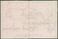
- Creator:
- Maury, Matthew Fontaine, 1806-1873
- Published / Created:
- 1852
- Call Number:
- 11cfk 1850F
- Container / Volume:
- BRBL_00774
- Image Count:
- 4
- Resource Type:
- Maps, Atlases & Globes
- Found in:
- Beinecke Rare Book and Manuscript Library > Whale chart of the world [cartographic material] / by M.F. Maury, L.L.D. Lieut. U.S. Navy, superin'dt. of U.S.N. Observatory ; compiled from materials in the Bureau of Ordnance and Hydrography by P.M. A.C. Jackson.
- Creator:
- Maury, Matthew Fontaine, 1806-1873
- Published / Created:
- 1851
- Call Number:
- 11DB 1851A-1
- Container / Volume:
- BRBL_00774
- Image Count:
- 1
- Resource Type:
- Maps, Atlases & Globes
- Found in:
- Beinecke Rare Book and Manuscript Library > Whale chart [cartographic material] : preliminary sketch / by M.F. Maury, A.M. Lieut., U.S. Navy ; constructed by Lts. Leigh. Herndon & Fleming & Pd. Midn. Jackson.
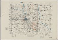
- Creator:
- United States. Army Map Service
- Published / Created:
- [19]44.
- Call Number:
- 269gmb 1945B
- Container / Volume:
- BRBL_00023A
- Image Count:
- 1
- Resource Type:
- Maps, Atlases & Globes
- Found in:
- Beinecke Rare Book and Manuscript Library > Western New Guinea : special strategic map / compiled by the Army Map Service.
- Creator:
- Westgard, A. L. (Anthon L.), b. 1865
- Published / Created:
- c1920.
- Call Number:
- 847gmb 1920A
- Container / Volume:
- BRBL_00629
- Image Count:
- 2
- Resource Type:
- Maps, Atlases & Globes
- Found in:
- Beinecke Rare Book and Manuscript Library > Washington and Oregon / prepared and issued by Touring Information Board, American Automobile Association ; prepared by A.L. Westgard, field representative, American Automobile Association ; F.S.R. jr.
- Creator:
- United States. Army. Signal Corps
- Published / Created:
- 1872
- Call Number:
- 75CF 1872
- Container / Volume:
- BRBL_00409
- Image Count:
- 1
- Resource Type:
- Maps, Atlases & Globes
- Found in:
- Beinecke Rare Book and Manuscript Library > War Department weather map / published by authority of the Secretary of War.
- Published / Created:
- 1883
- Call Number:
- 764cea V75 1883
- Container / Volume:
- BRBL_00461
- Image Count:
- 1
- Resource Type:
- Maps, Atlases & Globes
- Found in:
- Beinecke Rare Book and Manuscript Library > Vineyard Sound [Massachusetts] : from Woods Hole to Cuttyhunk / United States Coast Survey.
- Creator:
- Great Britain. Inter-service Topographical Dept
- Published / Created:
- 1943
- Call Number:
- 40 V715 1943
- Image Count:
- 1
- Resource Type:
- Maps, Atlases & Globes
- Found in:
- Beinecke Rare Book and Manuscript Library > Villa San Giovanni [cartographic material] / compiled and drawn by Inter-Service Topographical Department ; produced under the Superintendence of Vice-Admiral John Edgell, hydrographer.
- Creator:
- American Automobile Association
- Published / Created:
- 1920
- Call Number:
- 76gmb 1920A
- Container / Volume:
- BRBL_00446
- Image Count:
- 2
- Resource Type:
- Maps, Atlases & Globes
- Found in:
- Beinecke Rare Book and Manuscript Library > Vermont and New Hampshire / prepared by Touring Information Board American Automobile Association.
- Creator:
- United States. Army Map Service
- Published / Created:
- 1943
- Call Number:
- 7391 1943
- Container / Volume:
- BRBL_00394
- Image Count:
- 2
- Resource Type:
- Maps, Atlases & Globes
- Found in:
- Beinecke Rare Book and Manuscript Library > Vancouver Island / Army Map Service.
- Creator:
- United States. Army Map Service
- Published / Created:
- 1943
- Call Number:
- 493 V24 1943
- Container / Volume:
- BRBL_00270
- Image Count:
- 1
- Resource Type:
- Maps, Atlases & Globes
- Found in:
- Beinecke Rare Book and Manuscript Library > Valletta city plan [cartographic material] / prepared under the direction of the Chief of Engineers, U.S. Army 1943.
- Published / Created:
- 1909
- Call Number:
- 75cfe 1909
- Container / Volume:
- BRBL_00409
- Image Count:
- 1
- Resource Type:
- Maps, Atlases & Globes
- Found in:
- Beinecke Rare Book and Manuscript Library > United States, Contour Map.
- Creator:
- National Geographic Society (U.S.). Cartographic Section
- Published / Created:
- c1944.
- Call Number:
- 35 1944
- Container / Volume:
- BRBL_00101
- Image Count:
- 1
- Resource Type:
- Maps, Atlases & Globes
- Found in:
- Beinecke Rare Book and Manuscript Library > Union of Soviet Socialist Republics International boundaries according to Russian treaties and claims as of October 1, 1944 ; Boundaries of January 1, 1938, are shown in red Compiled and drawn in the Cartographic Section of the National Geographic Society
- Creator:
- Great Britain. Army. Middle East Forces
- Published / Created:
- 1943
- Call Number:
- 352 1943A
- Container / Volume:
- BRBL_00106
- Image Count:
- 1
- Resource Type:
- Maps, Atlases & Globes
- Found in:
- Beinecke Rare Book and Manuscript Library > U.S.S.R. and adjacent countries / Compiled and ... revised ... by 512 Fd. survey coy., R.E. ...
- Creator:
- Great Britain. War Office. General Staff. Geographical Section
- Published / Created:
- 1943
- Call Number:
- 501 1943
- Container / Volume:
- BRBL_00276
- Image Count:
- 1
- Resource Type:
- Maps, Atlases & Globes
- Found in:
- Beinecke Rare Book and Manuscript Library > Turkey [cartographic material].
- Creator:
- Great Britain. War Office. General Staff. Geographical Section
- Published / Created:
- 1945
- Call Number:
- 56 T83 1945
- Container / Volume:
- BRBL_00297
- Image Count:
- 1
- Resource Type:
- Maps, Atlases & Globes
- Found in:
- Beinecke Rare Book and Manuscript Library > Tungchow [cartographic material] / Geographical Section, General Staff.
- Creator:
- Great Britain. Army. Middle East Forces
- Published / Created:
- 1943
- Call Number:
- 69 T73 1943
- Container / Volume:
- BRBL_00352
- Image Count:
- 1
- Resource Type:
- Maps, Atlases & Globes
- Found in:
- Beinecke Rare Book and Manuscript Library > Tripoli : city plan / prepared under the direction of the Chief of Engineers, U.S. Army.
- Creator:
- United States. Hydrographic Office
- Published / Created:
- Sep., 1914 [that is, 1916]
- Call Number:
- BrSides Elephant Folio 2018 22
- Image Count:
- 1
- Resource Type:
- Maps, Atlases & Globes
- Found in:
- Beinecke Rare Book and Manuscript Library > Tracks for full powered steam vessels with the shortest navigable distances in nautical miles from anchorage to anchorage, New York distances are measures to and from the Battery achorage.
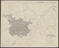
- Creator:
- Great Britain. War Office. General Staff. Geographical Section
- Published / Created:
- 1943
- Call Number:
- 408 V83 1943
- Container / Volume:
- BRBL_00239
- Image Count:
- 1
- Resource Type:
- Maps, Atlases & Globes
- Found in:
- Beinecke Rare Book and Manuscript Library > Town plan of Vittoria [cartographic material] / drawn and photolithographed by War Office, 1943.
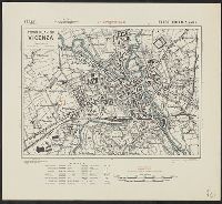
- Creator:
- Great Britain. War Office. General Staff. Geographical Section
- Published / Created:
- 1943
- Call Number:
- 40 V66 1943
- Image Count:
- 1
- Resource Type:
- Maps, Atlases & Globes
- Found in:
- Beinecke Rare Book and Manuscript Library > Town plan of Vicenza [cartographic material].
- Creator:
- Great Britain. Inter-service Topographical Dept
- Published / Created:
- 1943
- Call Number:
- 40 V652 1943
- Image Count:
- 1
- Resource Type:
- Maps, Atlases & Globes
- Found in:
- Beinecke Rare Book and Manuscript Library > Town plan of Vibo Valentia Marina [cartographic material] / compiled and drawn by Inter-Service Topographical Department ; produced under the Superintendence of Vice-Admiral John Edgell, hydrographer.
- Creator:
- Great Britain. War Office. General Staff. Geographical Section
- Published / Created:
- 1943
- Call Number:
- 40 Ud5 1943
- Image Count:
- 1
- Resource Type:
- Maps, Atlases & Globes
- Found in:
- Beinecke Rare Book and Manuscript Library > Town plan of Udine [cartographic material].
- Creator:
- Great Britain. War Office. General Staff. Geographical Section
- Published / Created:
- 1943
- Call Number:
- 685 T83 1943
- Container / Volume:
- BRBL_00351
- Image Count:
- 1
- Resource Type:
- Maps, Atlases & Globes
- Found in:
- Beinecke Rare Book and Manuscript Library > Town plan of Tunis / drawn by War Office.
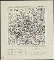
- Creator:
- Great Britain. War Office. General Staff. Geographical Section
- Published / Created:
- 1943
- Call Number:
- 40 T729 1943
- Image Count:
- 1
- Resource Type:
- Maps, Atlases & Globes
- Found in:
- Beinecke Rare Book and Manuscript Library > Town plan of Treviso [cartographic material].
- Creator:
- Great Britain. Army. Royal Engineers. Fd. Survey Coy., 512
- Published / Created:
- 1943
- Call Number:
- 40 T17 1943
- Image Count:
- 1
- Resource Type:
- Maps, Atlases & Globes
- Found in:
- Beinecke Rare Book and Manuscript Library > Town plan of Taranto [cartographic material] / reproduced by 512 Fd. Survey Coy., R.E., June, 1943, from W.O. pulls 1st edition, 1942, with revision from air photographs, dated 1943.
- Creator:
- Great Britain. War Office. General Staff. Geographical Section
- Published / Created:
- 1943
- Call Number:
- 408 Sy76 1943
- Container / Volume:
- BRBL_00239
- Image Count:
- 1
- Resource Type:
- Maps, Atlases & Globes
- Found in:
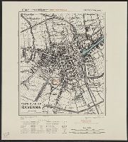
- Beinecke Rare Book and Manuscript Library > Town plan of Siracusa [cartographic material] / photolithographed by the Ordnance Survey, 1943.
- Creator:
- Great Britain. War Office. General Staff. Geographical Section
- Published / Created:
- 1943
- Call Number:
- 409 Sa79 1943
- Container / Volume:
- BRBL_00240
- Image Count:
- 1
- Resource Type:
- Maps, Atlases & Globes
- Found in:
- Beinecke Rare Book and Manuscript Library > Town plan of Sassari [cartographic material].
- Creator:
- Great Britain. Royal Air Force. Central Interpretation Unit
- Published / Created:
- 1944
- Call Number:
- 40 R66 1944
- Container / Volume:
- BRBL_00219
- Image Count:
- 2
- Resource Type:
- Maps, Atlases & Globes
- Found in:
- Beinecke Rare Book and Manuscript Library > Town plan of Roma (Rome) [cartographic material] / drawn by C.I.U. and War Office.
- Creator:
- Great Britain. War Office. General Staff. Geographical Section
- Published / Created:
- 1943
- Call Number:
- 40 R19 1943
- Container / Volume:
- BRBL_00215
- Image Count:
- 1
- Resource Type:
- Maps, Atlases & Globes
- Found in:
- Beinecke Rare Book and Manuscript Library > Town plan of Ravenna [cartographic material].
- Creator:
- Great Britain. War Office. General Staff. Geographical Section
- Published / Created:
- 1943
- Call Number:
- 40 P67 1943
- Container / Volume:
- BRBL_00214
- Image Count:
- 1
- Resource Type:
- Maps, Atlases & Globes
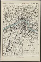
- Found in:
- Beinecke Rare Book and Manuscript Library > Town plan of Pisa [cartographic material].
- Creator:
- Great Britain. War Office. General Staff. Geographical Section
- Published / Created:
- 1943
- Call Number:
- 40 P57 1943
- Container / Volume:
- BRBL_00214
- Image Count:
- 1
- Resource Type:
- Maps, Atlases & Globes
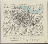
- Found in:
- Beinecke Rare Book and Manuscript Library > Town plan of Piacenza [cartographic material].
- Creator:
- Great Britain. War Office. General Staff. Geographical Section
- Published / Created:
- 1943
- Call Number:
- 40 P24 1943
- Container / Volume:
- BRBL_00213
- Image Count:
- 1
- Resource Type:
- Maps, Atlases & Globes
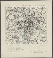
- Found in:
- Beinecke Rare Book and Manuscript Library > Town plan of Parma [cartographic material].
- Creator:
- Great Britain. War Office. General Staff. Geographical Section
- Published / Created:
- 1943
- Call Number:
- 408 P17 1943
- Container / Volume:
- BRBL_00239
- Image Count:
- 1
- Resource Type:
- Maps, Atlases & Globes
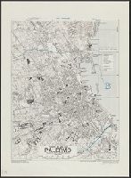
- Found in:
- Beinecke Rare Book and Manuscript Library > Town plan of Palermo [cartographic material].
- Creator:
- Great Britain. War Office. General Staff. Geographical Section
- Published / Created:
- 1943
- Call Number:
- 40 P13 1943
- Container / Volume:
- BRBL_00213
- Image Count:
- 1
- Resource Type:
- Maps, Atlases & Globes
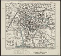
- Found in:
- Beinecke Rare Book and Manuscript Library > Town plan of Padua (Padova) [cartographic material].
- Creator:
- Great Britain. War Office. General Staff. Geographical Section
- Published / Created:
- 1943
- Call Number:
- 408 N84 1943
- Container / Volume:
- BRBL_00239
- Image Count:
- 1
- Resource Type:
- Maps, Atlases & Globes
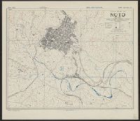
- Found in:
- Beinecke Rare Book and Manuscript Library > Town plan of Noto [cartographic material] / drawn and lithographed by War Office, 1943.
- Creator:
- Great Britain. War Office. General Staff. Geographical Section
- Published / Created:
- 1943
- Call Number:
- 408 M56 1943
- Container / Volume:
- BRBL_00239
- Image Count:
- 1
- Resource Type:
- Maps, Atlases & Globes
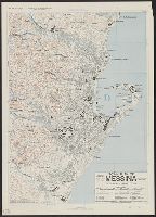
- Found in:
- Beinecke Rare Book and Manuscript Library > Town plan of Messina [cartographic material] / photolithographed by the Ordnance Survey, 1943.
- Creator:
- United States. Office of Strategic Services. Research and Analysis Branch
- Published / Created:
- 1943
- Call Number:
- 46 l769 1930
- Container / Volume:
- BRBL_00259
- Image Count:
- 1
- Resource Type:
- Maps, Atlases & Globes
- Found in:
- Beinecke Rare Book and Manuscript Library > Town plan of Ljubljana [cartographic material] : date prior to 1930.
- Creator:
- Great Britain. War Office. General Staff. Geographical Section
- Published / Created:
- 1943
- Call Number:
- 408 L61 1943
- Container / Volume:
- BRBL_00239
- Image Count:
- 1
- Resource Type:
- Maps, Atlases & Globes
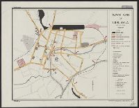
- Found in:
- Beinecke Rare Book and Manuscript Library > Town plan of Licata [cartographic material] / drawn and photolithographed by War Office, 1943.
- Creator:
- Great Britain. War Office. General Staff. Geographical Section
- Published / Created:
- 1943
- Call Number:
- 408 En61 1943
- Container / Volume:
- BRBL_00239
- Image Count:
- 1
- Resource Type:
- Maps, Atlases & Globes
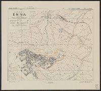
- Found in:
- Beinecke Rare Book and Manuscript Library > Town plan of Enna [cartographic material] / drawn and photolithographed by War Office, 1943.
- Creator:
- Great Britain. War Office. General Staff. Geographical Section
- Published / Created:
- 1943
- Call Number:
- 40 C737 1943
- Container / Volume:
- BRBL_00206
- Image Count:
- 1
- Resource Type:
- Maps, Atlases & Globes
- Found in:
- Beinecke Rare Book and Manuscript Library > Town plan of Como [cartographic material].
- Creator:
- Great Britain. War Office. General Staff. Geographical Section
- Published / Created:
- 1943
- Call Number:
- 38 C42 1943
- Container / Volume:
- BRBL_00156
- Image Count:
- 1
- Resource Type:
- Maps, Atlases & Globes
- Found in:
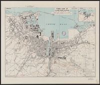
- Beinecke Rare Book and Manuscript Library > Town plan of Cherbourg [cartographic material] : France / drawn and photolithographed by War Office, 1943.
- Creator:
- Great Britain. War Office. General Staff. Geographical Section
- Published / Created:
- 1943
- Call Number:
- 408 C27 1943
- Container / Volume:
- BRBL_00239
- Image Count:
- 1
- Resource Type:
- Maps, Atlases & Globes
- Found in:
- Beinecke Rare Book and Manuscript Library > Town plan of Castelvetrano [cartographic material] / drawn and photolithographed by War Office, 1943.
- Creator:
- Great Britain. War Office. General Staff. Geographical Section
- Published / Created:
- 1943
- Call Number:
- 3897 B642 1943
- Container / Volume:
- BRBL_00184
- Image Count:
- 1
- Resource Type:
- Maps, Atlases & Globes
- Found in:
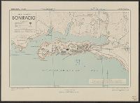
- Beinecke Rare Book and Manuscript Library > Town plan of Bonifacio [cartographic material].
- Creator:
- Great Britain. War Office. General Staff. Geographical Section
- Published / Created:
- 1943
- Call Number:
- 40 B45 1943
- Container / Volume:
- BRBL_00205
- Image Count:
- 1
- Resource Type:
- Maps, Atlases & Globes
- Found in:
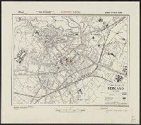
- Beinecke Rare Book and Manuscript Library > Town plan of Bergamo [cartographic material].
- Creator:
- Great Britain. War Office. General Staff. Geographical Section
- Published / Created:
- 1942,
- Call Number:
- 40 B239 1943
- Container / Volume:
- BRBL_00204
- Image Count:
- 1
- Resource Type:
- Maps, Atlases & Globes
- Found in:
- Beinecke Rare Book and Manuscript Library > Town plan of Bari [cartographic material].
- Creator:
- Great Britain. War Office. General Staff. Geographical Section
- Published / Created:
- 1943
- Call Number:
- 40 Ao75 1943
- Container / Volume:
- BRBL_00204
- Image Count:
- 1
- Resource Type:
- Maps, Atlases & Globes
- Found in:
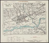
- Beinecke Rare Book and Manuscript Library > Town plan of Aosta [cartographic material].
- Creator:
- Great Britain. War Office. General Staff. Geographical Section
- Published / Created:
- 1943
- Call Number:
- 408 Ag84 1943
- Container / Volume:
- BRBL_00239
- Image Count:
- 1
- Resource Type:
- Maps, Atlases & Globes
- Found in:
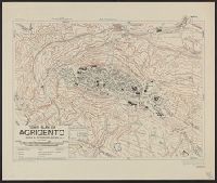
- Beinecke Rare Book and Manuscript Library > Town plan of Agrigento [cartographic material].
- Creator:
- Geological Survey (U.S.)
- Published / Created:
- 1922
- Call Number:
- 848 In5 1922
- Container / Volume:
- BRBL_00633
- Image Count:
- 1
- Resource Type:
- Maps, Atlases & Globes
- Found in:
- Beinecke Rare Book and Manuscript Library > Topographic map of Iniskin-Chinitna Peninsula, Cook Inlet region, Alaska / United States Department of the Interior Geological Survey ; Alfred H. Brooks, geologist in charge of division ; topography by C.P. McKinley and Gerald Fitz-Gerald.
- Creator:
- United States. Army Map Service
- Published / Created:
- 1945
- Call Number:
- 2726gmb 1945
- Container / Volume:
- BRBL_00023B
- Image Count:
- 1
- Resource Type:
- Maps, Atlases & Globes
- Found in:
- Beinecke Rare Book and Manuscript Library > Timor, special strategic map.
- Creator:
- National Geographic Society (U.S.). Cartographic Section
- Published / Created:
- 1940
- Call Number:
- 7821 1940
- Container / Volume:
- BRBL_00506
- Image Count:
- 1
- Resource Type:
- Maps, Atlases & Globes
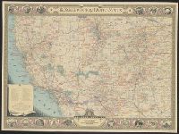
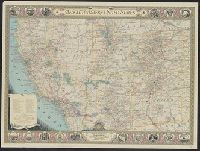
- Found in:
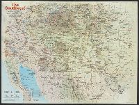
- Beinecke Rare Book and Manuscript Library > The southwestern United States / executed in the Cartographic Section of the National geographic magazine ; James M. Darley, chief cartographer ; culture by Apphia E. Holdstock ; research by Wellman Chamberlin ; physiography by John J. Brehm and H.E. East
- Creator:
- National Geographic Society (U.S.). Cartographic Section
- Published / Created:
- 1940
- Call Number:
- 7821 1940
- Container / Volume:
- BRBL_00506
- Image Count:
- 1
- Resource Type:
- Maps, Atlases & Globes
- Found in:
- Beinecke Rare Book and Manuscript Library > The southwestern United States / executed in the Cartographic Section of the National geographic magazine ; James M. Darley, chief cartographer ; culture by Apphia E. Holdstock ; research by Wellman Chamberlin ; physiography by John J. Brehm and H.E. East
- Creator:
- National Geographic Maps (Firm)
- Published / Created:
- c1997.
- Call Number:
- 741 1997
- Container / Volume:
- BRBL_00395
- Image Count:
- 2
- Resource Type:
- Maps, Atlases & Globes
- Found in:
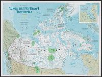
- Beinecke Rare Book and Manuscript Library > The making of Canada. Yukon and Northwest Territories / produced by National Geographic Maps for National Geographic magazine ; Allen Carroll, director of cartography ; John F. Shupe, chief cartographer.
- Creator:
- National Geographic Society (U.S.). Cartographic Division
- Published / Created:
- c1992.
- Call Number:
- 739 1992
- Container / Volume:
- BRBL_00389
- Image Count:
- 2
- Resource Type:
- Maps, Atlases & Globes
- Found in:
- Beinecke Rare Book and Manuscript Library > The making of Canada. British Columbia / produced by the Cartographic Division, National Geographic Society ; John F. Shupe, chief cartographer.
- Creator:
- National Geographic Society (U.S.). Map Dept
- Published / Created:
- c1922
- Call Number:
- 88cbf 1914
- Container / Volume:
- BRBL_00648
- Image Count:
- 1
- Resource Type:
- Maps, Atlases & Globes
- Found in:
- Beinecke Rare Book and Manuscript Library > The countries of the Caribbean : including Mexico, Central America, the West Indies, and the Panama Canal / prepared especially for the National geographic magazine.
- Creator:
- United States. Hydrographic Office
- Published / Created:
- 1894
- Call Number:
- 556cea 1894
- Container / Volume:
- BRBL_00293
- Image Count:
- 1
- Resource Type:
- Maps, Atlases & Globes
- Found in:
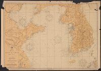
- Beinecke Rare Book and Manuscript Library > The coasts of the Hwang Hai or Yellow Sea and Gulf of Pechili [cartographic material] : compiled from the latest information.
- Published / Created:
- 1900
- Call Number:
- 85 1900
- Container / Volume:
- BRBL_00638
- Image Count:
- 1
- Resource Type:
- Maps, Atlases & Globes
- Found in:
- Beinecke Rare Book and Manuscript Library > The West India Islands : and adjacent territory showing the British possessions south of the United States.
- Creator:
- National Geographic Society (U.S.). Cartographic Division
- Published / Created:
- 1982
- Call Number:
- 7821 1982
- Container / Volume:
- BRBL_00506
- Image Count:
- 2
- Resource Type:
- Maps, Atlases & Globes
- Found in:
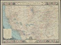
- Beinecke Rare Book and Manuscript Library > The Southwest / produced by the Cartographic Division, National Geographic Society ; John B. Garver, Jr., chief cartographer.
- Creator:
- United States. Bureau of Naval Personnel. Educational Services Section
- Published / Created:
- 1944
- Call Number:
- 5819hc 1944
- Container / Volume:
- BRBL_00314
- Image Count:
- 4
- Resource Type:
- Maps, Atlases & Globes
- Found in:
- Beinecke Rare Book and Manuscript Library > The South China Sea area.
- Published / Created:
- .
- Call Number:
- 5684 1905
- Container / Volume:
- BRBL_00300
- Image Count:
- 1
- Resource Type:
- Maps, Atlases & Globes
- Found in:
- Beinecke Rare Book and Manuscript Library > The Regent's Sword Peninsula.
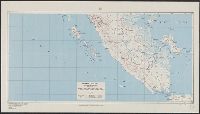
- Creator:
- Bouma, Donald G
Brehm, John J. B
Darley, James M. (James Morrison)
Holdstock, A. E
National Geographic Society (U.S.). Cartographic Division
- Published / Created:
- 1945
- Call Number:
- 28 1945
- Container / Volume:
- BRBL_00023E
- Image Count:
- 1
- Resource Type:
- Maps, Atlases & Globes
- Found in:
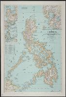
- Beinecke Rare Book and Manuscript Library > The Philippines / compiled and drawn in the Cartographic Section of the National Geographic Society ; James M. Darley, chief cartographer ; Apphia E. Holdstock & Donald G. Bouma, compilers ; relief by John J. Brehm.
- Creator:
- Miller, Herbert Adolphus, 1875-1951
- Published / Created:
- 1918
- Call Number:
- 30 1918
- Container / Volume:
- BRBL_00032A
- Image Count:
- 1
- Resource Type:
- Maps, Atlases & Globes
- Found in:
- Beinecke Rare Book and Manuscript Library > The New map of Europe : approximate boundaries of peoples / by Herbert Adolphus Miller.
- Creator:
- National Geographic Society (U.S.)
- Published / Created:
- 1907
- Call Number:
- 18 1907
- Container / Volume:
- BRBL_00013
- Image Count:
- 1
- Resource Type:
- Maps, Atlases & Globes
- Found in:
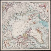
- Beinecke Rare Book and Manuscript Library > The National geographic magazine map of the North Pole regions / prepared by Gilbert H. Grosvenor, editor.
- Published / Created:
- 1909
- Call Number:
- 60g 1909
- Container / Volume:
- BRBL_00329
- Image Count:
- 1
- Resource Type:
- Maps, Atlases & Globes
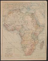
- Found in:
- Beinecke Rare Book and Manuscript Library > The National Geographic Magazine map of Africa / prepared from latest geographical data by Gilbert H. Grosvenor, Editor.
- Published / Created:
- 1896
- Call Number:
- 41hc 1896
- Container / Volume:
- BRBL_00243
- Image Count:
- 1
- Resource Type:
- Maps, Atlases & Globes
- Found in:
- Beinecke Rare Book and Manuscript Library > The Austro-Hungarian Maneuvers : September, 1896 / C.H. Ourand.
- Creator:
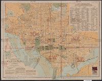
- Matthews-Northrup Company
- Published / Created:
- 1909, c1906.
- Call Number:
- 779 W27 1909
- Container / Volume:
- BRBL_00505A
- Image Count:
- 1
- Resource Type:
- Maps, Atlases & Globes
- Found in:
- Beinecke Rare Book and Manuscript Library > The "standard guide" ready reference map of Washington : to accompany the "Washington standard guide" / published by Foster & Reynolds.
- Creator:
- Matthews-Northrup Company
- Published / Created:
- 1904, c1901.
- Call Number:
- 779 W27 1904B
- Container / Volume:
- BRBL_00505A
- Image Count:
- 1
- Resource Type:
- Maps, Atlases & Globes
- Found in:
- Beinecke Rare Book and Manuscript Library > The "standard guide" ready reference map of Washington : to accompany the "Washington standard guide" / published by Foster & Reynolds.
- Creator:
- Matthews-Northrup Company
- Published / Created:
- 1902, c1901.
- Call Number:
- 779 W27 1902
- Container / Volume:
- BRBL_00505A
- Image Count:
- 1
- Resource Type:
- Maps, Atlases & Globes
- Found in:
- Beinecke Rare Book and Manuscript Library > The "standard guide" ready reference map of Washington : to accompany the "Washington standard guide" / published by Foster & Reynolds.
- Creator:
- National Geographic Society (U.S.). Cartographic Division
- Published / Created:
- 1986
- Call Number:
- 796 1986
- Container / Volume:
- BRBL_00526
- Image Count:
- 2
- Resource Type:
- Maps, Atlases & Globes
- Found in:
- Beinecke Rare Book and Manuscript Library > Texas / produced by the Cartographic Division, National Geographic Society.
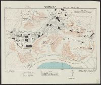
- Creator:
- Great Britain. Army. Royal Engineers. Field Survey Coy., 19th
- Published / Created:
- 1943
- Call Number:
- 408 T15 1943
- Container / Volume:
- BRBL_00239
- Image Count:
- 1
- Resource Type:
- Maps, Atlases & Globes
- Found in:
- Beinecke Rare Book and Manuscript Library > Taormina [cartographic material] / drawn by 19th. Fd. Survey Coy. R.E., June, '43, from W.O. Bromide.
- Creator:
- United States. Army Map Service
- Published / Created:
- [19]45.
- Call Number:
- 345gm 1945B
- Container / Volume:
- BRBL_00097
- Image Count:
- 1
- Resource Type:
- Maps, Atlases & Globes
- Found in:
- Beinecke Rare Book and Manuscript Library > Sweden and Finland (South) : special strategic map.
- Creator:
- United States. Army Map Service
- Published / Created:
- [19]45.
- Call Number:
- 345gm 1945A
- Container / Volume:
- BRBL_00097
- Image Count:
- 1
- Resource Type:
- Maps, Atlases & Globes
- Found in:
- Beinecke Rare Book and Manuscript Library > Sweden and Finland (North) : special strategic map.
- Creator:
- United States. Army Map Service
- Published / Created:
- [19]45.
- Call Number:
- 276GM 1945A
- Container / Volume:
- BRBL_00023C
- Image Count:
- 1
- Resource Type:
- Maps, Atlases & Globes
- Found in:
- Beinecke Rare Book and Manuscript Library > Sumatra (South) special strategic map / compiled by the Army Map Service.
- Creator:
- United States. Army Map Service
- Published / Created:
- [19]44.
- Call Number:
- 276GM 1944B
- Container / Volume:
- BRBL_00023C
- Image Count:
- 1
- Resource Type:
- Maps, Atlases & Globes
- Found in:
- Beinecke Rare Book and Manuscript Library > Sumatra (North) special strategic map / compiled by the Army Map Service.
- Creator:
- United States. Department of the Treasury. Bureau of Statistics
- Published / Created:
- [1899]
- Call Number:
- BrSides Folio 2019 64
- Image Count:
- 1
- Resource Type:
- Maps, Atlases & Globes
- Found in:
- Beinecke Rare Book and Manuscript Library > Submarine and land telegraph systems of the world [cartographic material].
- Creator:
- Bontz, Geo. F
United States. War Dept. General Staff. War College Division
Williams, Arch. B
- Published / Created:
- 1915
- Call Number:
- 304fab 1915
- Container / Volume:
- BRBL_00034B
- Image Count:
- 4
- Resource Type:
- Maps, Atlases & Globes
- Found in:
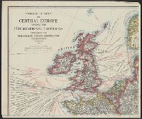
- Beinecke Rare Book and Manuscript Library > Strategic map of Central Europe showing the international frontiers / prepared in the War College Division, General Staff, War Department ; Arch. B. Williams and Geo. F. Bontz, Draftsmen.
- Creator:
- United States. Army. Corps of Engineers
- Published / Created:
- 1940
- Call Number:
- 814 M666 1940
- Container / Volume:
- BRBL_00558
- Image Count:
- 1
- Resource Type:
- Maps, Atlases & Globes
- Found in:
- Beinecke Rare Book and Manuscript Library > Strategic map [of the United States]. Twin Cities sheet.
- Creator:
- United States. General Land Office
- Published / Created:
- 1908
- Call Number:
- 824 1908
- Container / Volume:
- BRBL_00570
- Image Count:
- 1
- Resource Type:
- Maps, Atlases & Globes
- Found in:
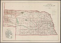
- Beinecke Rare Book and Manuscript Library > State of Nebraska / Department of the Interior, General Land Office ; compiled from the official records of the General Land Office and other sources under the direction of I.P. Berthrong ; compiled by A.F. Dinsmore ; traced and lettered by Wm. Bauman, Jr
- Creator:
- United States. General Land Office
- Published / Created:
- 1907
- Call Number:
- 832 1907
- Container / Volume:
- BRBL_00582
- Image Count:
- 1
- Resource Type:
- Maps, Atlases & Globes
- Found in:
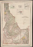
- Beinecke Rare Book and Manuscript Library > State of Idaho : 1907 / compiled from the official records of the General Land Office and other sources under the direction of Frank Bond ; rev. & drawn by Charles J. Helm.
- Creator:
- United States. General Land Office
- Published / Created:
- 1910
- Call Number:
- 834 1910A
- Container / Volume:
- BRBL_00588
- Image Count:
- 1
- Resource Type:
- Maps, Atlases & Globes
- Found in:
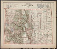
- Beinecke Rare Book and Manuscript Library > State of Colorado : compiled from the official records of the General land office and other sources / compiled by A.F. Dinsmore ; traced and lettered by Wm. Bauman Jr., U.S. General Land Office.
- Creator:
- Dinsmore, A. F
- Published / Created:
- 1905
- Call Number:
- 834 1905
- Container / Volume:
- BRBL_00588
- Image Count:
- 1
- Resource Type:
- Maps, Atlases & Globes
- Found in:
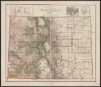
- Beinecke Rare Book and Manuscript Library > State of Colorado : compiled from the official records of the General Land Office and other sources under the direction of Frank Bond / U.S. General Land Office ; compiled by A.F. Dinsmore.
- Creator:
- National Geographic Society (U.S.). Cartographic Division
- Published / Created:
- 1959
- Call Number:
- 848 1959
- Container / Volume:
- BRBL_00631
- Image Count:
- 1
- Resource Type:
- Maps, Atlases & Globes
- Found in:
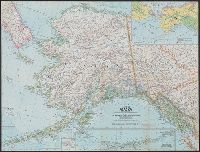
- Beinecke Rare Book and Manuscript Library > State of Alaska / compiled and drawn in the Cartographic Division of the National Geographic Society for the National Geographic Magazine.
- Creator:
- United States. Army Map Service
- Published / Created:
- 1943
- Call Number:
- 38 Sa24 1943
- Container / Volume:
- BRBL_00165
- Image Count:
- 1
- Resource Type:
- Maps, Atlases & Globes
- Found in:
- Beinecke Rare Book and Manuscript Library > St. Nazaire, city plan [cartographic material] / prepared under the direction of the Chief of Engineers, U.S. Army, Washington, D.C.
- Creator:
- Great Britain. Inter-service Topographical Dept
- Published / Created:
- 1943, 1944 printing.
- Call Number:
- 38 Sa233 1944
- Container / Volume:
- BRBL_00165
- Image Count:
- 1
- Resource Type:
- Maps, Atlases & Globes
- Found in:
- Beinecke Rare Book and Manuscript Library > St. Malo [cartographic material] : plan of port and town / compiled and drawn by Inter-Service Topographical Dept. ; produced under the Superintendence of Vice-Admiral John Edgell, hydrographer.
- Creator:
- United States. Army Map Service
- Published / Created:
- 1943
- Call Number:
- 675gm 1943
- Container / Volume:
- BRBL_00349
- Image Count:
- 1
- Resource Type:
- Maps, Atlases & Globes
- Found in:
- Beinecke Rare Book and Manuscript Library > Spanish Morocco : special strategic map.
- Creator:
- United States. Army Map Service
- Published / Created:
- 1943
- Call Number:
- 39 Ov4 1943
- Container / Volume:
- BRBL_00190
- Image Count:
- 1
- Resource Type:
- Maps, Atlases & Globes
- Found in:
- Beinecke Rare Book and Manuscript Library > Spain 1:8,000. Oviedo city plan / prepared under the direction of the Chief of Engineers, U.S. Army [cartographic material].
- Creator:
- United States. Army Map Service
- Published / Created:
- 1943
- Call Number:
- 39 V68 1943
- Container / Volume:
- BRBL_00192
- Image Count:
- 1
- Resource Type:
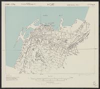
- Maps, Atlases & Globes
- Found in:
- Beinecke Rare Book and Manuscript Library > Spain 1:7,500. Vigo city plan / prepared under the direction of the Chief of Engineers, U.S. Army [cartographic material].