Skip to search
Skip to main content
Skip to first result
Search
You Searched For
Access
Public
Language
English
Publication Place
[London] :
New Search
Search Results
Creator:
Published / Created:
publish'd according to act of Parliament Sepbr. 30 1747.
Call Number:
Kinnaird 47K(b) Box 100
Image Count:
1
Found in:
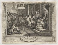
Lewis Walpole Library > The industrious 'prentice out of his time, & married to his master's daughter [graphic] / design'd & engrav'd by Wm. Hogarth.
Creator:
Published / Created:
March 3d 1736.
Call Number:
v. 1
Image Count:
1
Found in:
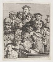
Lewis Walpole Library > [Scholars at a lecture] [graphic].
Published / Created:
Augt. 1st, 1835.
Call Number:
835.08.01.14 Impression 2
Image Count:
1
Found in:
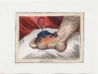
Lewis Walpole Library > The gout [graphic].
Published / Created:
[1834?]
Call Number:
834.00.00.13
Image Count:
1
Found in:
Lewis Walpole Library > The family secret [graphic].
Creator:
Published / Created:
[1799]
Call Number:
799.07.30.01.2
Image Count:
1
Found in:
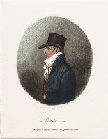
Lewis Walpole Library > A portrait [graphic] / Js. Gillray delt. & fect ad vivm.
Published / Created:
[April 1763]
Call Number:
763.04.30.01.2+
Image Count:
1
Found in:
Lewis Walpole Library > Ayliffe's ghost, or, The fox stinks worse than ever [graphic] : a dismal ditty / by Charles Alexander Churchill.
Published / Created:
[1535?]
Call Number:
2017 180
Image Count:
5
Resource Type:
Music (Printed & Manuscript)
Found in:
Beinecke Rare Book and Manuscript Library > Goostly psalmes and spirituall songes drawen out of the holy Scripture : for the co[m]forte and consolacyon of soch as loue to reioyse in God and his Worde.
Creator:
Published / Created:
[1570]
Call Number:
Osborn pa48
Image Count:
4
Found in:
Beinecke Rare Book and Manuscript Library > Graftons abridgement of the chronicles of Englande : newly and diligently corrected, and finished the last of October, 1570 : the contentes whereof apeareth in the next page of this lefe.
Creator:
Published / Created:
1579
Call Number:
1989 252
Image Count:
27
Found in:
Beinecke Rare Book and Manuscript Library > Of two wonderful popish monsters, to wyt, of a popish asse which was found at Rome in the riuer of Tyber, and of a moonkish calfe, calued at Friberge in Misne : which are the very foreshewings and tokens of Gods wrath, against blinde; obstinate, and monst
Published / Created:
[1606]
Call Number:
1977 2623
Image Count:
86
Resource Type:
Books, Journals & Pamphlets
Found in:
Beinecke Rare Book and Manuscript Library > No-body and Some-body : with the true chronicle historie of Elydure, who was fortunately three severall times crowned King of England : the true coppy thereof, as it hath beene acted by the Queens Maiesties seruants.
Published / Created:
1610
Call Number:
32 L53 1610
Container / Volume:
BRBL_00047A
Image Count:
2
Resource Type:
Maps, Atlases & Globes
Found in:
Beinecke Rare Book and Manuscript Library > Leicester, both countye and citie described ... / performed by John Speede ...
Creator:
Published / Created:
1610
Call Number:
32 H421 1610
Container / Volume:
BRBL_00047A
Image Count:
2
Resource Type:
Maps, Atlases & Globes
Found in:
Beinecke Rare Book and Manuscript Library > Hereford-shire described with the true plot of the citie Hereford as alsoe the armes of thos nobles that have bene intituled with that dignitye / performed by Iohn Speede.
Creator:
Published / Created:
[1614]
Call Number:
BrSides 2019 83
Image Count:
1
Resource Type:
Maps, Atlases & Globes
Found in:
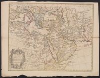
Beinecke Rare Book and Manuscript Library > The great desert of Arabia.
Creator:
Published / Created:
[1616]
Call Number:
3223 1616
Container / Volume:
BRBL_00076
Image Count:
2
Resource Type:
Maps, Atlases & Globes
Found in:
Beinecke Rare Book and Manuscript Library > Wilshire [cartographic material].
Creator:
Published / Created:
[1620?]
Call Number:
He54 48 1
Image Count:
3
Resource Type:
Books, Journals & Pamphlets
Found in:
Beinecke Rare Book and Manuscript Library > The history of Don Qvichote. The first parte.
Creator:
Published / Created:
[1625]
Call Number:
BrSides 2019 110
Image Count:
1
Resource Type:
Maps, Atlases & Globes
Found in:
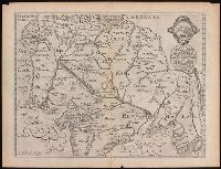
Beinecke Rare Book and Manuscript Library > A description of East India : conteyning the Empire of the Great Mogoll / R. Elstracke sculpsit.
Creator:
Published / Created:
[1625]
Call Number:
BrSides Box 2019 13
Image Count:
2
Resource Type:
Maps, Atlases & Globes
Found in:
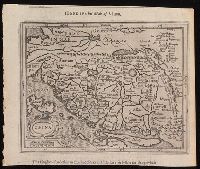
Beinecke Rare Book and Manuscript Library > China.
Creator:
Published / Created:
[1625]
Call Number:
BrSides Box 2019 14
Image Count:
2
Resource Type:
Maps, Atlases & Globes
Found in:
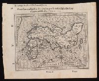
Beinecke Rare Book and Manuscript Library > Iapan I [cartographic material].
Creator:
Published / Created:
[1626 or 1627]
Call Number:
70 1626A
Container / Volume:
BRBL_00353
Image Count:
2
Resource Type:
Maps, Atlases & Globes
Found in:
Beinecke Rare Book and Manuscript Library > America with those known parts in that unknowne worlde both people and manner of buildings / discribed and inlarged by I.S., ano 1626 ; Abraham Goos ... sculpsit.
Creator:
Published / Created:
[1631]
Call Number:
70 1631
Container / Volume:
BRBL_00353
Image Count:
2
Resource Type:
Maps, Atlases & Globes
Found in:
Beinecke Rare Book and Manuscript Library > America with those known parts in that unknowne worlde both people and manner of buildings / discribed and inlarged by I.S., ano 1626 ; Abraham Goos ... sculpsit.
Published / Created:
1641
Call Number:
By38a L364 641n
Image Count:
8
Resource Type:
Books, Journals & Pamphlets
Found in:
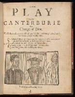
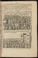
Beinecke Rare Book and Manuscript Library > A new play called Canterburie his change of diot : which sheweth variety of wit and mirth: privately acted neare the Palace-yard at Westminster ...
Creator:
Published / Created:
[1646]
Call Number:
Z45 49w
Image Count:
1
Resource Type:
Books, Journals & Pamphlets
Found in:
Beinecke Rare Book and Manuscript Library > A sight of ye transactions of these latter yeares emblemized with engrauen plats which men may read with out spectacles.
Creator:
Published / Created:
1651 [1676 printing]
Call Number:
11 1651
Container / Volume:
BRBL_00680
Image Count:
1
Resource Type:
Maps, Atlases & Globes
Found in:
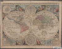
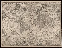
Beinecke Rare Book and Manuscript Library > A new and accurat map of the world : drawne according to ye truest descriptions, latest discoueries & best obseruations y[e]t have beene made by english or strangers.
Creator:
Published / Created:
1659
Call Number:
Mhc9 H497 N6 1659
Image Count:
132
Found in:
Beinecke Rare Book and Manuscript Library > Nine select sermons preached upon special occasions in the parish church of St. Gregories by St. Pauls / by the late reverend John Hewytt, D.D. : together with his publick prayers before and after sermon.
Creator:
Published / Created:
1669
Call Number:
Ih D718 C633h
Image Count:
15
Resource Type:
Books, Journals & Pamphlets
Found in:
Beinecke Rare Book and Manuscript Library > Poems, &c. / by John Donne, late dean of St. Pauls ; with elegies on the authors death ; to which is added divers copies under his own hand, never before printed.
Published / Created:
1674
Call Number:
36 1674
Container / Volume:
BRBL_00117
Image Count:
1
Resource Type:
Maps, Atlases & Globes
Found in:
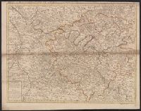
Beinecke Rare Book and Manuscript Library > A trew and exact mapp of Germany ... after N. Vischer and others.
Creator:
Published / Created:
1674
Call Number:
Mhc9 J712 B5 1660
Image Count:
13
Found in:
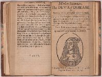
Beinecke Rare Book and Manuscript Library > Morbus satanicus = The devils disease, or, The sin of pride arraigned and condemned ...
Creator:
Published / Created:
1674
Call Number:
Mhc9 J712 B5 1660
Image Count:
11
Found in:
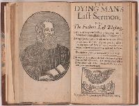
Beinecke Rare Book and Manuscript Library > The dying man's last sermon, or, The fathers last blessing ... / by Andrew Jones ...
Creator:
Published / Created:
[1676]
Call Number:
11 1651A
Container / Volume:
BRBL_00003
Image Count:
1
Resource Type:
Maps, Atlases & Globes
Found in:
Beinecke Rare Book and Manuscript Library > A new and accvrat map of the world : drawne according to ye truest descriptions, latest discoveries & best observations yt have beene made by English or strangers, 1651.
Creator:
Published / Created:
[1676?]
Call Number:
70 1676
Container / Volume:
BRBL_00354
Image Count:
2
Resource Type:
Maps, Atlases & Globes
Found in:
Beinecke Rare Book and Manuscript Library > America with those known parts in that unknowne worlde both people and manner of buildings / Discribed and inlarged by I.S. Ano 1626 ; Abraham Goos ... sculpsit.
Creator:
Published / Created:
[1676]
Call Number:
783 1680
Container / Volume:
BRBL_00691
Image Count:
2
Resource Type:
Maps, Atlases & Globes
Found in:
Beinecke Rare Book and Manuscript Library > A map of Virginia and Maryland / F. Lamb sculp.
Creator:
Published / Created:
[1676]
Call Number:
755 1676D
Container / Volume:
BRBL_00423
Image Count:
2
Resource Type:
Maps, Atlases & Globes
Found in:
Beinecke Rare Book and Manuscript Library > A map of Virginia and Maryland / F. Lamb sculp.
Creator:
Published / Created:
[1676]
Call Number:
755 1672A
Container / Volume:
BRBL_00423
Image Count:
2
Resource Type:
Maps, Atlases & Globes
Found in:
Beinecke Rare Book and Manuscript Library > A map of New England and New York / F. Lamb sculp.
Published / Created:
[1680?]
Call Number:
7855 1680
Container / Volume:
BRBL_00691
Image Count:
2
Resource Type:
Maps, Atlases & Globes
Found in:
Beinecke Rare Book and Manuscript Library > A new description of Carolina / Francis Lamb sculp.
Creator:
Published / Created:
1680
Call Number:
71 1680
Container / Volume:
BRBL_00360
Image Count:
1
Resource Type:
Maps, Atlases & Globes
Found in:
Beinecke Rare Book and Manuscript Library > North America divided into its principall parts where are distinguished the severall states which belong to the English, Spanish, and French / described by Sanson ; corrected and amended by William Berry.
Creator:
Published / Created:
[1680?]
Call Number:
327 1680
Container / Volume:
BRBL_00072
Image Count:
1
Resource Type:
Maps, Atlases & Globes
Found in:
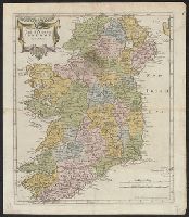
Beinecke Rare Book and Manuscript Library > The Kingdom of Ireland / by Robt. Morden.
Published / Created:
in the year 1681.
Call Number:
Z17 06
Image Count:
2
Resource Type:
Books, Journals & Pamphlets
Found in:
Beinecke Rare Book and Manuscript Library > Mercurius bifrons, or, The English Janus : the one side true and serious, the other jocular : the true and serious intelligence, or, occurrences domestick and forraign.
Published / Created:
[between 1685 and 1688?]
Call Number:
2000 Folio 6 108
Image Count:
2
Resource Type:
Books, Journals & Pamphlets
Found in:
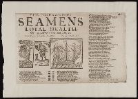
Beinecke Rare Book and Manuscript Library > The couragious seamens loyal health, Or, An answer to Dub, a dub, a dub, &c. : to the tune of The granadeers loyal health.
Creator:
Published / Created:
[1695]
Call Number:
BrSides Folio 2019 85
Image Count:
1
Resource Type:
Maps, Atlases & Globes
Found in:
Beinecke Rare Book and Manuscript Library > Bedford Shire / by Robt. Morden.
Published / Created:
1707
Call Number:
388hc 1707
Image Count:
1
Resource Type:
Maps, Atlases & Globes
Found in:
Beinecke Rare Book and Manuscript Library > The Theater of the Warr in the Sevennes ... Mr. de Basville intendant of Languedoc ...
Published / Created:
[1708?]
Call Number:
501 1708A
Container / Volume:
BRBL_00275
Image Count:
1
Resource Type:
Maps, Atlases & Globes
Found in:
Beinecke Rare Book and Manuscript Library > The Turkish Empire in Europe, Asia, and Africa ... H. Moll, Geographer.
Published / Created:
[1708?]
Call Number:
38 1708
Container / Volume:
BRBL_00151
Image Count:
1
Resource Type:
Maps, Atlases & Globes
Found in:
Beinecke Rare Book and Manuscript Library > A new and Exact map of France ... H. Moll Geographer.
Creator:
Published / Created:
[1708?]
Call Number:
352 1708
Container / Volume:
BRBL_00104
Image Count:
1
Resource Type:
Maps, Atlases & Globes
Found in:
Beinecke Rare Book and Manuscript Library > To his most serene and august majesty, Peter Alexovitz, absolute lord of Russia &c., this map of Moscovy, Poland, Little Tartary, and ye Black Sea &c. is most humbly dedicated by H. Moll, geographer.
Creator:
Published / Created:
c 1709.
Call Number:
2017 Folio 93
Image Count:
1
Resource Type:
Maps, Atlases & Globes
Found in:
Beinecke Rare Book and Manuscript Library > The VII United Provinces : corrected from the observations communicated to the Royal Society at London & ye Royal Academy at Paris / Io. Senex, F.R.S.
Published / Created:
[1709?]
Call Number:
34 1708
Container / Volume:
BRBL_00090
Image Count:
1
Resource Type:
Maps, Atlases & Globes
Found in:
Beinecke Rare Book and Manuscript Library > A new map of Denmark and Sweden ... H. Moll. Geographer.
Creator:
Published / Created:
[1710]
Call Number:
392 1710
Container / Volume:
BRBL_00684
Image Count:
1
Resource Type:
Maps, Atlases & Globes
Found in:
Beinecke Rare Book and Manuscript Library > A map of old & new Castile : from the observations of Rodrigo Mendes Silva and others.
Creator:
Published / Created:
[1710]
Call Number:
60 1708
Container / Volume:
BRBL_00322
Image Count:
1
Resource Type:
Maps, Atlases & Globes
Found in:
Beinecke Rare Book and Manuscript Library > To the right honourable Charles, Earl of Peterborow and Monmouth, &c this map of Africa ... is most humbly dedicated / by your Lordship's humble servant H: Moll geographer.
Creator:
Published / Created:
1711
Call Number:
53 1711
Container / Volume:
BRBL_00684
Image Count:
1
Resource Type:
Maps, Atlases & Globes
Found in:
Beinecke Rare Book and Manuscript Library > A map of Turky [sic] Arabia & Persia : corrected from the latest travels and from the observations of the Royal Societys of London and Paris / by G. De L'Isle.
Published / Created:
1711
Call Number:
39 1711
Container / Volume:
BRBL_00185
Image Count:
1
Resource Type:
Maps, Atlases & Globes
Found in:
Beinecke Rare Book and Manuscript Library > A new and Exact map of Spanish & Portugal ... H. Moll, Geographer.
Creator:
Published / Created:
1713
Call Number:
38 1713
Container / Volume:
BRBL_00684
Image Count:
1
Resource Type:
Maps, Atlases & Globes
Found in:
Beinecke Rare Book and Manuscript Library > A map of the provostship and vicounty of Paris [cartographic material] : drawn from a great number of particular memoirs made according to the observations of the Royal Academy of Sciences / by G Delisle ...
Creator:
Published / Created:
1714
Call Number:
3191 1714
Container / Volume:
BRBL_00683
Image Count:
2
Resource Type:
Maps, Atlases & Globes
Found in:
Beinecke Rare Book and Manuscript Library > A new map of Great Britain : corrected from the observations communicated to the Royal Society at London / by John Senex, F.R.S.
Published / Created:
1714
Call Number:
40 1714A
Container / Volume:
BRBL_00197
Image Count:
1
Resource Type:
Maps, Atlases & Globes
Found in:
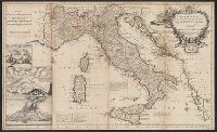
Beinecke Rare Book and Manuscript Library > A new map of Italy ... post roads ... / H. Moll, geographer.
Published / Created:
1714
Call Number:
40 1714A
Container / Volume:
BRBL_00197
Image Count:
1
Resource Type:
Maps, Atlases & Globes
Found in:
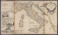
Beinecke Rare Book and Manuscript Library > A new map of Italy ... post roads ... / H. Moll, geographer.
Creator:
Published / Created:
1714
Call Number:
40 1714
Container / Volume:
BRBL_00196
Image Count:
1
Resource Type:
Maps, Atlases & Globes
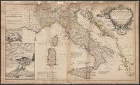
Found in:
Beinecke Rare Book and Manuscript Library > A new map of Italy : distinguishing all the sovereignties in it, whether states, kingdoms, dutchies, principalities, republicks &c. With the post roads, and many remarks not extant in any map. According to ye newest and most exact observations / by H. Mol
Published / Created:
1714
Call Number:
327 1714
Container / Volume:
BRBL_00072
Image Count:
1
Resource Type:
Maps, Atlases & Globes
Found in:
Beinecke Rare Book and Manuscript Library > A new map of Ireland ... Herman Moll, Geographer 1714.
Creator:
Published / Created:
1715 [i.e., 1726?]
Call Number:
755 1715B
Container / Volume:
BRBL_00425
Image Count:
1
Resource Type:
Maps, Atlases & Globes
Found in:
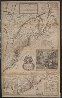
Beinecke Rare Book and Manuscript Library > A new and exact map of the dominions of the King of Great Britain on ye continent of North America : containing Newfoundland, New Scotland, New England, New York, New Jersey, Pensilvania, Maryland, Virginia, and Carolina ... / by Herman Moll, geographer.
Creator:
Published / Created:
1715
Call Number:
755 1715
Container / Volume:
BRBL_00425
Image Count:
1
Resource Type:
Maps, Atlases & Globes
Found in:
Beinecke Rare Book and Manuscript Library > A new and exact map of the dominions of the King of Great Britain on ye continent of North America : containing Newfoundland, New Scotland, New England, New York, New Jersey, Pensilvania, Maryland, Virginia, and Carolina ... / by Herman Moll, geographer.
Creator:
Published / Created:
1720
Call Number:
71 1720C
Container / Volume:
BRBL_00687
Image Count:
1
Resource Type:
Maps, Atlases & Globes
Found in:
Beinecke Rare Book and Manuscript Library > A new map of the north parts of America claimed by France under ye names of Louisiana, Mississipi, Canada and New France with ye adjoyning territories of England and Spain ... : the projection of this map is call'd Mercator's, and it is laid down accordin
Creator:
Published / Created:
[1720?]
Call Number:
3826 1710
Container / Volume:
BRBL_00684
Image Count:
1
Resource Type:
Maps, Atlases & Globes
Found in:
Beinecke Rare Book and Manuscript Library > A map of the county of Flanders / [cartographic material] / by William de l'Isle ...
Published / Created:
[1720?]
Call Number:
85 1720
Container / Volume:
BRBL_00636
Image Count:
1
Resource Type:
Maps, Atlases & Globes
Found in:
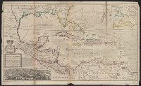
Beinecke Rare Book and Manuscript Library > A map of the West Indies or the Islands of America ... explaining what belongs to Spain, England, France, Holland & c. also ye trade winds ...
Published / Created:
[1720?]
Call Number:
85 1720
Container / Volume:
BRBL_00636
Image Count:
1
Resource Type:
Maps, Atlases & Globes
Found in:
Beinecke Rare Book and Manuscript Library > A map of the West Indies or the Islands of America ... explaining what belongs to Spain, England, France, Holland & c. also ye trade winds ...
Creator:
Published / Created:
[1720]
Call Number:
71 1720D
Container / Volume:
BRBL_00361
Image Count:
1
Resource Type:
Maps, Atlases & Globes
Found in:
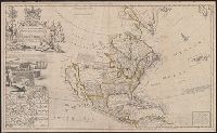
Beinecke Rare Book and Manuscript Library > To the right honourable John Lord Sommers, Baron of Evesham in ye county of Worcester, president of Her Majesty's most honourable Privy Council &c., this map of North America, according to ye newest and most exact observations is most humbly dedicated by
Creator:
Published / Created:
1720
Call Number:
71 1720C
Container / Volume:
BRBL_00361
Image Count:
1
Resource Type:
Maps, Atlases & Globes
Found in:
Beinecke Rare Book and Manuscript Library > A new map of the north parts of America claimed by France under ye names of Louisiana, Mississipi, Canada and New France with ye adjoyning territories of England and Spain ... : the projection of this map is call'd Mercator's, and it is laid down accordin
Published / Created:
[1720?]
Call Number:
3615 1720A
Image Count:
1
Resource Type:
Maps, Atlases & Globes
Found in:
Beinecke Rare Book and Manuscript Library > The seat of war on the Rhine ... from Basil to Bonn with the adjacent countries. By Mons. W. de L'Isle Geog.
Published / Created:
[1720?]
Call Number:
3615 1720
Image Count:
1
Resource Type:
Maps, Atlases & Globes
Found in:
Beinecke Rare Book and Manuscript Library > The seat of war on the Rhine ... from Strasbourg to Bonn with the adjacent countries. By Mons. G. de L'Isle Geog.
Creator:
Published / Created:
[1725]
Call Number:
50 1740
Container / Volume:
BRBL_00684
Image Count:
1
Resource Type:
Maps, Atlases & Globes
Found in:
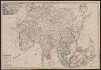
Beinecke Rare Book and Manuscript Library > Asia corrected from the observations communicated to the Royal Society at London and the Royal Academy at Paris / by Iohn Senex, F.R.S.
Creator:
Published / Created:
1728
Call Number:
Ik P810 728
Image Count:
68
Found in:
Beinecke Rare Book and Manuscript Library > The Dunciad. An heroic poem. In three books.
Creator:
Published / Created:
[1729?]
Call Number:
11 1724
Container / Volume:
BRBL_00680
Image Count:
1
Resource Type:
Maps, Atlases & Globes
Found in:
Beinecke Rare Book and Manuscript Library > A new and correct map of the world laid down according to the newest discoveries, and from the most exact observations / [cartographic material] / by Herman Moll, geographer.
Published / Created:
[1736?]
Call Number:
755 1736
Container / Volume:
BRBL_00728
Image Count:
1
Resource Type:
Maps, Atlases & Globes
Found in:
Beinecke Rare Book and Manuscript Library > New England, New York, New Jersey and Pensylvania.
Creator:
Published / Created:
[1736]
Call Number:
867 1729
Container / Volume:
BRBL_00696
Image Count:
1
Resource Type:
Maps, Atlases & Globes
Found in:
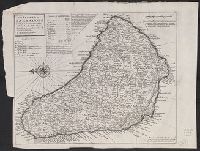
Beinecke Rare Book and Manuscript Library > The island of Barbadoes [cartographic material] : divided into its parishes, with the roads, paths, &c. according to an actual and accurate survey / by H. Moll, geographer.
Creator:
Published / Created:
[1736?]
Call Number:
18 1739
Container / Volume:
BRBL_00682
Image Count:
1
Resource Type:
Maps, Atlases & Globes
Found in:
Beinecke Rare Book and Manuscript Library > A map of the North Pole : with all the territories that lye near it, known to us &c. : according to the latest discoveries, and most exact observations : agreeable to modern history / by H. Moll geographer.
Published / Created:
1737
Call Number:
32 1737
Container / Volume:
BRBL_00043
Image Count:
1
Resource Type:
Maps, Atlases & Globes
Found in:
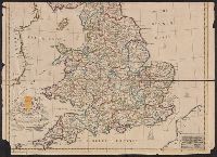
Beinecke Rare Book and Manuscript Library > The Travellers Guide through England and Wales ...
Published / Created:
[1738]
Call Number:
BrSides Folio 2017 4
Image Count:
12
Resource Type:
Maps, Atlases & Globes
Found in:
Beinecke Rare Book and Manuscript Library > The first [-twelfth] sheet of Chinese Tartary ...
Published / Created:
[between 1743-1747?]
Call Number:
BrSides Folio 2017 20
Image Count:
1
Resource Type:
Maps, Atlases & Globes
Found in:
Beinecke Rare Book and Manuscript Library > An accurate map of Kalbar River (commonly called Kalabar or Rio Real) and adjacent coast drawn on ye spot by several pilots, 1699 / G. Child, sculpt.
Published / Created:
[between 1743 and 1770]
Call Number:
755 1730A
Container / Volume:
BRBL_00690
Image Count:
1
Resource Type:
Maps, Atlases & Globes
Found in:
Beinecke Rare Book and Manuscript Library > Virginia, Maryland, Pennsilvania, east & west New Jarsey [cartographic material].
Creator:
Published / Created:
[1744]
Call Number:
BrSides Folio 2017 33
Image Count:
1
Resource Type:
Maps, Atlases & Globes
Found in:
Beinecke Rare Book and Manuscript Library > A plan of the city of Canton on the river Ta ho [cartographic material].
Creator:
Published / Created:
[approximately 1745]
Call Number:
BrSides 2019 87
Image Count:
1
Resource Type:
Maps, Atlases & Globes
Found in:
Beinecke Rare Book and Manuscript Library > A map of the River Gambra from Eropina to Barrakunda / by Captn. John Leach in 1732 ; Thos. Kitchin sculpt.
Creator:
Published / Created:
1746
Call Number:
2002 Folio 94
Image Count:
16
Resource Type:
Maps, Atlases & Globes
Found in:
Beinecke Rare Book and Manuscript Library > An exact survey of the city's of London and Westminster, ye borough of Southwark and the country near ten miles round : begun in 1741, finished in 1745, and published in 1746, according to act of Parliament / by John Rocque ; engrav'd by Richard Parr and printed by W. Pratt ... = Urbium maxime insignium Londini et Westmonasterii nec non municipii Sudovercencis, regionumque ad decem quasi milliaria circumjacentium : delineatio ichnographica anno 1741 incohata 1745 absoluta / a Johanne Rocque ... = Carte topographique des villes de Londres, Westminster, et bourg de Southwark et de leurs environs : levée très exactement sur les lieux, en 1741, achevée en 1745, et publieé selon un acte de Parlement en 1746 / par Jean Rocque.
Creator:
Published / Created:
[1747]
Call Number:
BrSides 2019 80
Image Count:
1
Resource Type:
Maps, Atlases & Globes
Found in:
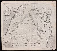
Beinecke Rare Book and Manuscript Library > A map of Paradise mount Ararat and the city of Babel : according to the three different hypotheses mentioned in this work.
Creator:
Published / Created:
[1747]
Call Number:
655 1747
Container / Volume:
BRBL_00345
Image Count:
1
Resource Type:
Maps, Atlases & Globes
Found in:
Beinecke Rare Book and Manuscript Library > A new & accurate map of Negroland and the adjacent countries : also Upper Guinea, shewing the principal European settlements, & distinguishing w[hi]ch belong to England, Denmark, Holland &c., the sea coast & some of the rivers being drawn from surveys & t
Creator:
Published / Created:
[1748]
Call Number:
BrSides Folio 2017 11
Image Count:
1
Resource Type:
Maps, Atlases & Globes
Found in:
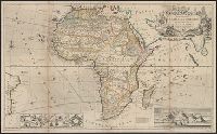
Beinecke Rare Book and Manuscript Library > Africa [cartographic material] / drawn from the best maps by T. Jefferys, Geographer to his Royal Highness the Prince of Wales.
Creator:
Published / Created:
[1749]
Call Number:
BrSides 2019 63
Image Count:
1
Resource Type:
Maps, Atlases & Globes
Found in:
Beinecke Rare Book and Manuscript Library > A map of New Scotland with its dependencies and a succint account of the country.
Creator:
Published / Created:
[1749]
Call Number:
2016 1346
Image Count:
1
Resource Type:
Maps, Atlases & Globes
Found in:
Beinecke Rare Book and Manuscript Library > An accurate map of the county of Huntingdon divided into its hundreds : drawn from surveys and illustrated with various additional improvements ; also historical extracts relating to its trade, manufactures, natural history &c. not extant in any other map
Creator:
Published / Created:
[between 1750 and 1769?]
Call Number:
71 1755B
Container / Volume:
BRBL_00363
Image Count:
1
Resource Type:
Maps, Atlases & Globes
Found in:
Beinecke Rare Book and Manuscript Library > North America : corrected from the observations communicated to the Royal Society at London and the Royal Academy at Paris / by John Senex F.R.S., 1710.
Published / Created:
1750
Call Number:
3218 1750
Container / Volume:
BRBL_00057
Image Count:
1
Resource Type:
Maps, Atlases & Globes
Found in:
Beinecke Rare Book and Manuscript Library > A new improved map of Oxfordshire ... By Thos. Kitchin Geographer.
Published / Created:
1751
Call Number:
3215 1751
Container / Volume:
BRBL_00056
Image Count:
1
Resource Type:
Maps, Atlases & Globes
Found in:
Beinecke Rare Book and Manuscript Library > Hampshire ... by T. Kitchin ...
Published / Created:
[1752]
Call Number:
BrSides 2019 82
Image Count:
1
Resource Type:
Maps, Atlases & Globes
Found in:
Beinecke Rare Book and Manuscript Library > The place of Paradise, the habitation of Adam and Seth, and the land of Nod.
Published / Created:
[1752]
Call Number:
BrSides 2019 81
Image Count:
1
Resource Type:
Maps, Atlases & Globes
Found in:
Beinecke Rare Book and Manuscript Library > A map of the terrestrial Paradise according to Mr. Huet / with improvements from Dr. Wells.
Published / Created:
[1752?]
Call Number:
755 1752
Container / Volume:
BRBL_00426
Image Count:
1
Resource Type:
Maps, Atlases & Globes
Found in:
Beinecke Rare Book and Manuscript Library > A new and accurate map of New Jersey, Pensilvania, New York and New England, with adjacent countries.
Published / Created:
[1754]
Call Number:
755 1754
Container / Volume:
BRBL_00728
Image Count:
1
Resource Type:
Maps, Atlases & Globes
Found in:
Beinecke Rare Book and Manuscript Library > An accurate map of the English colonies in North America, bordering on the river Ohio.
Creator:
Published / Created:
November 29th 1755.
Call Number:
76 1755A
Container / Volume:
BRBL_00443
Image Count:
2
Resource Type:
Maps, Atlases & Globes
Found in:
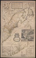
Beinecke Rare Book and Manuscript Library > A map of the most inhabited part of New England : containing the provinces of Massachusetts Bay and New Hampshire, with the colonies of Konektikut and Rhode Island, divided into counties and townships: The whole composed from actual surveys and its situat
Creator:
Published / Created:
1755
Call Number:
755 1755W
Container / Volume:
BRBL_00427
Image Count:
1
Resource Type:
Maps, Atlases & Globes
Found in:
Beinecke Rare Book and Manuscript Library > A new and accurate map of the English empire in North America : representing their rightful claim as confirm'd by charters, and the formal surrender of their Indian friends; likewise the encroachments of the French, with the several forts they have unjust
Published / Created:
1755
Call Number:
755 1755V
Container / Volume:
BRBL_00427
Image Count:
1
Resource Type:
Maps, Atlases & Globes
Found in:
Beinecke Rare Book and Manuscript Library > A new and accurate map of North America, (wherein the errors of all preceding British, French, and Dutch maps, respecting the rights of Great Britain, France & Spain & the limits of each of His Majesty's Provinces, are corrected) Tho: Kitchin, Sculpt.
Creator:
Published / Created:
May 1755.
Call Number:
755 1755B
Container / Volume:
BRBL_00427
Image Count:
1
Resource Type:
Maps, Atlases & Globes
Found in:
Beinecke Rare Book and Manuscript Library > North America from the French of Mr. D'Anville : improved with the back settlements of Virginia and course of Ohio : illustrated with geographical and historical remarks.
Creator:
Published / Created:
1756
Call Number:
755 1765A
Container / Volume:
BRBL_00690
Image Count:
1
Resource Type:
Maps, Atlases & Globes
Found in:
Beinecke Rare Book and Manuscript Library > A map of the eastern part of the Province of New York : with part of New Jersey &c. / drawn from the best authorities by T. Kitchin geogr.
Creator:
Published / Created:
February the 2d, 1756.
Call Number:
771hc H864 1756
Container / Volume:
BRBL_00495
Image Count:
1
Resource Type:
Maps, Atlases & Globes
Found in:
Beinecke Rare Book and Manuscript Library > A Prospective view of the battle fought near Lake George, on the 8th of Sepr. 1755 : between 2000 English, with 250 Mohawks, under the command of Gen. Johnson: & 2500 French & indians under the command of Genl. Dieskau in which the English were victorious
Published / Created:
[1756?]
Call Number:
755 1756C
Container / Volume:
BRBL_00428
Image Count:
1
Resource Type:
Maps, Atlases & Globes
Found in:
Beinecke Rare Book and Manuscript Library > The British & French dominions in North America : particularly shewing the French encroachments through all the British plantations from Nova Scotia down to the Gulf of Mexico.
Creator:
Published / Created:
1756
Call Number:
3969 SA25 1756
Container / Volume:
BRBL_00194
Image Count:
1
Resource Type:
Maps, Atlases & Globes
Found in:
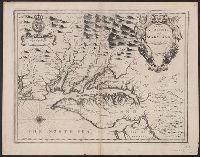
Beinecke Rare Book and Manuscript Library > A plan of St. Philips Castle on the island of Minorca : with its fortifications & the entrance of the harbour of Port Mahon / by Jno. Armstrong, Surveyor General to the Honble. Board of Ordnance.
Branch:v1.60.98 ,Deployed:2024-05-01T09:16:15-04:00